Athens neighborhood map 7 districts, with Plaka, Kolonaki and more
This poster maps the Municipality of Athens, the city proper, split into its 7 municipal districts. The districts are numbered, so neighborhood names like Plaka, Kolonaki, Koukaki and Pangrati print as small labels across the map. Highlight your district and print it.
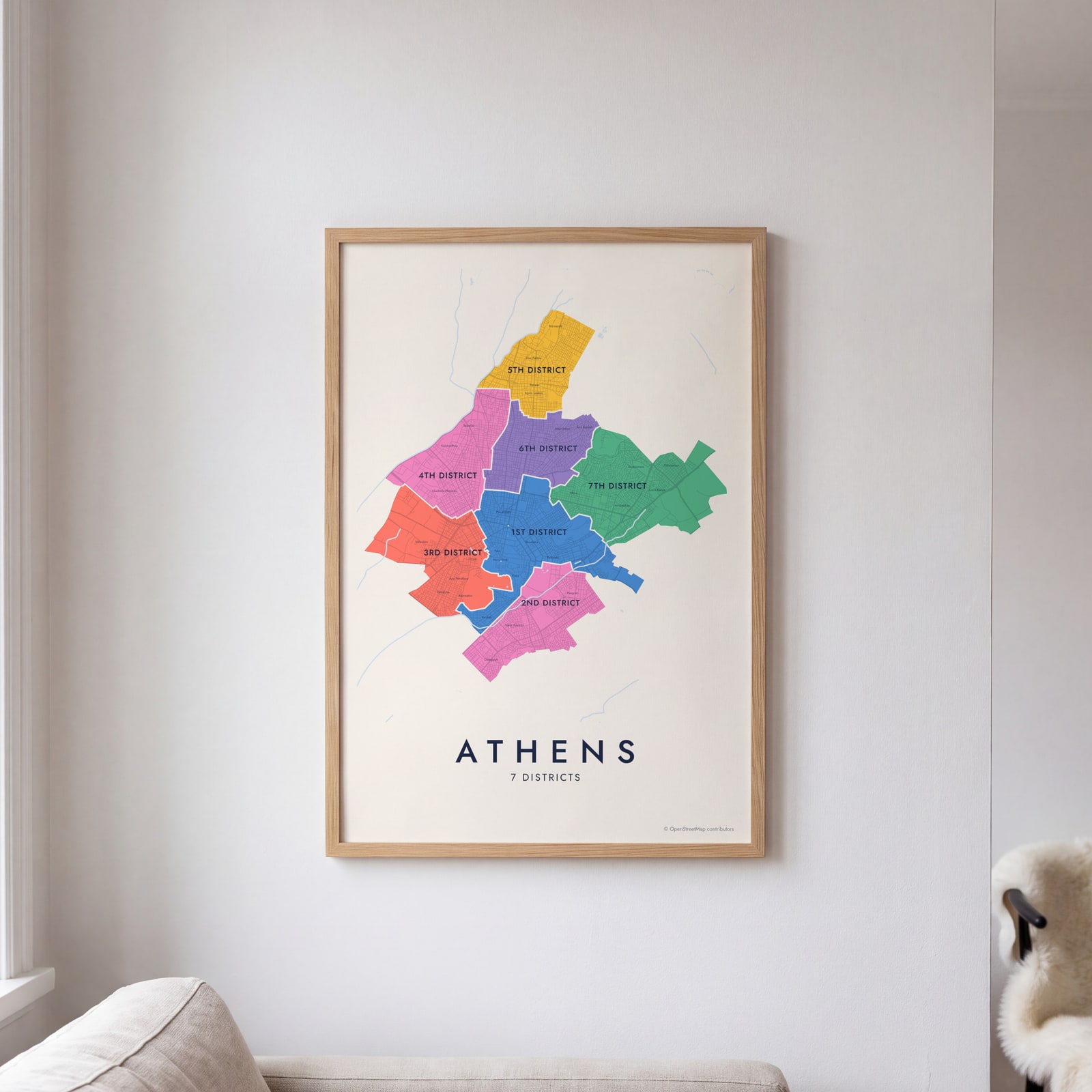
On the wall
A few of them framed at home. Open any one to make it yours.
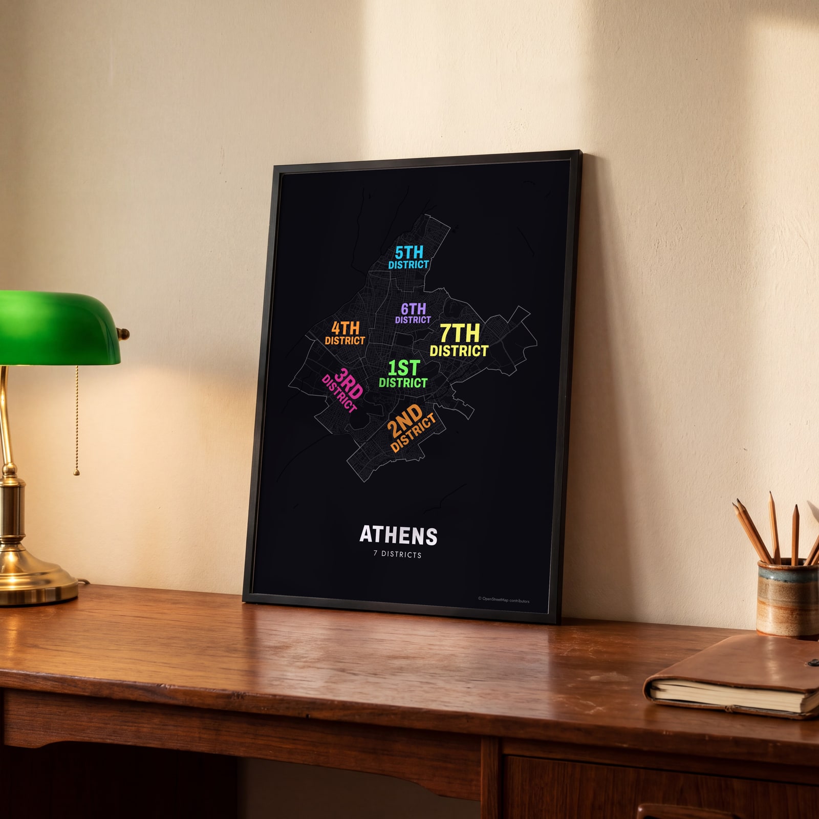 Typographic Athens map: the names fill their districtsEdit this →
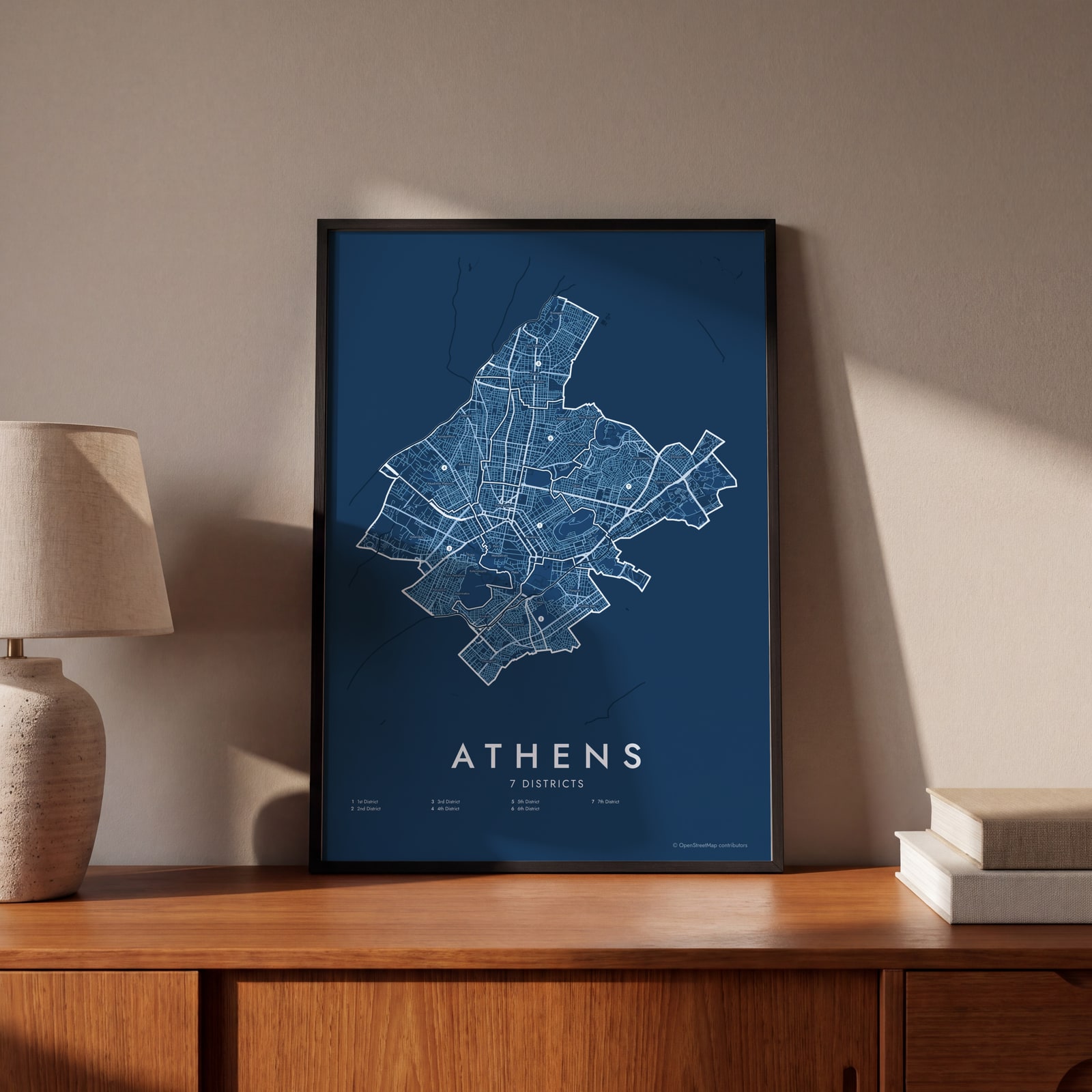 Athens street map with numbered districts and their listEdit this →
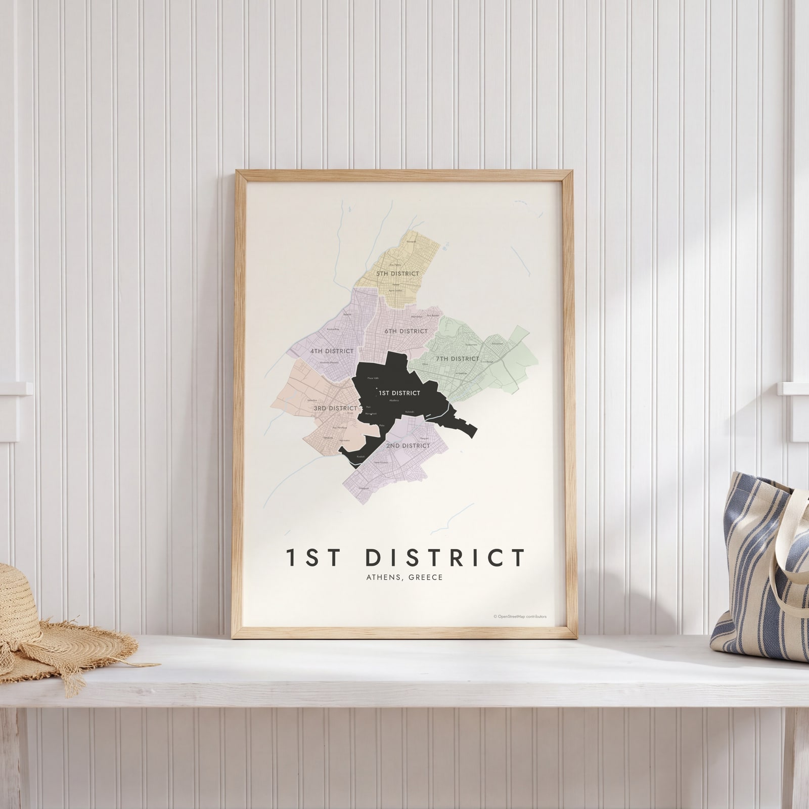 1st District highlighted on a map of AthensEdit this →
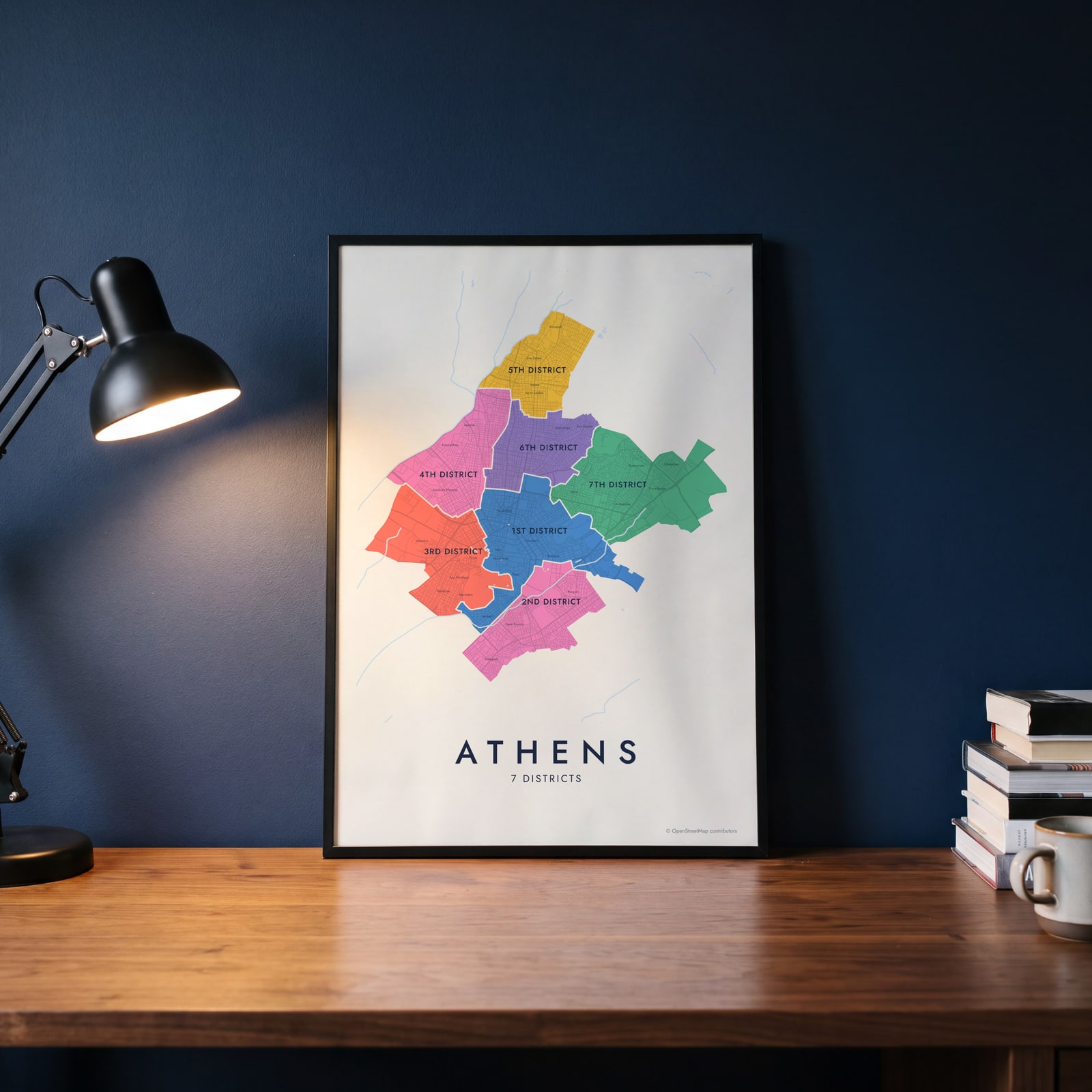 Athens neighborhood map in color, every district namedEdit this →
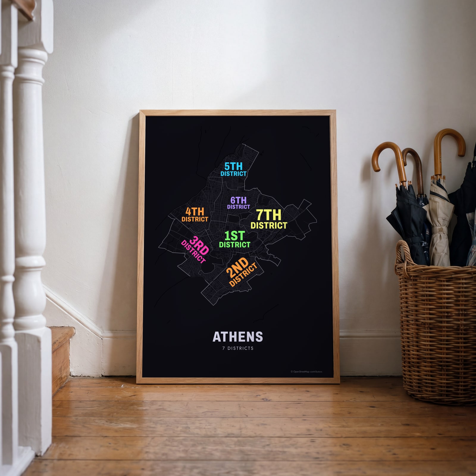 Typographic Athens map: the names fill their districtsEdit this →
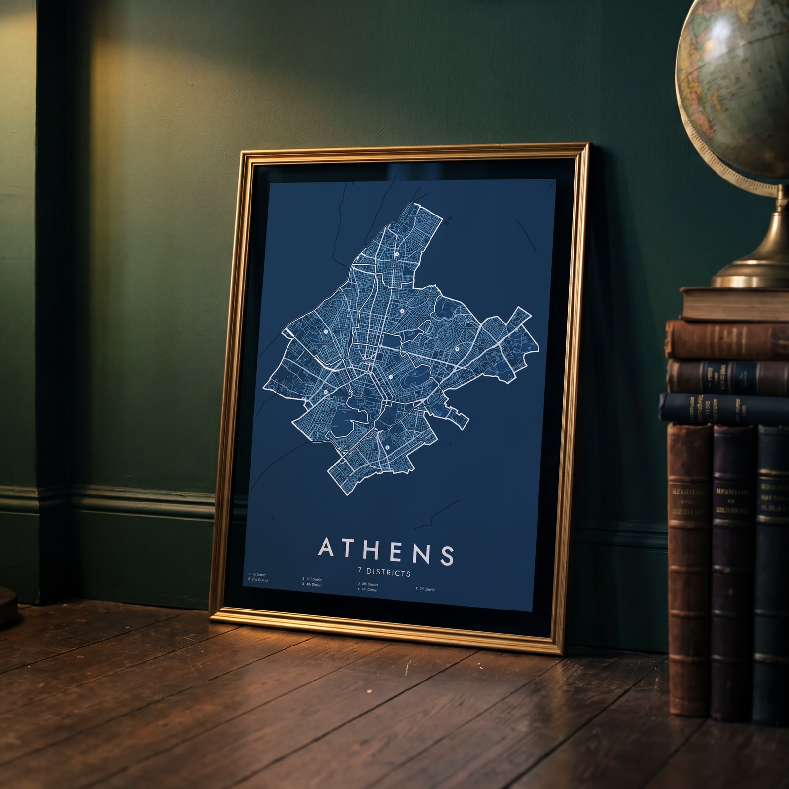 Athens street map with numbered districts and their listEdit this →
Examples
Open any of them to change the words, the place, the date and the style, then download the print file.
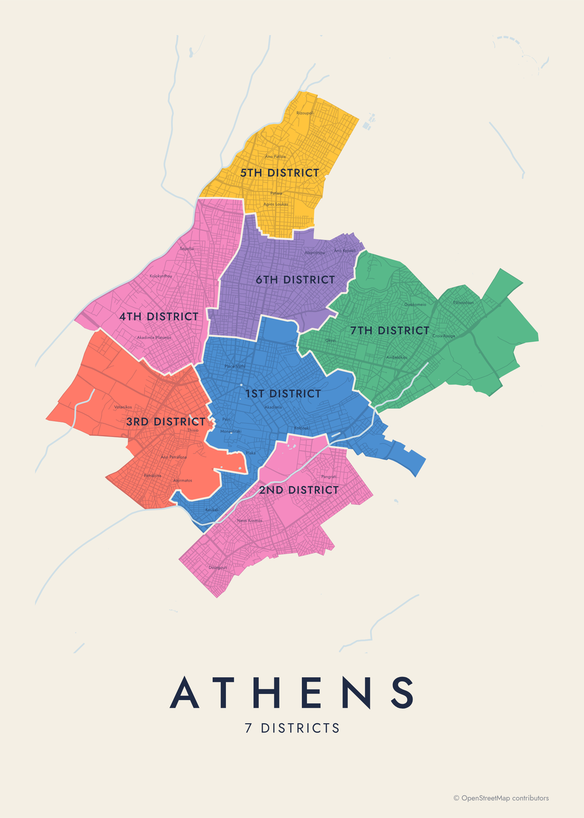 Athens neighborhood map in color, every district namedEdit this →More neighborhood maps →
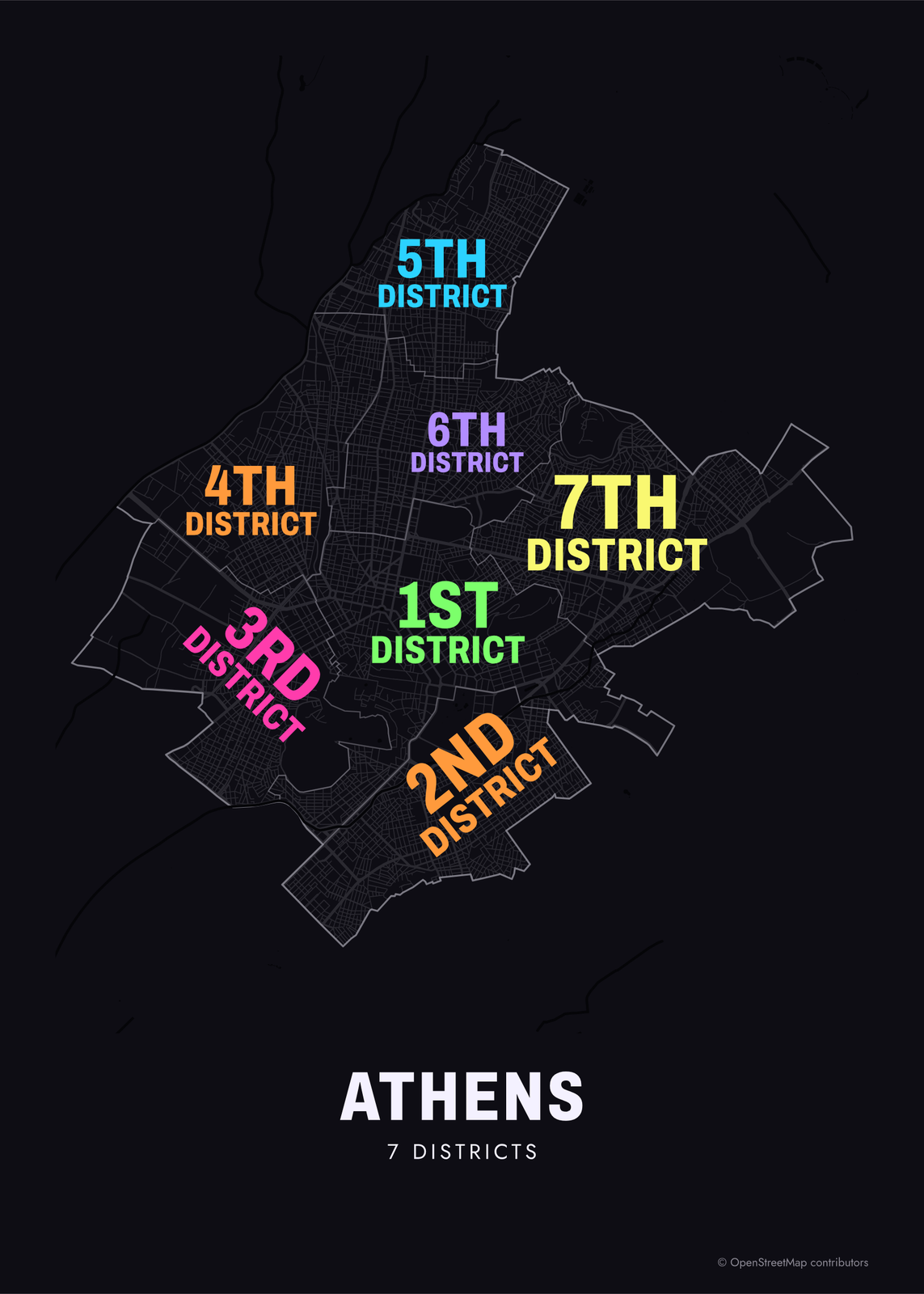 Typographic Athens map: the names fill their districtsEdit this →More neighborhood maps →
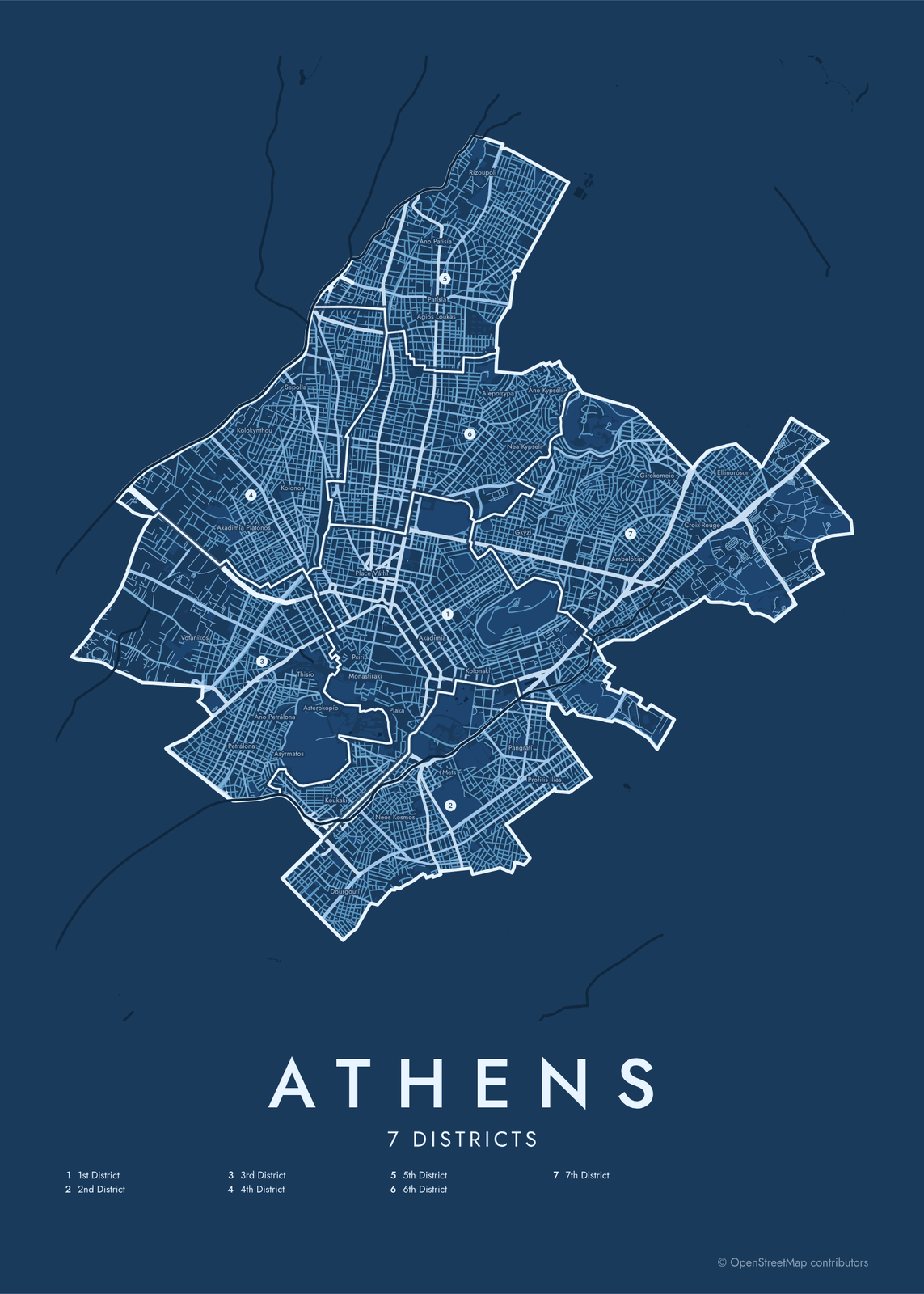 Athens street map with numbered districts and their listEdit this →More neighborhood maps →
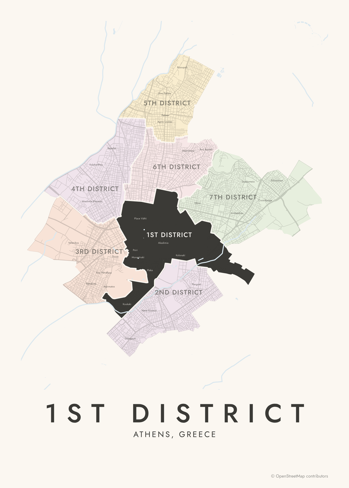 1st District highlighted on a map of AthensEdit this →More neighborhood maps →
How Athens is divided
Greater Athens is made up of dozens of separate municipalities. The one called Athens covers the historic center and the neighborhoods around it, and the city splits it into 7 municipal districts, numbered 1 to 7. They have numbers, not names.
The 1st District is the historic center: Plaka, Monastiraki, Syntagma, Kolonaki, Exarchia and Koukaki. The 2nd takes in Pangrati, Mets and Neos Kosmos, the 3rd Thisio, Kerameikos and Gazi, the 4th Kolonos and Sepolia, the 5th Patisia, the 6th Kypseli, and the 7th Ambelokipi and Goudi. Athenians name places after squares, hills and churches, and those names don't follow district lines, so we print them as labels. Piraeus, Glyfada and Marousi are separate municipalities, outside this map.
All 7 districts of Athens
- 1st District
- 2nd District
- 3rd District
- 4th District
- 5th District
- 6th District
- 7th District
More neighborhood names on the map
Inside the districts, the map also names 57 smaller neighborhoods where they fit, from OpenStreetMap: Petrálona, Neos Kosmos, Patísia, Kypséli, Pangrati, Ambelókipi, Votanikos, Rouf, Lower Petralona, Akadimia Platonos, Kolokynthou, Áno Petrálona, Kolonos, Sepolia, Dourgouti, Plaka, Káto Patísia, Áno Patísia, Kolonaki, Rizoupoli, Gkýzi, Nea Kypseli, Profitis Ilias, Áno Kypséli, Gkazi, Asýrmatos, Filopáppou, Thisio, Metaxourgío, Keramikos, Asterokopío, Koukaki, Thymarakia, Psiri, Akropoli, Monastiraki, Gargarétta, Place Váthi, Agios Panteleimonas, Anafiotika and more. Turn them off under Names if you want only the districts.
Neighborhoods to know
- Plaka: the old quarter on the slopes below the Acropolis, with narrow lanes and 19th-century houses.
- Anafiotika: a cluster of small whitewashed houses under the Acropolis, built in the 19th century by builders from the island of Anafi.
- Monastiraki: named for the small monastery church on its square, and known for its flea market.
- Makrygianni: just south of the Acropolis, home of the Acropolis Museum.
- Thisio: named for the Temple of Hephaestus, long known as the Theseion; its pedestrian walk faces the Acropolis.
- Gkazi: named for the old gasworks, now the Technopolis arts center.
- Kolonaki: at the foot of Lycabettus hill, home of the Benaki Museum and the Museum of Cycladic Art.
- Pangrati: a residential quarter east of the center, next to the marble Panathenaic Stadium of the 1896 Olympics.
How to make your Athens neighborhood poster
- Open the Athens map.
- Pick a style: Colored areas, Typographic (the names fill the map) or a Street map with the borders over the streets.
- Tap your own neighborhood to highlight it; it becomes the poster's title.
- Drag and zoom to frame the whole city or just your part of it, then pick a size and download the print file.
Questions
How many neighborhoods does Athens have?
The Municipality of Athens is split into 7 numbered districts. Within them, Athenians use well over a hundred neighborhood names, and many of them appear on this map as labels.
Which district is the center of Athens in?
The 1st District. It holds the historic center around the Acropolis, with Plaka, Monastiraki, Psiri, Syntagma, Kolonaki and Exarchia.
Is Piraeus part of Athens?
Not officially. Piraeus is a separate city and municipality on the coast southwest of the center, and the port of Athens. The two have grown into one urban area, but this map shows only the Municipality of Athens.
Where do the Athens boundaries come from?
From OpenStreetMap (© OpenStreetMap contributors). Streets and water are OpenStreetMap's. Boundaries are a snapshot and can differ from what neighbors call home; tell us if one looks wrong.
What sizes can I print?
US Letter, 8 × 10, 11 × 14, 12 × 16 and 12 × 18 in, A4 and A3, free. You download a 300 DPI JPEG drawn at the size you pick. Larger prints, up to 24 × 36 in, are coming soon.
Related

Gift ideas by occasion




Every example is made with the Posterage generators. Change anything, then download it as a 300 DPI JPEG.