Brussels neighborhood map 19 communes and 145 quartiers, named
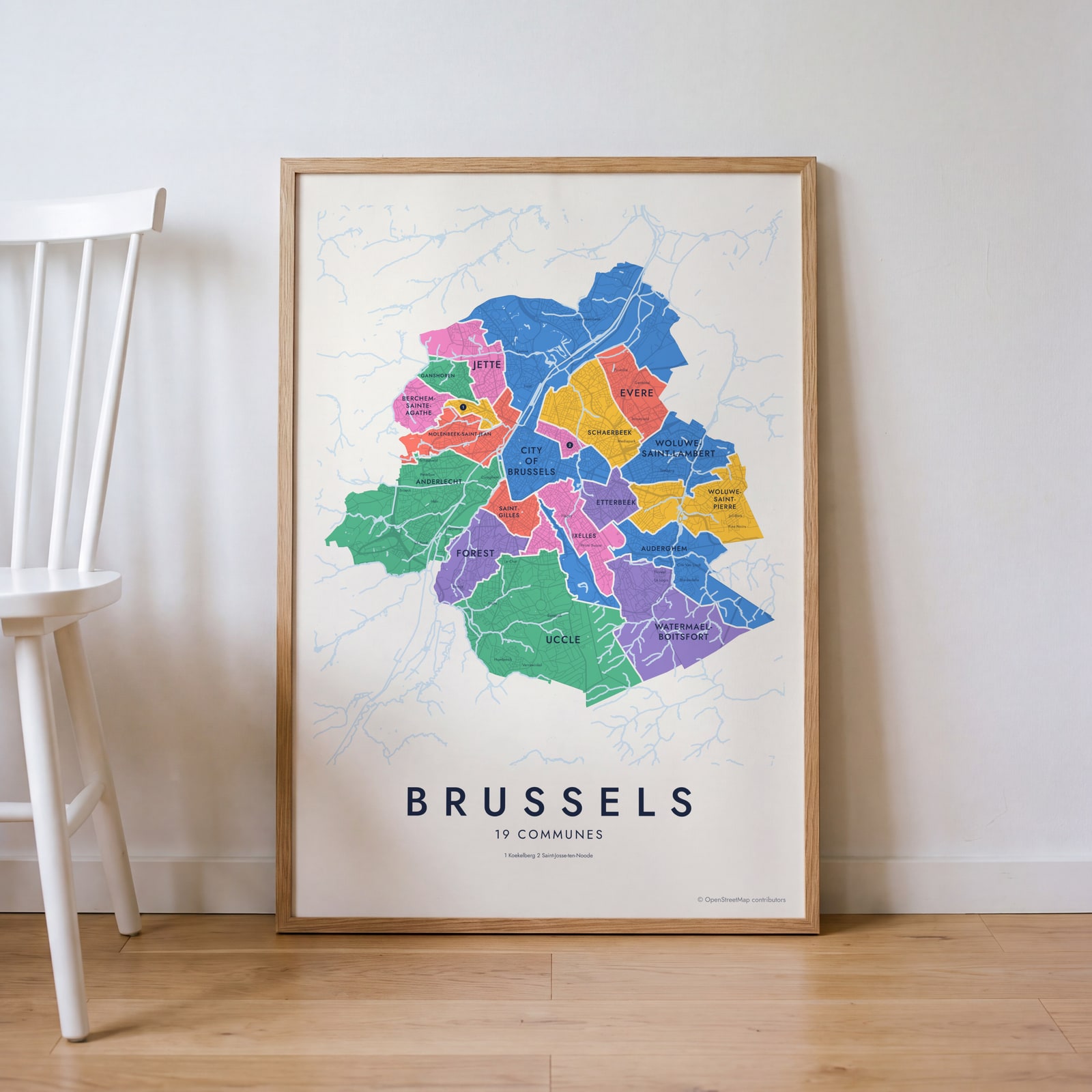
This poster maps the Brussels-Capital Region by its 19 communes, from Anderlecht to Woluwe-Saint-Pierre, each one named. Switch to the 145 quartiers for a finer map with names like Sablon, Marolles, Matongé and Châtelain. Highlight yours and print it.
On the wall
A few of them framed at home. Open any one to make it yours.
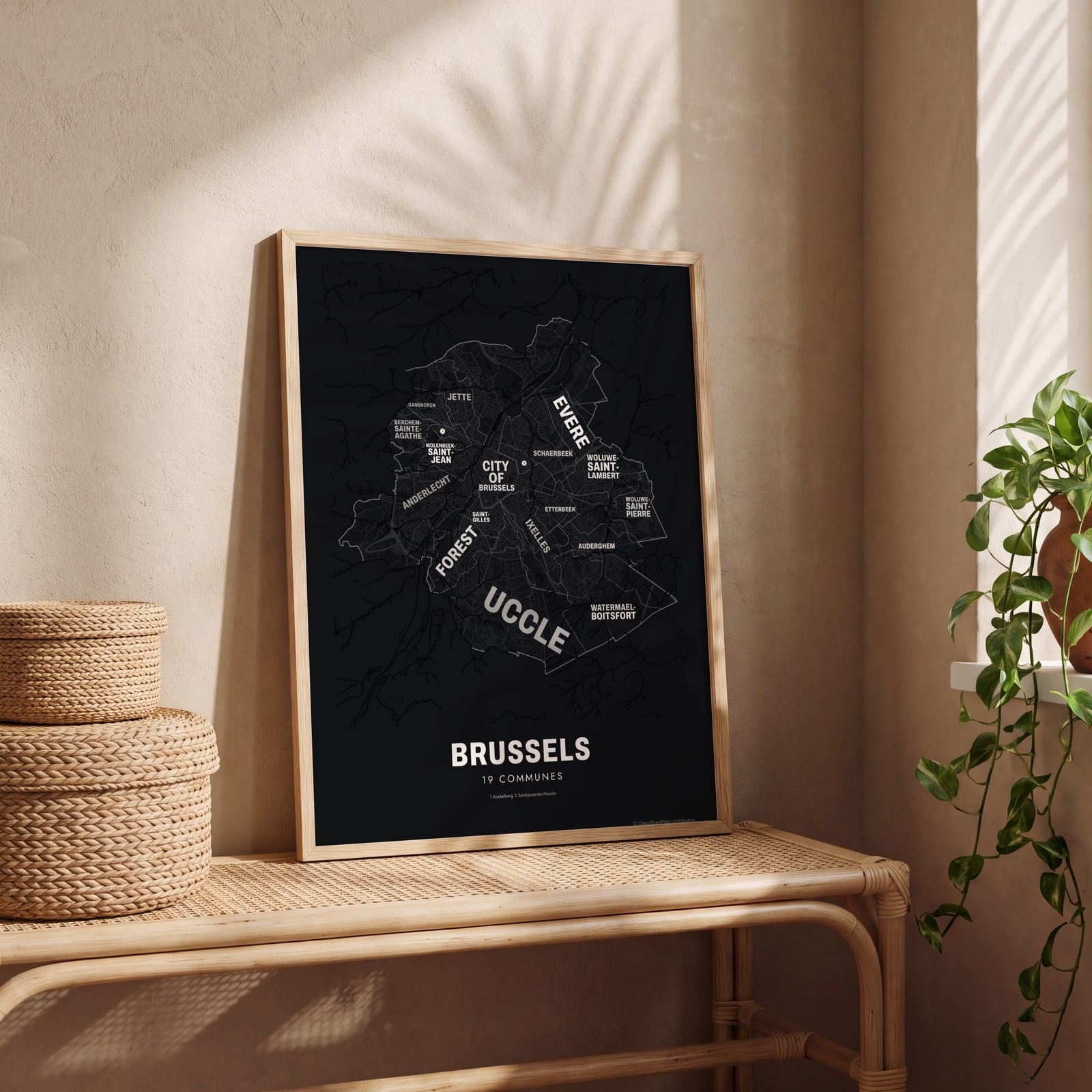 Typographic Brussels map: the names fill their communesEdit this →
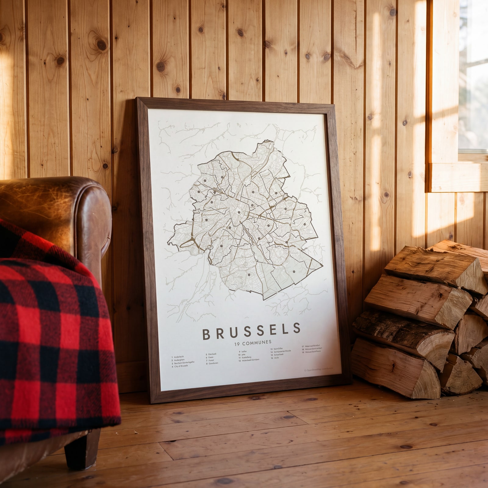 Brussels street map with numbered communes and their listEdit this →
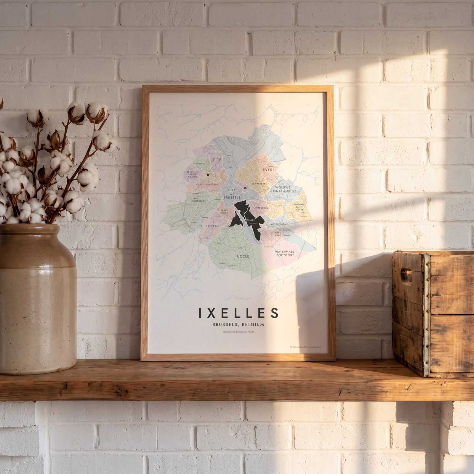 Ixelles highlighted on a map of BrusselsEdit this →
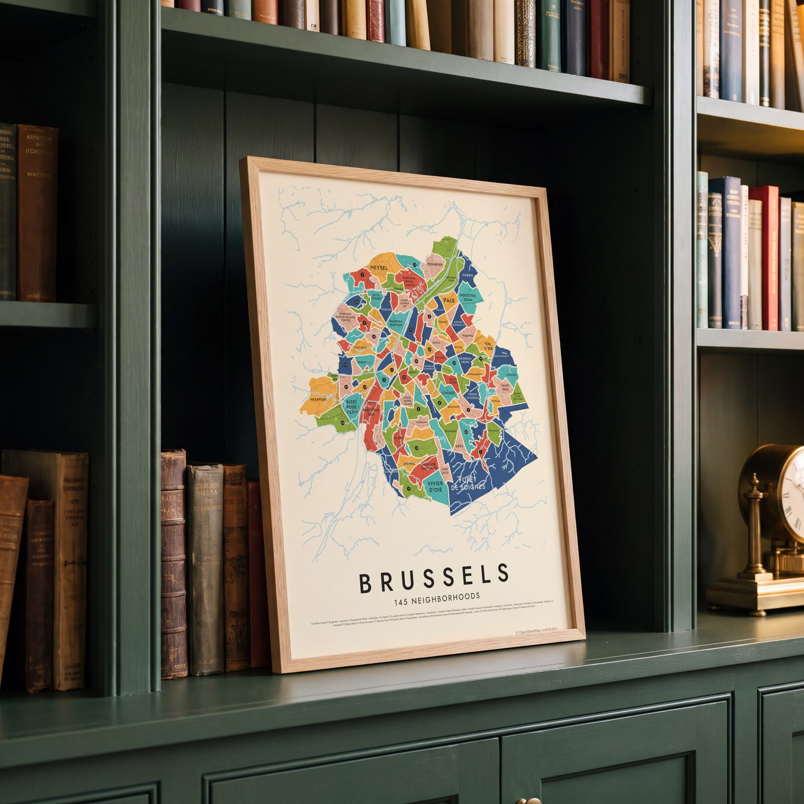 Brussels's 145 neighborhoods in colorEdit this →
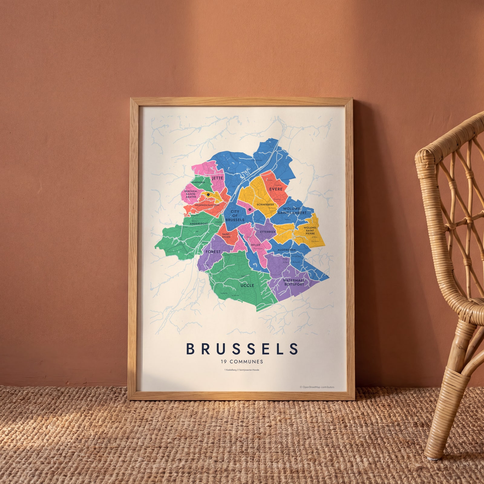 Brussels neighborhood map in color, every commune namedEdit this →
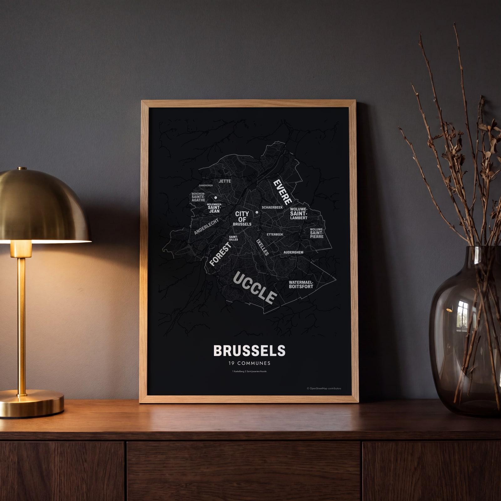 Typographic Brussels map: the names fill their communesEdit this →
Examples
Open any of them to change the words, the place, the date and the style, then download the print file.
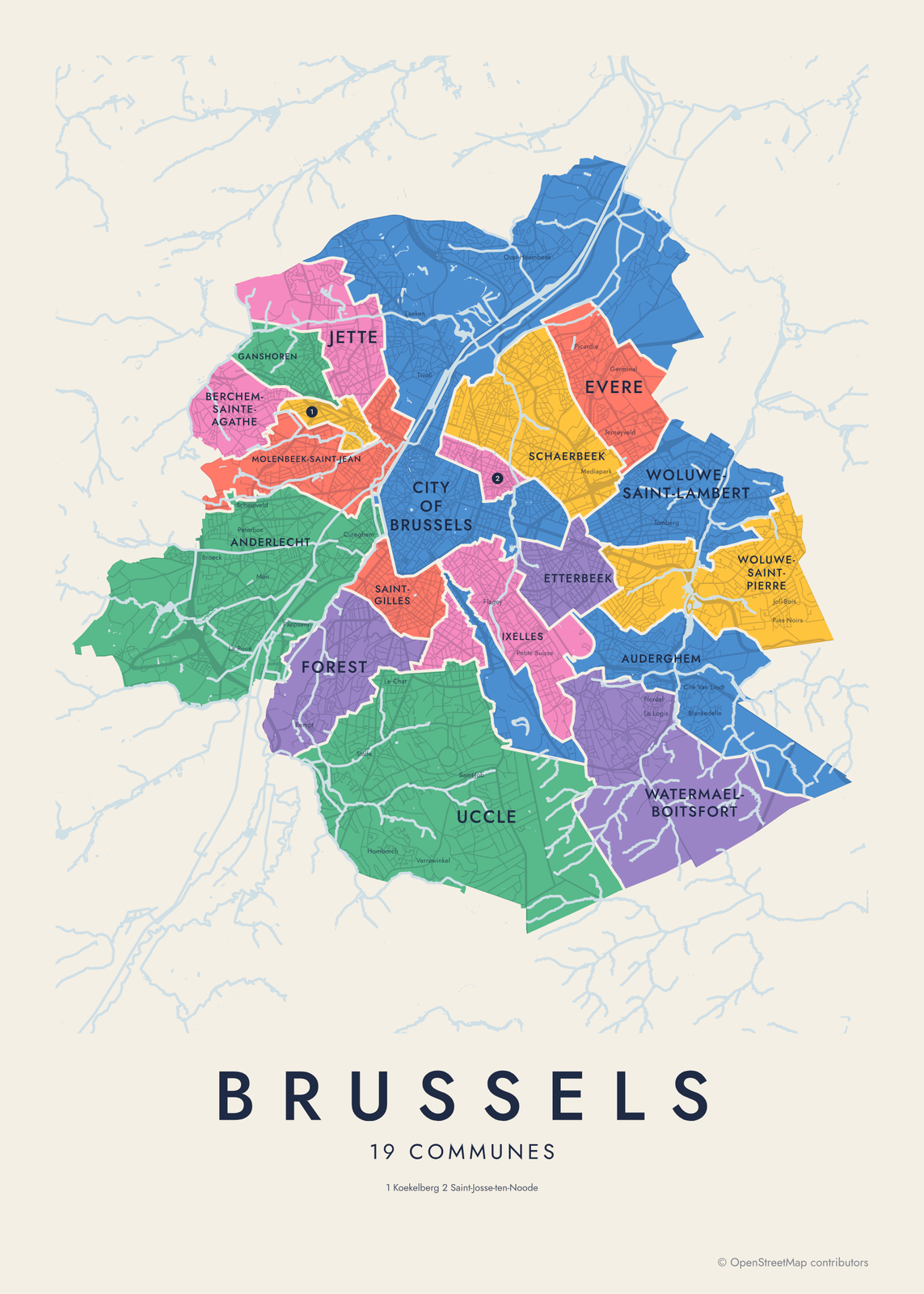 Brussels neighborhood map in color, every commune namedEdit this →More neighborhood maps →
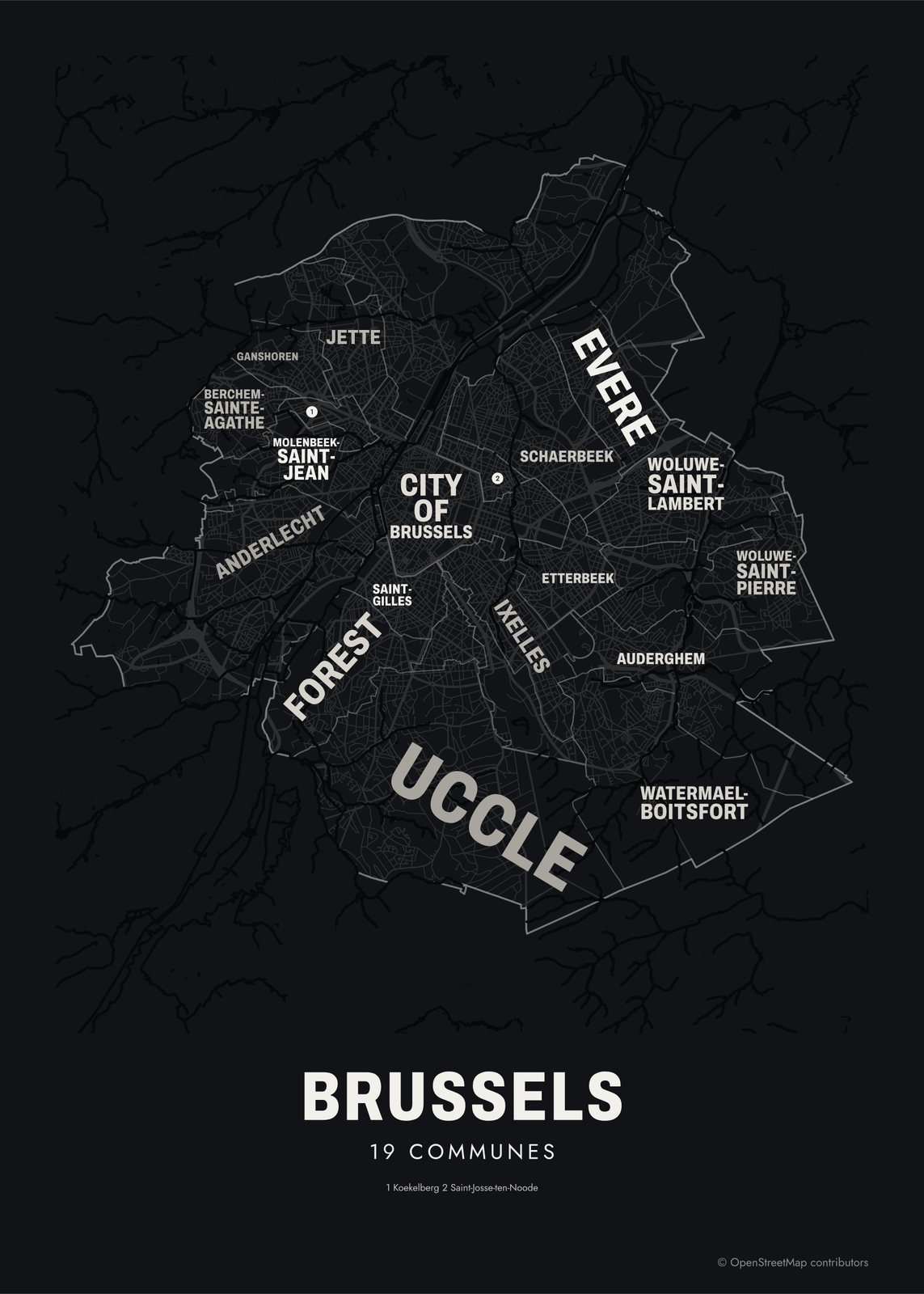 Typographic Brussels map: the names fill their communesEdit this →More neighborhood maps →
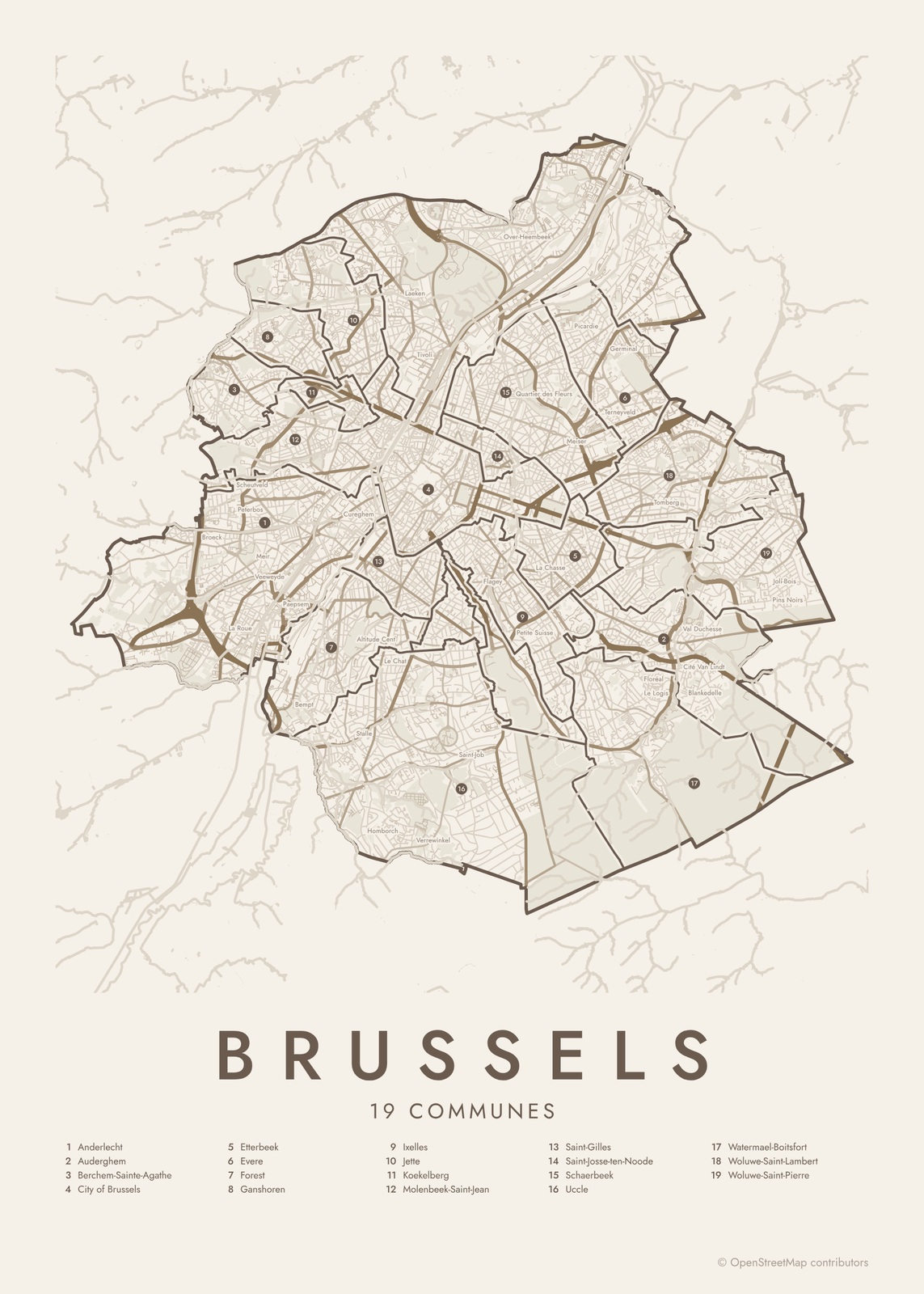 Brussels street map with numbered communes and their listEdit this →More neighborhood maps →
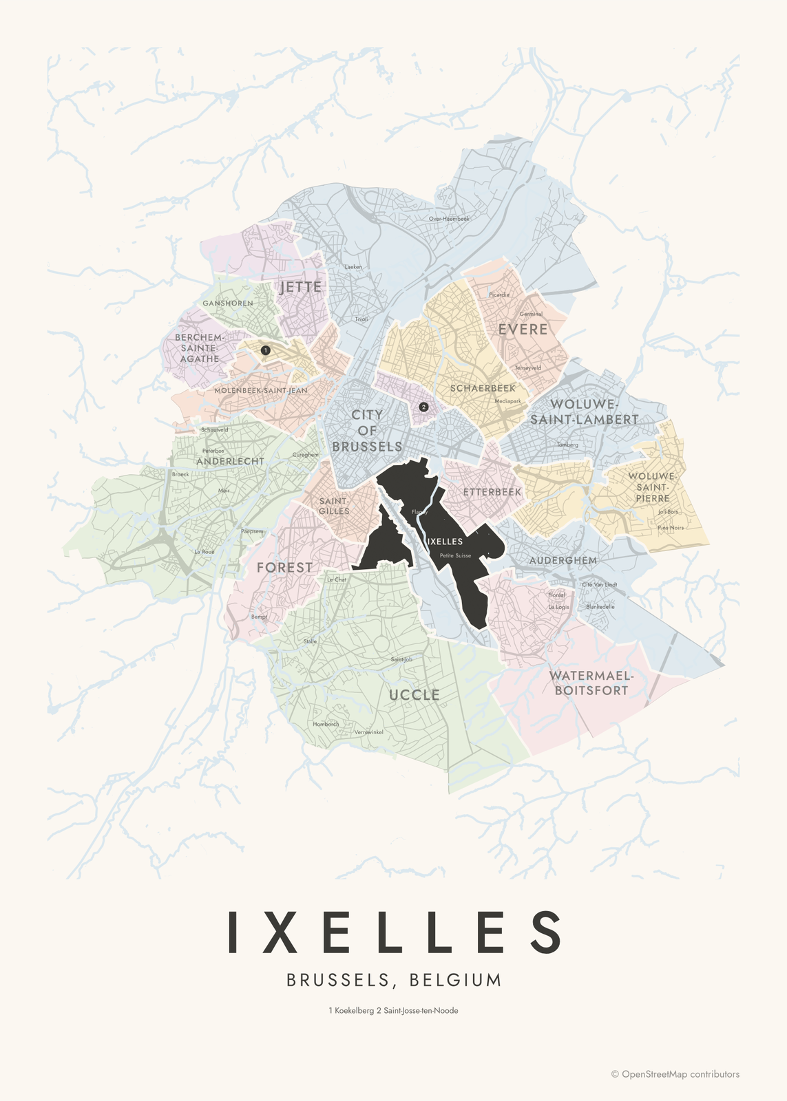 Ixelles highlighted on a map of BrusselsEdit this →More neighborhood maps →
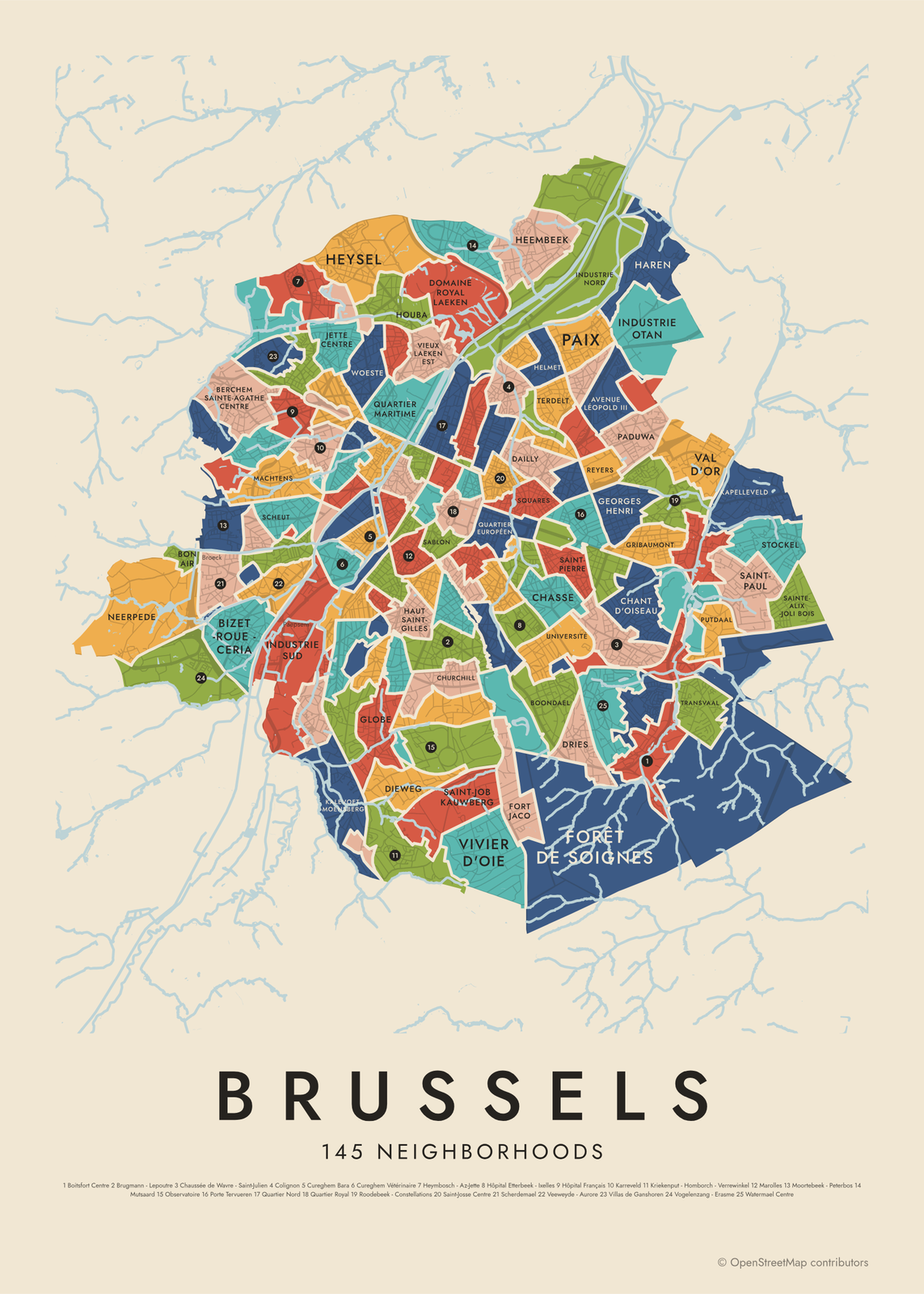 Brussels's 145 neighborhoods in colorEdit this →More neighborhood maps →
How Brussels is divided
The Brussels-Capital Region is made up of 19 communes (gemeenten in Dutch), each with its own mayor and council. One of them is the City of Brussels, which holds the historic center but also reaches north to Laeken, Neder-Over-Heembeek and Haren, and south along Avenue Louise. Most people say Brussels and mean the whole region.
The 145 quartiers come from the Monitoring des Quartiers, the Brussels neighborhood monitoring run by the region's statistics institute, IBSA. Of these, 118 are residential neighborhoods, and the other 27 are parks, forests, cemeteries and industrial zones, like the Forêt de Soignes. Quartiers don't always follow commune lines. Brussels is officially bilingual, French and Dutch, and the area names on the map are mostly in French.
All 19 communes of Brussels
- Anderlecht
- Auderghem
- Berchem-Sainte-Agathe
- City of Brussels
- Etterbeek
- Evere
- Forest
- Ganshoren
- Ixelles
- Jette
- Koekelberg
- Molenbeek-Saint-Jean
- Saint-Gilles
- Saint-Josse-ten-Noode
- Schaerbeek
- Uccle
- Watermael-Boitsfort
- Woluwe-Saint-Lambert
- Woluwe-Saint-Pierre
All 145 neighborhoods of Brussels
- Altitude 100
- Anderlecht Centre - Wayez
- Anneessens
- Auderghem Centre
- Avenue Léopold III
- Bas Forest
- Basilique
- Béguinage - Dixmude
- Berchem Sainte-Agathe Centre
- Berckmans - Hôtel des Monnaies
- Bizet - Roue - Ceria
- Bois de la Cambre
- Bois du Laarbeek - Poelbos
- Boitsfort Centre
- Bon Air
- Boondael
- Bosnie
- Botanique
- Boulevard de la Woluwe
- Brugmann - Lepoutre
- Buffon
- Chant d'Oiseau
- Chasse
- Châtelain
- Chaussée de Haecht
- Chaussée de Wavre - Saint-Julien
- Churchill
- Cimetière d'Ixelles
- Cimetière de Bruxelles
- Cimetière Saint-Gilles
- Cinquantenaire
- Colignon
- Conscience
- Cureghem Bara
- Cureghem Rosée
- Cureghem Vétérinaire
- Dailly
- Dansaert
- Delta
- Dieweg
- Domaine Royal Laeken
- Dries
- Duchesse
- Étangs d'Ixelles
- Flagey - Malibran
- Forêt de Soignes
- Fort Jaco
- Ganshoren Centre
- Gare de l'Ouest
- Gare de Schaerbeek
- Gare du Midi
- Gare Josaphat
- Georges Henri
- Globe
- Grand Place
- Gribaumont
- Haren
- Haut Saint-Gilles
- Heembeek
- Helmet
- Heymbosch - Az-Jette
- Heysel
- Hôpital Etterbeek - Ixelles
- Hôpital Français
- Houba
- Industrie Birmingham
- Industrie Nord
- Industrie Otan
- Industrie Sud
- Jette Centre
- Josaphat
- Jourdan
- Kalevoet - Moensberg
- Kapelleveld
- Karreveld
- Koekelberg
- Korenbeek
- Kriekenput - Homborch - Verrewinkel
- Louise - Longue Haie
- Machtens
- Marolles
- Martyrs
- Matongé
- Molenbeek Historique
- Molière - Longchamp
- Montjoie - Langeveld
- Moortebeek - Peterbos
- Mutsaard
- Neerpede
- Notre-Dame aux Neiges
- Observatoire
- Paduwa
- Paix
- Parc Astrid
- Parc Baudouin - Dielegembos
- Parc de la Woluwe
- Parc des Étangs
- Parc Duden - Parc de Forest
- Parc Élisabeth
- Parc Forestier
- Parc Josaphat
- Parc Léopold
- Parc Marie-José
- Parc Wolvendael
- Plasky
- Porte de Hal
- Porte Tervueren
- Potaarde
- Putdaal
- Quartier Brabant
- Quartier européen
- Quartier Maritime
- Quartier Nord
- Quartier Royal
- Reyers
- Roodebeek - Constellations
- Sablon
- Saint-Denis - Neerstalle
- Saint-Job Kauwberg
- Saint-Josse Centre
- Saint-Michel
- Saint-Paul
- Saint-Pierre
- Sainte-Alix - Joli Bois
- Scherdemael
- Scheut
- Scheutbos
- Squares
- Stalingrad
- Stockel
- Terdelt
- Transvaal
- Trois Tilleuls
- Université
- Val d'Or
- Van Volxem - van Haelen
- Veeweyde - Aurore
- Vieux Laeken Est
- Vieux Laeken Ouest
- Villas de Ganshoren
- Vivier d'Oie
- Vogelenzang - Erasme
- Vossegat - Roosendaal
- Watermael Centre
- Woeste
More neighborhood names on the map
Inside the communes, the map also names 93 smaller neighborhoods where they fit, from OpenStreetMap: Laeken, Vogelzang, Broeck, Moortebeek, Quartier des Trèfles, La Roue, Peterbos, Scheutveld, Meir, Veeweyde, Cité Moderne, Jardins de Jette, Paepsem, Cité Nogent, Bempt, Petite Île, Osseghem, Het Heideken, Neerstalle, Dieleghem, Gazomètre, Cité Modèle, Miroir, Heymbosch, Calevoet, Verregat, Cureghem, Étangs Noirs, Stalle, Esseghem, Altitude Cent, Homborch, Engeland, Rive Gauche, Albert, Le Chat, Quartier des Quais, Tour et Taxis, Quartier Saint-Jacques, Brugmann and more. Turn them off under Names if you want only the communes.
Neighborhoods to know
- Grand Place: the central square, framed by the Town Hall and the guild houses.
- Sablon: the Notre-Dame du Sablon church, chocolate shops and a weekend antiques market.
- Marolles: home of the daily flea market on the Place du Jeu de Balle.
- Quartier européen: the main EU institutions, including the European Commission and the European Parliament.
- Cinquantenaire: the park and triumphal arch named for Belgium's 50th anniversary, with museums in its halls.
- Matongé: named after a neighborhood of Kinshasa, just off the Porte de Namur.
- Heysel: the Atomium, built for the 1958 World's Fair, and the King Baudouin Stadium.
- Saint-Gilles: Art Nouveau townhouses and the Horta Museum, Victor Horta's own home and studio.
How to make your Brussels neighborhood poster
- Open the Brussels map and pick communes or neighborhoods.
- Pick a style: Colored areas, Typographic (the names fill the map) or a Street map with the borders over the streets.
- Tap your own neighborhood to highlight it; it becomes the poster's title.
- Drag and zoom to frame the whole city or just your part of it, then pick a size and download the print file.
Questions
How many communes does Brussels have?
The Brussels-Capital Region has 19 communes, each with its own mayor and council. This map names all 19, then splits them into 145 quartiers.
Is the City of Brussels the same as Brussels?
No. The City of Brussels is one of the 19 communes. It holds the old center, the Grand Place and the Atomium, but places like Ixelles, Schaerbeek and Uccle are communes of their own. When people say Brussels, they usually mean the whole region.
Why do places in Brussels have two names?
Brussels is officially bilingual, so every commune, street and station has a French and a Dutch name: Ixelles is Elsene, Uccle is Ukkel. This map mostly uses the French names.
Where do the Brussels boundaries come from?
From OpenStreetMap (© OpenStreetMap contributors) and IBSA / perspective.brussels (Monitoring des Quartiers), via Ville de Bruxelles. Streets and water are OpenStreetMap's. Boundaries are a snapshot and can differ from what neighbors call home; tell us if one looks wrong.
What sizes can I print?
US Letter, 8 × 10, 11 × 14, 12 × 16 and 12 × 18 in, A4 and A3, free. You download a 300 DPI JPEG drawn at the size you pick. Larger prints, up to 24 × 36 in, are coming soon.
Related

Gift ideas by occasion




Every example is made with the Posterage generators. Change anything, then download it as a 300 DPI JPEG.