Budapest districts map District I to XXIII, and 202 neighborhoods
This poster maps Budapest by its 23 districts, or kerületek, numbered District I to District XXIII on both banks of the Danube. Switch to the 202 városrészek for a finer map with names like Lipótváros, Rózsadomb and Újlipótváros. Highlight yours and print it.
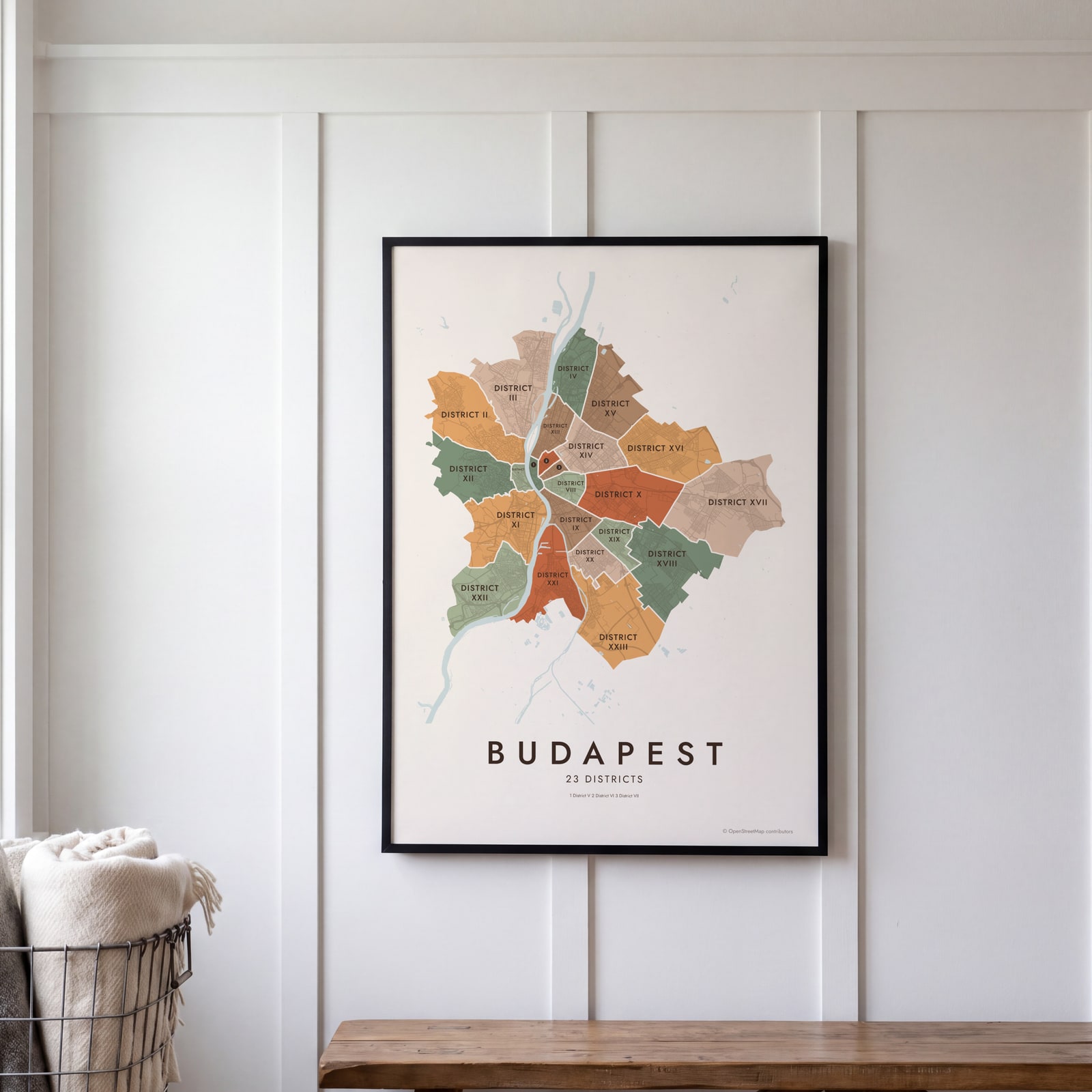
On the wall
A few of them framed at home. Open any one to make it yours.
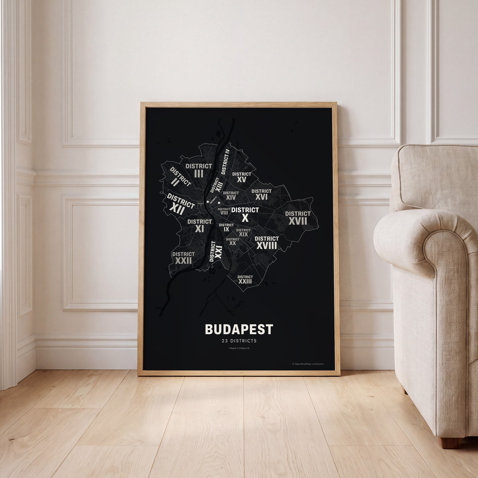 Typographic Budapest map: the names fill their districtsEdit this →
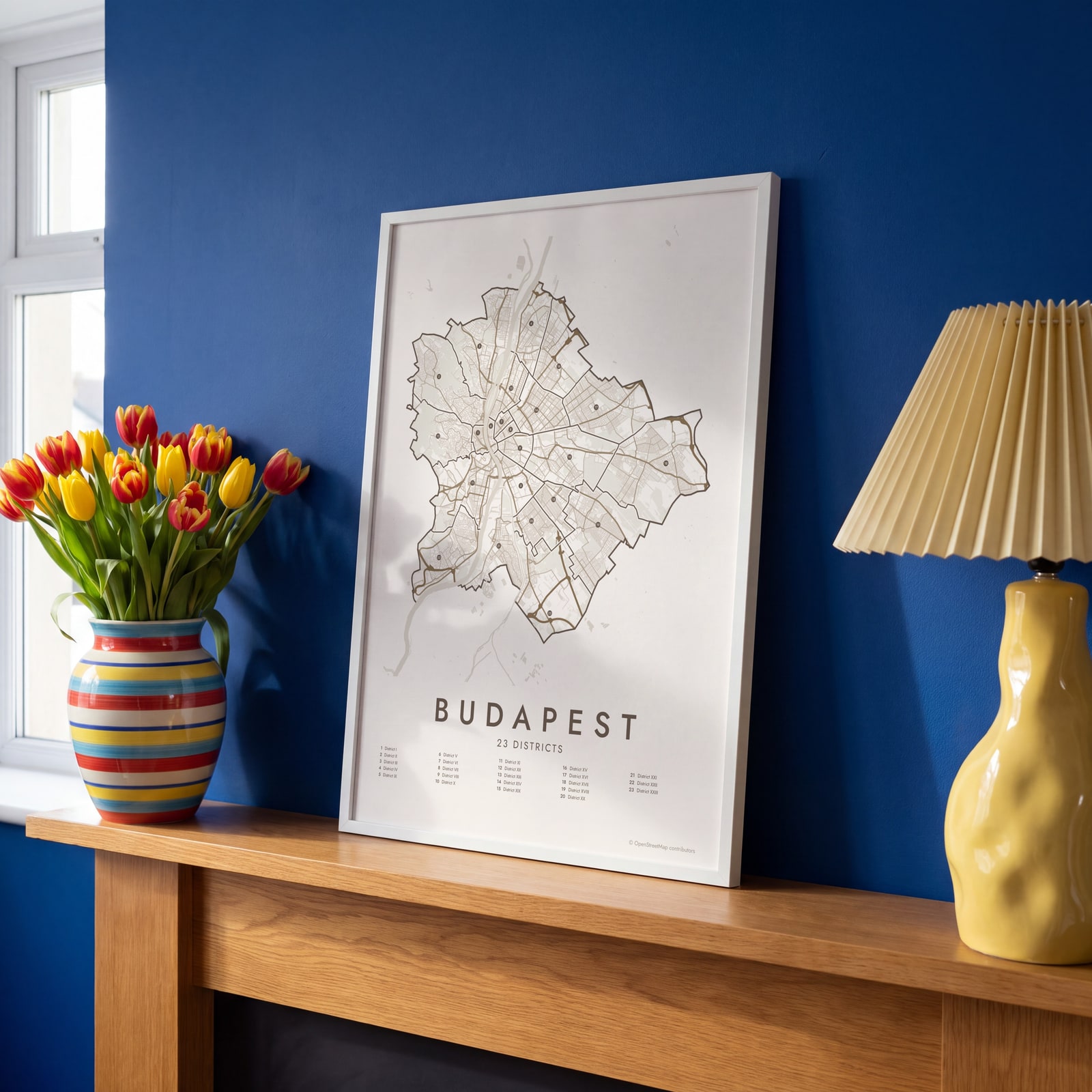 Budapest street map with numbered districts and their listEdit this →
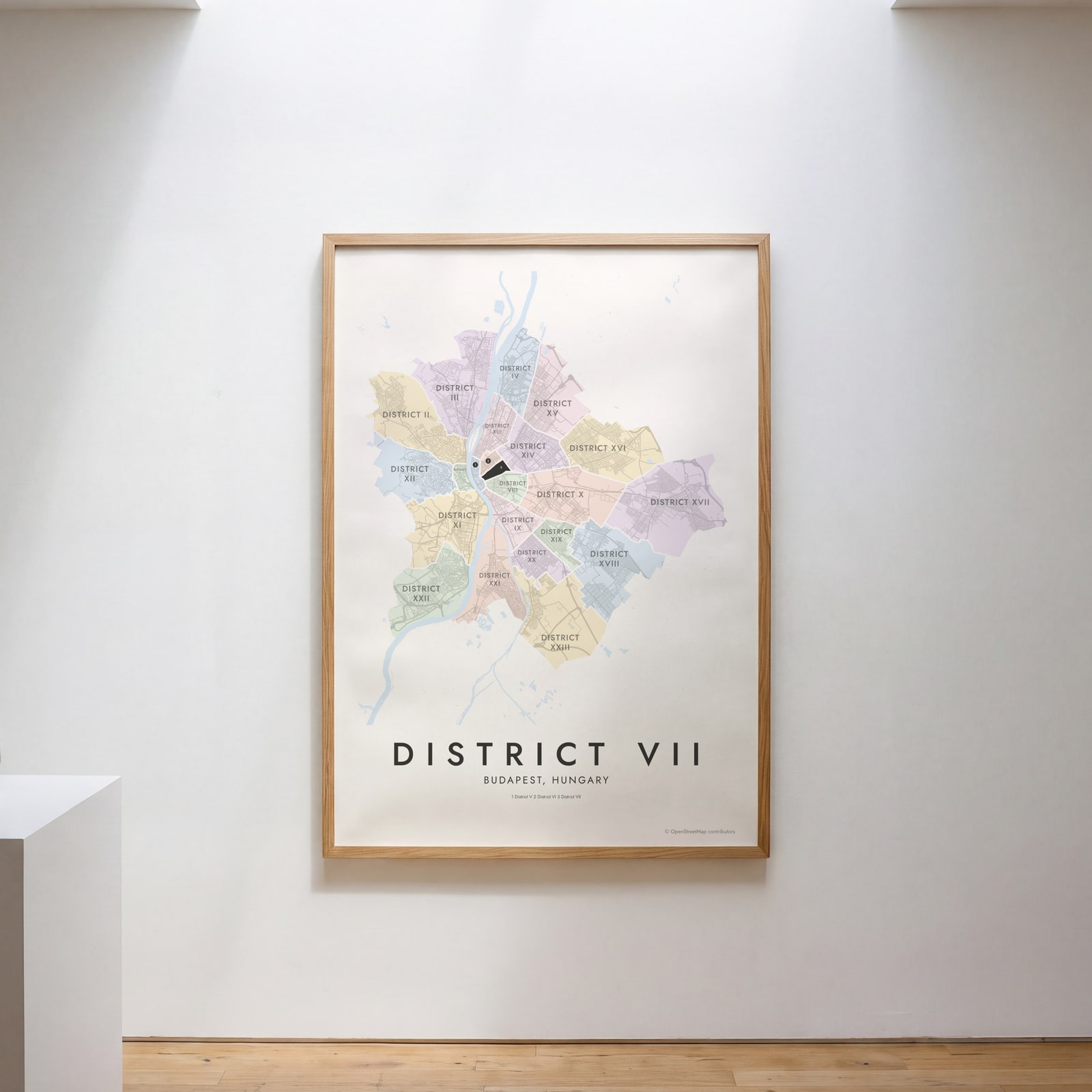 District VII highlighted on a map of BudapestEdit this →
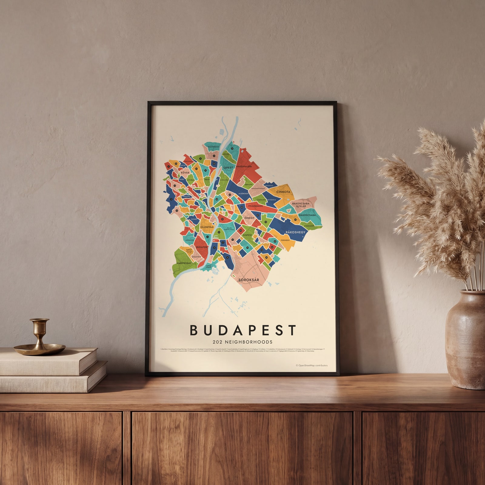 Budapest's 202 neighborhoods in colorEdit this →
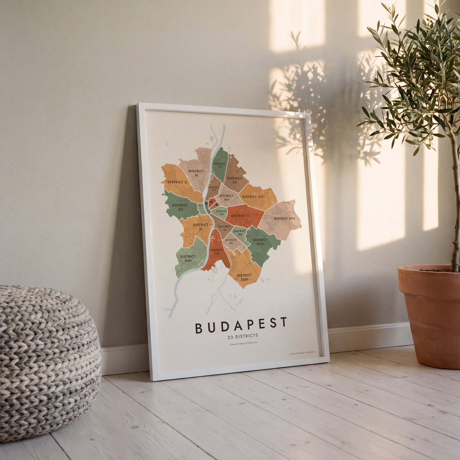 Budapest neighborhood map in color, every district namedEdit this →
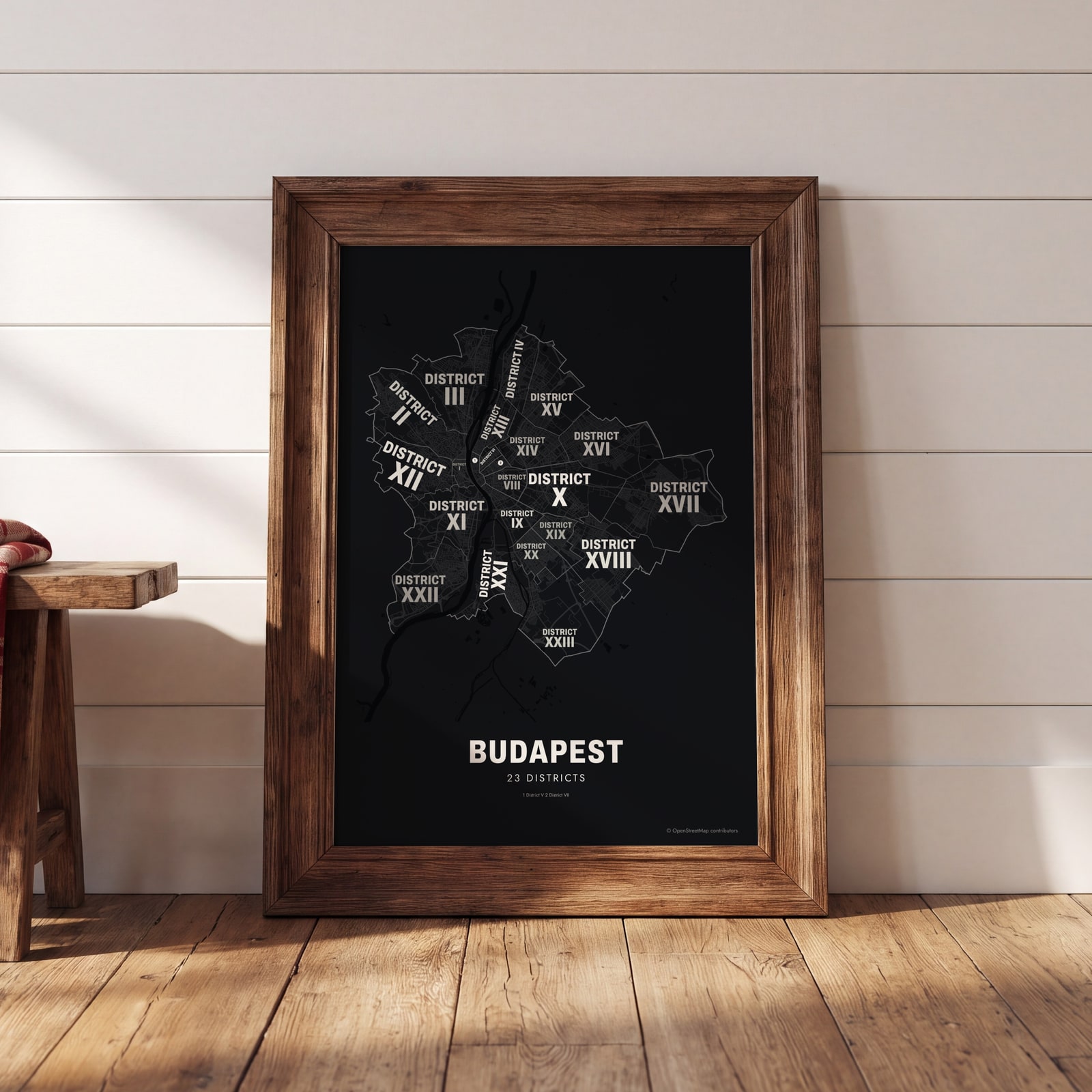 Typographic Budapest map: the names fill their districtsEdit this →
Examples
Open any of them to change the words, the place, the date and the style, then download the print file.
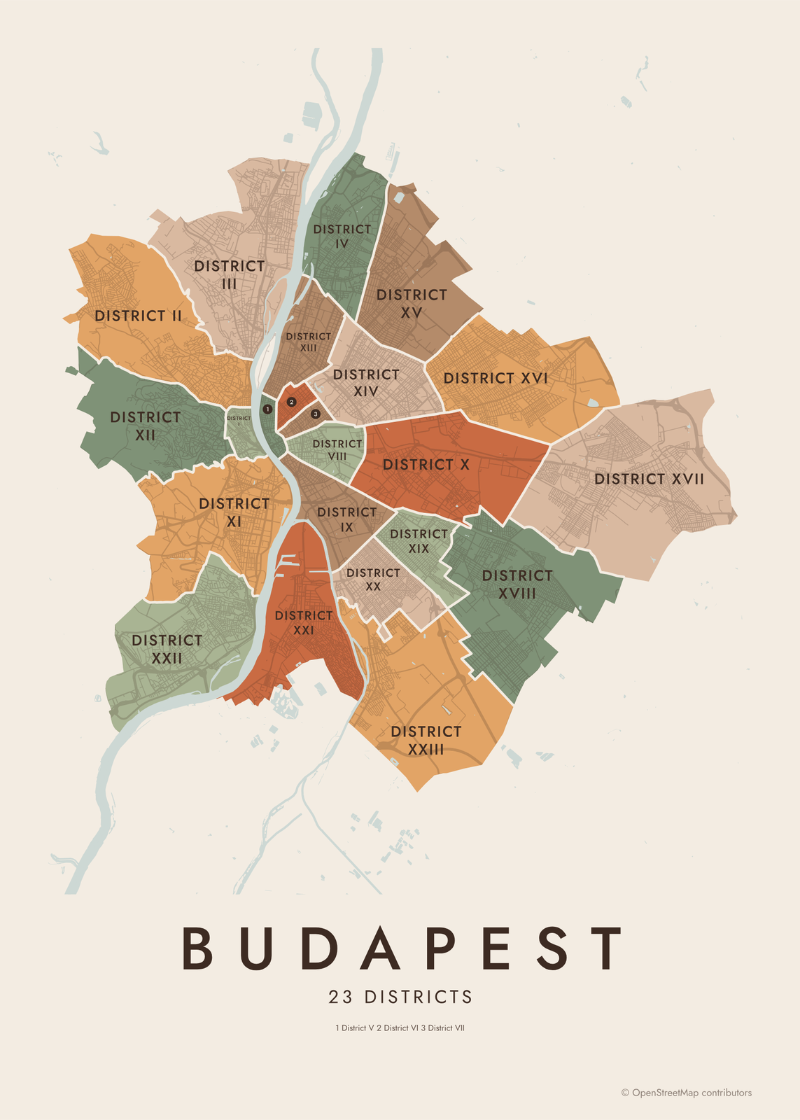 Budapest neighborhood map in color, every district namedEdit this →More neighborhood maps →
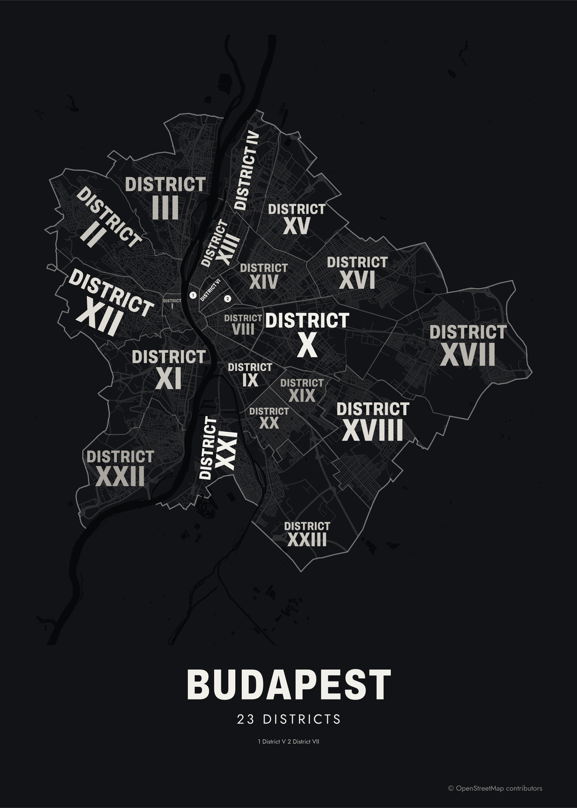 Typographic Budapest map: the names fill their districtsEdit this →More neighborhood maps →
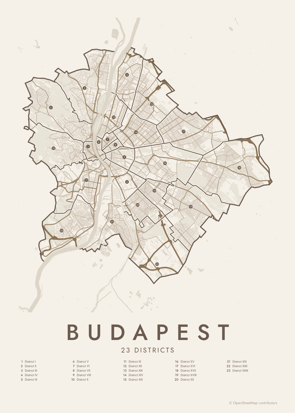 Budapest street map with numbered districts and their listEdit this →More neighborhood maps →
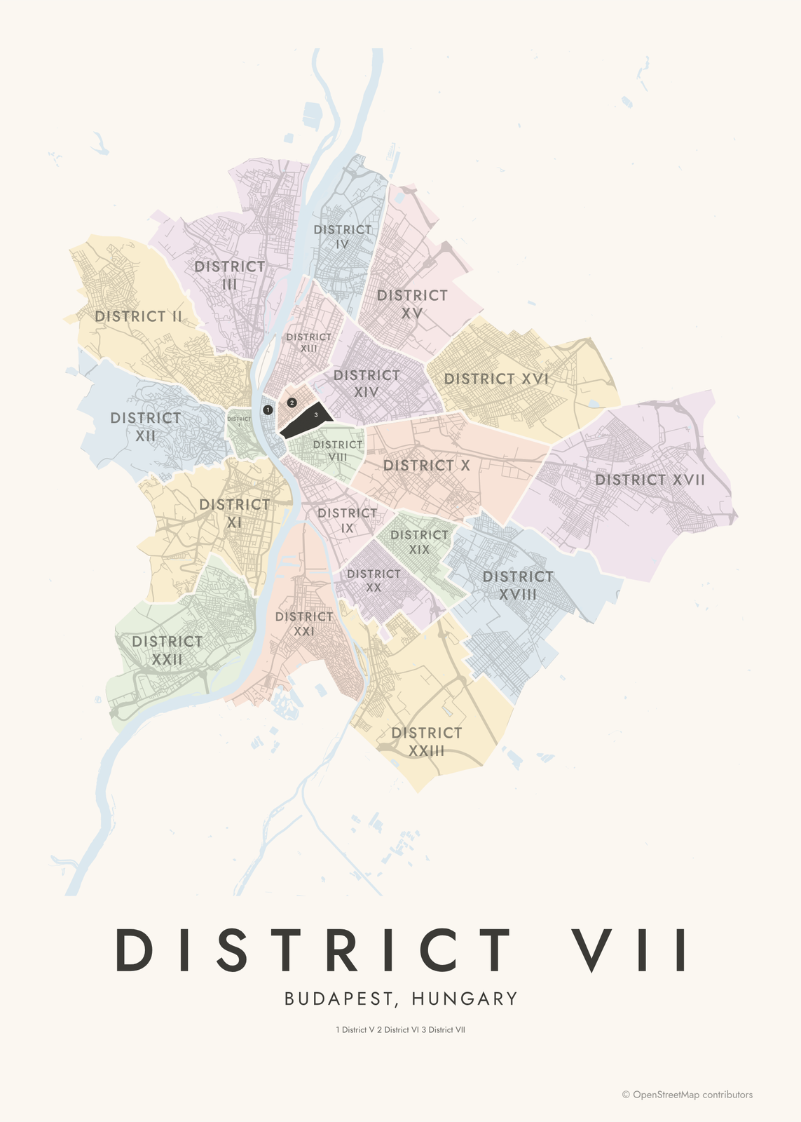 District VII highlighted on a map of BudapestEdit this →More neighborhood maps →
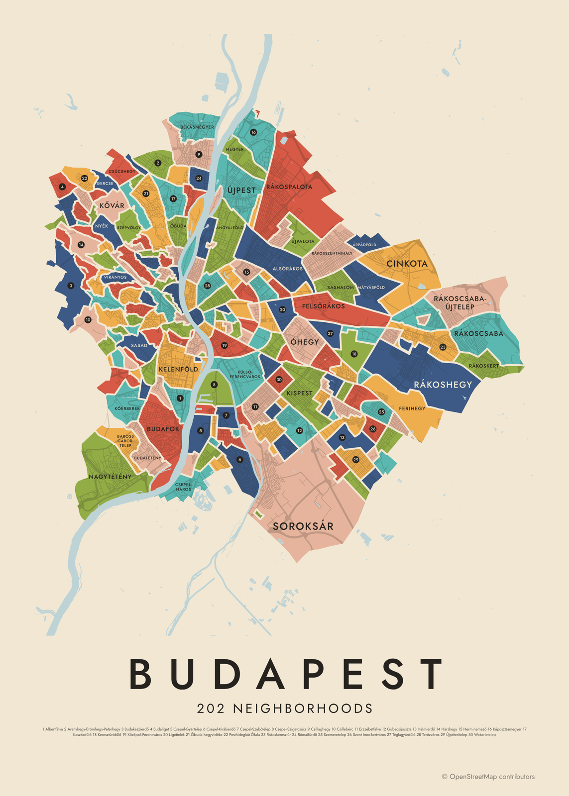 Budapest's 202 neighborhoods in colorEdit this →More neighborhood maps →
How Budapest is divided
Budapest was formed in 1873 by joining Buda, Óbuda and Pest. In 1950 the city took in the towns and villages around it, such as Újpest, Kispest and Csepel, and the 23rd district, Soroksár, split off from the 20th in 1994. Each district has a Roman numeral, a name, and its own mayor and council. Budapesters mostly use the number: District VII is Erzsébetváros.
Below the districts are the városrészek, the city's officially named neighborhoods, set by the Budapest General Assembly. There are about 200, and our map shows 202. Most sit inside one district, but a few cross district lines. Many recall an old village or estate, like Rákospalota or Wekerletelep, and they are the names people use for where they live.
All 23 districts of Budapest
- District I
- District II
- District III
- District IV
- District V
- District VI
- District VII
- District VIII
- District IX
- District X
- District XI
- District XII
- District XIII
- District XIV
- District XV
- District XVI
- District XVII
- District XVIII
- District XIX
- District XX
- District XXI
- District XXII
- District XXIII
All 202 neighborhoods of Budapest
- Adyliget
- Akadémiaújtelep
- Albertfalva
- Almáskert
- Alsórákos
- Angyalföld
- Aquincum
- Aranyhegy-Ürömhegy-Péterhegy
- Árpádföld
- Baross Gábor-telep
- Békásmegyer
- Bélatelep
- Belső-Ferencváros
- Belsőmajor
- Belváros
- Bókaytelep
- Budafok
- Budakeszierdő
- Budaliget
- Budatétény
- Cinkota
- Corvinnegyed
- Csarnoknegyed
- Csatárka
- Csepel-Belváros
- Csepel-Csillagtelep
- Csepel-Erdőalja
- Csepel-Erdősor
- Csepel-Gyártelep
- Csepel-Háros
- Csepel-Kertváros
- Csepel-Királyerdő
- Csepel-Királymajor
- Csepel-Ófalu
- Csepel-Rózsadomb
- Csepel-Szabótelep
- Csepel-Szigetcsúcs
- Csillaghegy
- Csillebérc
- Csúcshegy
- Dobogó
- Erdőskert
- Erzsébetfalva
- Erzsébetliget
- Erzsébettelek
- Erzsébettelep
- Erzsébetváros
- Farkasrét
- Farkasvölgy
- Felhévíz
- Felsőrákos
- Ferihegy
- Ganzkertváros
- Ganznegyed
- Ganztelep
- Gazdagrét
- Gellérthegy
- Gercse
- Gloriett-telep
- Göncz Árpád városközpont
- Gubacs
- Gubacsipuszta
- Gyárdűlő
- Halmierdő
- Hármashatárhegy
- Hársakalja
- Harsánylejtő
- Hárshegy
- Havanna-lakótelep
- Herminamező
- Hosszúrét
- Hűvösvölgy
- Infopark
- Istenhegy
- Istvánmező
- Istvántelek
- Jánoshegy
- József Attila-lakótelep
- Káposztásmegyer
- Kaszásdűlő
- Kelenföld
- Kelenvölgy
- Kerepesdűlő
- Keresztúridűlő
- Kispest
- Kissvábhegy
- Kiszugló
- Kőbánya-Kertváros
- Kőérberek
- Kossuth Ferenc-telep
- Kossuthfalva
- Kővár
- Középső-Ferencváros
- Krepuska Géza-telep
- Krisztinaváros
- Külső-Ferencváros
- Kurucles
- Kúttó
- Kútvölgy
- Lágymányos
- Lakatos-lakótelep
- Laposdűlő
- Ligettelek
- Lipótmező
- Lipótváros
- Liptáktelep
- Lónyaytelep
- Losoncinegyed
- Madárdomb
- Madárhegy
- Magasút
- Magdolnanegyed
- Margitsziget
- Máriaremete
- Mártonhegy
- Mátyásföld
- Megyer
- Miklóstelep
- Millenniumtelep
- Mocsárosdűlő
- Nádorkert
- Nagytétény
- Nagyzugló
- Németvölgy
- Népliget
- Népsziget
- Népszínháznegyed
- Nyék
- Óbuda
- Óbuda hegyvidéke
- Óbudai-sziget
- Óhegy
- Orbánhegy
- Orczynegyed
- Őrmező
- Örsöd
- Országút
- Pacsirtatelep
- Palotanegyed
- Pálvölgy
- Pasarét
- Pesthidegkút-Ófalu
- Pestújhely
- Péterhegy
- Petneházyrét
- Pösingermajor
- Rákoscsaba
- Rákoscsaba-Újtelep
- Rákosfalva
- Rákoshegy
- Rákoskeresztúr
- Rákoskert
- Rákosliget
- Rákospalota
- Rákosszentmihály
- Régiakadémiatelep
- Remetekertváros
- Rendessytelep
- Rézmál
- Rómaifürdő
- Rózsadomb
- Sasad
- Sashalom
- Sashegy
- Solymárvölgy
- Soroksár
- Soroksár-Újtelep
- Spanyolrét
- Svábhegy
- Szabótelep
- Századosnegyed
- Széchenyihegy
- Székesdűlő
- Szemeretelep
- Szemlőhegy
- Szent Imre-kertváros
- Szent Lőrinc-lakótelep
- Szentimreváros
- Széphalom
- Szépilona
- Szépvölgy
- Tabán
- Téglagyárdűlő
- Terézváros
- Tisztviselőtelep
- Törökőr
- Törökvész
- Újhegy
- Újlak
- Újlipótváros
- Újpalota
- Újpest
- Újpéteritelep
- Vár
- Városliget
- Vérhalom
- Virányos
- Vizafogó
- Víziváros
- Wekerletelep
- Zöldmál
- Zugliget
Neighborhoods to know
- Vár: the Castle District on Castle Hill, with Buda Castle, Matthias Church and the Fishermen's Bastion.
- Lipótváros: the Hungarian Parliament Building on the Danube and St. Stephen's Basilica.
- Erzsébetváros: the old Jewish Quarter, home of the Dohány Street Synagogue.
- Városliget: City Park, with Heroes' Square, the Széchenyi Baths and Vajdahunyad Castle.
- Margitsziget: Margaret Island, a park island in the middle of the Danube.
- Gellérthegy: Gellért Hill, with the Liberty Statue on top and the Gellért Baths at its foot.
- Aquincum: the ruins of the Roman town that stood here long before Budapest.
- Wekerletelep: a garden suburb in Kispest, built in the early 1900s around a central square.
How to make your Budapest neighborhood poster
- Open the Budapest map and pick districts or neighborhoods.
- Pick a style: Colored areas, Typographic (the names fill the map) or a Street map with the borders over the streets.
- Tap your own neighborhood to highlight it; it becomes the poster's title.
- Drag and zoom to frame the whole city or just your part of it, then pick a size and download the print file.
Questions
How many districts does Budapest have?
23. They're numbered with Roman numerals, from District I, the Castle District in Buda, to District XXIII, Soroksár. Each also has a name: District V is Belváros-Lipótváros and District VIII is Józsefváros.
Which districts are in Buda and which are in Pest?
Buda, on the west bank, has Districts I, II, III, XI, XII and XXII. Pest, on the east bank, has IV to X, XIII to XX and XXIII. District XXI is Csepel, on Csepel Island in the Danube.
How do I find the district from a Budapest address?
Look at the postal code. Budapest codes start with 1, and the next two digits are the district: 1072 is in District VII, 1114 in District XI.
Where do the Budapest boundaries come from?
From OpenStreetMap (© OpenStreetMap contributors). Streets and water are OpenStreetMap's. Boundaries are a snapshot and can differ from what neighbors call home; tell us if one looks wrong.
What sizes can I print?
US Letter, 8 × 10, 11 × 14, 12 × 16 and 12 × 18 in, A4 and A3, free. You download a 300 DPI JPEG drawn at the size you pick. Larger prints, up to 24 × 36 in, are coming soon.
Related

Gift ideas by occasion




Every example is made with the Posterage generators. Change anything, then download it as a 300 DPI JPEG.