Dublin neighborhood map Dublin 1 to Dublin 24, all 22 districts
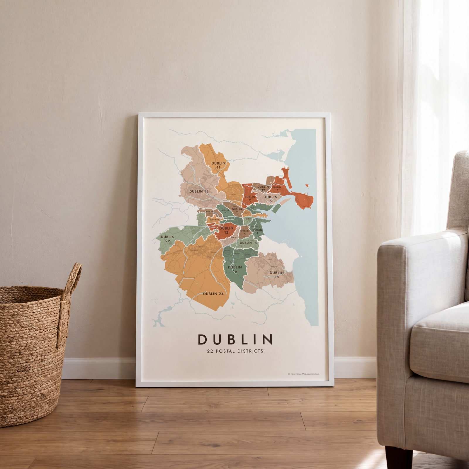
This poster maps Dublin split into its 22 postal districts, from Dublin 1 in the north inner city out to Dublin 24 in Tallaght. More than 100 neighborhood names, like Stoneybatter, Rathmines and Clontarf, print as small labels. Highlight your district and print it.
On the wall
A few of them framed at home. Open any one to make it yours.
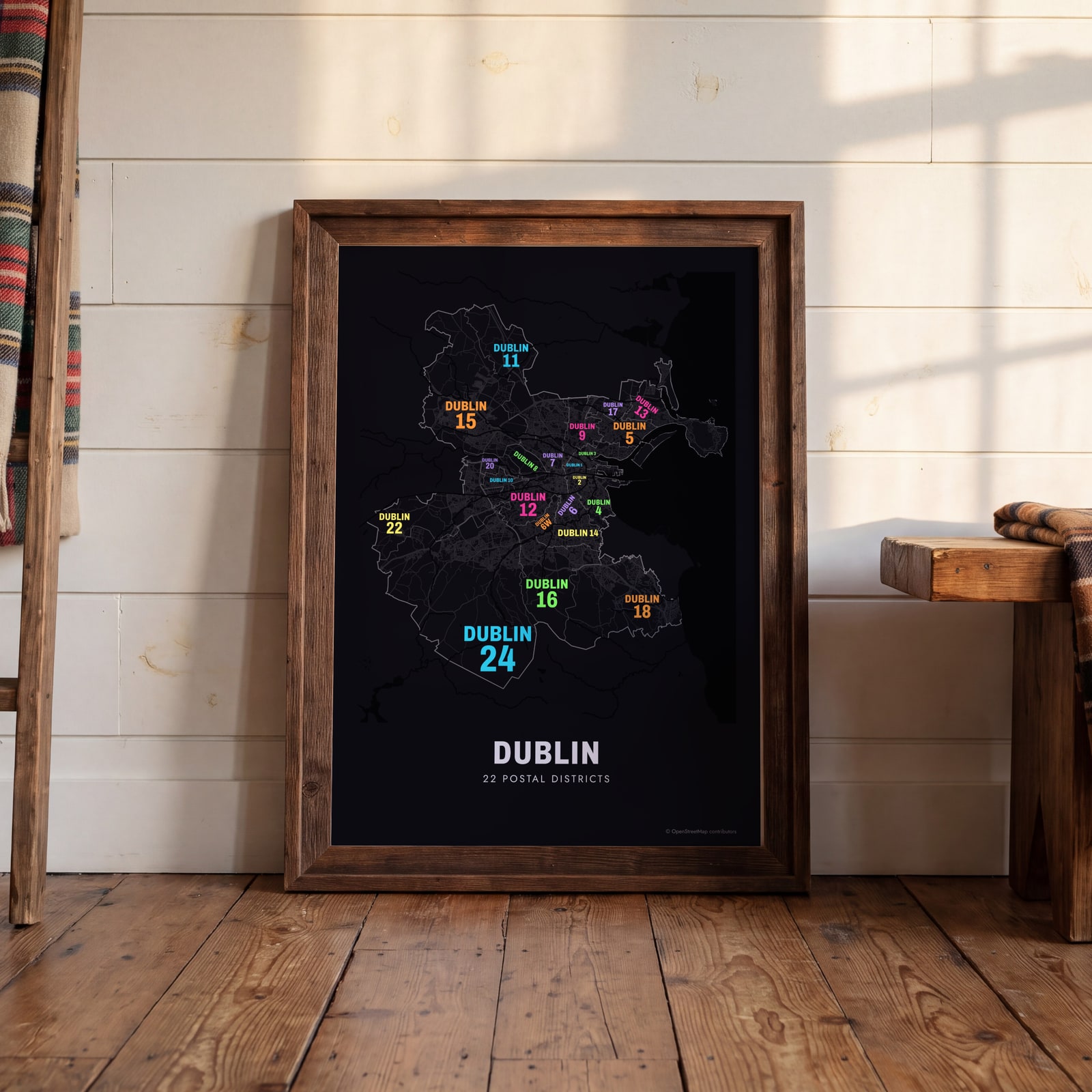 Typographic Dublin map: the names fill their postal districtsEdit this →
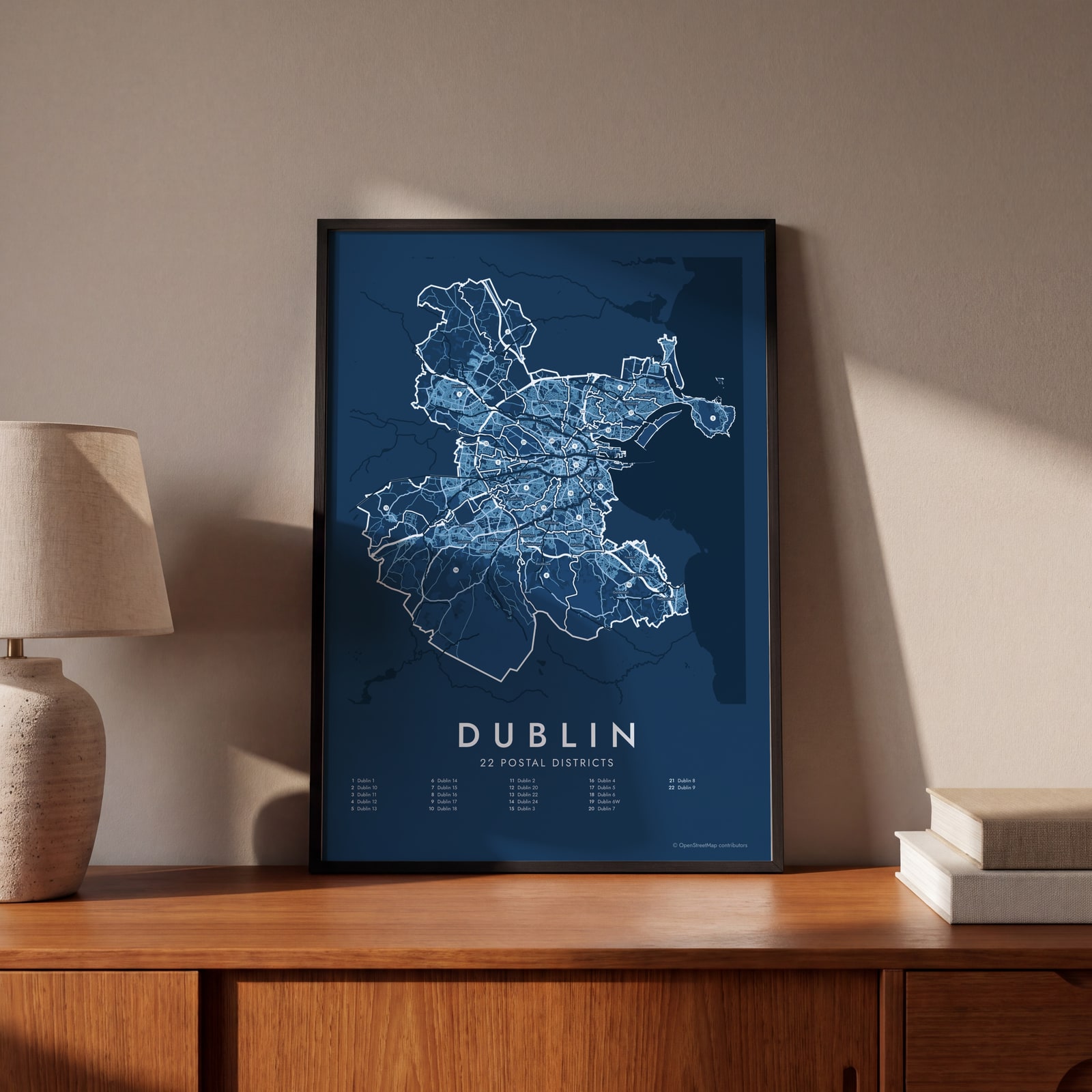 Dublin street map with numbered postal districts and their listEdit this →
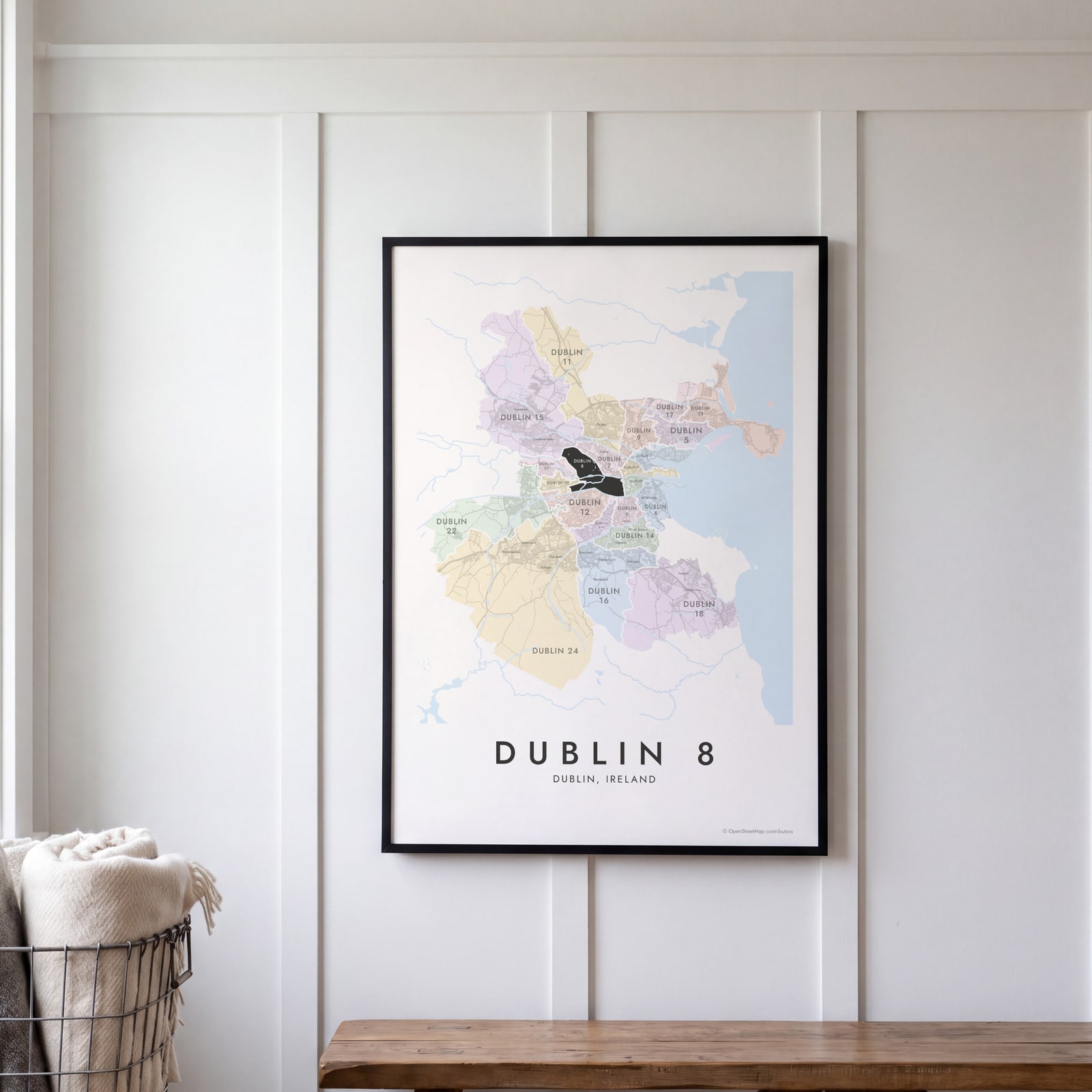 Dublin 8 highlighted on a map of DublinEdit this →
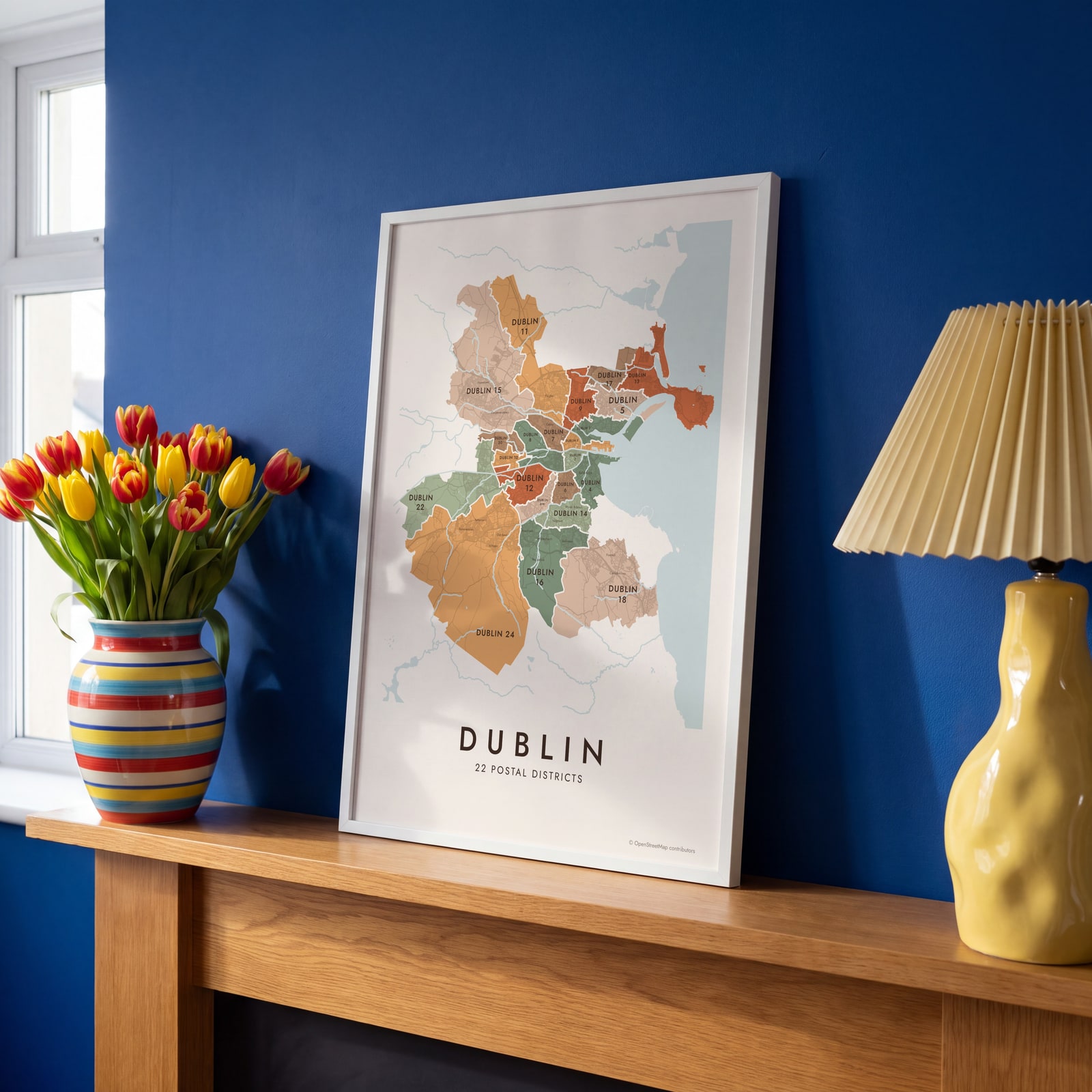 Dublin neighborhood map in color, every postal district namedEdit this →
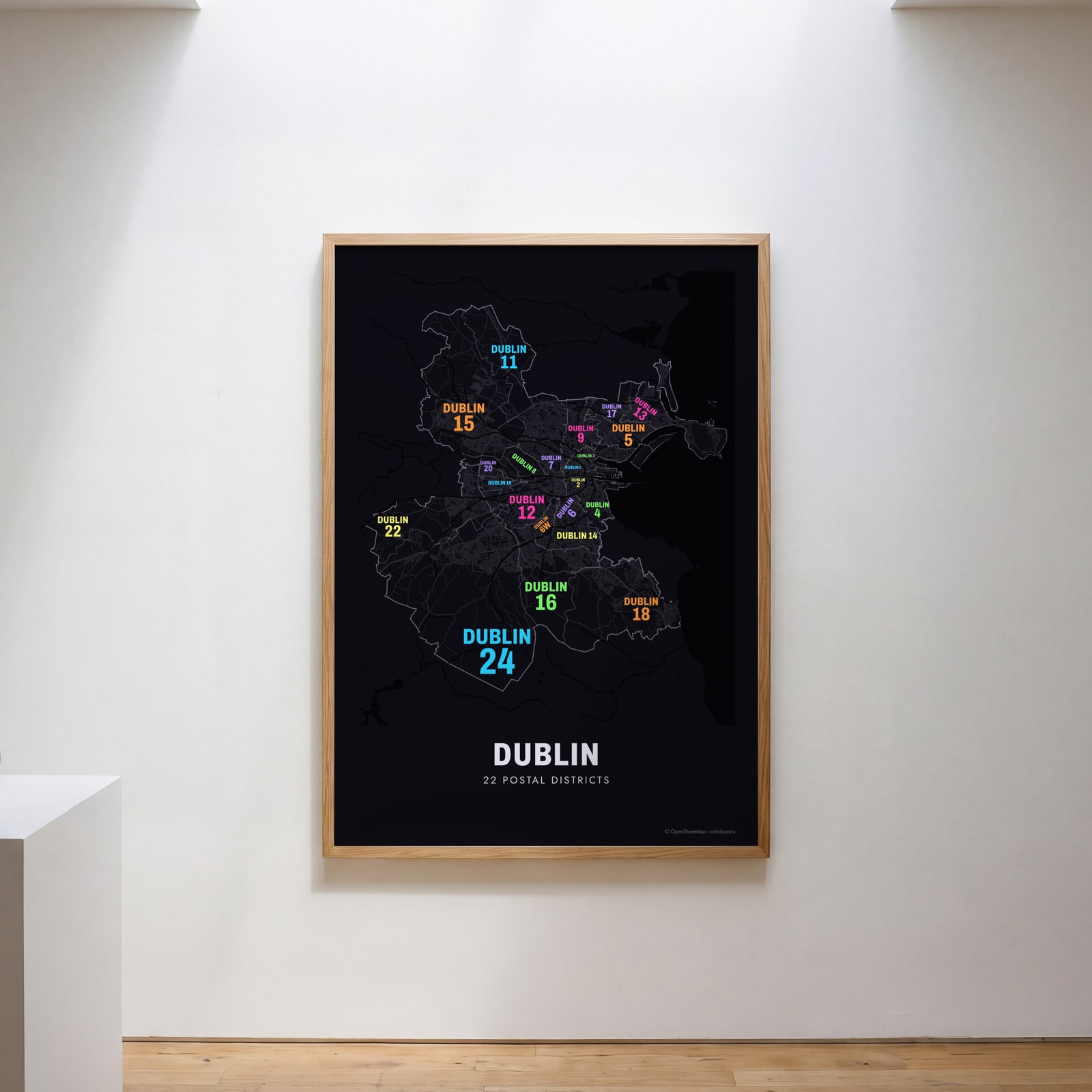 Typographic Dublin map: the names fill their postal districtsEdit this →
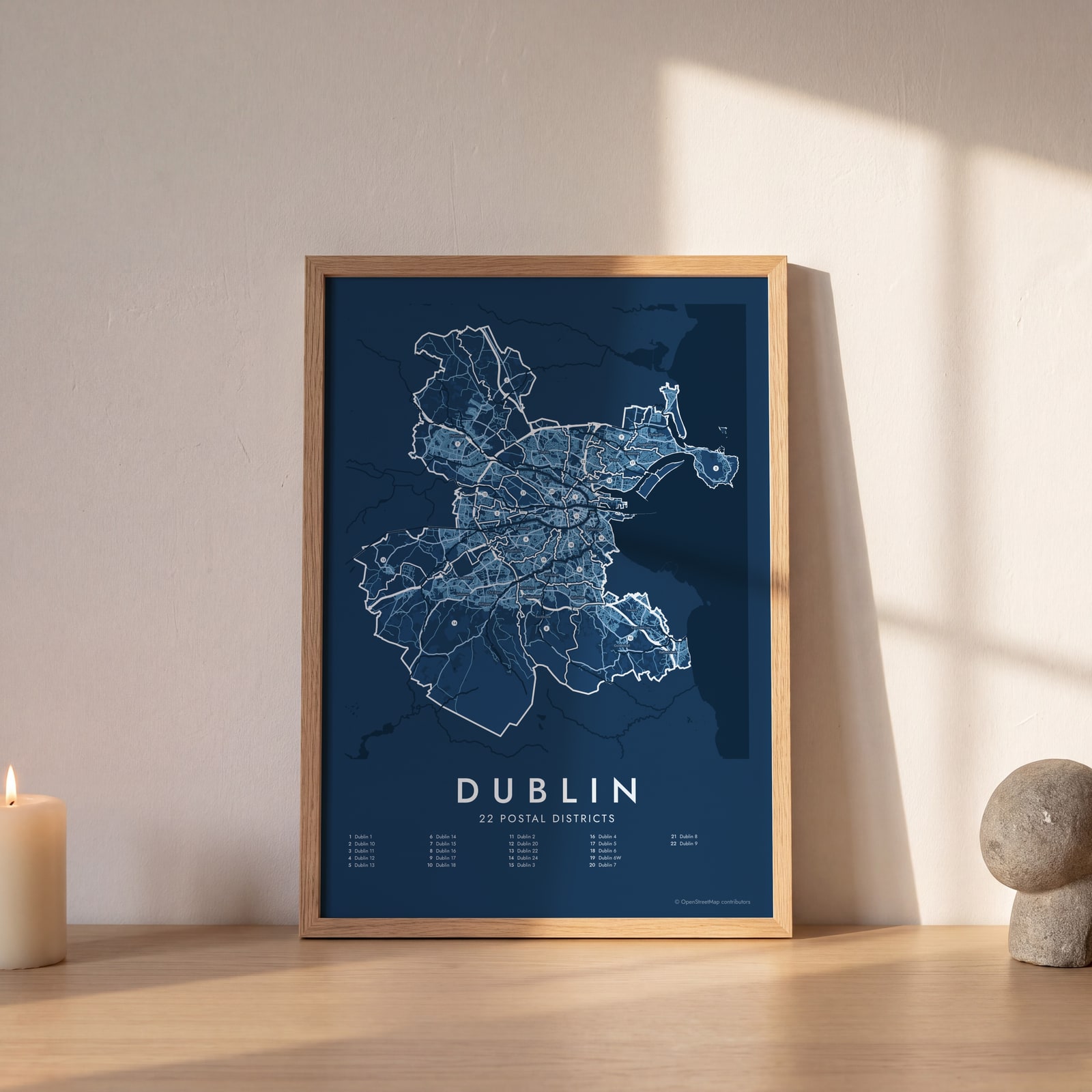 Dublin street map with numbered postal districts and their listEdit this →
Examples
Open any of them to change the words, the place, the date and the style, then download the print file.
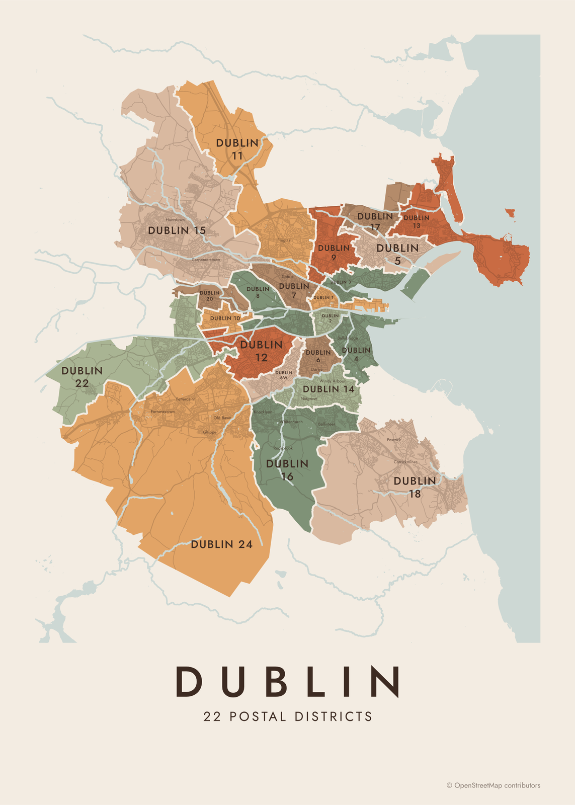 Dublin neighborhood map in color, every postal district namedEdit this →More neighborhood maps →
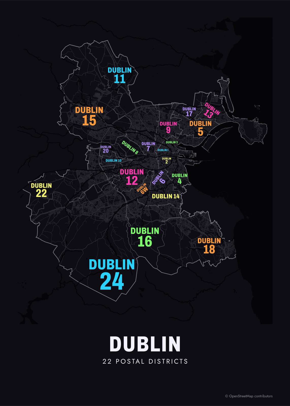 Typographic Dublin map: the names fill their postal districtsEdit this →More neighborhood maps →
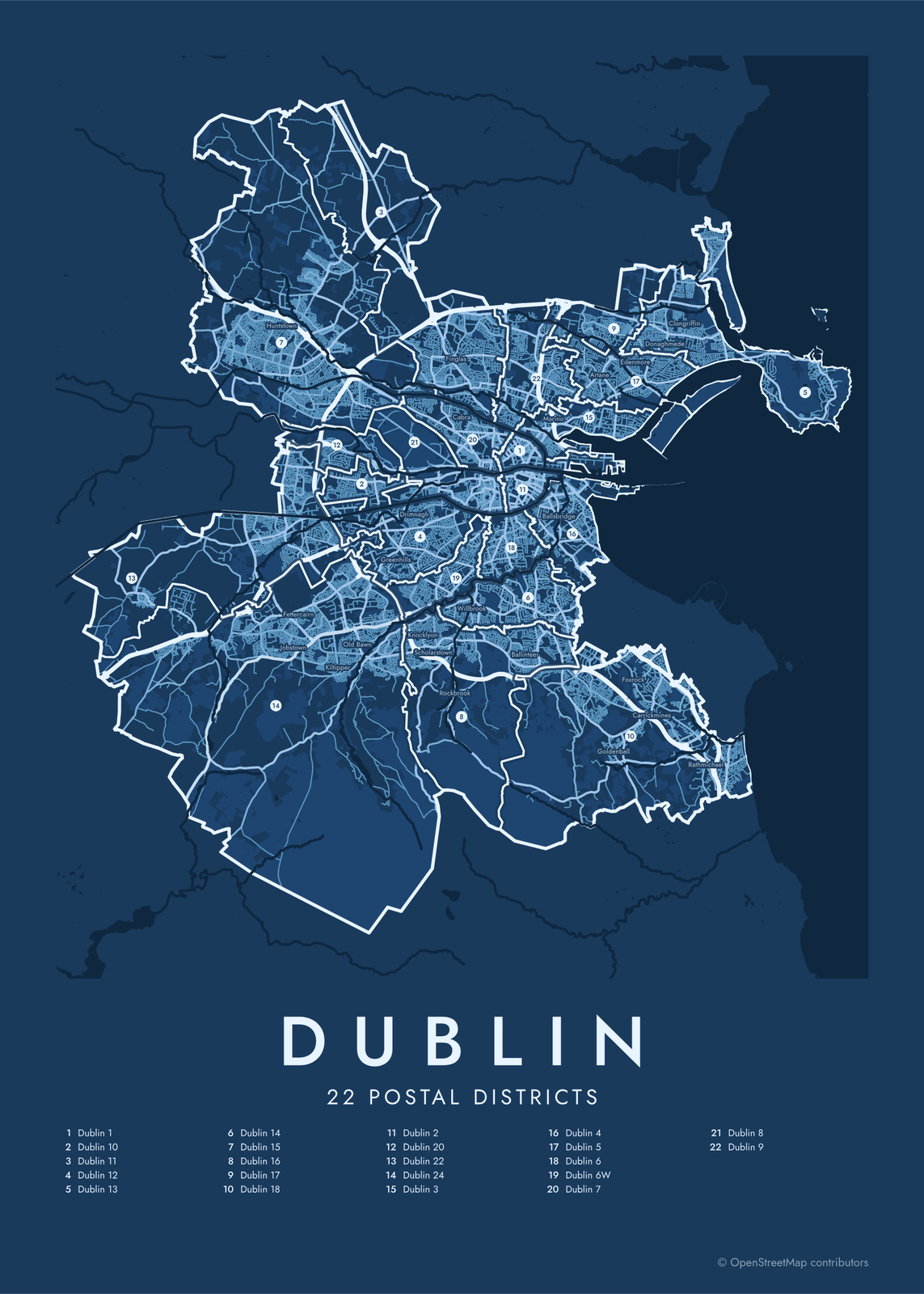 Dublin street map with numbered postal districts and their listEdit this →More neighborhood maps →
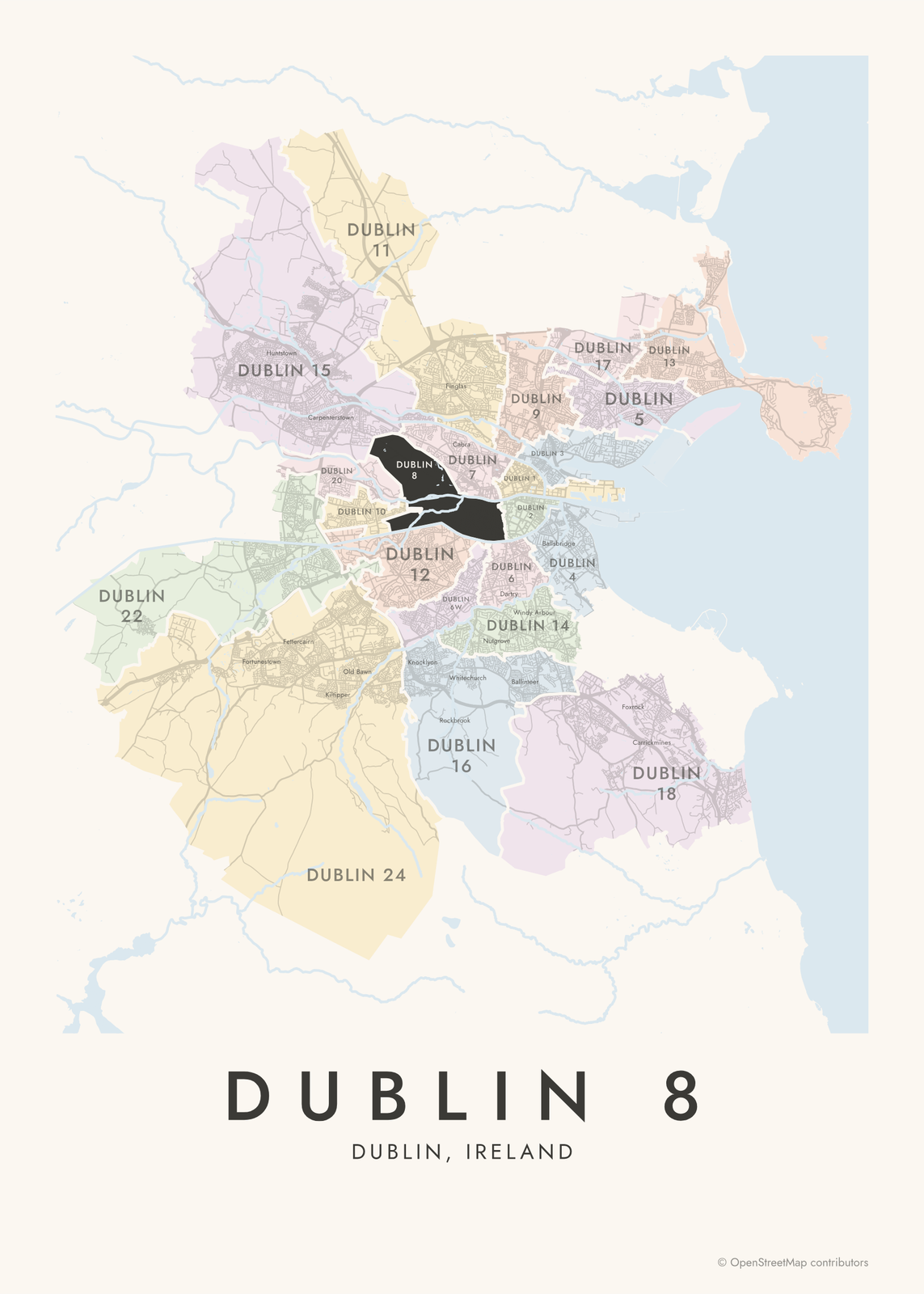 Dublin 8 highlighted on a map of DublinEdit this →More neighborhood maps →
How Dublin is divided
Dubliners often name where they live by postal district: Dublin 4, Dublin 8, D6. There are 22 of them, numbered 1 to 24 plus 6W, with no Dublin 19, 21 or 23. Odd numbers are north of the Liffey and even numbers south. The exceptions are Dublin 8 and Dublin 20, the only two that cross the river: the Phoenix Park is in Dublin 8. Dublin 6W was split from Dublin 6 in 1985.
When Eircode arrived in 2015, the districts became the first part of every Dublin postcode, D01 to D24, with D6W kept as is. Our borders follow those Eircode routing areas. The districts cover the city and its nearer suburbs. Towns farther out in County Dublin, like Swords, Lucan and Dún Laoghaire, never had a district number. Inside each district, local names like Phibsborough, Ranelagh and Crumlin print as labels.
All 22 postal districts of Dublin
- Dublin 1
- Dublin 2
- Dublin 3
- Dublin 4
- Dublin 5
- Dublin 6
- Dublin 6W
- Dublin 7
- Dublin 8
- Dublin 9
- Dublin 10
- Dublin 11
- Dublin 12
- Dublin 13
- Dublin 14
- Dublin 15
- Dublin 16
- Dublin 17
- Dublin 18
- Dublin 20
- Dublin 22
- Dublin 24
More neighborhood names on the map
Inside the postal districts, the map also names 108 smaller neighborhoods where they fit, from OpenStreetMap: Fortunestown, Jobstown, Old Bawn, Ballyfermot, Chapelizod, Bluebell, Firhouse, Greenhills, Ashtown, Walkinstown, Ballycullen, Drimnagh, Inchicore, Perrystown, Knocklyon, Crumlin, Scholarstown, Islandbridge, Kilmainham, Templeogue, Kimmage, Ballyroan, Finglas, Rialto, Cabra, Dolphin's Barn, Whitechurch, Oxmantown, Willbrook, Terenure, Stoneybatter, Grangegorman, Harold's Cross, The Liberties, Rathgar, Phibsborough, Portobello, Glasnevin, Ballymun, Rathmines and more. Turn them off under Names if you want only the postal districts.
Districts and neighborhoods to know
- Dublin 1: the north inner city, with O'Connell Street and the General Post Office.
- Dublin 2: the south city center, with Trinity College, Grafton Street and St Stephen's Green.
- Dublin 4: Ballsbridge, Donnybrook and Sandymount, south of the Grand Canal toward Dublin Bay.
- Dublin 8: The Liberties, Kilmainham and the Guinness brewery at St James's Gate, plus the Phoenix Park north of the river.
- Temple Bar: cobbled lanes on the south bank of the Liffey, with pubs, galleries and the Irish Film Institute.
- Kilmainham: Kilmainham Gaol and the Irish Museum of Modern Art in the Royal Hospital.
- Glasnevin: the National Botanic Gardens and Glasnevin Cemetery, on the north side.
- Clontarf: a seafront promenade on Dublin Bay, near the Bull Wall and North Bull Island.
How to make your Dublin neighborhood poster
- Open the Dublin map.
- Pick a style: Colored areas, Typographic (the names fill the map) or a Street map with the borders over the streets.
- Tap your own neighborhood to highlight it; it becomes the poster's title.
- Drag and zoom to frame the whole city or just your part of it, then pick a size and download the print file.
Questions
How many postal districts does Dublin have?
22. They run from Dublin 1 to Dublin 24, plus Dublin 6W. There's no Dublin 19, 21 or 23.
Is north Dublin odd or even?
Odd. Districts north of the Liffey have odd numbers and those to the south have even numbers. Dublin 8 and Dublin 20 cross the river, so the Phoenix Park and Chapelizod village are on the north side with even numbers.
What is Dublin 6W?
The western part of the old Dublin 6, split off in 1985. It covers Harold's Cross, Kimmage, Templeogue and most of Terenure. Its Eircode routing key is D6W.
Why aren't Swords or Dún Laoghaire on the map?
They're outside the numbered districts. Towns in the rest of County Dublin, like Swords, Lucan, Malahide and Dún Laoghaire, have their own Eircode routing keys instead of a Dublin number, so this map stops at the 22 districts.
Where do the Dublin boundaries come from?
From OpenStreetMap (© OpenStreetMap contributors) and autoaddress.ie / Codema (Zenodo), CSO. Streets and water are OpenStreetMap's. Boundaries are a snapshot and can differ from what neighbors call home; tell us if one looks wrong.
What sizes can I print?
US Letter, 8 × 10, 11 × 14, 12 × 16 and 12 × 18 in, A4 and A3, free. You download a 300 DPI JPEG drawn at the size you pick. Larger prints, up to 24 × 36 in, are coming soon.
Related

Gift ideas by occasion




Every example is made with the Posterage generators. Change anything, then download it as a 300 DPI JPEG.