Barcelona neighborhood map 10 districts and 73 barris, named
This poster maps Barcelona as its 10 districts, from Ciutat Vella by the port to Nou Barris in the north. Switch to the 73 barris for a finer map, named in Catalan, like El Gòtic, El Raval and La Vila de Gràcia. Highlight yours and print it.
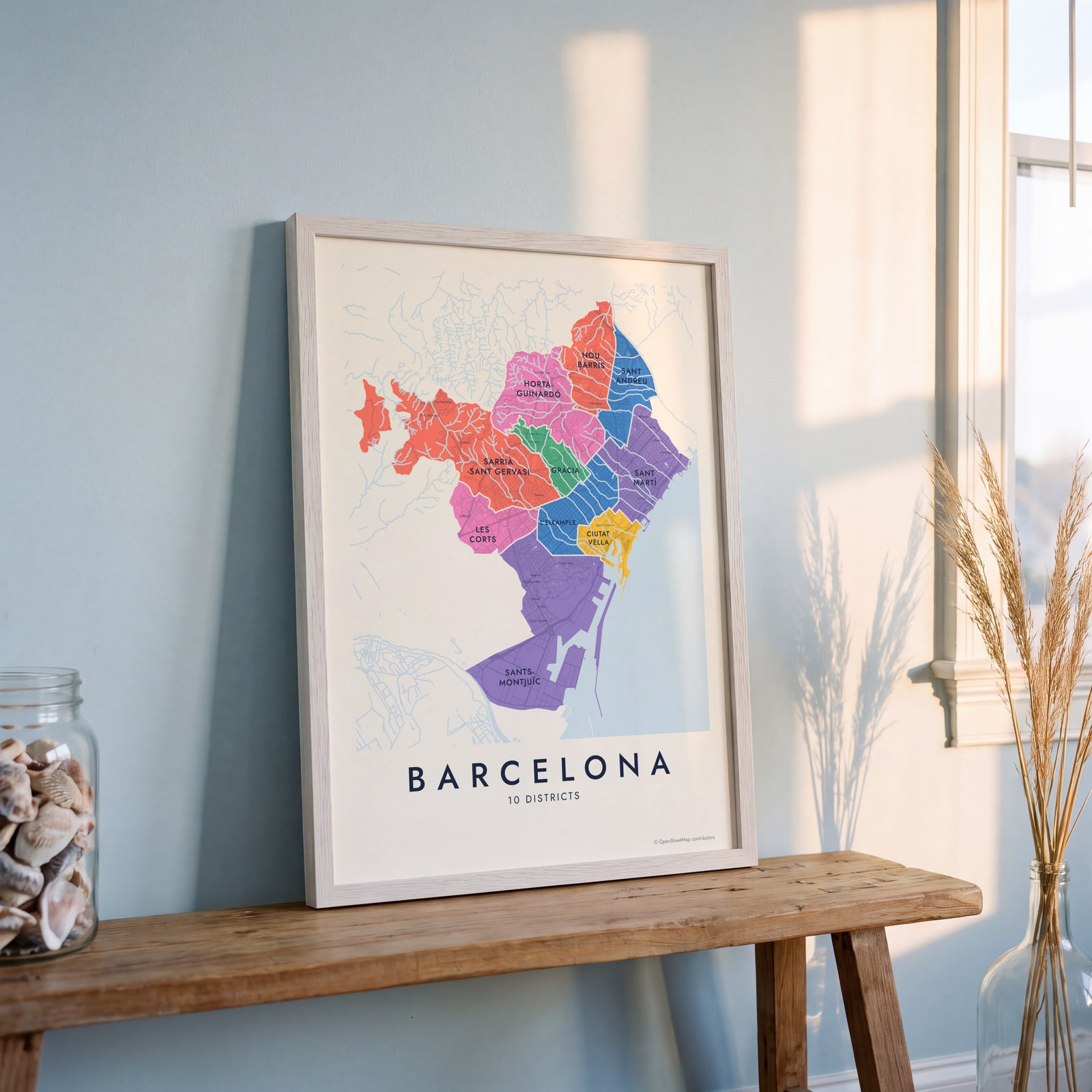
On the wall
A few of them framed at home. Open any one to make it yours.
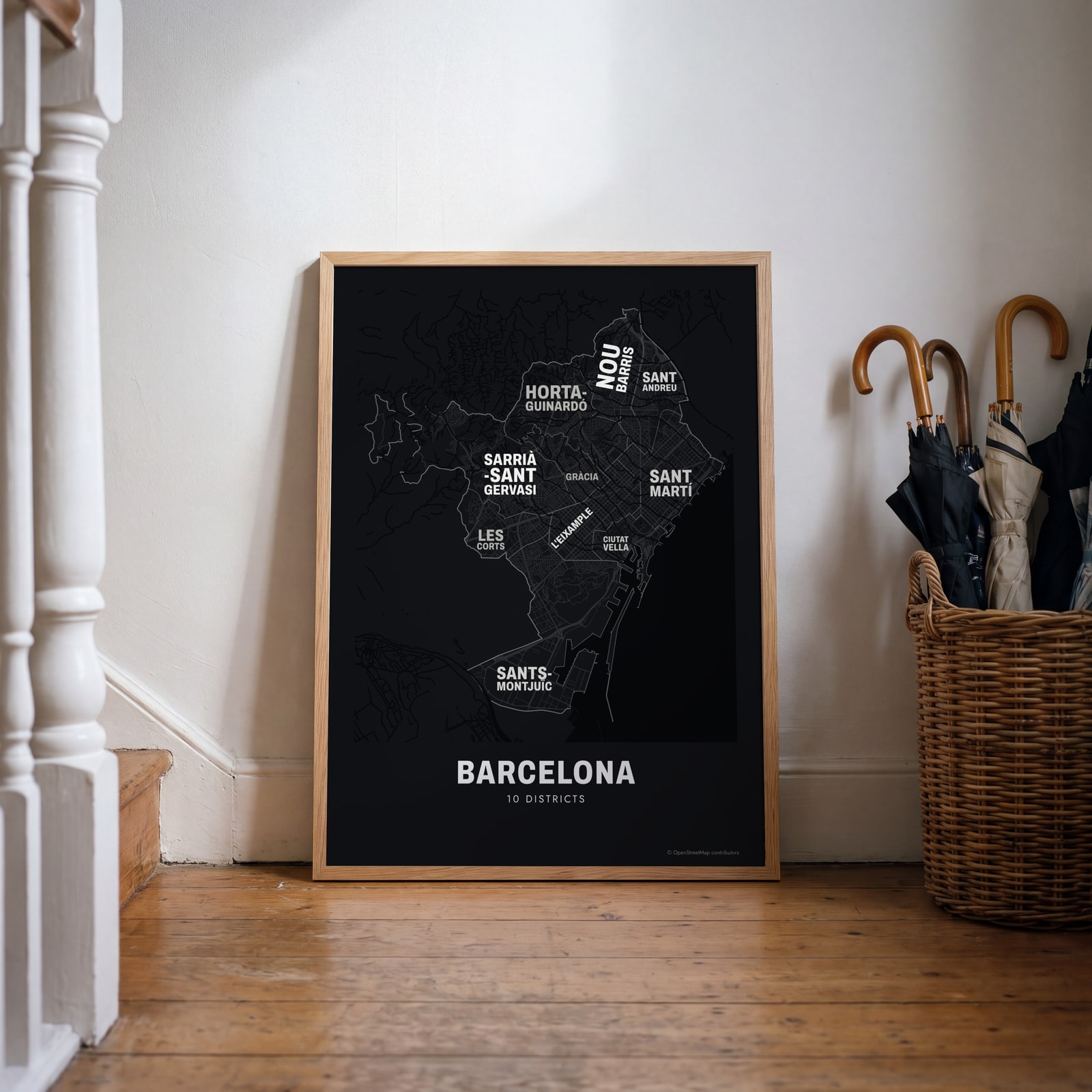 Typographic Barcelona map: the names fill their districtsEdit this →
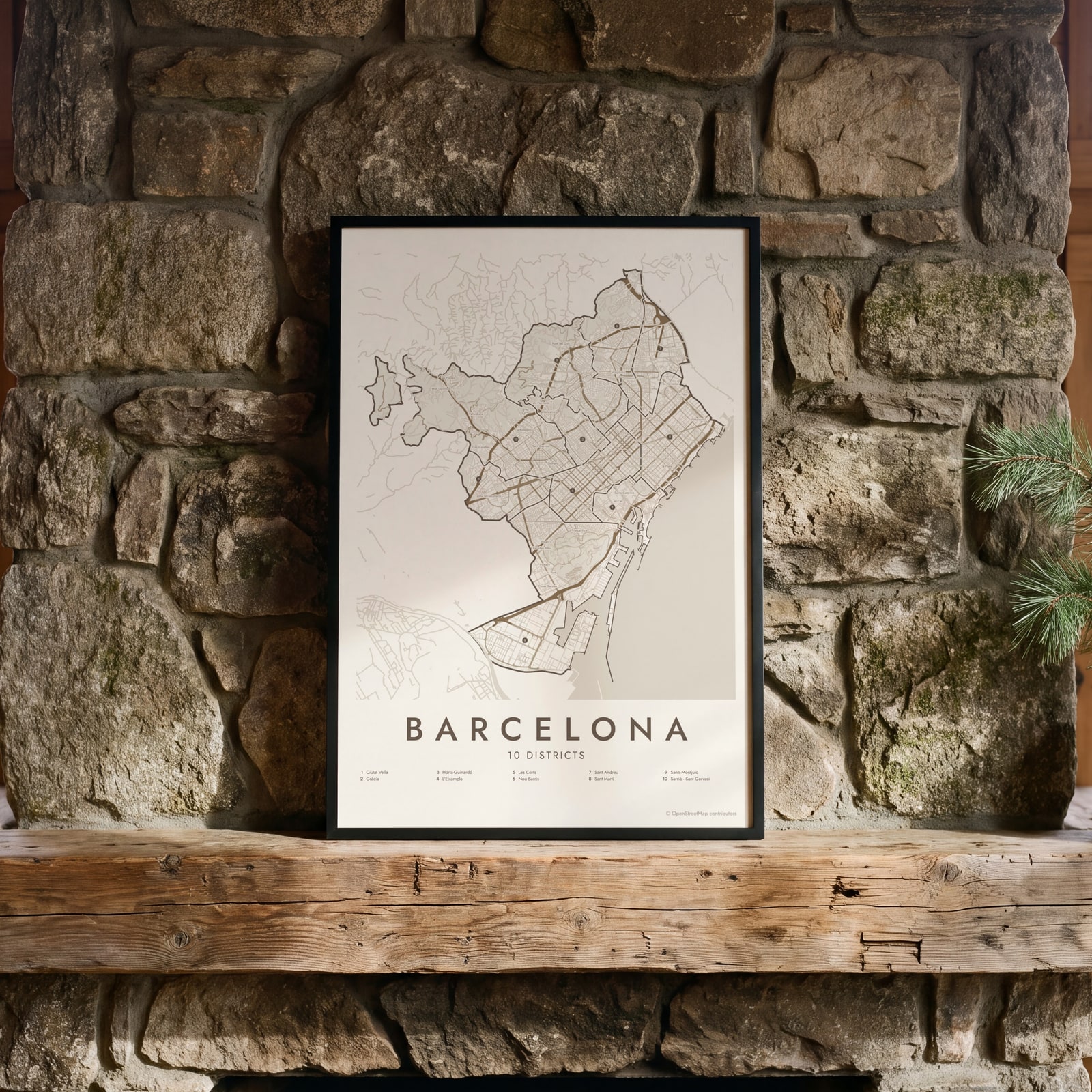 Barcelona street map with numbered districts and their listEdit this →
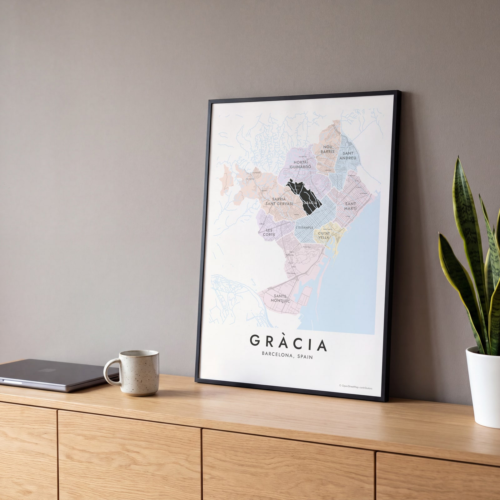 Gràcia highlighted on a map of BarcelonaEdit this →
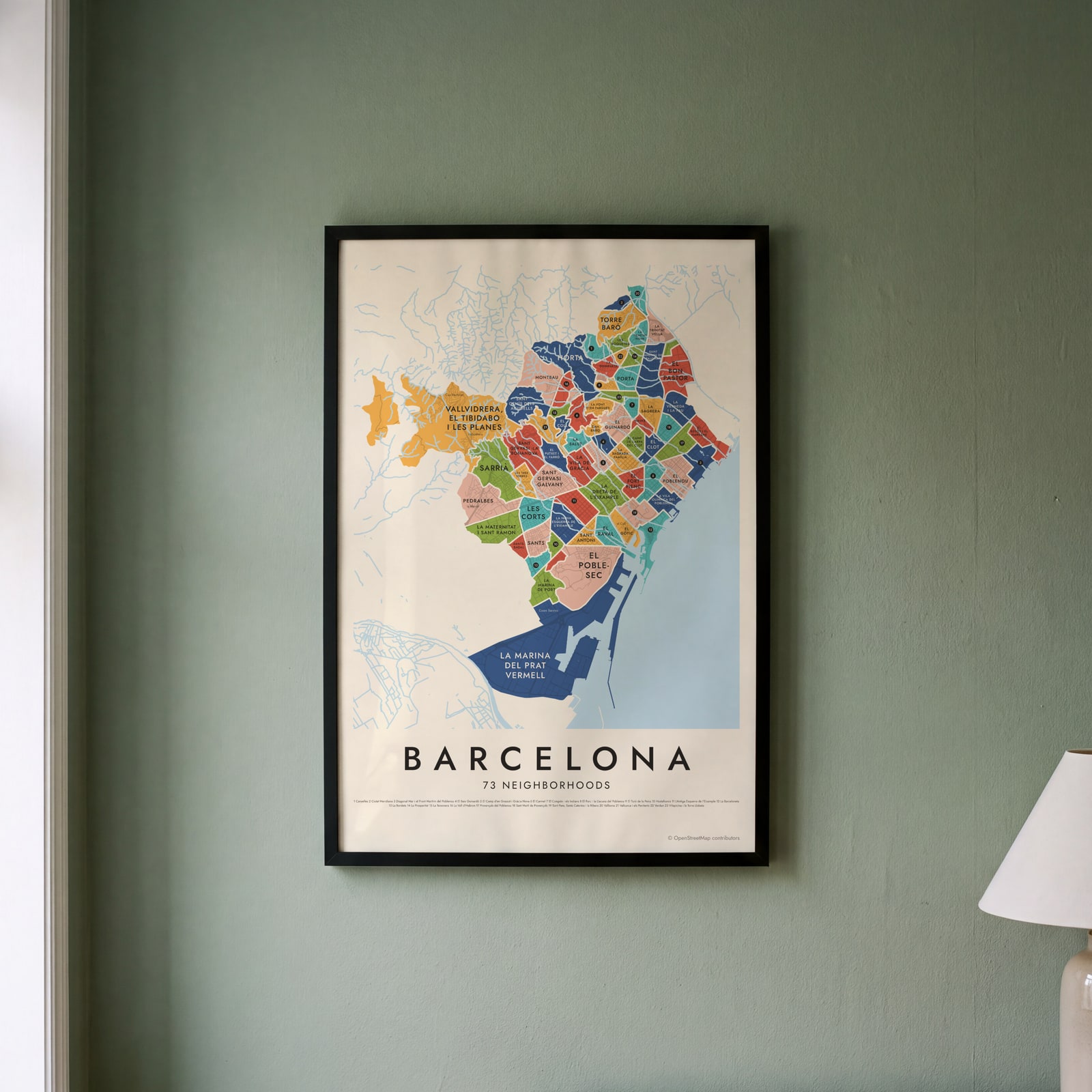 Barcelona's 73 neighborhoods in colorEdit this →
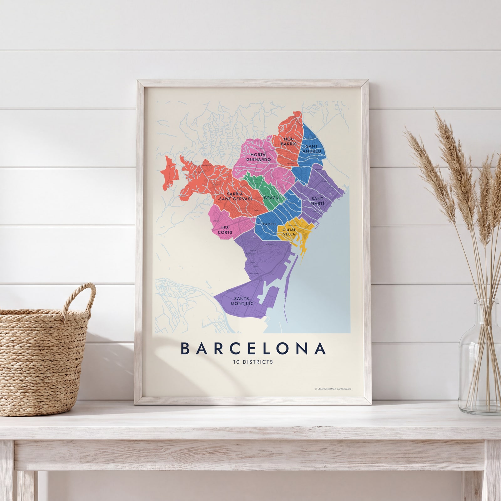 Barcelona neighborhood map in color, every district namedEdit this →
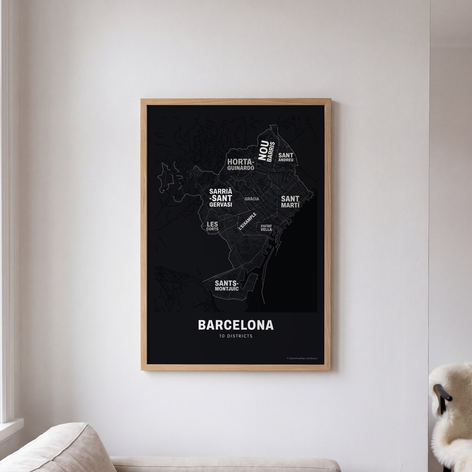 Typographic Barcelona map: the names fill their districtsEdit this →
Examples
Open any of them to change the words, the place, the date and the style, then download the print file.
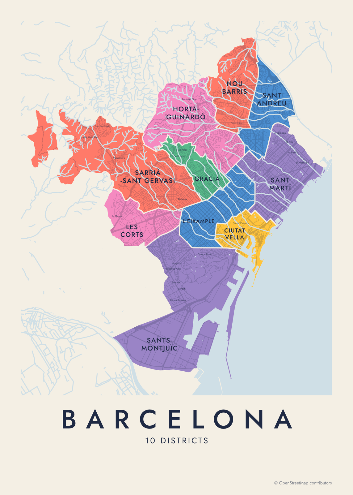 Barcelona neighborhood map in color, every district namedEdit this →More neighborhood maps →
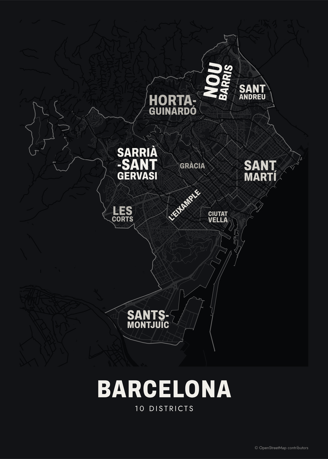 Typographic Barcelona map: the names fill their districtsEdit this →More neighborhood maps →
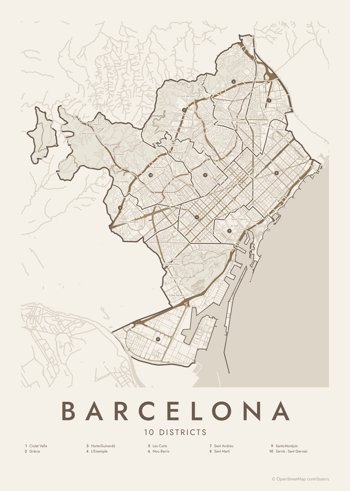 Barcelona street map with numbered districts and their listEdit this →More neighborhood maps →
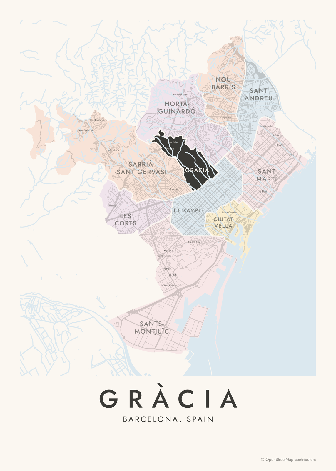 Gràcia highlighted on a map of BarcelonaEdit this →More neighborhood maps →
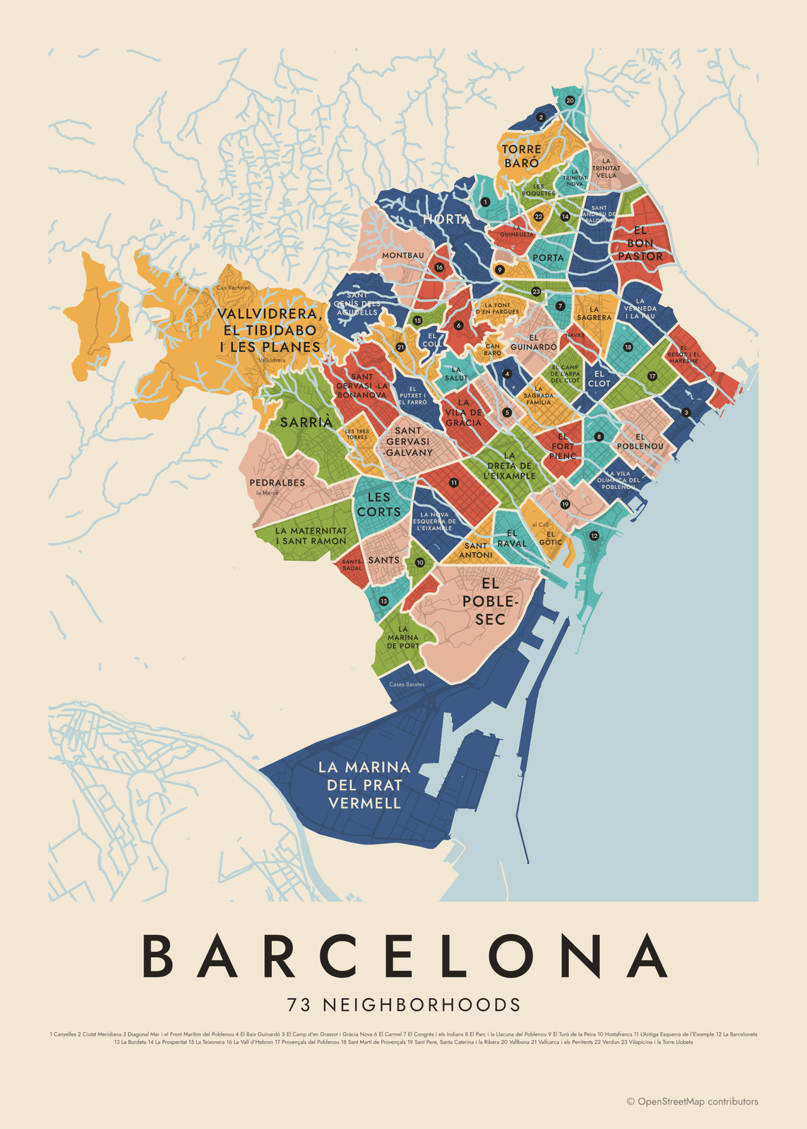 Barcelona's 73 neighborhoods in colorEdit this →More neighborhood maps →
How Barcelona is divided
Barcelona has had its 10 districts since 1984, when the city redrew its map and split Nou Barris from Sant Andreu. Each district has its own council. Several began as separate towns that joined Barcelona in 1897, like Gràcia, Sants, Les Corts and Sant Andreu.
The districts split into 73 barris, the official neighborhoods the city uses for planning and statistics. Many join two or three older names, like Sant Pere, Santa Caterina i la Ribera, or Vallcarca i els Penitents. Familiar names inside them, like el Call, la Ribera or Vallvidrera, print as small labels.
All 10 districts of Barcelona
- Ciutat Vella
- Gràcia
- Horta-Guinardó
- L'Eixample
- Les Corts
- Nou Barris
- Sant Andreu
- Sant Martí
- Sants-Montjuïc
- Sarrià - Sant Gervasi
All 73 neighborhoods of Barcelona
- Baró de Viver
- Can Baró
- Can Peguera
- Canyelles
- Ciutat Meridiana
- Diagonal Mar i el Front Marítim del Poblenou
- El Baix Guinardó
- El Besòs i el Maresme
- El Bon Pastor
- El Camp d'en Grassot i Gràcia Nova
- El Camp de l'Arpa del Clot
- El Carmel
- El Clot
- El Coll
- El Congrés i els Indians
- El Fort Pienc
- El Gòtic
- El Guinardó
- El Parc i la Llacuna del Poblenou
- El Poble-sec
- El Poblenou
- El Putxet i el Farró
- El Raval
- El Turó de la Peira
- Horta
- Hostafrancs
- L'Antiga Esquerra de l'Eixample
- La Barceloneta
- La Bordeta
- La Clota
- La Dreta de l'Eixample
- La Font d'en Fargues
- La Font de la Guatlla
- La Guineueta
- La Marina de Port
- La Marina del Prat Vermell
- La Maternitat i Sant Ramon
- La Nova Esquerra de l'Eixample
- La Prosperitat
- La Sagrada Família
- La Sagrera
- La Salut
- La Teixonera
- La Trinitat Nova
- La Trinitat Vella
- La Vall d'Hebron
- La Verneda i la Pau
- La Vila de Gràcia
- La Vila Olímpica del Poblenou
- Les Corts
- Les Roquetes
- Les Tres Torres
- Montbau
- Navas
- Pedralbes
- Porta
- Provençals del Poblenou
- Sant Andreu de Palomar
- Sant Antoni
- Sant Genís dels Agudells
- Sant Gervasi - Galvany
- Sant Gervasi - la Bonanova
- Sant Martí de Provençals
- Sant Pere, Santa Caterina i la Ribera
- Sants
- Sants-Badal
- Sarrià
- Torre Baró
- Vallbona
- Vallcarca i els Penitents
- Vallvidrera, el Tibidabo i les Planes
- Verdun
- Vilapicina i la Torre Llobeta
More neighborhood names on the map
Inside the districts, the map also names 65 smaller neighborhoods where they fit, from OpenStreetMap: Zona Franca-Port, Montjuïc, Mas Guimbau, les Planes, Mas Sauró, Can Rectoret, la Vall de la Font del Caçador, la Mercè, Vallvidrera, la Budellera, Can Caralleu, Font del Mont, Zona Universitària, Sant Ramon, el Tibidabo, la Maternitat, la Bonanova, Vallparc, el Maduixer, Ciutat Groga, Sant Cristòfol, Sant Gervasi, els Penitents, Estrelles Altes, Foment, Magòria, Plus Ultra, Cases Barates, el Polvorí, Vallcarca, la Vinya, el Port, Mas Falcó, Galvany, el Putxet, Can Clos, el Farró, Barriada Nova de Port, Font del Gos, França Xica and more. Turn them off under Names if you want only the districts.
Neighborhoods to know
- El Gòtic: the cathedral and the narrow medieval streets of the old city, with stretches of Roman wall.
- El Raval: the old quarter west of La Rambla, with MACBA and the Boqueria market.
- La Barceloneta: a grid of narrow streets laid out in the 1700s, next to the beach.
- La Sagrada Família: named for Gaudí's basilica, begun in 1882.
- La Vila de Gràcia: a separate town until 1897, known for its small squares and its Festa Major each August.
- Sant Pere, Santa Caterina i la Ribera: El Born, the Santa Maria del Mar basilica and the Picasso Museum.
- La Vila Olímpica del Poblenou: built as the athletes' village for the 1992 Olympic Games.
- Pedralbes: named for its 14th-century Gothic monastery, in the uptown hills.
How to make your Barcelona neighborhood poster
- Open the Barcelona map and pick districts or neighborhoods.
- Pick a style: Colored areas, Typographic (the names fill the map) or a Street map with the borders over the streets.
- Tap your own neighborhood to highlight it; it becomes the poster's title.
- Drag and zoom to frame the whole city or just your part of it, then pick a size and download the print file.
Questions
How many neighborhoods does Barcelona have?
Officially 73, called barris, grouped into 10 districts. Locals use many more names for smaller areas, and lots of them appear on this map as labels.
What are the 10 districts of Barcelona?
Ciutat Vella, L'Eixample, Sants-Montjuïc, Les Corts, Sarrià - Sant Gervasi, Gràcia, Horta-Guinardó, Nou Barris, Sant Andreu and Sant Martí. The city numbers them 1 to 10 in that order.
Is the Eixample a neighborhood?
It's a district, split into six barris: El Fort Pienc, La Sagrada Família, La Dreta de l'Eixample, L'Antiga Esquerra de l'Eixample, La Nova Esquerra de l'Eixample and Sant Antoni. It was built on Ildefons Cerdà's 1859 plan of square blocks with cut corners.
Where is El Born?
El Born is in Ciutat Vella, inside the barri officially called Sant Pere, Santa Caterina i la Ribera, around the Santa Maria del Mar basilica.
Where do the Barcelona boundaries come from?
From OpenStreetMap (© OpenStreetMap contributors). Streets and water are OpenStreetMap's. Boundaries are a snapshot and can differ from what neighbors call home; tell us if one looks wrong.
What sizes can I print?
US Letter, 8 × 10, 11 × 14, 12 × 16 and 12 × 18 in, A4 and A3, free. You download a 300 DPI JPEG drawn at the size you pick. Larger prints, up to 24 × 36 in, are coming soon.
Related

Gift ideas by occasion




Every example is made with the Posterage generators. Change anything, then download it as a 300 DPI JPEG.