Madrid neighborhood map 21 districts and 131 barrios, named
This poster maps Madrid as its 21 distritos, from Centro out to Fuencarral-El Pardo, the largest. Switch to the 131 barrios for a finer map, with names like Sol, Embajadores and Justicia. Highlight yours and print it.
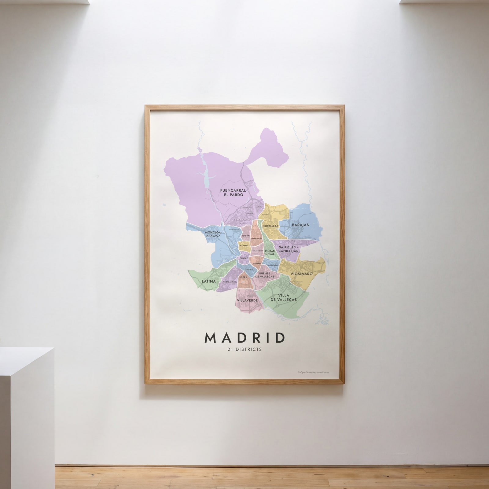
On the wall
A few of them framed at home. Open any one to make it yours.
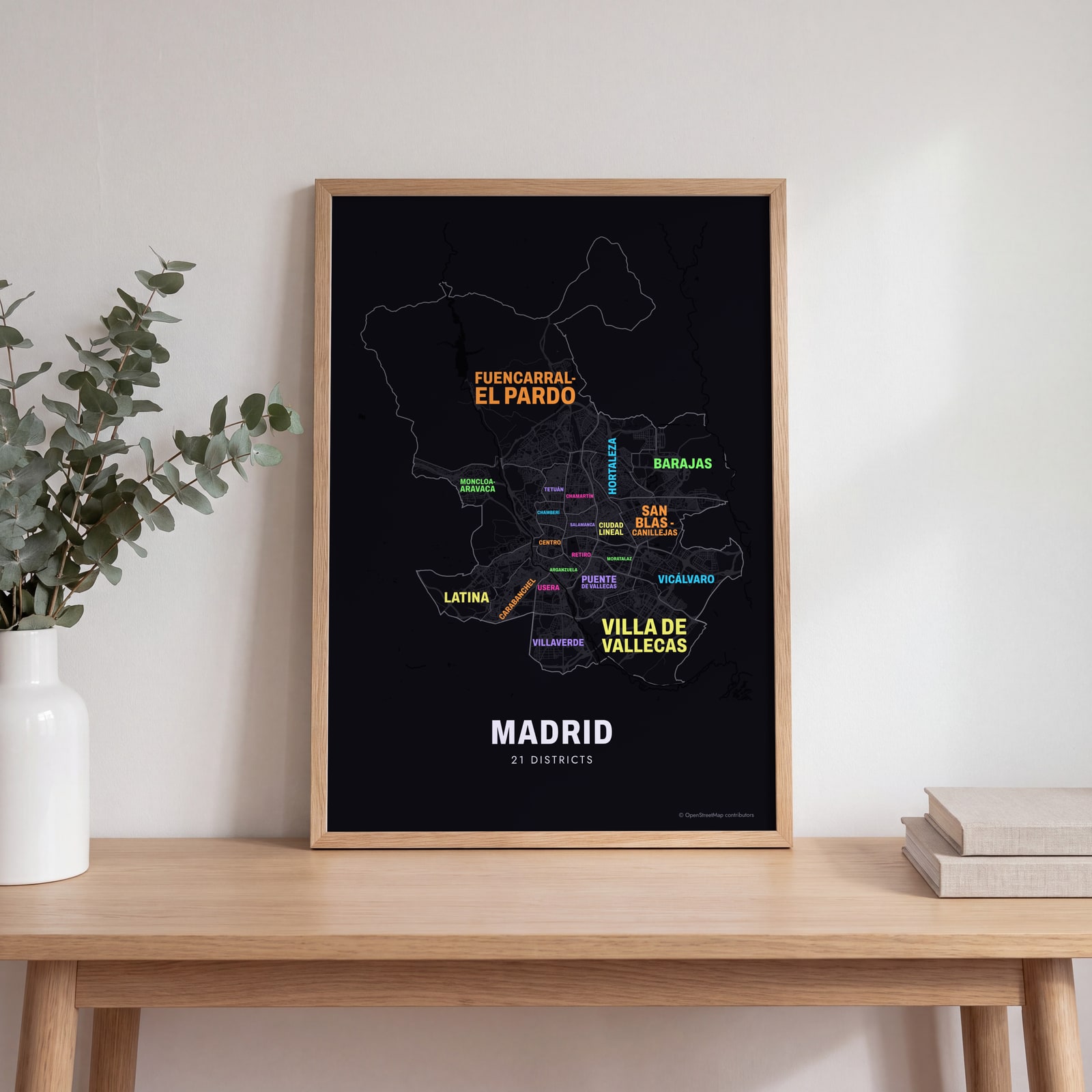 Typographic Madrid map: the names fill their districtsEdit this →
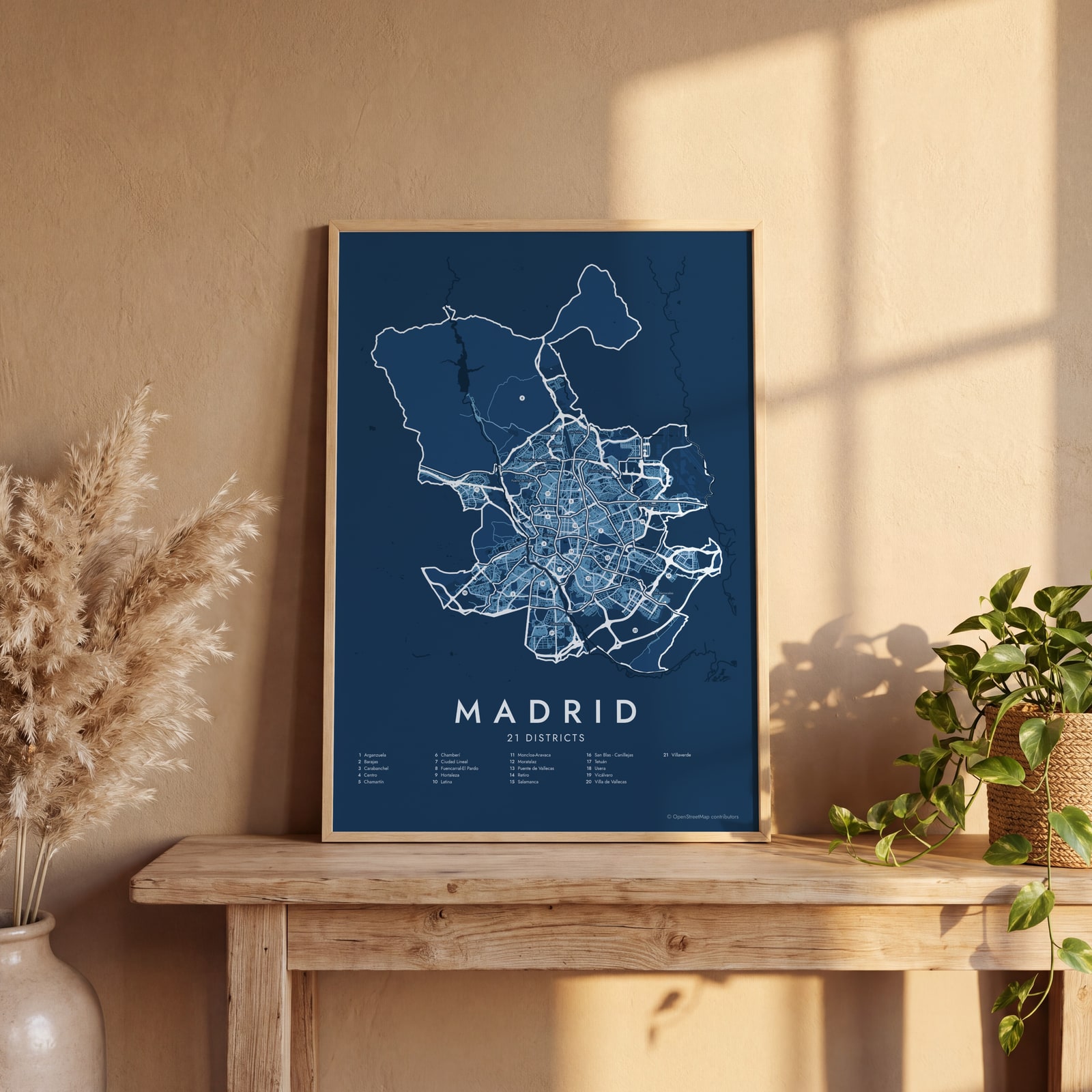 Madrid street map with numbered districts and their listEdit this →
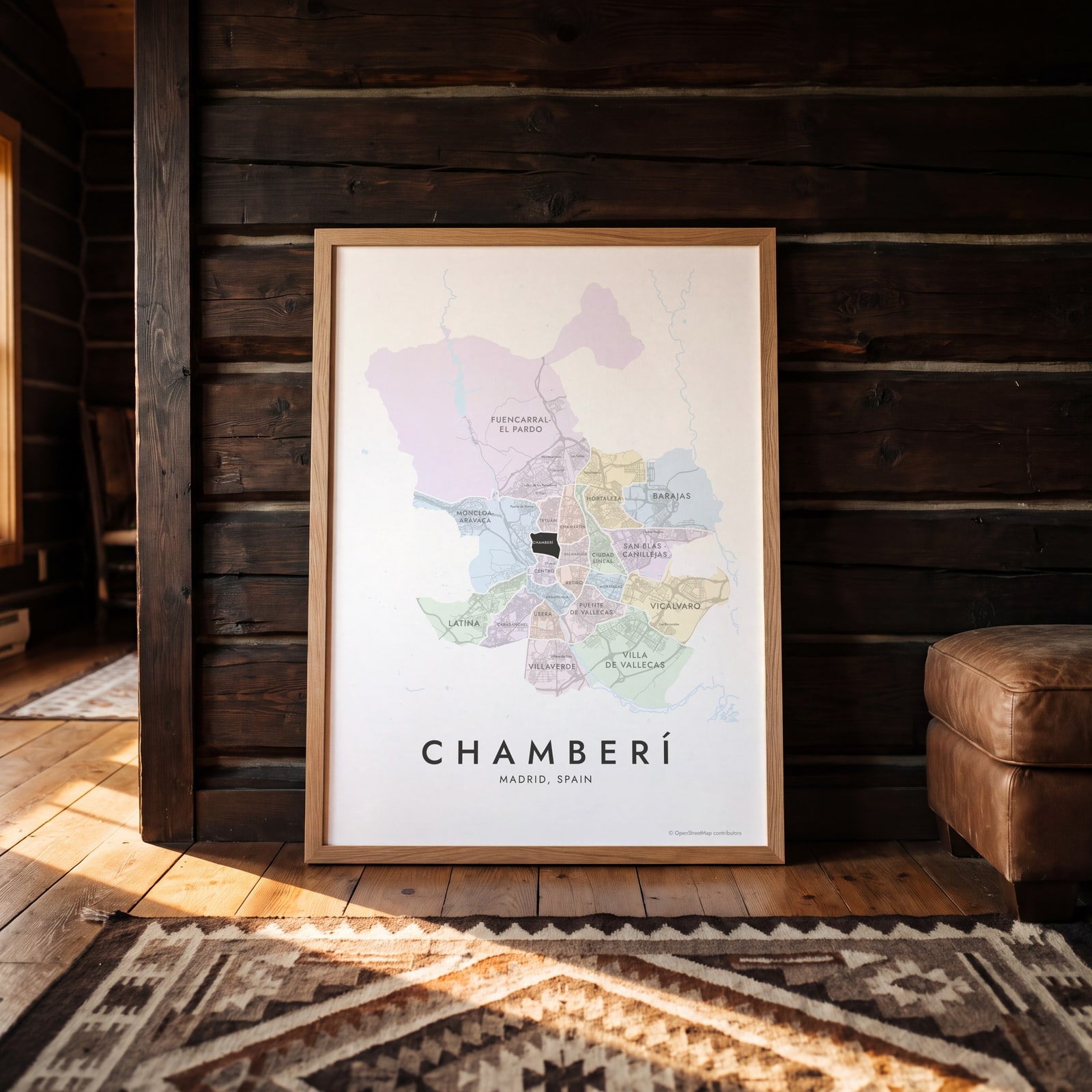 Chamberí highlighted on a map of MadridEdit this →
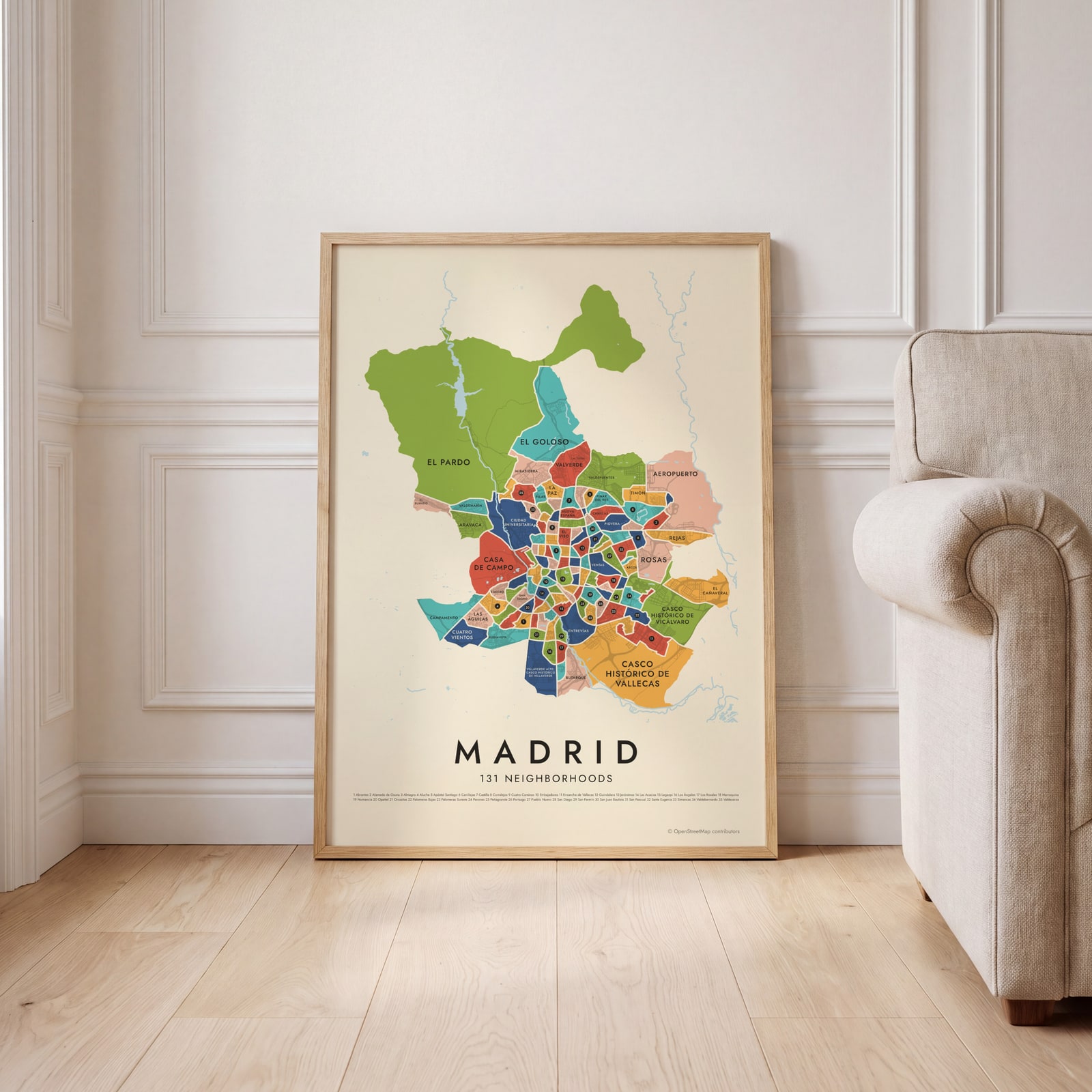 Madrid's 131 neighborhoods in colorEdit this →
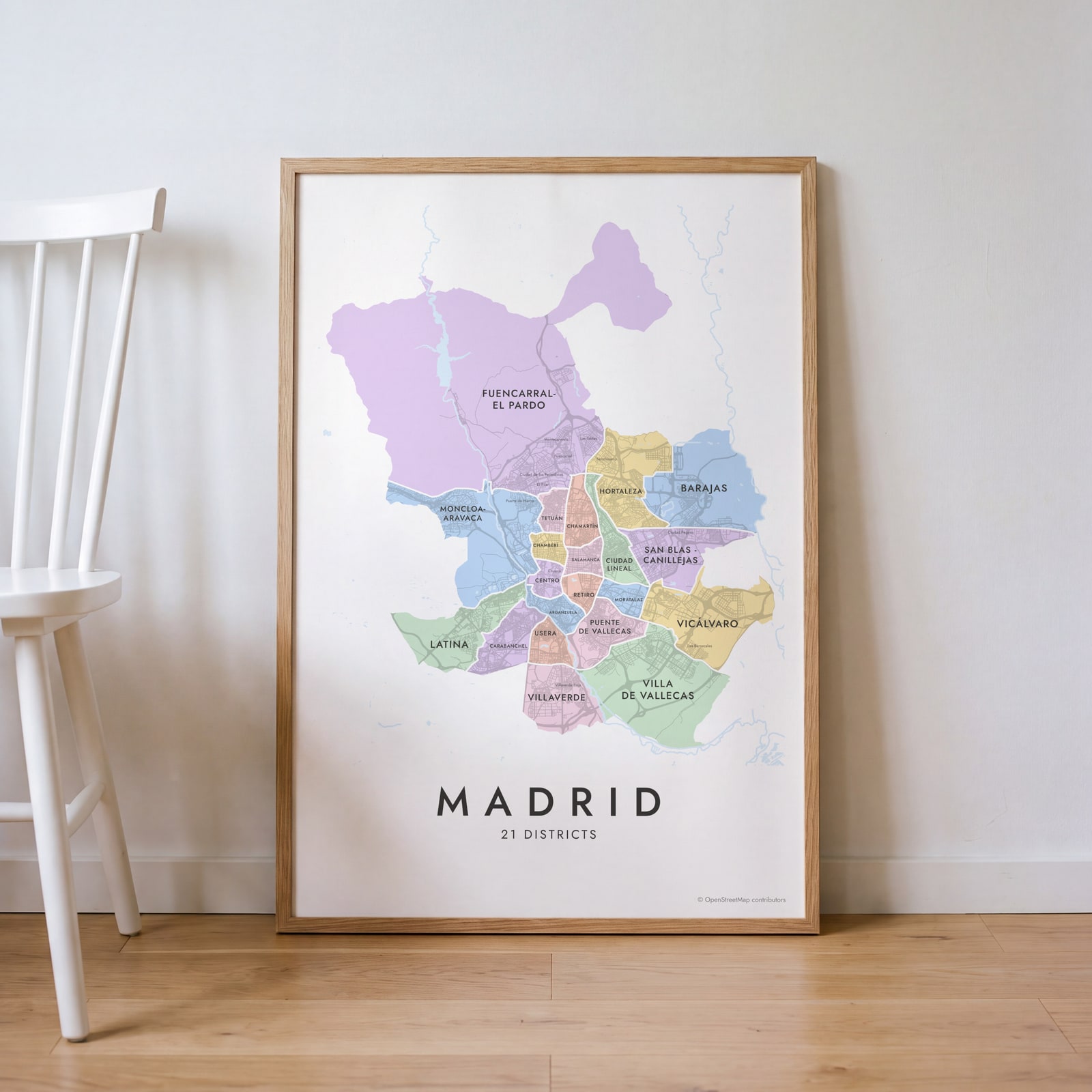 Madrid neighborhood map in color, every district namedEdit this →
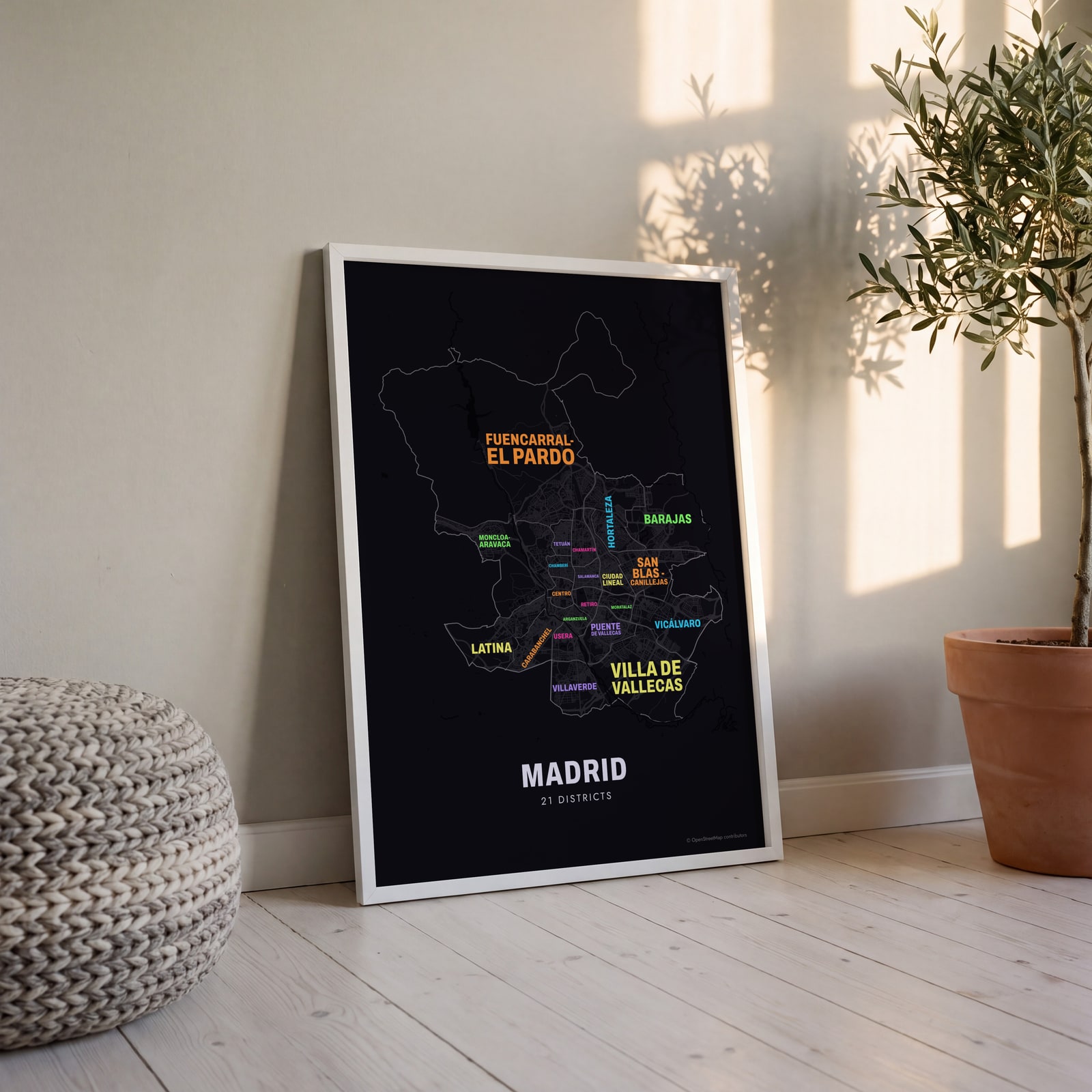 Typographic Madrid map: the names fill their districtsEdit this →
Examples
Open any of them to change the words, the place, the date and the style, then download the print file.
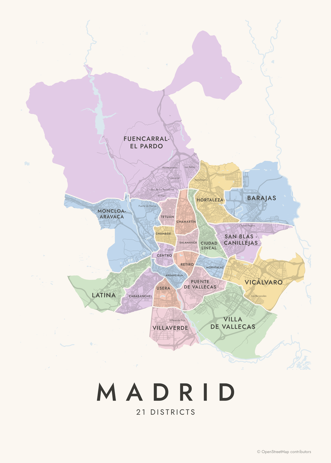 Madrid neighborhood map in color, every district namedEdit this →More neighborhood maps →
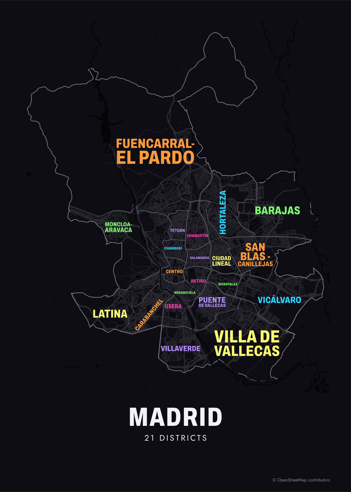 Typographic Madrid map: the names fill their districtsEdit this →More neighborhood maps →
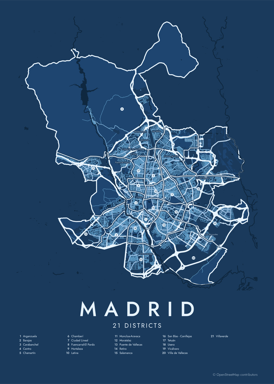 Madrid street map with numbered districts and their listEdit this →More neighborhood maps →
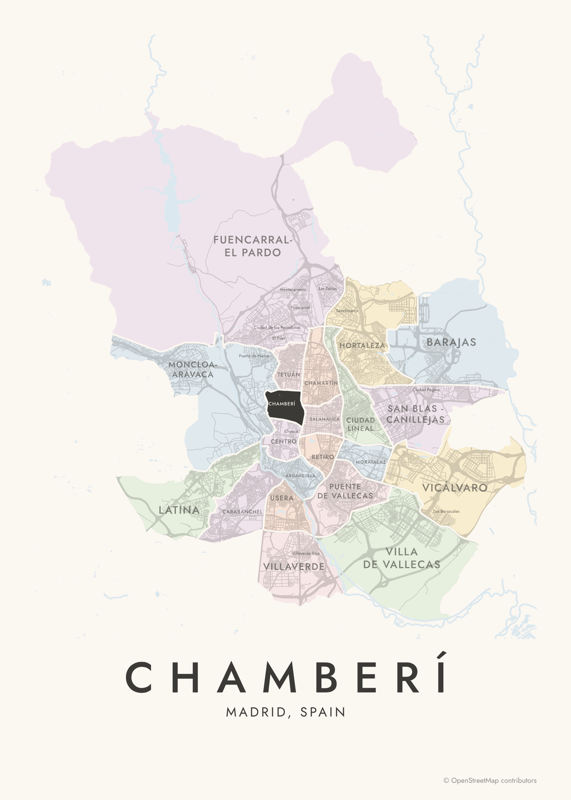 Chamberí highlighted on a map of MadridEdit this →More neighborhood maps →
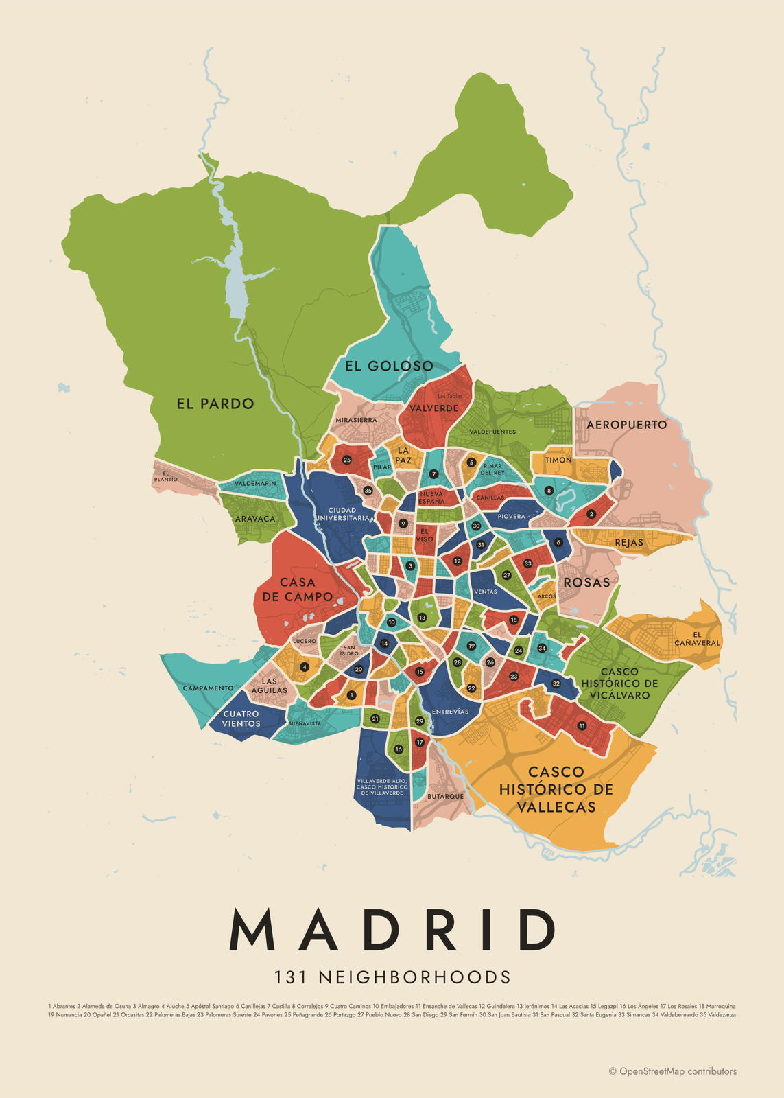 Madrid's 131 neighborhoods in colorEdit this →More neighborhood maps →
How Madrid is divided
Madrid's 21 distritos are its local government districts, each with its own municipal board. The current layout dates from a 1987 reorganization. Several districts began as towns Madrid annexed in the late 1940s and 1950s, like Carabanchel, Vallecas, Barajas and Vicálvaro.
Each district splits into barrios, 131 in all. The official names often aren't the ones people use: Malasaña is in Universidad, Chueca in Justicia, Lavapiés in Embajadores and the Barrio de las Letras in Cortes. Those everyday names print as small labels.
All 21 districts of Madrid
- Arganzuela
- Barajas
- Carabanchel
- Centro
- Chamartín
- Chamberí
- Ciudad Lineal
- Fuencarral-El Pardo
- Hortaleza
- Latina
- Moncloa-Aravaca
- Moratalaz
- Puente de Vallecas
- Retiro
- Salamanca
- San Blas - Canillejas
- Tetuán
- Usera
- Vicálvaro
- Villa de Vallecas
- Villaverde
All 131 neighborhoods of Madrid
- Abrantes
- Adelfas
- Aeropuerto
- Alameda de Osuna
- Almagro
- Almenara
- Almendrales
- Aluche
- Amposta
- Apóstol Santiago
- Arapiles
- Aravaca
- Arcos
- Argüelles
- Atalaya
- Atocha
- Bellas Vistas
- Berruguete
- Buenavista
- Butarque
- Campamento
- Canillas
- Canillejas
- Casa de Campo
- Casco Histórico de Barajas
- Casco Histórico de Vallecas
- Casco Histórico de Vicálvaro
- Castellana
- Castilla
- Castillejos
- Chopera
- Ciudad Jardín
- Ciudad Universitaria
- Colina
- Comillas
- Concepción
- Corralejos
- Cortes
- Costillares
- Cuatro Caminos
- Cuatro Vientos
- Delicias
- El Cañaveral
- El Goloso
- El Pardo
- El Plantío
- El Viso
- Embajadores
- Ensanche de Vallecas
- Entrevías
- Estrella
- Fontarrón
- Fuente del Berro
- Fuentelarreina
- Gaztambide
- Goya
- Guindalera
- Hellín
- Hispanoamérica
- Horcajo
- Ibiza
- Imperial
- Jerónimos
- Justicia
- La Paz
- Las Acacias
- Las Águilas
- Legazpi
- Lista
- Los Ángeles
- Los Cármenes
- Los Rosales
- Lucero
- Marroquina
- Media Legua
- Mirasierra
- Moscardó
- Niño Jesús
- Nueva España
- Numancia
- Opañel
- Orcasitas
- Orcasur
- Pacífico
- Palacio
- Palomas
- Palomeras Bajas
- Palomeras Sureste
- Palos de la Frontera
- Pavones
- Peñagrande
- Pilar
- Pinar del Rey
- Piovera
- Portazgo
- Pradolongo
- Prosperidad
- Pueblo Nuevo
- Puerta Bonita
- Puerta del Ángel
- Quintana
- Recoletos
- Rejas
- Ríos Rosas
- Rosas
- Salvador
- San Cristóbal
- San Diego
- San Fermín
- San Isidro
- San Juan Bautista
- San Pascual
- Santa Eugenia
- Simancas
- Sol
- Timón
- Trafalgar
- Universidad
- Valdeacederas
- Valdebernardo
- Valdefuentes
- Valdemarín
- Valderrivas
- Valdezarza
- Vallehermoso
- Valverde
- Ventas
- Villaverde Alto, Casco Histórico de Villaverde
- Vinateros
- Vista Alegre
- Zofío
More neighborhood names on the map
Inside the districts, the map also names 45 smaller neighborhoods where they fit, from OpenStreetMap: Fuencarral, Cármenes, El Pilar, Villaverde Alto, La Elipa, Valderribas, Barrio del Aeropuerto, Los Berrocales, Urbanización Fuente del Rey, Nickelodeon Land, Naturaleza, Tranquilidad, Maquinismo, Colonia de la Prensa, Puerta de Hierro, Barrio de la Pradera, Ciudad de los Poetas, Colonia de la Policía, Mancomunidad Inmaculada Concepción, Barrio de la Latina, Ciudad de los Periodistas, Barrio de los Austrias, Altamira, Malasaña, Lavapiés, Barrio de las Letras, Chueca, Montecarmelo, Barrio de los Metales, Begoña, Villaverde Bajo, Costa Fleming, Colonia de San Cristóbal, Manoteras, Las Tablas, Barrio del Parral, Virgen del Cortijo, El Pozo del Tío Raimundo, Sanchinarro, Colonia de Orisa and more. Turn them off under Names if you want only the districts.
Neighborhoods to know
- Sol: Puerta del Sol, with the Kilometer Zero plaque from which Spain's radial roads are measured.
- Palacio: the Royal Palace and Almudena Cathedral, above the Manzanares valley.
- Embajadores: Lavapiés and El Rastro, the Sunday flea market.
- Cortes: named for the Spanish parliament, and home of the Barrio de las Letras, where Cervantes and Lope de Vega lived.
- Universidad: Malasaña, around Plaza del Dos de Mayo.
- Jerónimos: the Prado Museum and Retiro Park.
- Casa de Campo: a former royal hunting estate, now the city's largest park.
- El Pardo: a royal palace and the protected woods of Monte de El Pardo.
How to make your Madrid neighborhood poster
- Open the Madrid map and pick districts or neighborhoods.
- Pick a style: Colored areas, Typographic (the names fill the map) or a Street map with the borders over the streets.
- Tap your own neighborhood to highlight it; it becomes the poster's title.
- Drag and zoom to frame the whole city or just your part of it, then pick a size and download the print file.
Questions
How many neighborhoods does Madrid have?
Officially, 131 barrios, grouped into 21 districts. Many well-known names, like Malasaña, Chueca and Lavapiés, aren't official barrios; they show on this map as labels.
What are the 21 districts of Madrid?
Centro, Arganzuela, Retiro, Salamanca, Chamartín, Tetuán, Chamberí, Fuencarral-El Pardo, Moncloa-Aravaca, Latina, Carabanchel, Usera, Puente de Vallecas, Moratalaz, Ciudad Lineal, Hortaleza, Villaverde, Villa de Vallecas, Vicálvaro, San Blas - Canillejas and Barajas. The city numbers them 1 to 21 in that order.
Which district is Malasaña in?
Centro. Malasaña is the everyday name for most of the barrio of Universidad, north of Gran Vía around Plaza del Dos de Mayo.
Is Lavapiés an official barrio?
No. Lavapiés is part of the barrio of Embajadores, in Centro. On this map it shows as a label inside Embajadores.
Where do the Madrid boundaries come from?
From OpenStreetMap (© OpenStreetMap contributors). Streets and water are OpenStreetMap's. Boundaries are a snapshot and can differ from what neighbors call home; tell us if one looks wrong.
What sizes can I print?
US Letter, 8 × 10, 11 × 14, 12 × 16 and 12 × 18 in, A4 and A3, free. You download a 300 DPI JPEG drawn at the size you pick. Larger prints, up to 24 × 36 in, are coming soon.
Related

Gift ideas by occasion




Every example is made with the Posterage generators. Change anything, then download it as a 300 DPI JPEG.