Berlin neighborhood map 12 boroughs and 97 Ortsteile, named
This poster maps Berlin split into its 12 boroughs, or Bezirke, from Spandau in the west to Marzahn-Hellersdorf in the east. Switch to the 97 Ortsteile for a finer map with Kreuzberg, Prenzlauer Berg and Wedding, while many Kiez names print as small labels. Highlight yours and print it.
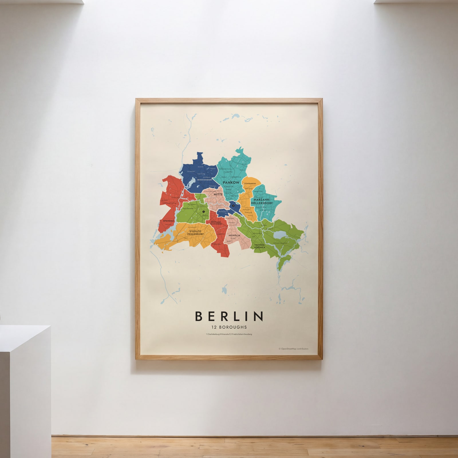
On the wall
A few of them framed at home. Open any one to make it yours.
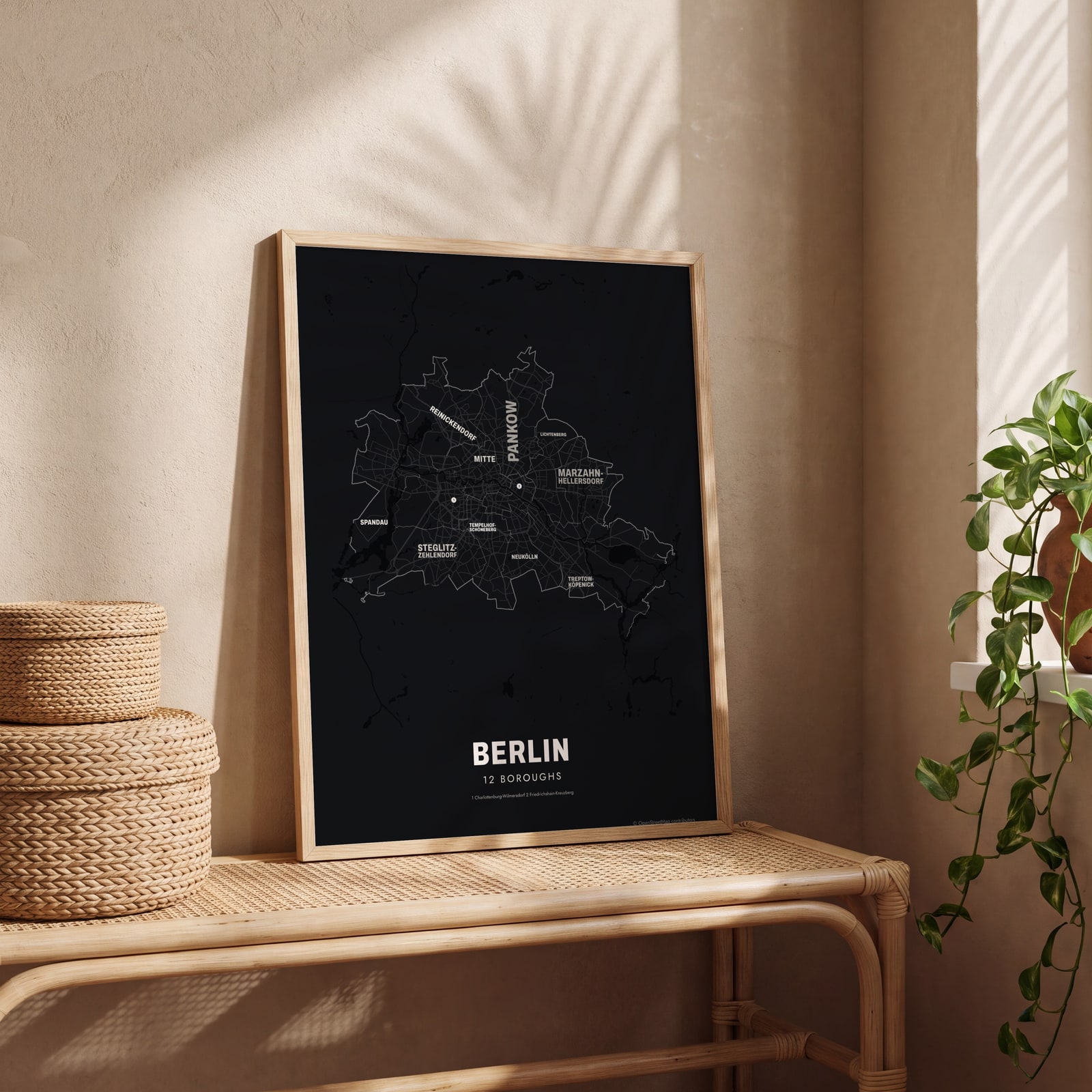 Typographic Berlin map: the names fill their boroughsEdit this →
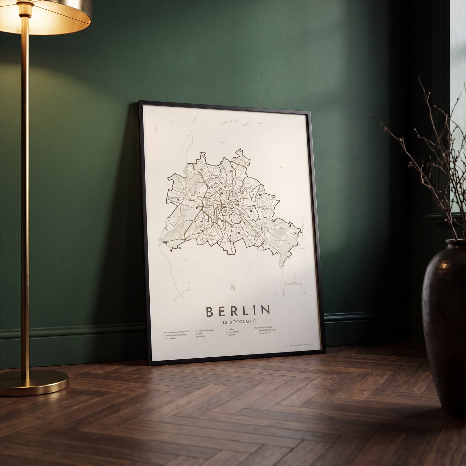 Berlin street map with numbered boroughs and their listEdit this →
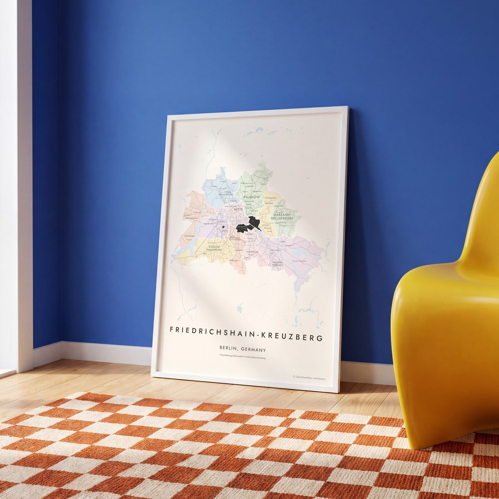 Friedrichshain-Kreuzberg highlighted on a map of BerlinEdit this →
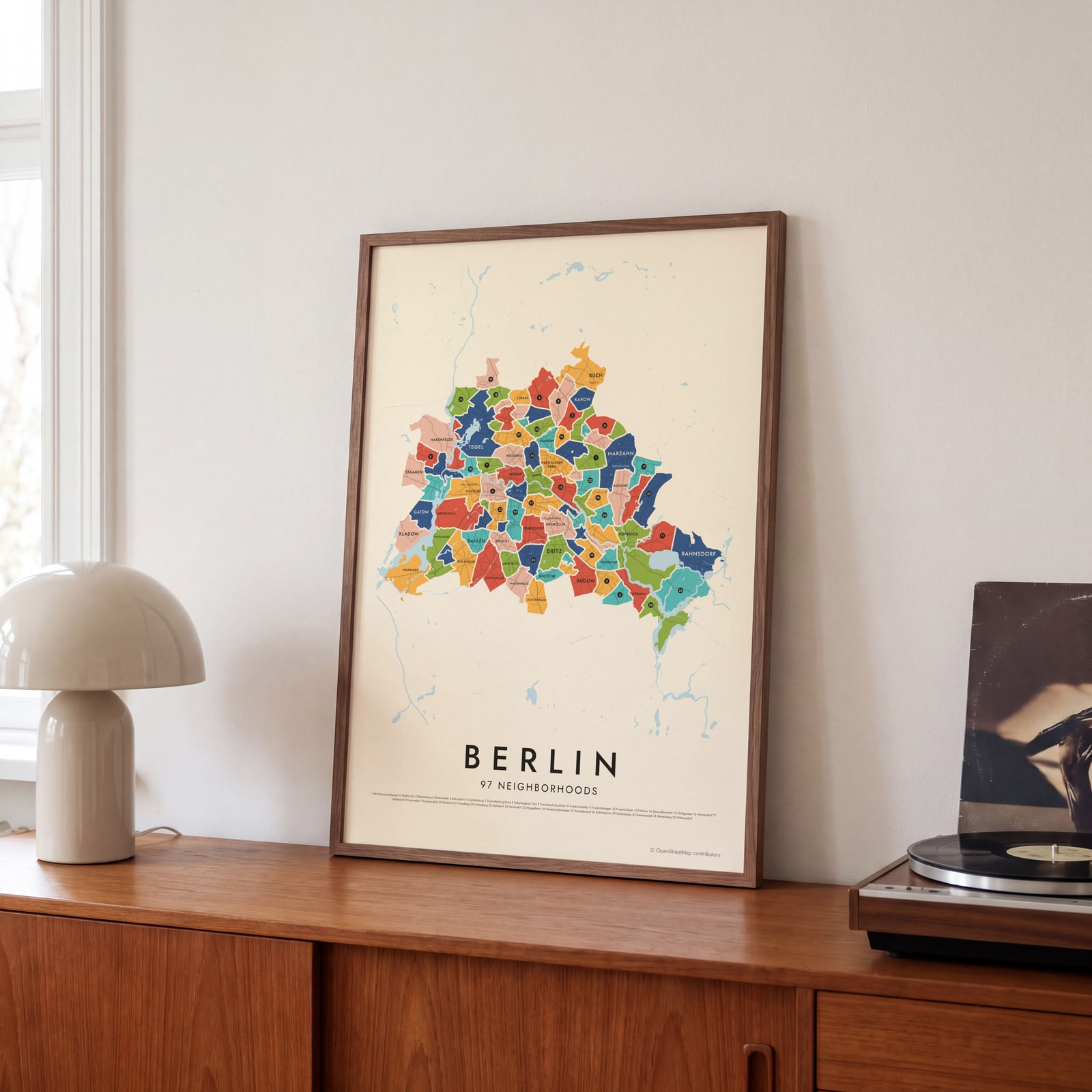 Berlin's 97 neighborhoods in colorEdit this →
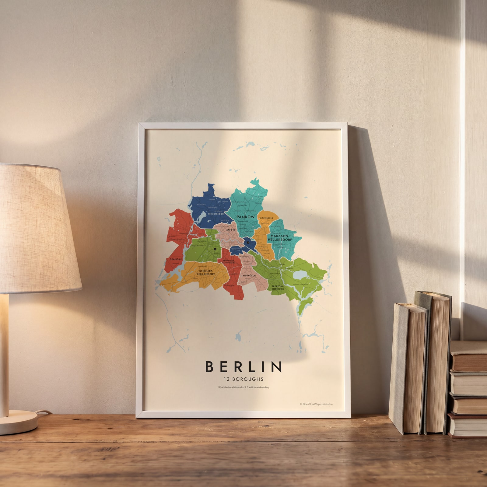 Berlin neighborhood map in color, every borough namedEdit this →
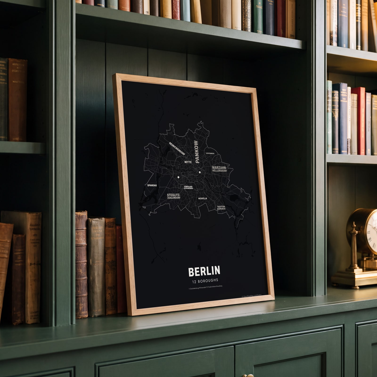 Typographic Berlin map: the names fill their boroughsEdit this →
Examples
Open any of them to change the words, the place, the date and the style, then download the print file.
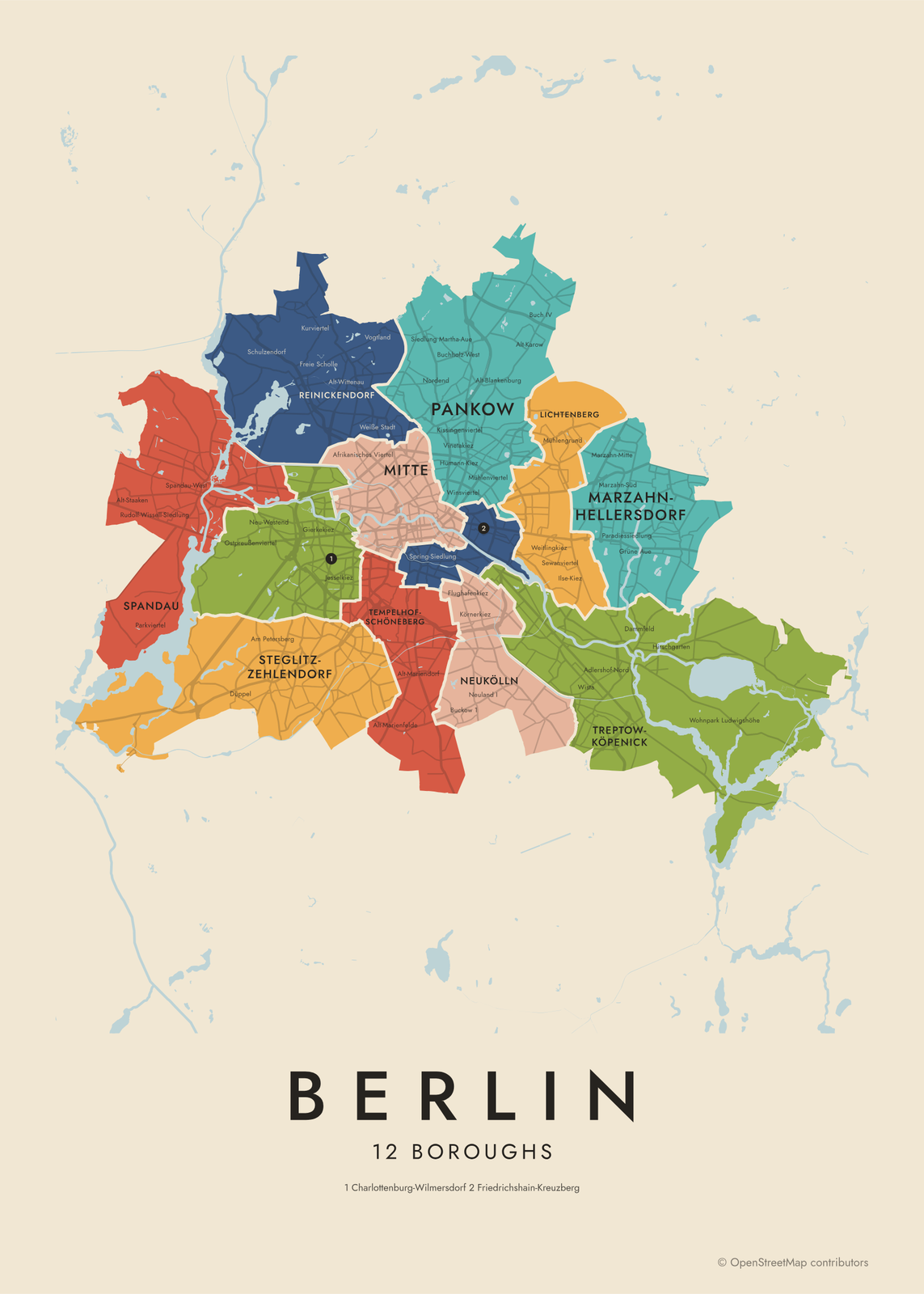 Berlin neighborhood map in color, every borough namedEdit this →More neighborhood maps →
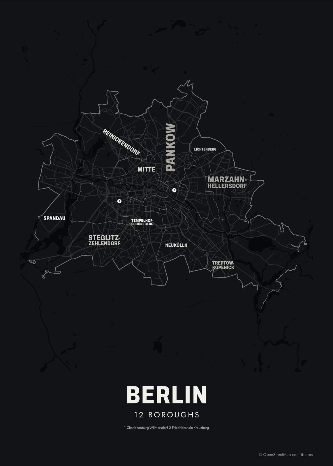 Typographic Berlin map: the names fill their boroughsEdit this →More neighborhood maps →
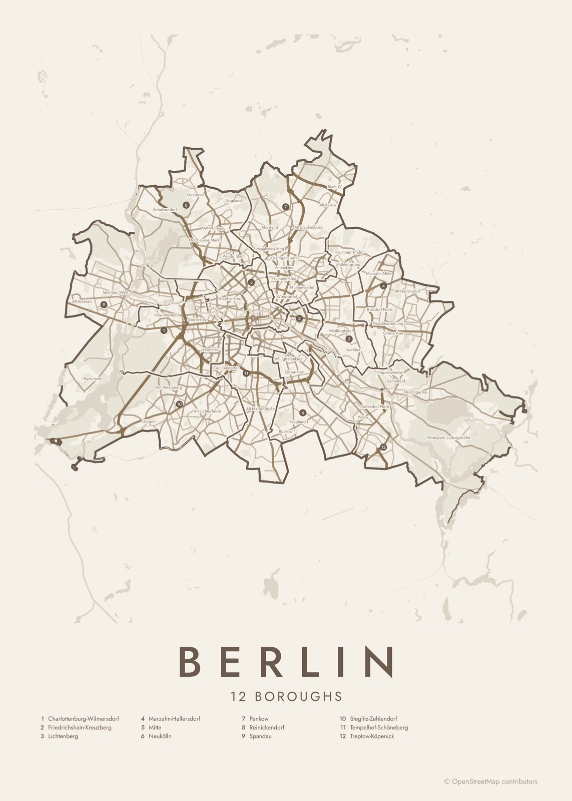 Berlin street map with numbered boroughs and their listEdit this →More neighborhood maps →
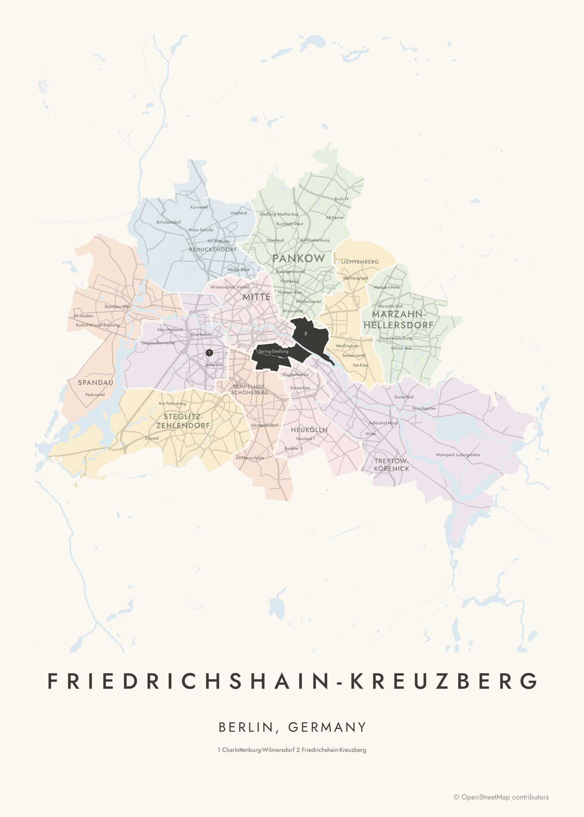 Friedrichshain-Kreuzberg highlighted on a map of BerlinEdit this →More neighborhood maps →
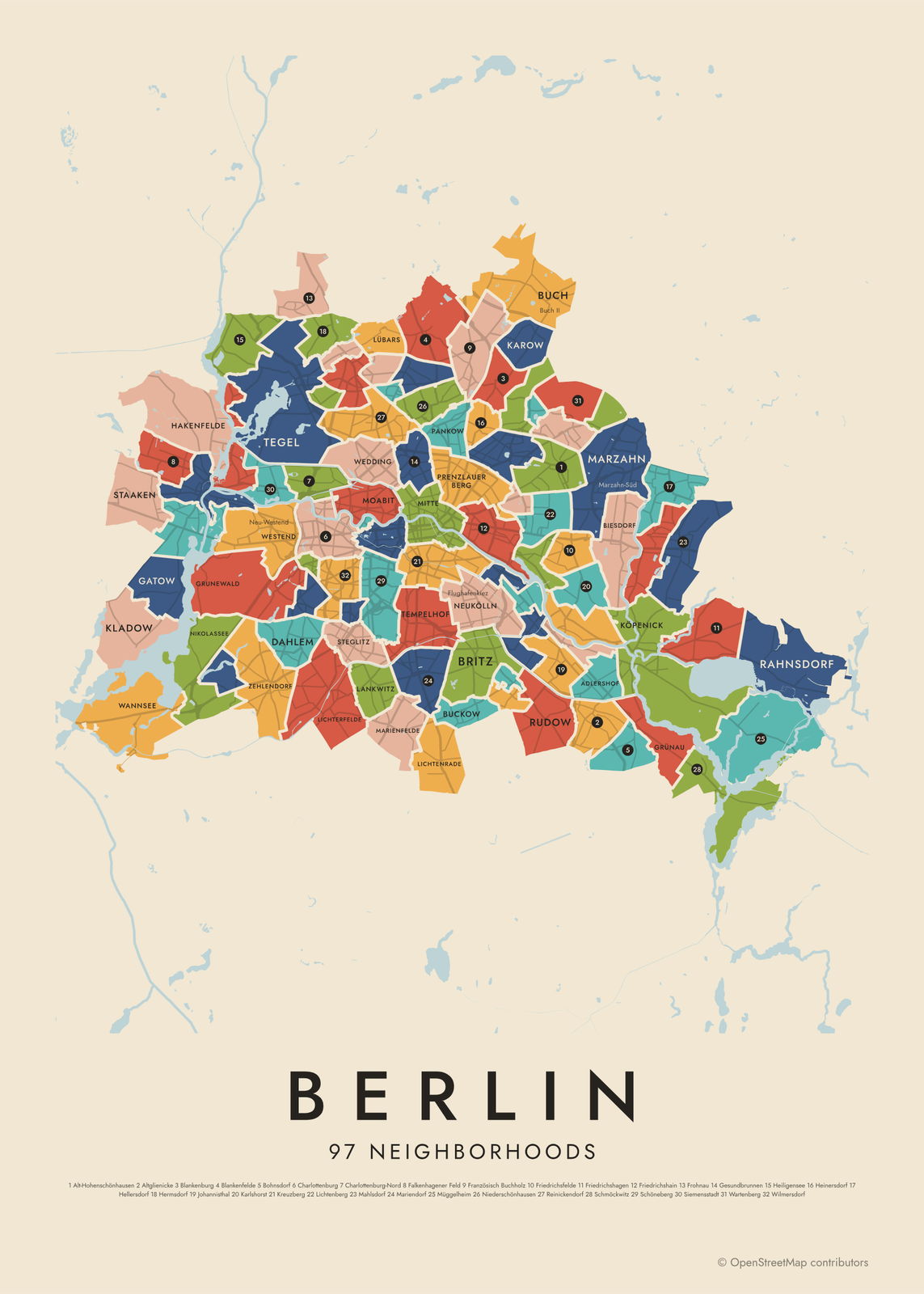 Berlin's 97 neighborhoods in colorEdit this →More neighborhood maps →
How Berlin is divided
Berlin's 12 boroughs, or Bezirke, are often called districts in English. Each has its own mayor, council and town hall. They date from 2001, when the city's 23 boroughs were merged down to 12, which is why many have double names like Friedrichshain-Kreuzberg or Charlottenburg-Wilmersdorf.
Inside them are 97 Ortsteile, the localities Berliners give as where they live. Many follow the villages and towns joined into Greater Berlin in 1920, like Spandau, Köpenick and Charlottenburg. Smaller still is the Kiez: a few blocks around a square or main street, like the Graefekiez or the Bergmannkiez. Many of those names print as small labels.
All 12 boroughs of Berlin
- Charlottenburg-Wilmersdorf
- Friedrichshain-Kreuzberg
- Lichtenberg
- Marzahn-Hellersdorf
- Mitte
- Neukölln
- Pankow
- Reinickendorf
- Spandau
- Steglitz-Zehlendorf
- Tempelhof-Schöneberg
- Treptow-Köpenick
All 97 neighborhoods of Berlin
- Adlershof
- Alt-Hohenschönhausen
- Alt-Treptow
- Altglienicke
- Baumschulenweg
- Biesdorf
- Blankenburg
- Blankenfelde
- Bohnsdorf
- Borsigwalde
- Britz
- Buch
- Buckow
- Charlottenburg
- Charlottenburg-Nord
- Dahlem
- Falkenberg
- Falkenhagener Feld
- Fennpfuhl
- Französisch Buchholz
- Friedenau
- Friedrichsfelde
- Friedrichshagen
- Friedrichshain
- Frohnau
- Gatow
- Gesundbrunnen
- Gropiusstadt
- Grünau
- Grunewald
- Hakenfelde
- Halensee
- Hansaviertel
- Haselhorst
- Heiligensee
- Heinersdorf
- Hellersdorf
- Hermsdorf
- Johannisthal
- Karlshorst
- Karow
- Kaulsdorf
- Kladow
- Konradshöhe
- Köpenick
- Kreuzberg
- Lankwitz
- Lichtenberg
- Lichtenrade
- Lichterfelde
- Lübars
- Mahlsdorf
- Malchow
- Mariendorf
- Marienfelde
- Märkisches Viertel
- Marzahn
- Mitte
- Moabit
- Müggelheim
- Neu-Hohenschönhausen
- Neukölln
- Niederschöneweide
- Niederschönhausen
- Nikolassee
- Oberschöneweide
- Pankow
- Plänterwald
- Prenzlauer Berg
- Rahnsdorf
- Reinickendorf
- Rosenthal
- Rudow
- Rummelsburg
- Schlachtensee
- Schmargendorf
- Schmöckwitz
- Schöneberg
- Siemensstadt
- Spandau
- Staaken
- Stadtrandsiedlung Malchow
- Steglitz
- Tegel
- Tempelhof
- Tiergarten
- Waidmannslust
- Wannsee
- Wartenberg
- Wedding
- Weißensee
- Westend
- Wilhelmsruh
- Wilhelmstadt
- Wilmersdorf
- Wittenau
- Zehlendorf
More neighborhood names on the map
Inside the boroughs, the map also names 528 smaller neighborhoods where they fit, from OpenStreetMap: Landstadt Gatow, Siedlung Hahneberg, Metropolitan Park, Albrechtshof, Stolpe (Wannsee), Gartenstadt Staaken, Louise-Schröder-Siedlung, Parkviertel, Heerstraße Nord, Hohengatow, Siegener Viertel, Weinmeisterhöhe, Bocksfelde, Spandau-West, Klosterfelde, Pichelsdorf, Neustadt, Altstadt, Stresow, Waldsiedlung Hakenfelde, Maselake-Zentrum, Tiefwerder, Maselake Nord, Wasserstadt Spandau, Quartier Haveleck, Tegelort, Düppel, Reichsforschungssiedlung Haselhorst, Ruhleben, Borsigsiedlung, Waldsiedlung Krumme Lanke, Ostpreußenviertel, Neues Gartenfeld, Onkel Toms Hütte, Neu-Westend, Siedlung Siemensstadt, Alt-Siemensstadt, Villenkolonie Westend, Schönow, Großsiedlung Siemensstadt and more. Turn them off under Names if you want only the boroughs.
Neighborhoods to know
- Mitte: the historic center, with the Brandenburg Gate, Unter den Linden and Museum Island.
- Kreuzberg: named for the hill in Viktoriapark, topped by Schinkel's Prussian National Monument.
- Prenzlauer Berg: late-19th-century apartment blocks around squares like Kollwitzplatz.
- Friedrichshain: home of the East Side Gallery, the longest surviving stretch of the Berlin Wall.
- Charlottenburg: grew up around Charlottenburg Palace, and holds much of the Kurfürstendamm.
- Tempelhof: the old city airport, closed in 2008, whose airfield is now the Tempelhofer Feld park.
- Hansaviertel: modernist housing built for the 1957 Interbau exhibition, with buildings by Gropius, Aalto and Niemeyer.
- Köpenick: an old town and palace where the Dahme flows into the Spree.
How to make your Berlin neighborhood poster
- Open the Berlin map and pick boroughs or neighborhoods.
- Pick a style: Colored areas, Typographic (the names fill the map) or a Street map with the borders over the streets.
- Tap your own neighborhood to highlight it; it becomes the poster's title.
- Drag and zoom to frame the whole city or just your part of it, then pick a size and download the print file.
Questions
How many districts does Berlin have?
Berlin has 12 boroughs (Bezirke), often called districts, each with its own mayor and council. Until 2001 there were 23. The boroughs are split into 97 Ortsteile, and this map can show either level.
Is Kreuzberg a borough of Berlin?
Not anymore. Kreuzberg was its own borough until 2001, when it merged with Friedrichshain, across the Spree, to form Friedrichshain-Kreuzberg. Today it's an Ortsteil inside that borough.
Which Berlin boroughs were in East Berlin?
Pankow, Lichtenberg, Marzahn-Hellersdorf and Treptow-Köpenick were wholly in the East. Mitte and Friedrichshain-Kreuzberg join former East and West parts. The other six boroughs were in West Berlin.
What is a Kiez?
Kiez is the Berlin word for a small neighborhood, often a few blocks around a square or main street, like the Bergmannkiez in Kreuzberg or the Kollwitzkiez in Prenzlauer Berg. Kiez names have no official borders, so they print as small labels.
Where do the Berlin boundaries come from?
From OpenStreetMap (© OpenStreetMap contributors). Streets and water are OpenStreetMap's. Boundaries are a snapshot and can differ from what neighbors call home; tell us if one looks wrong.
What sizes can I print?
US Letter, 8 × 10, 11 × 14, 12 × 16 and 12 × 18 in, A4 and A3, free. You download a 300 DPI JPEG drawn at the size you pick. Larger prints, up to 24 × 36 in, are coming soon.
Related

Gift ideas by occasion




Every example is made with the Posterage generators. Change anything, then download it as a 300 DPI JPEG.