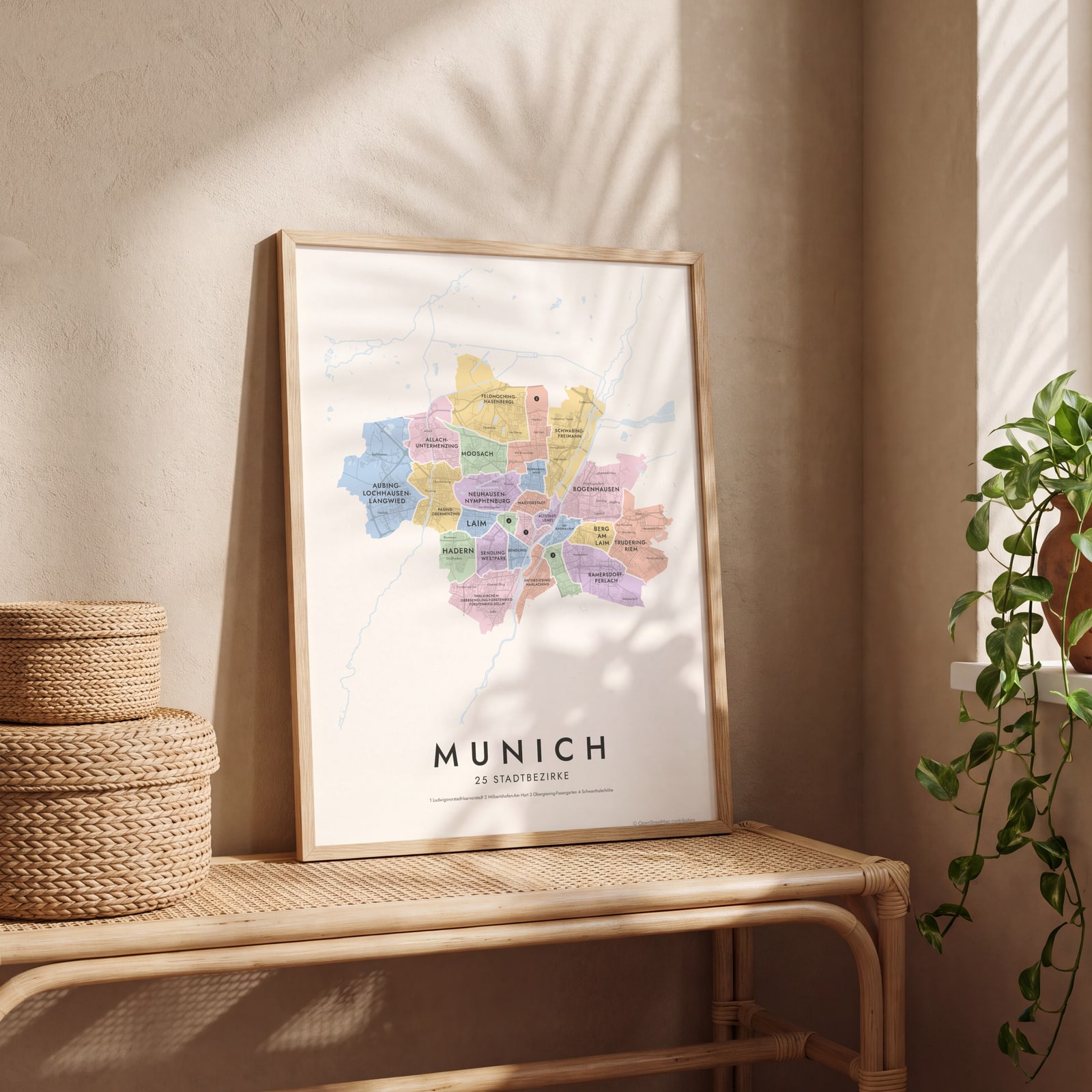
Munich neighborhood map all 25 Stadtbezirke, named
This poster maps Munich by its 25 Stadtbezirke, the city's official districts, from Altstadt-Lehel to Trudering-Riem, each one named. Inside them, more than 200 neighborhood names like Schwabing, Haidhausen and Giesing print as smaller labels. Highlight your district and print it.
On the wall
A few of them framed at home. Open any one to make it yours.
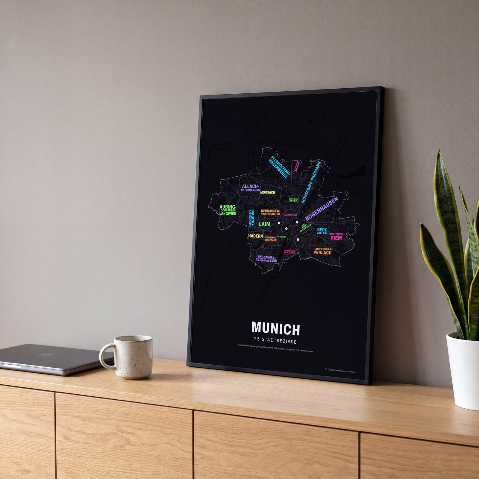 Typographic Munich map: the names fill their stadtbezirkeEdit this →
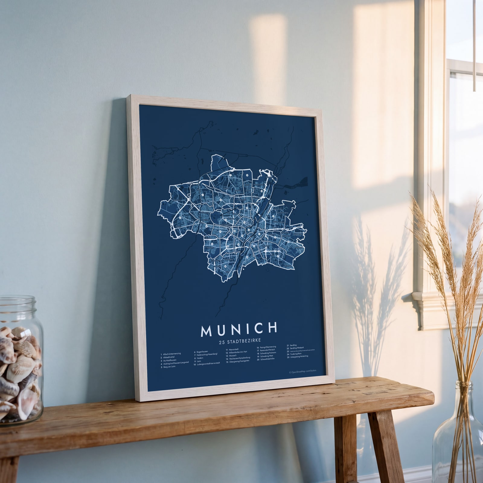 Munich street map with numbered stadtbezirke and their listEdit this →
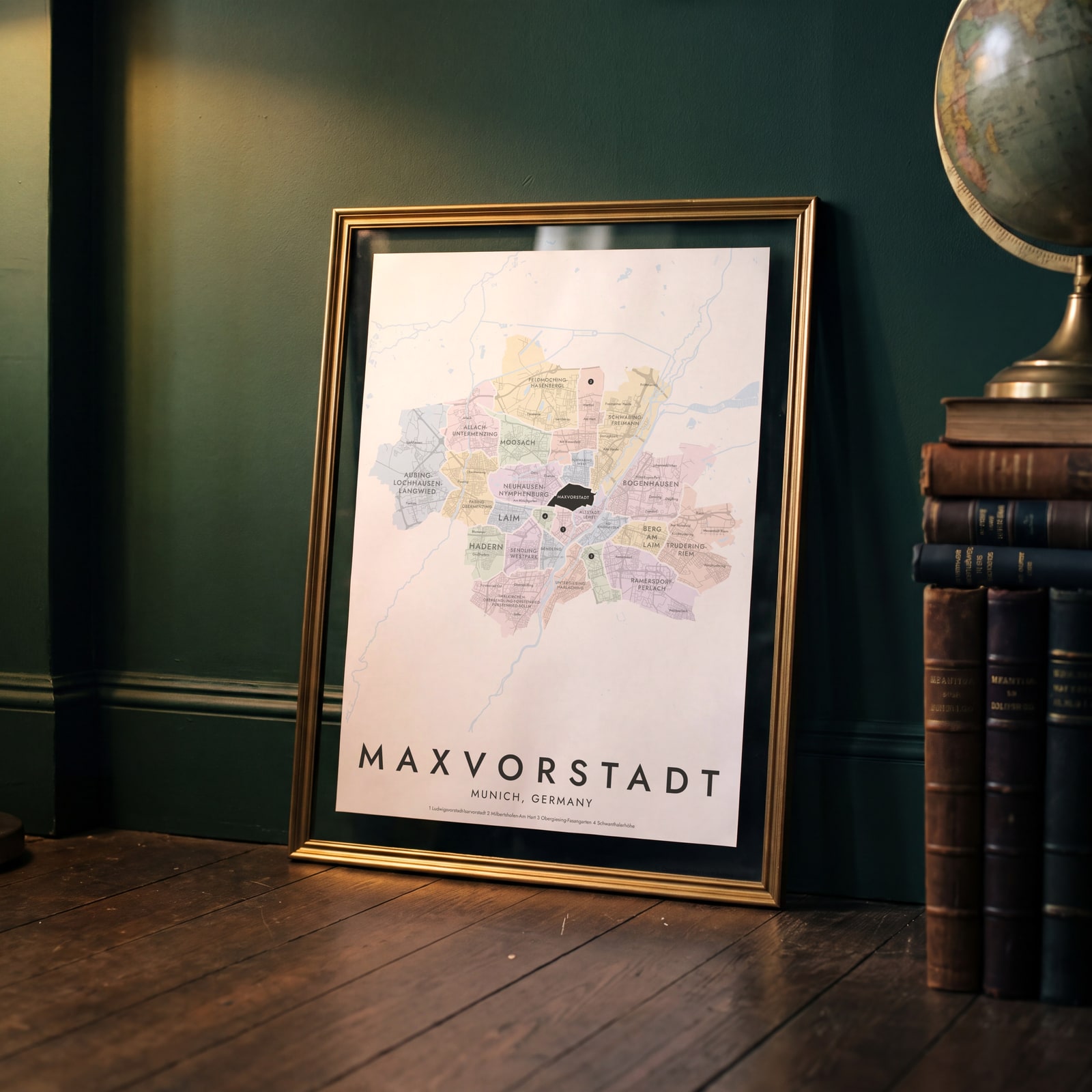 Maxvorstadt highlighted on a map of MunichEdit this →
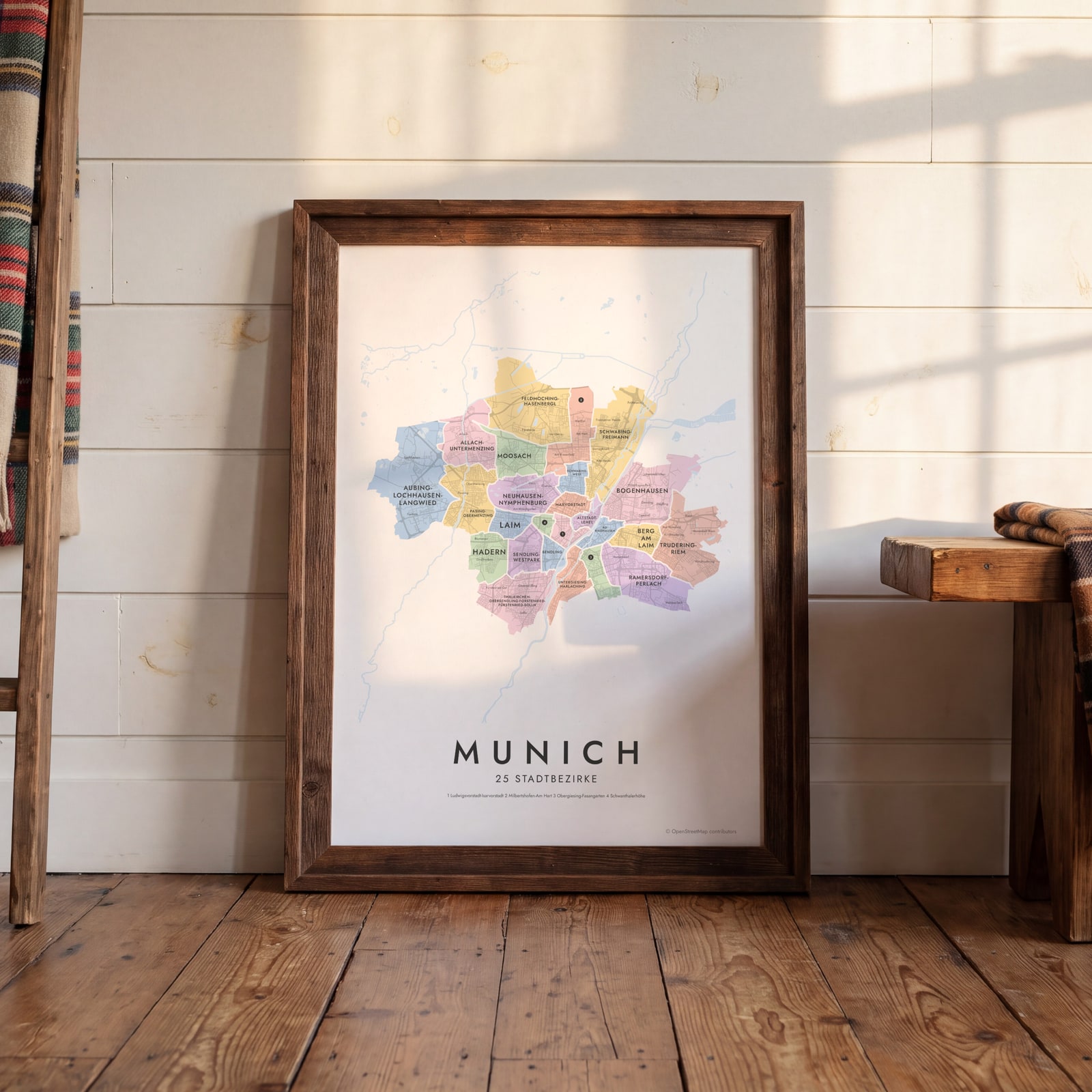 Munich neighborhood map in color, every stadtbezirk namedEdit this →
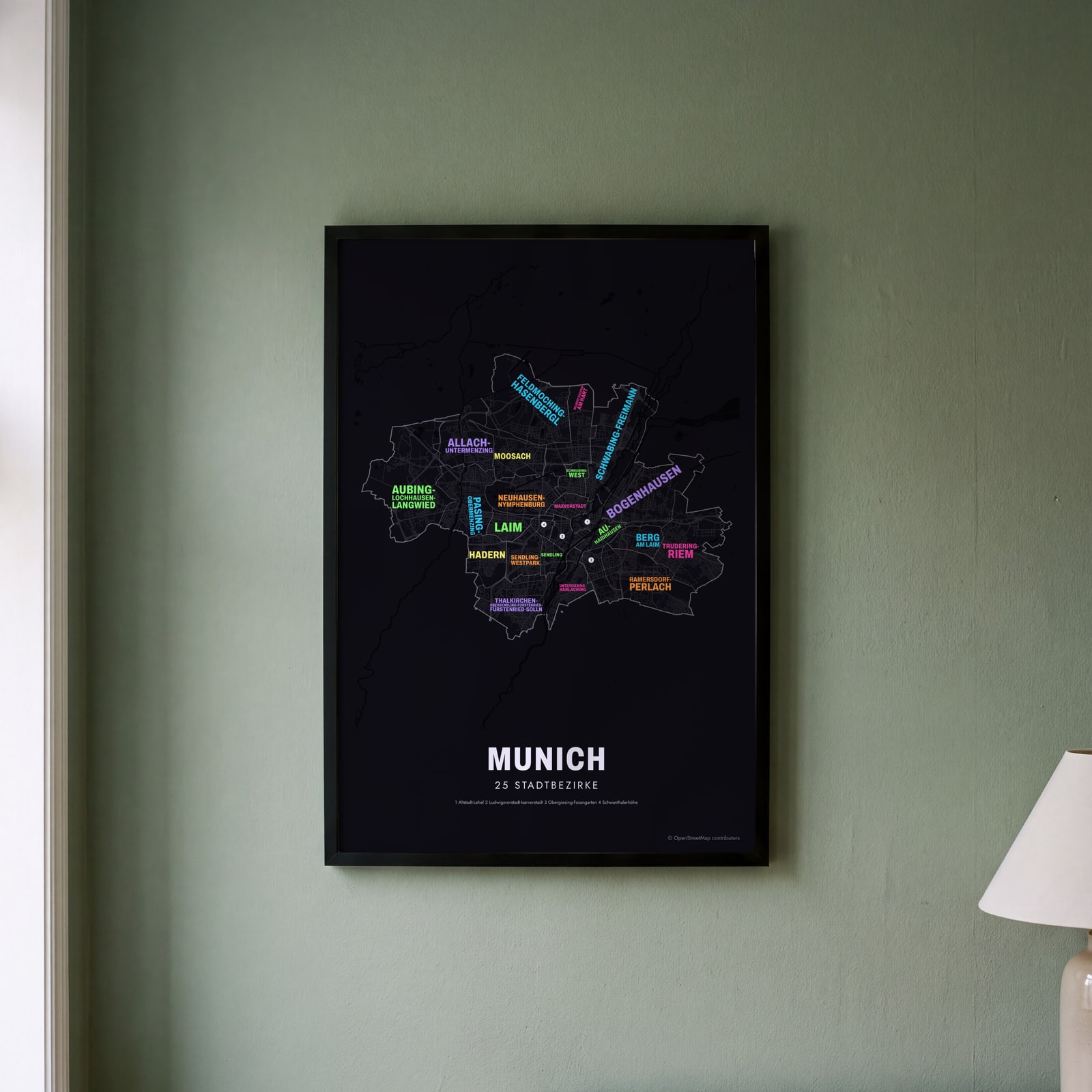 Typographic Munich map: the names fill their stadtbezirkeEdit this →
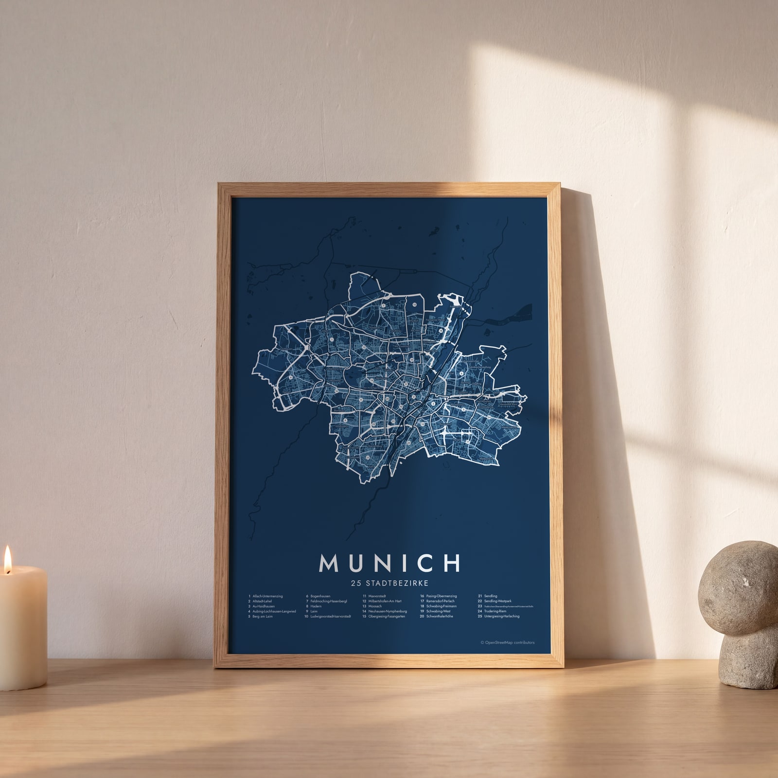 Munich street map with numbered stadtbezirke and their listEdit this →
Examples
Open any of them to change the words, the place, the date and the style, then download the print file.
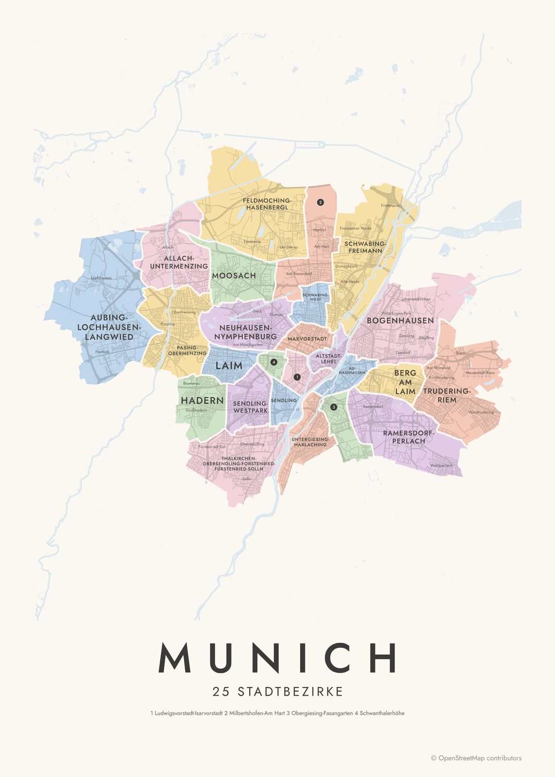 Munich neighborhood map in color, every stadtbezirk namedEdit this →More neighborhood maps →
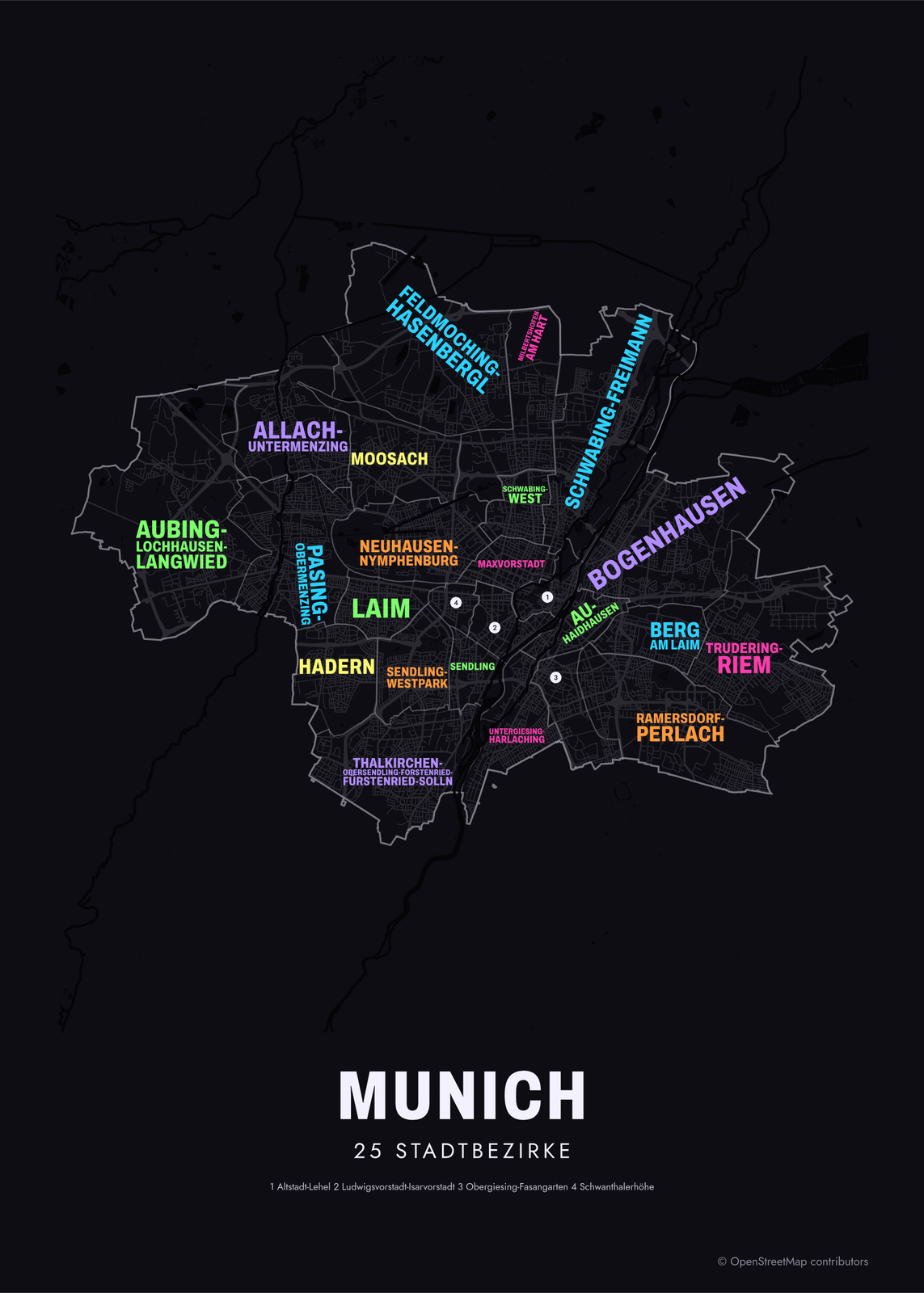 Typographic Munich map: the names fill their stadtbezirkeEdit this →More neighborhood maps →
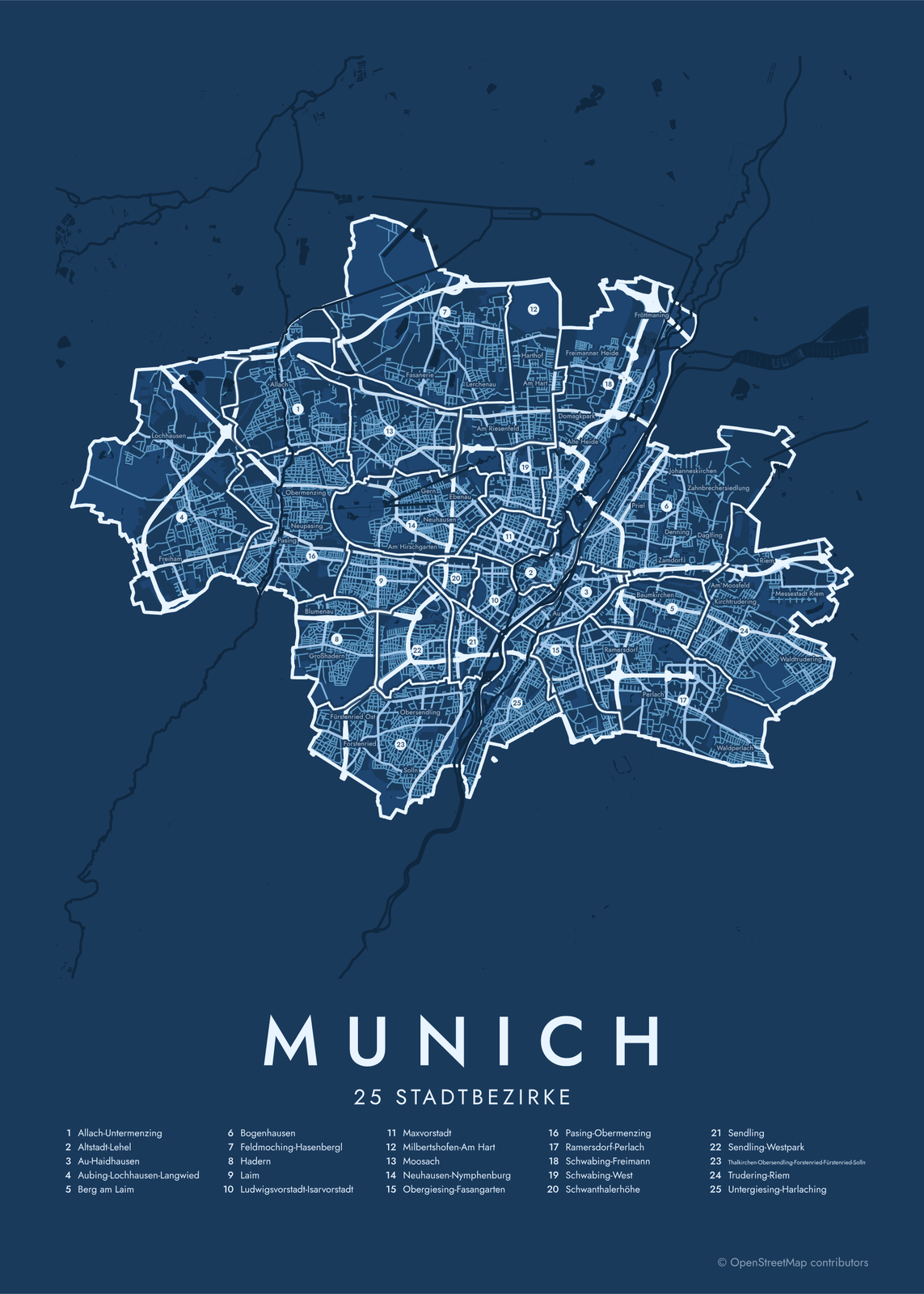 Munich street map with numbered stadtbezirke and their listEdit this →More neighborhood maps →
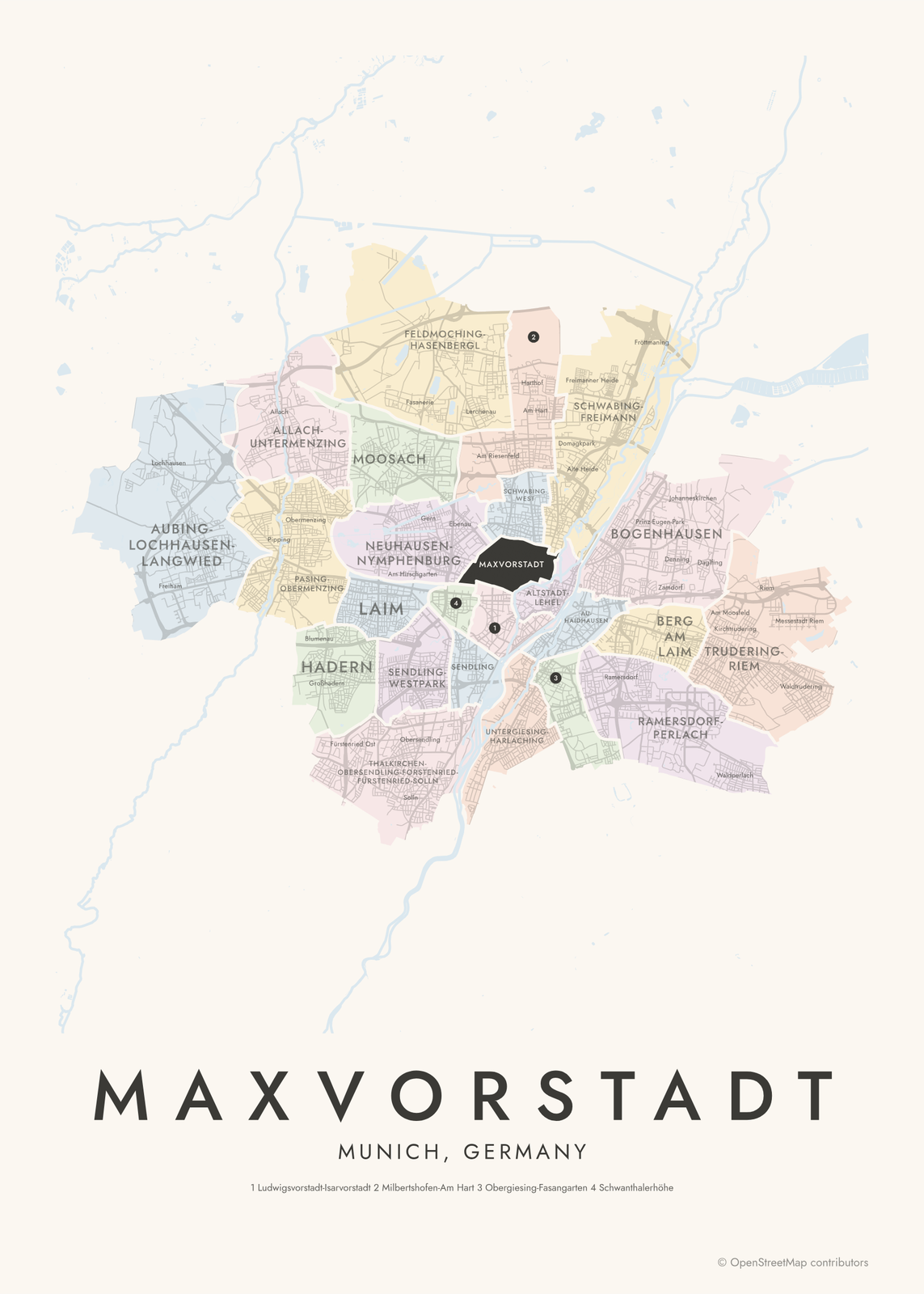 Maxvorstadt highlighted on a map of MunichEdit this →More neighborhood maps →
How Munich is divided
Munich is split into 25 Stadtbezirke, numbered 1 to 25, each with its own elected district committee, the Bezirksausschuss. The current set dates from 1992, when 41 districts were merged into 24, and 1996, when Laim became a district of its own again. That's why so many have long, hyphenated names that join older areas, like Thalkirchen-Obersendling-Forstenried-Fürstenried-Solln.
Locals usually name the Stadtteil, the older neighborhood or village, rather than the district: Schwabing, Haidhausen, Pasing, Giesing. These have no official borders, so they appear on the map as small labels inside the districts. Schwabing, for example, is spread across Schwabing-West and Schwabing-Freimann.
All 25 stadtbezirke of Munich
- Allach-Untermenzing
- Altstadt-Lehel
- Au-Haidhausen
- Aubing-Lochhausen-Langwied
- Berg am Laim
- Bogenhausen
- Feldmoching-Hasenbergl
- Hadern
- Laim
- Ludwigsvorstadt-Isarvorstadt
- Maxvorstadt
- Milbertshofen-Am Hart
- Moosach
- Neuhausen-Nymphenburg
- Obergiesing-Fasangarten
- Pasing-Obermenzing
- Ramersdorf-Perlach
- Schwabing-Freimann
- Schwabing-West
- Schwanthalerhöhe
- Sendling
- Sendling-Westpark
- Thalkirchen-Obersendling-Forstenried-Fürstenried-Solln
- Trudering-Riem
- Untergiesing-Harlaching
More neighborhood names on the map
Inside the stadtbezirke, the map also names 203 smaller neighborhoods where they fit, from OpenStreetMap: Lochhausen, Freiham, Aubing, Langwied, Allach, Pasing, Obermenzing, Untermenzing, Großhadern, Fürstenried, Ludwigsfeld, Forstenried, Nymphenburg, Solln, Fasanerie, Obersendling, Neuhausen, Feldmoching, Thalkirchen, Lerchenau, Hasenbergl, Ludwigsvorstadt, Harlaching, Isarvorstadt, Harthof, Altstadt, Milbertshofen, Am Hart, Giesing, Au, Lehel, Schwabing, Fasangarten, Haidhausen, Freimann, Ramersdorf, Oberföhring, Perlach, Zamdorf, Denning and more. Turn them off under Names if you want only the stadtbezirke.
Districts and neighborhoods to know
- Altstadt-Lehel: the old town, with Marienplatz, the Frauenkirche and the Viktualienmarkt.
- Maxvorstadt: the museum quarter of the Pinakotheken and the main building of Ludwig Maximilian University.
- Ludwigsvorstadt-Isarvorstadt: the Theresienwiese, where Oktoberfest is held, and the Glockenbach quarter.
- Neuhausen-Nymphenburg: Nymphenburg Palace and its park.
- Schwabing: an artists' quarter around 1900, next to the English Garden.
- Haidhausen: the Franzosenviertel, with streets named for battles of the Franco-Prussian War.
- Olympisches Dorf: the athletes' village of the 1972 Olympics, now homes and student housing.
- Fröttmaning: home of the Allianz Arena, at the city's northern edge.
How to make your Munich neighborhood poster
- Open the Munich map.
- Pick a style: Colored areas, Typographic (the names fill the map) or a Street map with the borders over the streets.
- Tap your own neighborhood to highlight it; it becomes the poster's title.
- Drag and zoom to frame the whole city or just your part of it, then pick a size and download the print file.
Questions
How many districts does Munich have?
25 Stadtbezirke, numbered from 1, Altstadt-Lehel, to 25, Laim. Each has its own elected district committee. The current set has been in place since 1996.
What's the difference between a Stadtbezirk and a Stadtteil?
A Stadtbezirk is an official district with fixed borders. A Stadtteil is a traditional neighborhood or former village, like Schwabing or Pasing, without exact borders. One district often holds several: Pasing-Obermenzing covers Pasing and Obermenzing.
Which district is Oktoberfest in?
Ludwigsvorstadt-Isarvorstadt, district 2. The festival grounds, the Theresienwiese, are at its western edge, a short walk from the main station.
Where do the Munich boundaries come from?
From OpenStreetMap (© OpenStreetMap contributors). Streets and water are OpenStreetMap's. Boundaries are a snapshot and can differ from what neighbors call home; tell us if one looks wrong.
What sizes can I print?
US Letter, 8 × 10, 11 × 14, 12 × 16 and 12 × 18 in, A4 and A3, free. You download a 300 DPI JPEG drawn at the size you pick. Larger prints, up to 24 × 36 in, are coming soon.
Related

Gift ideas by occasion




Every example is made with the Posterage generators. Change anything, then download it as a 300 DPI JPEG.