Nice neighborhood map 38 quartiers and 146 neighborhoods, named
This poster maps Nice split into 38 quartiers, from the Vieille Ville and the port to the hills of Cimiez and Mont Boron. Switch to the finer level for 146 smaller neighborhoods, from Carabacel to Saint-Barthélemy. Highlight yours and print it.
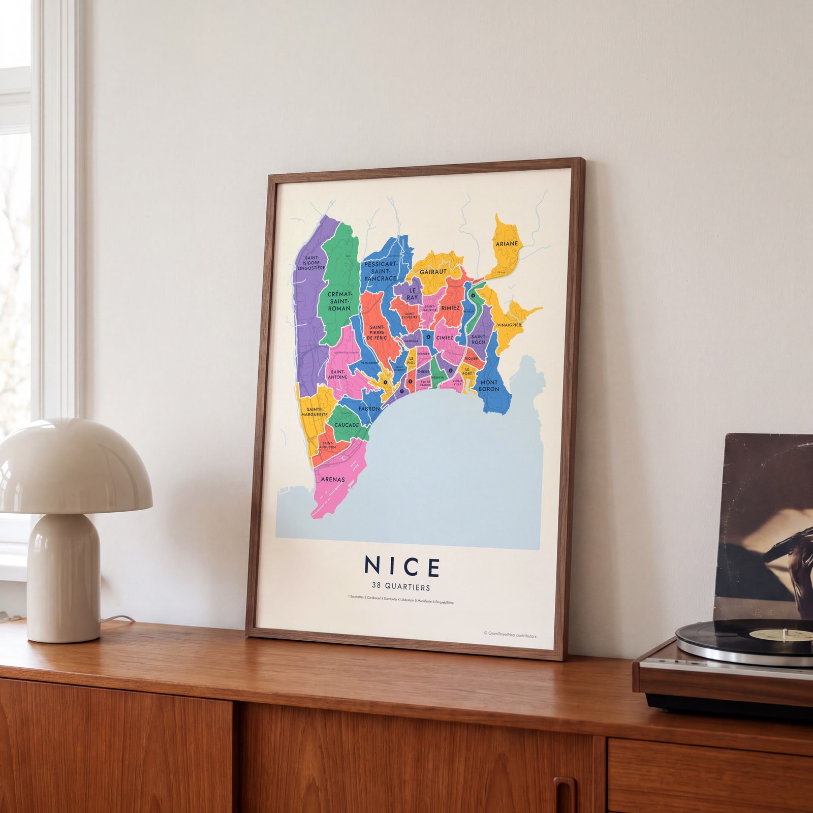
On the wall
A few of them framed at home. Open any one to make it yours.
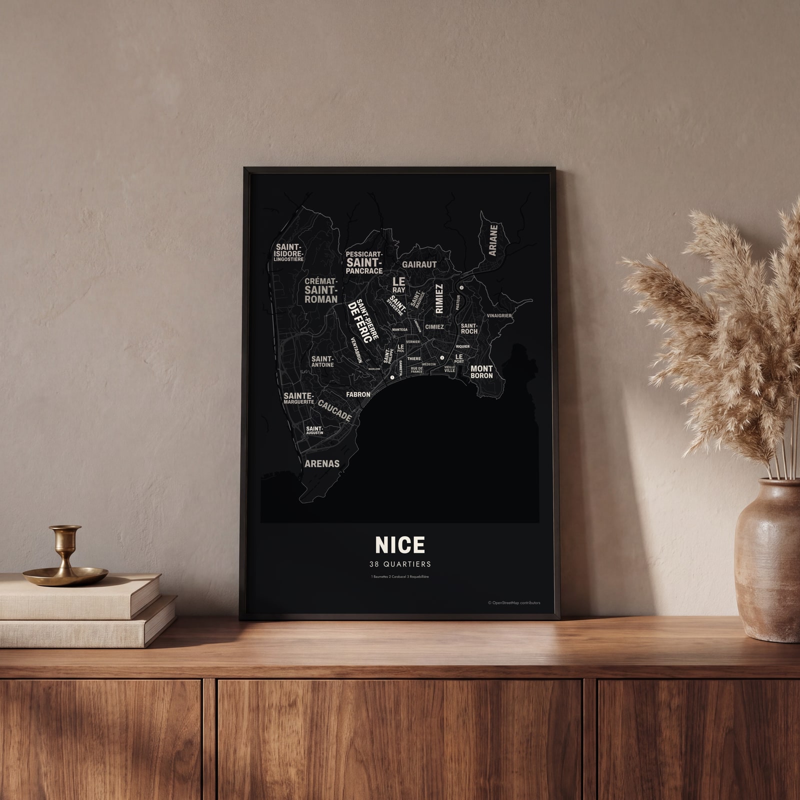 Typographic Nice map: the names fill their quartiersEdit this →
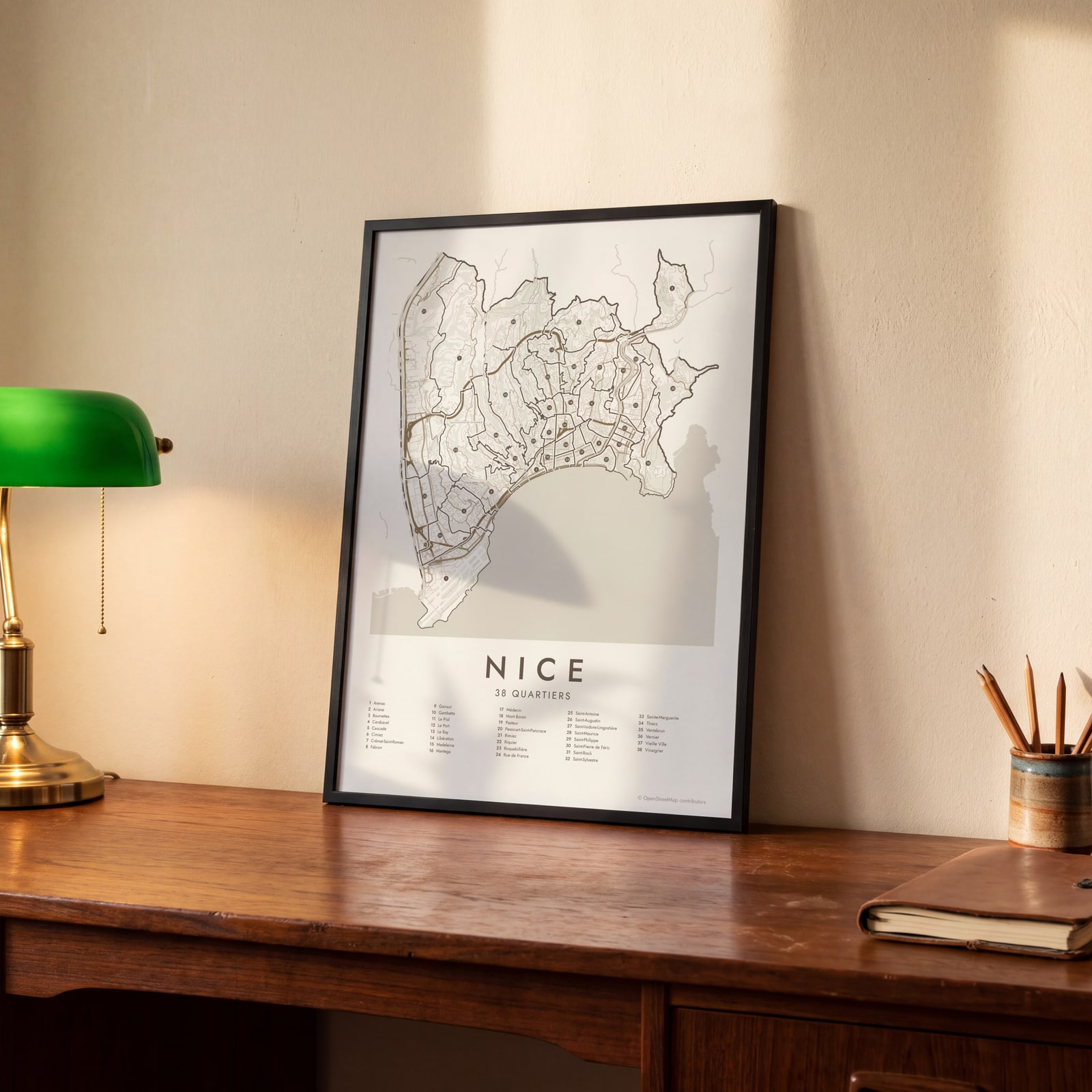 Nice street map with numbered quartiers and their listEdit this →
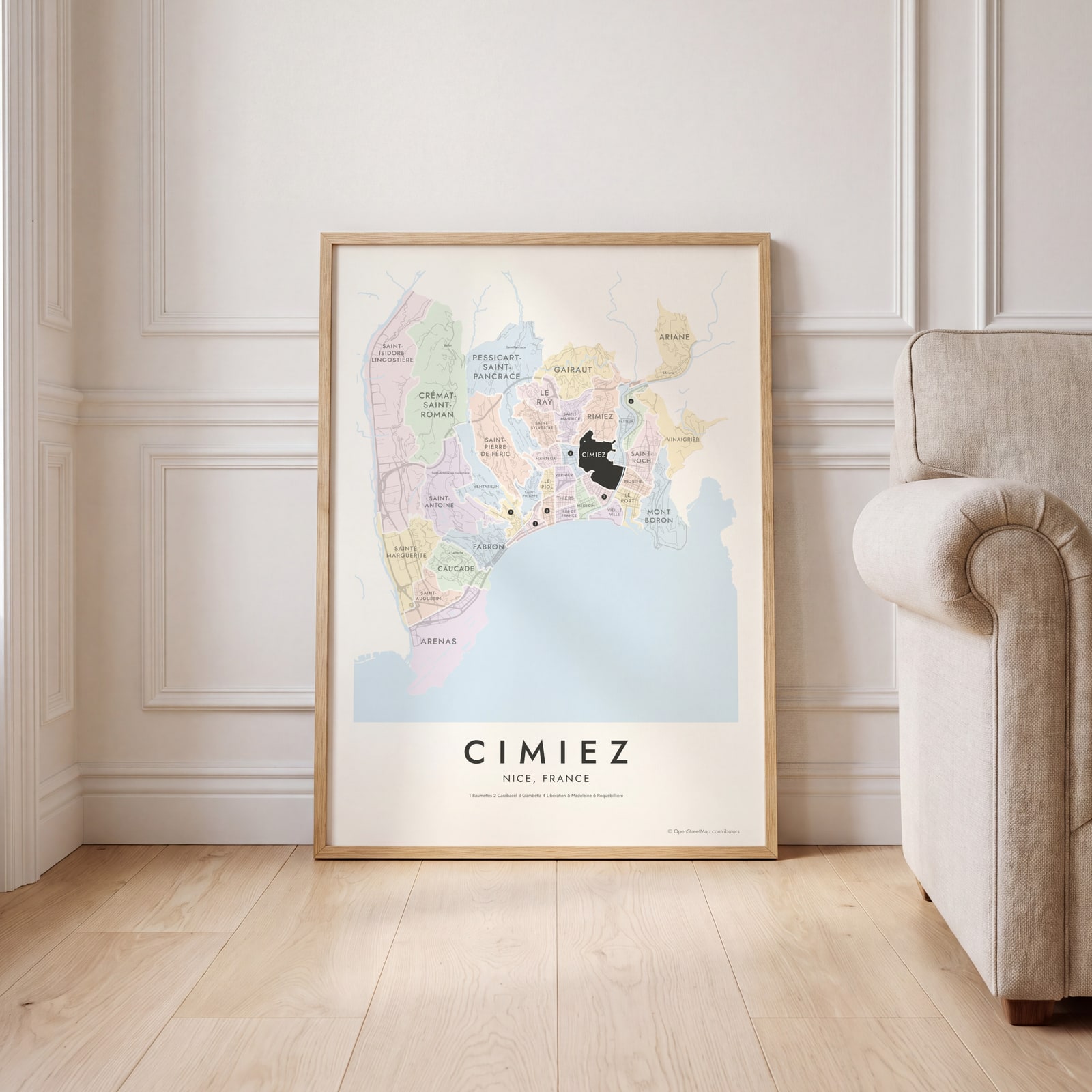 Cimiez highlighted on a map of NiceEdit this →
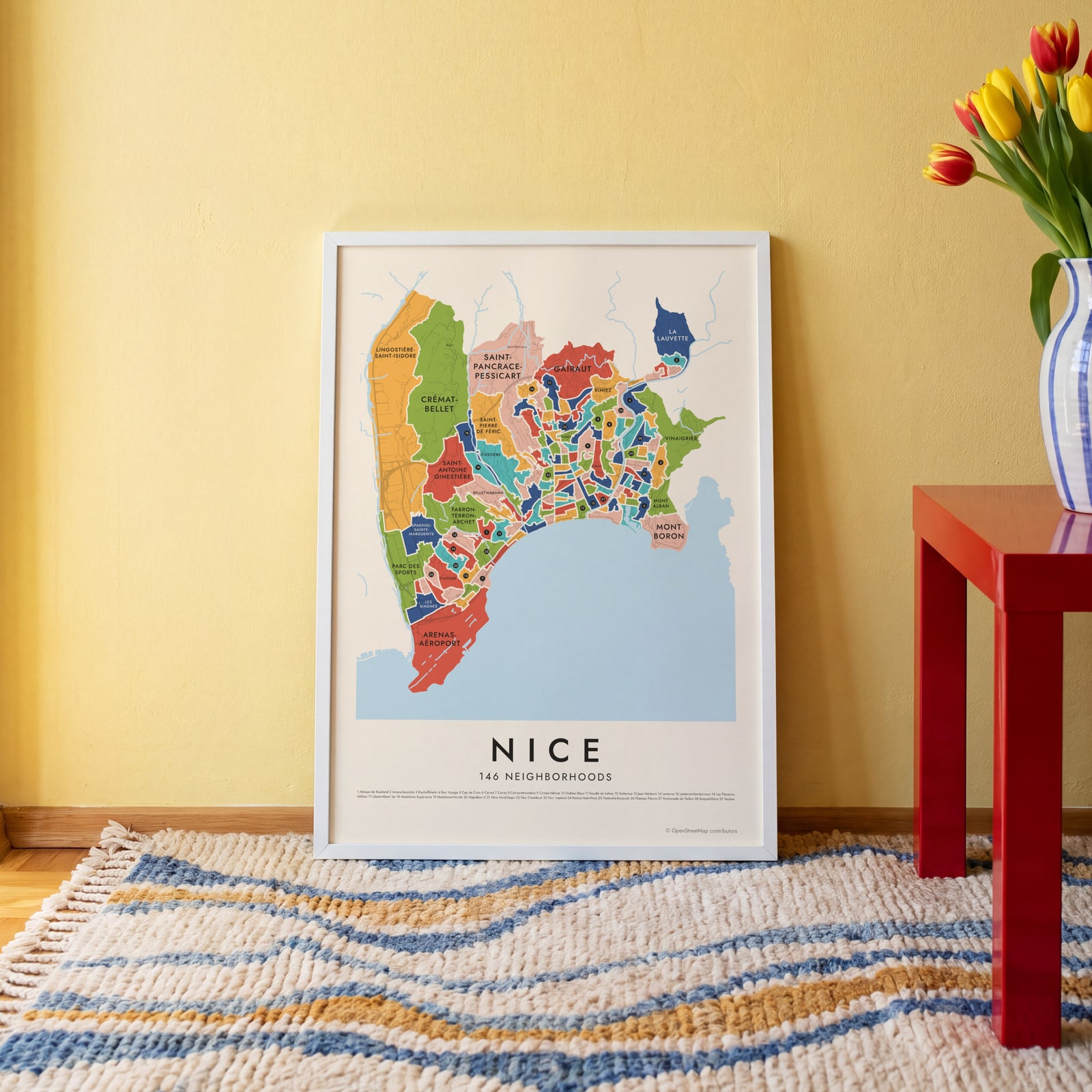 Nice's 146 neighborhoods in colorEdit this →
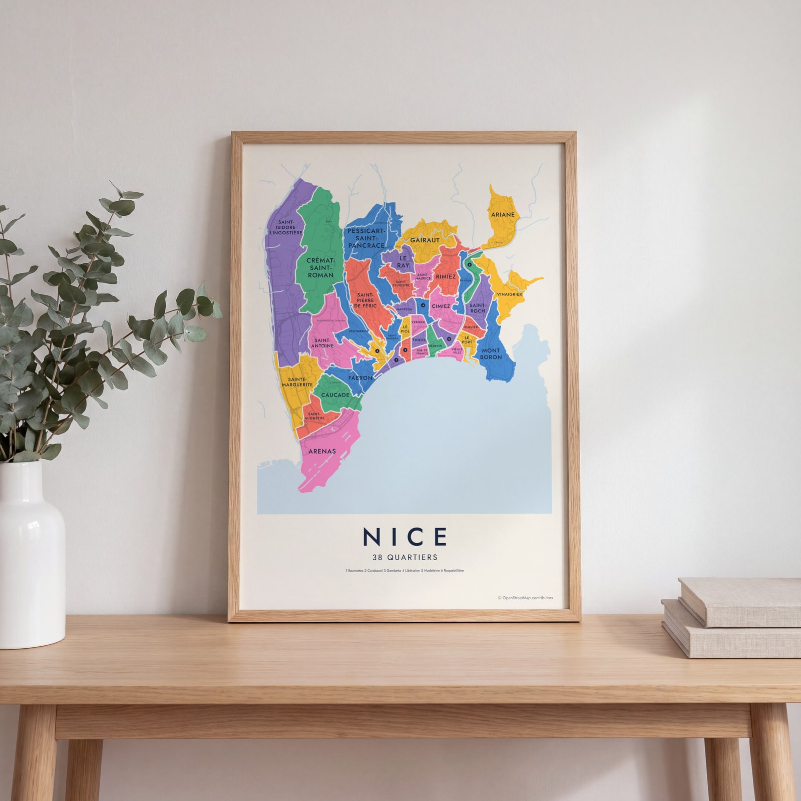 Nice neighborhood map in color, every quartier namedEdit this →
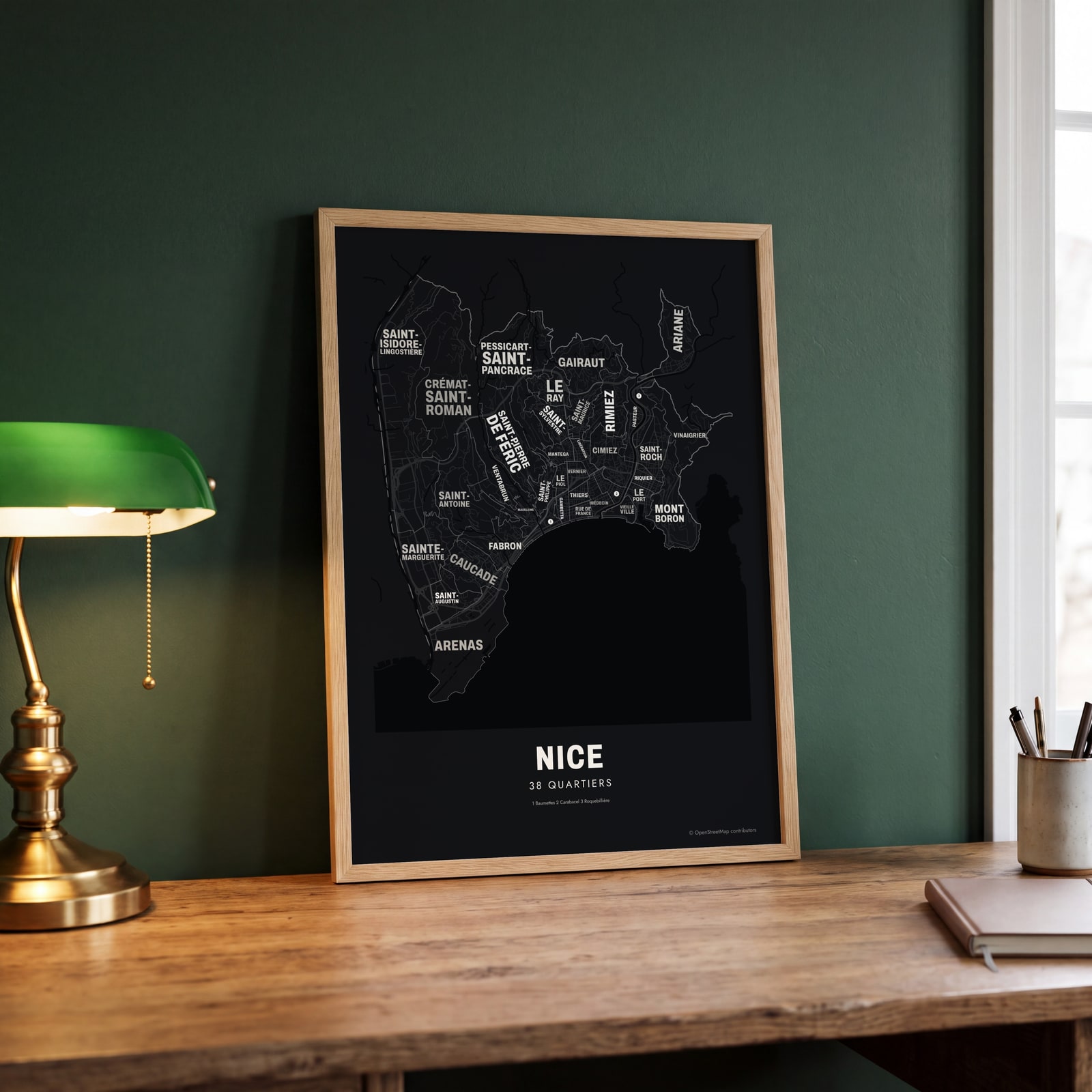 Typographic Nice map: the names fill their quartiersEdit this →
Examples
Open any of them to change the words, the place, the date and the style, then download the print file.
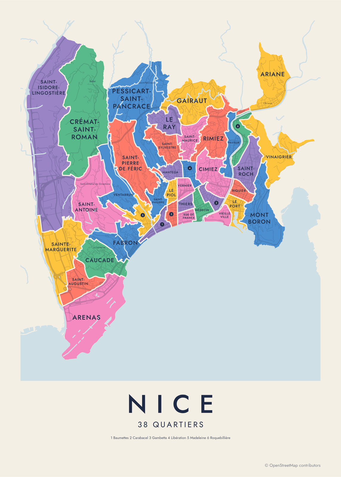 Nice neighborhood map in color, every quartier namedEdit this →More neighborhood maps →
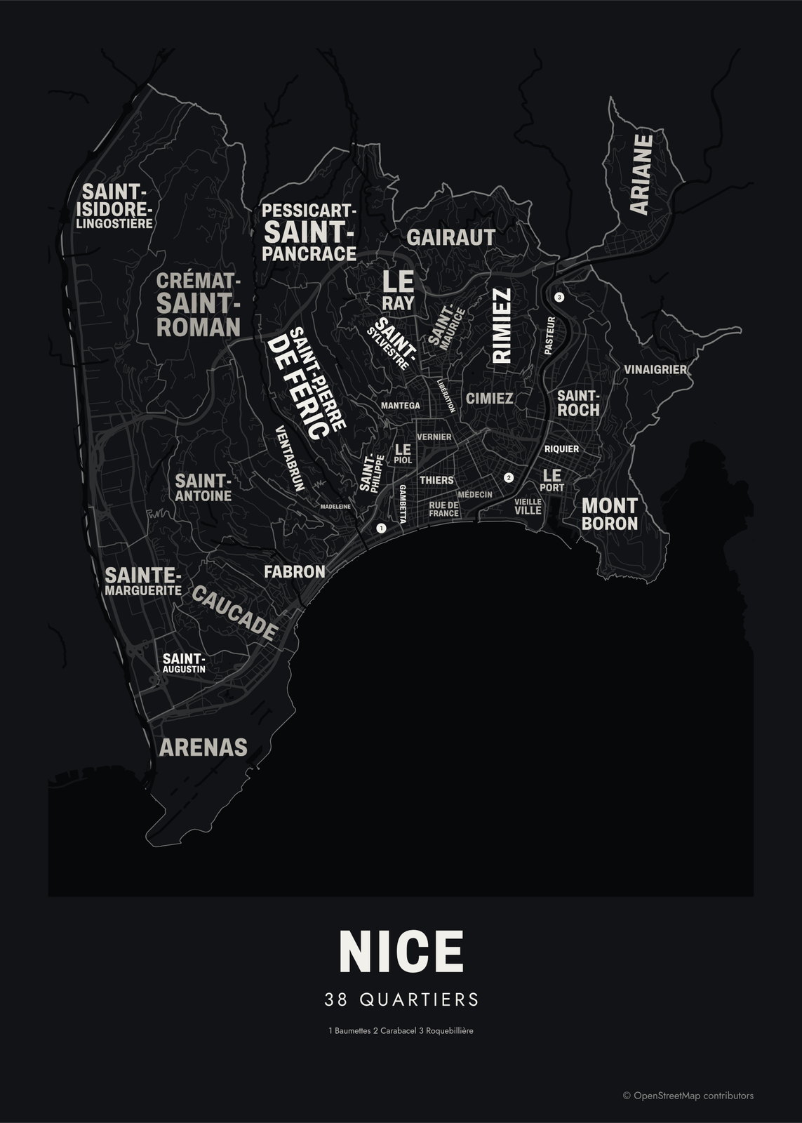 Typographic Nice map: the names fill their quartiersEdit this →More neighborhood maps →
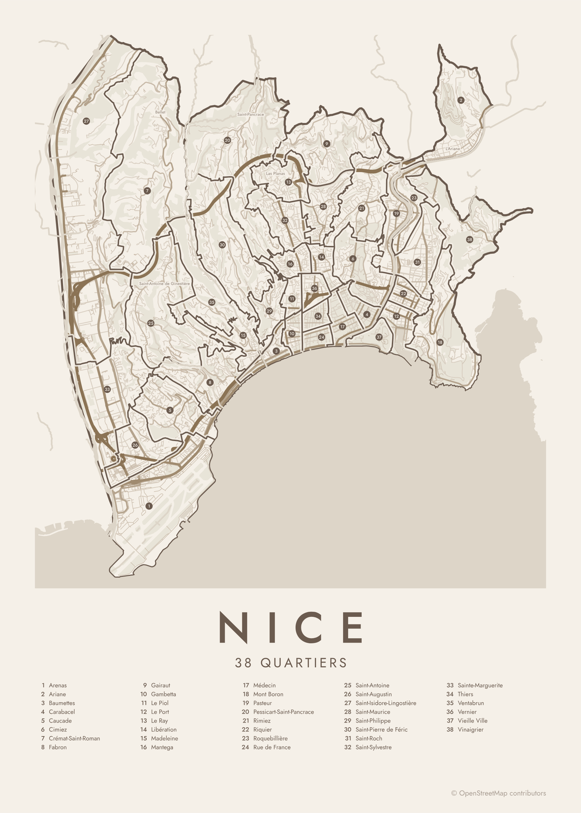 Nice street map with numbered quartiers and their listEdit this →More neighborhood maps →
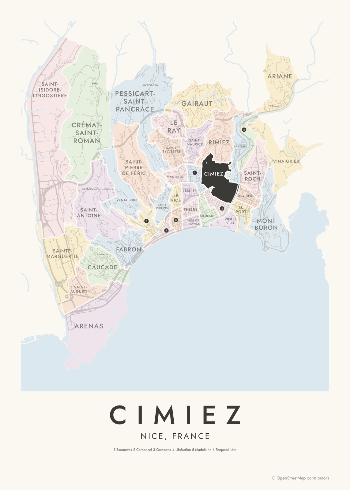 Cimiez highlighted on a map of NiceEdit this →More neighborhood maps →
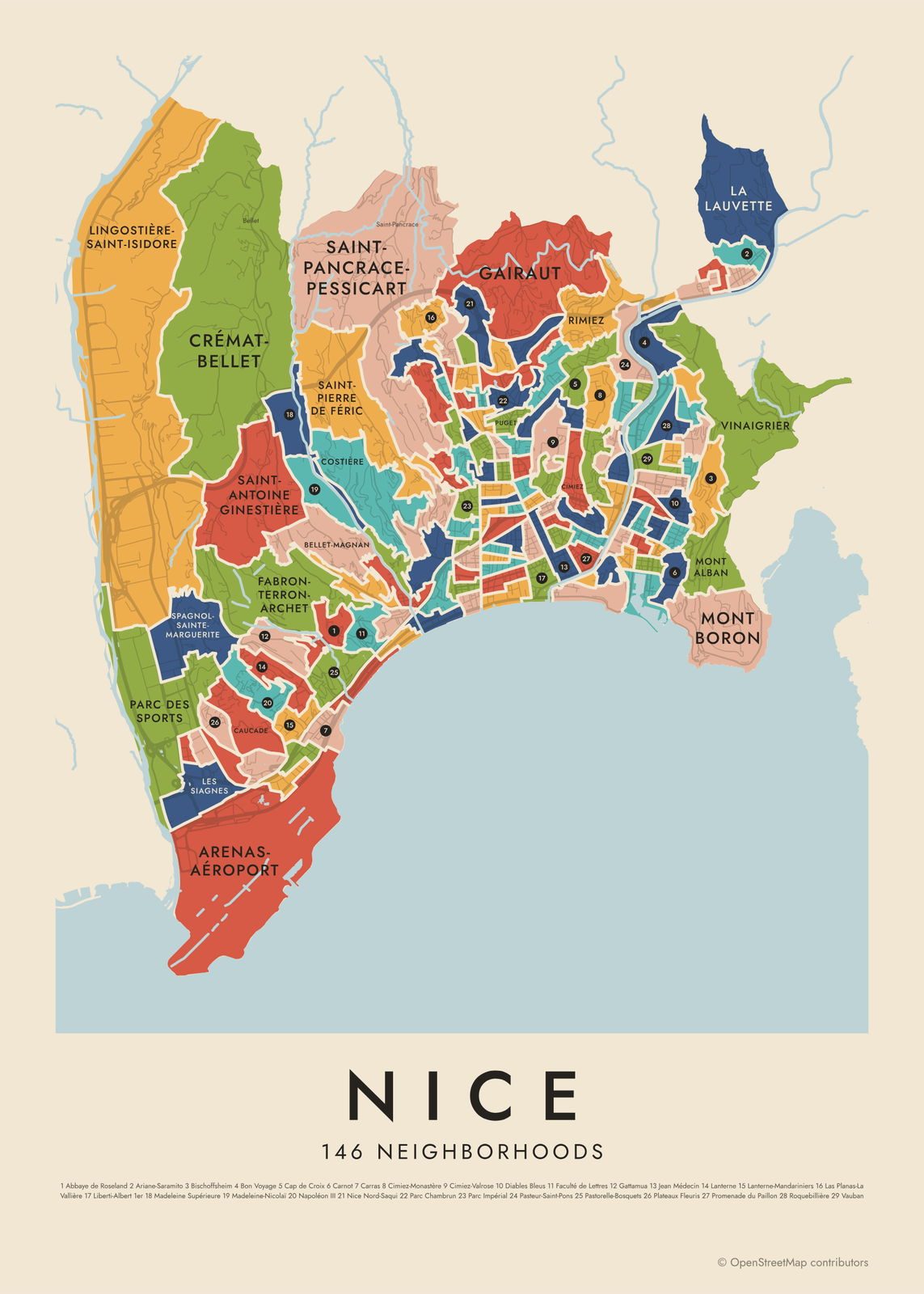 Nice's 146 neighborhoods in colorEdit this →More neighborhood maps →
How Nice is divided
France's statistics office, INSEE, splits large towns into small blocks called IRIS, usually home to a few thousand people each, and groups them into larger "grands quartiers". In Nice that gives 38 quartiers and 146 IRIS, the two levels on this map.
Most of the names are the ones people in Nice already use: hills like Cimiez, Fabron and Gairaut, saints' names like Saint-Roch and Saint-Pierre de Féric, and central areas named after a street or square, like Jean Médecin or Libération. Smaller local names, such as Carré d'Or, Valrose and Saint-Pancrace, print as labels.
All 38 quartiers of Nice
- Arenas
- Ariane
- Baumettes
- Carabacel
- Caucade
- Cimiez
- Crémat-Saint-Roman
- Fabron
- Gairaut
- Gambetta
- Le Piol
- Le Port
- Le Ray
- Libération
- Madeleine
- Mantega
- Médecin
- Mont Boron
- Pasteur
- Pessicart-Saint-Pancrace
- Rimiez
- Riquier
- Roquebillière
- Rue de France
- Saint-Antoine
- Saint-Augustin
- Saint-Isidore-Lingostière
- Saint-Maurice
- Saint-Philippe
- Saint-Pierre de Féric
- Saint-Roch
- Saint-Sylvestre
- Sainte-Marguerite
- Thiers
- Ventabrun
- Vernier
- Vieille Ville
- Vinaigrier
All 146 neighborhoods of Nice
- Abbaye de Roseland
- Acropolis-XVe Corps
- Arenas-Aéroport
- Arenas-Cassin
- Ariane-Les Chênes
- Ariane-Monzie
- Ariane-Ripert
- Ariane-Saramito
- Barla
- Baumettes
- Bellet-Magnan
- Bellevue
- Bischoffsheim
- Bon Voyage
- Bonaparte
- Borriglione-Saint Lambert
- Bottero
- Brancolar-Régina
- Brancolar-Scudéri
- Canavese
- Cap de Croix
- Carabacel
- Caravadossi-George V
- Carlone
- Carnot
- Carras
- Cassini
- Caucade
- Cernuschi
- Cessole
- Châteauneuf
- Cimiez
- Cimiez-Monastère
- Cimiez-Valrose
- Clemenceau
- Clément Roassal
- Comte de Falicon
- Costière
- Crémat-Bellet
- Cyrille Besset-La Forêt
- Cyrnos
- Dante
- Desambrois
- Diables Bleus
- Digue des Français
- Église Russe
- Évêché
- Fabron-Terron-Archet
- Faculté de Lettres
- France-Negresco
- Gairaut
- Gare Nice-Ville
- Garibaldi
- Garnier-Gare de Provence
- Gattamua
- Gorbella
- Gravier
- Grosso
- Henry Dunant
- Hôpital Saint-Roch
- Jean Médecin
- Jeanne d'Arc-Fuon-Cauda
- La Bornala
- La Californie
- La Clua
- La Lauvette
- La Victorine-Grinda
- Lanterne
- Lanterne-Mandariniers
- Las Planas-La Vallière
- Le Piol-Cyrnos
- Le Ray-Gravier-Dunant
- Le Righi
- Lenval
- Les Moulins
- Les Siagnes
- Liberti-Albert 1er
- Lingostière-Saint-Isidore
- Lyautey-Gendarmerie
- Madeleine
- Madeleine Robiony
- Madeleine Supérieure
- Madeleine-Nicolaï
- Magnan
- Mantega
- Marceau
- Michel-Ange
- Michelet
- Mont Alban
- Mont Boron
- Mont Gros
- Musiciens
- Napoléon III
- Nice Nord-Saqui
- Notre-Dame
- Parc Chambrun
- Parc des Sports
- Parc Impérial
- Paschetta
- Pasteur
- Pasteur-Saint-Pons
- Pasteur-Voie Romaine
- Pastorelle-Bosquets
- Paul Montel
- Pierre Semard
- Pierre Sola
- Plateaux Fleuris
- Port
- Potiers
- Promenade du Paillon
- Puget
- Raimbaldi
- République
- Rimiez
- Riquier
- Riquier-Arson
- Riquier-Fontaine de la Ville
- Roquebillière
- Rossini
- Route de Turin
- Saint-Antoine Ginestière
- Saint-Augustin
- Saint-Barthélemy
- Saint-Charles
- Saint-Jean d'Angély
- Saint-Pancrace-Pessicart
- Saint-Philippe
- Saint-Pierre de Féric
- Saint-Roch-Jean XXIII
- Saint-Roch-Ricolfi
- Saint-Sylvestre
- Sainte-Rosalie-Arbre Inférieur
- Saleya-Château
- Sasserno
- Spagnol-Sainte-Marguerite
- Thiers-Durante
- Thiole
- TNL-Beaumont
- Trachel
- Vauban
- Vernier
- Victor Hugo-Buffa
- Vieux Nice-Sainte-Réparate
- Vieux Nice-Visitation
- Villa Arson
- Vinaigrier
More neighborhood names on the map
Inside the quartiers, the map also names 23 smaller neighborhoods where they fit, from OpenStreetMap: Saint-Isidore, Bellet, Saint-Antoine de Ginestière, L'Archet, La Madeleine, Saint-Pierre-de-Féric, Saint-Pancrace, Pessicart, Las Planas, Les Baumettes, Saint-Barthélémy, Henri Sappia, La Buffa, Borriglione, L'Ariane, Fabron Supérieur, La Lanterne, Terron, La Costière, Evêché, Carré d'Or, Valrose, Vallon des Fleurs. Turn them off under Names if you want only the quartiers.
Neighborhoods to know
- Vieille Ville: the old town below Castle Hill, with the flower market on the Cours Saleya.
- Le Port: Port Lympia, the harbor between Castle Hill and Mont Boron, with ferries to Corsica.
- Cimiez: the hill of the Roman town of Cemenelum, with the Matisse Museum and a Franciscan monastery.
- Mont Boron: a wooded hill east of the port, looking over the bay of Villefranche.
- Église Russe: named for the Saint Nicholas Russian Orthodox Cathedral, finished in 1912.
- Musiciens: streets named after composers, like rue Rossini and rue Berlioz.
- Libération: around the old Gare du Sud station, with a morning market.
- France-Negresco: by the Promenade des Anglais, around the Hotel Negresco, which opened in 1913.
How to make your Nice neighborhood poster
- Open the Nice map and pick quartiers or neighborhoods.
- Pick a style: Colored areas, Typographic (the names fill the map) or a Street map with the borders over the streets.
- Tap your own neighborhood to highlight it; it becomes the poster's title.
- Drag and zoom to frame the whole city or just your part of it, then pick a size and download the print file.
Questions
How many neighborhoods does Nice have?
INSEE splits Nice into 38 grands quartiers and 146 smaller IRIS areas, the two levels on this map. People in Nice also use many older local names, and some of them appear as labels.
What is the old town of Nice called?
Vieux Nice, or the Vieille Ville. Locals also call it the Babazouk. It sits between Castle Hill and the Paillon, a short walk from the Promenade des Anglais.
Where is the Promenade des Anglais?
It runs about 4 miles along the Baie des Anges, from near the airport in the west to the edge of the old town.
Where do the Nice boundaries come from?
From OpenStreetMap (© OpenStreetMap contributors) and INSEE, IGN (via Opendatasoft) and INSEE, IGN (via Opendatasoft). Streets and water are OpenStreetMap's. Boundaries are a snapshot and can differ from what neighbors call home; tell us if one looks wrong.
What sizes can I print?
US Letter, 8 × 10, 11 × 14, 12 × 16 and 12 × 18 in, A4 and A3, free. You download a 300 DPI JPEG drawn at the size you pick. Larger prints, up to 24 × 36 in, are coming soon.
Related

Gift ideas by occasion




Every example is made with the Posterage generators. Change anything, then download it as a 300 DPI JPEG.