Paris arrondissements map all 20 arrondissements and 80 quartiers
This poster maps Paris as its 20 arrondissements, labeled 1er to 20e, spiraling out from the Louvre. Switch to the 80 quartiers for a finer map, with names like Saint-Germain-des-Prés, Belleville and Batignolles. Highlight your arrondissement and print it.
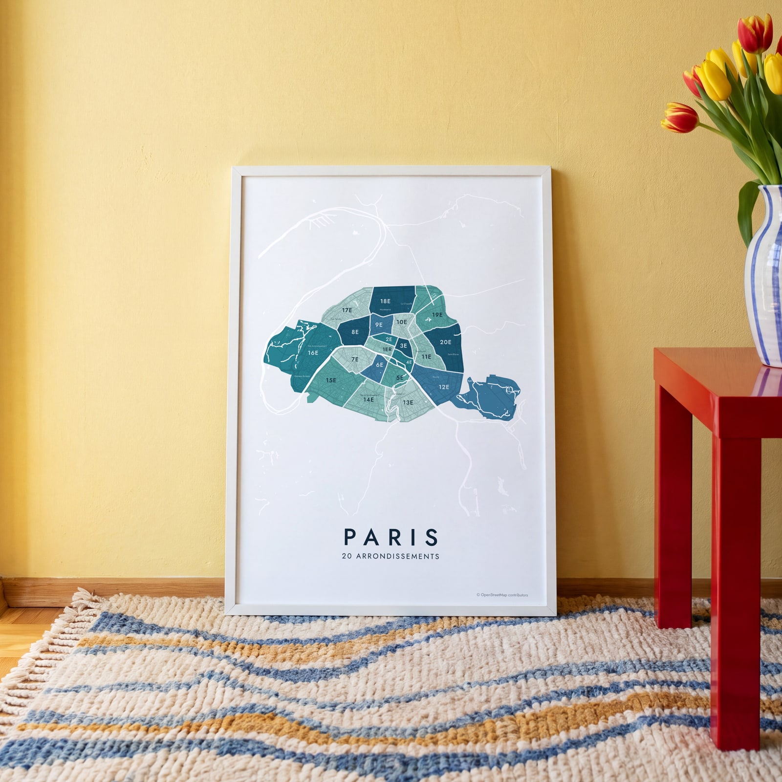
On the wall
A few of them framed at home. Open any one to make it yours.
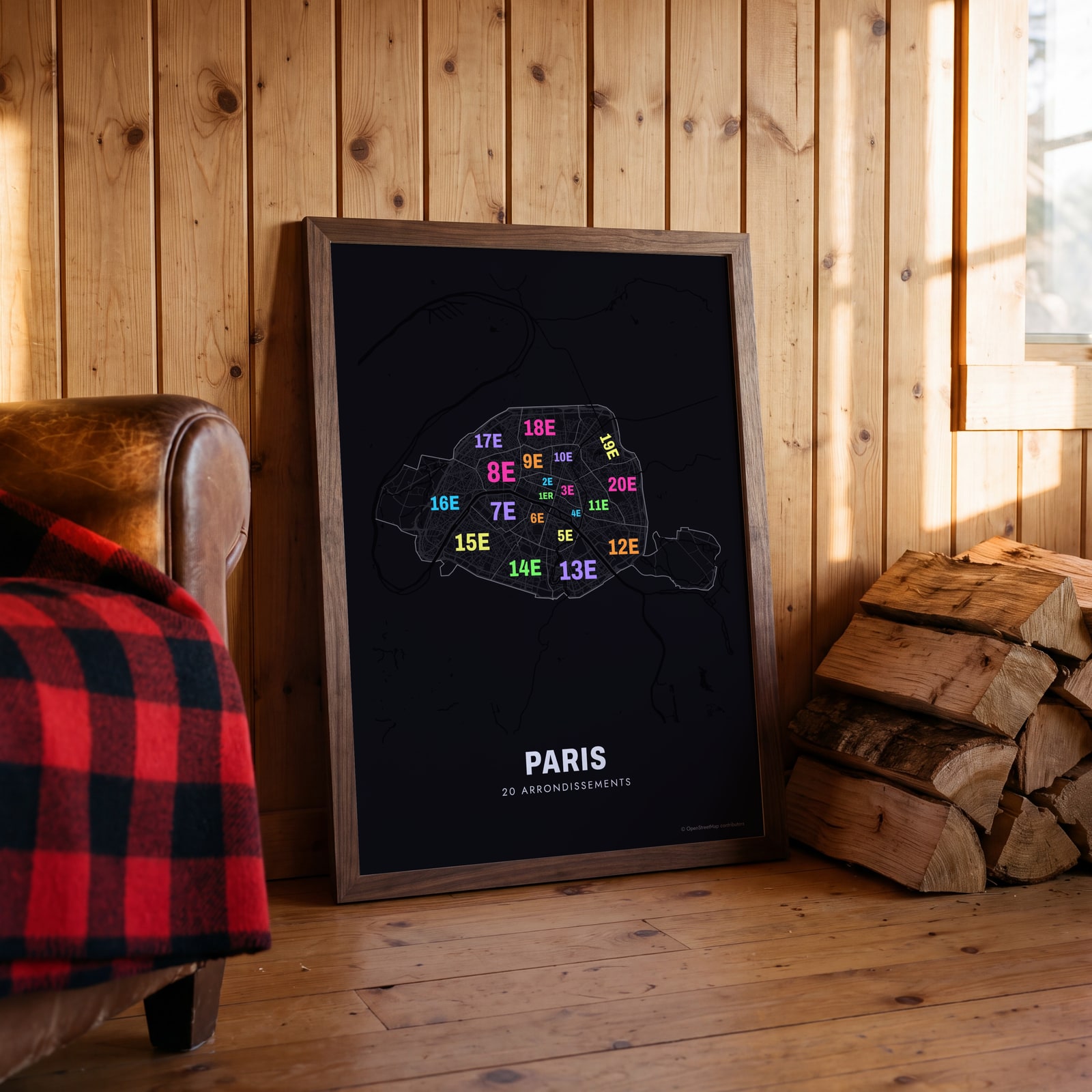 Typographic Paris map: the names fill their arrondissementsEdit this →
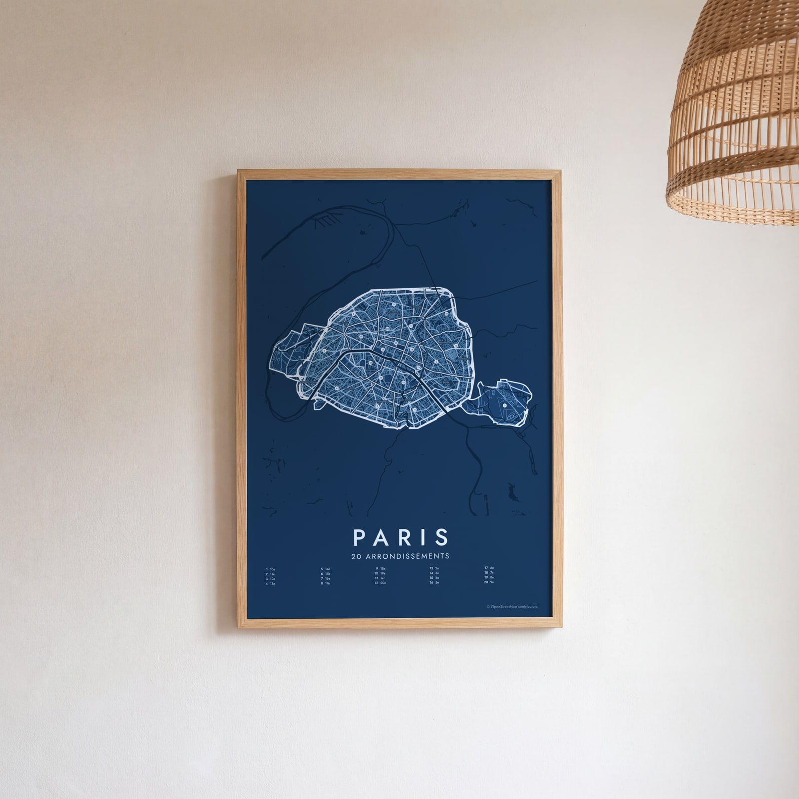 Paris street map with numbered arrondissements and their listEdit this →
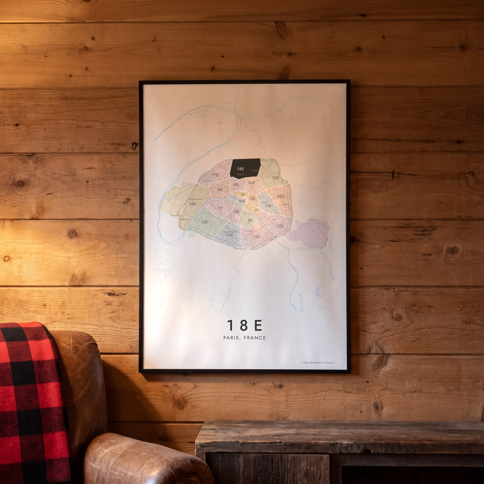 18e highlighted on a map of ParisEdit this →
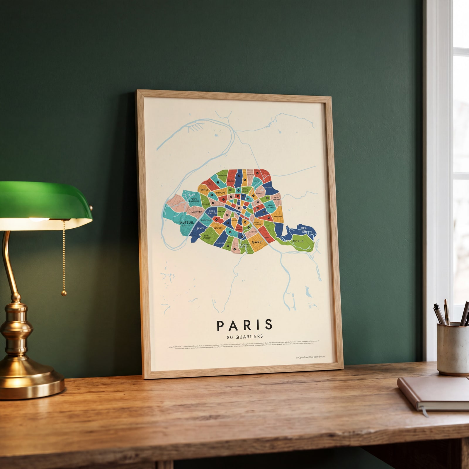 Paris's 80 quartiers in colorEdit this →
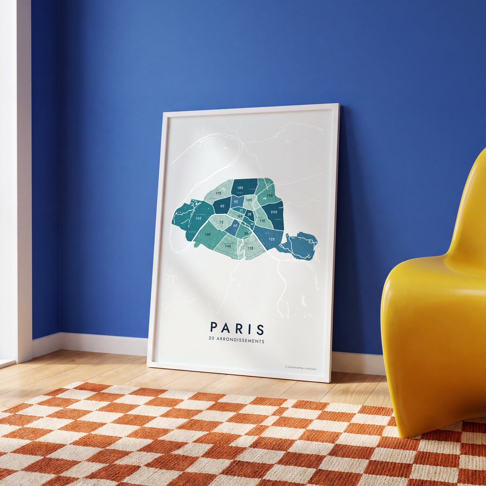 Paris neighborhood map in color, every arrondissement namedEdit this →
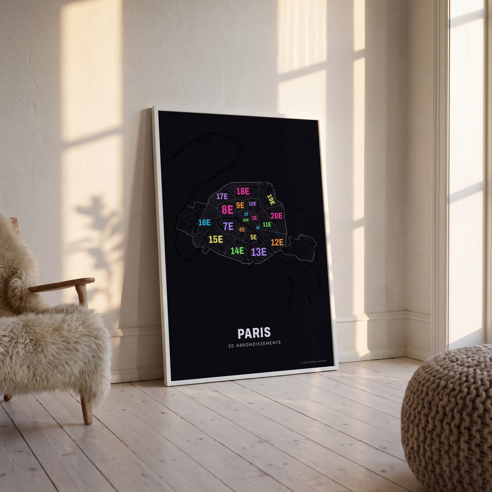 Typographic Paris map: the names fill their arrondissementsEdit this →
Examples
Open any of them to change the words, the place, the date and the style, then download the print file.
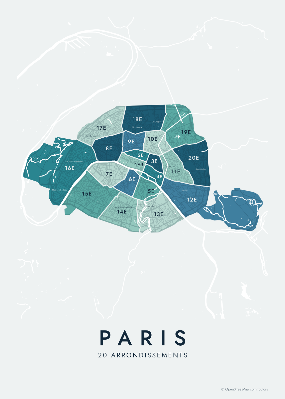 Paris neighborhood map in color, every arrondissement namedEdit this →More neighborhood maps →
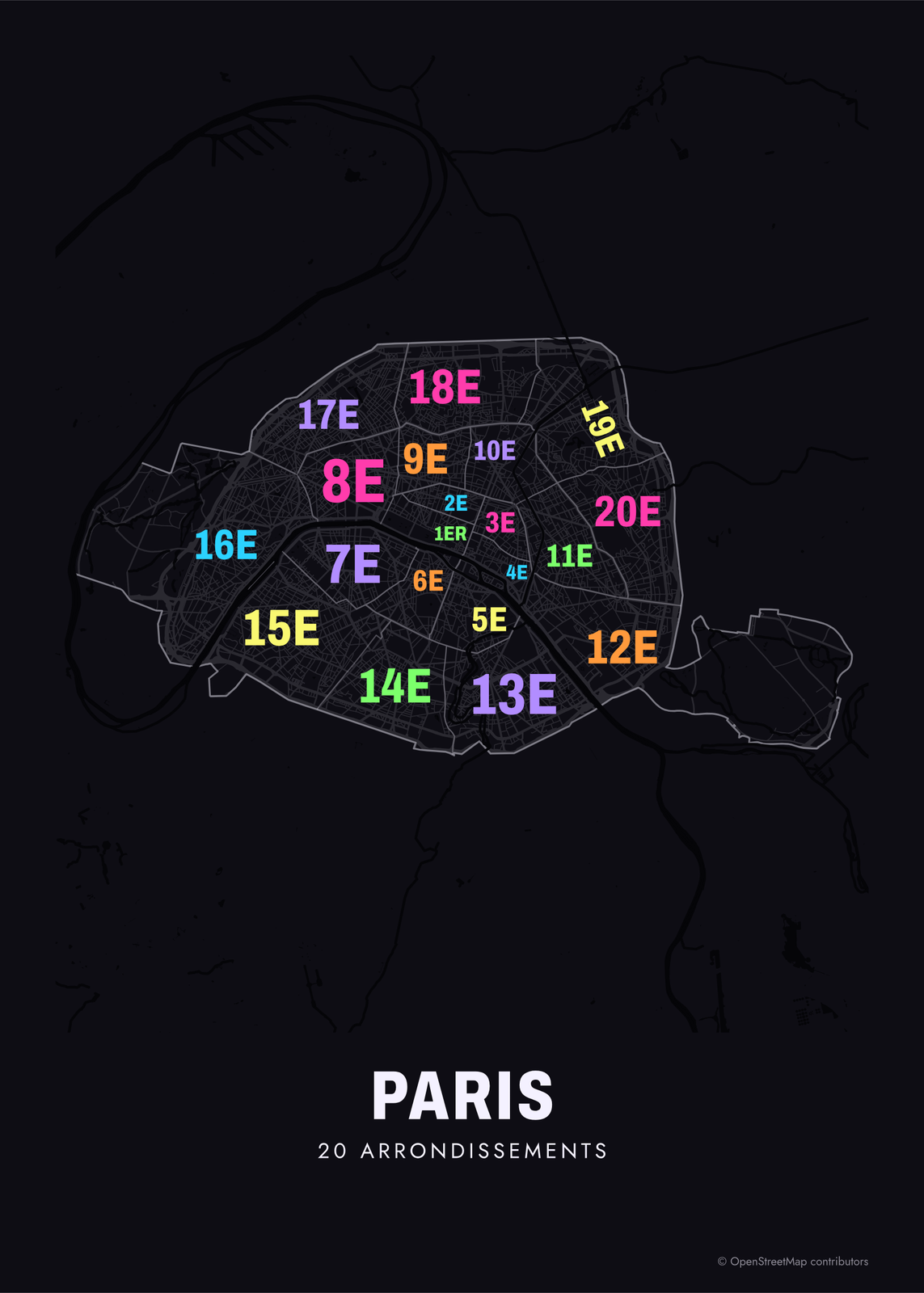 Typographic Paris map: the names fill their arrondissementsEdit this →More neighborhood maps →
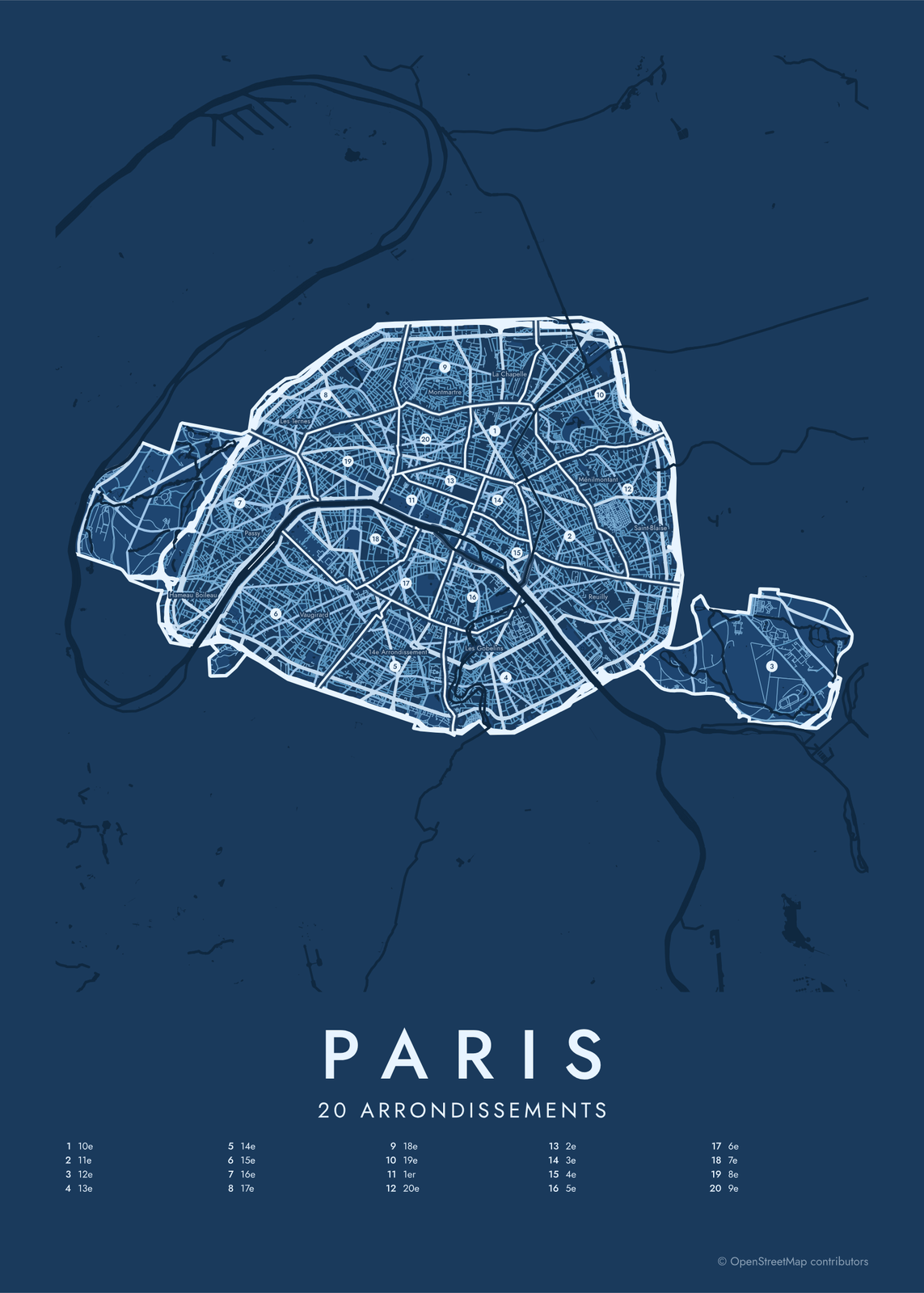 Paris street map with numbered arrondissements and their listEdit this →More neighborhood maps →
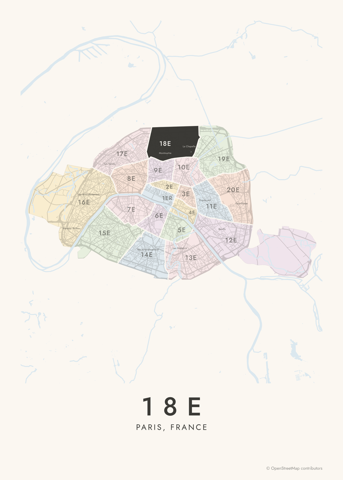 18e highlighted on a map of ParisEdit this →More neighborhood maps →
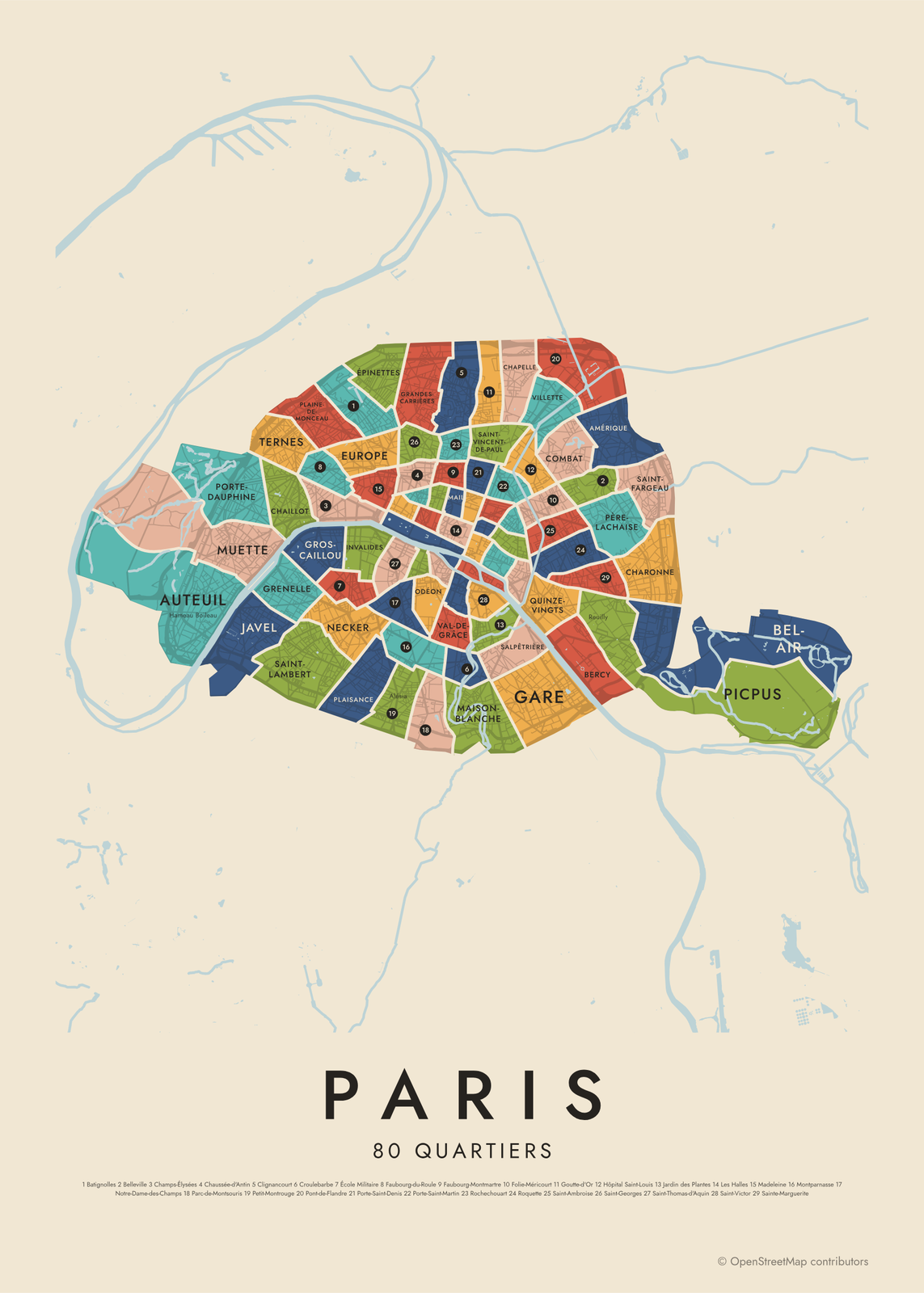 Paris's 80 quartiers in colorEdit this →More neighborhood maps →
How Paris is divided
Paris has had 20 arrondissements since 1860, when it annexed the villages around it, among them Montmartre, Belleville and Vaugirard. They're numbered in a clockwise spiral, from the 1er around the Louvre to the 20e in the east. Each has its own town hall, and the last two digits of a Paris postcode give the arrondissement: 75011 is the 11e. Since 2020 the first four share one town hall as Paris Centre, but they keep their numbers.
Each arrondissement splits into four quartiers administratifs, 80 in all, drawn at the same time. They're used mostly for statistics, and their names often aren't the ones Parisians use. Le Marais spans the 3e and 4e, and Montmartre isn't a quartier at all. Those names, and dozens more, print as small labels.
All 20 arrondissements of Paris
- 1er
- 2e
- 3e
- 4e
- 5e
- 6e
- 7e
- 8e
- 9e
- 10e
- 11e
- 12e
- 13e
- 14e
- 15e
- 16e
- 17e
- 18e
- 19e
- 20e
All 80 quartiers of Paris
- Amérique
- Archives
- Arsenal
- Arts-et-Métiers
- Auteuil
- Batignolles
- Bel-Air
- Belleville
- Bercy
- Bonne-Nouvelle
- Chaillot
- Champs-Élysées
- Chapelle
- Charonne
- Chaussée-d'Antin
- Clignancourt
- Combat
- Croulebarbe
- École Militaire
- Enfants-Rouges
- Épinettes
- Europe
- Faubourg-du-Roule
- Faubourg-Montmartre
- Folie-Méricourt
- Gaillon
- Gare
- Goutte-d'Or
- Grandes-Carrières
- Grenelle
- Gros-Caillou
- Hôpital Saint-Louis
- Invalides
- Jardin des Plantes
- Javel
- Les Halles
- Les Îles
- Madeleine
- Maison-Blanche
- Monnaie
- Montparnasse
- Muette
- Necker
- Notre-Dame-des-Champs
- Odéon
- Palais Royal
- Parc-de-Montsouris
- Père-Lachaise
- Petit-Montrouge
- Picpus
- Plaine-de-Monceau
- Plaisance
- Pont-de-Flandre
- Porte-Dauphine
- Porte-Saint-Denis
- Porte-Saint-Martin
- Quinze-Vingts
- Rochechouart
- Roquette
- Saint-Ambroise
- Saint-Fargeau
- Saint-Georges
- Saint-Germain-des-Prés
- Saint-Germain-l'Auxerrois
- Saint-Gervais
- Saint-Lambert
- Saint-Merri
- Saint-Thomas-d'Aquin
- Saint-Victor
- Saint-Vincent-de-Paul
- Sainte-Avoye
- Sainte-Marguerite
- Salpêtrière
- Sorbonne
- Ternes
- Val-de-Grâce
- Vendôme
- Villette
- Vivienne
More neighborhood names on the map
Inside the arrondissements, the map also names 71 smaller neighborhoods where they fit, from OpenStreetMap: 16e Arrondissement, Passy, 15e Arrondissement, Les Ternes, Vaugirard, Plaine de Monceau, 17e Arrondissement, 8e Arrondissement, 7e Arrondissement, Les Épinettes, Quartier de l'Europe, 14e Arrondissement, Alésia, Opéra, 6e Arrondissement, 1er Arrondissement, Montsouris, Pigalle, Faubourg Montmartre, 9e Arrondissement, Montmartre, 2e Arrondissement, Quartier latin, 5e Arrondissement, 18e Arrondissement, Faubourg Poissonnière, Sentier, La Goutte d'Or, 4e Arrondissement, Faubourg Saint-Denis, Faubourg Saint-Martin, 10e Arrondissement, Le Marais, 3e Arrondissement, La Chapelle, République, 13e Arrondissement, Bastille, Faubourg du Temple, Popincourt and more. Turn them off under Names if you want only the arrondissements.
Neighborhoods to know
- Les Îles: Île Saint-Louis and the eastern part of Île de la Cité, with Notre-Dame.
- Le Marais: 17th-century mansions and the Place des Vosges, across the 3e and 4e.
- Saint-Germain-des-Prés: grew up around its abbey church, one of the oldest in Paris, on the Left Bank.
- Quartier latin: the Sorbonne and the Panthéon, on the Left Bank in the 5e.
- Montmartre: the hill of the 18e, with the Sacré-Cœur basilica and Place du Tertre.
- Gros-Caillou: the Champ de Mars and the Eiffel Tower, in the 7e.
- Belleville: a hill in the east, with a park that looks out over the city.
- Père-Lachaise: named for the cemetery where Chopin, Oscar Wilde and Édith Piaf are buried.
How to make your Paris neighborhood poster
- Open the Paris map and pick arrondissements or quartiers.
- Pick a style: Colored areas, Typographic (the names fill the map) or a Street map with the borders over the streets.
- Tap your own neighborhood to highlight it; it becomes the poster's title.
- Drag and zoom to frame the whole city or just your part of it, then pick a size and download the print file.
Questions
What are the 20 arrondissements of Paris?
They're the 20 numbered districts Paris has been divided into since 1860. They spiral clockwise from the 1er, at the Louvre, to the 20e on the eastern edge. Six are on the Left Bank, south of the Seine: the 5e, 6e, 7e, 13e, 14e and 15e.
Which arrondissement is the Eiffel Tower in?
The 7e, in the Gros-Caillou quartier at the end of the Champ de Mars. The Louvre is in the 1er, and Notre-Dame is on Île de la Cité in the 4e.
Which arrondissement is Le Marais in?
Two: Le Marais spans the 3e and the 4e. It isn't an official quartier, so it shows as a label, over quartiers like Archives and Saint-Gervais.
What's the difference between an arrondissement and a quartier?
An arrondissement is a district with its own town hall and postcode. Each one splits into four quartiers, used mostly for statistics. Everyday neighborhood names like Le Marais or Montmartre don't follow either set of lines exactly.
Where do the Paris boundaries come from?
From OpenStreetMap (© OpenStreetMap contributors). Streets and water are OpenStreetMap's. Boundaries are a snapshot and can differ from what neighbors call home; tell us if one looks wrong.
What sizes can I print?
US Letter, 8 × 10, 11 × 14, 12 × 16 and 12 × 18 in, A4 and A3, free. You download a 300 DPI JPEG drawn at the size you pick. Larger prints, up to 24 × 36 in, are coming soon.
Related

Gift ideas by occasion




Every example is made with the Posterage generators. Change anything, then download it as a 300 DPI JPEG.