Milan neighborhood map 9 municipi and 88 neighborhoods, named
This poster maps Milan split into its 9 municipi, the numbered districts with their own local councils, or into its 88 NIL, the city's official neighborhoods. Names run from Duomo and Brera in the center to Bicocca and Quarto Oggiaro on the edges. Highlight yours and print it.
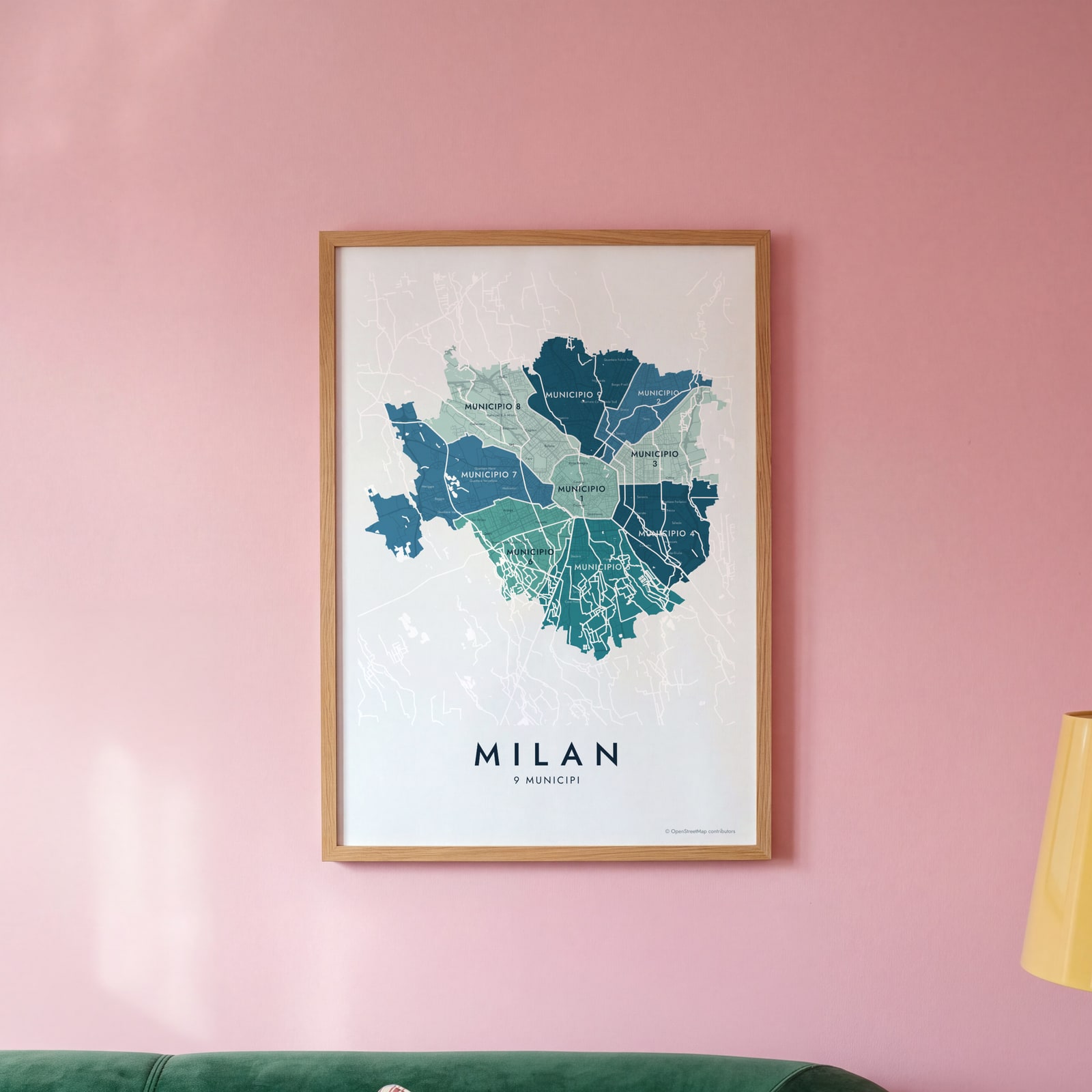
On the wall
A few of them framed at home. Open any one to make it yours.
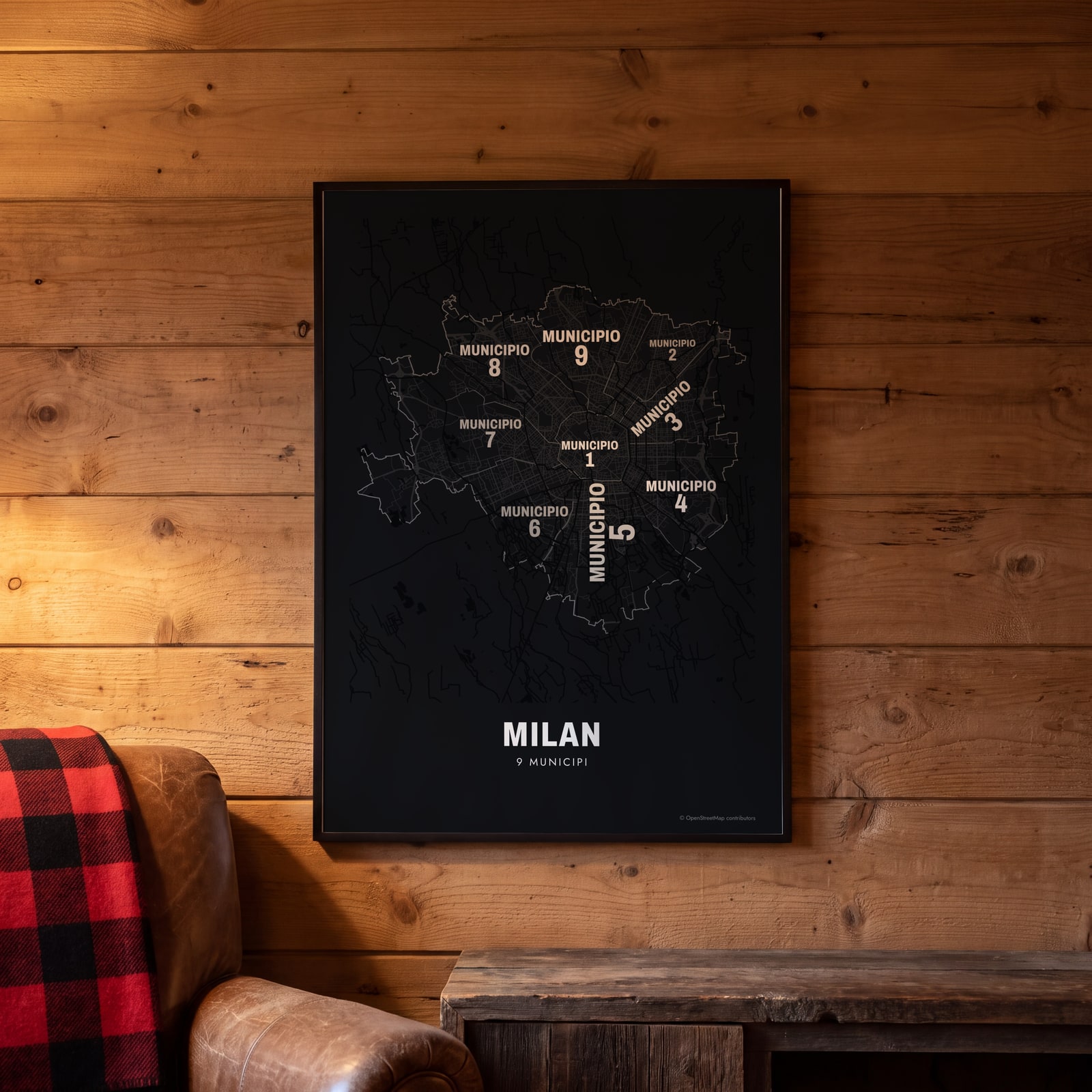 Typographic Milan map: the names fill their municipiEdit this →
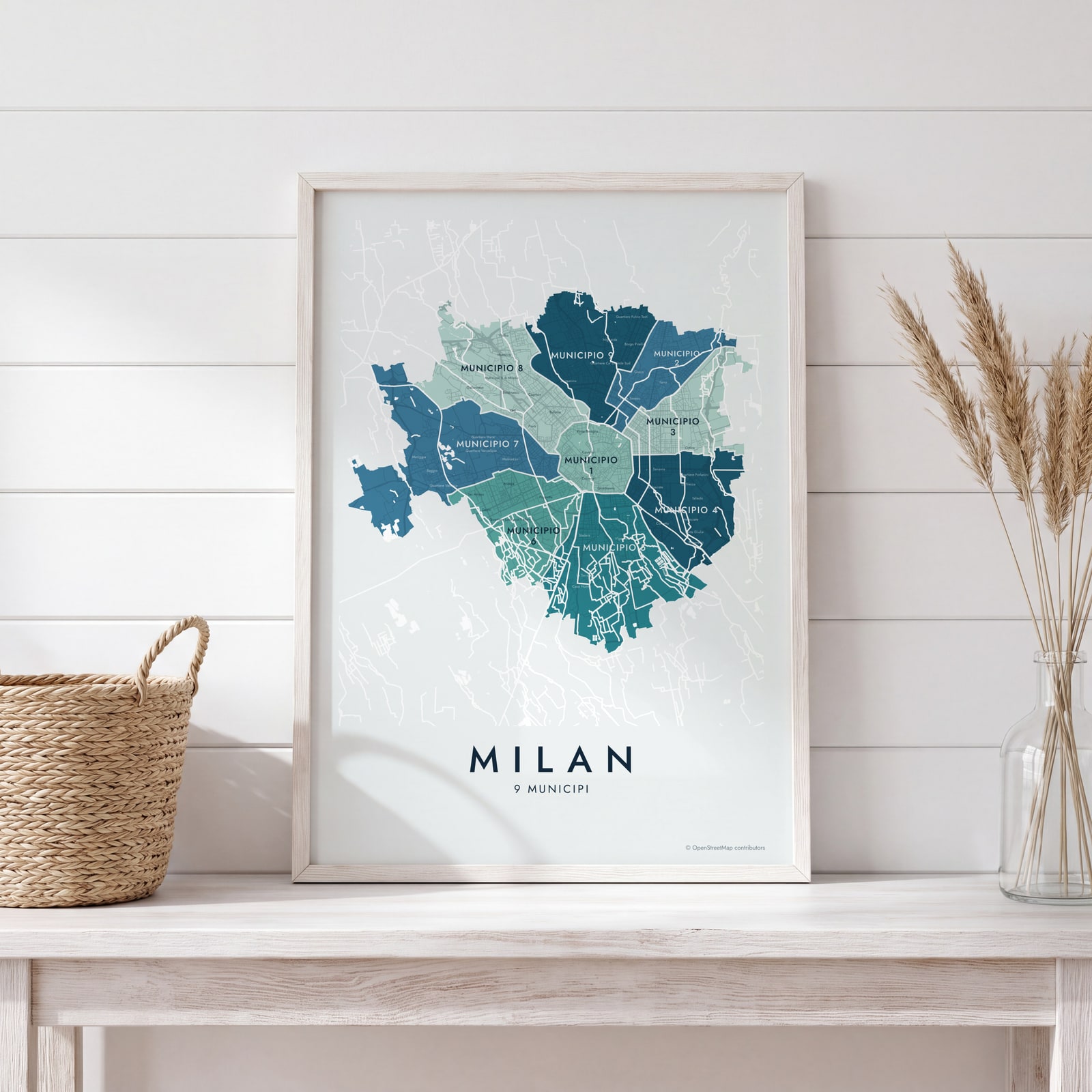
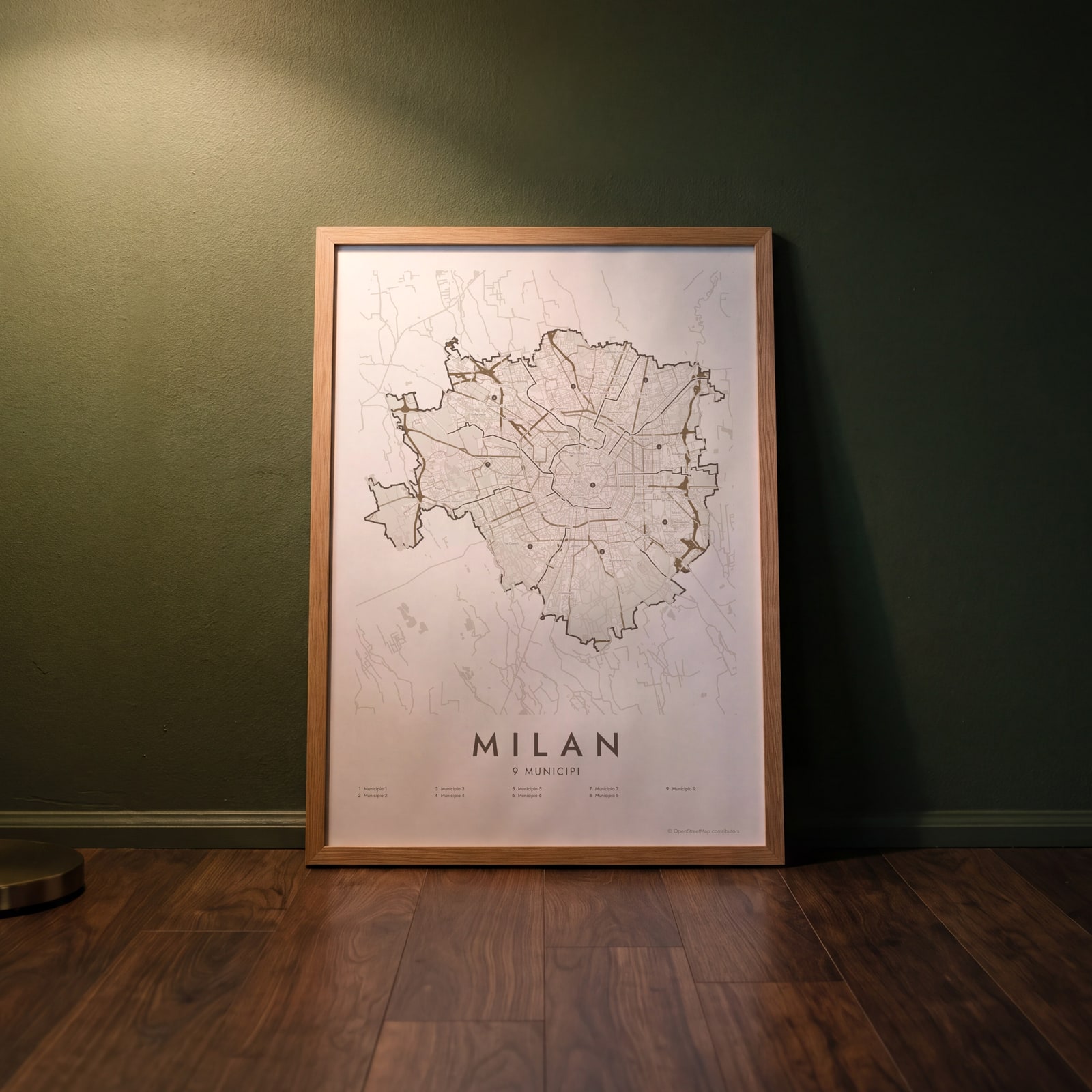 Milan street map with numbered municipi and their listEdit this →
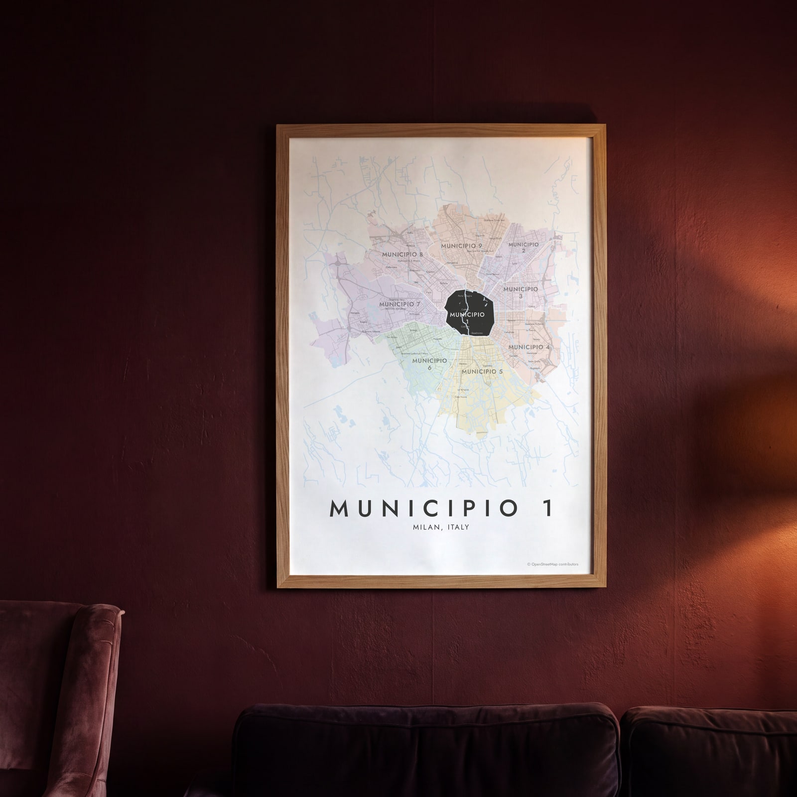 Municipio 1 highlighted on a map of MilanEdit this →
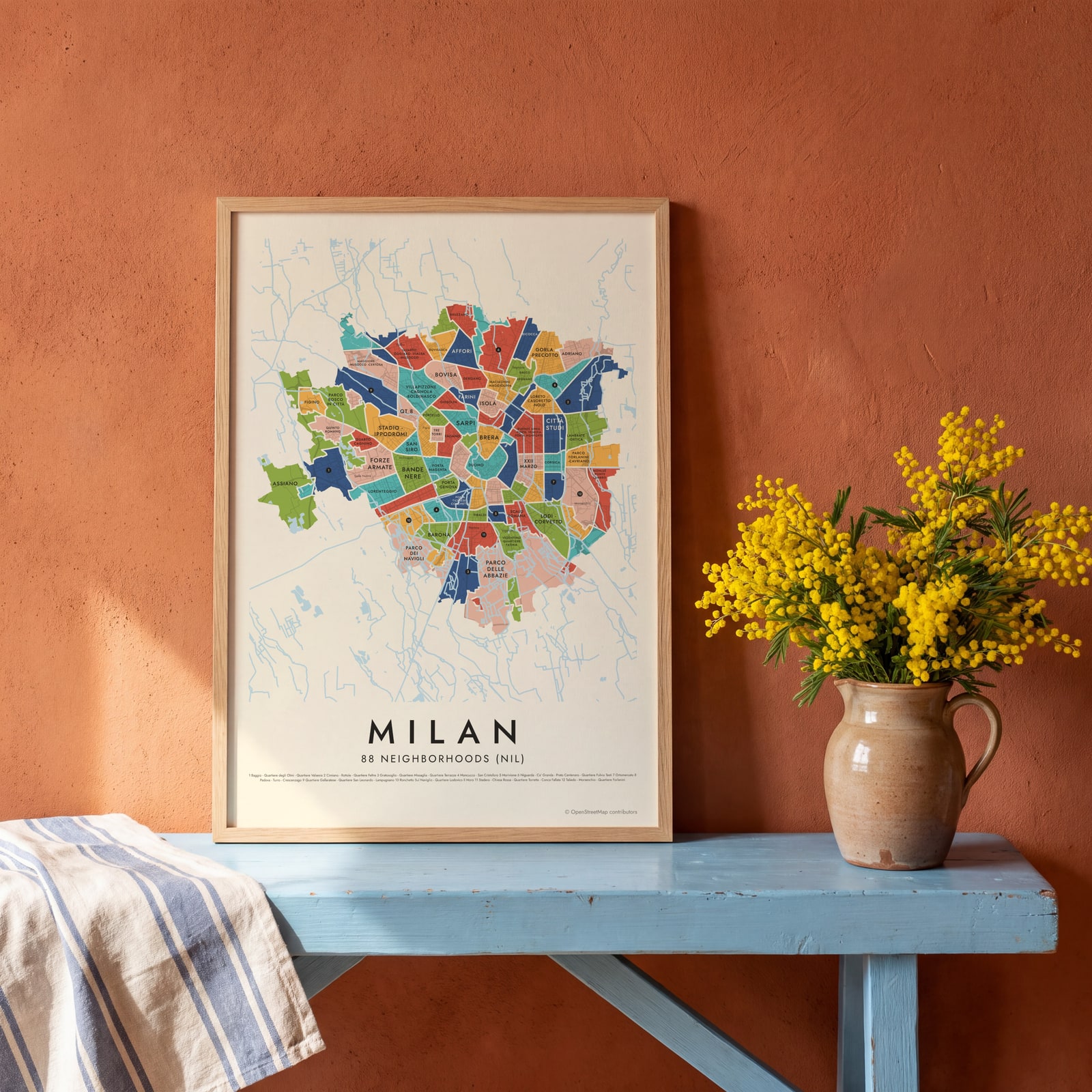 Milan's 88 neighborhoods (nil) in colorEdit this →
 Milan neighborhood map in color, every municipio namedEdit this →
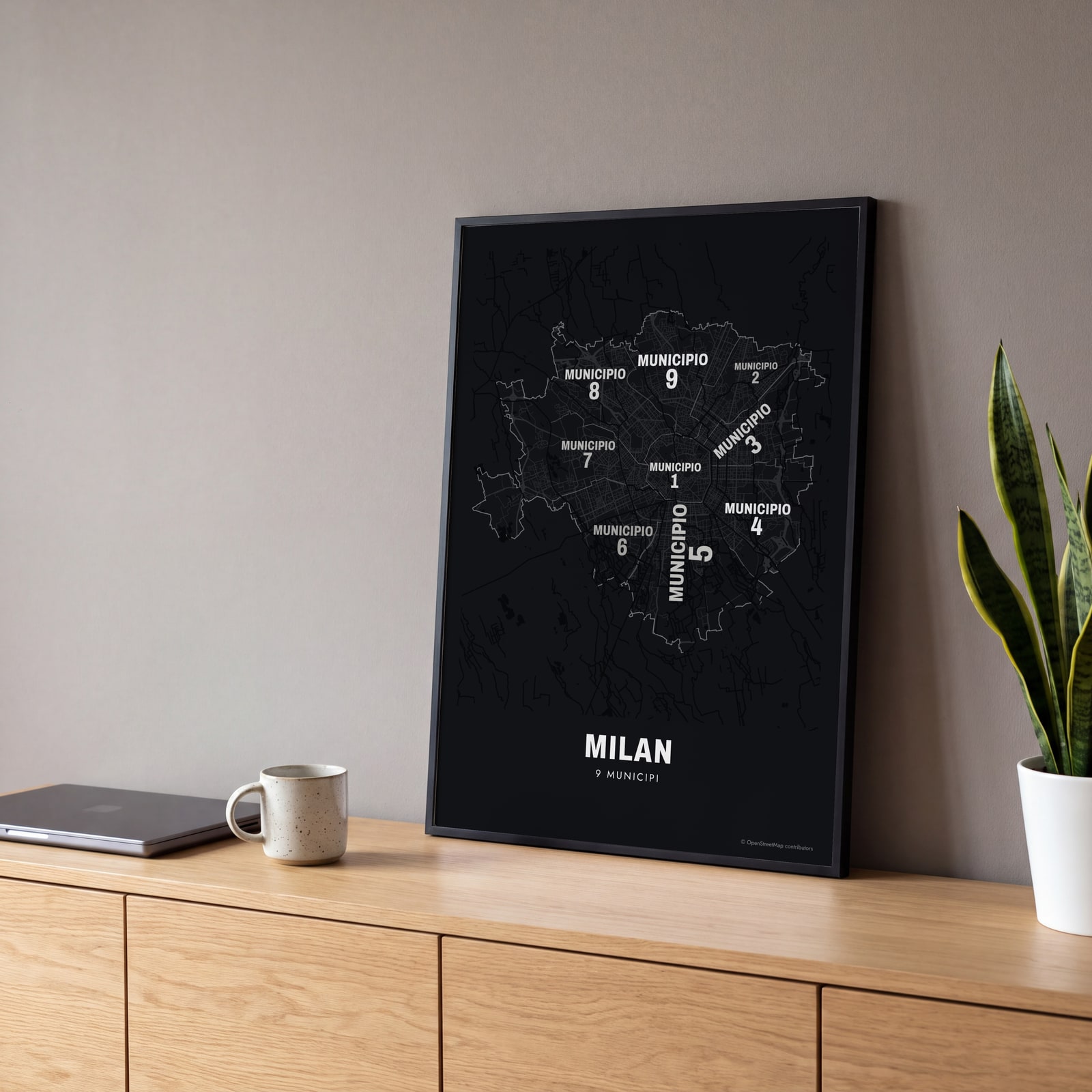 Typographic Milan map: the names fill their municipiEdit this →
Examples
Open any of them to change the words, the place, the date and the style, then download the print file.
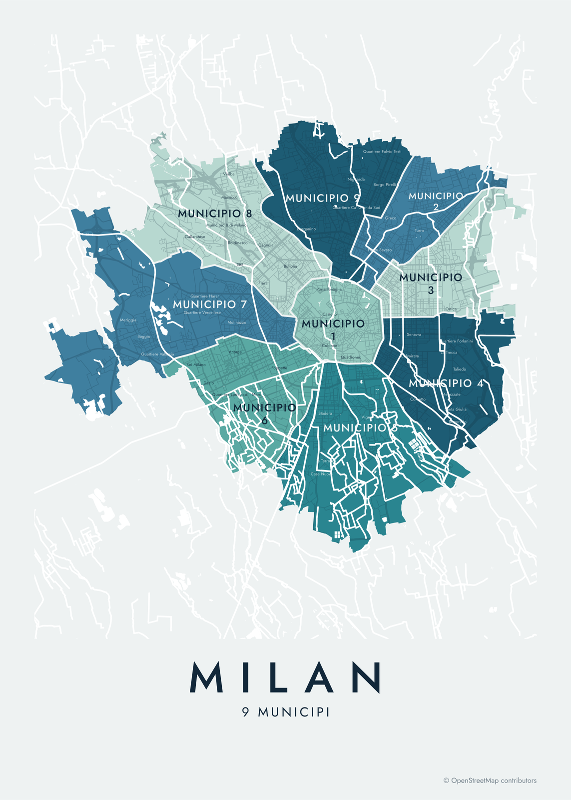 Milan neighborhood map in color, every municipio namedEdit this →More neighborhood maps →
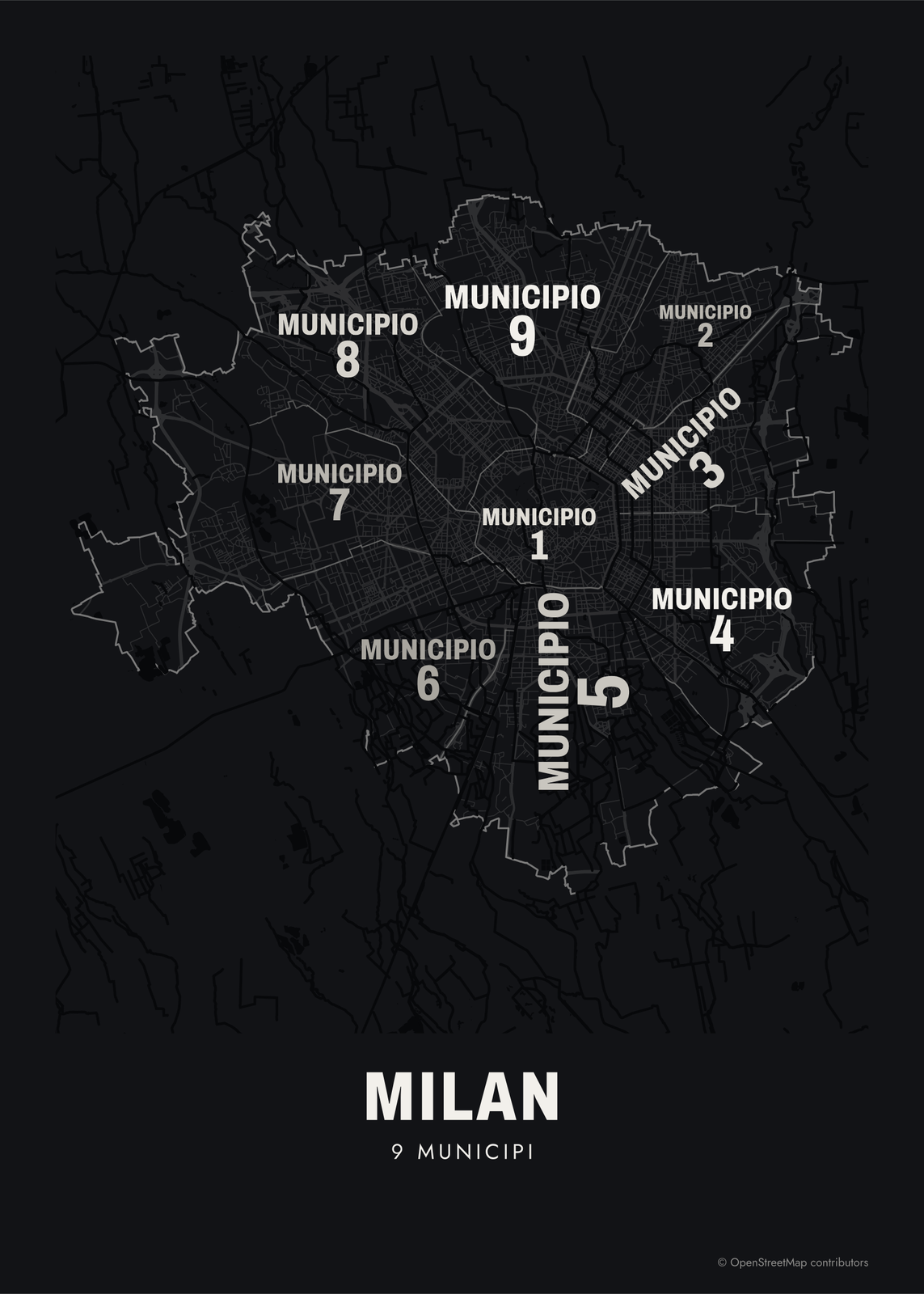 Typographic Milan map: the names fill their municipiEdit this →More neighborhood maps →
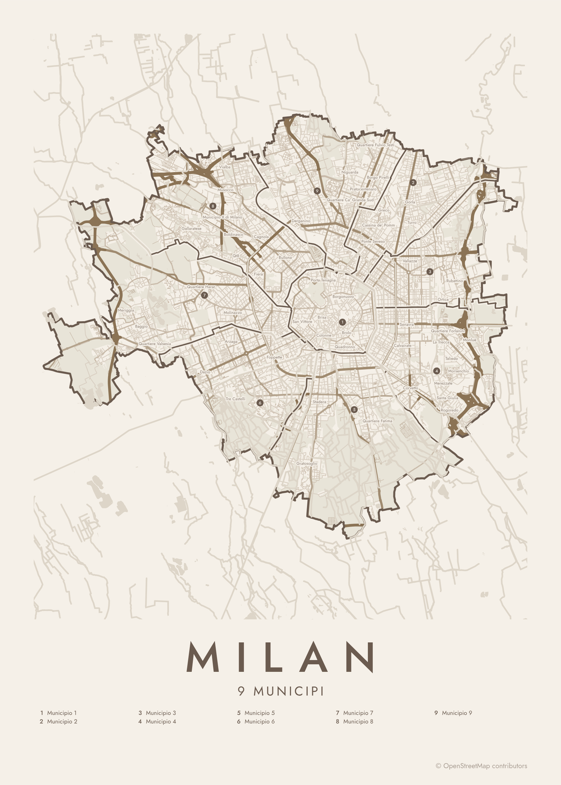 Milan street map with numbered municipi and their listEdit this →More neighborhood maps →
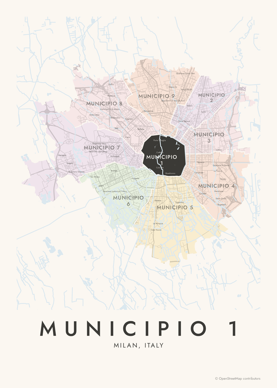 Municipio 1 highlighted on a map of MilanEdit this →More neighborhood maps →
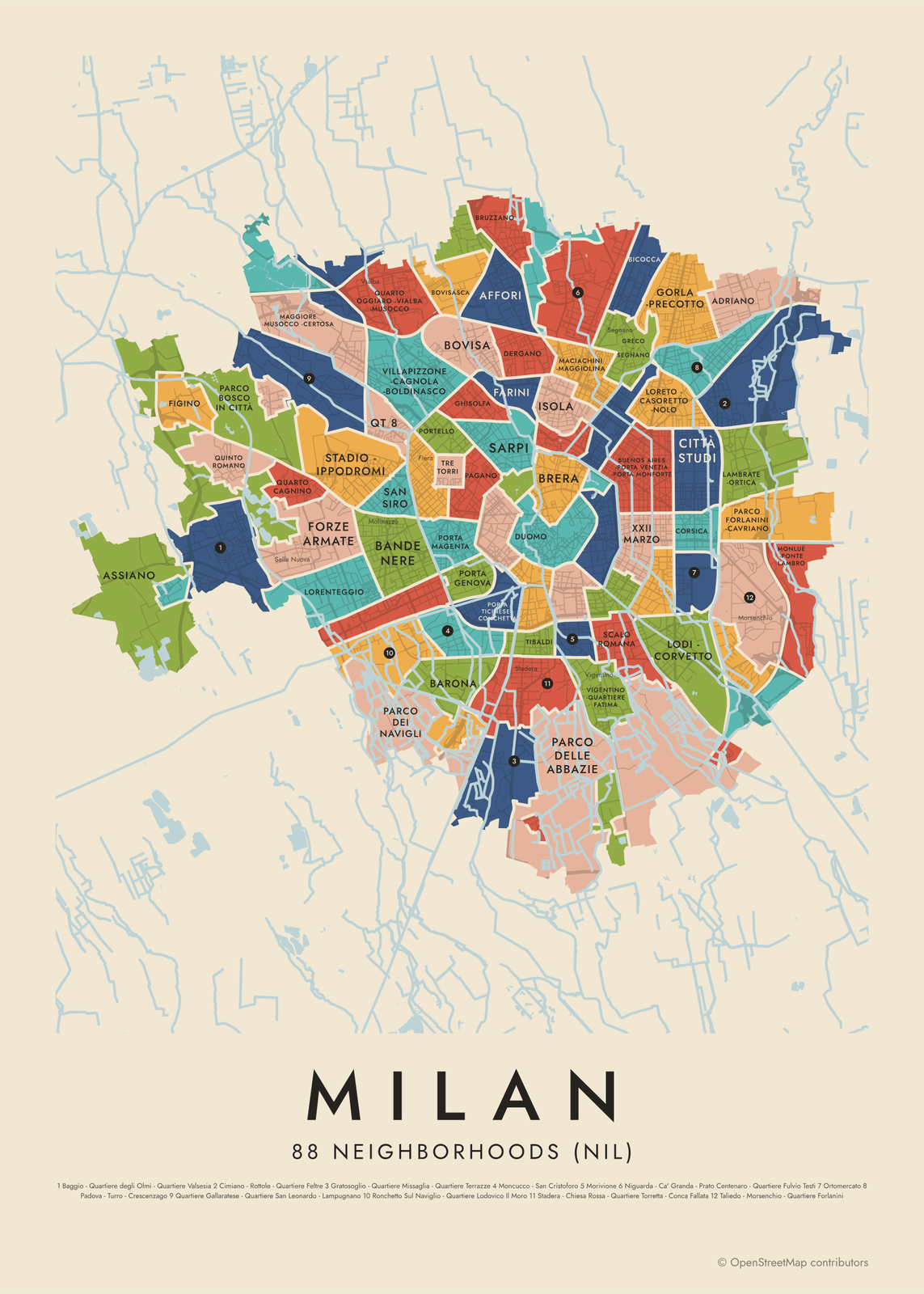 Milan's 88 neighborhoods (nil) in colorEdit this →More neighborhood maps →
How Milan is divided
Milan's 9 municipi are its local government districts. Municipio 1 is the historic center, and the other eight fan out around it like slices, numbered clockwise from the northeast. They replaced the city's 9 zones in 2016; before 1999 there were 20 zones.
The 88 NIL (Nuclei di Identità Locale, or local identity cores) come from the city's urban plan, which uses them to plan schools, parks and other services. Many join two or three names, like Loreto - Casoretto - Nolo, because they take in several neighborhoods, and a few cross municipio borders. Smaller local names like Porta Venezia, Crocetta and Fiera print as labels.
All 9 municipi of Milan
- Municipio 1
- Municipio 2
- Municipio 3
- Municipio 4
- Municipio 5
- Municipio 6
- Municipio 7
- Municipio 8
- Municipio 9
All 88 neighborhoods (nil) of Milan
- Adriano
- Affori
- Assiano
- Baggio - Quartiere degli Olmi - Quartiere Valsesia
- Bande Nere
- Barona
- Bicocca
- Bovisa
- Bovisasca
- Brera
- Bruzzano
- Buenos Aires - Porta Venezia - Porta Monforte
- Cantalupa
- Cascina Merlata
- Chiaravalle
- Cimiano - Rottole - Quartiere Feltre
- Città Studi
- Comasina
- Corsica
- De Angeli - Monte Rosa
- Dergano
- Duomo
- Farini
- Figino
- Forze Armate
- Ghisolfa
- Giambellino
- Giardini Porta Venezia
- Gorla - Precotto
- Gratosoglio - Quartiere Missaglia - Quartiere Terrazze
- Greco - Segnano
- Guastalla
- Isola
- Lambrate - Ortica
- Lodi - Corvetto
- Lorenteggio
- Loreto - Casoretto - Nolo
- Maciachini - Maggiolina
- Magenta - San Vittore
- Maggiore - Musocco - Certosa
- Moncucco - San Cristoforo
- Monluè - Ponte Lambro
- Morivione
- Muggiano
- Niguarda - Ca' Granda - Prato Centenaro - Quartiere Fulvio Testi
- Ortomercato
- Padova - Turro - Crescenzago
- Pagano
- Parco Bosco in Città
- Parco dei Navigli
- Parco delle Abbazie
- Parco Forlanini - Cavriano
- Parco Nord
- Parco Sempione
- Porta Garibaldi - Porta Nuova
- Porta Genova
- Porta Magenta
- Porta Romana
- Porta Ticinese - Conca del Naviglio
- Porta Ticinese - Conchetta
- Porta Vigentina - Porta Lodovica
- Portello
- Qt 8
- Quartiere Gallaratese - Quartiere San Leonardo - Lampugnano
- Quarto Cagnino
- Quarto Oggiaro - Vialba - Musocco
- Quinto Romano
- Quintosole
- Rogoredo - Santa Giulia
- Ronchetto delle Rane
- Ronchetto Sul Naviglio - Quartiere Lodovico Il Moro
- Roserio
- San Siro
- Sarpi
- Scalo Romana
- Stadera - Chiesa Rossa - Quartiere Torretta - Conca Fallata
- Stadio - Ippodromi
- Stazione Centrale - Ponte Seveso
- Stephenson
- Taliedo - Morsenchio - Quartiere Forlanini
- Tibaldi
- Tre Torri
- Trenno
- Triulzo Superiore
- Umbria - Molise - Calvairate
- Vigentino - Quartiere Fatima
- Villapizzone - Cagnola - Boldinasco
- XXII Marzo
More neighborhood names on the map
Inside the municipi, the map also names 165 smaller neighborhoods where they fit, from OpenStreetMap: Baggio, Quartiere Valsesia, Mind, Sella Nuova, Gallaratese, Creta, Lampugnano, Ronchetto sul Naviglio, Municipio 8 di Milano, Vialba, Musocco, Garegnano, Arzaga, Molinazzo, Qt8, Quarto Oggiaro, Villapizzone, Cagnola, Boffalora, San Cristoforo, Bullona, Quartiere Comasina, Moncucco, Porta Sempione, Gratosoglio, Chiesa Rossa, Porta Ticinese, Stadera, Porta Tenaglia, Porta Volta, Porta Garibaldi, Porta Nuova, Montalbino, Niguarda, Mirabello, Pratocentenaro, Vigentino, Centrale, Porta Venezia, Porta Vittoria and more. Turn them off under Names if you want only the municipi.
Neighborhoods to know
- Duomo: the heart of the city, with the cathedral and the Galleria Vittorio Emanuele II.
- Brera: narrow streets around the Pinacoteca di Brera art gallery and the Brera Academy.
- Parco Sempione: the city's central park, behind Castello Sforzesco.
- Porta Ticinese: where Corso di Porta Ticinese runs from the Colonne di San Lorenzo toward the Navigli canals.
- Porta Garibaldi - Porta Nuova: the skyscraper district around Piazza Gae Aulenti and Garibaldi station.
- Tre Torri: the CityLife towers by Arata Isozaki, Zaha Hadid and Daniel Libeskind, on the old trade fair grounds.
- Sarpi: Milan's Chinatown, along Via Paolo Sarpi.
- Stadio - Ippodromi: home of the city's football stadium at San Siro and its horse racing tracks.
How to make your Milan neighborhood poster
- Open the Milan map and pick municipi or neighborhoods (nil).
- Pick a style: Colored areas, Typographic (the names fill the map) or a Street map with the borders over the streets.
- Tap your own neighborhood to highlight it; it becomes the poster's title.
- Drag and zoom to frame the whole city or just your part of it, then pick a size and download the print file.
Questions
How many neighborhoods does Milan have?
The city's urban plan defines 88 neighborhoods, called NIL, grouped into 9 municipi. This map shows both levels, plus many smaller local names as labels.
What are the 9 municipi of Milan?
They're numbered, not named. Municipio 1 is the historic center. The rest go clockwise around it: 2 (Stazione Centrale, Gorla, Turro), 3 (Città Studi, Lambrate), 4 (Porta Vittoria, Forlanini, Rogoredo), 5 (Vigentino, Chiaravalle, Gratosoglio), 6 (Barona, Lorenteggio, Giambellino), 7 (Baggio, San Siro), 8 (Fiera, Gallaratese, Quarto Oggiaro) and 9 (Porta Garibaldi, Niguarda, Bicocca).
What does NIL mean in Milan?
NIL stands for Nuclei di Identità Locale, "local identity cores". They're the 88 neighborhoods the city uses in its urban plan to measure and plan local services.
Where are the Navigli?
The Navigli are canals southwest of the center. The Naviglio Grande and the Naviglio Pavese meet at the Darsena, the old canal harbor near Porta Ticinese.
Where do the Milan boundaries come from?
From OpenStreetMap (© OpenStreetMap contributors) and Comune di Milano. Streets and water are OpenStreetMap's. Boundaries are a snapshot and can differ from what neighbors call home; tell us if one looks wrong.
What sizes can I print?
US Letter, 8 × 10, 11 × 14, 12 × 16 and 12 × 18 in, A4 and A3, free. You download a 300 DPI JPEG drawn at the size you pick. Larger prints, up to 24 × 36 in, are coming soon.
Related

Gift ideas by occasion




Every example is made with the Posterage generators. Change anything, then download it as a 300 DPI JPEG.