Rome neighborhood map 15 municipi, 110 rioni and quartieri
This poster maps Rome as its 15 municipi, from Municipio I in the historic center out to Ostia on the coast. Switch to 110 rioni, quartieri and zone for a finer map, with names like Trastevere, Monti and Testaccio. Highlight yours and print it.
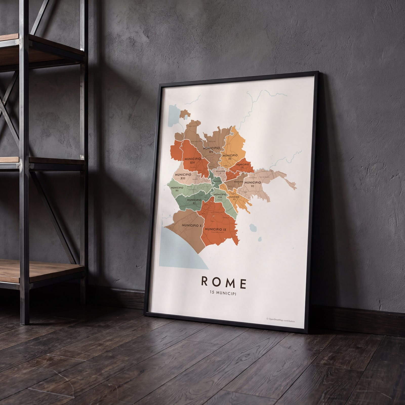
On the wall
A few of them framed at home. Open any one to make it yours.
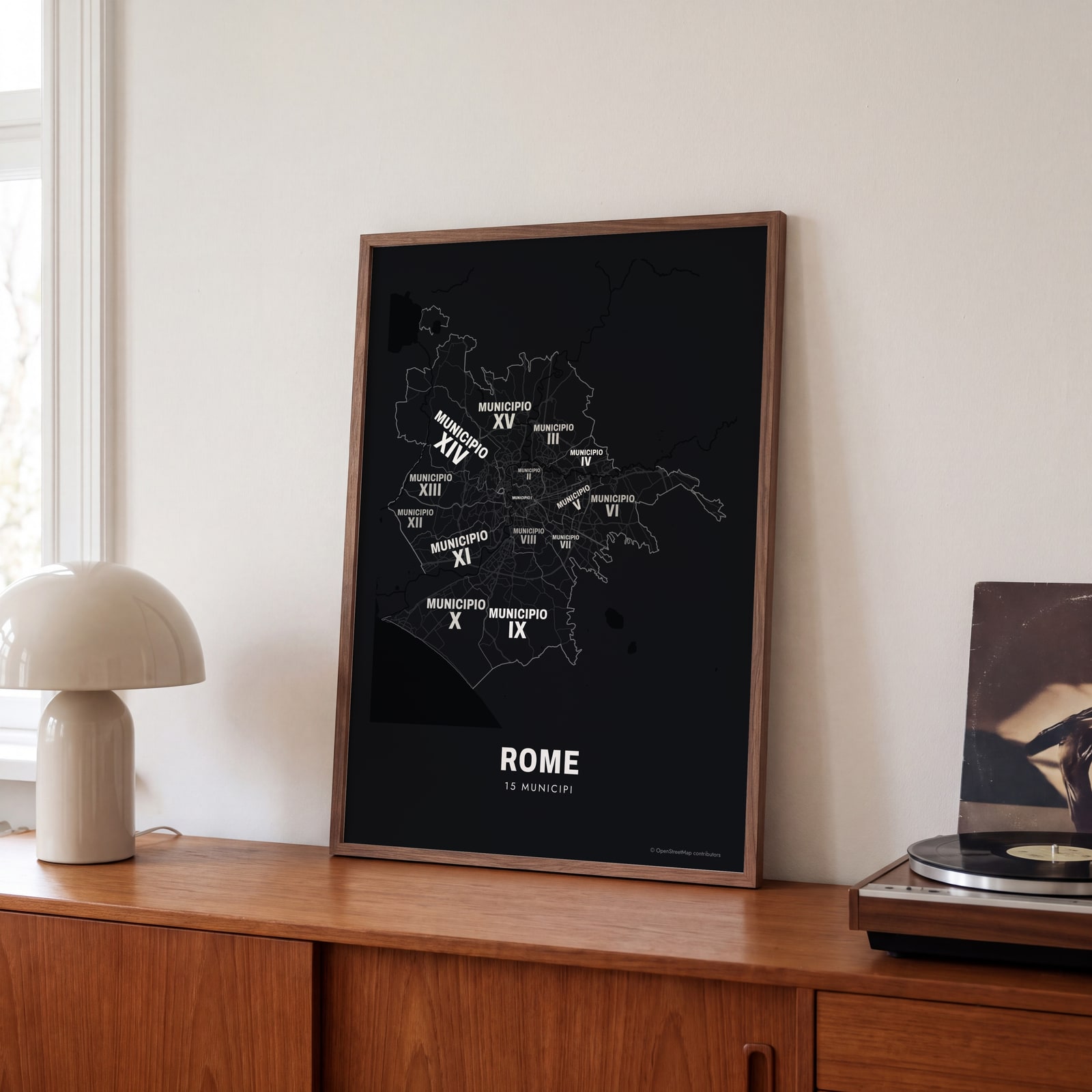 Typographic Rome map: the names fill their municipiEdit this →
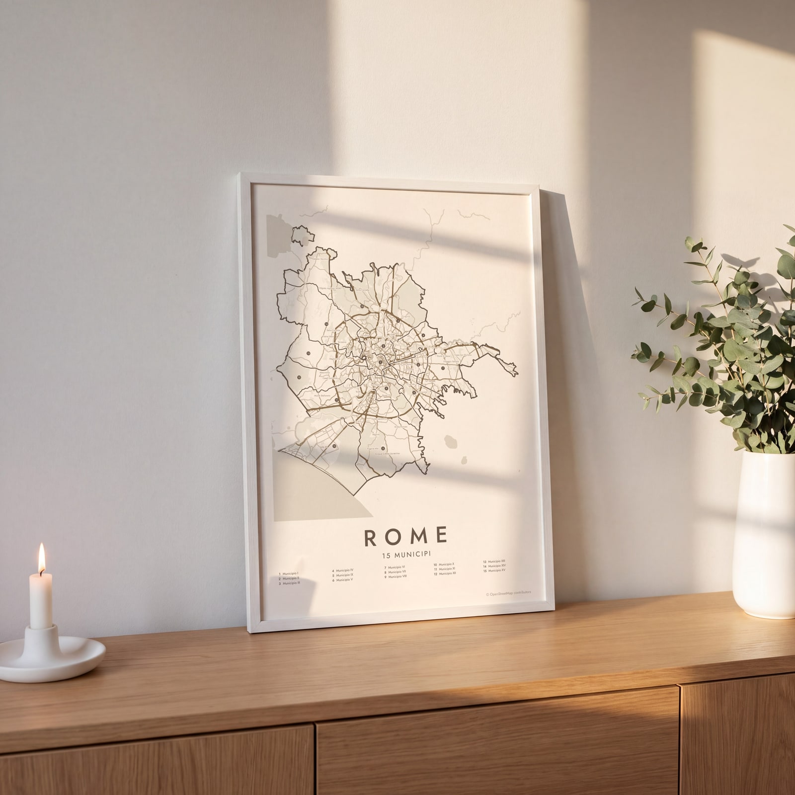 Rome street map with numbered municipi and their listEdit this →
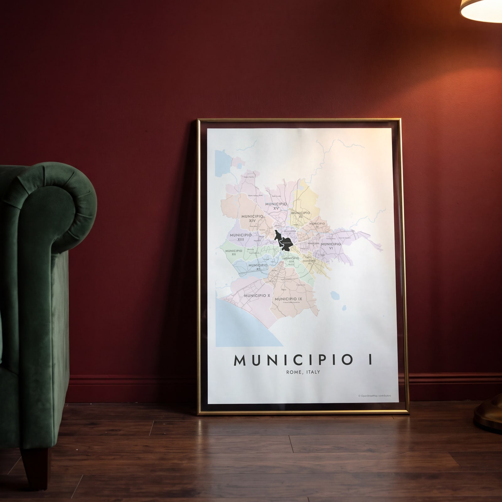 Municipio I highlighted on a map of RomeEdit this →
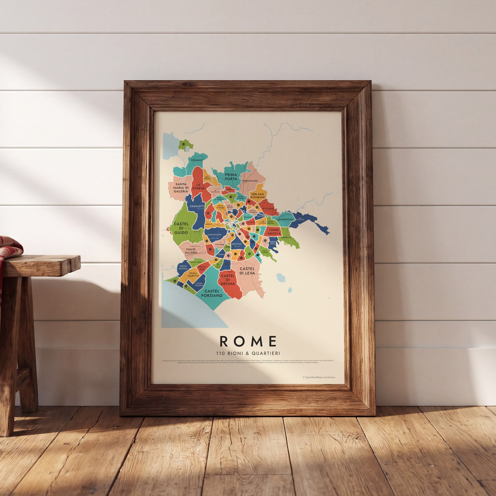 Rome's 110 rioni & quartieri in colorEdit this →
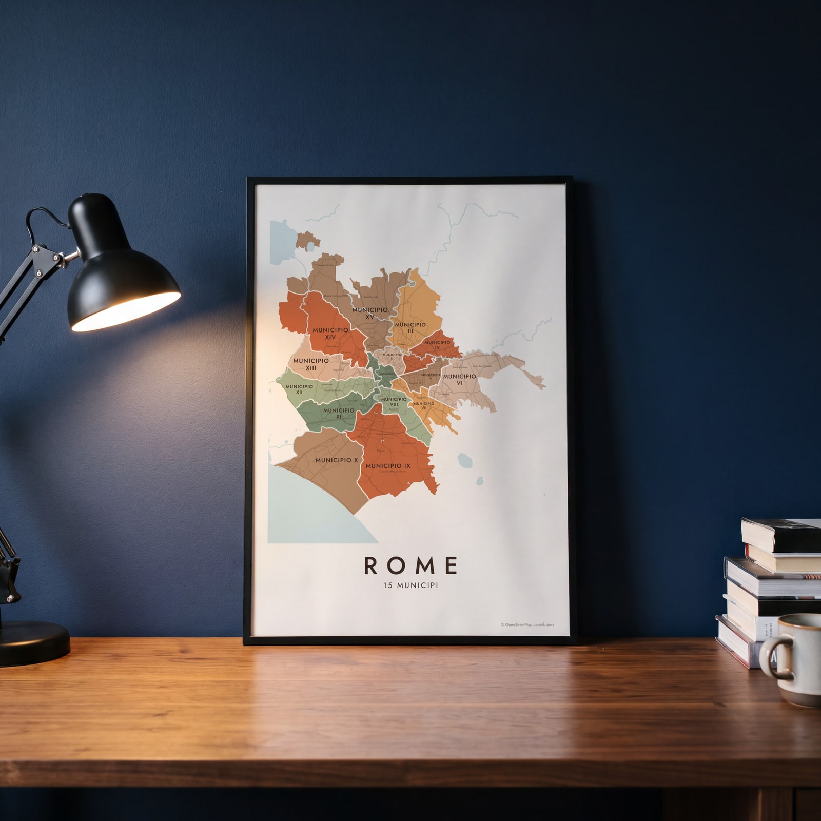 Rome neighborhood map in color, every municipio namedEdit this →
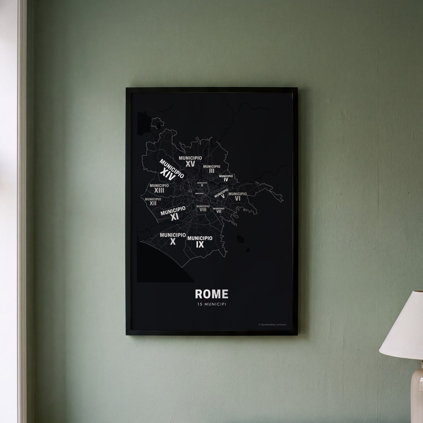 Typographic Rome map: the names fill their municipiEdit this →
Examples
Open any of them to change the words, the place, the date and the style, then download the print file.
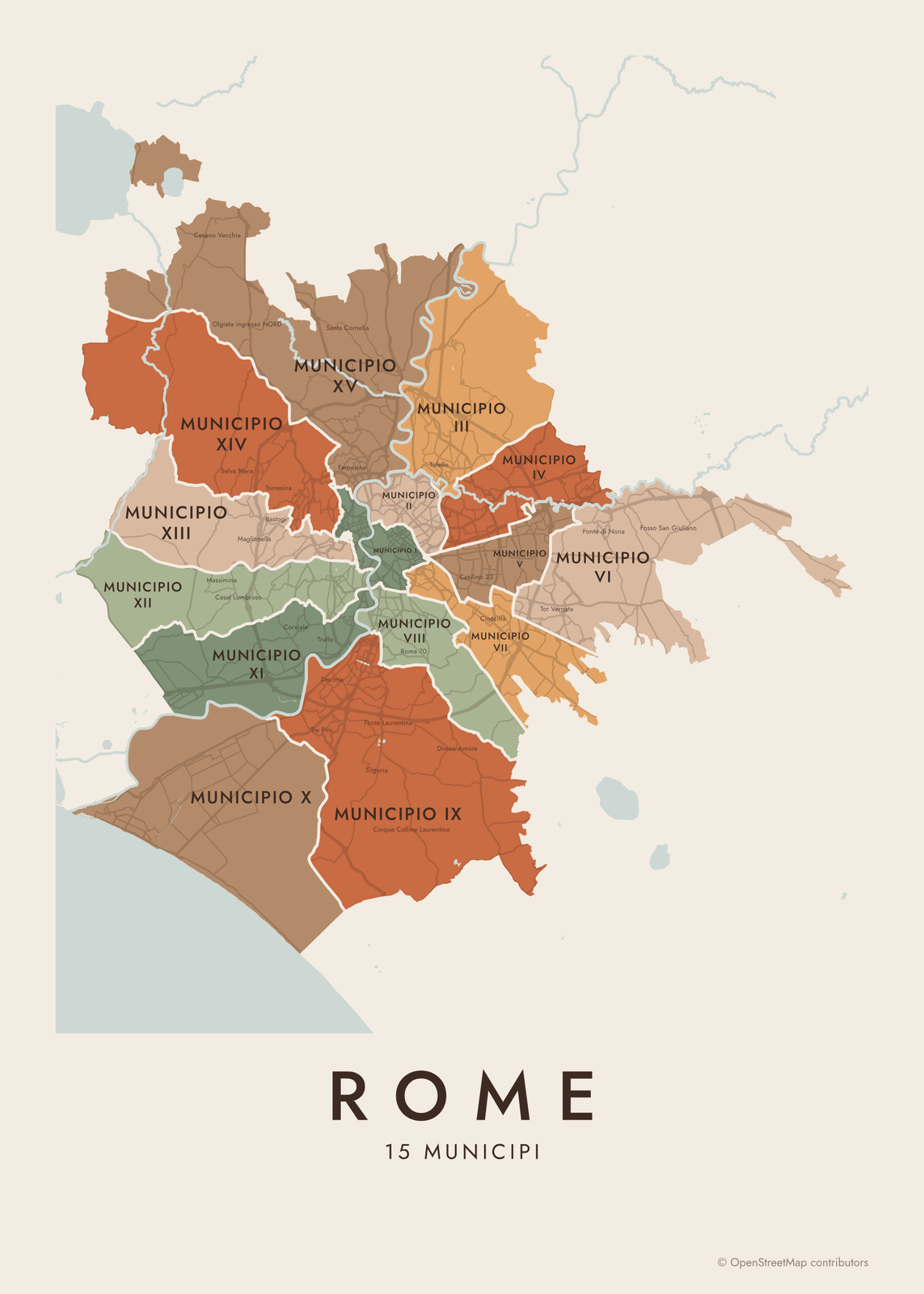 Rome neighborhood map in color, every municipio namedEdit this →More neighborhood maps →
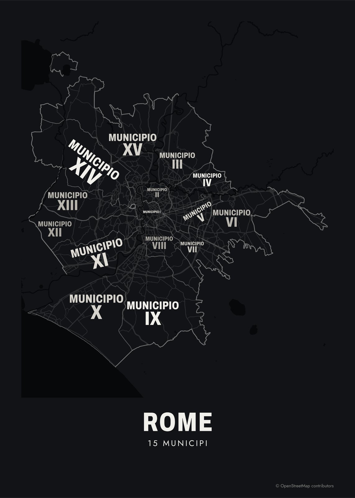 Typographic Rome map: the names fill their municipiEdit this →More neighborhood maps →
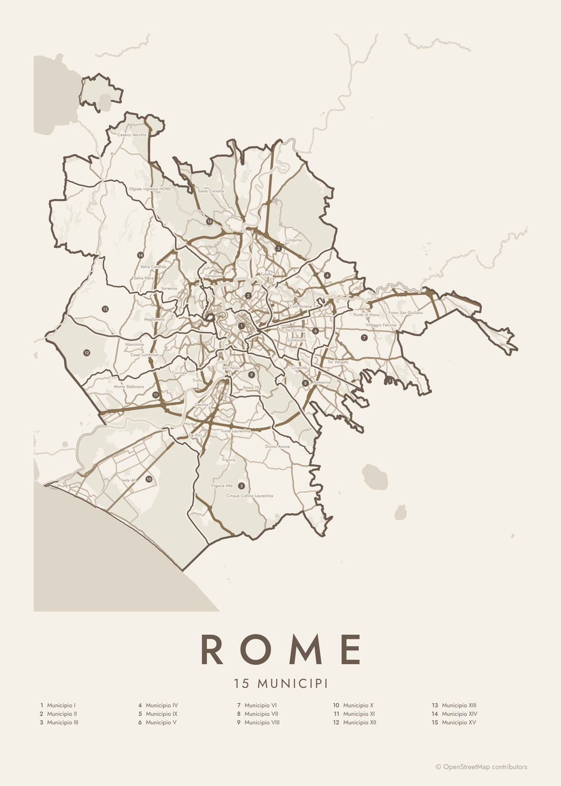 Rome street map with numbered municipi and their listEdit this →More neighborhood maps →
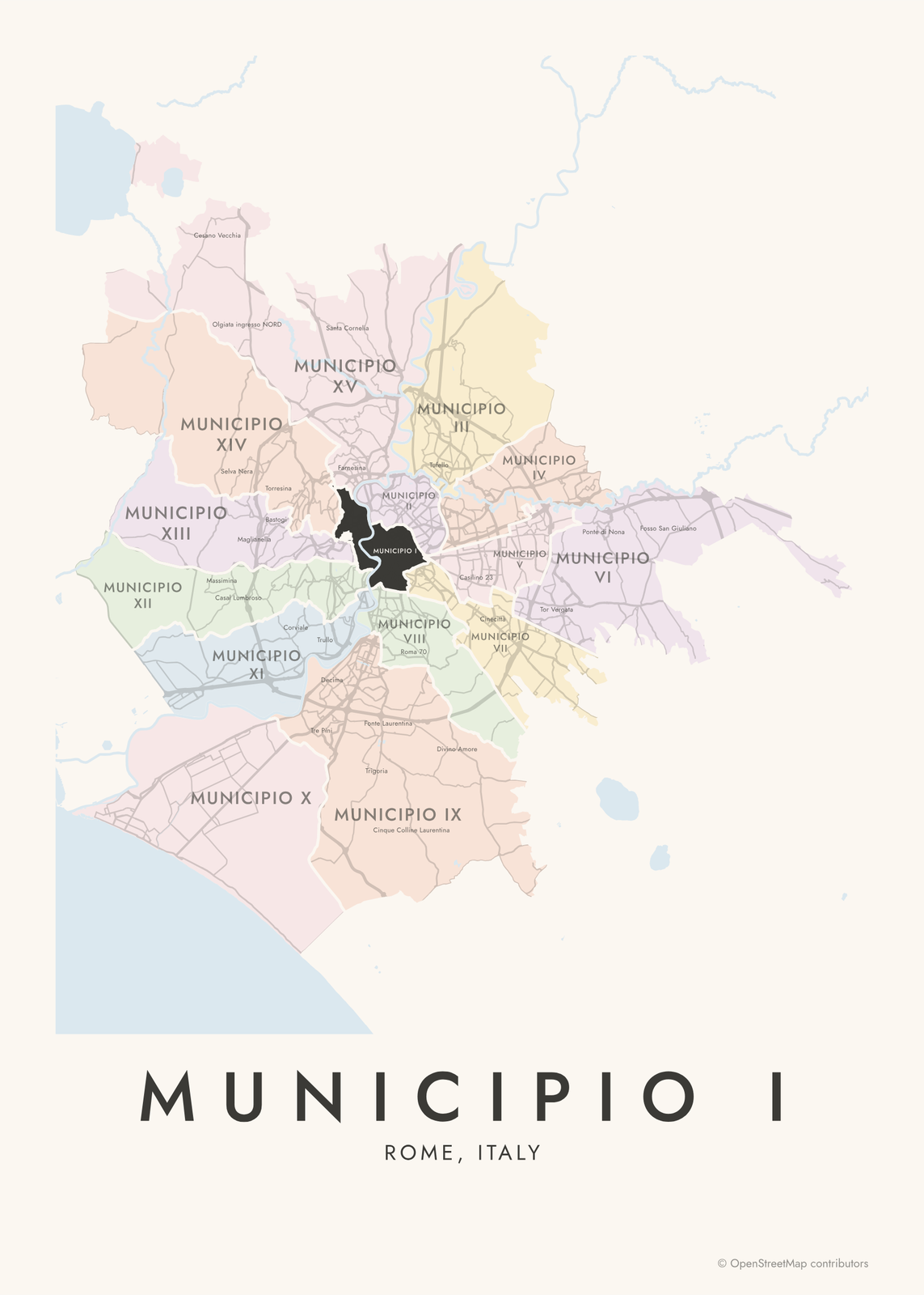 Municipio I highlighted on a map of RomeEdit this →More neighborhood maps →
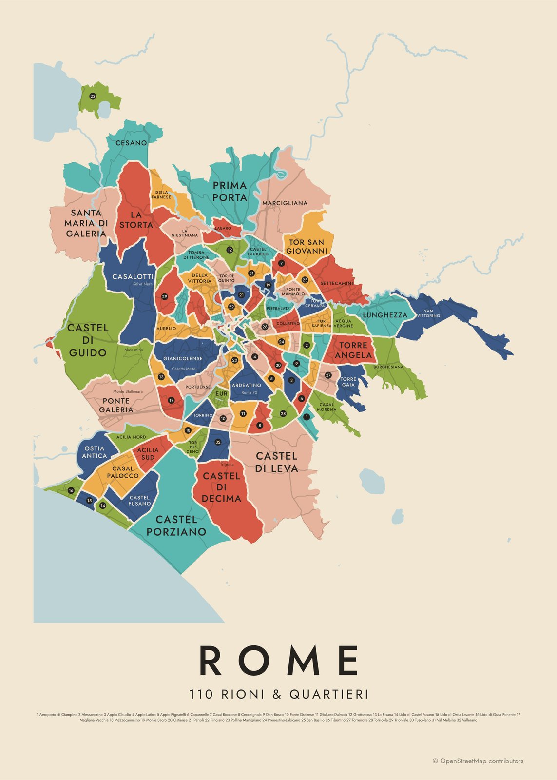 Rome's 110 rioni & quartieri in colorEdit this →More neighborhood maps →
How Rome is divided
Rome's municipi are its local government districts, each with an elected president and council. The city had 19 until 2013, when it merged them into the 15 used today, numbered I to XV. Municipio I covers the historic center, and Municipio X reaches the sea at Ostia.
For neighborhood names, Romans use an older system. The 22 rioni are the historic center, numbered from Monti (I) to Prati (XXII). Around them are 35 quartieri, then 6 suburbi and 53 zone in the Agro Romano, the countryside inside the city limits. The six suburbi share their names with quartieri next to them, so our map shows 110 names. Local names like Garbatella, Pigneto and Monteverde print as small labels.
All 15 municipi of Rome
- Municipio I
- Municipio II
- Municipio III
- Municipio IV
- Municipio V
- Municipio VI
- Municipio VII
- Municipio VIII
- Municipio IX
- Municipio X
- Municipio XI
- Municipio XII
- Municipio XIII
- Municipio XIV
- Municipio XV
All 110 rioni & quartieri of Rome
- Acilia Nord
- Acilia Sud
- Acqua Vergine
- Aeroporto di Ciampino
- Alessandrino
- Appio Claudio
- Appio-Latino
- Appio-Pignatelli
- Ardeatino
- Aurelio
- Borghesiana
- Borgo
- Campitelli
- Campo Marzio
- Capannelle
- Casal Boccone
- Casal Morena
- Casal Palocco
- Casalotti
- Castel di Decima
- Castel di Guido
- Castel di Leva
- Castel Fusano
- Castel Giubileo
- Castel Porziano
- Castro Pretorio
- Cecchignola
- Celio
- Cesano
- Collatino
- Colonna
- Della Vittoria
- Don Bosco
- Esquilino
- EUR
- Flaminio
- Fonte Ostiense
- Gianicolense
- Giuliano-Dalmata
- Grottarossa
- Isola Farnese
- La Giustiniana
- La Pisana
- La Storta
- Labaro
- Lido di Castel Fusano
- Lido di Ostia Levante
- Lido di Ostia Ponente
- Ludovisi
- Lunghezza
- Maccarese Nord
- Magliana Vecchia
- Marcigliana
- Mezzocammino
- Monte Sacro
- Monte Sacro Alto
- Monti
- Nomentano
- Ostia Antica
- Ostiense
- Ottavia
- Parioli
- Parione
- Pietralata
- Pigna
- Pinciano
- Polline Martignano
- Ponte
- Ponte Galeria
- Ponte Mammolo
- Portuense
- Prati
- Prenestino-Centocelle
- Prenestino-Labicano
- Prima Porta
- Primavalle
- Regola
- Ripa
- Salario
- Sallustiano
- San Basilio
- San Saba
- San Vittorino
- Sant'Angelo
- Sant'Eustachio
- Santa Maria di Galeria
- Settecamini
- Testaccio
- Tiburtino
- Tomba di Nerone
- Tor Cervara
- Tor de' Cenci
- Tor di Quinto
- Tor di Valle
- Tor San Giovanni
- Tor Sapienza
- Torre Angela
- Torre Gaia
- Torre Maura
- Torre Spaccata
- Torrenova
- Torricola
- Torrino
- Trastevere
- Trevi
- Trieste
- Trionfale
- Tuscolano
- Val Melaina
- Vallerano
More neighborhood names on the map
Inside the municipi, the map also names 128 smaller neighborhoods where they fit, from OpenStreetMap: Monte dell'Ara-Valle Santa, Selva Nera, Casal Lumbroso, Infernetto, Selva Candida, Fonte Laurentina, Centocelle, Cinecittà, Tor Vergata, Tor Bella Monaca, Case Rosse, Massimina, Vecchio Ovile dell'Olgiata, Maglianella, Colle Aurelio, Collina delle Muse, Monte del Marmo, Montespaccato, Acquafredda, Bastogi, Torresina, Val Cannuta, Corviale, Casetta Mattei, Monte Mario Alto, Trullo, Città giudiziaria, Monteverde, San Paolo, Garbatella, Tor Marancia, Pigneto, Torpignattara, Quadraro, Cinecittà Est, Colle Due Pini, Fontignani, Isola 46, Monte Stallonara, Ponte Galeria-La Pisana and more. Turn them off under Names if you want only the municipi.
Neighborhoods to know
- Trastevere: medieval lanes across the Tiber, around the church of Santa Maria in Trastevere.
- Monti: Rione I, on the slopes northeast of the Roman Forum, where ancient Rome's Suburra stood.
- Testaccio: built around Monte Testaccio, a hill of broken ancient amphorae, and the former city slaughterhouse.
- Trevi: the Trevi Fountain and the Quirinal Palace.
- Pigna: named for an ancient bronze pine cone, and home of the Pantheon.
- Parione: Piazza Navona, which keeps the shape of an ancient stadium.
- EUR: white stone buildings and wide avenues, planned for a 1942 world's fair that never took place.
- Ostia Antica: the excavated ruins of ancient Rome's port town.
How to make your Rome neighborhood poster
- Open the Rome map and pick municipi or rioni & quartieri.
- Pick a style: Colored areas, Typographic (the names fill the map) or a Street map with the borders over the streets.
- Tap your own neighborhood to highlight it; it becomes the poster's title.
- Drag and zoom to frame the whole city or just your part of it, then pick a size and download the print file.
Questions
How many neighborhoods does Rome have?
It depends on the system. Rome has 15 municipi for local government. Its traditional neighborhood names come from 22 rioni, 35 quartieri, 6 suburbi and 53 zone, which this map shows as 110 named areas. Smaller local names show as labels.
What are the 22 rioni of Rome?
They're the historic districts of the center, numbered I to XXII: Monti, Trevi, Colonna, Campo Marzio, Ponte, Parione, Regola, Sant'Eustachio, Pigna, Campitelli, Sant'Angelo, Ripa, Trastevere, Borgo, Esquilino, Ludovisi, Sallustiano, Castro Pretorio, Celio, Testaccio, San Saba and Prati.
What's the difference between a rione and a quartiere?
Rioni are the historic districts of the old center, many with medieval roots. Quartieri are the districts beyond them, mostly built up in the 1900s, like Parioli, Flaminio and Ostiense.
Is Vatican City on the map?
No. Vatican City is an independent state, so it isn't one of Rome's areas. It sits on the west bank of the Tiber, next to Borgo.
Where do the Rome boundaries come from?
From OpenStreetMap (© OpenStreetMap contributors). Streets and water are OpenStreetMap's. Boundaries are a snapshot and can differ from what neighbors call home; tell us if one looks wrong.
What sizes can I print?
US Letter, 8 × 10, 11 × 14, 12 × 16 and 12 × 18 in, A4 and A3, free. You download a 300 DPI JPEG drawn at the size you pick. Larger prints, up to 24 × 36 in, are coming soon.
Related

Gift ideas by occasion




Every example is made with the Posterage generators. Change anything, then download it as a 300 DPI JPEG.