Atlanta neighborhood map 25 NPUs and 95 neighborhood names
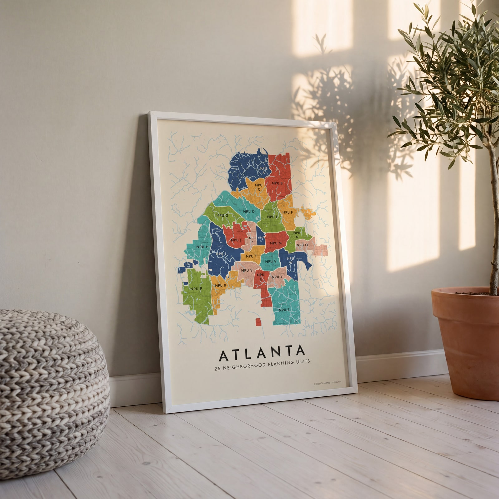
This poster maps Atlanta split into its 25 Neighborhood Planning Units, or NPUs, each labeled by letter. On top, 95 neighborhood names print as small labels, from Buckhead and Midtown to Inman Park and West End. Highlight your NPU and print it.
On the wall
A few of them framed at home. Open any one to make it yours.
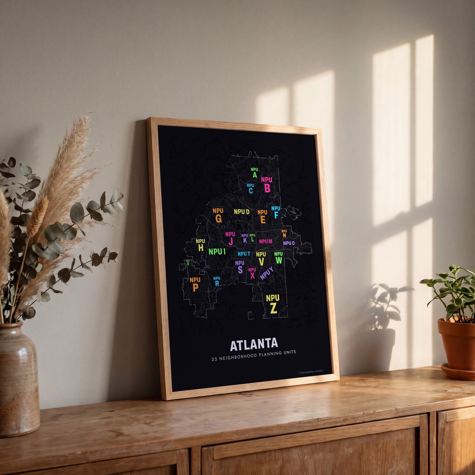 Typographic Atlanta map: the names fill their neighborhood planning unitsEdit this →
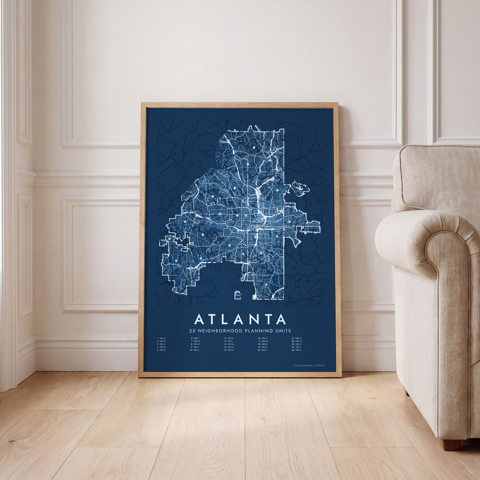 Atlanta street map with numbered neighborhood planning units and their listEdit this →
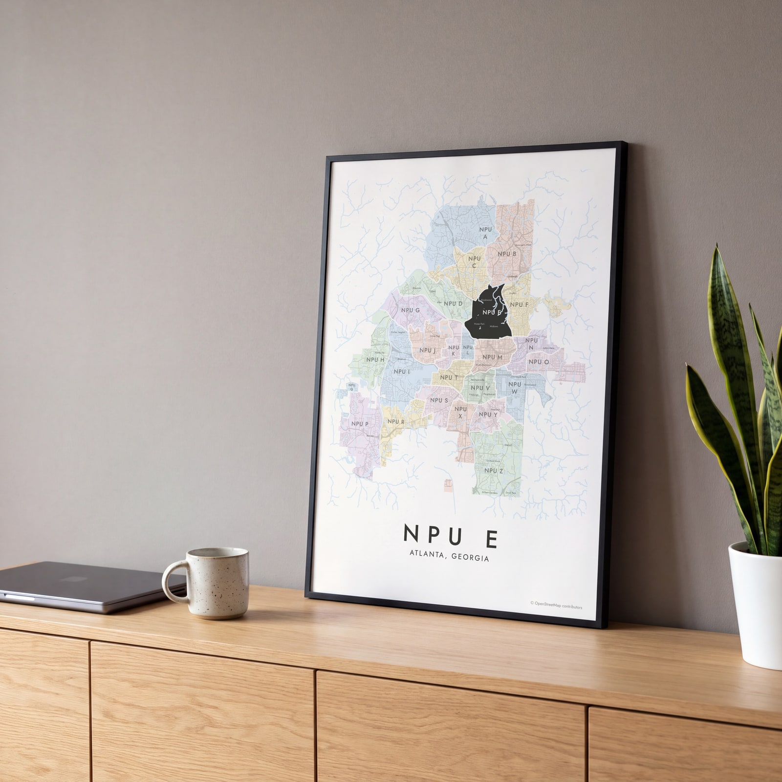 NPU E highlighted on a map of AtlantaEdit this →
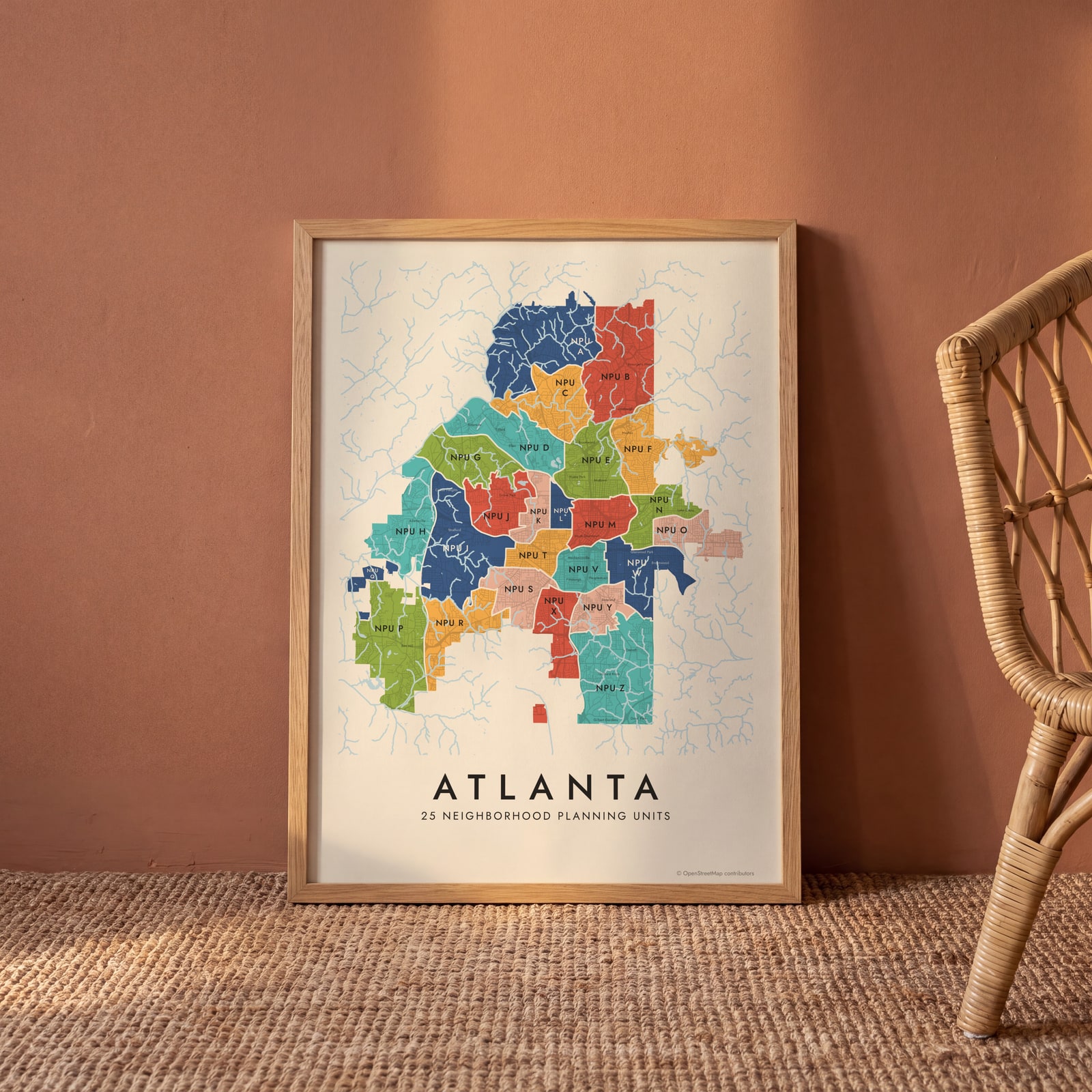 Atlanta neighborhood map in color, every neighborhood planning unit namedEdit this →
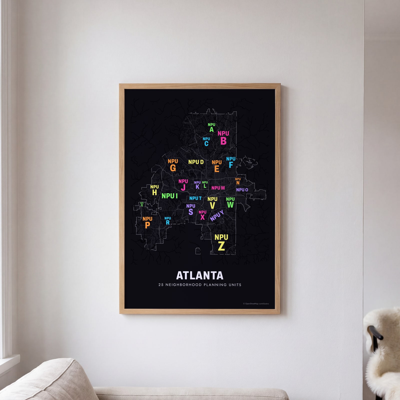 Typographic Atlanta map: the names fill their neighborhood planning unitsEdit this →
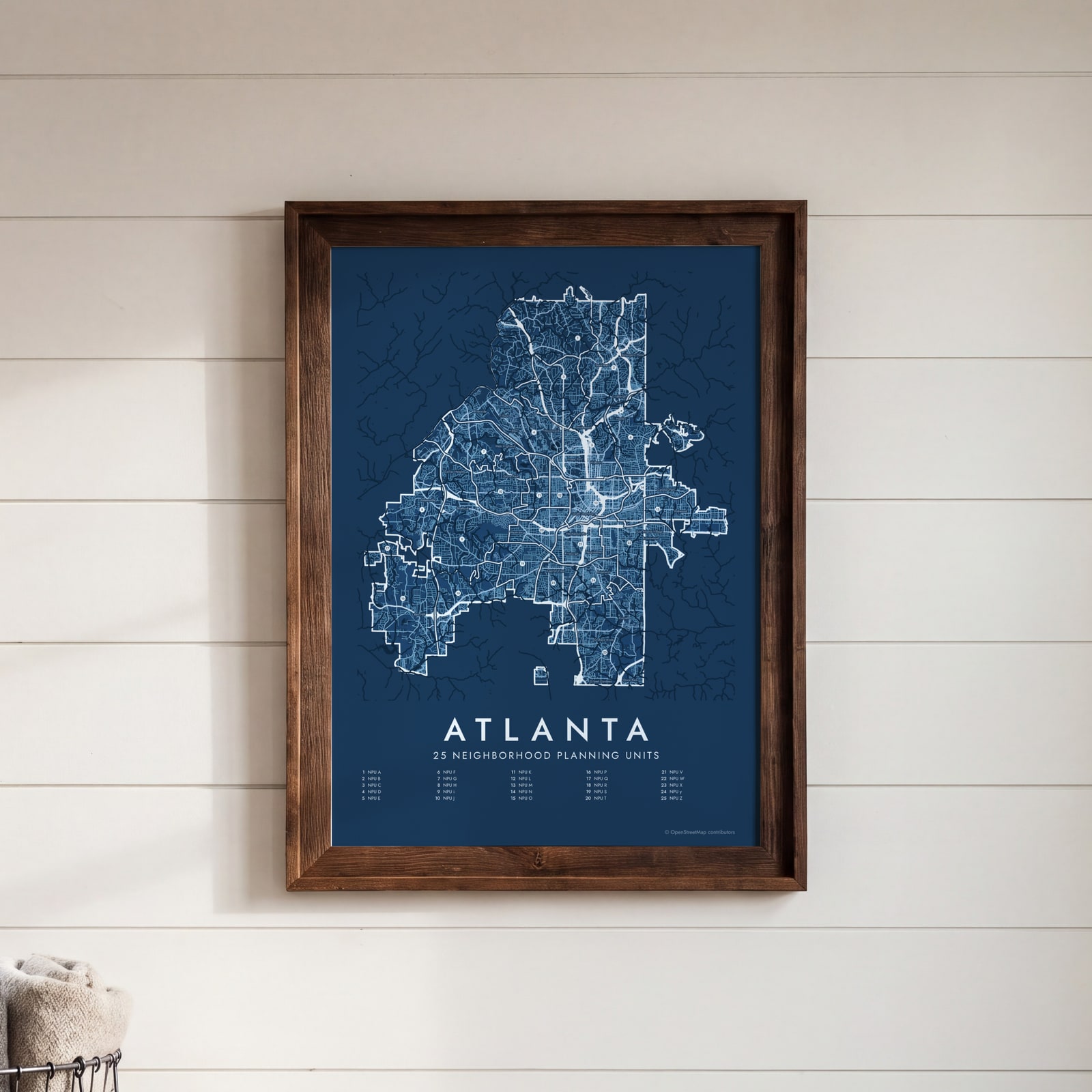 Atlanta street map with numbered neighborhood planning units and their listEdit this →
Examples
Open any of them to change the words, the place, the date and the style, then download the print file.
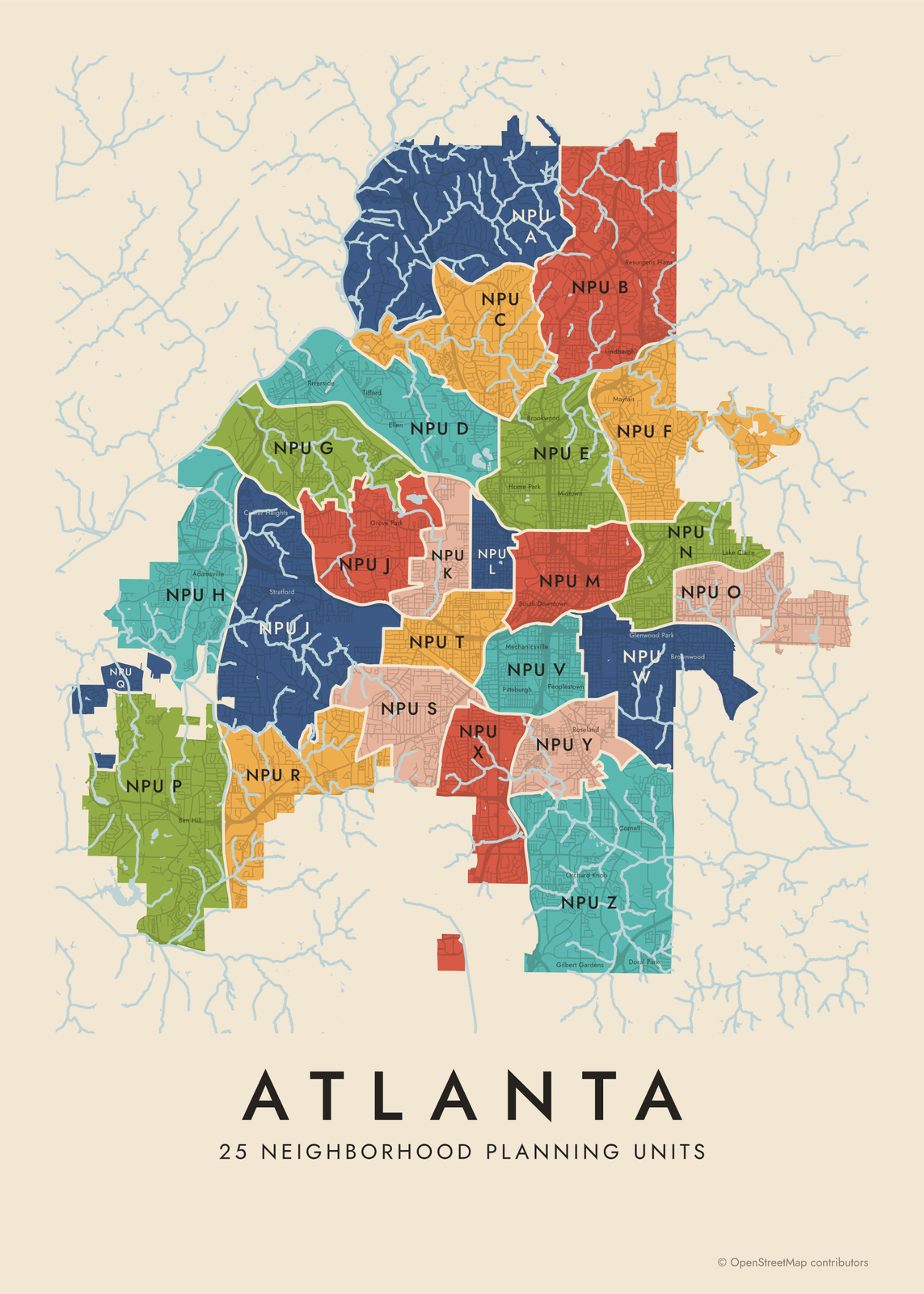 Atlanta neighborhood map in color, every neighborhood planning unit namedEdit this →More neighborhood maps →
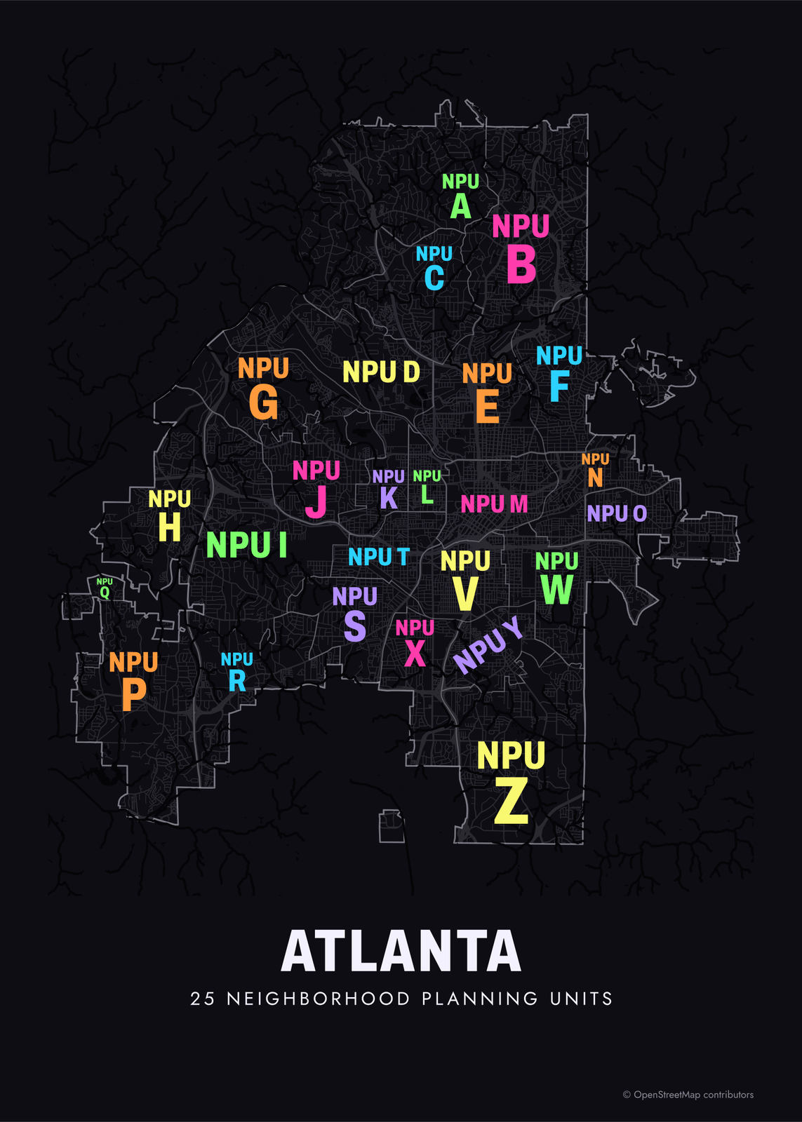 Typographic Atlanta map: the names fill their neighborhood planning unitsEdit this →More neighborhood maps →
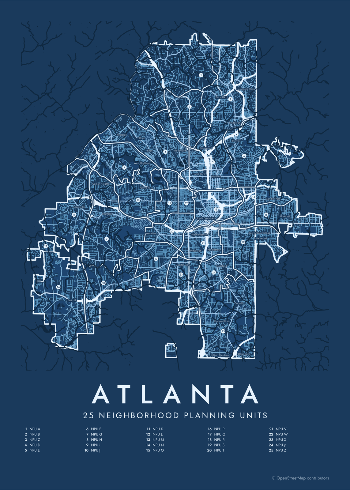 Atlanta street map with numbered neighborhood planning units and their listEdit this →More neighborhood maps →
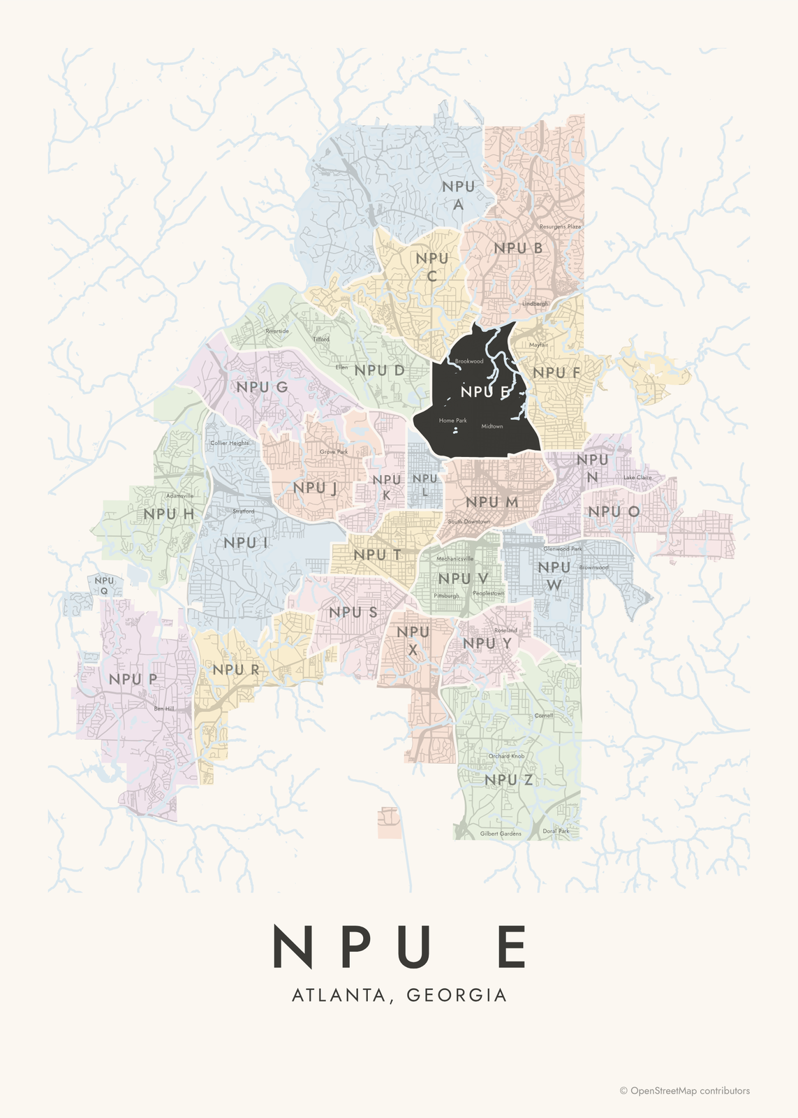 NPU E highlighted on a map of AtlantaEdit this →More neighborhood maps →
How Atlanta is divided
Atlanta's Neighborhood Planning Units date from 1974, when Mayor Maynard Jackson set them up so residents could weigh in on zoning, land use and other city plans. There are 25, lettered A to Z with no U. Each NPU has a citizen council that makes recommendations to the mayor and City Council.
The NPUs are made of neighborhoods. The city recognizes more than 240 of them, and each NPU holds several: NPU E covers Midtown, Ansley Park and Atlantic Station, NPU M holds Downtown, Old Fourth Ward and Castleberry Hill, and NPU N includes Inman Park, Cabbagetown and Candler Park. Our map prints 95 well-known neighborhood names on top of the NPU borders.
All 25 neighborhood planning units of Atlanta
- NPU A
- NPU B
- NPU C
- NPU D
- NPU E
- NPU F
- NPU G
- NPU H
- NPU i
- NPU J
- NPU K
- NPU L
- NPU M
- NPU N
- NPU O
- NPU P
- NPU Q
- NPU R
- NPU S
- NPU T
- NPU V
- NPU W
- NPU X
- NPU y
- NPU Z
More neighborhood names on the map
Inside the neighborhood planning units, the map also names 95 smaller neighborhoods where they fit, from OpenStreetMap: Ben Hill, Bankhead, Buckhead, Old Fourth Ward, Lindbergh, Thomasville, Adamsville, Normandy Forest, Carroll Heights, Fairburn Heights, Collier Heights, Chattahoochee, Stratford, Center Hill, Carey Park, Dixie Hills, Riverside, Cascade Heights, Magnolia, Adams Park, Rivermeade, Tilford, West Highland, Battle Hill Haven, Ridgewood Heights, Grove Park, Ellen, Westview, Westover Plantation, Rockdale, West End, Forrest Park, Joel Chandler Harris Homes, Sylvan Hills, Woodward, Capitol View, English Ave., Atlanta University Center, Ellsworth Park, Bellwood and more. Turn them off under Names if you want only the neighborhood planning units.
Neighborhoods to know
- Midtown: Piedmont Park, the High Museum of Art and the Fox Theatre.
- Old Fourth Ward: Historic Fourth Ward Park and Ponce City Market, along the Atlanta BeltLine.
- Sweet Auburn: Auburn Avenue, where Martin Luther King Jr. was born and preached at Ebenezer Baptist Church.
- Inman Park: Atlanta's first planned suburb, laid out in the 1880s, with Victorian houses.
- Cabbagetown: small mill houses built for workers at the Fulton Bag and Cotton Mill.
- Little Five Points: independent shops and music venues where Euclid and Moreland Avenues meet.
- West End: Victorian houses and the Wren's Nest, the home of writer Joel Chandler Harris.
- Buckhead: the city's north end, with the towers of Peachtree Road and the Atlanta History Center.
How to make your Atlanta neighborhood poster
- Open the Atlanta map.
- Pick a style: Colored areas, Typographic (the names fill the map) or a Street map with the borders over the streets.
- Tap your own neighborhood to highlight it; it becomes the poster's title.
- Drag and zoom to frame the whole city or just your part of it, then pick a size and download the print file.
Questions
What is an NPU in Atlanta?
A Neighborhood Planning Unit: one of 25 citizen advisory councils, lettered A to Z without U, that review zoning, land use and other plans for their part of the city and make recommendations to the City Council. Each one covers a group of neighborhoods.
How many neighborhoods does Atlanta have?
The city recognizes more than 240 neighborhoods, grouped into 25 NPUs. This map draws the NPU borders and prints 95 well-known neighborhood names as labels.
Which NPU is my neighborhood in?
Find your neighborhood's label on the map and look at the NPU around it. A few examples: Midtown is in NPU E, Downtown and Old Fourth Ward are in NPU M, Inman Park is in NPU N, and West End is in NPU T.
Where do the Atlanta boundaries come from?
From OpenStreetMap (© OpenStreetMap contributors) and Atlanta Regional Commission. Streets and water are OpenStreetMap's. Boundaries are a snapshot and can differ from what neighbors call home; tell us if one looks wrong.
What sizes can I print?
US Letter, 8 × 10, 11 × 14, 12 × 16 and 12 × 18 in, A4 and A3, free. You download a 300 DPI JPEG drawn at the size you pick. Larger prints, up to 24 × 36 in, are coming soon.
Related




Gift ideas by occasion




Every example is made with the Posterage generators. Change anything, then download it as a 300 DPI JPEG.