Manhattan neighborhood map 52 neighborhoods, from Inwood to the Battery
This poster maps Manhattan neighborhood by neighborhood: 52 named areas from Inwood and Marble Hill down to the Financial District. Small places like SoHo, Tribeca and Tudor City each get their own shape. Highlight yours and print it.
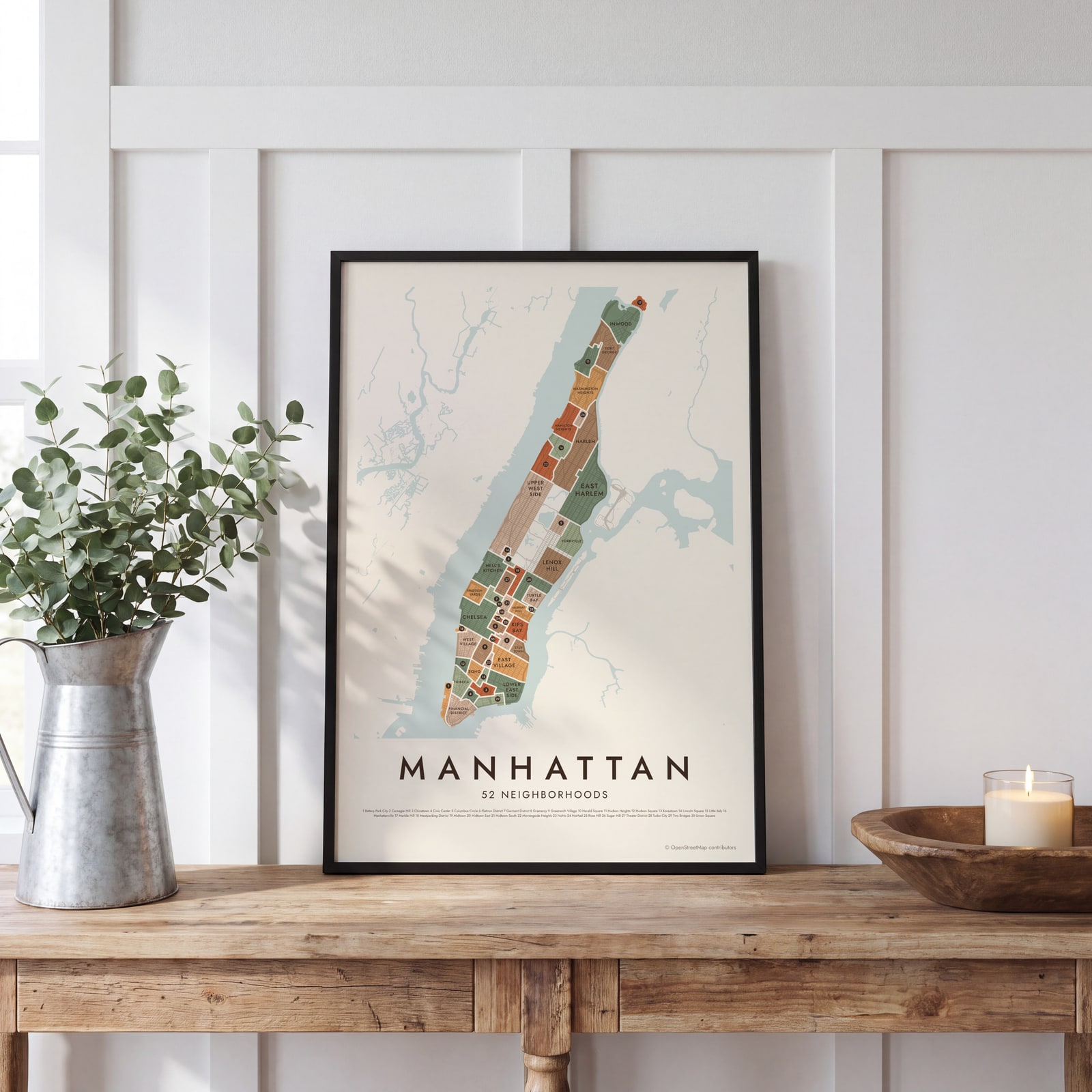
On the wall
A few of them framed at home. Open any one to make it yours.
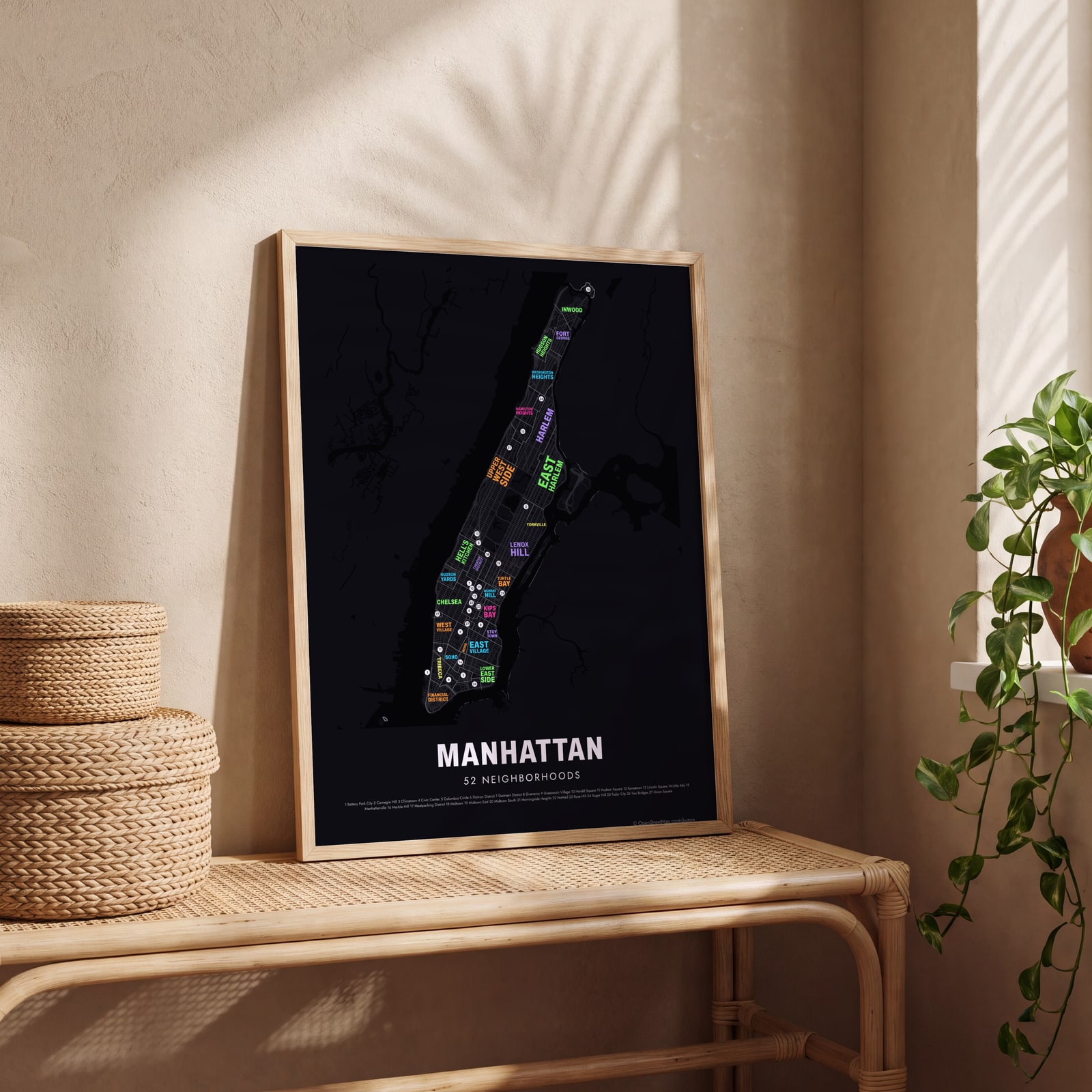 Typographic Manhattan map: the names fill their neighborhoodsEdit this →
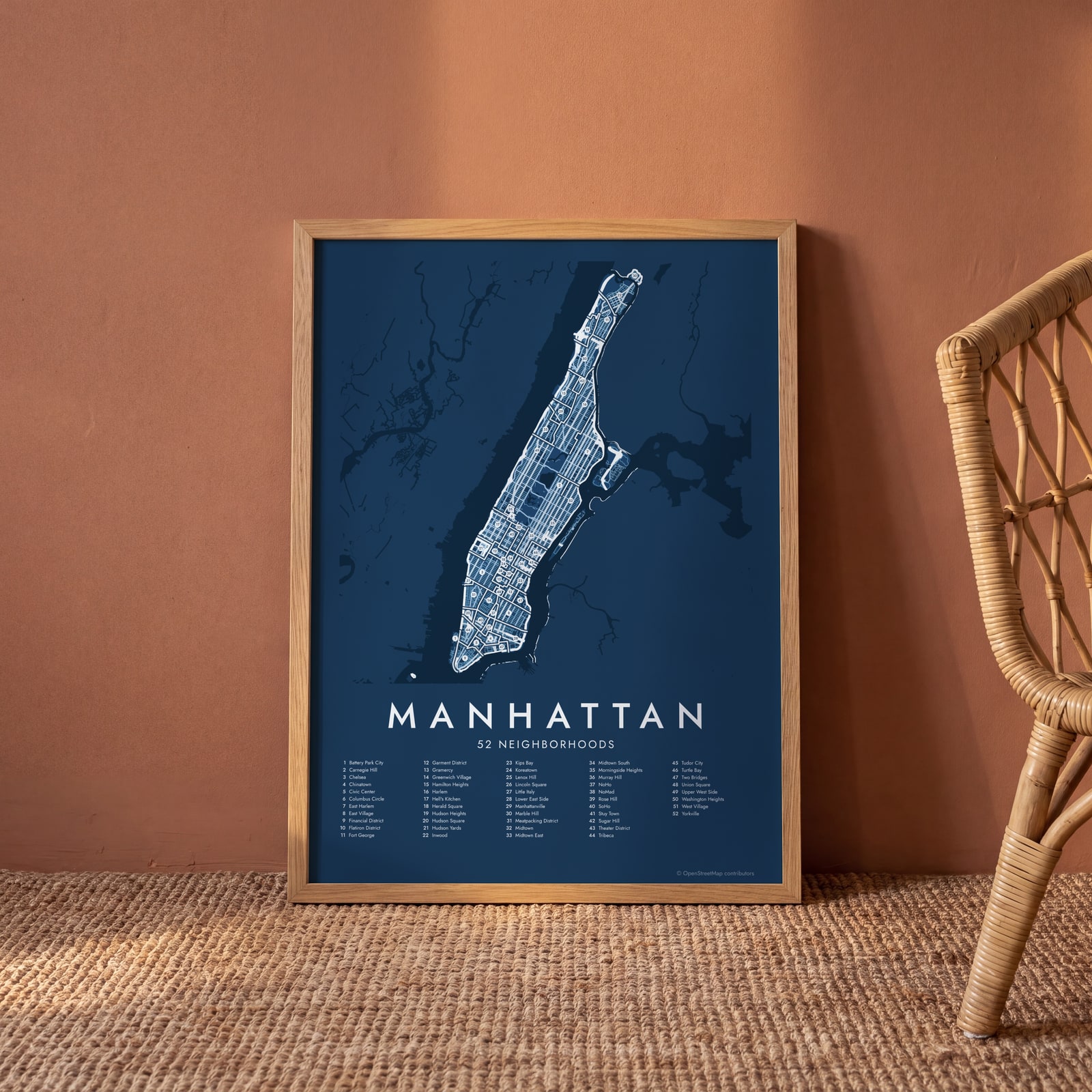 Manhattan street map with numbered neighborhoods and their listEdit this →
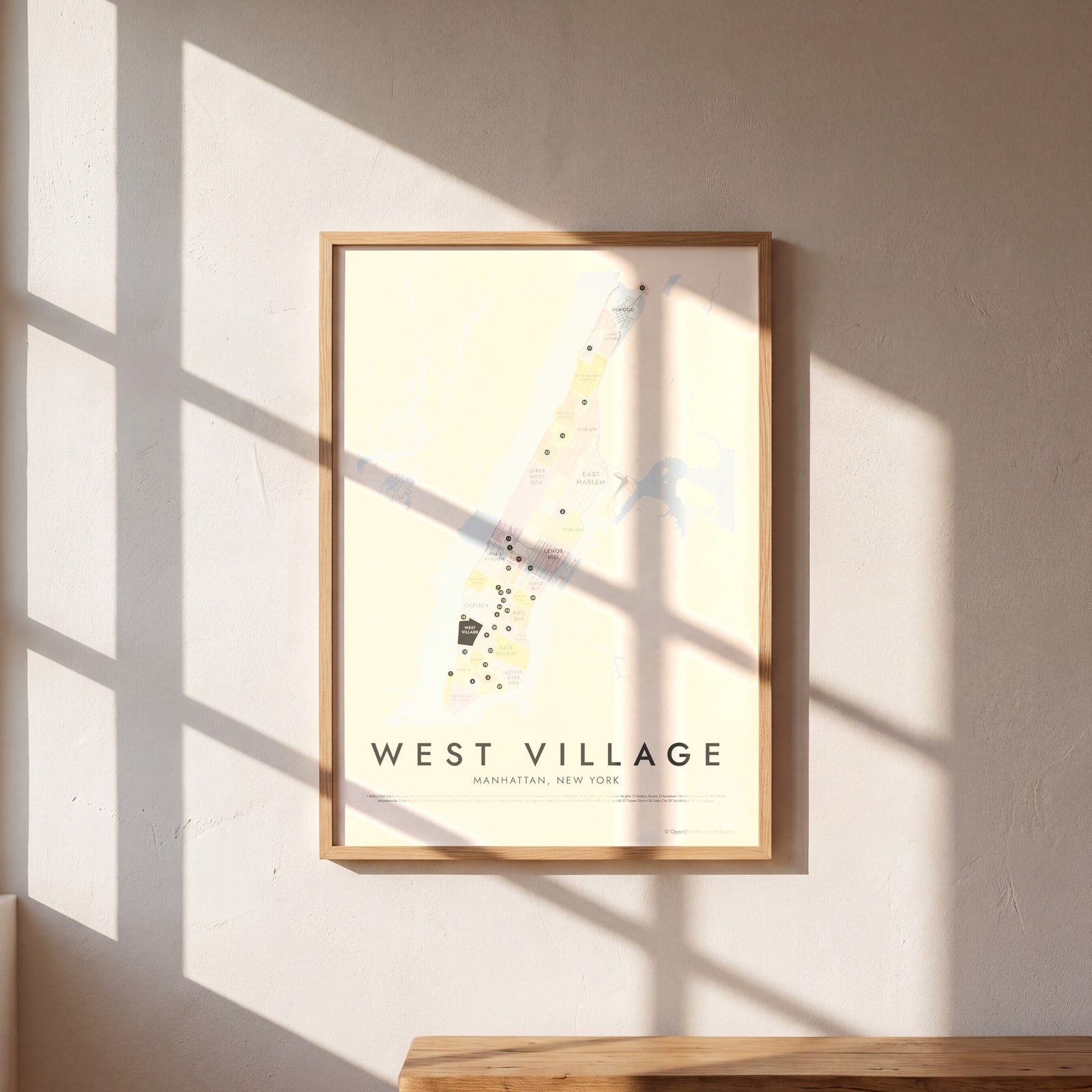 West Village highlighted on a map of ManhattanEdit this →
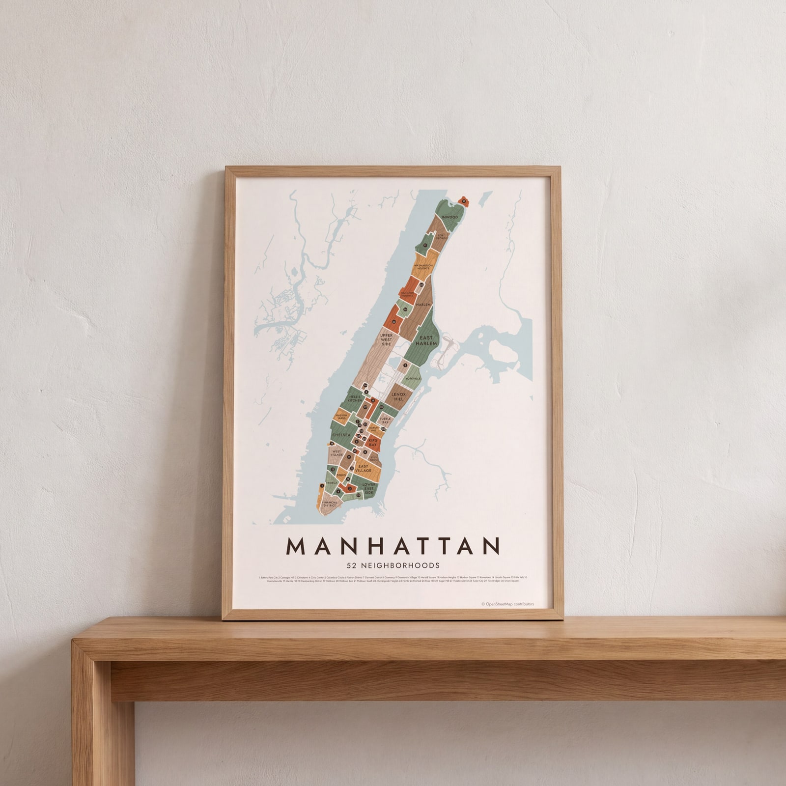 Manhattan neighborhood map in color, every neighborhood namedEdit this →
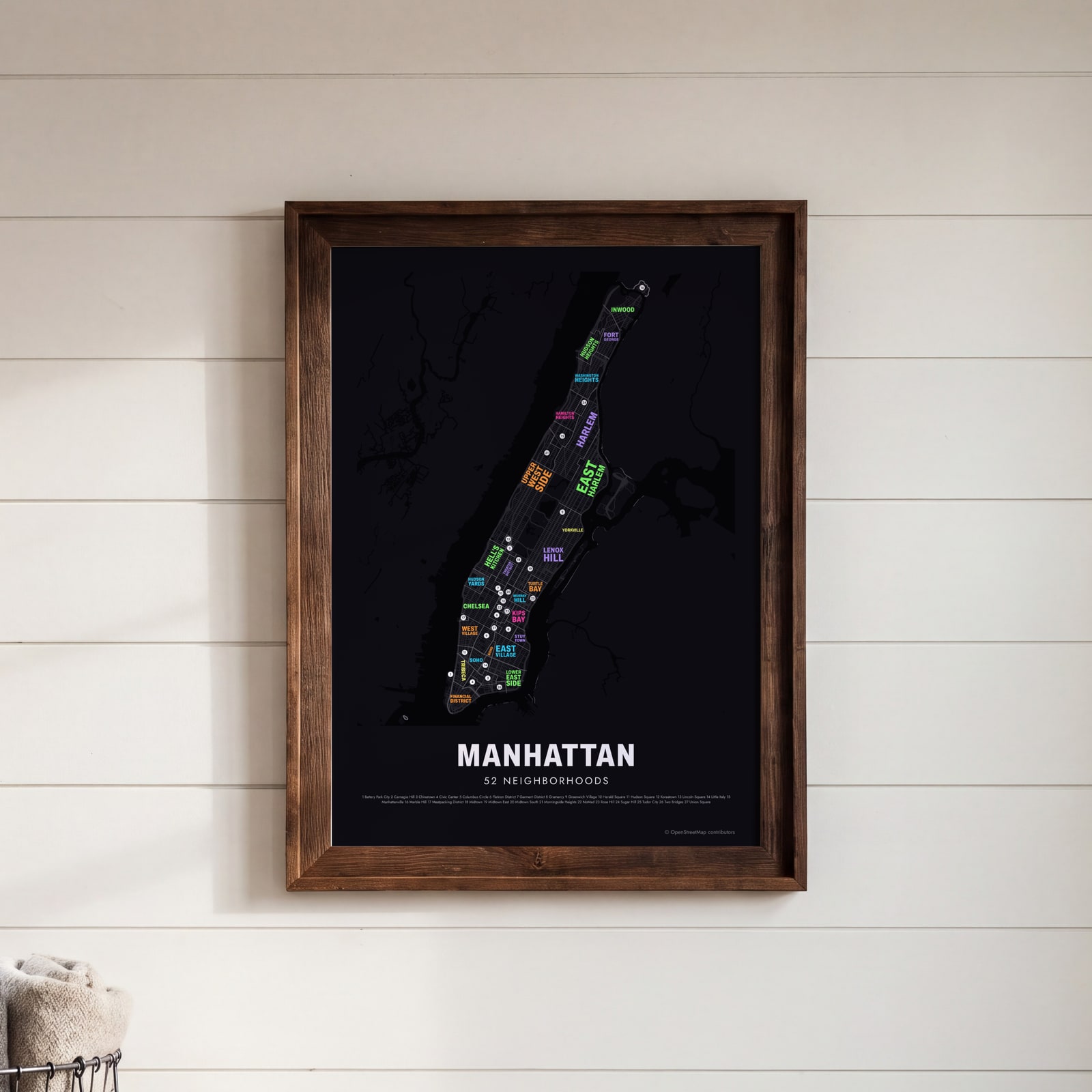 Typographic Manhattan map: the names fill their neighborhoodsEdit this →
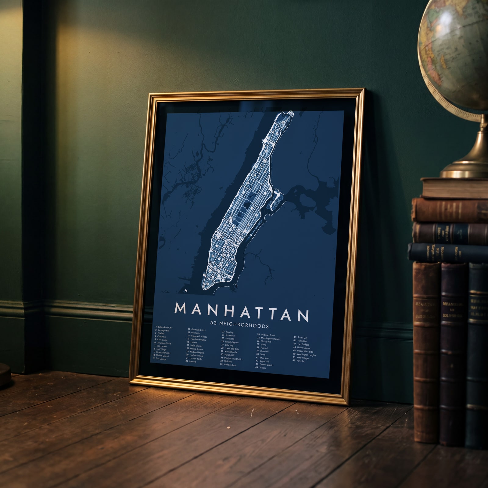 Manhattan street map with numbered neighborhoods and their listEdit this →
Examples
Open any of them to change the words, the place, the date and the style, then download the print file.
 Manhattan neighborhood map in color, every neighborhood namedEdit this →More neighborhood maps →
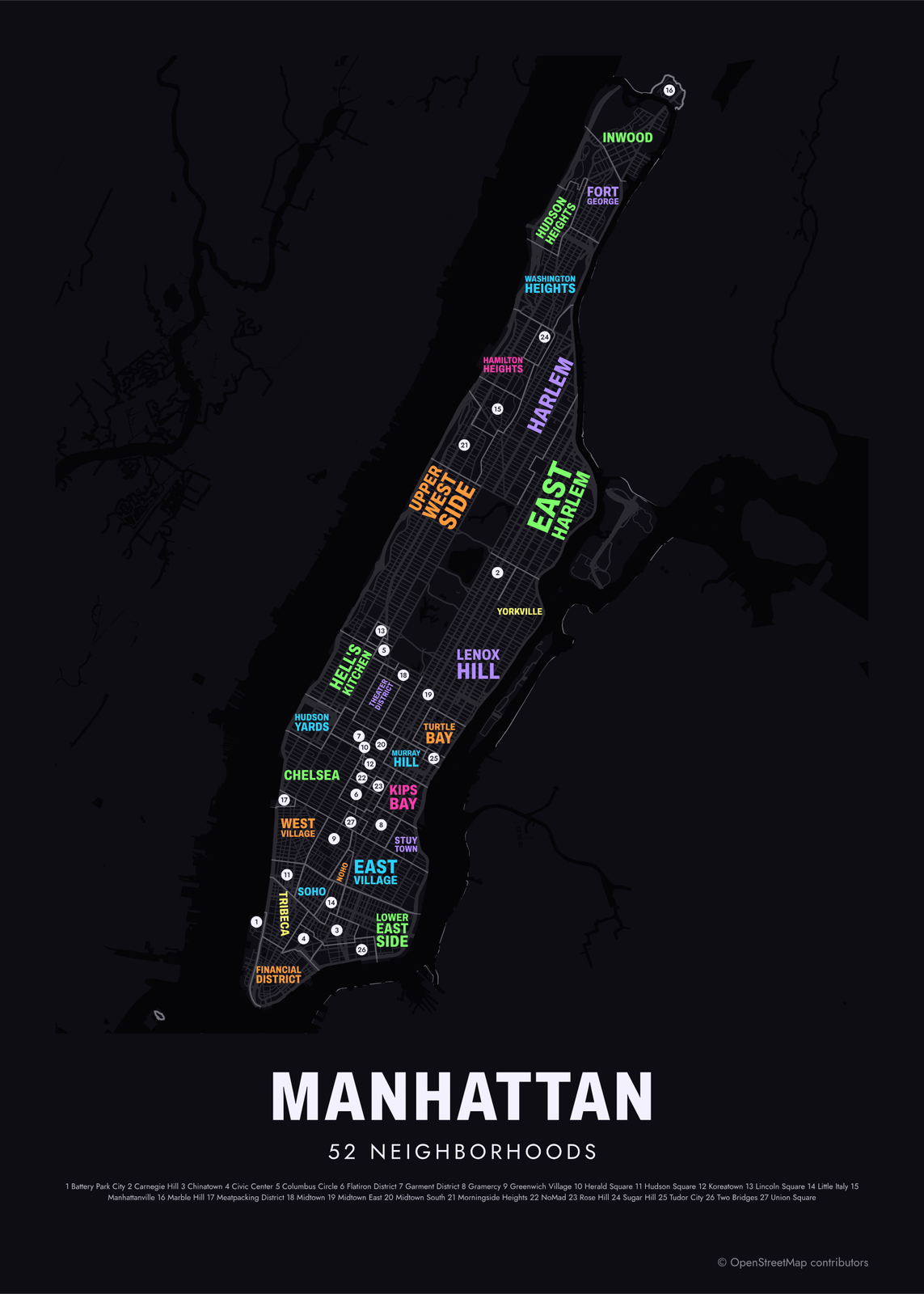 Typographic Manhattan map: the names fill their neighborhoodsEdit this →More neighborhood maps →
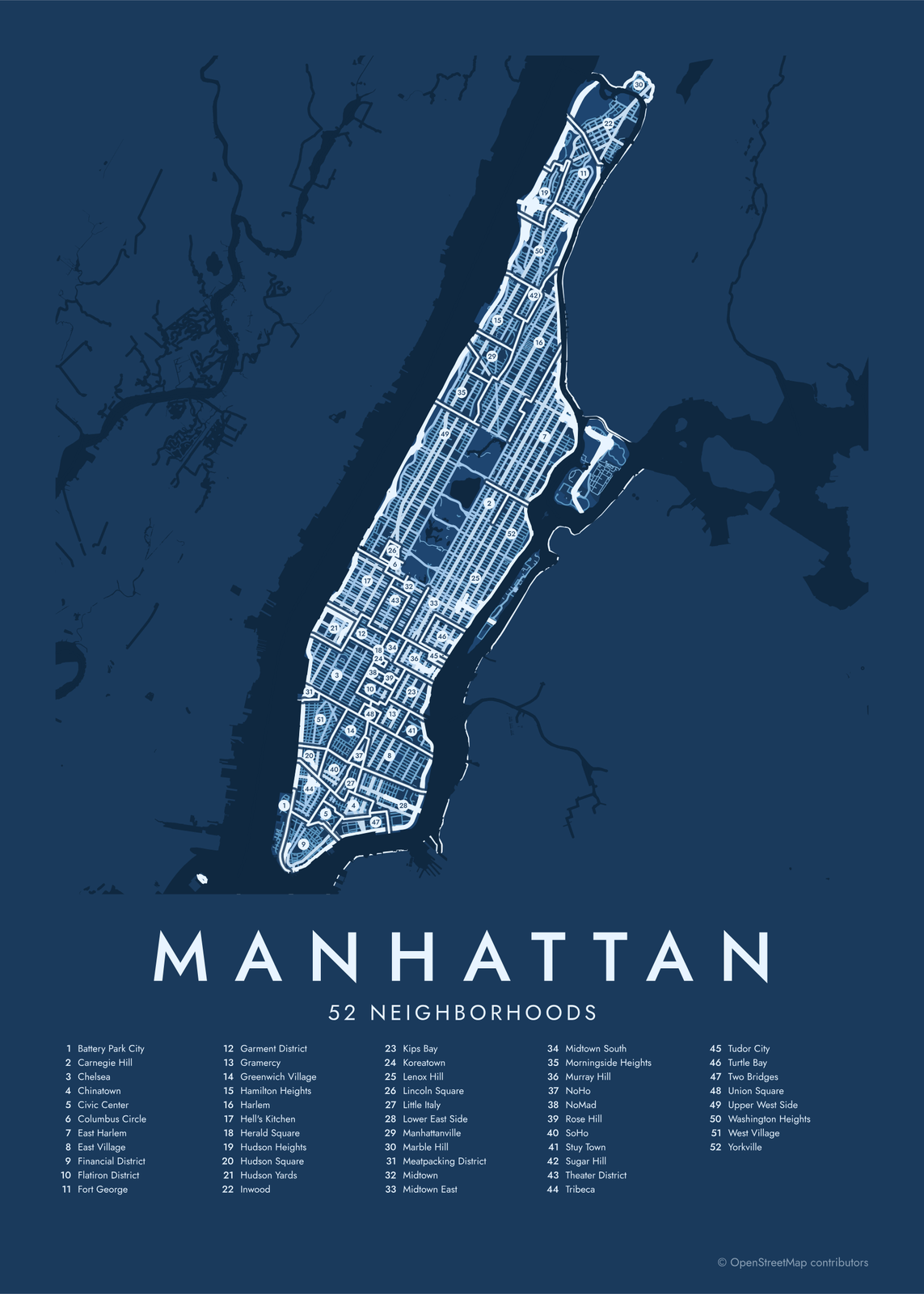 Manhattan street map with numbered neighborhoods and their listEdit this →More neighborhood maps →
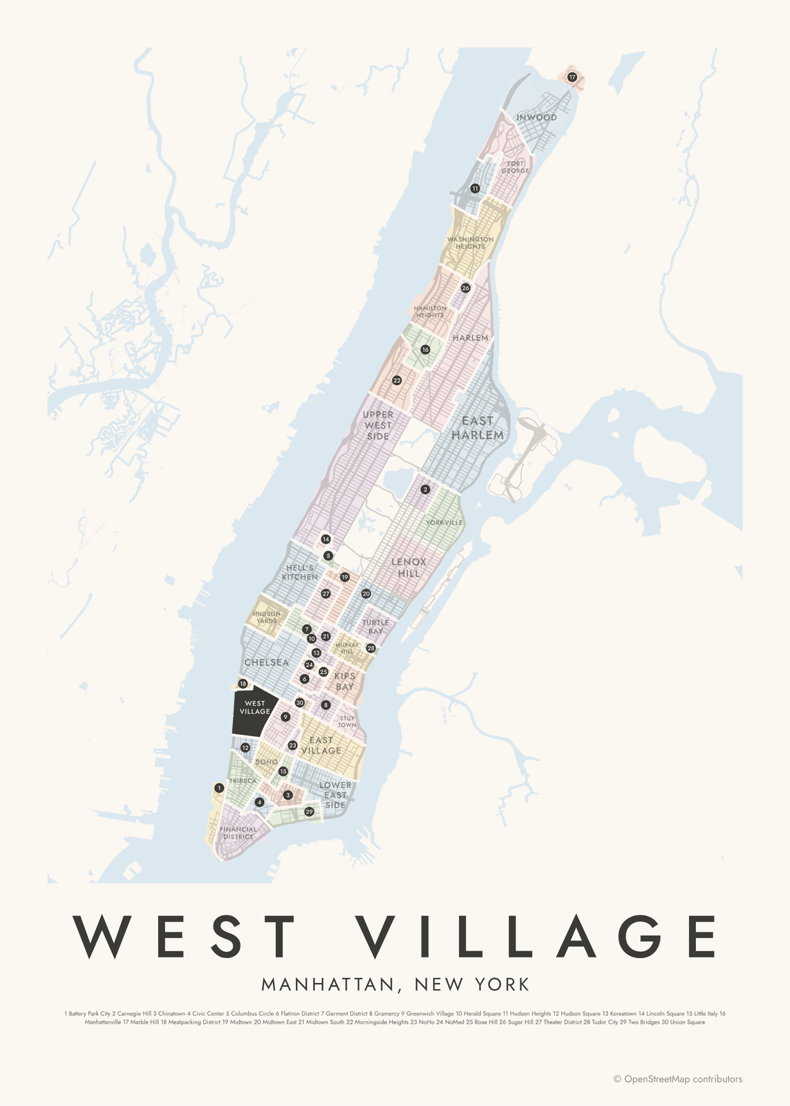 West Village highlighted on a map of ManhattanEdit this →More neighborhood maps →
How Manhattan is divided
Manhattan is one of New York City's five boroughs and is also New York County. It's mostly one long island, plus Marble Hill on the mainland. Downtown streets are older and irregular, while most of the island north of 14th Street follows the 1811 street grid.
The city draws no official neighborhood borders, so the 52 areas here range from big ones like Harlem and the Upper West Side to small pockets like Tudor City and NoMad. The Upper East Side is shown through its parts, Lenox Hill, Yorkville and Carnegie Hill, and names like Alphabet City and Sutton appear as labels.
All 52 neighborhoods of Manhattan
- Battery Park City
- Carnegie Hill
- Chelsea
- Chinatown
- Civic Center
- Columbus Circle
- East Harlem
- East Village
- Financial District
- Flatiron District
- Fort George
- Garment District
- Gramercy
- Greenwich Village
- Hamilton Heights
- Harlem
- Hell's Kitchen
- Herald Square
- Hudson Heights
- Hudson Square
- Hudson Yards
- Inwood
- Kips Bay
- Koreatown
- Lenox Hill
- Lincoln Square
- Little Italy
- Lower East Side
- Manhattanville
- Marble Hill
- Meatpacking District
- Midtown
- Midtown East
- Midtown South
- Morningside Heights
- Murray Hill
- NoHo
- NoMad
- Rose Hill
- SoHo
- Stuy Town
- Sugar Hill
- Theater District
- Tribeca
- Tudor City
- Turtle Bay
- Two Bridges
- Union Square
- Upper West Side
- Washington Heights
- West Village
- Yorkville
More neighborhood names on the map
Inside the neighborhoods, the map also names 11 smaller neighborhoods where they fit, from OpenStreetMap: Lower Manhattan, Upper East Side, Whitehall, Seaport, University Village, Washington Square Village, Clinton, Alphabet City, Manhattan Valley, Beekman, Sutton. Turn them off under Names if you want only the neighborhoods.
Neighborhoods to know
- SoHo: cast-iron buildings and cobblestone streets south of Houston Street.
- Greenwich Village: Washington Square Park and its arch, with New York University around it.
- Lower East Side: tenement blocks around Orchard Street, home of the Tenement Museum.
- Theater District: most of Broadway's theaters, around Times Square.
- Battery Park City: built on landfill along the Hudson, with a long riverside esplanade.
- Harlem: the Apollo Theater on 125th Street and long rows of brownstones.
- Inwood: Inwood Hill Park, with the last natural forest in Manhattan.
- Marble Hill: part of Manhattan, but on the Bronx side of the Harlem River since a ship canal cut it off in 1895.
How to make your Manhattan neighborhood poster
- Open the Manhattan map.
- Pick a style: Colored areas, Typographic (the names fill the map) or a Street map with the borders over the streets.
- Tap your own neighborhood to highlight it; it becomes the poster's title.
- Drag and zoom to frame the whole city or just your part of it, then pick a size and download the print file.
Questions
How many neighborhoods are in Manhattan?
There's no official count. This map names 52 and adds smaller ones like Alphabet City and Sutton as labels. For local government, the borough is split into 12 community districts.
What do SoHo, Tribeca, NoHo and NoMad mean?
They describe where each one sits. SoHo is South of Houston Street, NoHo is North of Houston, Tribeca is the Triangle Below Canal Street, and NoMad is North of Madison Square.
Where do downtown, Midtown and uptown begin?
Locals use the words loosely. Downtown is roughly everything south of 14th Street, uptown starts around 59th Street at the bottom of Central Park, and Midtown is the business district in between.
Where do the Manhattan boundaries come from?
From OpenStreetMap (© OpenStreetMap contributors). Streets and water are OpenStreetMap's. Boundaries are a snapshot and can differ from what neighbors call home; tell us if one looks wrong.
What sizes can I print?
US Letter, 8 × 10, 11 × 14, 12 × 16 and 12 × 18 in, A4 and A3, free. You download a 300 DPI JPEG drawn at the size you pick. Larger prints, up to 24 × 36 in, are coming soon.
Related



Gift ideas by occasion




Every example is made with the Posterage generators. Change anything, then download it as a 300 DPI JPEG.