Chicago neighborhood map all 77 community areas, named
This poster maps Chicago split into its 77 community areas, each one named, from Rogers Park down to Hegewisch. Switch to the city's 98 neighborhoods for a finer map, with places like Wicker Park, Bucktown and Andersonville. Highlight the one you call home and print it.
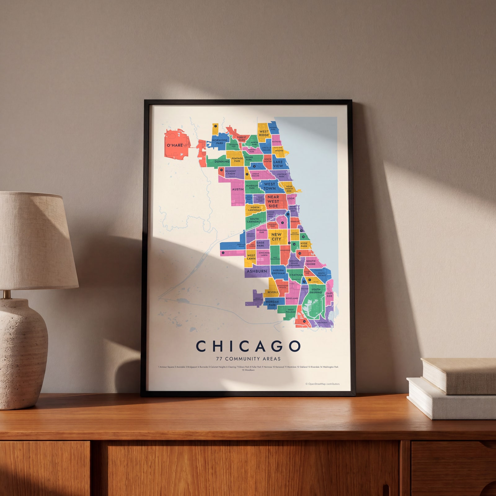
On the wall
A few of them framed at home. Open any one to make it yours.
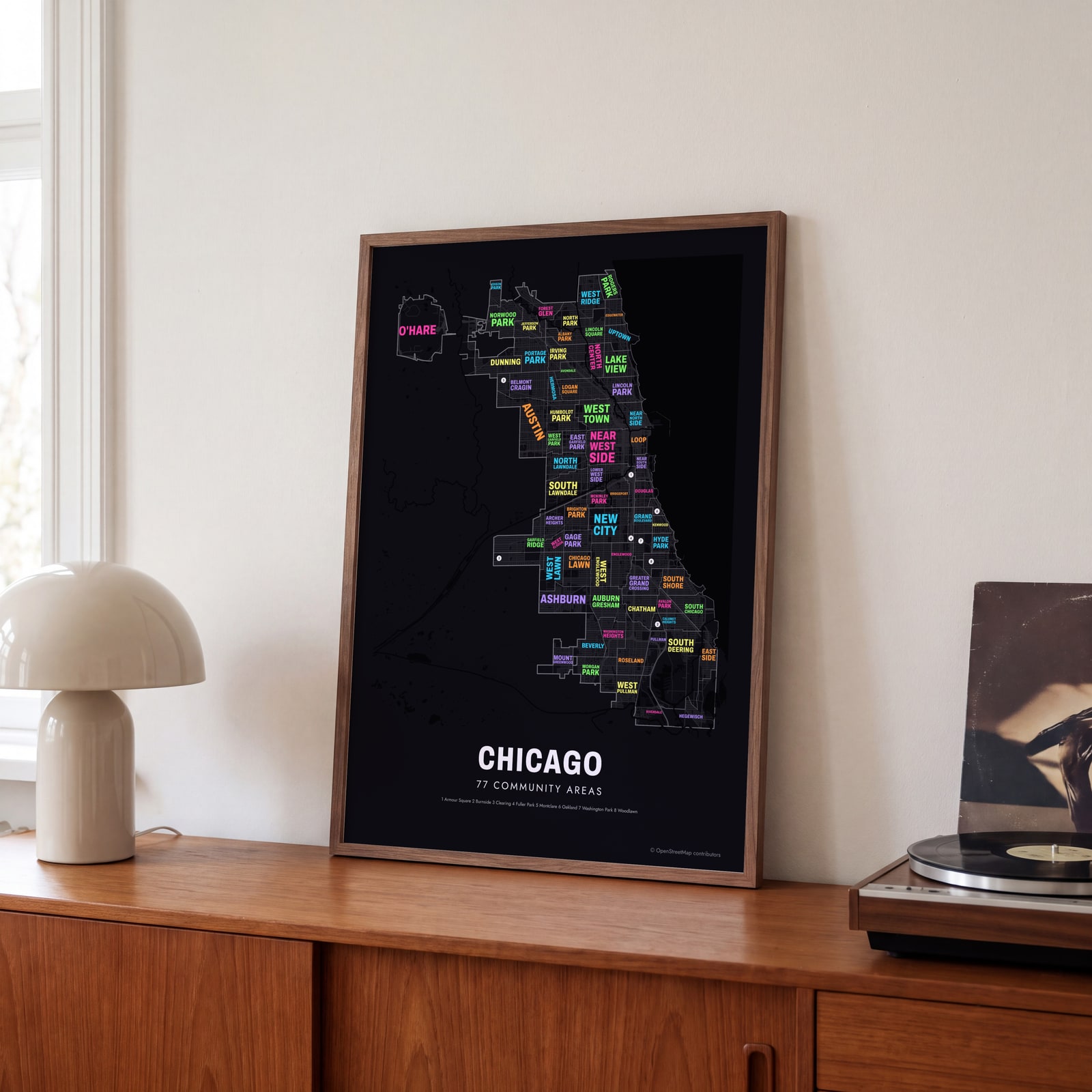 Typographic Chicago map: the names fill their community areasEdit this →
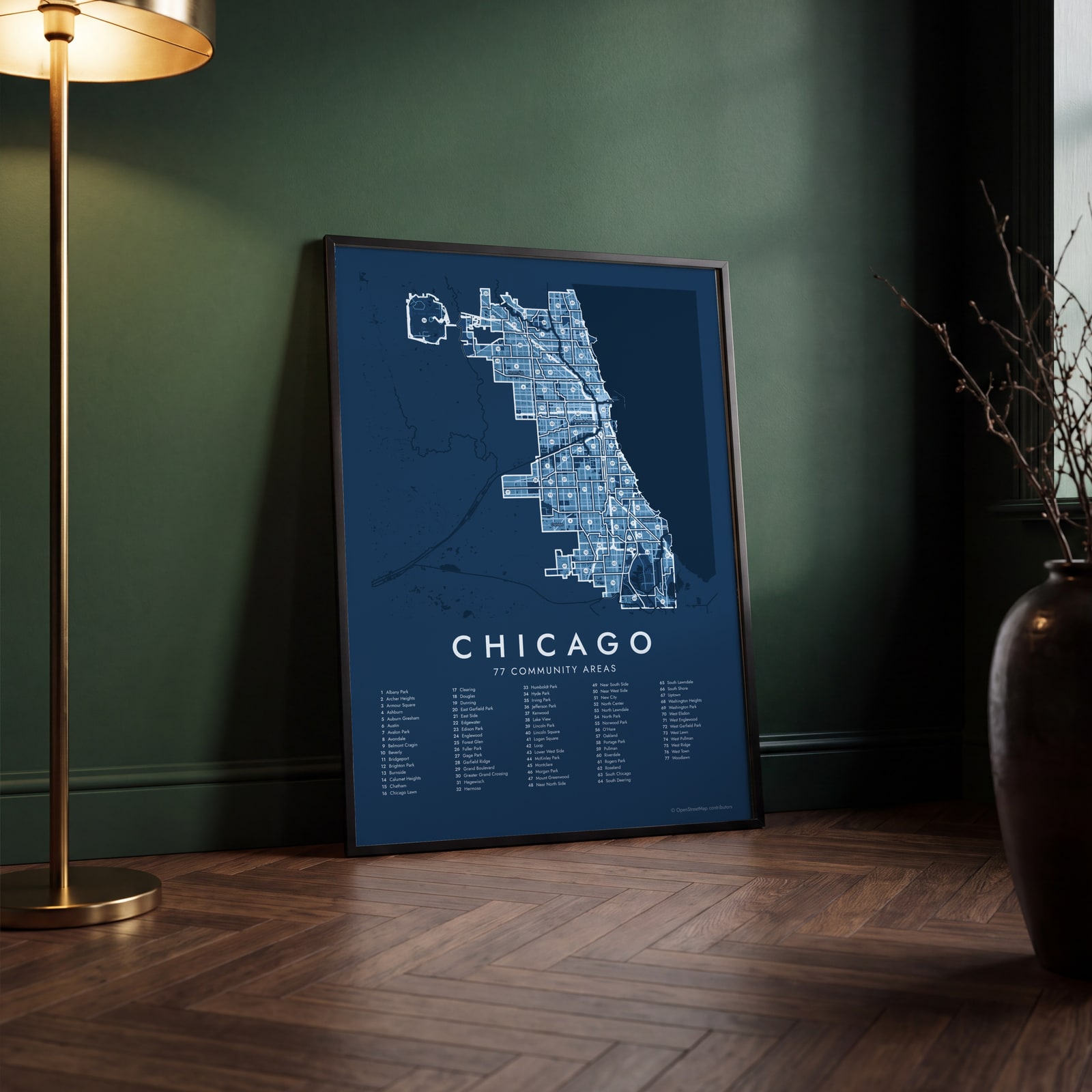 Chicago street map with numbered community areas and their listEdit this →
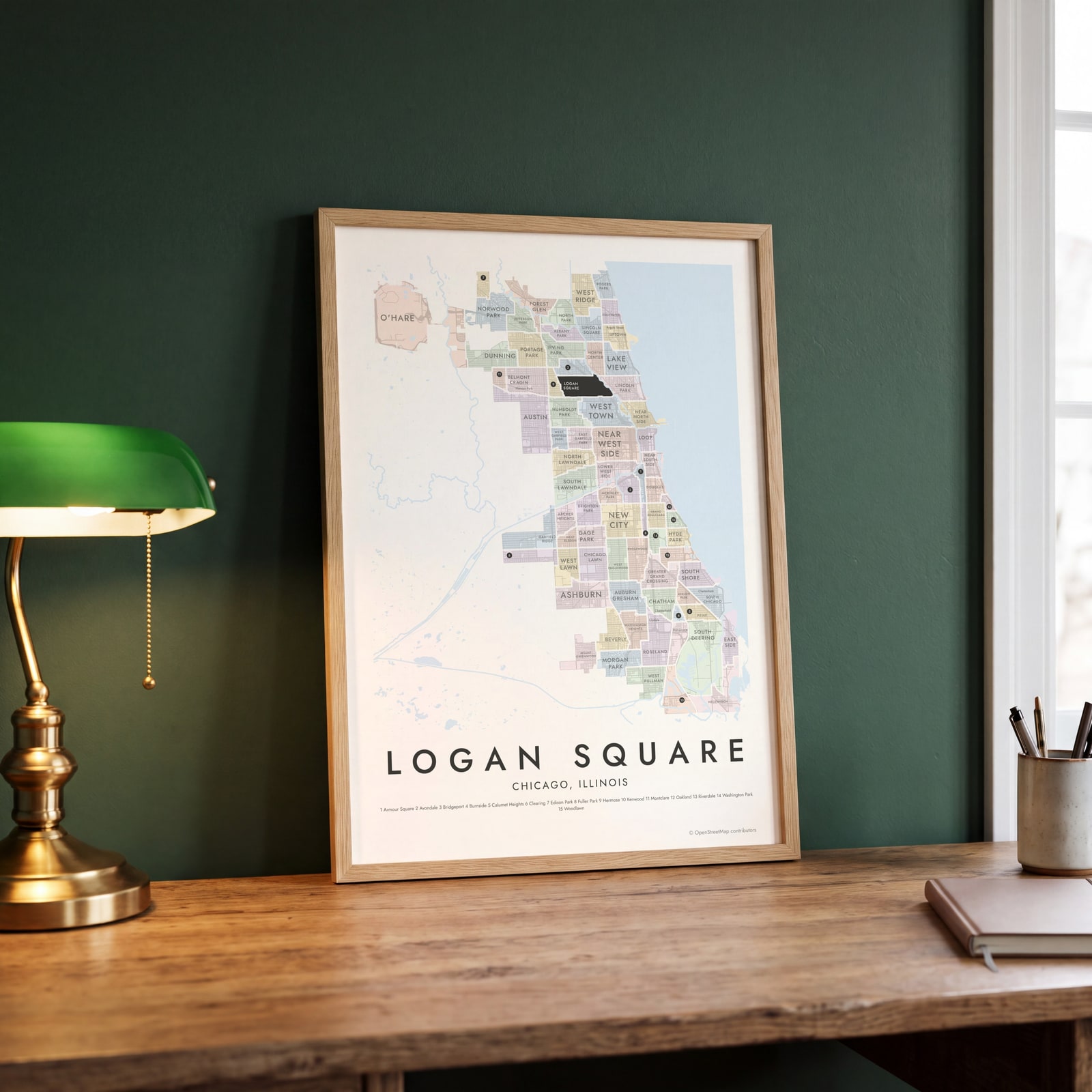 Logan Square highlighted on a map of ChicagoEdit this →
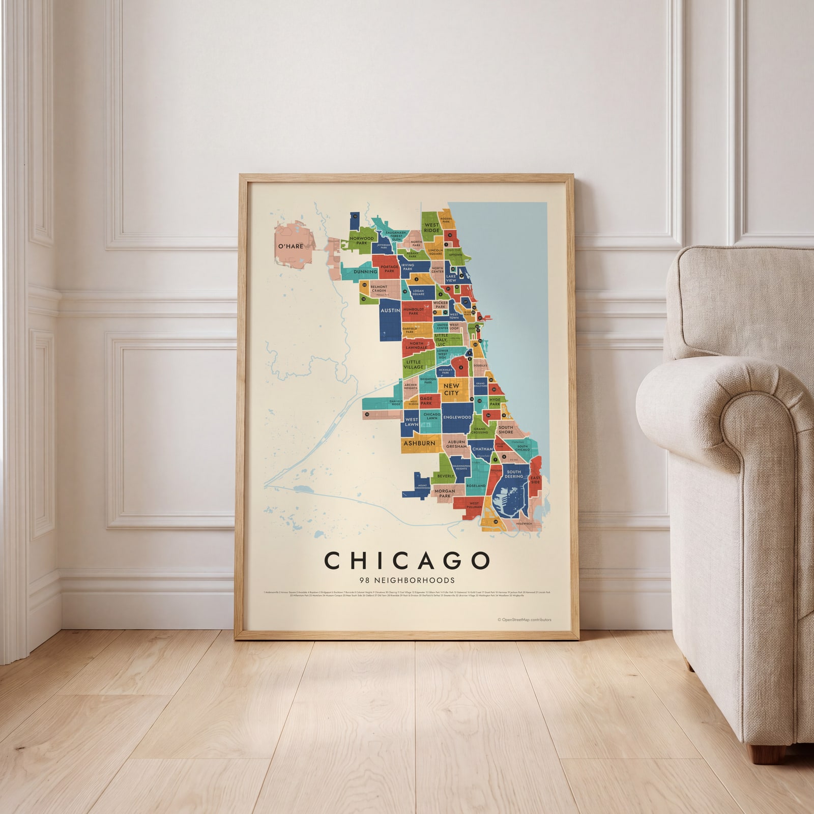 Chicago's 98 neighborhoods in colorEdit this →
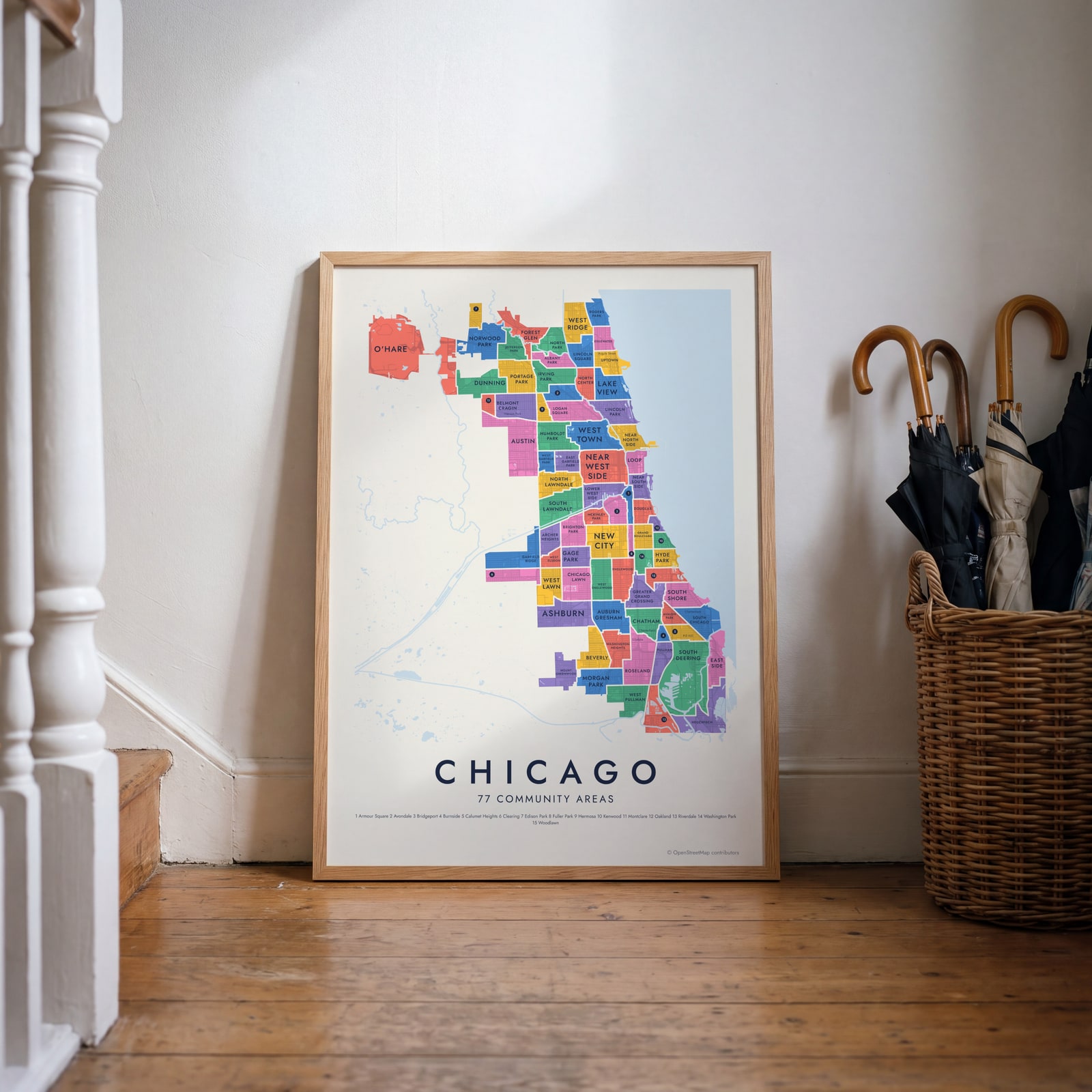 Chicago neighborhood map in color, every community area namedEdit this →
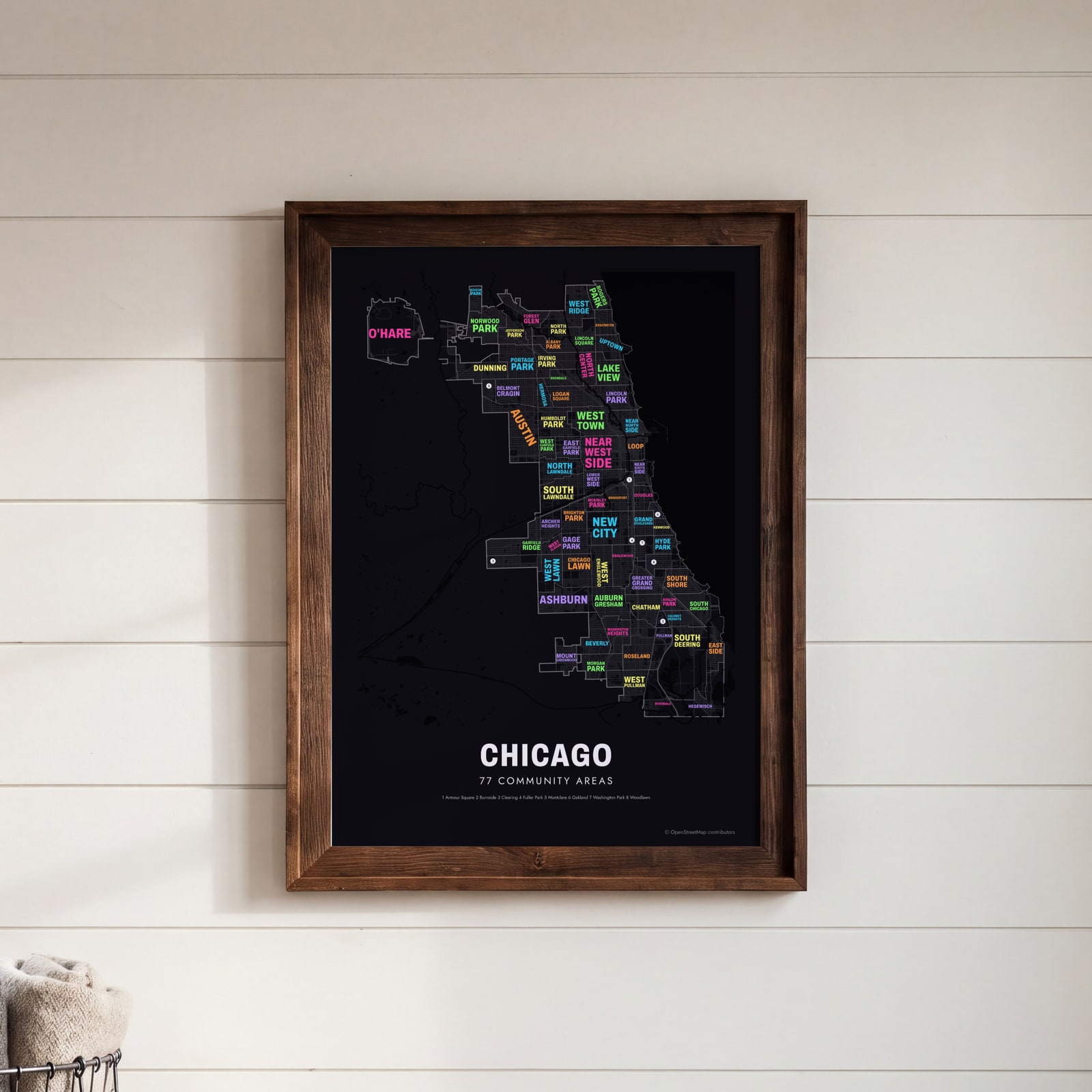 Typographic Chicago map: the names fill their community areasEdit this →
Examples
Open any of them to change the words, the place, the date and the style, then download the print file.
 Chicago neighborhood map in color, every community area namedEdit this →More neighborhood maps →
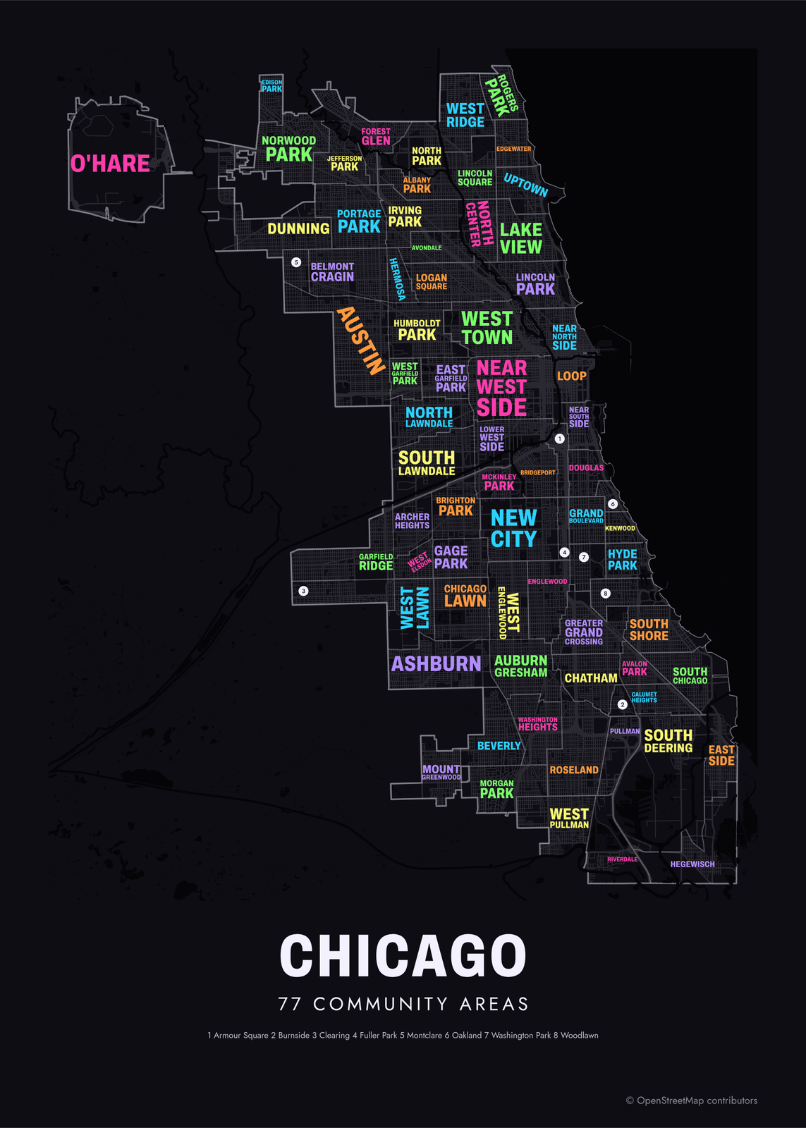 Typographic Chicago map: the names fill their community areasEdit this →More neighborhood maps →
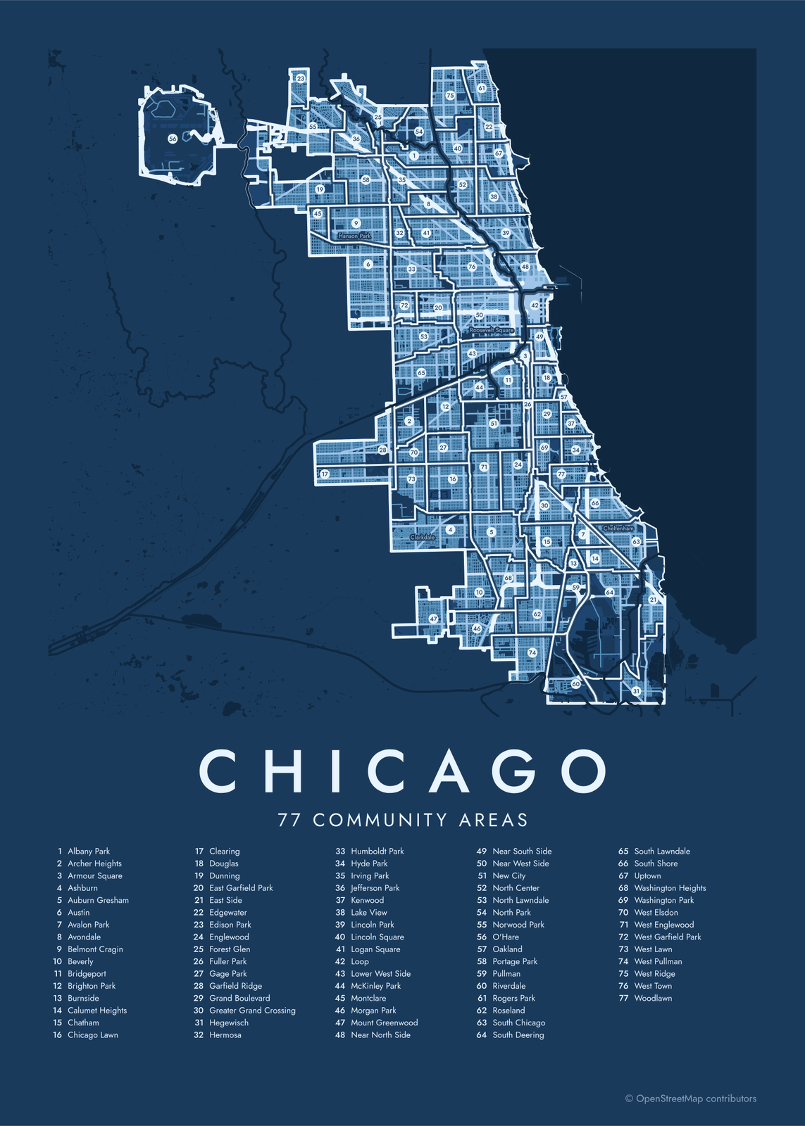 Chicago street map with numbered community areas and their listEdit this →More neighborhood maps →
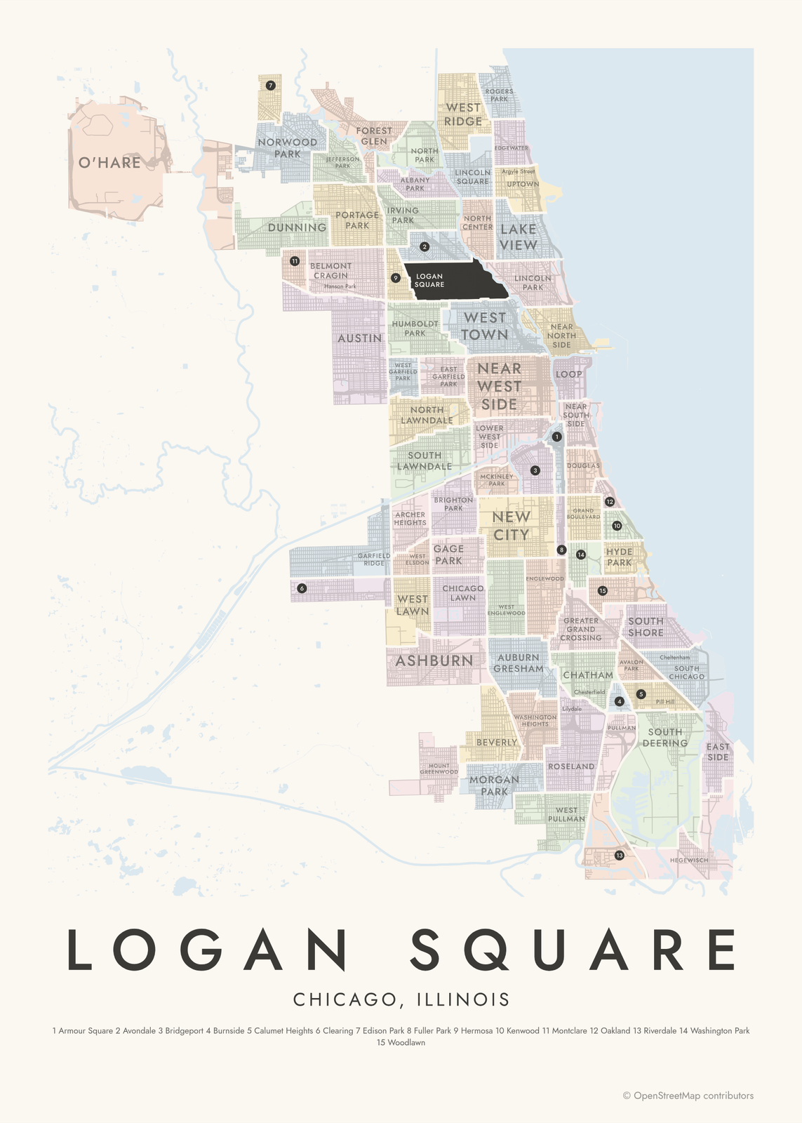 Logan Square highlighted on a map of ChicagoEdit this →More neighborhood maps →
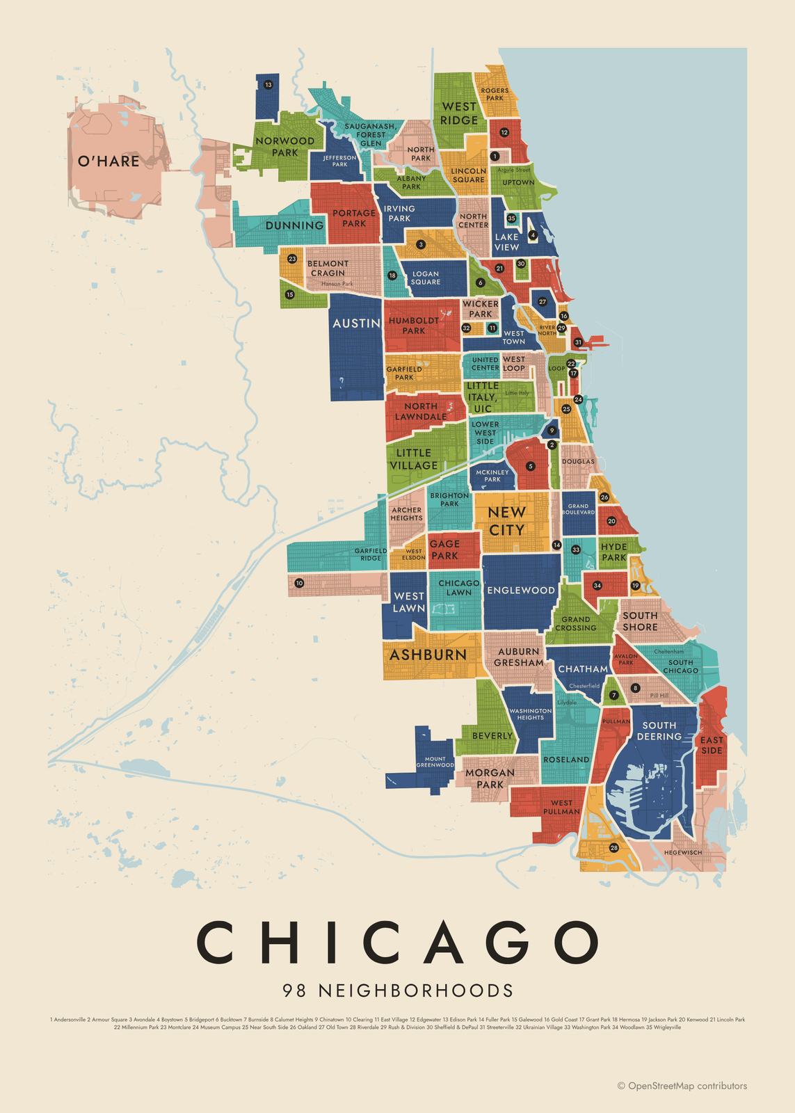 Chicago's 98 neighborhoods in colorEdit this →More neighborhood maps →
How Chicago is divided
Chicago's community areas were drawn in the 1920s by social scientists at the University of Chicago, so the city could be studied area by area over time. There were 75 at first. O'Hare was added in the 1950s after the city annexed the airport land, and Edgewater split from Uptown in 1980, making 77. City departments and researchers still report data by them, and the borders have barely moved in a century.
Community areas aren't quite what locals mean by neighborhood. Wicker Park and Ukrainian Village both sit inside West Town, and Wrigleyville and Boystown inside Lake View. That's why the map has a second level: 98 neighborhoods from the City of Chicago's data portal, which also names landmarks like Millennium Park and the Magnificent Mile. Many more local names, like Pilsen, Bronzeville and Ravenswood, appear as small labels.
All 77 community areas of Chicago
- Albany Park
- Archer Heights
- Armour Square
- Ashburn
- Auburn Gresham
- Austin
- Avalon Park
- Avondale
- Belmont Cragin
- Beverly
- Bridgeport
- Brighton Park
- Burnside
- Calumet Heights
- Chatham
- Chicago Lawn
- Clearing
- Douglas
- Dunning
- East Garfield Park
- East Side
- Edgewater
- Edison Park
- Englewood
- Forest Glen
- Fuller Park
- Gage Park
- Garfield Ridge
- Grand Boulevard
- Greater Grand Crossing
- Hegewisch
- Hermosa
- Humboldt Park
- Hyde Park
- Irving Park
- Jefferson Park
- Kenwood
- Lake View
- Lincoln Park
- Lincoln Square
- Logan Square
- Loop
- Lower West Side
- McKinley Park
- Montclare
- Morgan Park
- Mount Greenwood
- Near North Side
- Near South Side
- Near West Side
- New City
- North Center
- North Lawndale
- North Park
- Norwood Park
- O'Hare
- Oakland
- Portage Park
- Pullman
- Riverdale
- Rogers Park
- Roseland
- South Chicago
- South Deering
- South Lawndale
- South Shore
- Uptown
- Washington Heights
- Washington Park
- West Elsdon
- West Englewood
- West Garfield Park
- West Lawn
- West Pullman
- West Ridge
- West Town
- Woodlawn
All 98 neighborhoods of Chicago
- Albany Park
- Andersonville
- Archer Heights
- Armour Square
- Ashburn
- Auburn Gresham
- Austin
- Avalon Park
- Avondale
- Belmont Cragin
- Beverly
- Boystown
- Bridgeport
- Brighton Park
- Bucktown
- Burnside
- Calumet Heights
- Chatham
- Chicago Lawn
- Chinatown
- Clearing
- Douglas
- Dunning
- East Side
- East Village
- Edgewater
- Edison Park
- Englewood
- Fuller Park
- Gage Park
- Galewood
- Garfield Park
- Garfield Ridge
- Gold Coast
- Grand Boulevard
- Grand Crossing
- Grant Park
- Greektown
- Hegewisch
- Hermosa
- Humboldt Park
- Hyde Park
- Irving Park
- Jackson Park
- Jefferson Park
- Kenwood
- Lake View
- Lincoln Park
- Lincoln Square
- Little Italy, UIC
- Little Village
- Logan Square
- Loop
- Lower West Side
- Magnificent Mile
- McKinley Park
- Millennium Park
- Montclare
- Morgan Park
- Mount Greenwood
- Museum Campus
- Near South Side
- New City
- North Center
- North Lawndale
- North Park
- Norwood Park
- O'Hare
- Oakland
- Old Town
- Portage Park
- Printers Row
- Pullman
- River North
- Riverdale
- Rogers Park
- Roseland
- Rush & Division
- Sauganash, Forest Glen
- Sheffield & DePaul
- South Chicago
- South Deering
- South Shore
- Streeterville
- Ukrainian Village
- United Center
- Uptown
- Washington Heights
- Washington Park
- West Elsdon
- West Lawn
- West Loop
- West Pullman
- West Ridge
- West Town
- Wicker Park
- Woodlawn
- Wrigleyville
More neighborhood names on the map
Inside the community areas, the map also names 182 smaller neighborhoods where they fit, from OpenStreetMap: The Loop, Ravenswood, Back of the Yards, Pilsen, Little Italy, South Loop, Bronzeville, Schorsch Forest View, Western Dunning, North Edgebrook, Schorsch, Wildwood, Colonial Gardens, Gladstone Park, Martin Luther, Edgebrook Manor, Hanson Park, Old Edgebrook, Edgebrook, Cragin, Whiskey Point, Belmont Park, Archer Limits, Montrose, Grayland, Kelvyn Grove, Moreland, Mandell, LeClaire Courts, Sauganash, Sleepy Hollow, Kilbourn Park, Mayfair, Kelvyn Park, Brynford Park, Central Park, K-Town Historic District, Belmont Gardens, Crawford, Kosciuszko Park and more. Turn them off under Names if you want only the community areas.
Neighborhoods to know
- Loop: downtown Chicago, where the elevated 'L' tracks run in a ring around the business district.
- Hyde Park: home of the University of Chicago, on the lakefront of the South Side.
- Lincoln Park: named for the lakefront park that holds the Lincoln Park Zoo.
- Wrigleyville: the blocks around Wrigley Field, where the Cubs have played since 1916.
- Pilsen: named by Czech settlers after Plzeň, and known for its murals and the National Museum of Mexican Art.
- Andersonville: settled by Swedish immigrants; the Swedish American Museum is on Clark Street.
- Pullman: a company town built in the 1880s for railroad car workers, now protected by the National Park Service.
- Logan Square: wide boulevards and the Illinois Centennial Monument at its namesake square.
How to make your Chicago neighborhood poster
- Open the Chicago map and pick community areas or neighborhoods.
- Pick a style: Colored areas, Typographic (the names fill the map) or a Street map with the borders over the streets.
- Tap your own neighborhood to highlight it; it becomes the poster's title.
- Drag and zoom to frame the whole city or just your part of it, then pick a size and download the print file.
Questions
How many neighborhoods does Chicago have?
There's no single count. The city has 77 official community areas, and its data portal lists 98 neighborhoods. Chicagoans use more than 200 neighborhood names in all, and many of the smaller ones appear on this map as labels.
What's the difference between a community area and a neighborhood in Chicago?
Community areas are fixed districts the city uses for planning and statistics. Neighborhoods are what people call the place they live, and their edges are looser. One community area often holds several neighborhoods: West Town includes Wicker Park and Ukrainian Village.
Where is downtown Chicago on the map?
Downtown is the Loop, plus the parts of the Near North Side, Near South Side and Near West Side around it. On the neighborhood level it splits into areas like River North, Streeterville, the West Loop and Printers Row.
Where do the Chicago boundaries come from?
From OpenStreetMap (© OpenStreetMap contributors) and City of Chicago. Streets and water are OpenStreetMap's. Boundaries are a snapshot and can differ from what neighbors call home; tell us if one looks wrong.
What sizes can I print?
US Letter, 8 × 10, 11 × 14, 12 × 16 and 12 × 18 in, A4 and A3, free. You download a 300 DPI JPEG drawn at the size you pick. Larger prints, up to 24 × 36 in, are coming soon.
Related



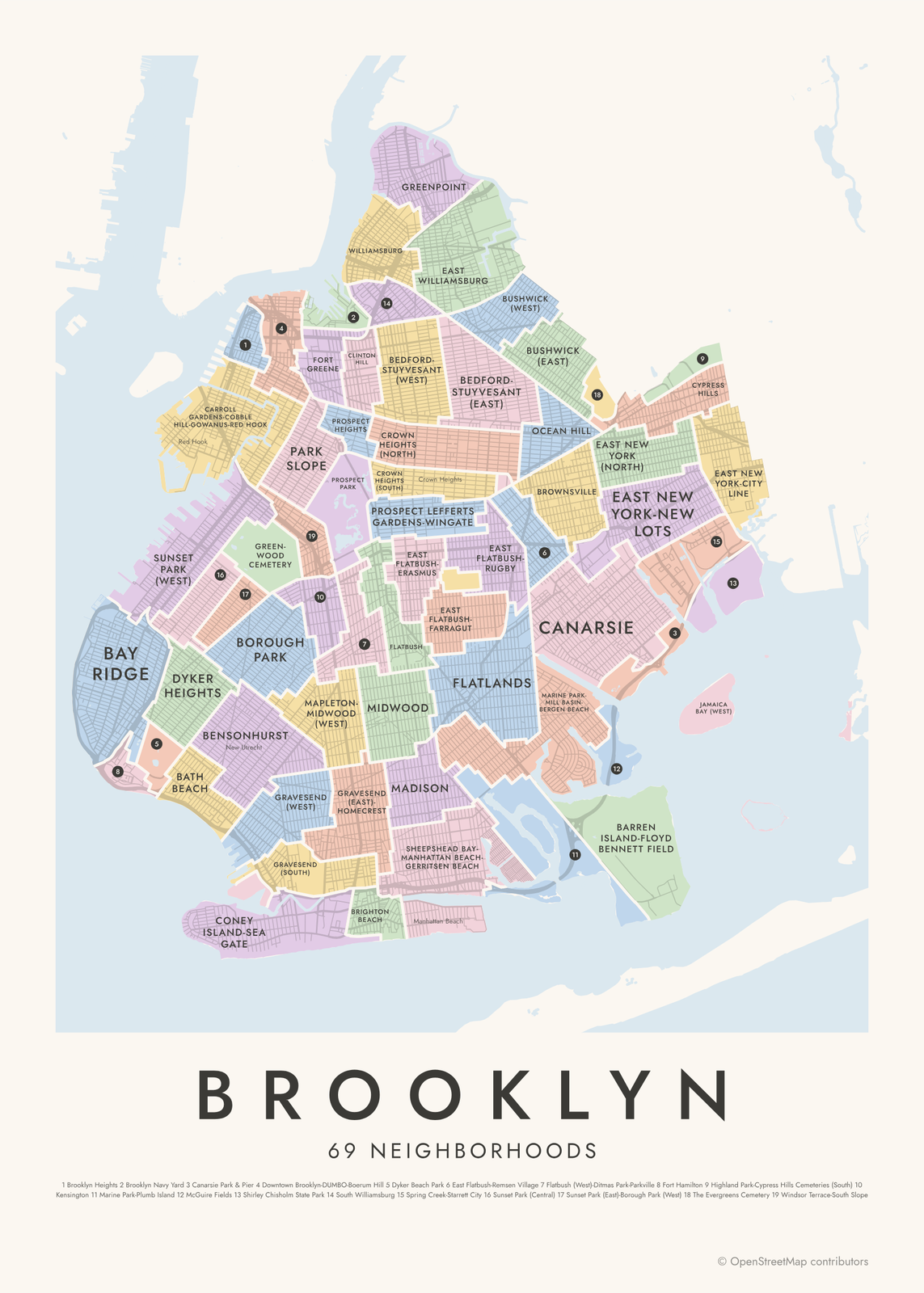
Gift ideas by occasion




Every example is made with the Posterage generators. Change anything, then download it as a 300 DPI JPEG.