Austin neighborhood map 97 neighborhood areas, all named
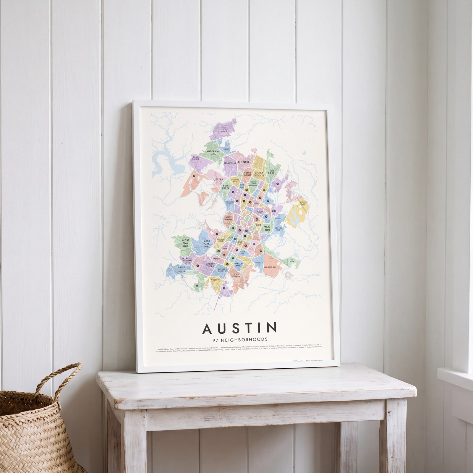
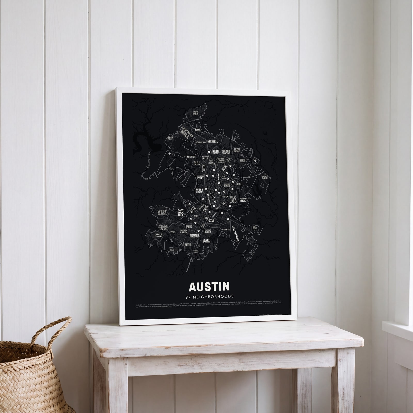
This poster maps Austin split into 97 neighborhood areas, each one named, from Hyde Park and Zilker to Mueller and Circle C South. Smaller labels add 168 local names, like Travis Heights, Clarksville and Tarrytown. Highlight the one you call home and print it.
On the wall
A few of them framed at home. Open any one to make it yours.
 Typographic Austin map: the names fill their neighborhoodsEdit this →
 Austin street map with numbered neighborhoods and their listEdit this →
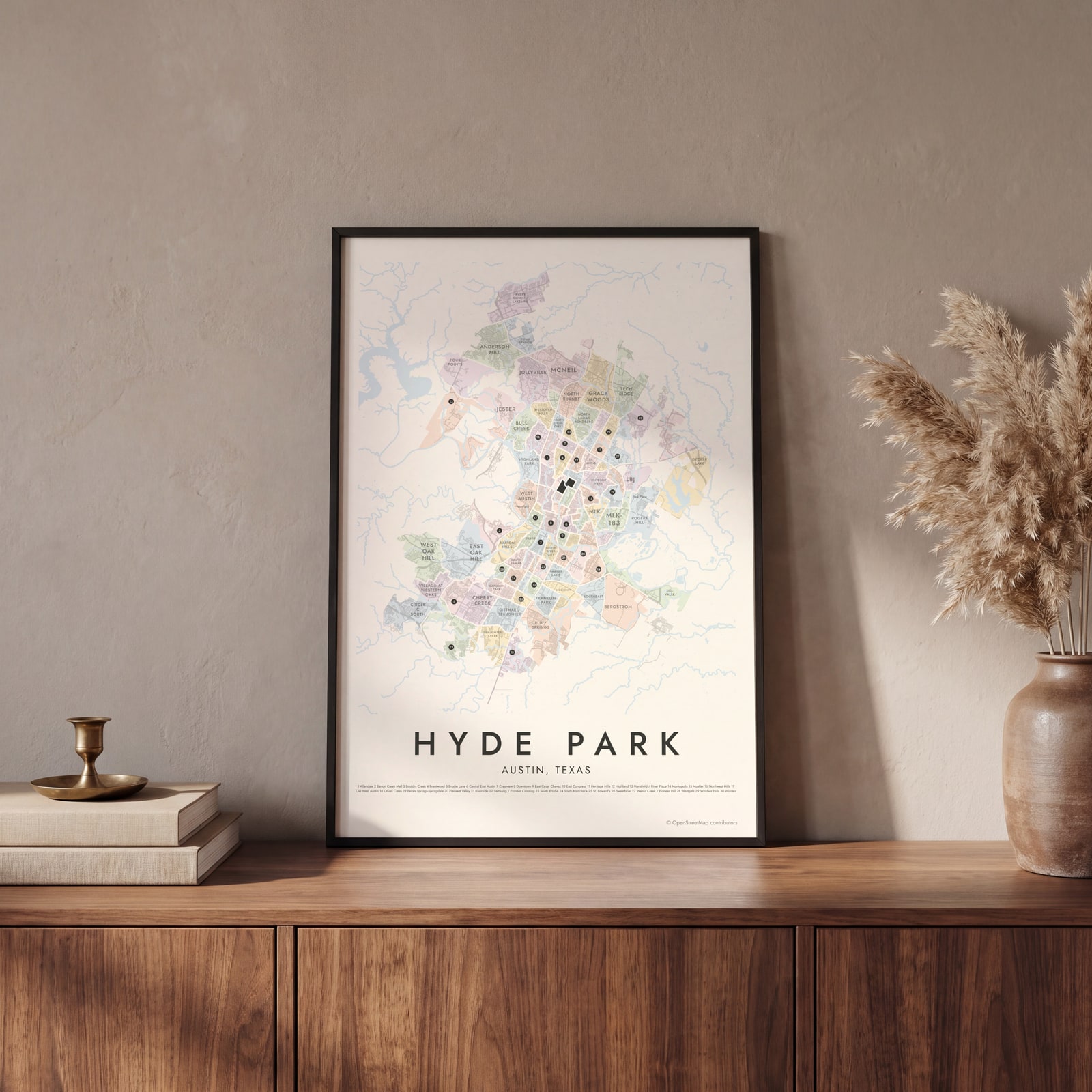 Hyde Park highlighted on a map of AustinEdit this →
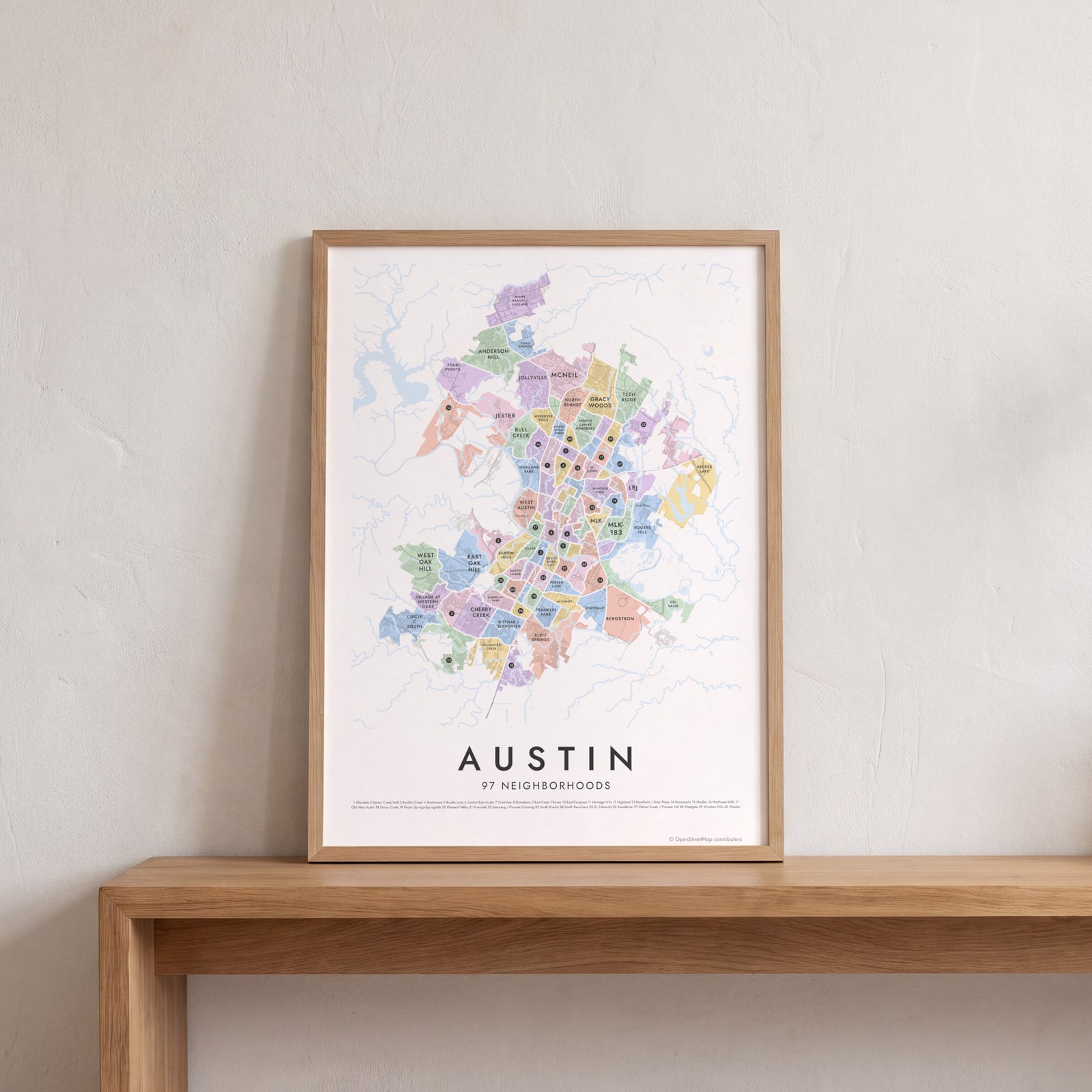 Austin neighborhood map in color, every neighborhood namedEdit this →
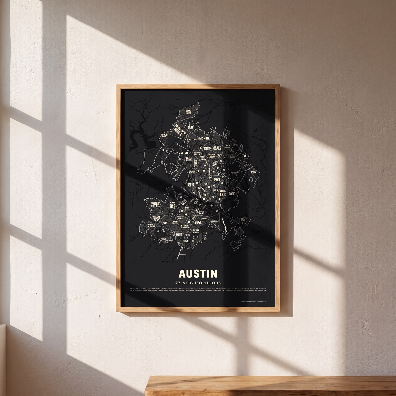 Typographic Austin map: the names fill their neighborhoodsEdit this →
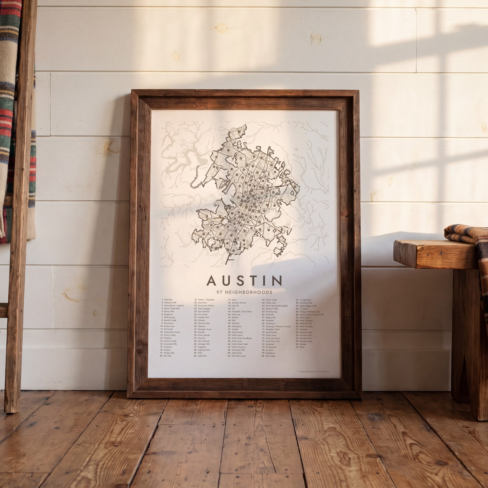
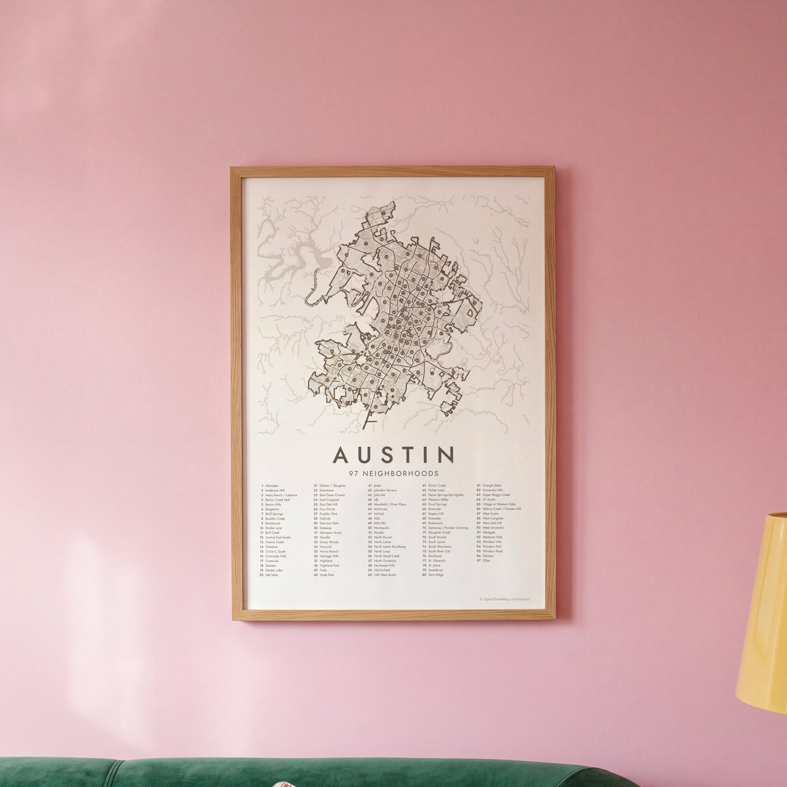 Austin street map with numbered neighborhoods and their listEdit this →
Examples
Open any of them to change the words, the place, the date and the style, then download the print file.
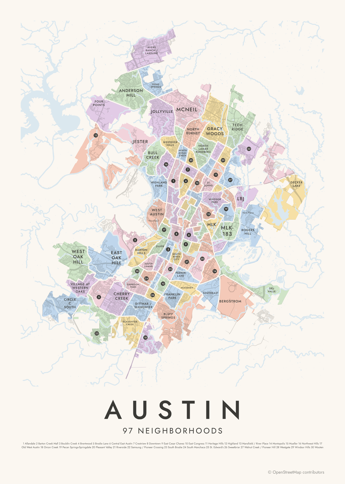 Austin neighborhood map in color, every neighborhood namedEdit this →More neighborhood maps →
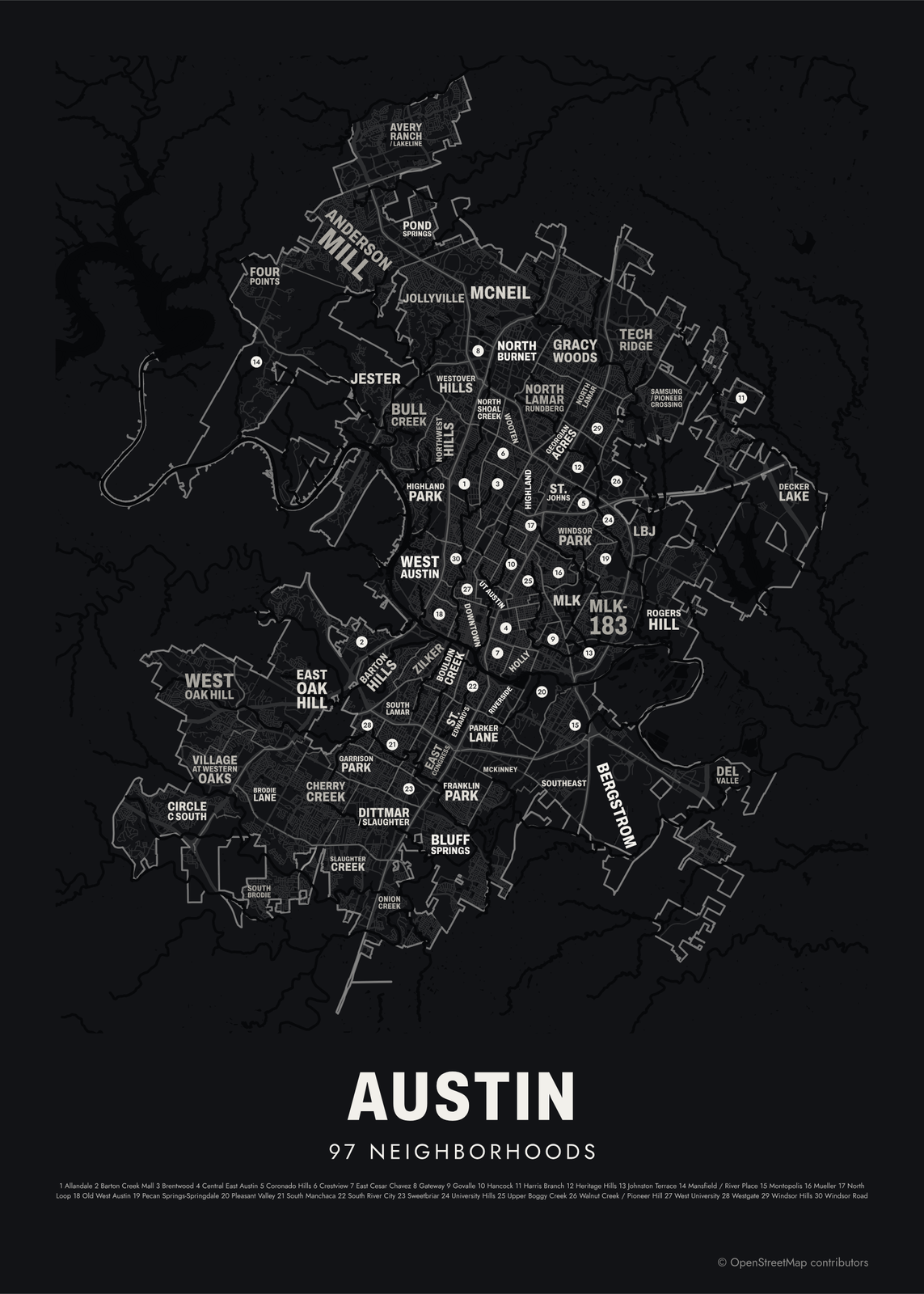 Typographic Austin map: the names fill their neighborhoodsEdit this →More neighborhood maps →
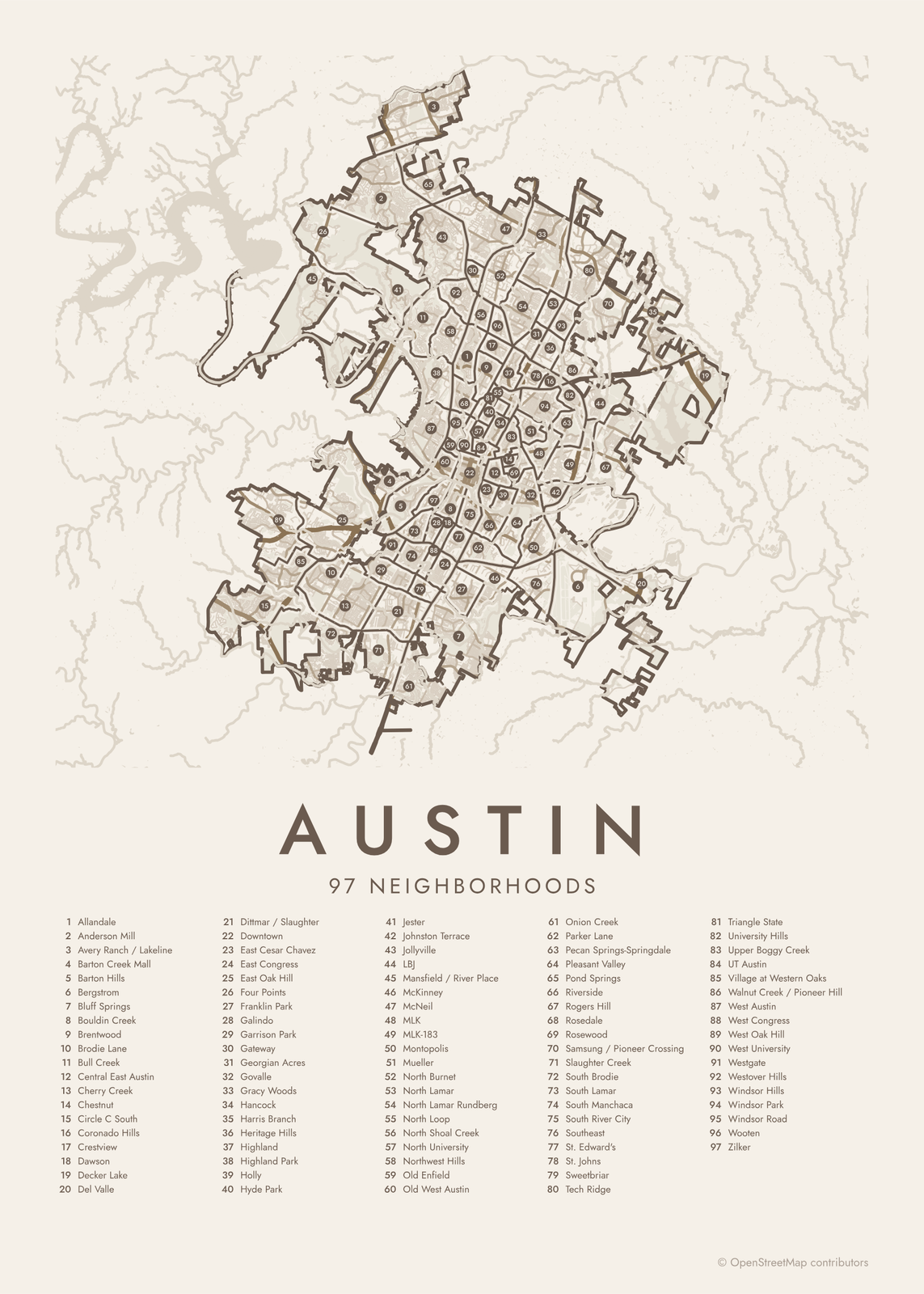 Austin street map with numbered neighborhoods and their listEdit this →More neighborhood maps →
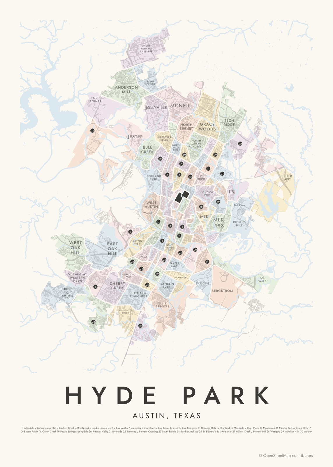 Hyde Park highlighted on a map of AustinEdit this →More neighborhood maps →
How Austin is divided
Austin has no single official neighborhood map. The areas here are the city's Neighborhood Reporting Areas, which its planners use to collect and report data. In the central city they follow the Neighborhood Planning Areas set by City Council. Farther out they're drawn along major roads and often take in several neighborhoods.
The city notes that these areas aren't meant to match neighborhood association boundaries, and Austin has hundreds of those. So the map also prints 168 local names as small labels, from Clarksville and Bryker Woods to Travis Heights and Cherrywood. A few areas are named for what's there, like UT Austin, Mueller on the old airport site, or Bergstrom, home of today's airport.
All 97 neighborhoods of Austin
- Allandale
- Anderson Mill
- Avery Ranch / Lakeline
- Barton Creek Mall
- Barton Hills
- Bergstrom
- Bluff Springs
- Bouldin Creek
- Brentwood
- Brodie Lane
- Bull Creek
- Central East Austin
- Cherry Creek
- Chestnut
- Circle C South
- Coronado Hills
- Crestview
- Dawson
- Decker Lake
- Del Valle
- Dittmar / Slaughter
- Downtown
- East Cesar Chavez
- East Congress
- East Oak Hill
- Four Points
- Franklin Park
- Galindo
- Garrison Park
- Gateway
- Georgian Acres
- Govalle
- Gracy Woods
- Hancock
- Harris Branch
- Heritage Hills
- Highland
- Highland Park
- Holly
- Hyde Park
- Jester
- Johnston Terrace
- Jollyville
- LBJ
- Mansfield / River Place
- McKinney
- McNeil
- MLK
- MLK-183
- Montopolis
- Mueller
- North Burnet
- North Lamar
- North Lamar Rundberg
- North Loop
- North Shoal Creek
- North University
- Northwest Hills
- Old Enfield
- Old West Austin
- Onion Creek
- Parker Lane
- Pecan Springs-Springdale
- Pleasant Valley
- Pond Springs
- Riverside
- Rogers Hill
- Rosedale
- Rosewood
- Samsung / Pioneer Crossing
- Slaughter Creek
- South Brodie
- South Lamar
- South Manchaca
- South River City
- Southeast
- St. Edward's
- St. Johns
- Sweetbriar
- Tech Ridge
- Triangle State
- University Hills
- Upper Boggy Creek
- UT Austin
- Village at Western Oaks
- Walnut Creek / Pioneer Hill
- West Austin
- West Congress
- West Oak Hill
- West University
- Westgate
- Westover Hills
- Windsor Hills
- Windsor Park
- Windsor Road
- Wooten
- Zilker
More neighborhood names on the map
Inside the neighborhoods, the map also names 159 smaller neighborhoods where they fit, from OpenStreetMap: Avery Ranch, River Place, Palomino Park, Woodstone Village, Tanglewood Forest, Forum, Woodland Village, Brodie Oaks, The Doke, South Bend, Banister Heights, North Cat Mountain, Cat Mountain, Pleasant Hill, Circle S Ridge, The Waters at Bluff Springs, Westfield, Barrington Oaks, Springwoods, Little Texas, Tarrytown, Placidena, Prominent Point, Hunter's Chase, Balcones Park, St. Elmo, Evergreen Heights, Spice Forest, The Bluffs of Great Hills, Adirondack, Clarksville, Highland Hills, Enfield, Indian Oaks, Bouldin, Mountain Ridge, St. Edwards, Bryker Woods, Military Heights, Leffler Commercial and more. Turn them off under Names if you want only the neighborhoods.
Neighborhoods to know
- Downtown: the Texas State Capitol at the head of Congress Avenue, with Lady Bird Lake to the south.
- UT Austin: the main campus of the University of Texas, with the UT Tower.
- Zilker: home to Zilker Park and Barton Springs Pool, fed by natural springs.
- Hyde Park: one of Austin's first suburbs, laid out in the 1890s, with the Elisabet Ney Museum.
- Clarksville: founded west of downtown in 1871 by Charles Clark, a freedman.
- South Congress: the stretch of Congress Avenue south of the river, lined with shops and restaurants.
- Mueller: a newer neighborhood built on the site of the old Robert Mueller Municipal Airport.
- Barton Hills: hilly streets along the Barton Creek Greenbelt.
How to make your Austin neighborhood poster
- Open the Austin map.
- Pick a style: Colored areas, Typographic (the names fill the map) or a Street map with the borders over the streets.
- Tap your own neighborhood to highlight it; it becomes the poster's title.
- Drag and zoom to frame the whole city or just your part of it, then pick a size and download the print file.
Questions
How many neighborhoods does Austin have?
There's no official count. The city's planners split Austin into Neighborhood Reporting Areas, and this map shows 97 of them. Hundreds of neighborhood associations use their own names, and 168 of those names appear on the map as labels.
What are Neighborhood Reporting Areas?
They're boundaries the City of Austin uses to gather and report data, a bit like census tracts with names. The names are labels for each area, not official neighborhood names, so one area can hold several neighborhoods.
Where is SoCo in Austin?
SoCo is short for South Congress, the stretch of Congress Avenue south of Lady Bird Lake. On the map it runs between the Bouldin Creek and South River City areas, with Travis Heights to the east.
Are Round Rock and Pflugerville part of Austin?
No. They're separate cities north of Austin, as are Cedar Park and Leander, so they aren't on this map.
Where do the Austin boundaries come from?
From OpenStreetMap (© OpenStreetMap contributors) and City of Austin. Streets and water are OpenStreetMap's. Boundaries are a snapshot and can differ from what neighbors call home; tell us if one looks wrong.
What sizes can I print?
US Letter, 8 × 10, 11 × 14, 12 × 16 and 12 × 18 in, A4 and A3, free. You download a 300 DPI JPEG drawn at the size you pick. Larger prints, up to 24 × 36 in, are coming soon.
Related




Gift ideas by occasion




Every example is made with the Posterage generators. Change anything, then download it as a 300 DPI JPEG.