Baltimore neighborhood map 279 neighborhoods in 55 communities
This poster maps Baltimore split into its 55 Community Statistical Areas, groups of neighborhoods like Fells Point or Medfield/Hampden/Woodberry/Remington, each one named. Switch to the finer level for all 279 neighborhoods on the city's planning map, from Abell to York-Homeland. Highlight the one you call home and print it.
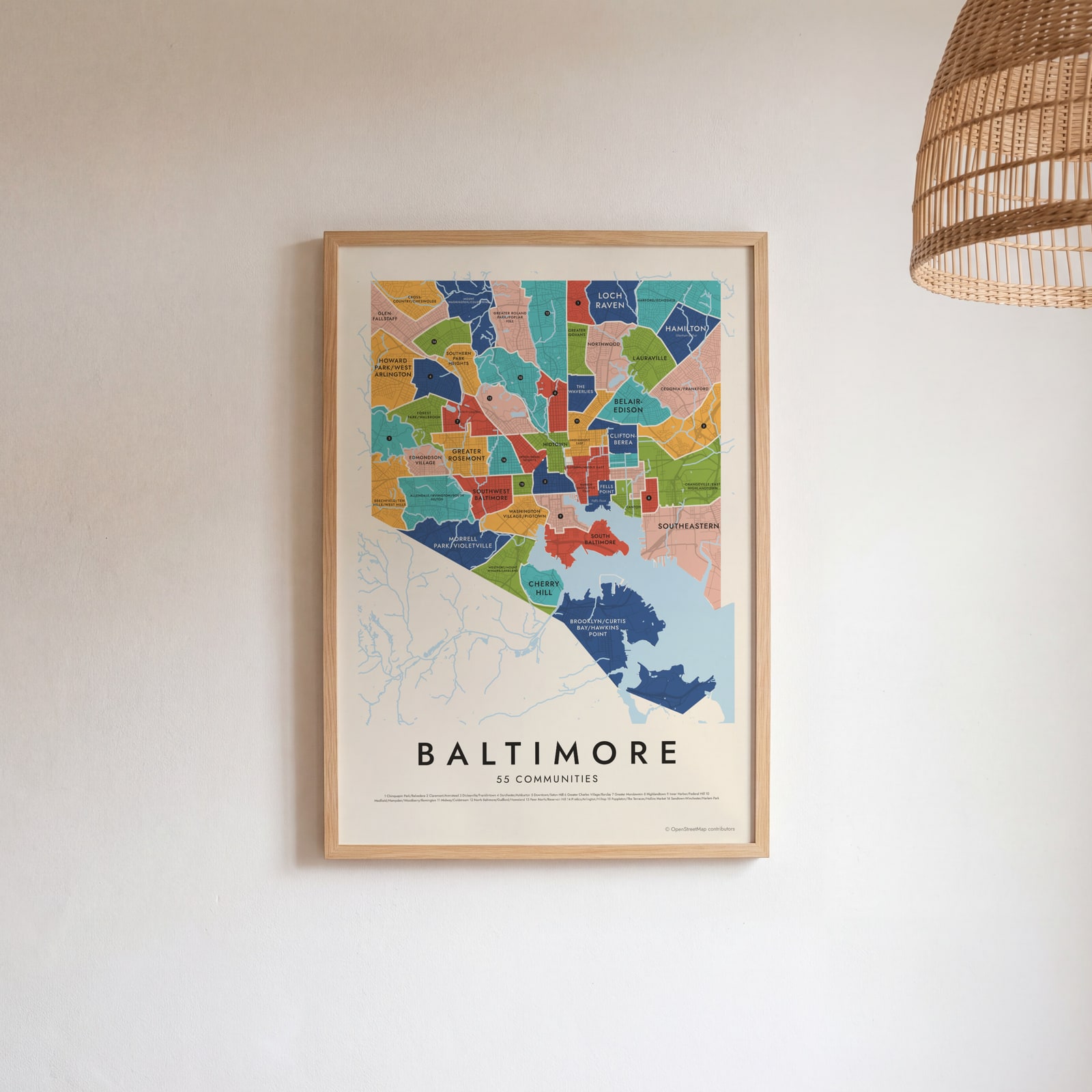
On the wall
A few of them framed at home. Open any one to make it yours.
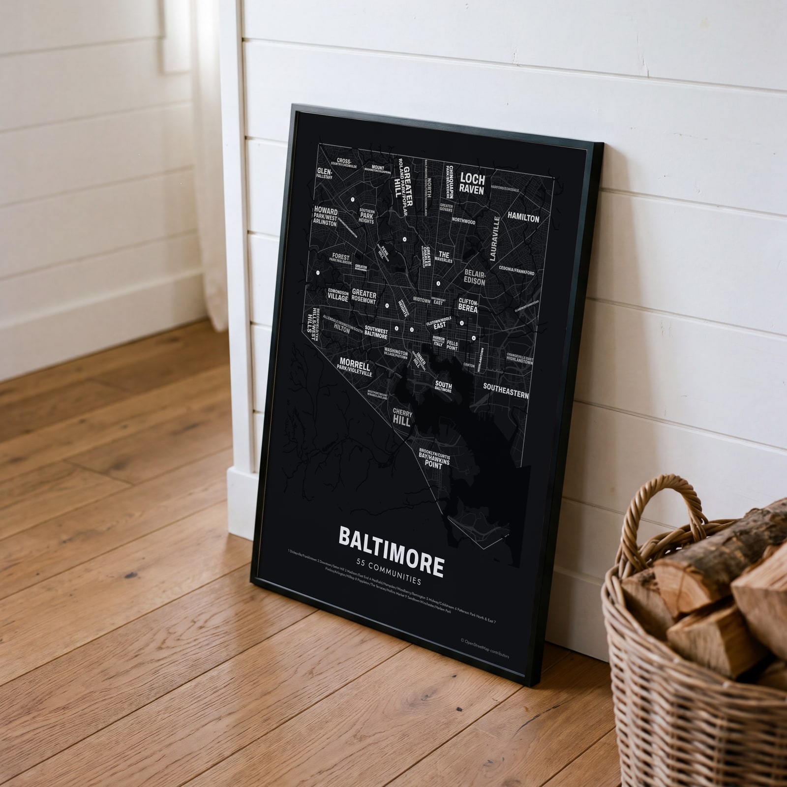 Typographic Baltimore map: the names fill their communitiesEdit this →
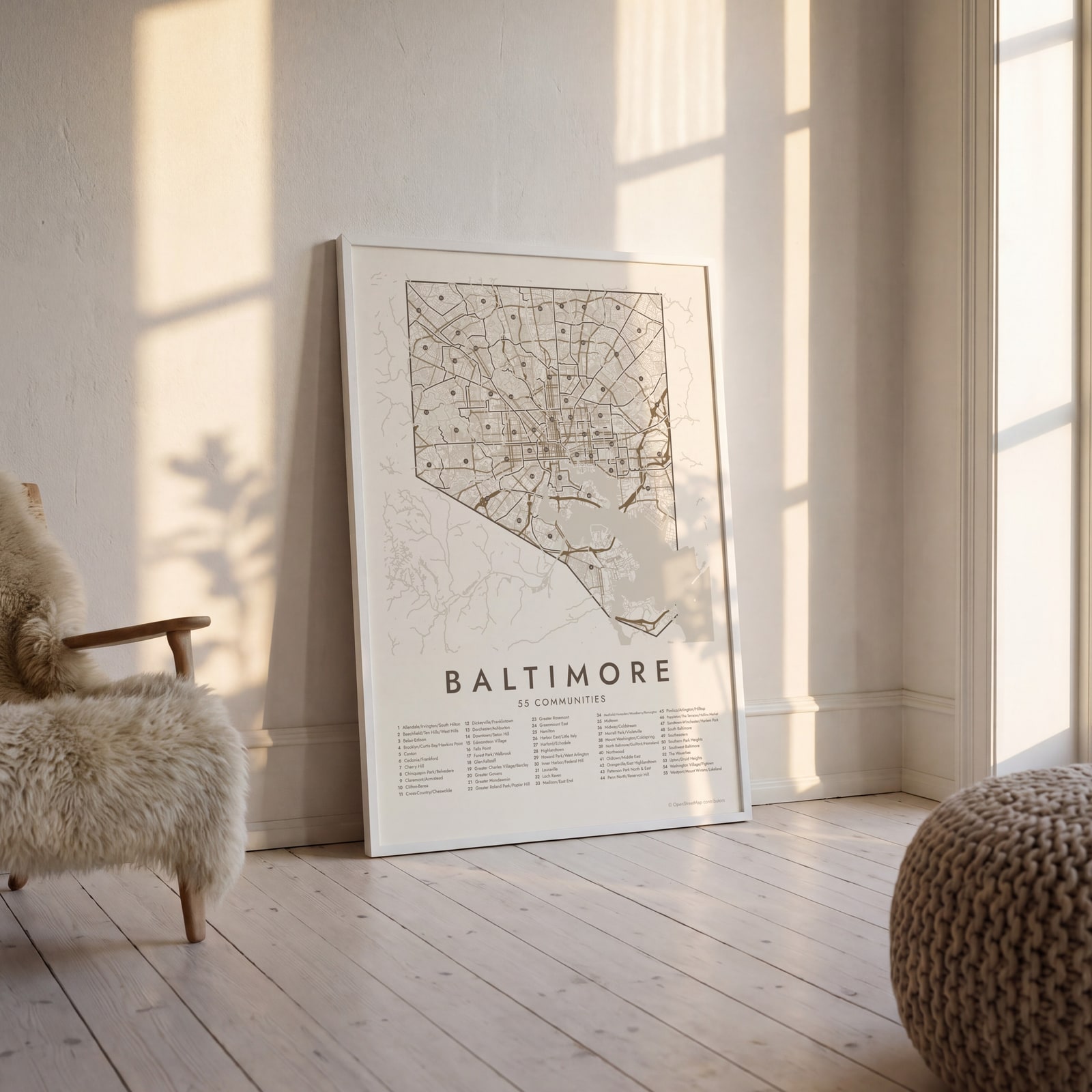 Baltimore street map with numbered communities and their listEdit this →
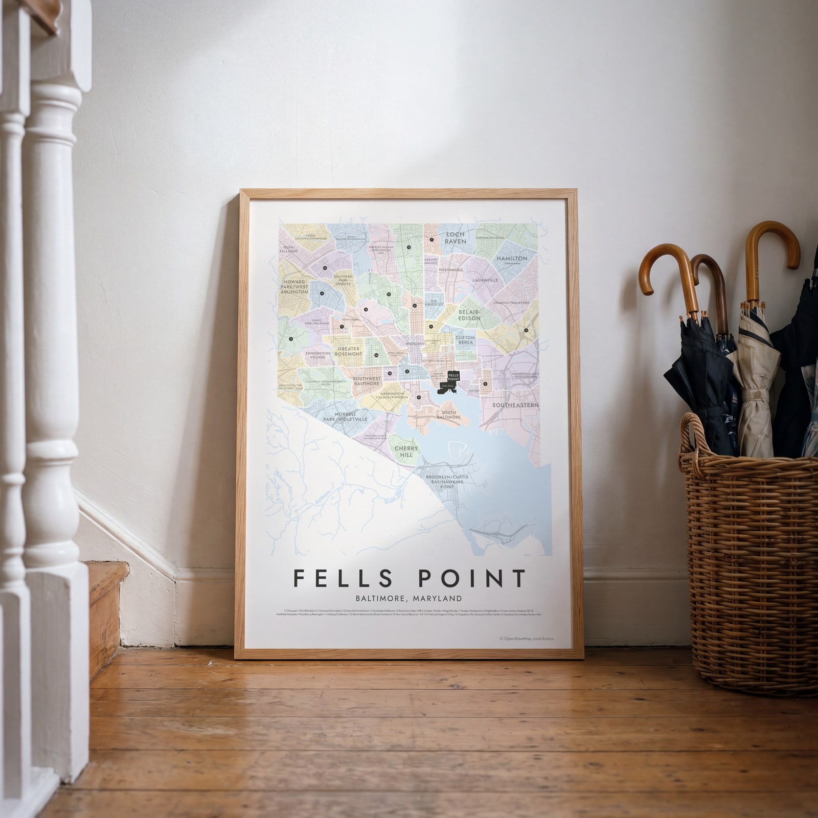 Fells Point highlighted on a map of BaltimoreEdit this →
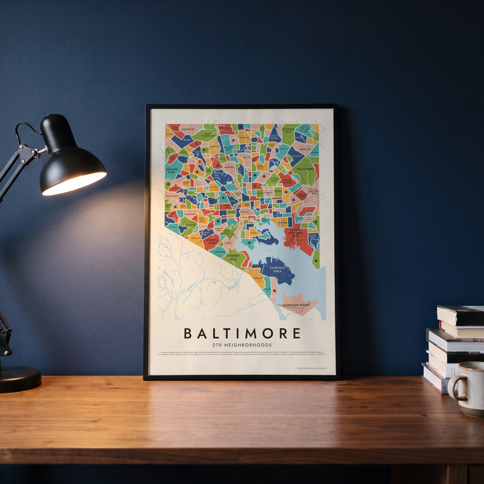 Baltimore's 279 neighborhoods in colorEdit this →
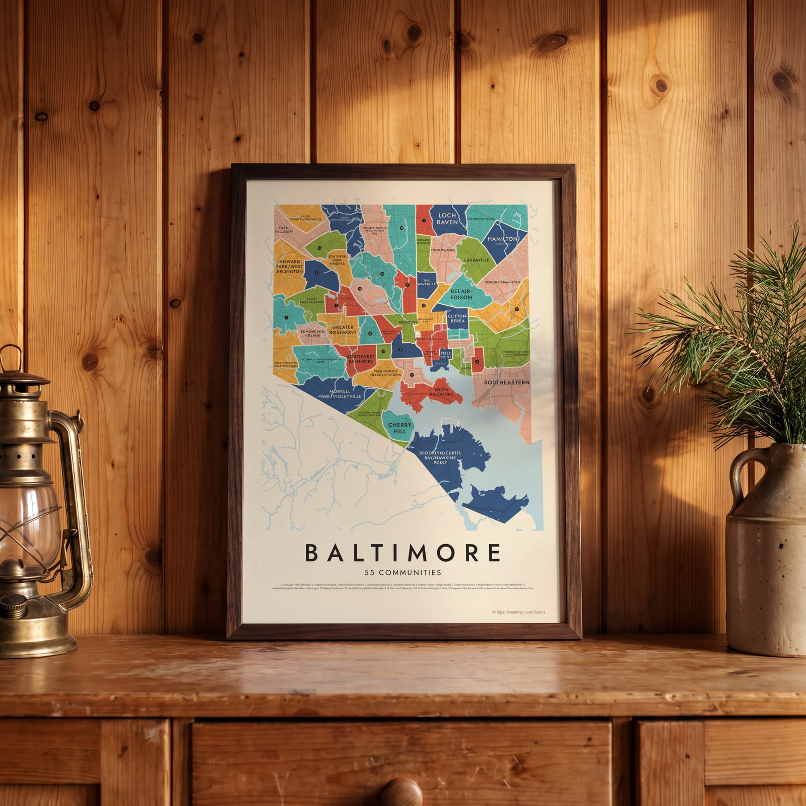 Baltimore neighborhood map in color, every community namedEdit this →
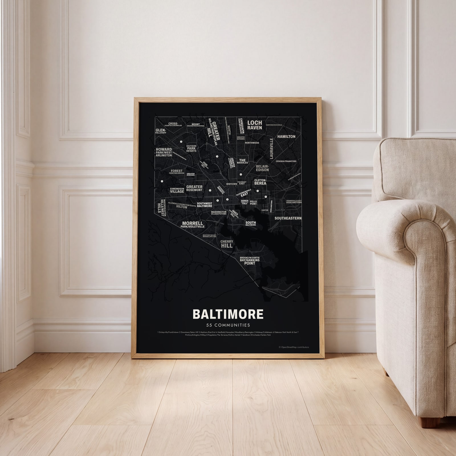 Typographic Baltimore map: the names fill their communitiesEdit this →
Examples
Open any of them to change the words, the place, the date and the style, then download the print file.
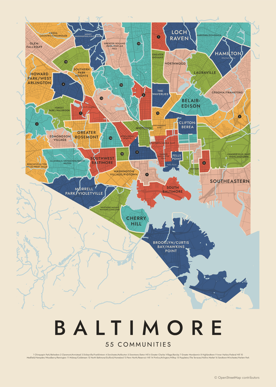 Baltimore neighborhood map in color, every community namedEdit this →More neighborhood maps →
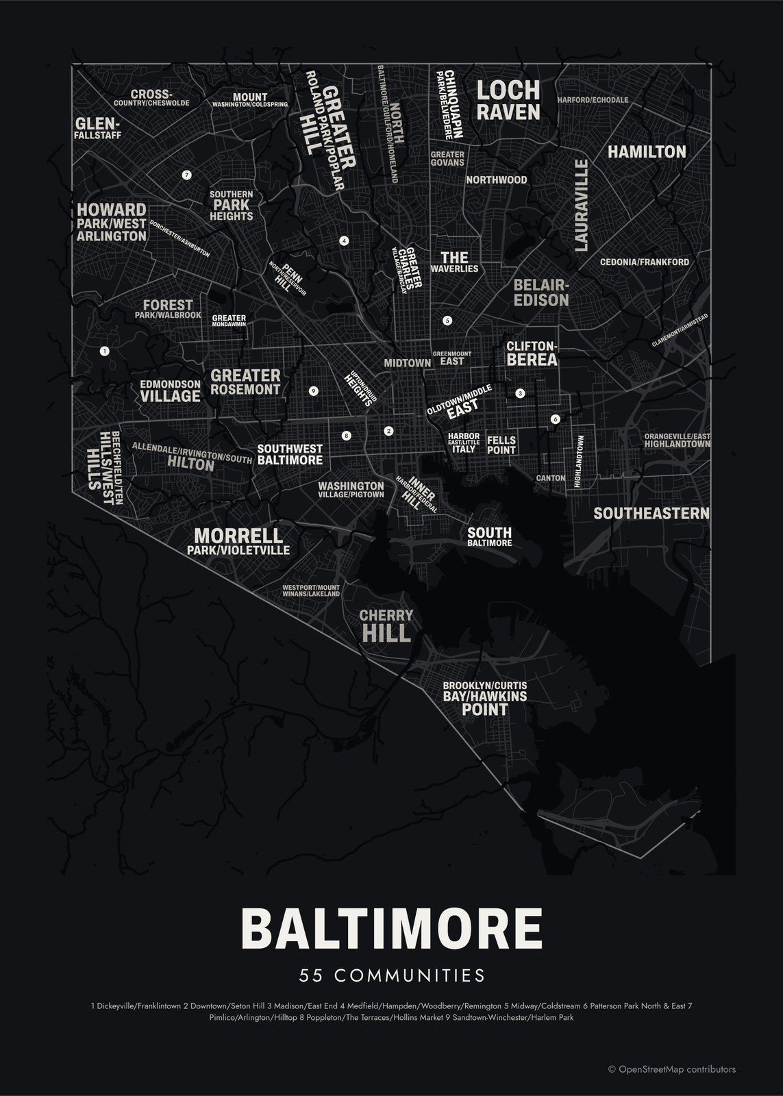 Typographic Baltimore map: the names fill their communitiesEdit this →More neighborhood maps →
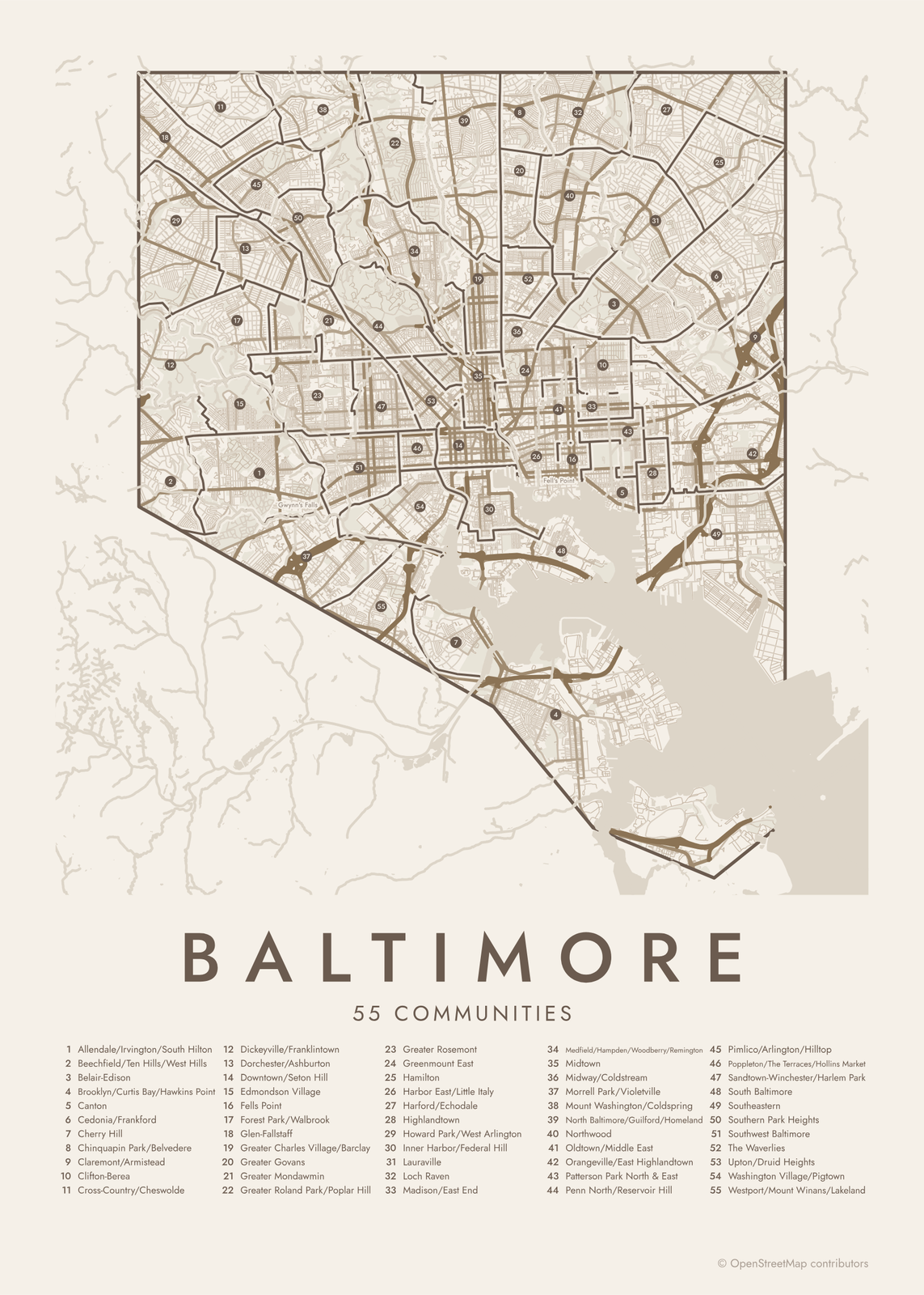 Baltimore street map with numbered communities and their listEdit this →More neighborhood maps →
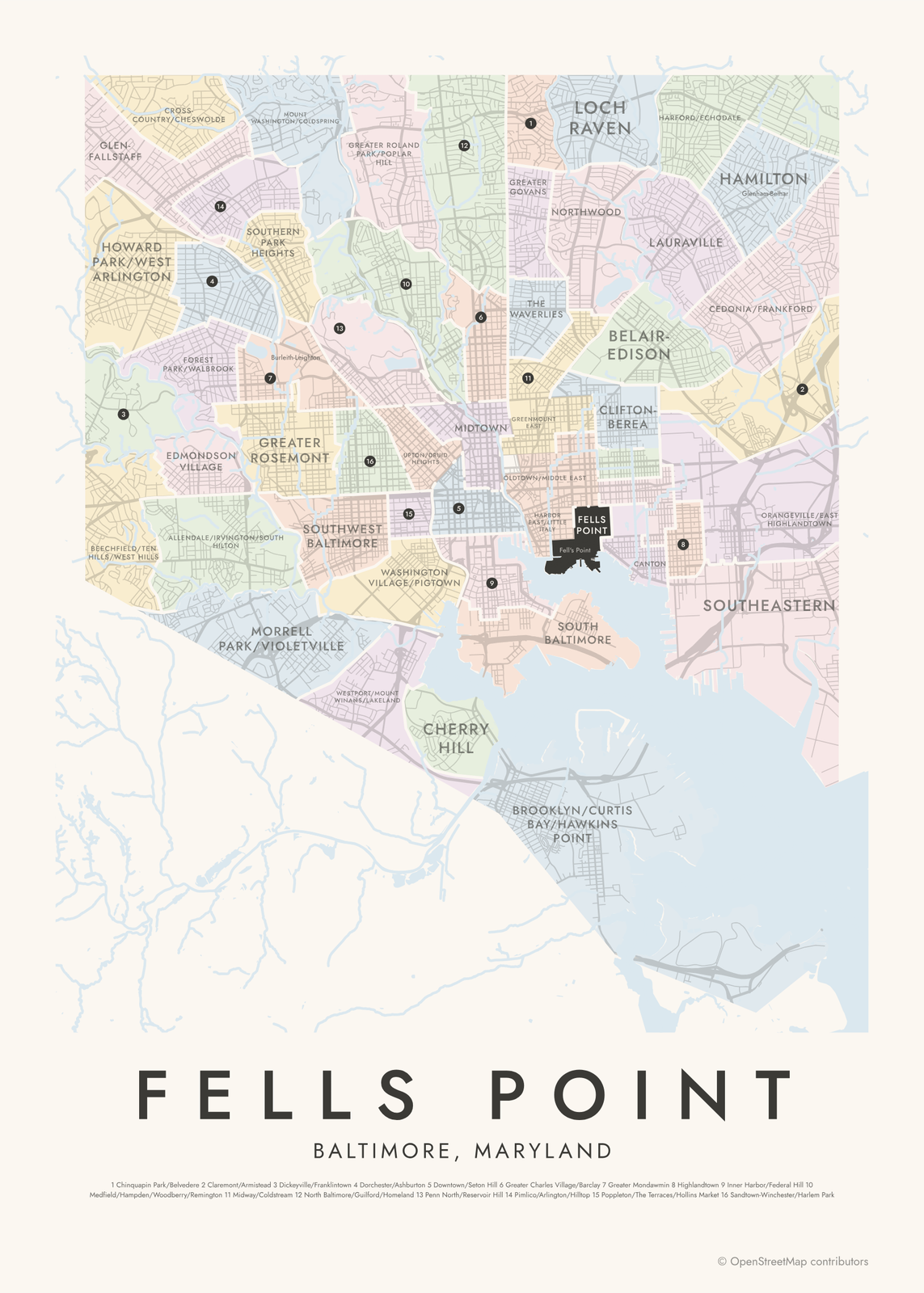 Fells Point highlighted on a map of BaltimoreEdit this →More neighborhood maps →
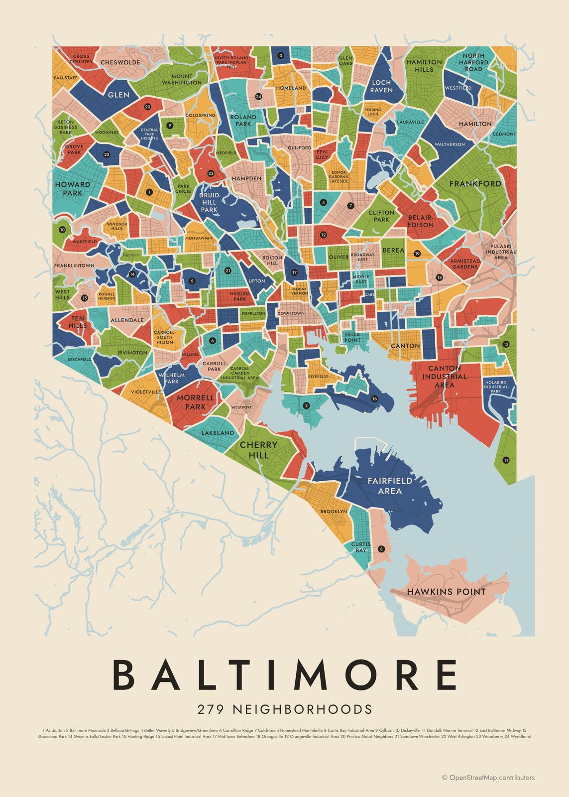 Baltimore's 279 neighborhoods in colorEdit this →More neighborhood maps →
How Baltimore is divided
The finer level shows the neighborhood boundaries kept by Baltimore's Department of Planning: 279 areas, from large ones like Roland Park to a few blocks like Barre Circle. Some aren't neighborhoods people live in but parks, campuses or industrial land, such as Druid Hill Park, Johns Hopkins Homewood and Dundalk Marine Terminal.
The first level groups those neighborhoods into 55 Community Statistical Areas. They follow census tract lines, so city data can be compared over time, and the Baltimore Neighborhood Indicators Alliance publishes its Vital Signs reports by them. Their names join the main neighborhoods inside, which is why many have slashes, like Allendale/Irvington/South Hilton. The map also adds 22 local names as labels, like Chinatown, Port Covington and Sowebo.
All 55 communities of Baltimore
- Allendale/Irvington/South Hilton
- Beechfield/Ten Hills/West Hills
- Belair-Edison
- Brooklyn/Curtis Bay/Hawkins Point
- Canton
- Cedonia/Frankford
- Cherry Hill
- Chinquapin Park/Belvedere
- Claremont/Armistead
- Clifton-Berea
- Cross-Country/Cheswolde
- Dickeyville/Franklintown
- Dorchester/Ashburton
- Downtown/Seton Hill
- Edmondson Village
- Fells Point
- Forest Park/Walbrook
- Glen-Fallstaff
- Greater Charles Village/Barclay
- Greater Govans
- Greater Mondawmin
- Greater Roland Park/Poplar Hill
- Greater Rosemont
- Greenmount East
- Hamilton
- Harbor East/Little Italy
- Harford/Echodale
- Highlandtown
- Howard Park/West Arlington
- Inner Harbor/Federal Hill
- Lauraville
- Loch Raven
- Madison/East End
- Medfield/Hampden/Woodberry/Remington
- Midtown
- Midway/Coldstream
- Morrell Park/Violetville
- Mount Washington/Coldspring
- North Baltimore/Guilford/Homeland
- Northwood
- Oldtown/Middle East
- Orangeville/East Highlandtown
- Patterson Park North & East
- Penn North/Reservoir Hill
- Pimlico/Arlington/Hilltop
- Poppleton/The Terraces/Hollins Market
- Sandtown-Winchester/Harlem Park
- South Baltimore
- Southeastern
- Southern Park Heights
- Southwest Baltimore
- The Waverlies
- Upton/Druid Heights
- Washington Village/Pigtown
- Westport/Mount Winans/Lakeland
All 279 neighborhoods of Baltimore
- Abell
- Allendale
- Arcadia
- Arlington
- Armistead Gardens
- Ashburton
- Auchentoroly-Parkwood
- Baltimore Highlands
- Baltimore Peninsula
- Barclay
- Barre Circle
- Bayview
- Beechfield
- Belair-Edison
- Belair-Parkside
- Bellona-Gittings
- Belvedere
- Berea
- Better Waverly
- Beverly Hills
- Biddle Street
- Blythewood
- Bolton Hill
- Boyd-Booth
- Brewers Hill
- Bridgeview/Greenlawn
- Broadway East
- Broening Manor
- Brooklyn
- Butchers Hill
- Callaway-Garrison
- Cameron Village
- Canton
- Canton Industrial Area
- Care
- Carroll - Camden Industrial Area
- Carroll Park
- Carroll-South Hilton
- Carrollton Ridge
- Cedarcroft
- Cedmont
- Cedonia
- Central Forest Park
- Central Park Heights
- Charles North
- Charles Village
- Cherry Hill
- Cheswolde
- Chinquapin Park
- Clifton Park
- Coldspring
- Coldstream Homestead Montebello
- Concerned Citizens of Forest Park
- Coppin Heights/Ash-Co-East
- Cross Country
- Cross Keys
- Curtis Bay
- Curtis Bay Industrial Area
- Cylburn
- Darley Park
- Dickeyville
- Dolfield
- Dorchester
- Downtown
- Downtown West
- Druid Heights
- Druid Hill Park
- Dunbar-Broadway
- Dundalk Marine Terminal
- East Arlington
- East Baltimore Midway
- Easterwood
- Eastwood
- Edgewood
- Edmondson Village
- Ednor Gardens-Lakeside
- Ellwood Park/Monument
- Evergreen
- Evergreen Lawn
- Evesham Park
- Fairfield Area
- Fairmount
- Fallstaff
- Federal Hill
- Fells Point
- Forest Park
- Forest Park Golf Course
- Four By Four
- Frankford
- Franklin Square
- Franklintown
- Franklintown Road
- Garwyn Oaks
- Gay Street
- Glen
- Glen Oaks
- Graceland Park
- Greektown
- Greenmount Cemetery
- Greenmount West
- Greenspring
- Grove Park
- Guilford
- Gwynns Falls
- Gwynns Falls/Leakin Park
- Hamilton
- Hamilton Hills
- Hampden
- Hanlon-Longwood
- Harbor East
- Harbor Point
- Harlem Park
- Harwood
- Hawkins Point
- Heritage Crossing
- Herring Run Park
- Highlandtown
- Hillen
- Hoes Heights
- Holabird Industrial Park
- Hollins Market
- Homeland
- Hopkins Bayview
- Howard Park
- Hunting Ridge
- Idlewood
- Inner Harbor
- Irvington
- Johns Hopkins Homewood
- Johnston Square
- Jones Falls Area
- Jonestown
- Kenilworth Park
- Kernewood
- Keswick
- Key Highway
- Kresson
- Lake Evesham
- Lake Walker
- Lakeland
- Langston Hughes
- Lauraville
- Levindale
- Liberty Square
- Little Italy
- Loch Raven
- Locust Point
- Locust Point Industrial Area
- Lower Herring Run Park
- Loyola/Notre Dame
- Lucille Park
- Madison Park
- Madison-Eastend
- Mayfield
- McElderry Park
- Medfield
- Medford
- Mid-Govans
- Mid-Town Belvedere
- Middle Branch/Reedbird Parks
- Middle East
- Midtown-Edmondson
- Millhill
- Milton-Montford
- Mondawmin
- Montebello
- Moravia-Walther
- Morgan Park
- Morgan State University
- Morrell Park
- Mosher
- Mount Clare
- Mount Holly
- Mount Vernon
- Mount Washington
- Mount Winans
- Mt Pleasant Park
- New Northwood
- North Harford Road
- North Roland Park/Poplar Hill
- Northwest Community Action
- O'Donnell Heights
- Oakenshawe
- Oaklee
- Old Goucher
- Oldtown
- Oliver
- Orangeville
- Orangeville Industrial Area
- Orchard Ridge
- Original Northwood
- Otterbein
- Overlea
- Panway/Braddish Avenue
- Park Circle
- Parklane
- Parkside
- Parkway
- Patterson Park
- Patterson Park Neighborhood
- Patterson Place
- Pen Lucy
- Penn North
- Penn-Fallsway
- Penrose/Fayette Street Outreach
- Perkins
- Perring Loch
- Pimlico Good Neighbors
- Pleasant View Gardens
- Poppleton
- Pulaski Industrial Area
- Purnell
- Radnor-Winston
- Ramblewood
- Reisterstown Station
- Remington
- Reservoir Hill
- Richnor Springs
- Ridgely's Delight
- Riverside
- Rognel Heights
- Roland Park
- Rosebank
- Rosemont
- Rosemont East
- Rosemont Homeowners/Tenants
- Sabina-Mattfeldt
- Saint Agnes
- Saint Helena
- Saint Josephs
- Saint Paul
- Sandtown-Winchester
- Seton Business Park
- Seton Hill
- Sharp-Leadenhall
- Shipley Hill
- South Baltimore
- South Clifton Park
- Spring Garden Industrial Area
- Stadium/Entertainment Area
- Stonewood-Pentwood-Winston
- Taylor Heights
- Ten Hills
- The Orchards
- Towanda-Grantley
- Tremont
- Tuscany-Canterbury
- Union Square
- University of Maryland
- Uplands
- Upper Fells Point
- Upton
- Villages of Homeland
- Violetville
- Wakefield
- Walbrook
- Waltherson
- Washington Hill
- Washington Village/Pigtown
- Waverly
- West Arlington
- West Forest Park
- West Hills
- Westfield
- Westgate
- Westport
- Wilhelm Park
- Wilson Park
- Winchester
- Windsor Hills
- Winston-Govans
- Woodberry
- Woodbourne Heights
- Woodbourne-McCabe
- Woodmere
- Wyman Park
- Wyndhurst
- Yale Heights
- York-Homeland
More neighborhood names on the map
Inside the communities, the map also names 22 smaller neighborhoods where they fit, from OpenStreetMap: Park Heights, Sowebo, Greater Roland Park, Fairmont, Lower Edmondson Village, Gwynn's Falls, Burleith-Leighton, Milhill, Midtown-Edmonson, Parkview/Woodbrook, Auchentoroly Terrace, New Southwest/Mount Clare, Hoe's Heights, Chinatown, Port Covington, Wrenlane, Old Town, Coldstream-Homestead-Montebello, Perkins Homes, Fell's Point, Upper Fell's Point, Glenham-Belhar. Turn them off under Names if you want only the communities.
Neighborhoods to know
- Fells Point: a waterfront port from the 1700s, with cobblestone streets and brick rowhouses.
- Inner Harbor: the downtown waterfront, with the National Aquarium and the USS Constellation.
- Mount Vernon: built around Baltimore's Washington Monument, with the Walters Art Museum and the Peabody Institute.
- Hampden: a former mill village along the Jones Falls, with shops on 36th Street.
- Roland Park: an early planned suburb from the 1890s, with later sections laid out by the Olmsted Brothers.
- Locust Point: a peninsula neighborhood that ends at Fort McHenry, where the 1814 battle inspired the Star-Spangled Banner.
- Druid Hill Park: a large city park with the Maryland Zoo and the Rawlings Conservatory.
- Canton: rowhouses around O'Donnell Square and a waterfront of old industrial buildings turned into homes and offices.
How to make your Baltimore neighborhood poster
- Open the Baltimore map and pick communities or neighborhoods.
- Pick a style: Colored areas, Typographic (the names fill the map) or a Street map with the borders over the streets.
- Tap your own neighborhood to highlight it; it becomes the poster's title.
- Drag and zoom to frame the whole city or just your part of it, then pick a size and download the print file.
Questions
How many neighborhoods does Baltimore have?
The Department of Planning's map has 279, and that's the number on this poster. Some of those are parks, campuses or industrial areas rather than places people live, so you'll see other counts quoted. The city also groups them into 55 Community Statistical Areas.
What is a Community Statistical Area?
A cluster of neighborhoods drawn along census tract lines, so data can be compared from one census to the next. Baltimore has 55. They're used in reports like the Baltimore Neighborhood Indicators Alliance's Vital Signs and the Health Department's neighborhood profiles.
Is Baltimore City part of Baltimore County?
No. Baltimore has been an independent city, separate from Baltimore County, since 1851. Places like Towson, Catonsville and Pikesville are in the county, so they aren't on this map.
Where do the Baltimore boundaries come from?
From OpenStreetMap (© OpenStreetMap contributors) and Baltimore Neighborhood Indicators Alliance (BNIA-JFI) and City of Baltimore. Streets and water are OpenStreetMap's. Boundaries are a snapshot and can differ from what neighbors call home; tell us if one looks wrong.
What sizes can I print?
US Letter, 8 × 10, 11 × 14, 12 × 16 and 12 × 18 in, A4 and A3, free. You download a 300 DPI JPEG drawn at the size you pick. Larger prints, up to 24 × 36 in, are coming soon.
Related




Gift ideas by occasion




Every example is made with the Posterage generators. Change anything, then download it as a 300 DPI JPEG.