Boston neighborhood map 26 neighborhoods, named
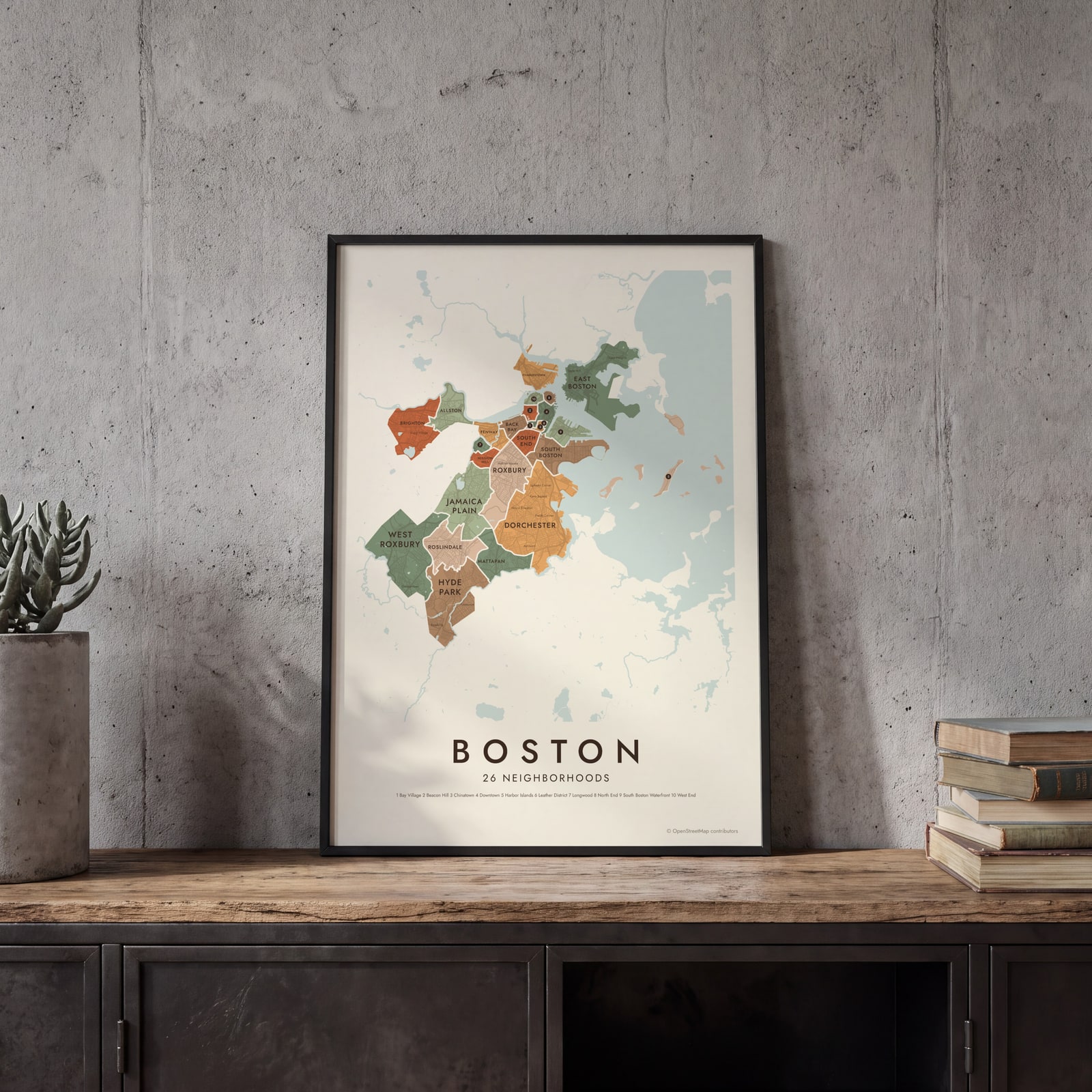
This poster maps Boston in 26 named neighborhoods, from East Boston and Charlestown to Hyde Park and the Harbor Islands. Smaller squares and villages, like Savin Hill, Oak Square and Jeffries Point, appear as labels. Highlight yours and print it.
On the wall
A few of them framed at home. Open any one to make it yours.
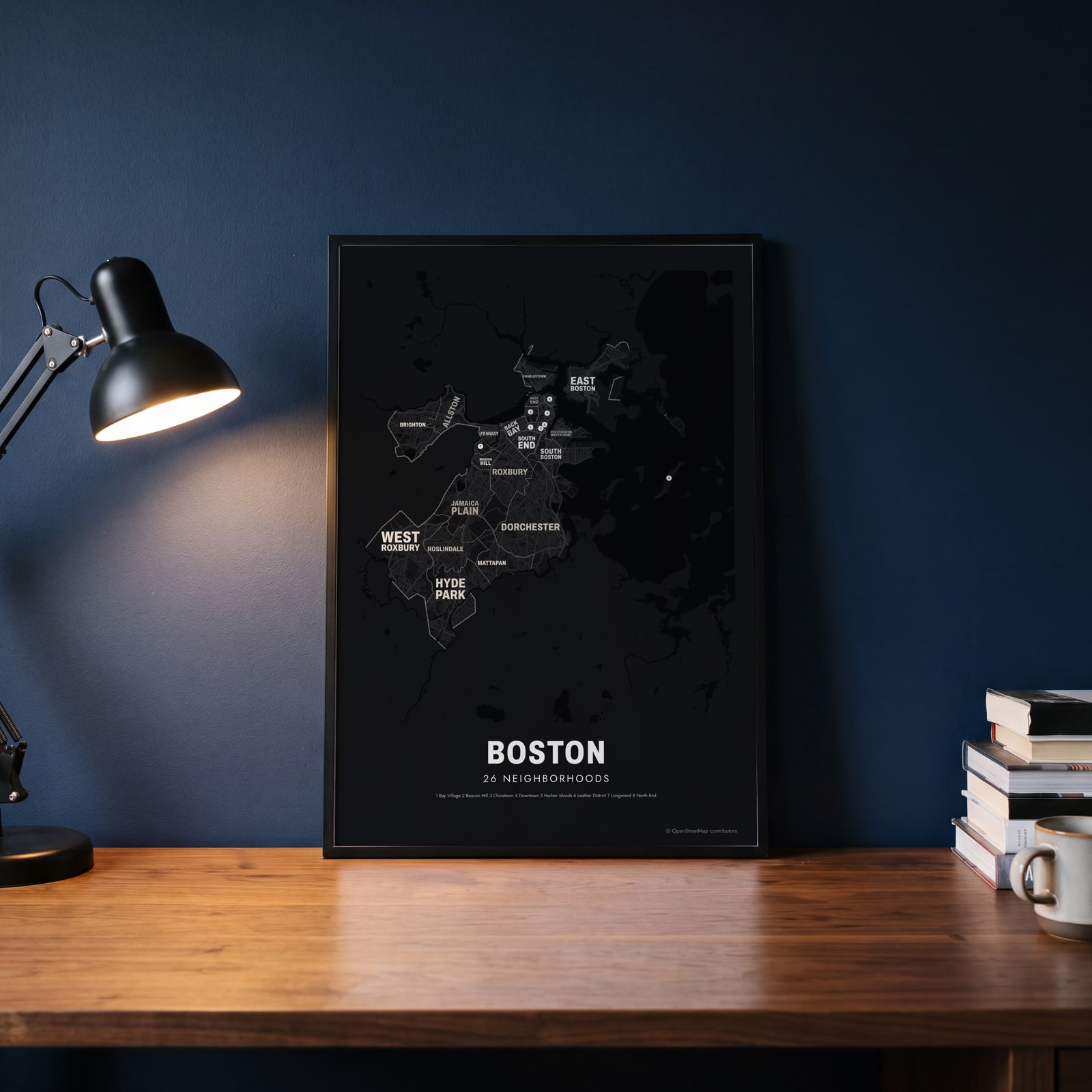 Typographic Boston map: the names fill their neighborhoodsEdit this →
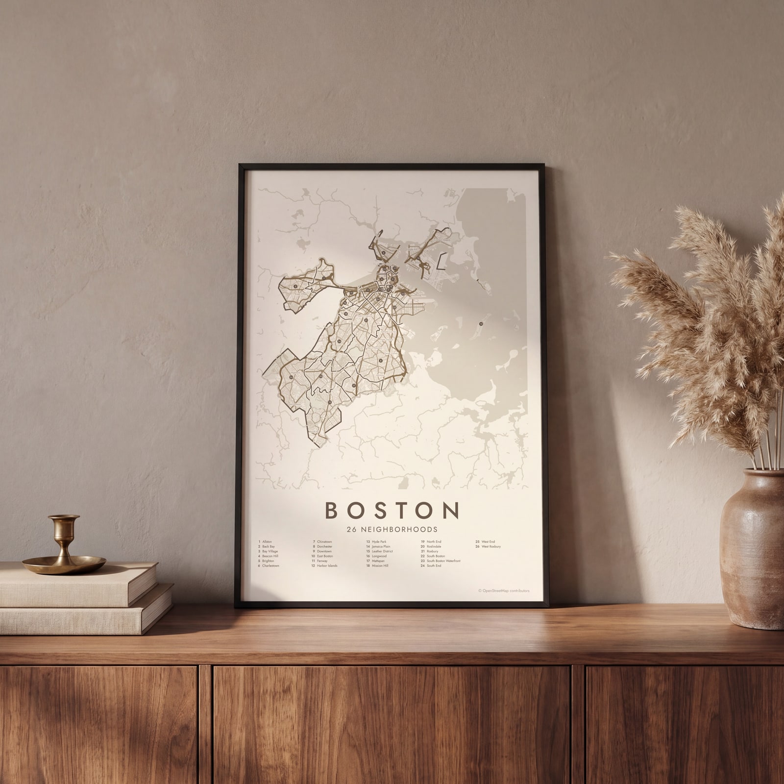 Boston street map with numbered neighborhoods and their listEdit this →
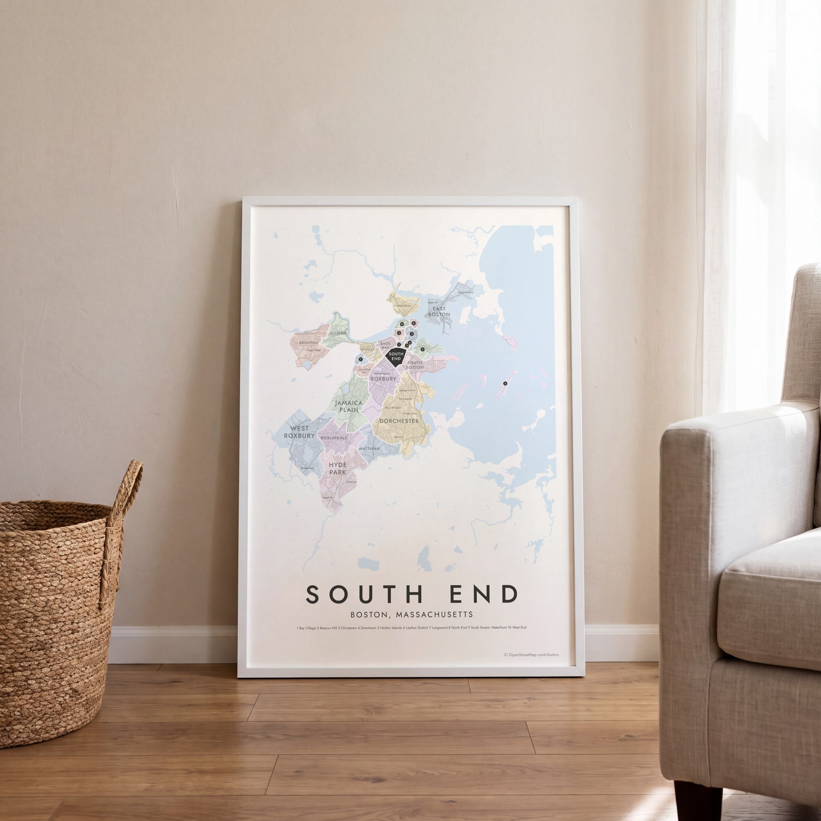 South End highlighted on a map of BostonEdit this →
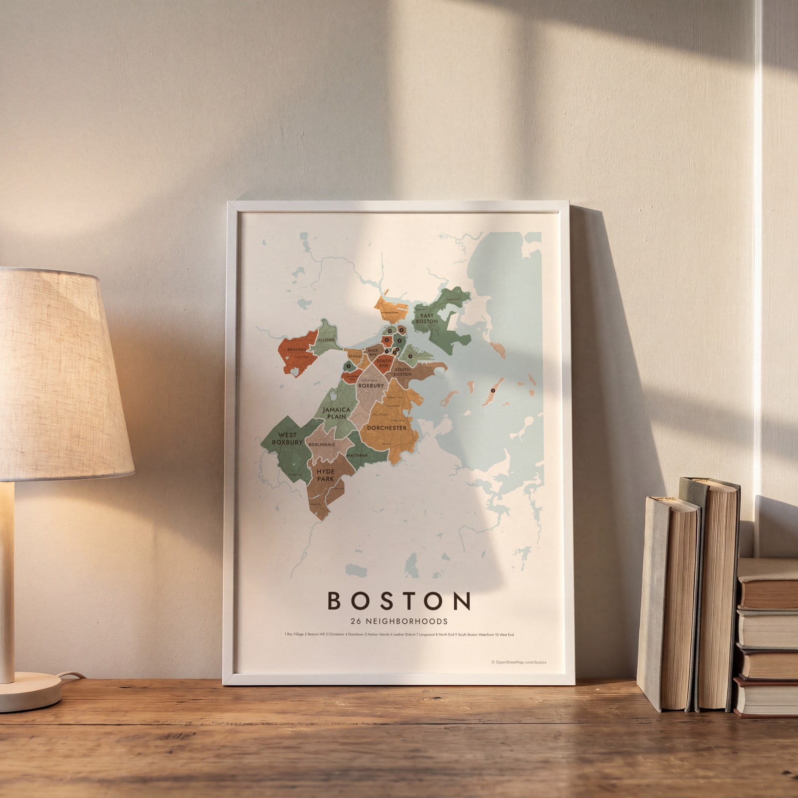 Boston neighborhood map in color, every neighborhood namedEdit this →
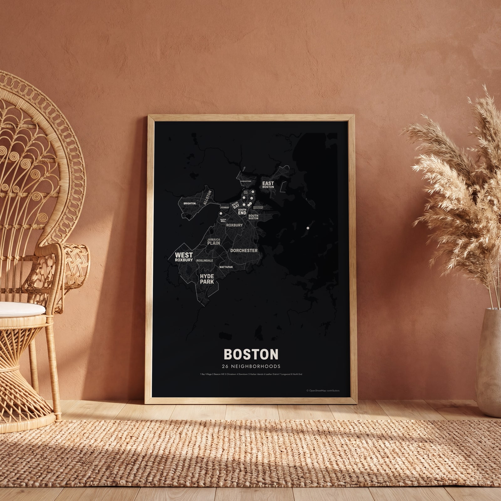 Typographic Boston map: the names fill their neighborhoodsEdit this →
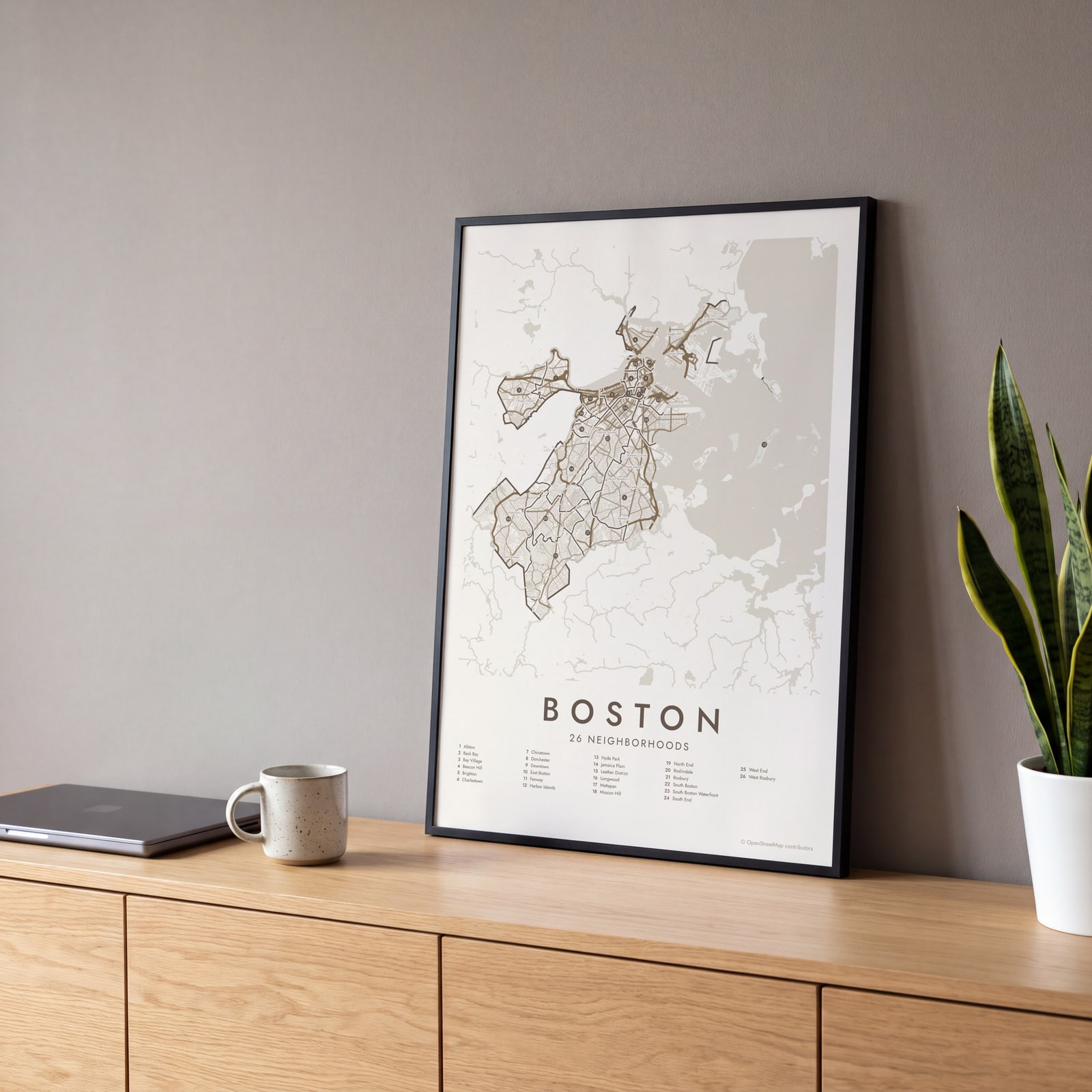 Boston street map with numbered neighborhoods and their listEdit this →
Examples
Open any of them to change the words, the place, the date and the style, then download the print file.
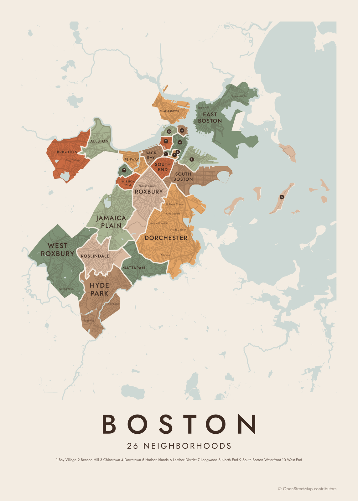 Boston neighborhood map in color, every neighborhood namedEdit this →More neighborhood maps →
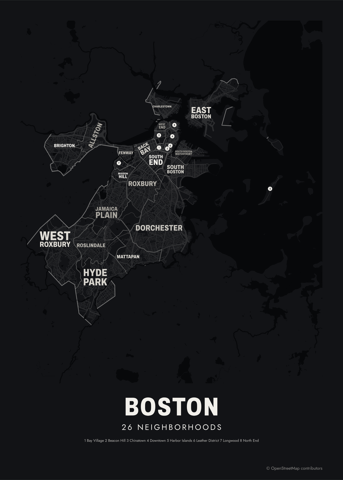 Typographic Boston map: the names fill their neighborhoodsEdit this →More neighborhood maps →
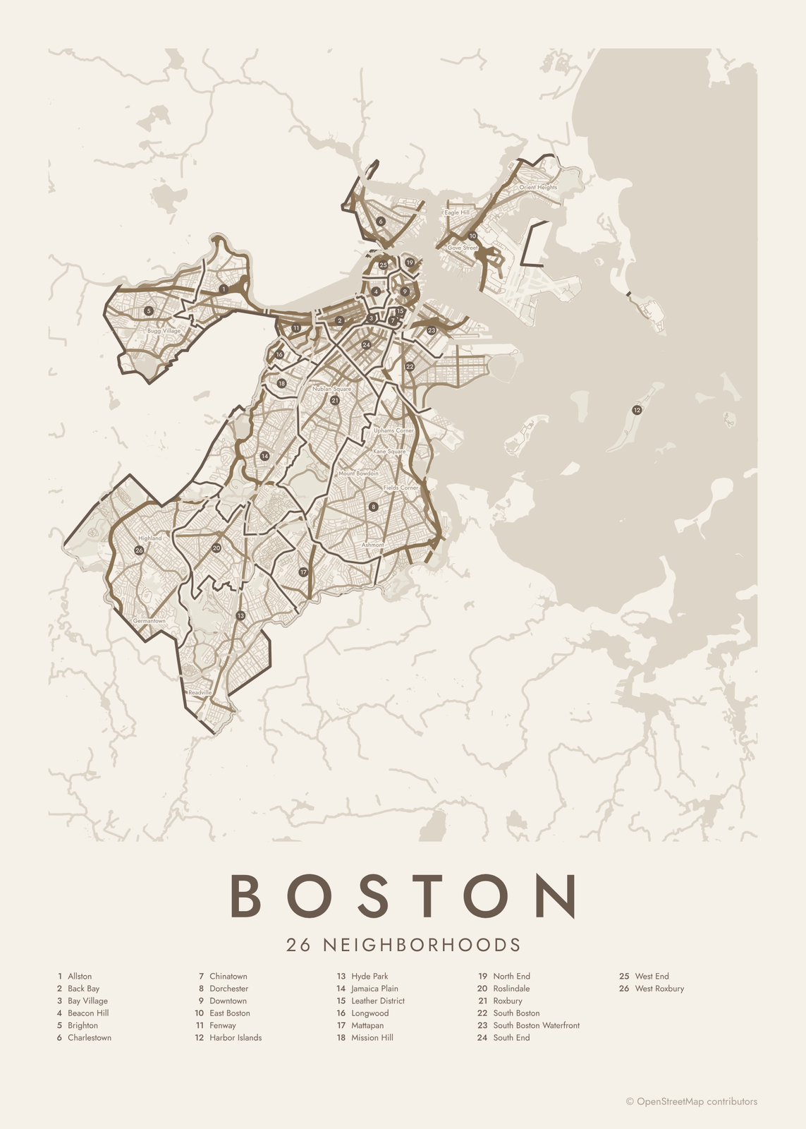 Boston street map with numbered neighborhoods and their listEdit this →More neighborhood maps →
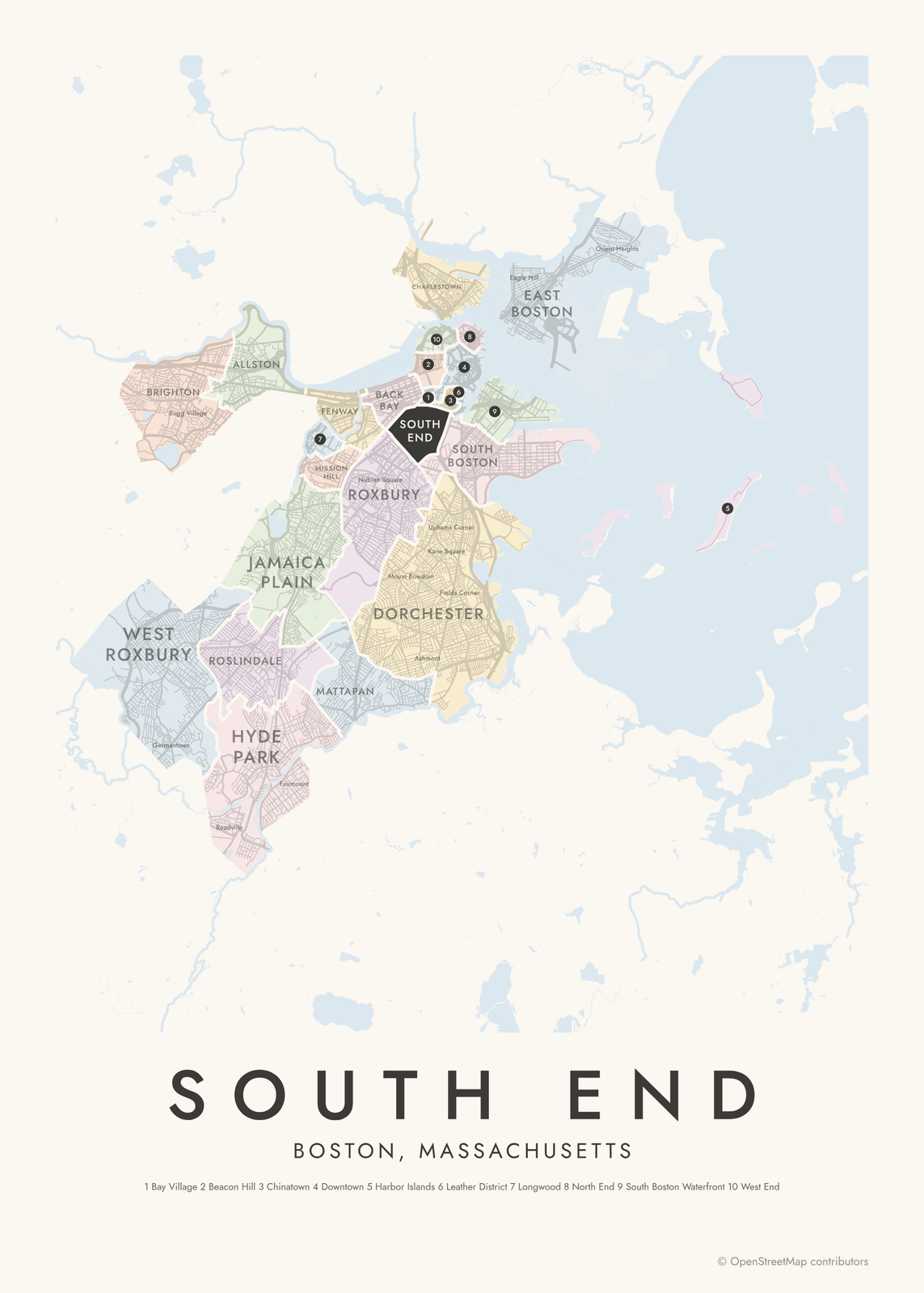 South End highlighted on a map of BostonEdit this →More neighborhood maps →
How Boston is divided
Boston grew by filling in its marshes and annexing its neighbors. Roxbury joined in 1868, Dorchester in 1870, Charlestown, Brighton and West Roxbury in 1874, and Hyde Park in 1912. Back Bay and much of the South End stand on land that was once tidal flats.
The city usually speaks of 23 neighborhoods. Our map uses the planning department's boundaries, which have 26: they split out smaller areas such as the Leather District, Longwood and the South Boston Waterfront, and add the Harbor Islands. Within them, people still use the names of old villages and squares, which appear as labels.
All 26 neighborhoods of Boston
- Allston
- Back Bay
- Bay Village
- Beacon Hill
- Brighton
- Charlestown
- Chinatown
- Dorchester
- Downtown
- East Boston
- Fenway
- Harbor Islands
- Hyde Park
- Jamaica Plain
- Leather District
- Longwood
- Mattapan
- Mission Hill
- North End
- Roslindale
- Roxbury
- South Boston
- South Boston Waterfront
- South End
- West End
- West Roxbury
More neighborhood names on the map
Inside the neighborhoods, the map also names 52 smaller neighborhoods where they fit, from OpenStreetMap: Fenway-Kenmore, Seaport, Oak Square, Derek's Corner, Germantown, Highland, Brighton Center, Bugg Village, Cleveland Circle, Aberdeen, Bellevue, Stonybrook Village, North Brighton, Allston Heights, Union Square, Readville, Lower Allston, Allston Village, Barry's Corner, Packard's Corner, Mount Hope, Clarendon Hills, Fairmount, Forest Hills, Audubon Circle, Roxbury Crossing, Nubian Square, Frederick Douglass Square Historic District, Mount Bowdoin, Grove Hall, Dorchester Center, Ashmont, Lower Mills, Mount Ida, Kane Square, Meeting House Hill, Uphams Corner, Downtown Crossing, Cedar Grove, Fields Corner and more. Turn them off under Names if you want only the neighborhoods.
Neighborhoods to know
- Beacon Hill: gas lamps, brick sidewalks and the gold-domed Massachusetts State House.
- North End: the Paul Revere House and the Old North Church, on narrow old streets.
- Back Bay: Victorian brownstones on filled land, along Commonwealth Avenue to Copley Square.
- Fenway: Fenway Park, home of the Red Sox since 1912, and the Back Bay Fens.
- Charlestown: the Bunker Hill Monument and USS Constitution at the old Navy Yard.
- Jamaica Plain: Jamaica Pond and the Arnold Arboretum.
- South Boston: Castle Island, with its old granite fort, and beaches along the harbor.
- Harbor Islands: part of a national and state park, reached by ferry.
How to make your Boston neighborhood poster
- Open the Boston map.
- Pick a style: Colored areas, Typographic (the names fill the map) or a Street map with the borders over the streets.
- Tap your own neighborhood to highlight it; it becomes the poster's title.
- Drag and zoom to frame the whole city or just your part of it, then pick a size and download the print file.
Questions
How many neighborhoods does Boston have?
The city usually counts 23. This map uses the planning department's 26 areas, which split a few of those further, and adds smaller villages and squares as labels.
Is Cambridge part of Boston?
No. Cambridge, Brookline, Somerville and Quincy are separate municipalities, so they're not on this map.
Which Boston neighborhoods were once separate towns?
Roxbury, Dorchester, Charlestown, Brighton, West Roxbury and Hyde Park were all independent towns, annexed between 1868 and 1912. Allston was part of Brighton.
Where do the Boston boundaries come from?
From OpenStreetMap (© OpenStreetMap contributors) and Boston Planning & Development Agency. Streets and water are OpenStreetMap's. Boundaries are a snapshot and can differ from what neighbors call home; tell us if one looks wrong.
What sizes can I print?
US Letter, 8 × 10, 11 × 14, 12 × 16 and 12 × 18 in, A4 and A3, free. You download a 300 DPI JPEG drawn at the size you pick. Larger prints, up to 24 × 36 in, are coming soon.
Related




Gift ideas by occasion




Every example is made with the Posterage generators. Change anything, then download it as a 300 DPI JPEG.