Bristol neighborhood map all 34 wards, named
This poster maps Bristol by its 34 council wards, from Avonmouth to Stockwood, each one named. Smaller local names like Montpelier, Totterdown, Stokes Croft and Spike Island show as labels. Highlight the area you live in and print it.
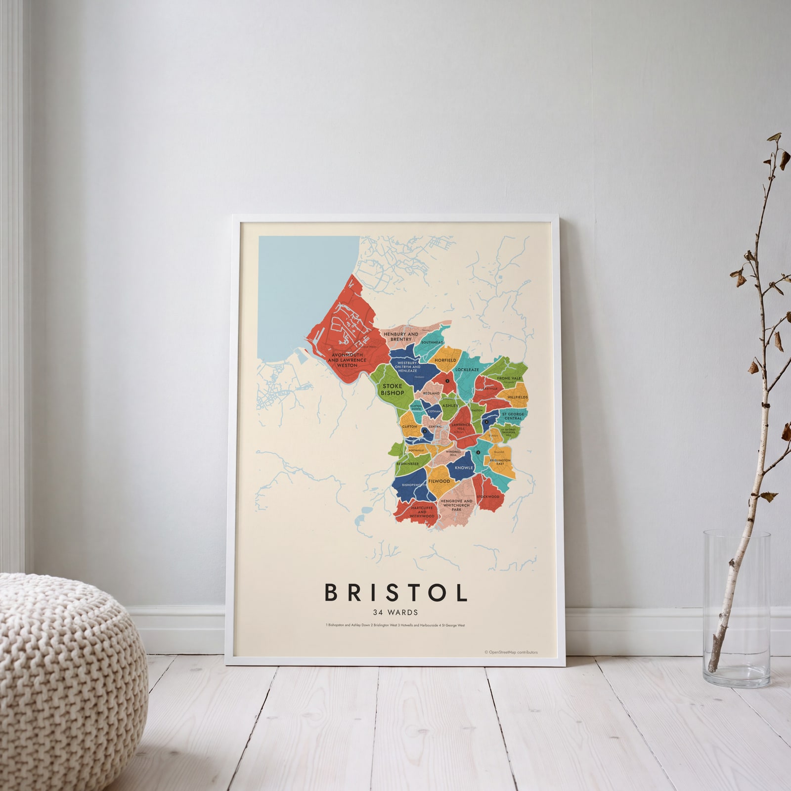
On the wall
A few of them framed at home. Open any one to make it yours.
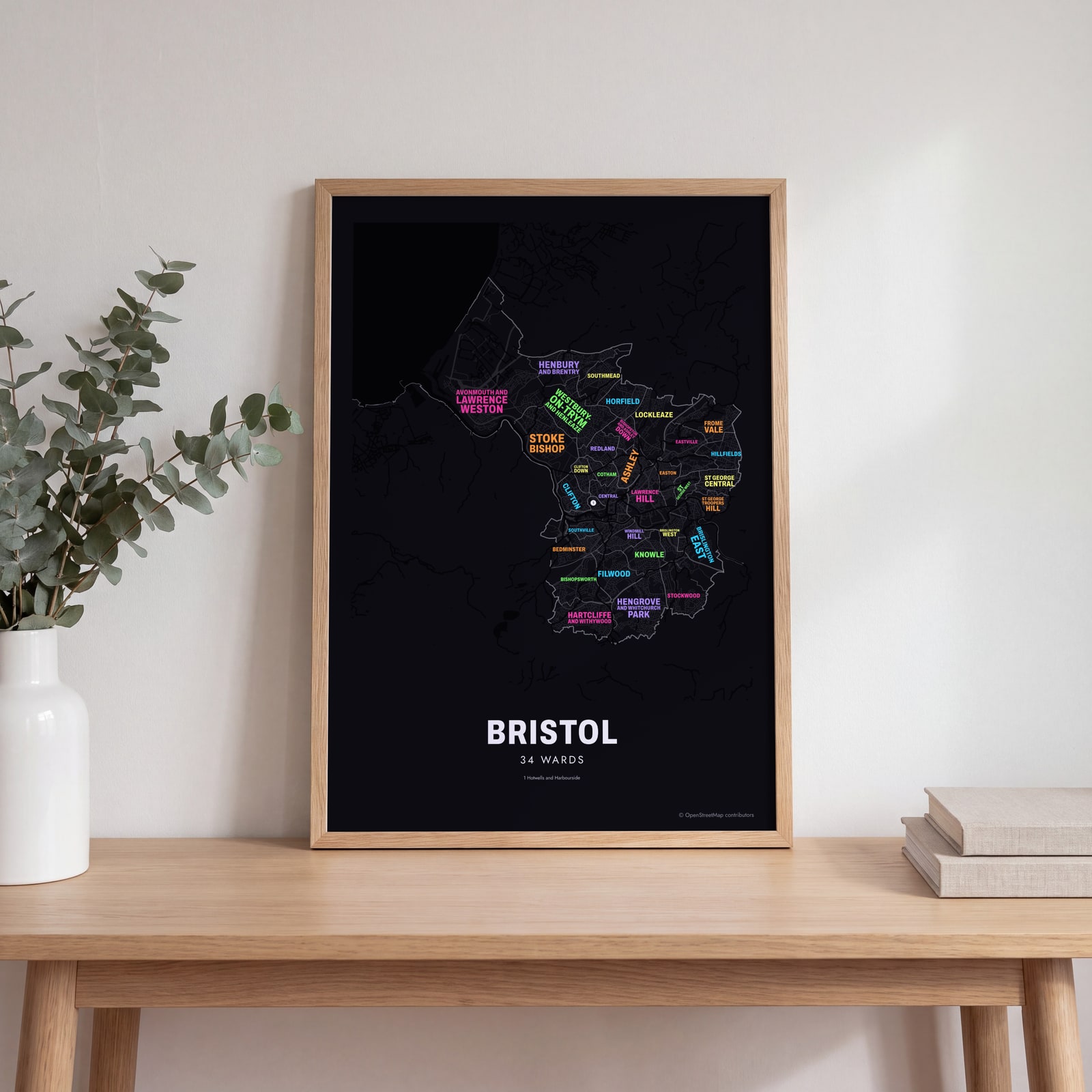 Typographic Bristol map: the names fill their wardsEdit this →
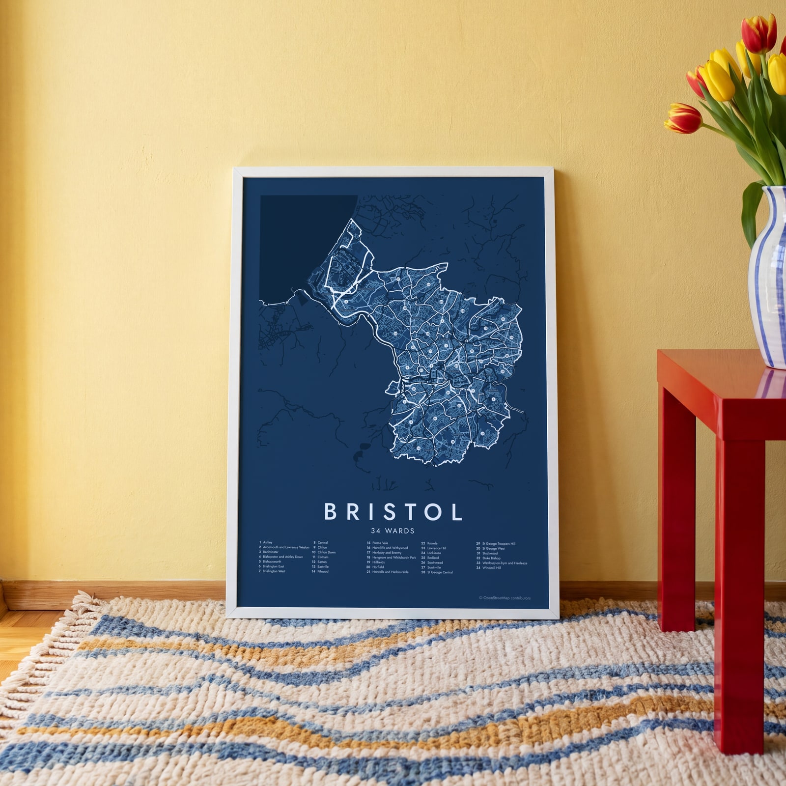 Bristol street map with numbered wards and their listEdit this →
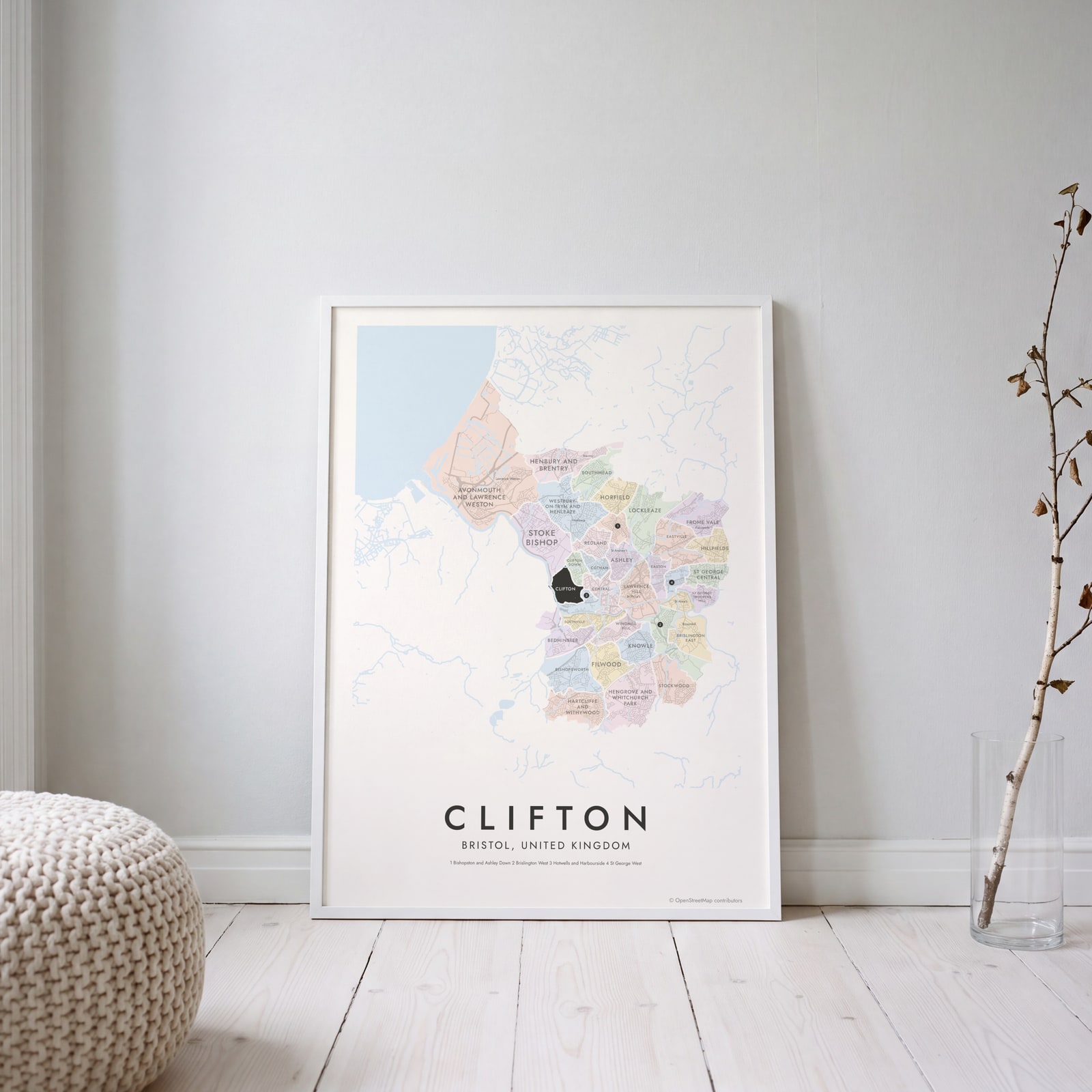 Clifton highlighted on a map of BristolEdit this →
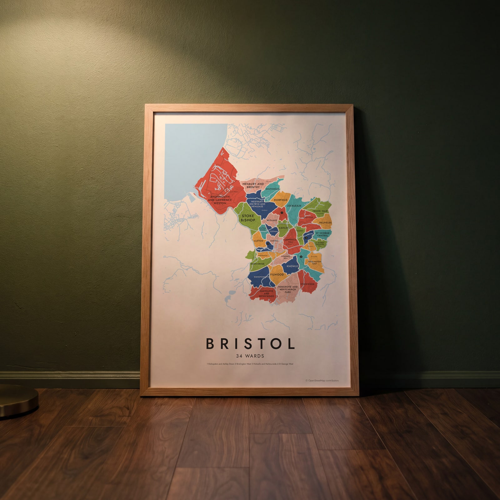 Bristol neighborhood map in color, every ward namedEdit this →
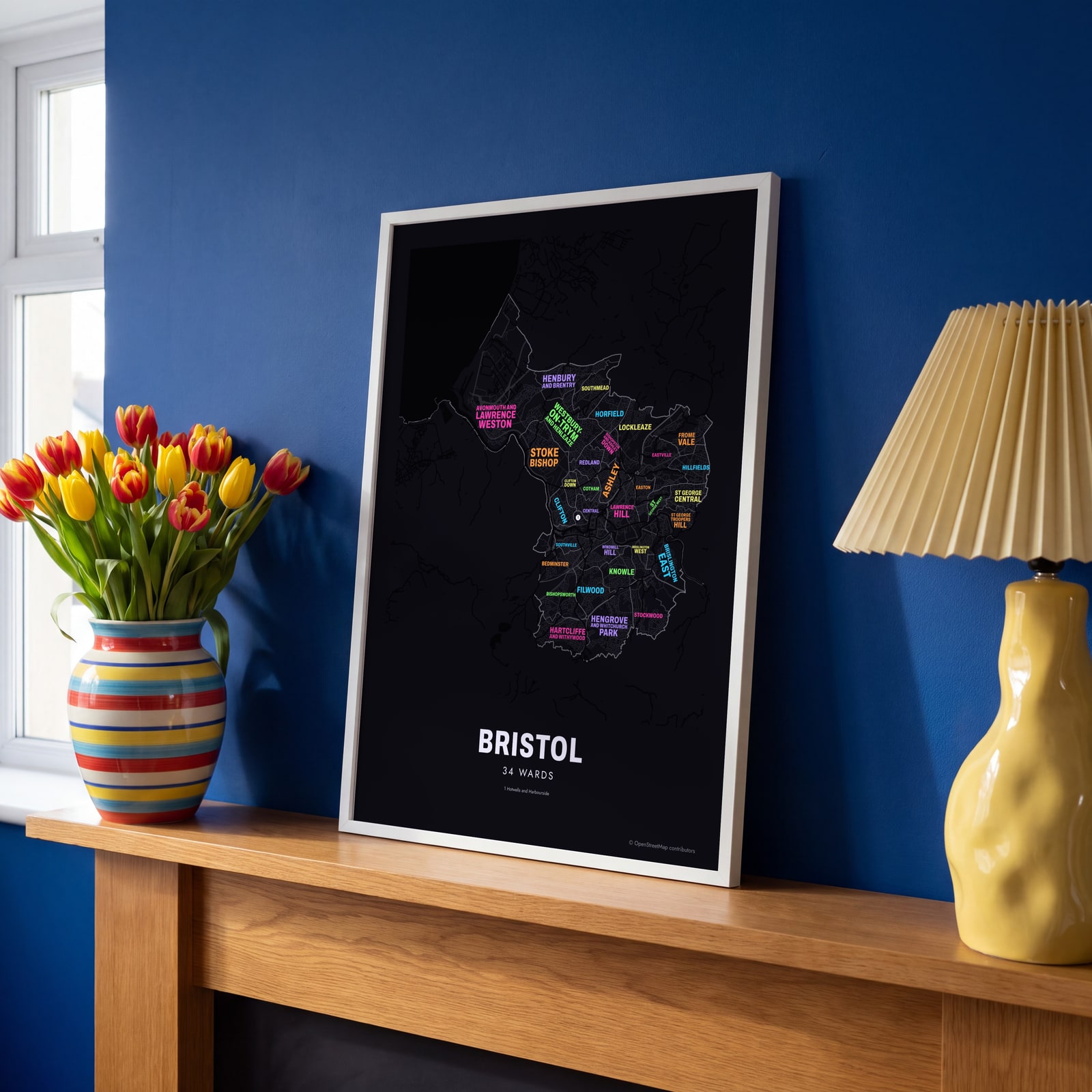 Typographic Bristol map: the names fill their wardsEdit this →
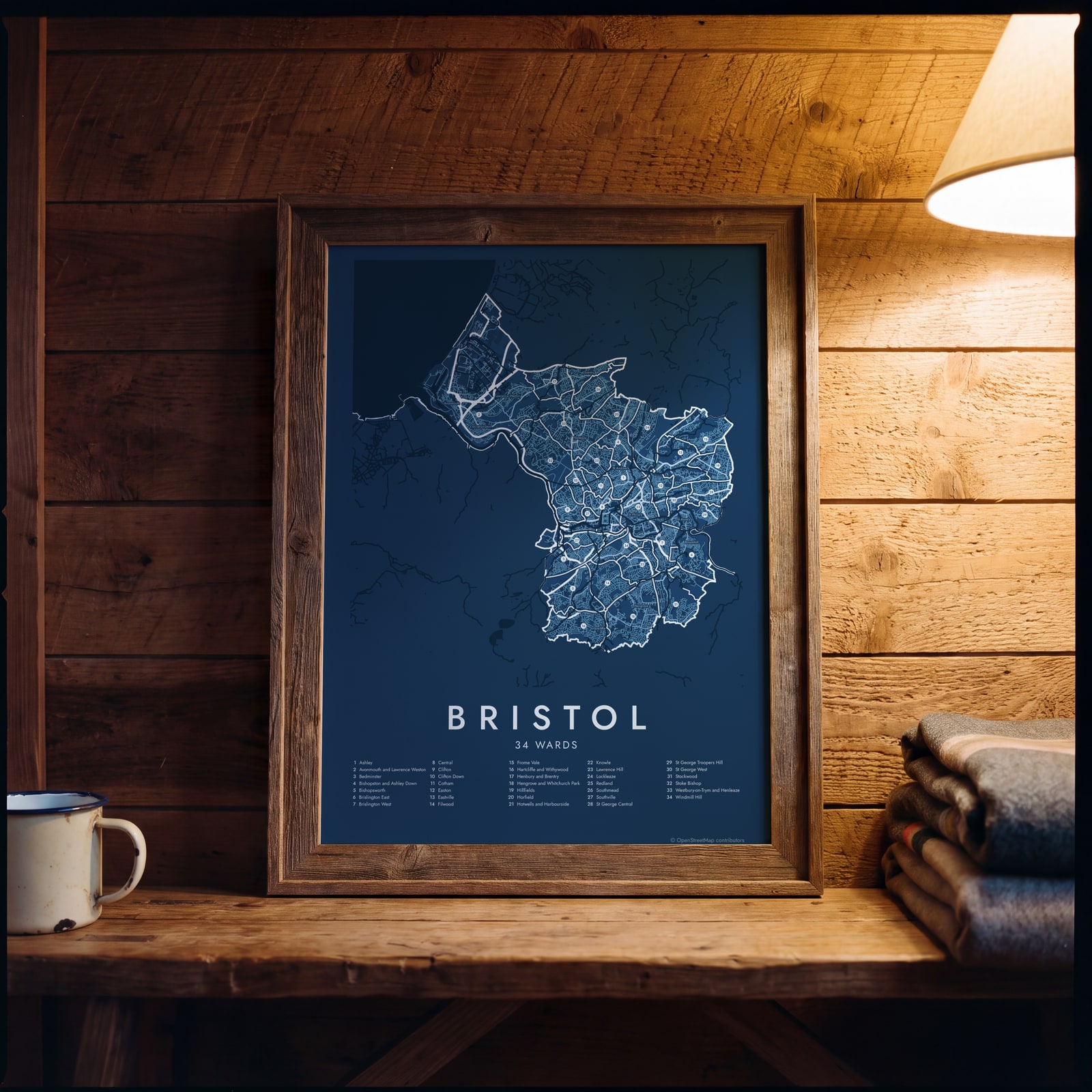 Bristol street map with numbered wards and their listEdit this →
Examples
Open any of them to change the words, the place, the date and the style, then download the print file.
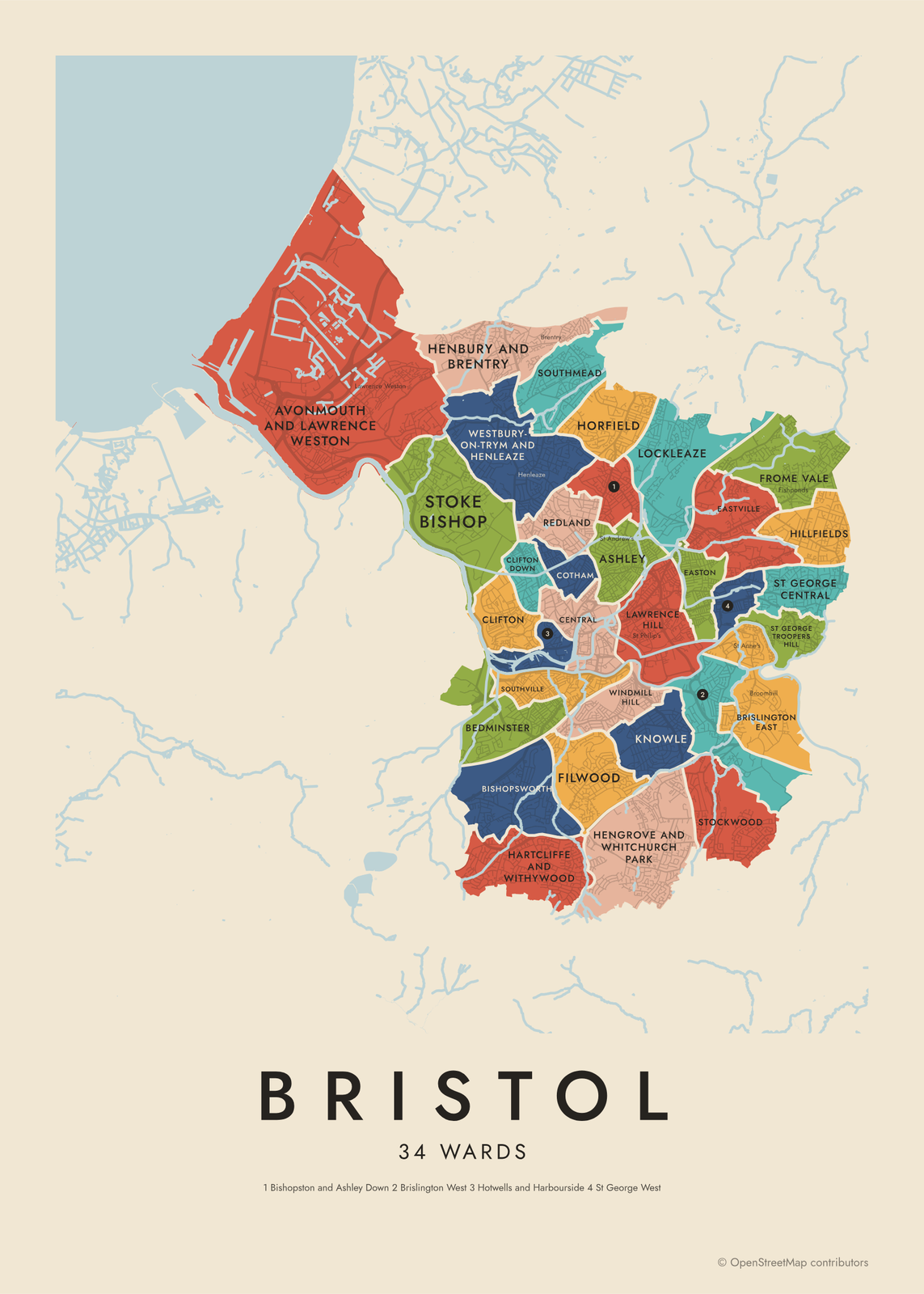 Bristol neighborhood map in color, every ward namedEdit this →More neighborhood maps →
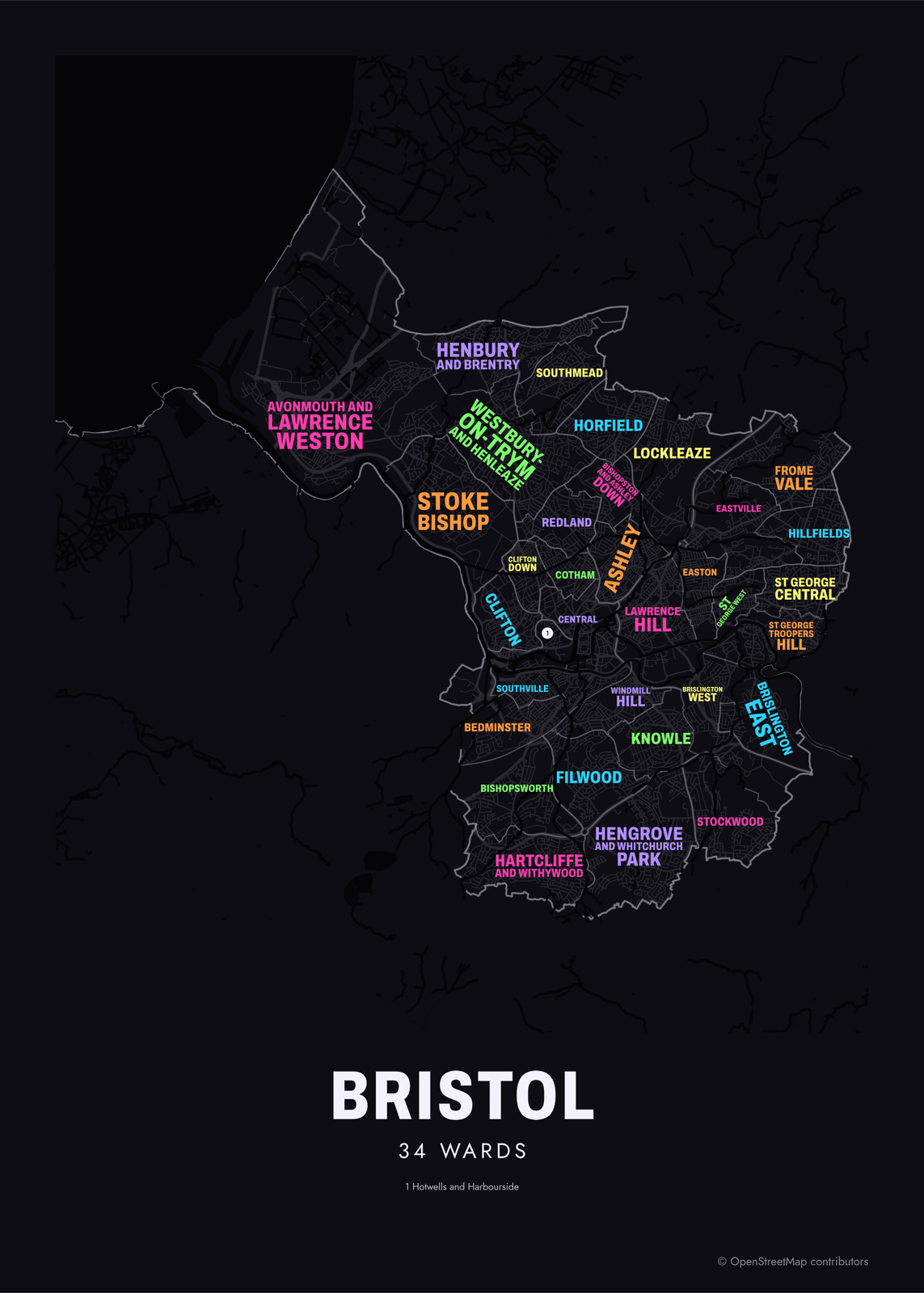 Typographic Bristol map: the names fill their wardsEdit this →More neighborhood maps →
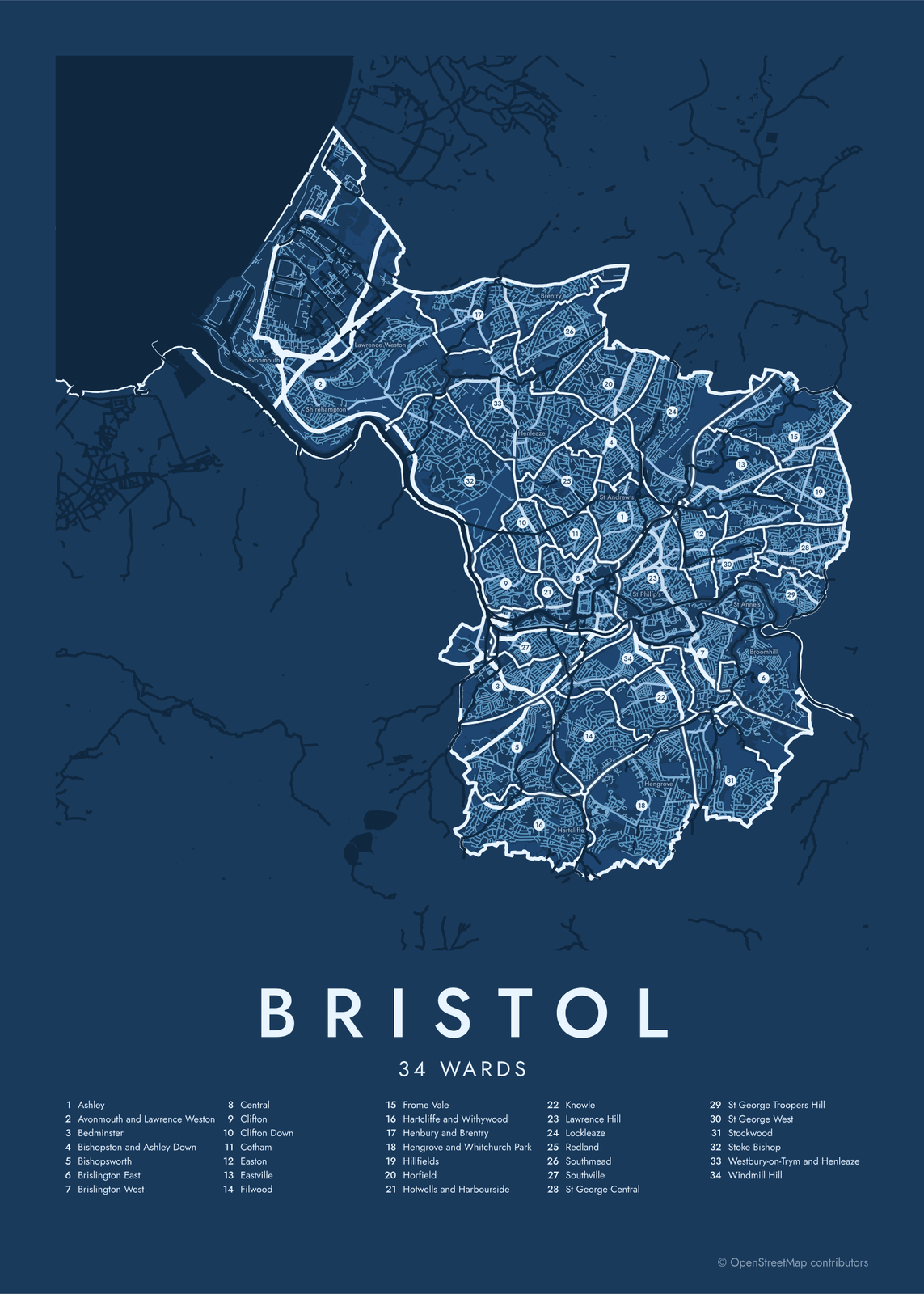 Bristol street map with numbered wards and their listEdit this →More neighborhood maps →
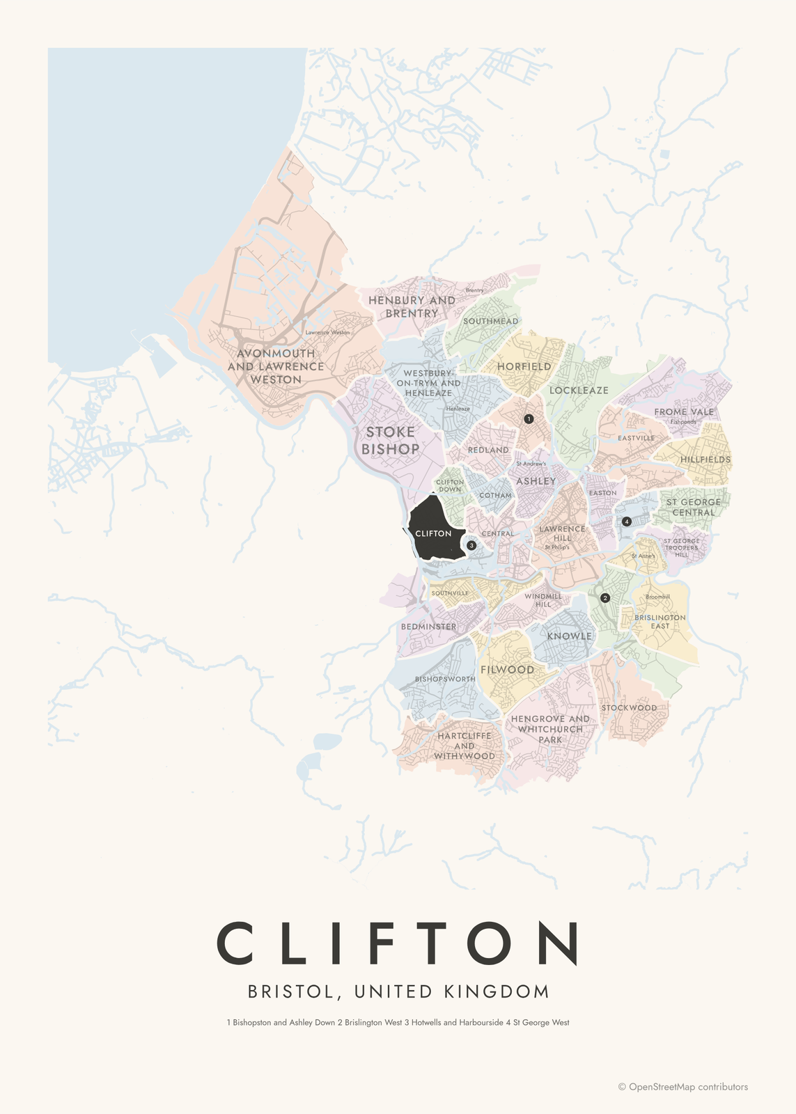 Clifton highlighted on a map of BristolEdit this →More neighborhood maps →
How Bristol is divided
Bristol has no official map of neighborhoods, so this map uses its electoral wards, the only division that covers the whole city. The current 34 wards were first used in 2016, after a boundary review replaced the old ones, and each elects one to three council members.
Most wards are named after a neighborhood, and some join two, like Hartcliffe and Withywood or Westbury-on-Trym and Henleaze. Wards are drawn to balance population, so well-known areas often sit inside a bigger ward: Ashley covers Montpelier, St Paul's and St Werburgh's. Places many people count as Bristol, like Filton and Kingswood, are in South Gloucestershire, outside the city boundary.
All 34 wards of Bristol
- Ashley
- Avonmouth and Lawrence Weston
- Bedminster
- Bishopston and Ashley Down
- Bishopsworth
- Brislington East
- Brislington West
- Central
- Clifton
- Clifton Down
- Cotham
- Easton
- Eastville
- Filwood
- Frome Vale
- Hartcliffe and Withywood
- Henbury and Brentry
- Hengrove and Whitchurch Park
- Hillfields
- Horfield
- Hotwells and Harbourside
- Knowle
- Lawrence Hill
- Lockleaze
- Redland
- Southmead
- Southville
- St George Central
- St George Troopers Hill
- St George West
- Stockwood
- Stoke Bishop
- Westbury-on-Trym and Henleaze
- Windmill Hill
More neighborhood names on the map
Inside the wards, the map also names 70 smaller neighborhoods where they fit, from OpenStreetMap: Avonmouth, Shirehampton, Lawrence Weston, Sea Mills, Coombe Dingle, Sneyd Park, Henbury, Withywood, Ashton Vale, Hotwells, Ashton Gate, Westbury on Trym, Bedminster Down, Westbury Park, Henleaze, Spike Island, Brentry, Hartcliffe, City Centre, Kingsdown, Bishopston, Broadmead, Redcliffe, Ashley Down, Montpelier, St Andrew's, St Paul's, St Werburgh's, Totterdown, St Philip's, Hengrove, St Philip's Marsh, Barton Hill, Redfield, Stapleton, Whitehall, Brislington, St Anne's, St George, Speedwell and more. Turn them off under Names if you want only the wards.
Neighborhoods to know
- Clifton: Georgian terraces above the Avon Gorge and Brunel's Clifton Suspension Bridge.
- Spike Island: Brunel's SS Great Britain, back in the dry dock where it was built.
- Stokes Croft: known for its street art, including Banksy's Mild Mild West.
- Southville: the Tobacco Factory, a former tobacco works that is now a theater and arts venue.
- Redcliffe: St Mary Redcliffe, a Gothic parish church near the harbor.
- Totterdown: rows of brightly painted terraced houses on a steep hill.
- Old City: the medieval center, with St Nicholas Market in the old Corn Exchange.
- Avonmouth: the docks where the River Avon meets the Severn Estuary.
How to make your Bristol neighborhood poster
- Open the Bristol map.
- Pick a style: Colored areas, Typographic (the names fill the map) or a Street map with the borders over the streets.
- Tap your own neighborhood to highlight it; it becomes the poster's title.
- Drag and zoom to frame the whole city or just your part of it, then pick a size and download the print file.
Questions
How many wards does Bristol have?
34. They have been used since 2016, and each elects one, two or three council members. Ward names usually come from the neighborhoods they cover.
Are Bristol's wards the same as its neighborhoods?
Not quite. Wards are drawn for elections and often group several neighborhoods. Ashley ward, for example, covers Montpelier, St Paul's and St Werburgh's. Those smaller names appear on the map as labels.
Is Filton part of Bristol?
Not for the city council. Filton, Bradley Stoke and Kingswood are in South Gloucestershire, so they're outside Bristol's 34 wards, even though many people think of them as Bristol.
Where do the Bristol boundaries come from?
From OpenStreetMap (© OpenStreetMap contributors) and Office for National Statistics, OGL v3.0; contains OS data © Crown copyright and database right 2024. Streets and water are OpenStreetMap's. Boundaries are a snapshot and can differ from what neighbors call home; tell us if one looks wrong.
What sizes can I print?
US Letter, 8 × 10, 11 × 14, 12 × 16 and 12 × 18 in, A4 and A3, free. You download a 300 DPI JPEG drawn at the size you pick. Larger prints, up to 24 × 36 in, are coming soon.
Related

Gift ideas by occasion




Every example is made with the Posterage generators. Change anything, then download it as a 300 DPI JPEG.