Manchester neighborhood map all 32 wards, named
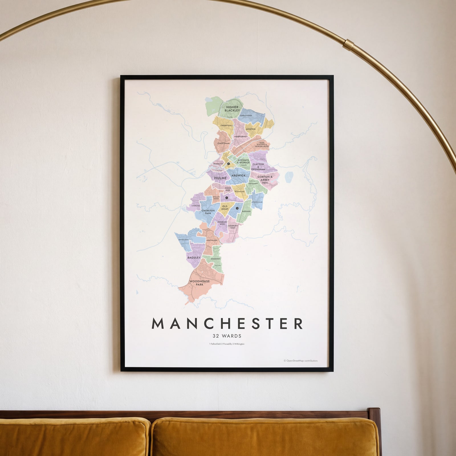
This poster maps the City of Manchester split into its 32 electoral wards, from Higher Blackley in the north to Woodhouse Park in the south. Most wards are named after a neighborhood, and smaller places like Ancoats, Castlefield and the Northern Quarter print as labels. Highlight yours and print it.
On the wall
A few of them framed at home. Open any one to make it yours.
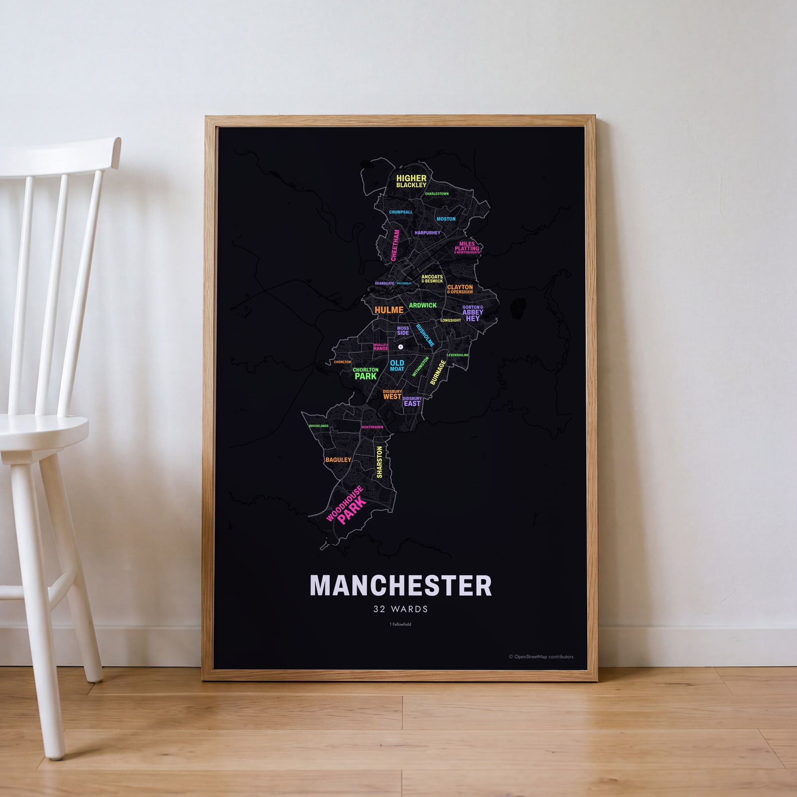 Typographic Manchester map: the names fill their wardsEdit this →
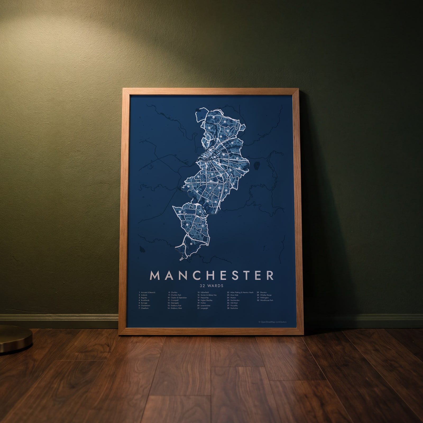 Manchester street map with numbered wards and their listEdit this →
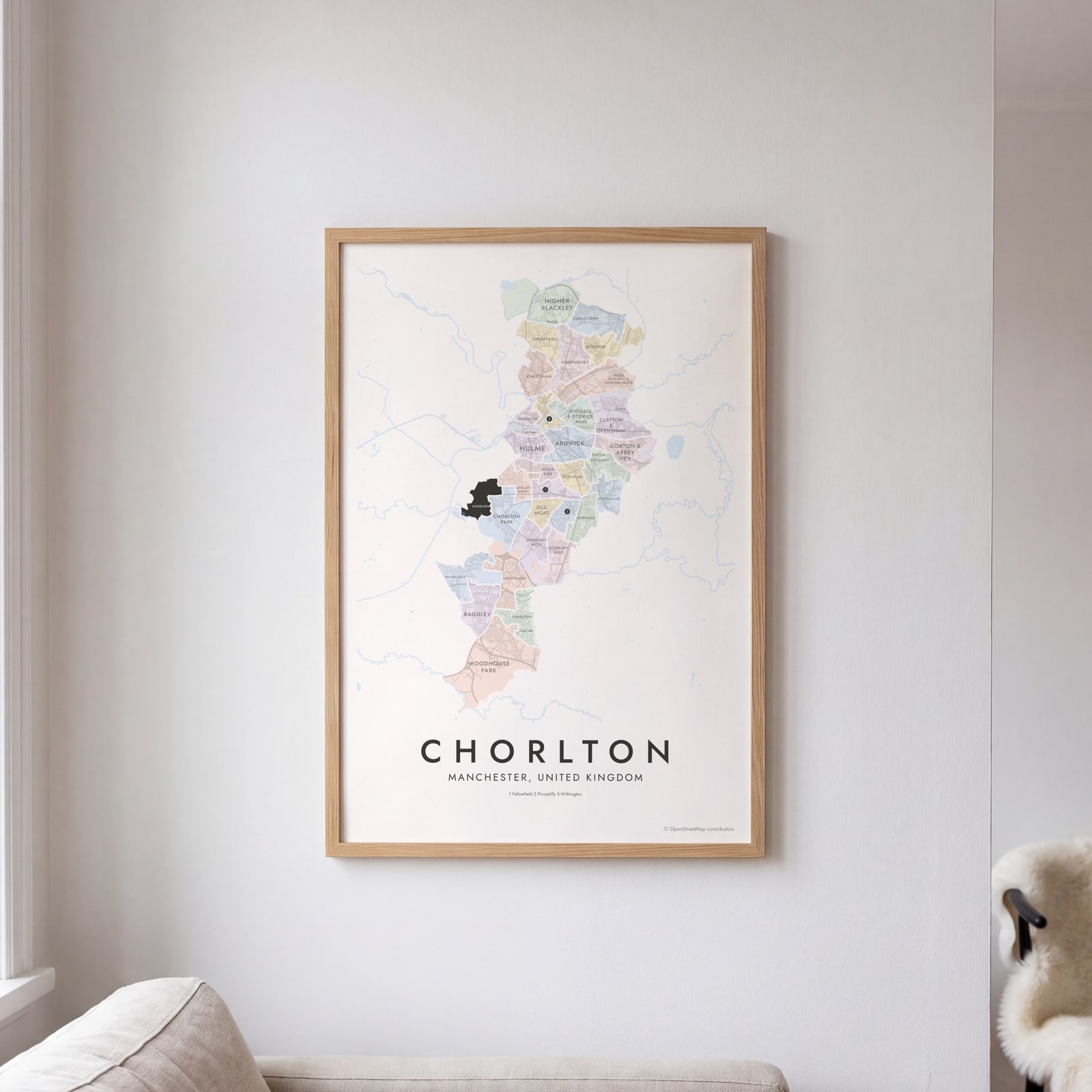 Chorlton highlighted on a map of ManchesterEdit this →
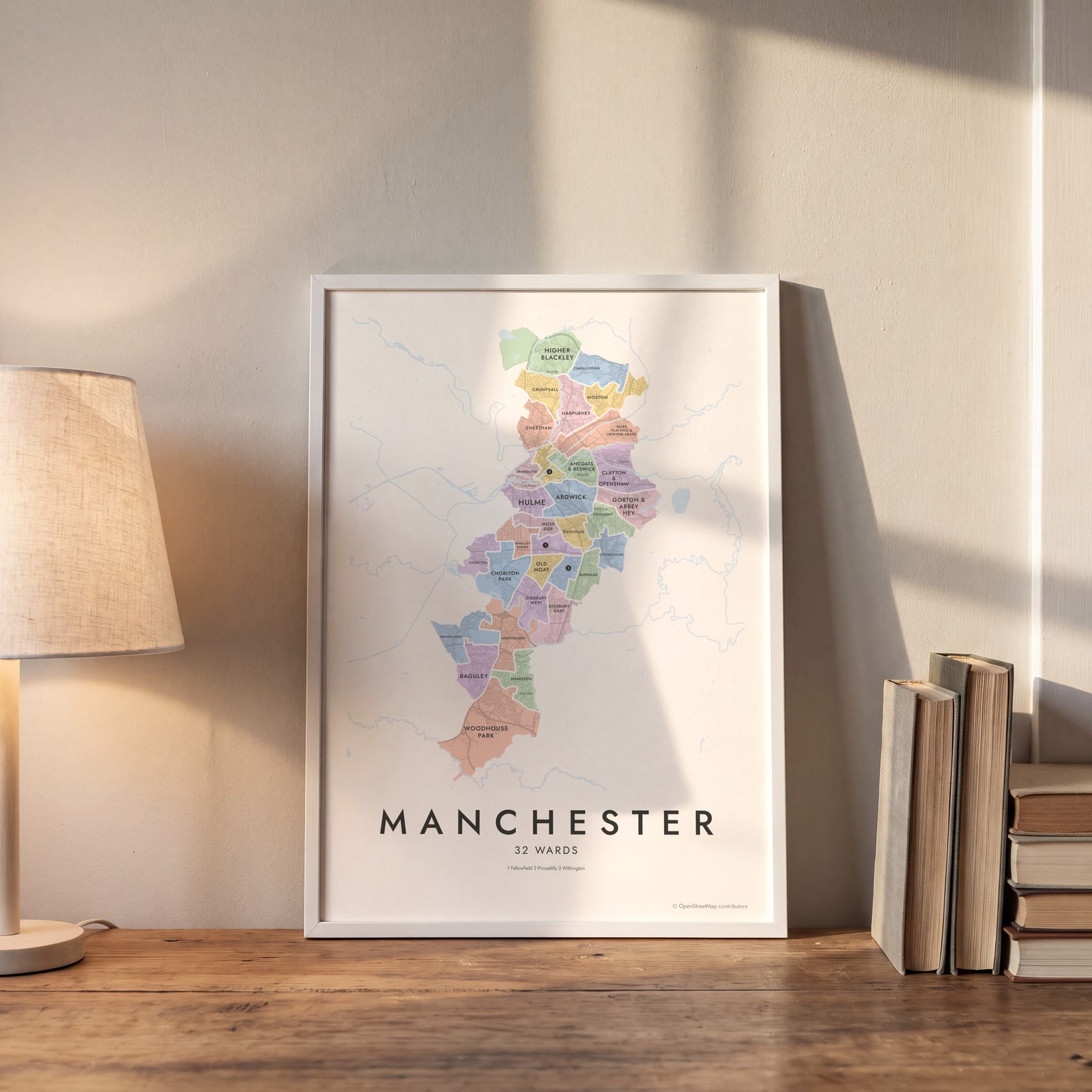 Manchester neighborhood map in color, every ward namedEdit this →
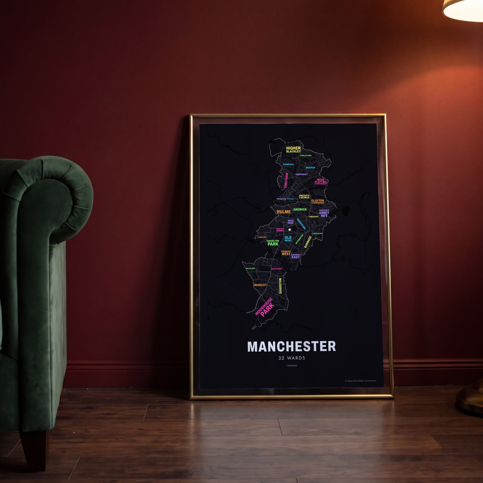 Typographic Manchester map: the names fill their wardsEdit this →
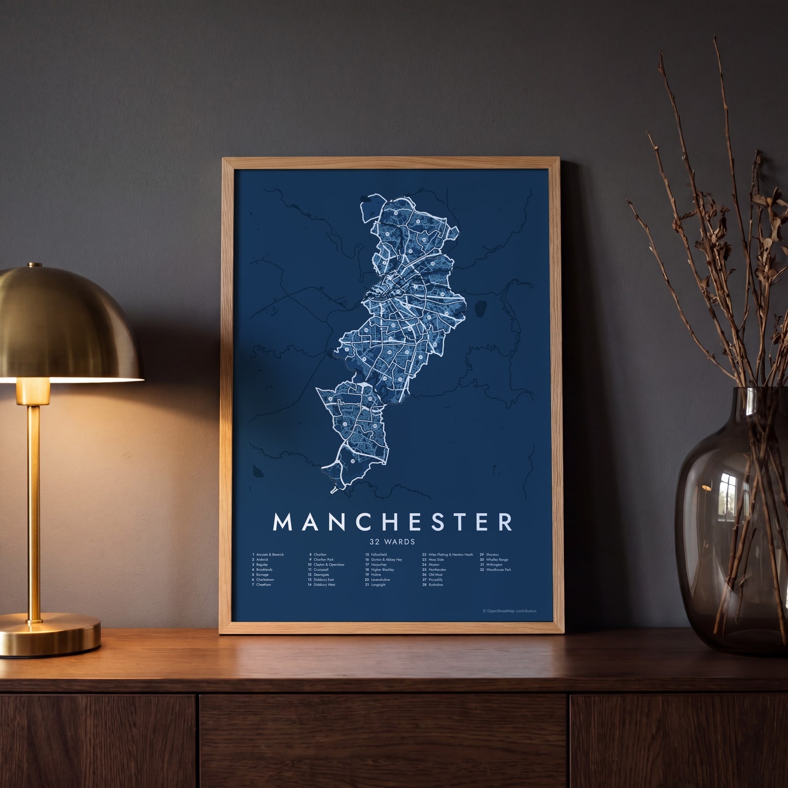 Manchester street map with numbered wards and their listEdit this →
Examples
Open any of them to change the words, the place, the date and the style, then download the print file.
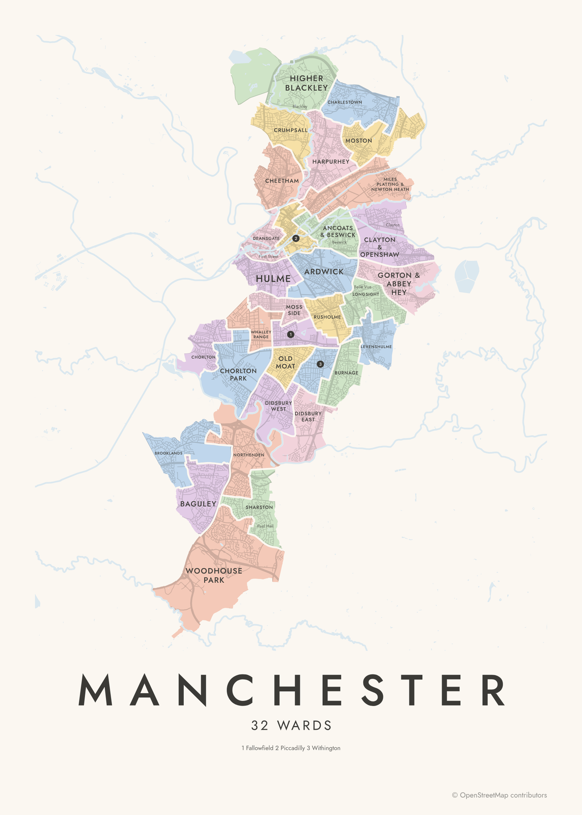 Manchester neighborhood map in color, every ward namedEdit this →More neighborhood maps →
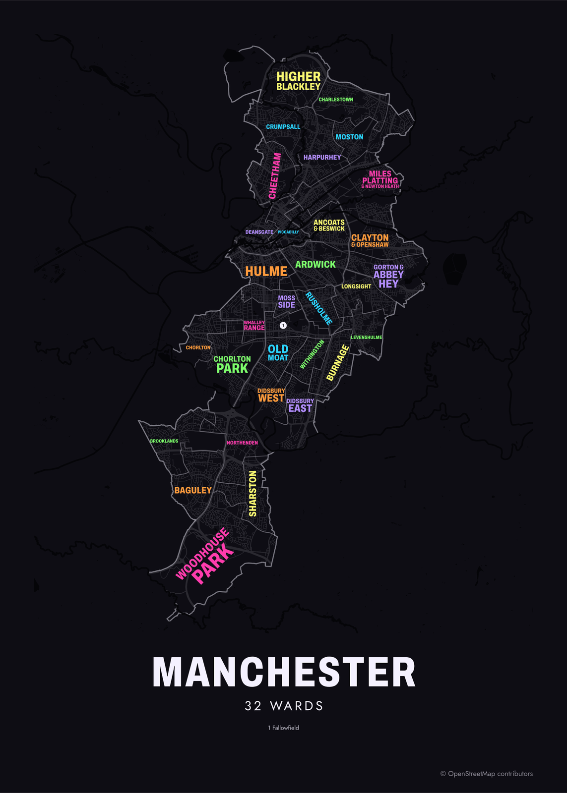 Typographic Manchester map: the names fill their wardsEdit this →More neighborhood maps →
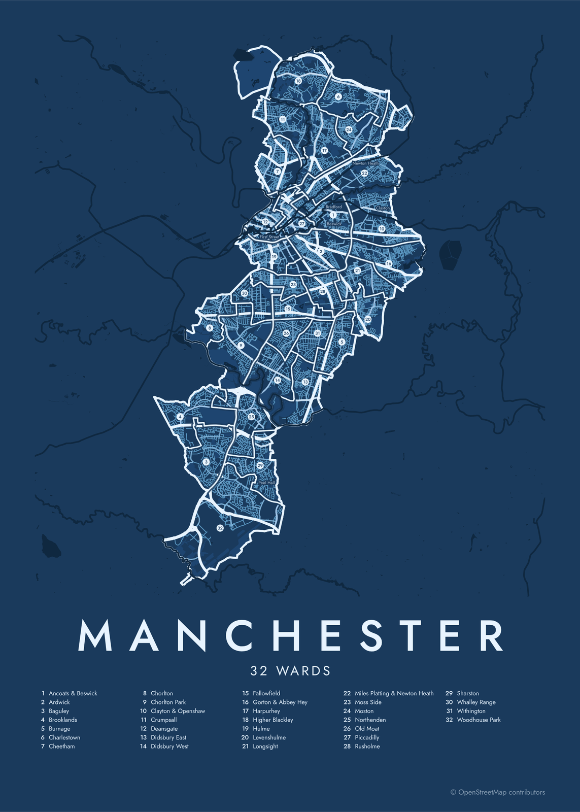 Manchester street map with numbered wards and their listEdit this →More neighborhood maps →
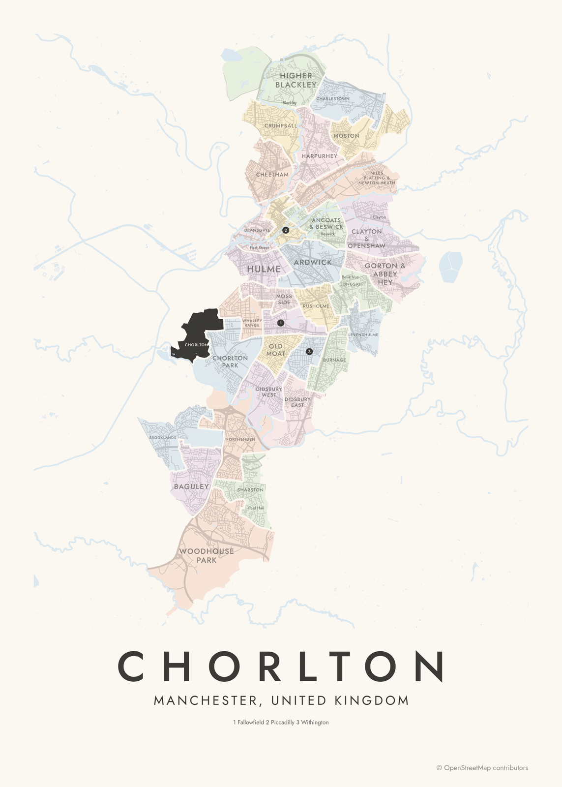 Chorlton highlighted on a map of ManchesterEdit this →More neighborhood maps →
How Manchester is divided
Manchester City Council is elected from 32 wards, with three council members each. The current boundaries date from 2018. The city has no official set of neighborhood boundaries, so wards are the closest thing.
Most wards are named after a neighborhood, but the edges don't always match. Most of the city center falls in the Deansgate and Piccadilly wards, and Wythenshawe, the large garden-city estate in the south, spans several wards, including Sharston, Woodhouse Park and Baguley. Salford, Trafford and Stockport are separate boroughs, so they're outside the map.
All 32 wards of Manchester
- Ancoats & Beswick
- Ardwick
- Baguley
- Brooklands
- Burnage
- Charlestown
- Cheetham
- Chorlton
- Chorlton Park
- Clayton & Openshaw
- Crumpsall
- Deansgate
- Didsbury East
- Didsbury West
- Fallowfield
- Gorton & Abbey Hey
- Harpurhey
- Higher Blackley
- Hulme
- Levenshulme
- Longsight
- Miles Platting & Newton Heath
- Moss Side
- Moston
- Northenden
- Old Moat
- Piccadilly
- Rusholme
- Sharston
- Whalley Range
- Withington
- Woodhouse Park
More neighborhood names on the map
Inside the wards, the map also names 52 smaller neighborhoods where they fit, from OpenStreetMap: Northern Moor, Newall Green, Chorlton-cum-Hardy, Benchill, Peel Hall, Strangeways, West Didsbury, City Centre, Cheetham Hill, Didsbury, Blackley, Ancoats, Chorlton-on-Medlock, Boothroyden, Collyhurst, Miles Platting, Bradford, Beswick, Belle Vue, Newton Heath, Openshaw, Gorton, Clayton, New Moston, Brunswick, Parrs Wood, Victoria Park, Chorltonville, Castlefield, St. Johns, New Jackson, Spinningfields, First Street, Petersfield, Central Retail District, Civic Quarter, Medieval Quarter, Moss Nook, Chinatown, Green Quarter and more. Turn them off under Names if you want only the wards.
Neighborhoods to know
- Castlefield: canal basins at the end of the Bridgewater Canal, next to a reconstructed Roman fort.
- Northern Quarter: red-brick former warehouses and workshops just north of Piccadilly Gardens.
- Ancoats: early steam-powered cotton mills along the Rochdale Canal, many now turned into apartments.
- Chinatown: south of Mosley Street, marked by a Chinese imperial arch on Faulkner Street.
- Gay Village: the bars and clubs along Canal Street, beside the Rochdale Canal.
- Curry Mile: the stretch of Wilmslow Road in Rusholme lined with restaurants.
- Hulme: just south of the center; its 1960s Crescents were demolished in the 1990s and replaced with new streets.
- Didsbury: a south Manchester suburb by the Mersey, with the Fletcher Moss Botanical Gardens.
How to make your Manchester neighborhood poster
- Open the Manchester map.
- Pick a style: Colored areas, Typographic (the names fill the map) or a Street map with the borders over the streets.
- Tap your own neighborhood to highlight it; it becomes the poster's title.
- Drag and zoom to frame the whole city or just your part of it, then pick a size and download the print file.
Questions
How many wards does Manchester have?
32, each electing three members of Manchester City Council. The current ward boundaries were first used in the 2018 local elections.
Is Salford part of Manchester?
No. Salford is a separate city, just across the River Irwell from Manchester city center. Old Trafford is in Trafford, another separate borough. Both are outside this map.
What's the difference between Manchester and Greater Manchester?
Manchester is one city council area. Greater Manchester is the wider county of ten boroughs: Manchester, Salford, Trafford, Stockport, Tameside, Oldham, Rochdale, Bury, Bolton and Wigan. This map covers the City of Manchester only.
Which ward is Manchester city center in?
Mostly in Deansgate and Piccadilly. Both wards were created in 2018 from the old City Centre ward, and parts of the center's edges fall in neighboring wards.
Where do the Manchester boundaries come from?
From OpenStreetMap (© OpenStreetMap contributors) and Office for National Statistics, OGL v3.0; contains OS data © Crown copyright and database right 2024. Streets and water are OpenStreetMap's. Boundaries are a snapshot and can differ from what neighbors call home; tell us if one looks wrong.
What sizes can I print?
US Letter, 8 × 10, 11 × 14, 12 × 16 and 12 × 18 in, A4 and A3, free. You download a 300 DPI JPEG drawn at the size you pick. Larger prints, up to 24 × 36 in, are coming soon.
Related

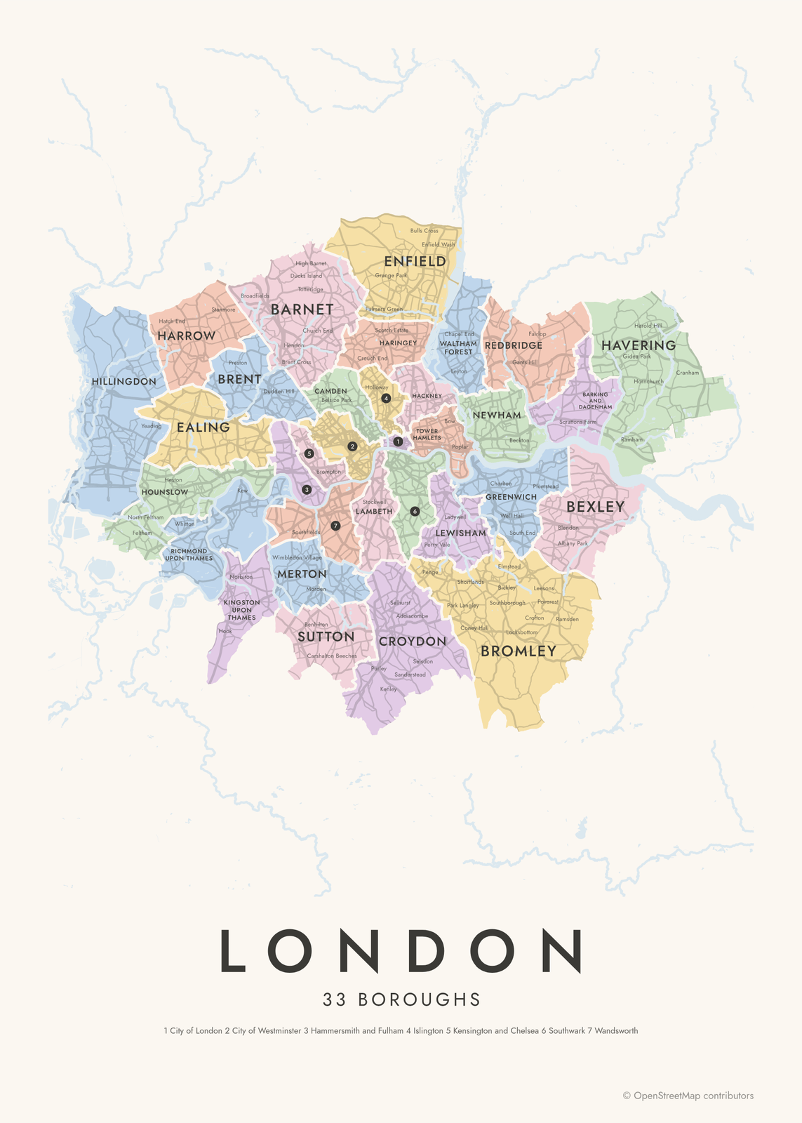
Gift ideas by occasion




Every example is made with the Posterage generators. Change anything, then download it as a 300 DPI JPEG.