Bronx neighborhood map 50 neighborhood areas, all named
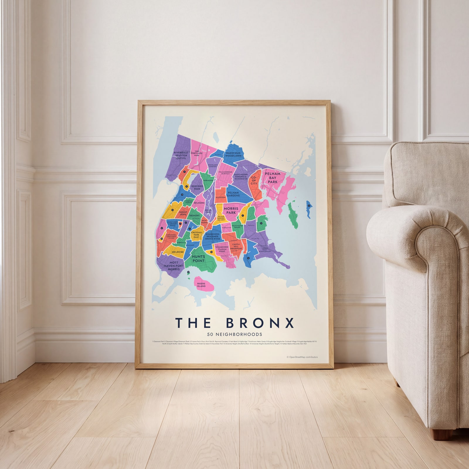
This poster maps the Bronx split into the 50 neighborhood areas New York City uses for its census data, from Riverdale-Spuyten Duyvil to Co-op City, each one named. Smaller labels add 37 familiar names like Mott Haven, Fordham and City Island. Highlight the one you call home and print it.
On the wall
A few of them framed at home. Open any one to make it yours.
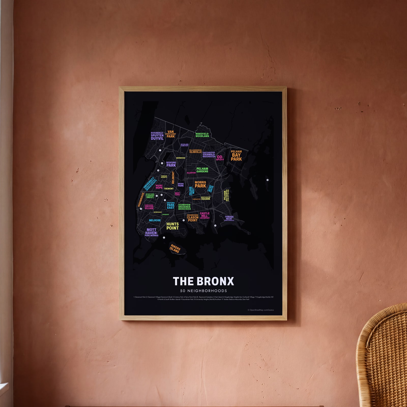 Typographic The Bronx map: the names fill their neighborhoodsEdit this →
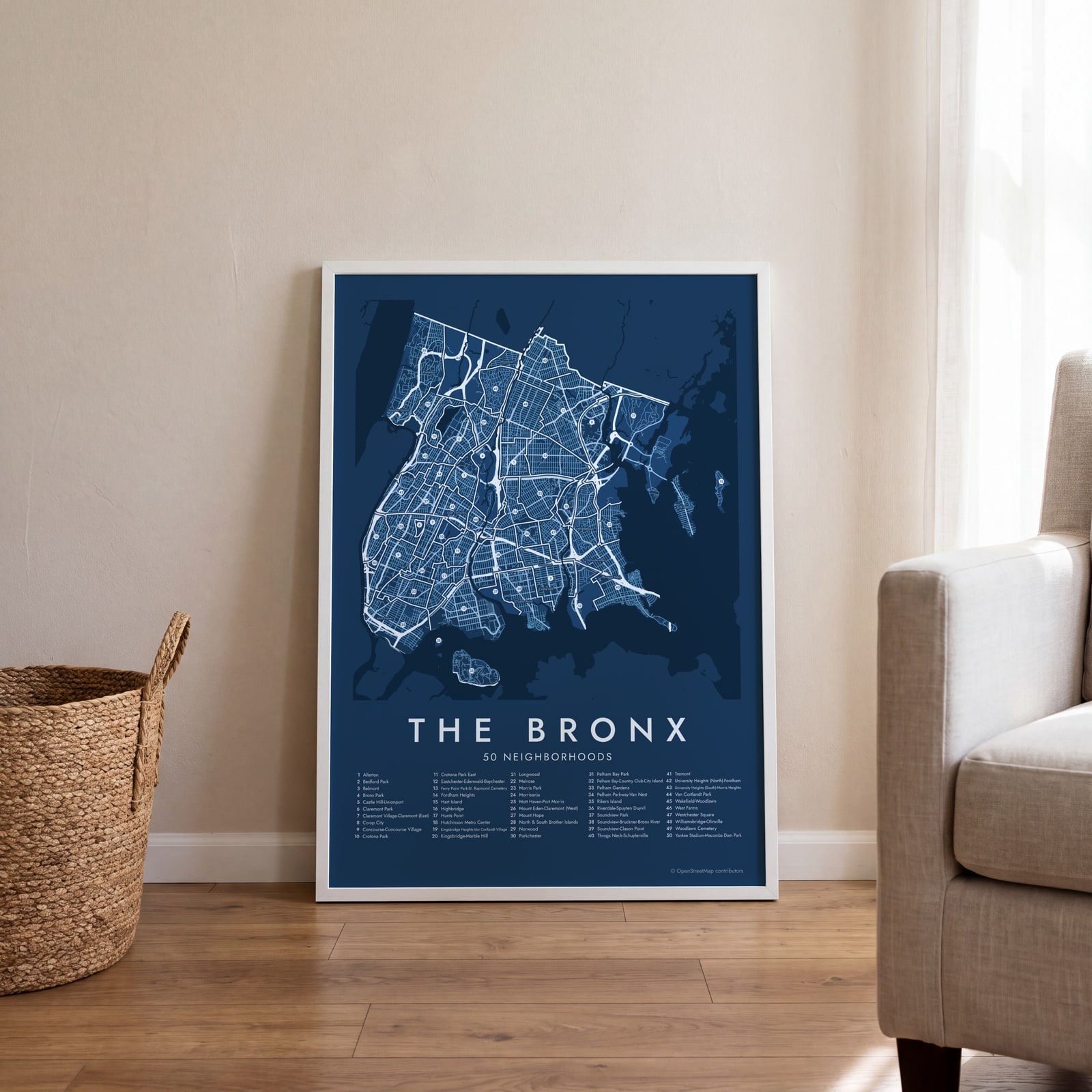 The Bronx street map with numbered neighborhoods and their listEdit this →
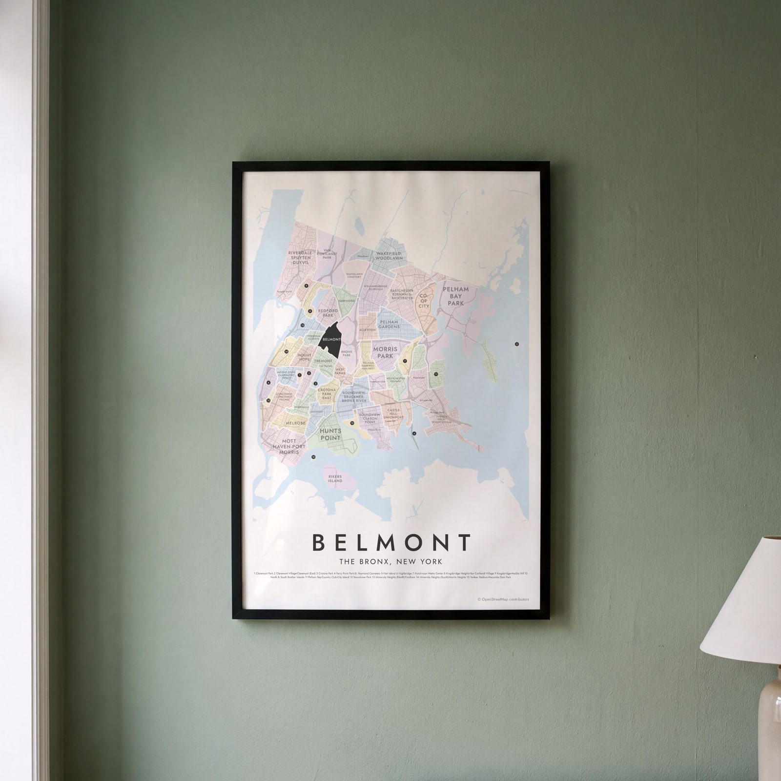 Belmont highlighted on a map of The BronxEdit this →
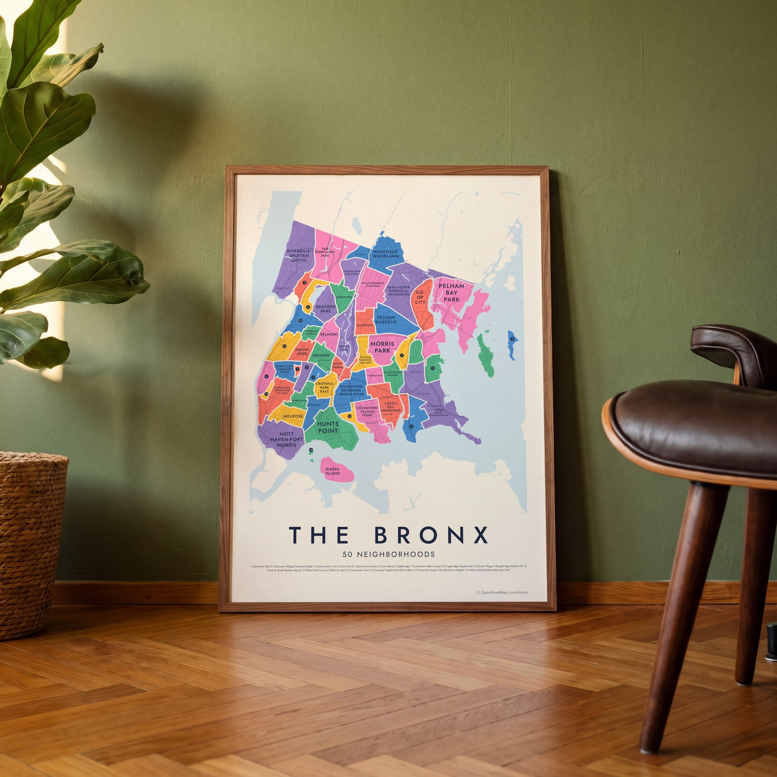 The Bronx neighborhood map in color, every neighborhood namedEdit this →
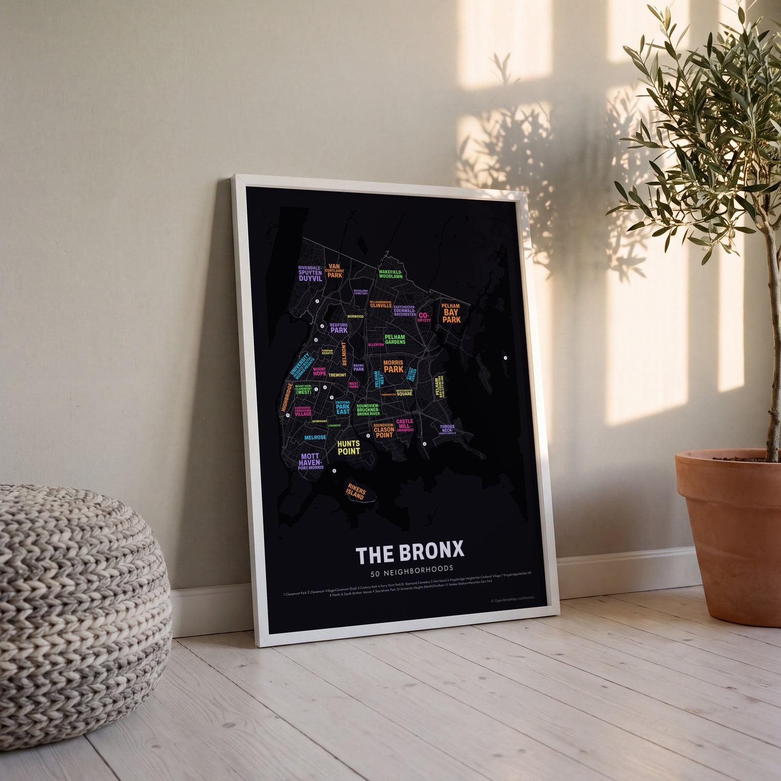 Typographic The Bronx map: the names fill their neighborhoodsEdit this →
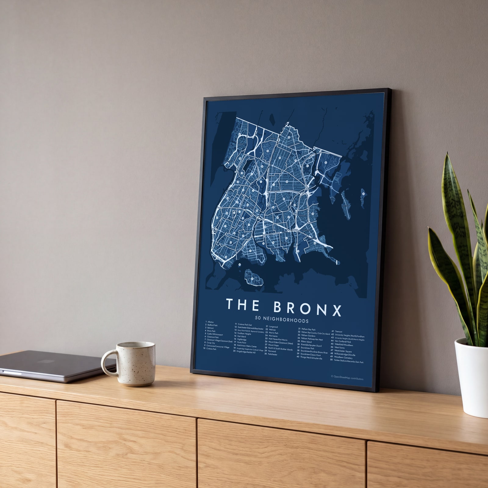 The Bronx street map with numbered neighborhoods and their listEdit this →
Examples
Open any of them to change the words, the place, the date and the style, then download the print file.
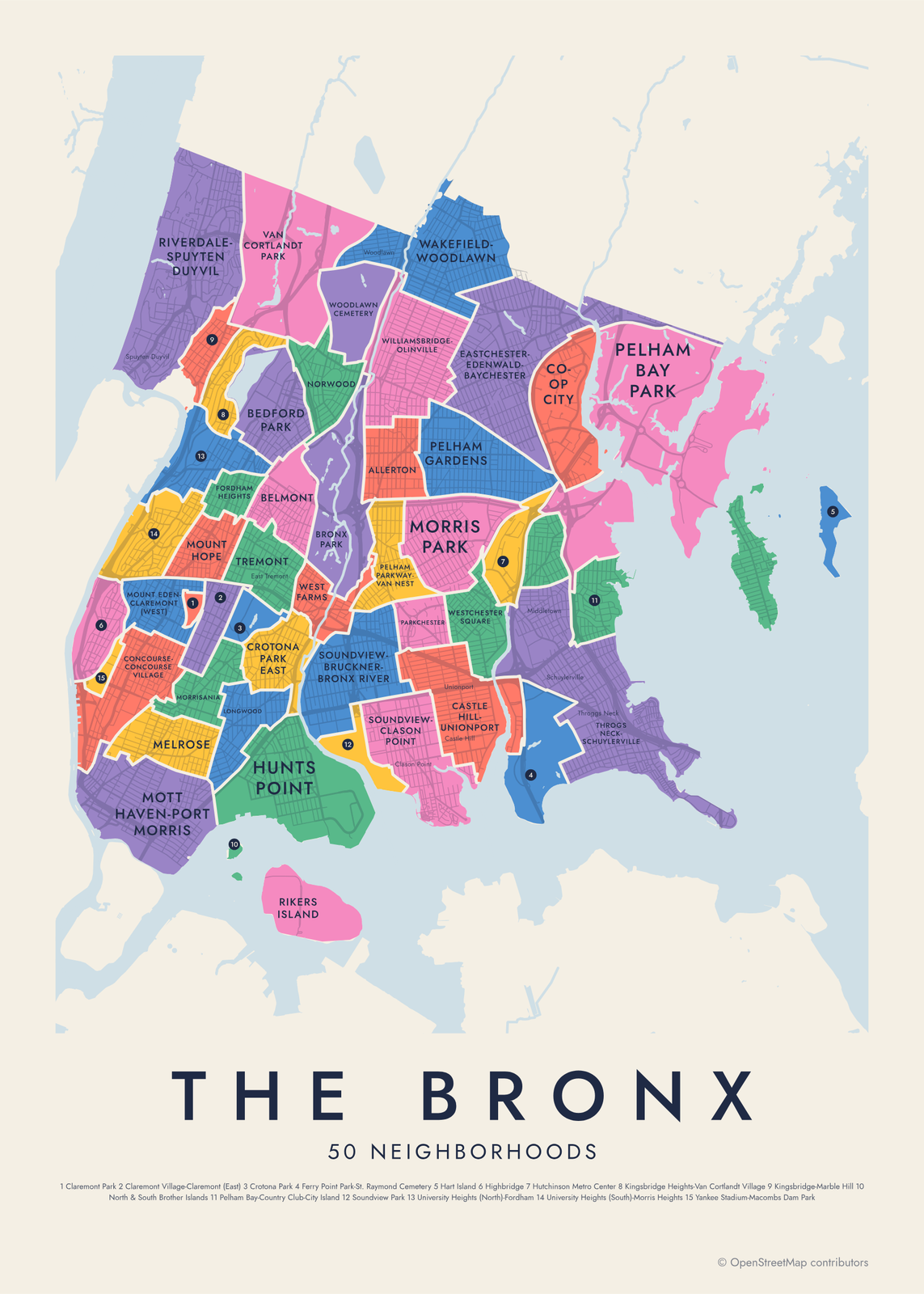 The Bronx neighborhood map in color, every neighborhood namedEdit this →More neighborhood maps →
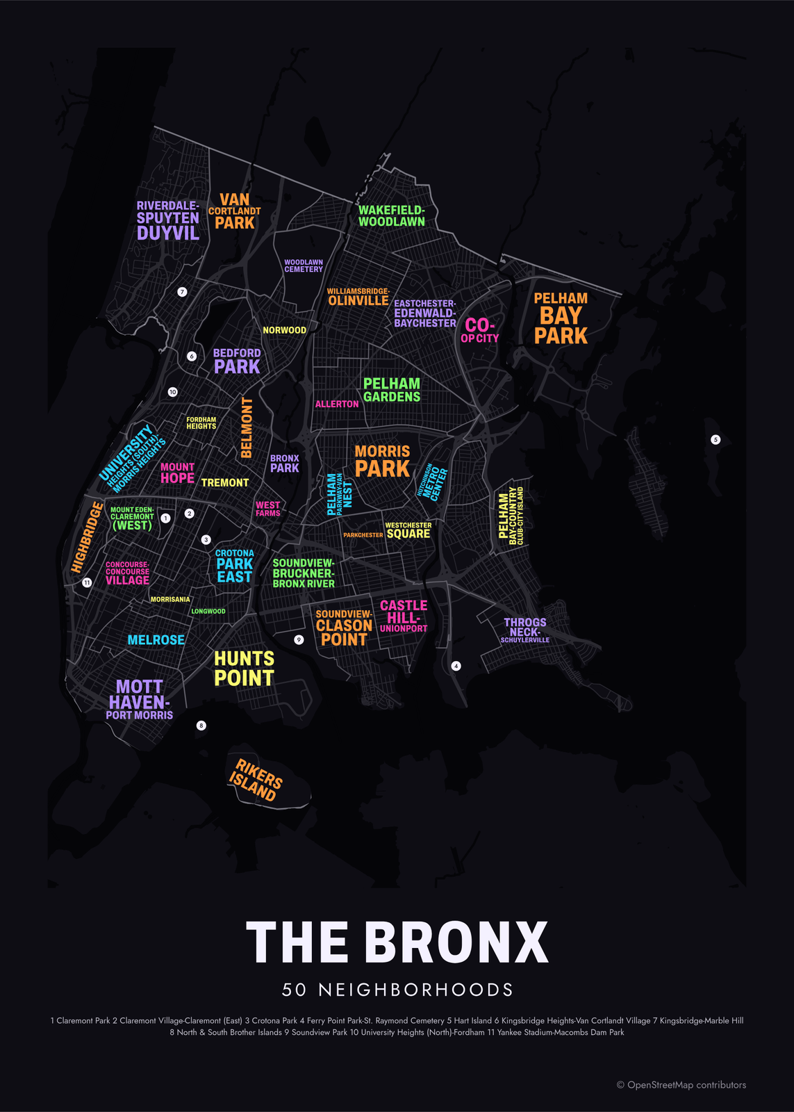 Typographic The Bronx map: the names fill their neighborhoodsEdit this →More neighborhood maps →
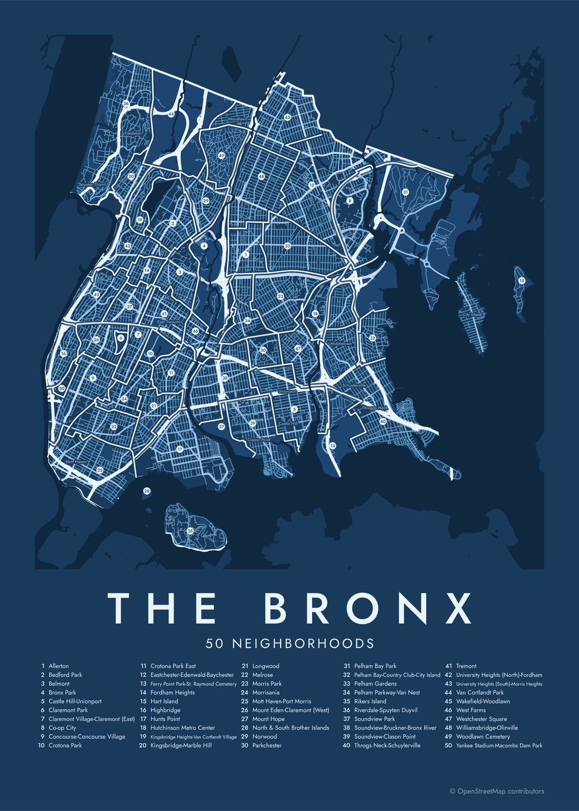 The Bronx street map with numbered neighborhoods and their listEdit this →More neighborhood maps →
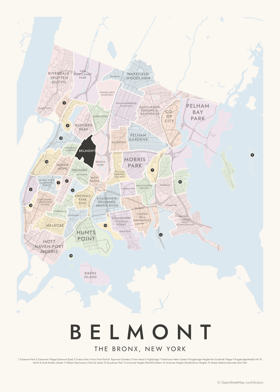 Belmont highlighted on a map of The BronxEdit this →More neighborhood maps →
How the Bronx is divided
The areas on this map are the Bronx's Neighborhood Tabulation Areas, drawn by the NYC Department of City Planning from census tracts for the 2020 Census. Smaller neighborhoods are often combined, which is why many names are joined, like Mott Haven-Port Morris or Wakefield-Woodlawn. Thirty-seven areas are residential. The other 13 are parks, cemeteries and islands, such as Van Cortlandt Park, Woodlawn Cemetery and Rikers Island.
The names Bronxites use don't always line up with these areas. The South Bronx isn't on any official map, and Fieldston sits inside Riverdale. That's why the map also prints 37 local names as small labels. For city government, the Bronx is split again into 12 community districts, each with its own community board.
All 50 neighborhoods of The Bronx
- Allerton
- Bedford Park
- Belmont
- Bronx Park
- Castle Hill-Unionport
- Claremont Park
- Claremont Village-Claremont (East)
- Co-op City
- Concourse-Concourse Village
- Crotona Park
- Crotona Park East
- Eastchester-Edenwald-Baychester
- Ferry Point Park-St. Raymond Cemetery
- Fordham Heights
- Hart Island
- Highbridge
- Hunts Point
- Hutchinson Metro Center
- Kingsbridge Heights-Van Cortlandt Village
- Kingsbridge-Marble Hill
- Longwood
- Melrose
- Morris Park
- Morrisania
- Mott Haven-Port Morris
- Mount Eden-Claremont (West)
- Mount Hope
- North & South Brother Islands
- Norwood
- Parkchester
- Pelham Bay Park
- Pelham Bay-Country Club-City Island
- Pelham Gardens
- Pelham Parkway-Van Nest
- Rikers Island
- Riverdale-Spuyten Duyvil
- Soundview Park
- Soundview-Bruckner-Bronx River
- Soundview-Clason Point
- Throgs Neck-Schuylerville
- Tremont
- University Heights (North)-Fordham
- University Heights (South)-Morris Heights
- Van Cortlandt Park
- Wakefield-Woodlawn
- West Farms
- Westchester Square
- Williamsbridge-Olinville
- Woodlawn Cemetery
- Yankee Stadium-Macombs Dam Park
More neighborhood names on the map
Inside the neighborhoods, the map also names 36 smaller neighborhoods where they fit, from OpenStreetMap: City Island, South Bronx, High Bridge, Mott Haven, Morris Heights, Spuyten Duyvil, Port Morris, University Heights, Riverdale, Kingsbridge, Fieldston, Kingsbridge Heights, Fordham, Charlotte Gardens, East Tremont, Lambert Houses, Woodlawn, Bronxdale, Williamsbridge, Van Nest, Clason Point, Wakefield, Unionport, Castle Hill, Eastchester Heights, Pelham Bay, Middletown, Eastchester, Schuylerville, Spencer Estates, Throggs Neck, Country Club, Eastchester Bay, Park of Edgewater, Silver Beach, Locust Point. Turn them off under Names if you want only the neighborhoods.
Neighborhoods to know
- Belmont: the Bronx's Little Italy, with food shops along Arthur Avenue and the Arthur Avenue Retail Market.
- Bronx Park: home to the Bronx Zoo and the New York Botanical Garden, with the Bronx River running between them.
- Yankee Stadium-Macombs Dam Park: Yankee Stadium and the park beside it, along East 161st Street.
- Concourse-Concourse Village: along the Grand Concourse, a wide boulevard lined with Art Deco apartment buildings.
- Pelham Bay Park: New York City's largest park, with Orchard Beach on Long Island Sound.
- City Island: a small island reached by a bridge from Pelham Bay Park, with boatyards and seafood restaurants.
- Riverdale: a hilly area above the Hudson, home to the Wave Hill public garden.
- Woodlawn Cemetery: opened in 1863; Herman Melville, Duke Ellington and Miles Davis are buried here.
How to make your The Bronx neighborhood poster
- Open the The Bronx map.
- Pick a style: Colored areas, Typographic (the names fill the map) or a Street map with the borders over the streets.
- Tap your own neighborhood to highlight it; it becomes the poster's title.
- Drag and zoom to frame the whole city or just your part of it, then pick a size and download the print file.
Questions
How many neighborhoods are in the Bronx?
There's no official count. City planners split the Bronx into 50 Neighborhood Tabulation Areas, 37 of them residential, and that's what this map shows. Locals use many more names, and 37 of them appear on the map as smaller labels.
Is the Bronx a borough or a county?
Both. The Bronx is one of New York City's five boroughs, and it's also Bronx County, with the same borders. It became a borough in 1898 and its own county in 1914.
Why is it called the Bronx?
It's named after the Bronx River, which took its name from Jonas Bronck, who settled the area in 1639.
Where is the South Bronx?
The South Bronx is an informal name for the southern part of the borough, around Mott Haven, Port Morris, Melrose, Hunts Point and Morrisania. It has no official border, so it appears on the map as a label, not an area.
Where do the The Bronx boundaries come from?
From OpenStreetMap (© OpenStreetMap contributors) and NYC Department of City Planning. Streets and water are OpenStreetMap's. Boundaries are a snapshot and can differ from what neighbors call home; tell us if one looks wrong.
What sizes can I print?
US Letter, 8 × 10, 11 × 14, 12 × 16 and 12 × 18 in, A4 and A3, free. You download a 300 DPI JPEG drawn at the size you pick. Larger prints, up to 24 × 36 in, are coming soon.
Related




Gift ideas by occasion




Every example is made with the Posterage generators. Change anything, then download it as a 300 DPI JPEG.