Brooklyn neighborhood map 69 areas, from Greenpoint to Coney Island
This poster maps Brooklyn as 69 named areas, from Greenpoint and Williamsburg down to Coney Island and Jamaica Bay. Prospect Park, Green-Wood Cemetery and the Navy Yard get their own shapes too. Highlight yours and print it.
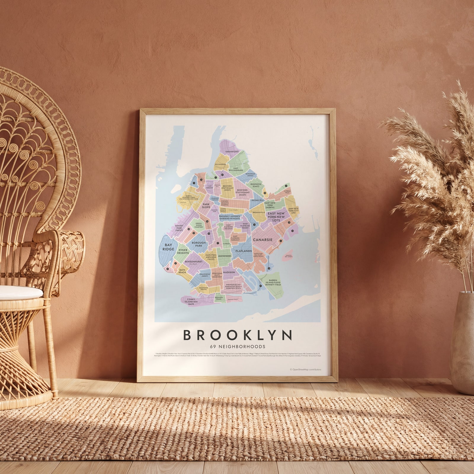
On the wall
A few of them framed at home. Open any one to make it yours.
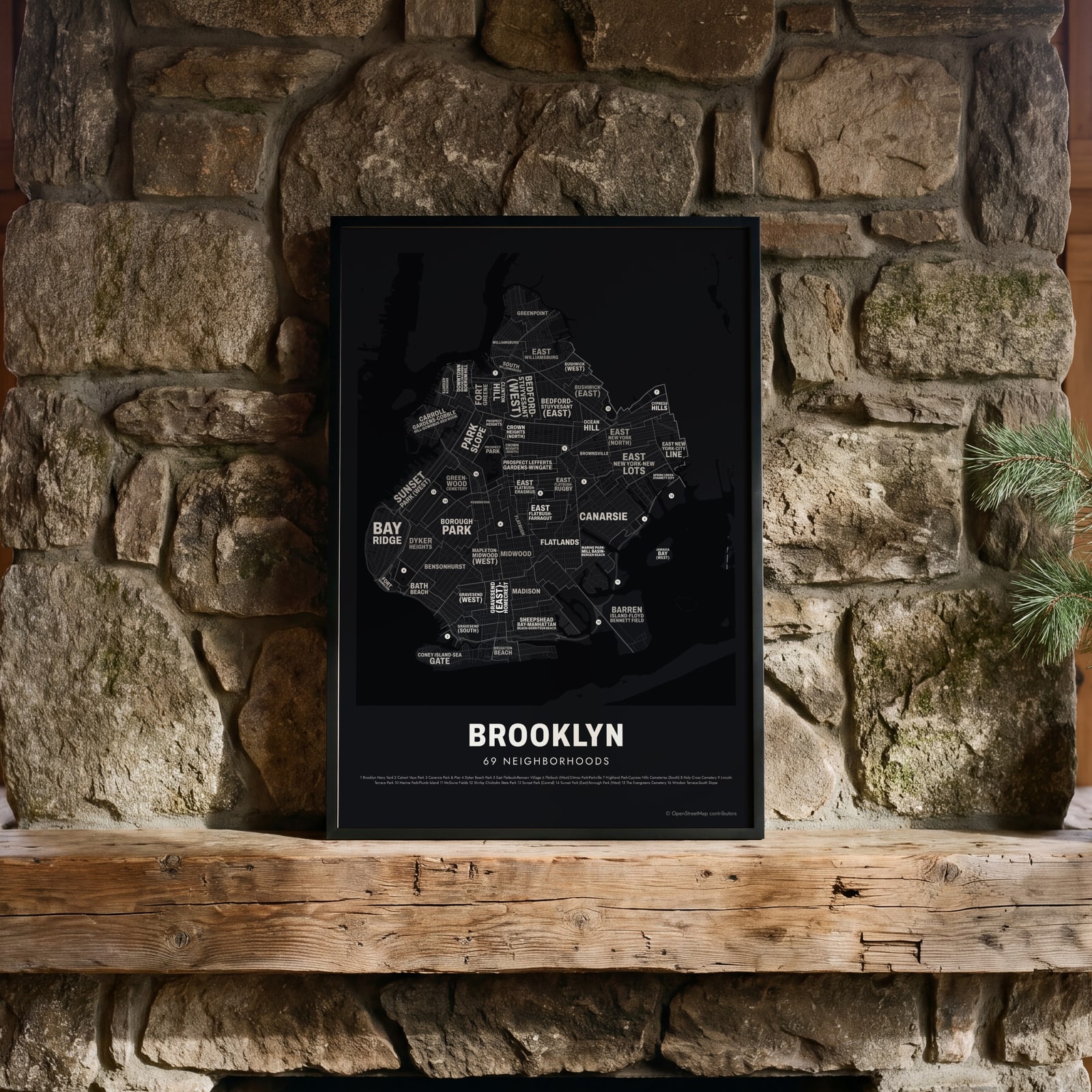 Typographic Brooklyn map: the names fill their neighborhoodsEdit this →
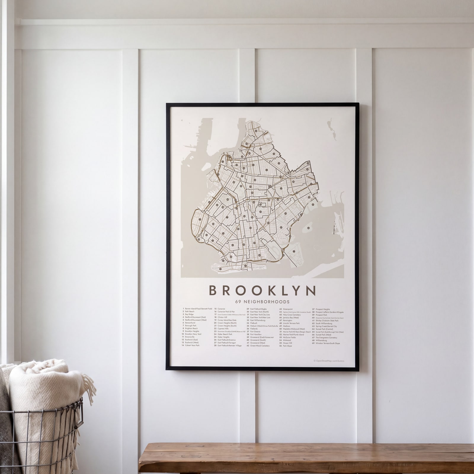 Brooklyn street map with numbered neighborhoods and their listEdit this →
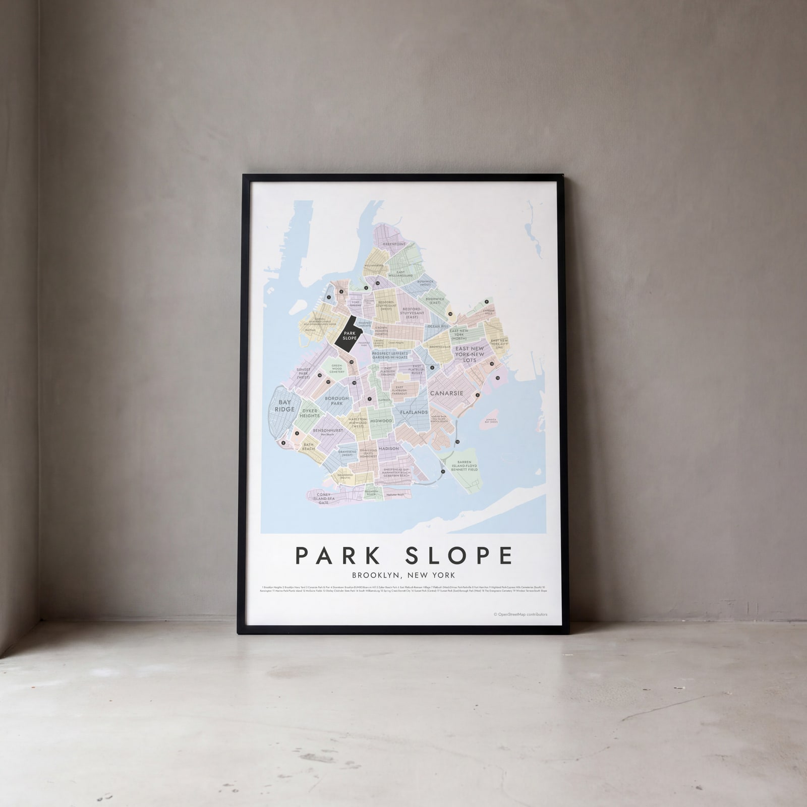 Park Slope highlighted on a map of BrooklynEdit this →
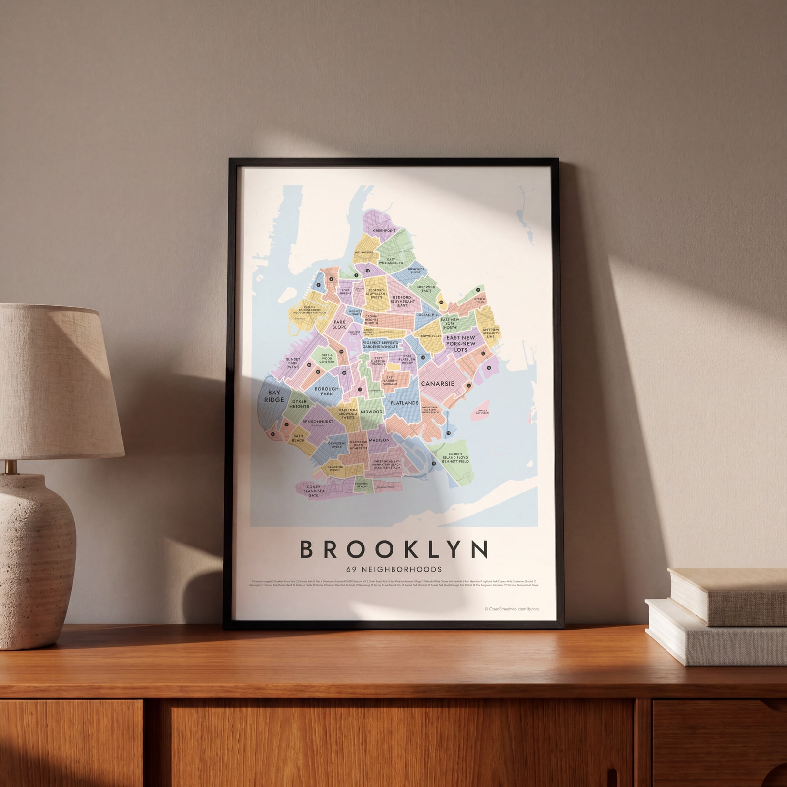 Brooklyn neighborhood map in color, every neighborhood namedEdit this →
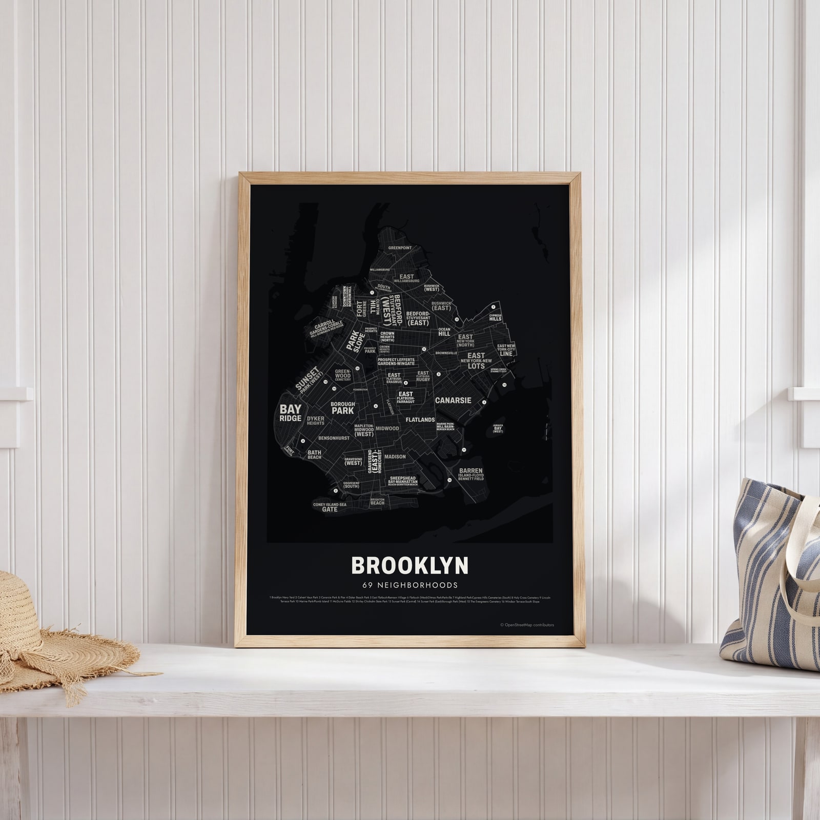 Typographic Brooklyn map: the names fill their neighborhoodsEdit this →
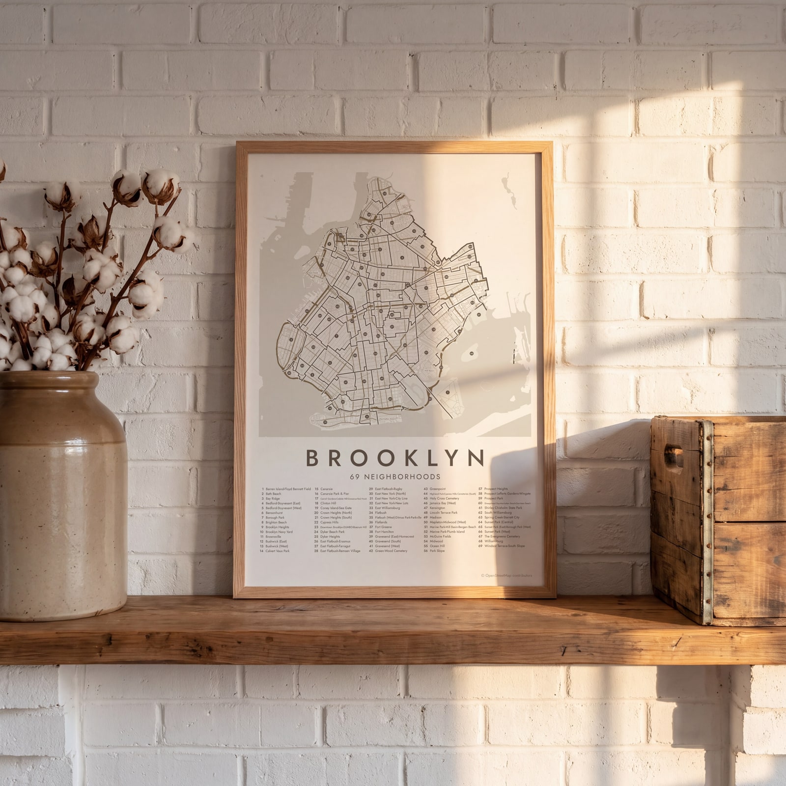 Brooklyn street map with numbered neighborhoods and their listEdit this →
Examples
Open any of them to change the words, the place, the date and the style, then download the print file.
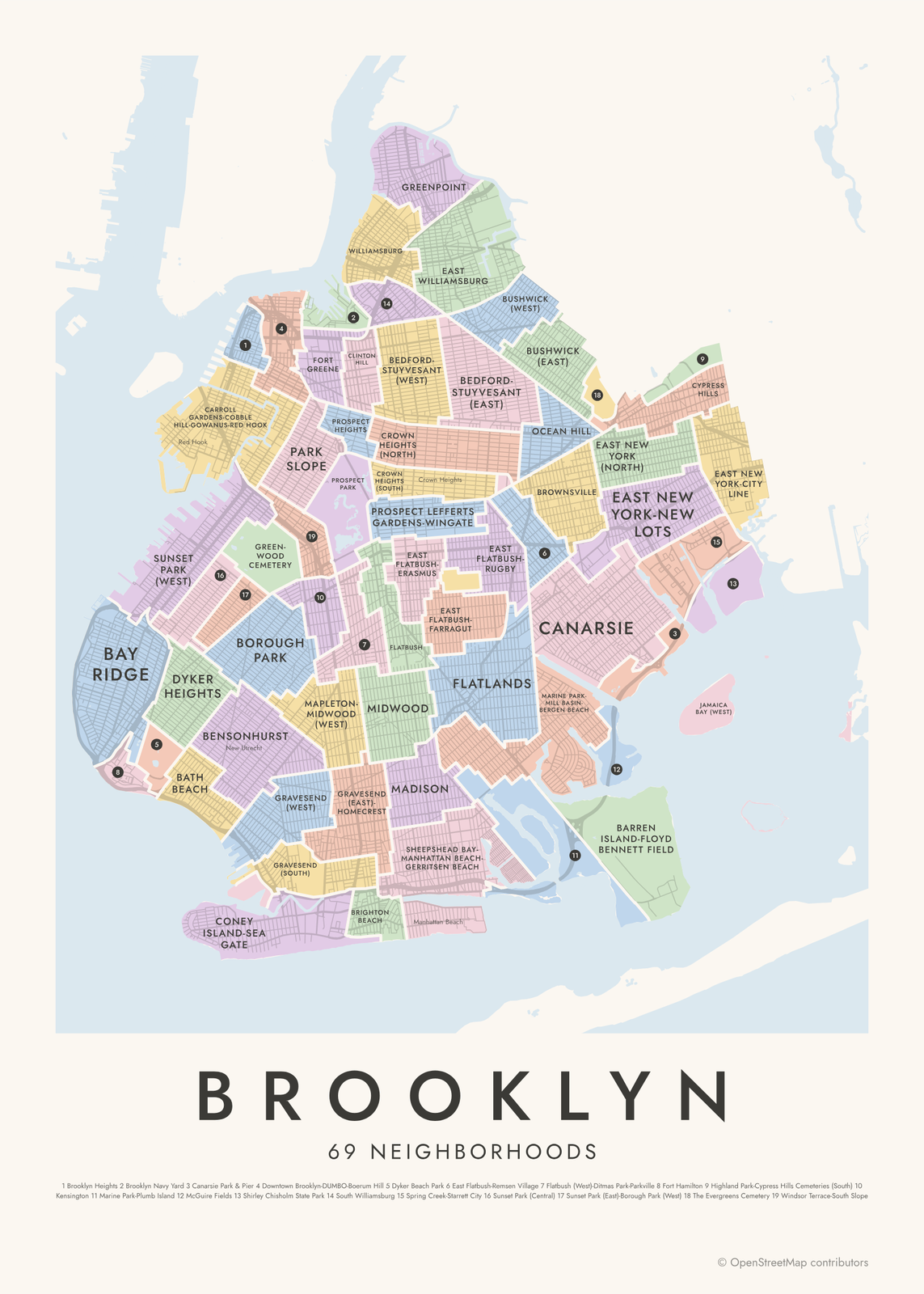 Brooklyn neighborhood map in color, every neighborhood namedEdit this →More neighborhood maps →
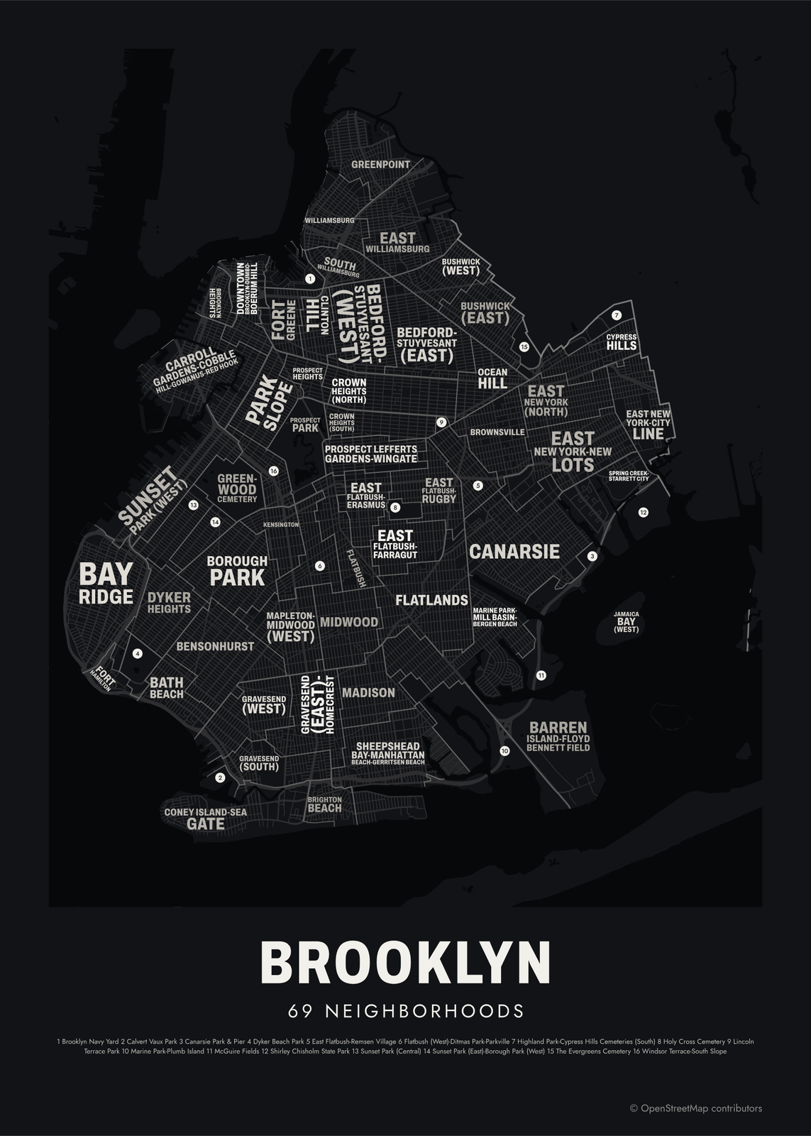 Typographic Brooklyn map: the names fill their neighborhoodsEdit this →More neighborhood maps →
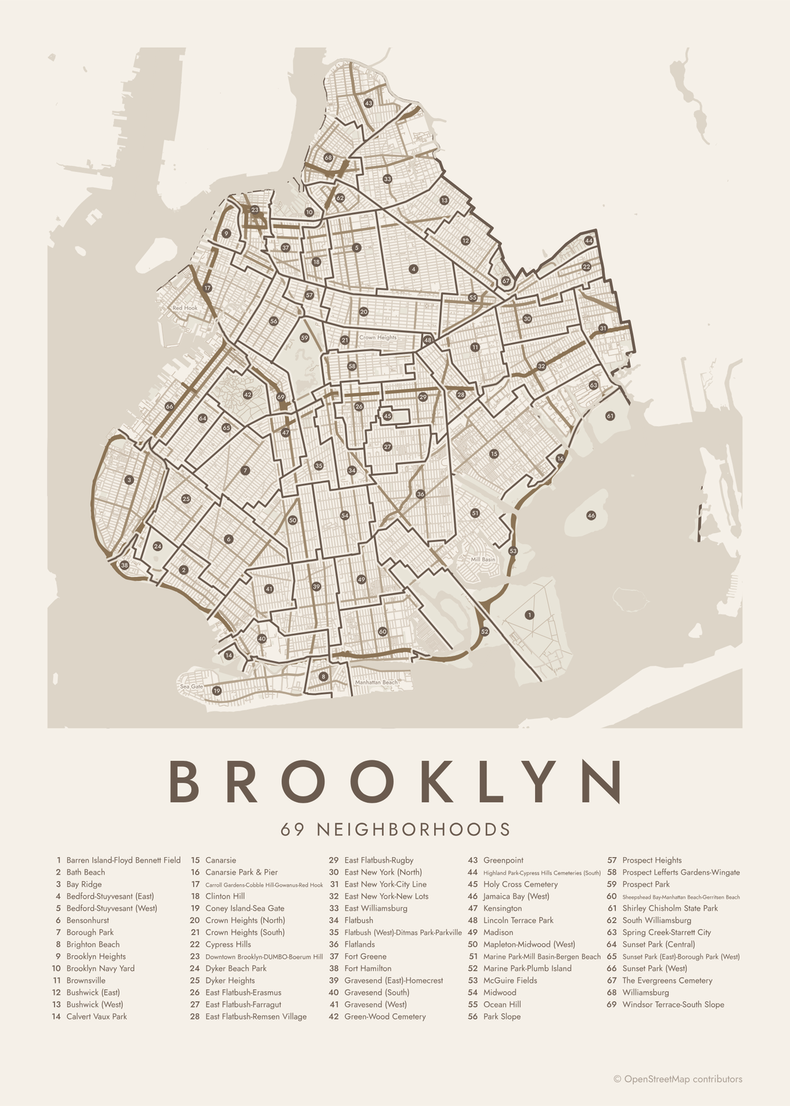 Brooklyn street map with numbered neighborhoods and their listEdit this →More neighborhood maps →
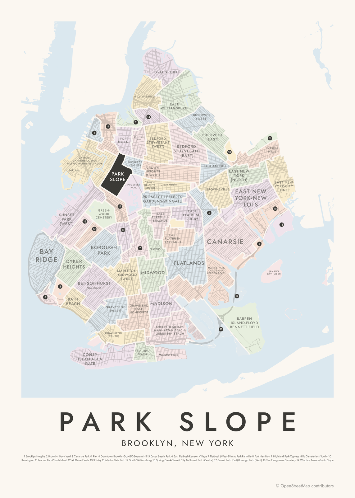 Park Slope highlighted on a map of BrooklynEdit this →More neighborhood maps →
How Brooklyn is divided
Brooklyn is one of New York City's five boroughs and is also Kings County. It was a city in its own right until 1898, when it merged into Greater New York. Today it has 18 community districts for local planning.
Our areas are the Department of City Planning's 2020 Neighborhood Tabulation Areas, built from census tracts so the city can report data by neighborhood. Each needs enough residents for reliable numbers, so small neighborhoods are often grouped, as in Carroll Gardens-Cobble Hill-Gowanus-Red Hook. Large parks and cemeteries are areas of their own, and smaller names like Dumbo, Gowanus and Mill Basin appear as labels.
All 69 neighborhoods of Brooklyn
- Barren Island-Floyd Bennett Field
- Bath Beach
- Bay Ridge
- Bedford-Stuyvesant (East)
- Bedford-Stuyvesant (West)
- Bensonhurst
- Borough Park
- Brighton Beach
- Brooklyn Heights
- Brooklyn Navy Yard
- Brownsville
- Bushwick (East)
- Bushwick (West)
- Calvert Vaux Park
- Canarsie
- Canarsie Park & Pier
- Carroll Gardens-Cobble Hill-Gowanus-Red Hook
- Clinton Hill
- Coney Island-Sea Gate
- Crown Heights (North)
- Crown Heights (South)
- Cypress Hills
- Downtown Brooklyn-DUMBO-Boerum Hill
- Dyker Beach Park
- Dyker Heights
- East Flatbush-Erasmus
- East Flatbush-Farragut
- East Flatbush-Remsen Village
- East Flatbush-Rugby
- East New York (North)
- East New York-City Line
- East New York-New Lots
- East Williamsburg
- Flatbush
- Flatbush (West)-Ditmas Park-Parkville
- Flatlands
- Fort Greene
- Fort Hamilton
- Gravesend (East)-Homecrest
- Gravesend (South)
- Gravesend (West)
- Green-Wood Cemetery
- Greenpoint
- Highland Park-Cypress Hills Cemeteries (South)
- Holy Cross Cemetery
- Jamaica Bay (West)
- Kensington
- Lincoln Terrace Park
- Madison
- Mapleton-Midwood (West)
- Marine Park-Mill Basin-Bergen Beach
- Marine Park-Plumb Island
- McGuire Fields
- Midwood
- Ocean Hill
- Park Slope
- Prospect Heights
- Prospect Lefferts Gardens-Wingate
- Prospect Park
- Sheepshead Bay-Manhattan Beach-Gerritsen Beach
- Shirley Chisholm State Park
- South Williamsburg
- Spring Creek-Starrett City
- Sunset Park (Central)
- Sunset Park (East)-Borough Park (West)
- Sunset Park (West)
- The Evergreens Cemetery
- Williamsburg
- Windsor Terrace-South Slope
More neighborhood names on the map
Inside the neighborhoods, the map also names 28 smaller neighborhoods where they fit, from OpenStreetMap: New Utrecht, Coney Island, Bushwick, East New York, Red Hook, Sunset Park, Sea Gate, Columbia Street Waterfront District, Cobble Hill, Carroll Gardens, South Slope, Dumbo, Gowanus, Gravesend, Parkville, Sheepshead Bay, Manhattan Beach, Crown Heights, Bedford-Stuyvesant, Eastern Parkway, East Flatbush, Gerritsen Beach, Paerdegat, Mill Basin, Bergen Beach, Broadway Junction, New Lots, City Line. Turn them off under Names if you want only the neighborhoods.
Neighborhoods to know
- Brooklyn Heights: brownstones and the Promenade over the East River; it became the city's first historic district in 1965.
- Downtown Brooklyn-DUMBO-Boerum Hill: DUMBO stands for Down Under the Manhattan Bridge Overpass.
- Brooklyn Navy Yard: a Navy shipyard from 1801 to 1966, now an industrial park.
- Prospect Park: designed by Frederick Law Olmsted and Calvert Vaux, who also designed Central Park.
- Park Slope: brownstone blocks on the western edge of Prospect Park.
- Green-Wood Cemetery: founded in 1838, with hills, ponds and a Gothic Revival gate.
- Coney Island-Sea Gate: the boardwalk, the beach and the Cyclone roller coaster.
- Barren Island-Floyd Bennett Field: New York City's first municipal airport, now part of Gateway National Recreation Area.
How to make your Brooklyn neighborhood poster
- Open the Brooklyn map.
- Pick a style: Colored areas, Typographic (the names fill the map) or a Street map with the borders over the streets.
- Tap your own neighborhood to highlight it; it becomes the poster's title.
- Drag and zoom to frame the whole city or just your part of it, then pick a size and download the print file.
Questions
Is Brooklyn a borough or a city?
A borough. Brooklyn was its own city until 1898, when it joined Manhattan, Queens, the Bronx and Staten Island to form today's New York City. It's also Kings County.
How many neighborhoods are in Brooklyn?
There's no official count. The city's planners group Brooklyn into 69 tabulation areas, big parks and cemeteries included, and many smaller neighborhood names show as labels on the map.
Why do some areas have hyphenated names?
Each tabulation area needs enough residents for reliable census estimates, so small neighborhoods are grouped and their names joined, as in Marine Park-Mill Basin-Bergen Beach.
Where does Brooklyn end and Queens begin?
Brooklyn's only land border is with Queens. It runs from Newtown Creek in the north, through Bushwick and Ridgewood and the cemeteries of Cypress Hills, down to Jamaica Bay.
Where do the Brooklyn boundaries come from?
From OpenStreetMap (© OpenStreetMap contributors) and NYC Department of City Planning. Streets and water are OpenStreetMap's. Boundaries are a snapshot and can differ from what neighbors call home; tell us if one looks wrong.
What sizes can I print?
US Letter, 8 × 10, 11 × 14, 12 × 16 and 12 × 18 in, A4 and A3, free. You download a 300 DPI JPEG drawn at the size you pick. Larger prints, up to 24 × 36 in, are coming soon.
Related




Gift ideas by occasion




Every example is made with the Posterage generators. Change anything, then download it as a 300 DPI JPEG.