Denver neighborhood map 77 neighborhoods, named
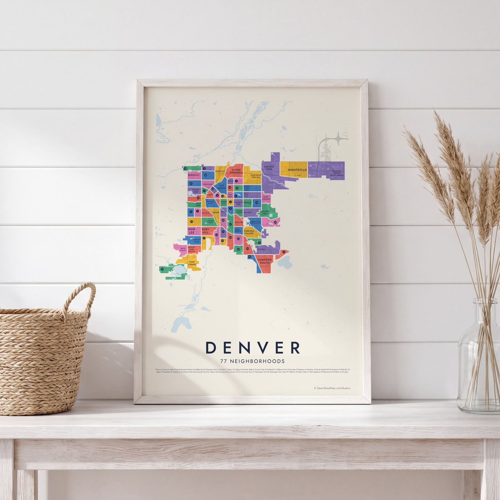
This poster maps Denver split into its official neighborhoods, 77 of them, each named, from Sloan Lake and Highland to Capitol Hill and Washington Park. Smaller local names like Lower Downtown and Curtis Park appear as labels. Highlight the one you call home and print it.
On the wall
A few of them framed at home. Open any one to make it yours.
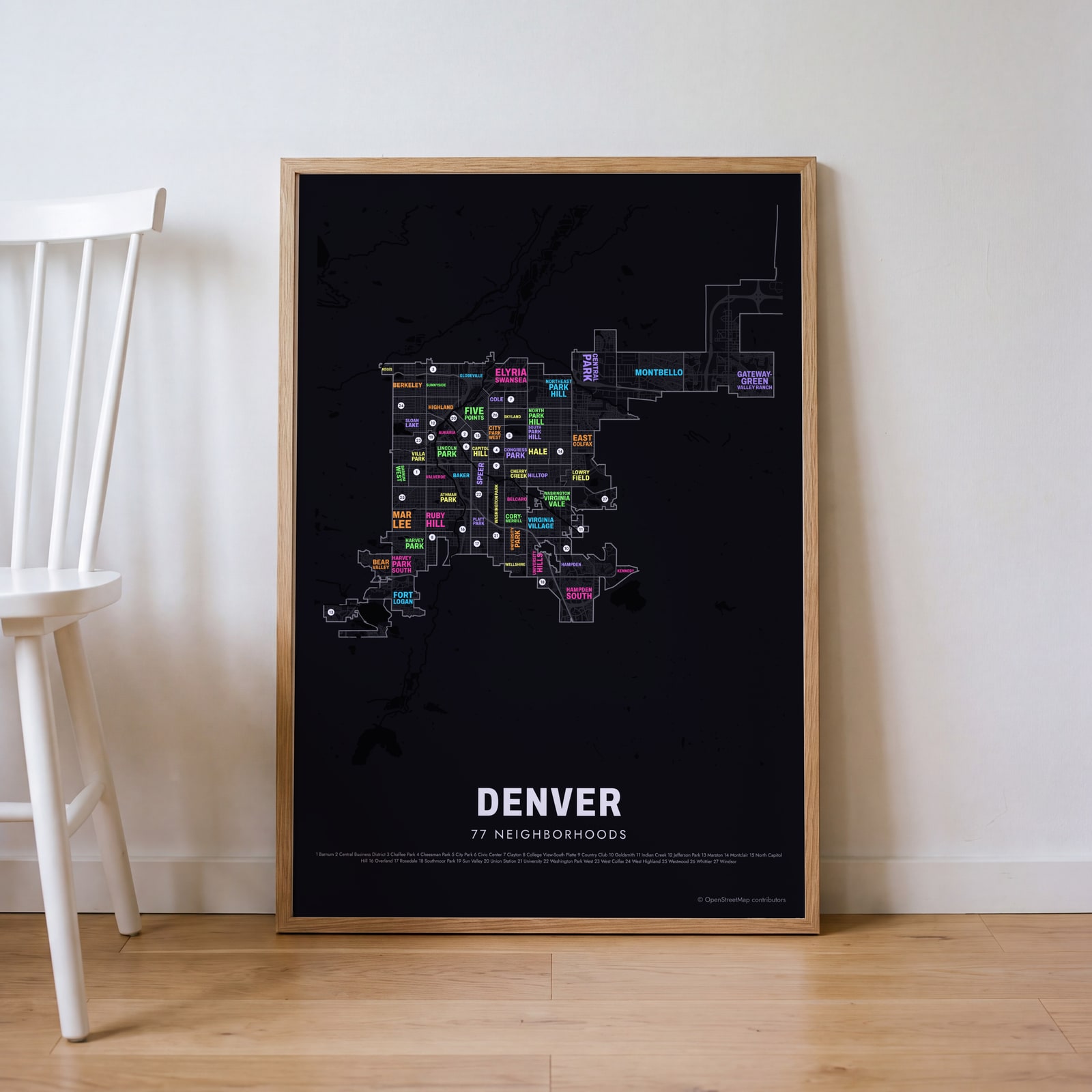 Typographic Denver map: the names fill their neighborhoodsEdit this →
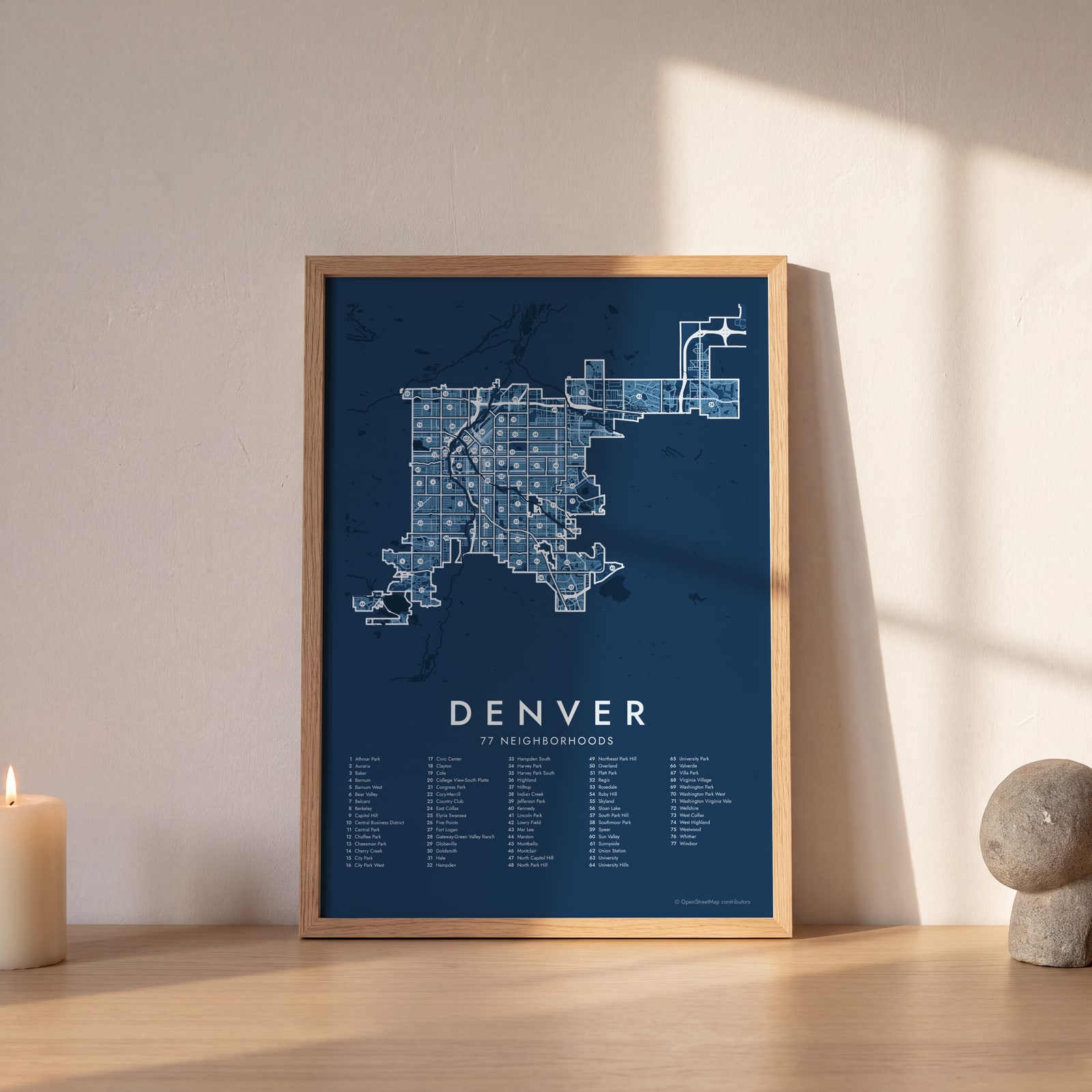 Denver street map with numbered neighborhoods and their listEdit this →
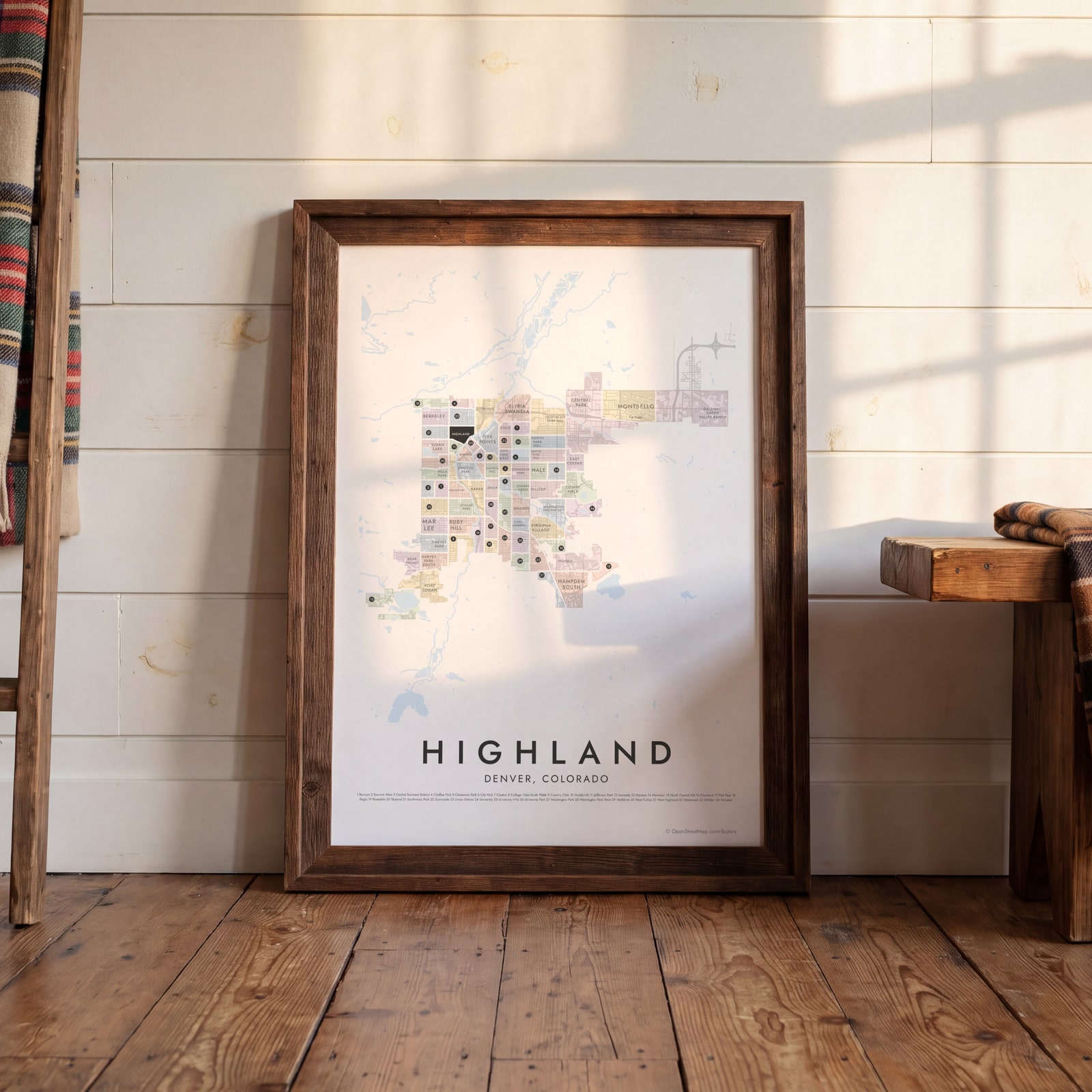 Highland highlighted on a map of DenverEdit this →
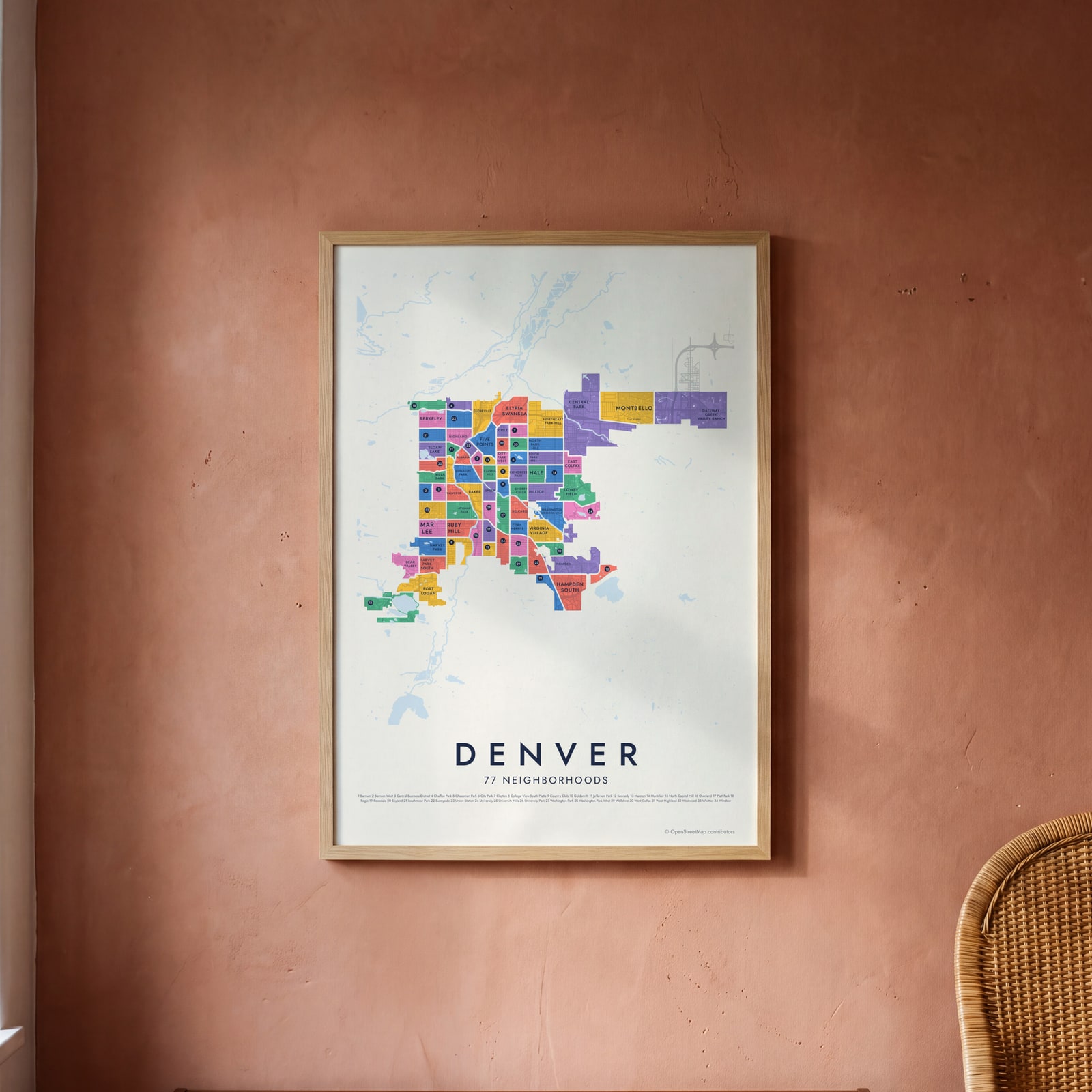 Denver neighborhood map in color, every neighborhood namedEdit this →
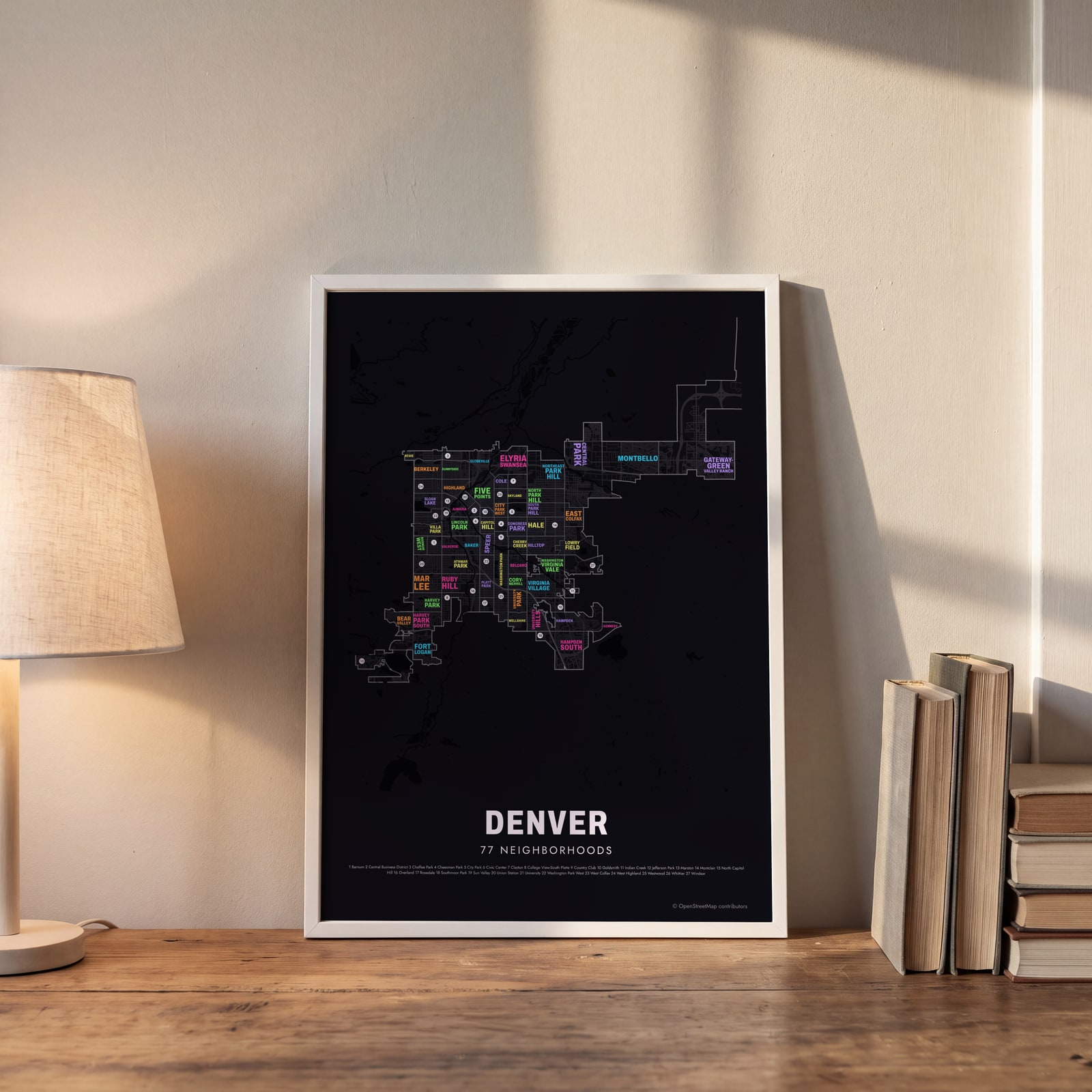 Typographic Denver map: the names fill their neighborhoodsEdit this →
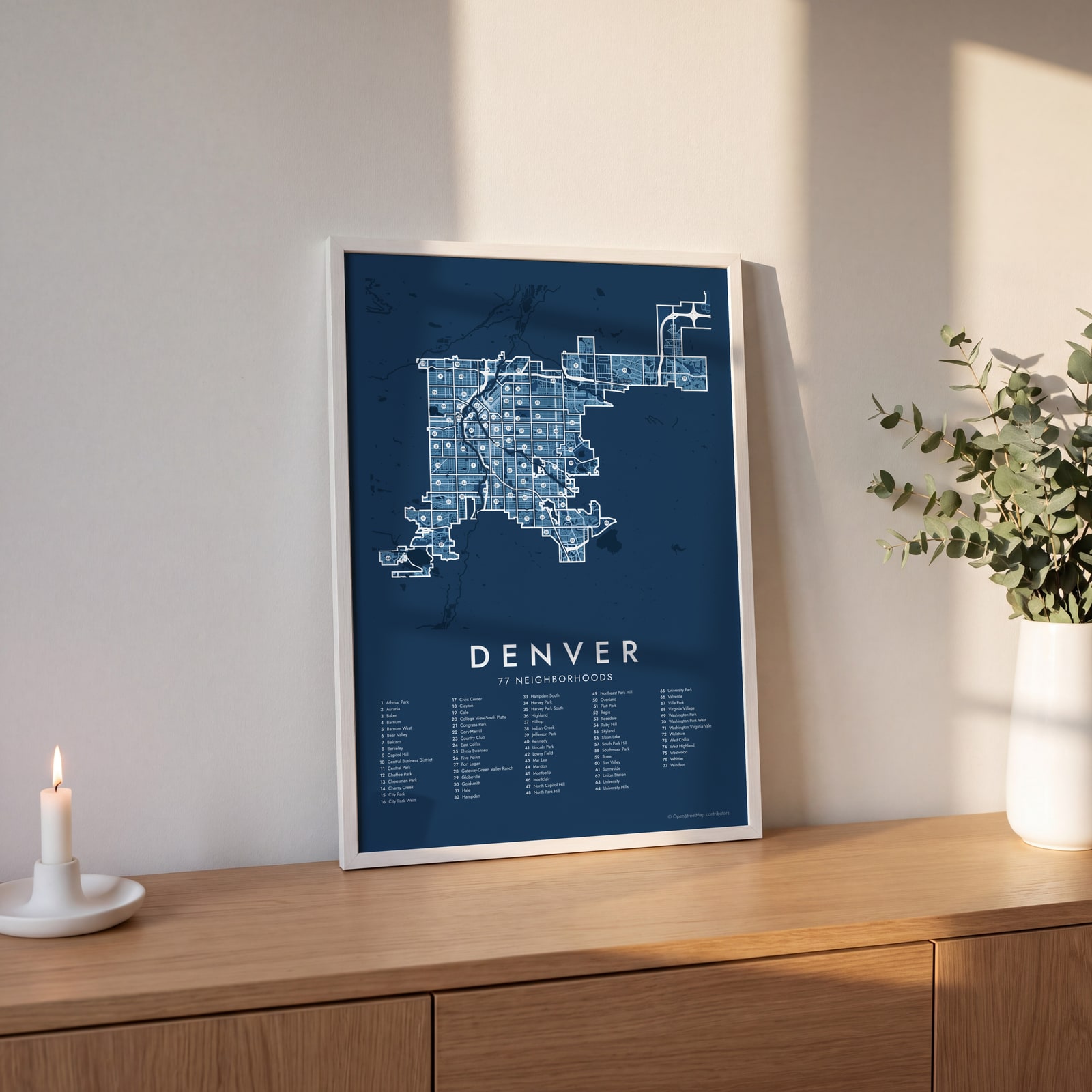 Denver street map with numbered neighborhoods and their listEdit this →
Examples
Open any of them to change the words, the place, the date and the style, then download the print file.
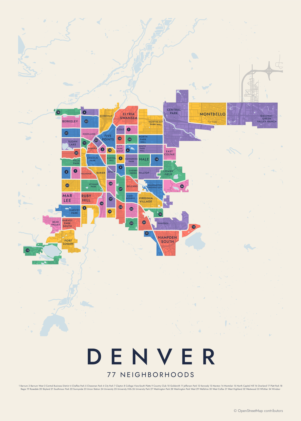 Denver neighborhood map in color, every neighborhood namedEdit this →More neighborhood maps →
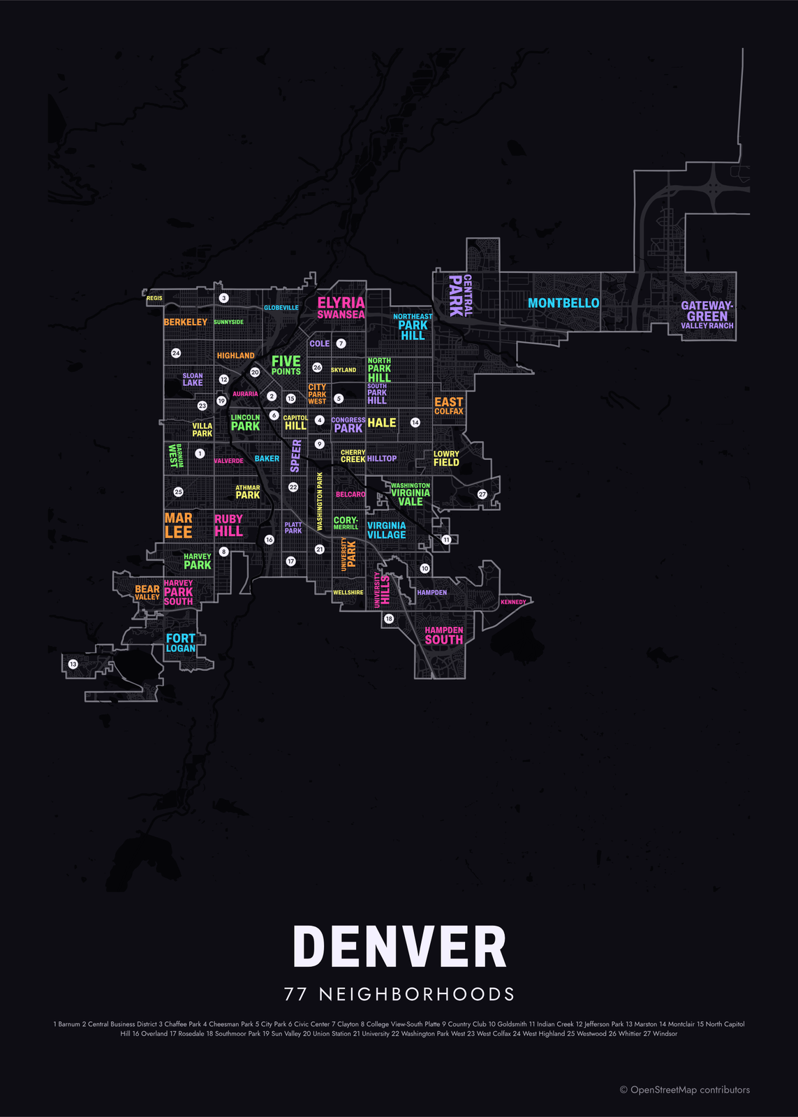 Typographic Denver map: the names fill their neighborhoodsEdit this →More neighborhood maps →
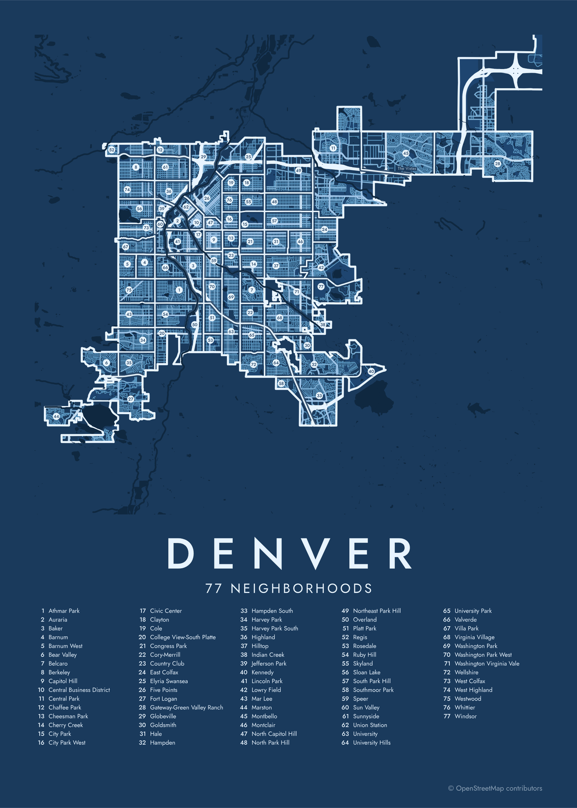 Denver street map with numbered neighborhoods and their listEdit this →More neighborhood maps →
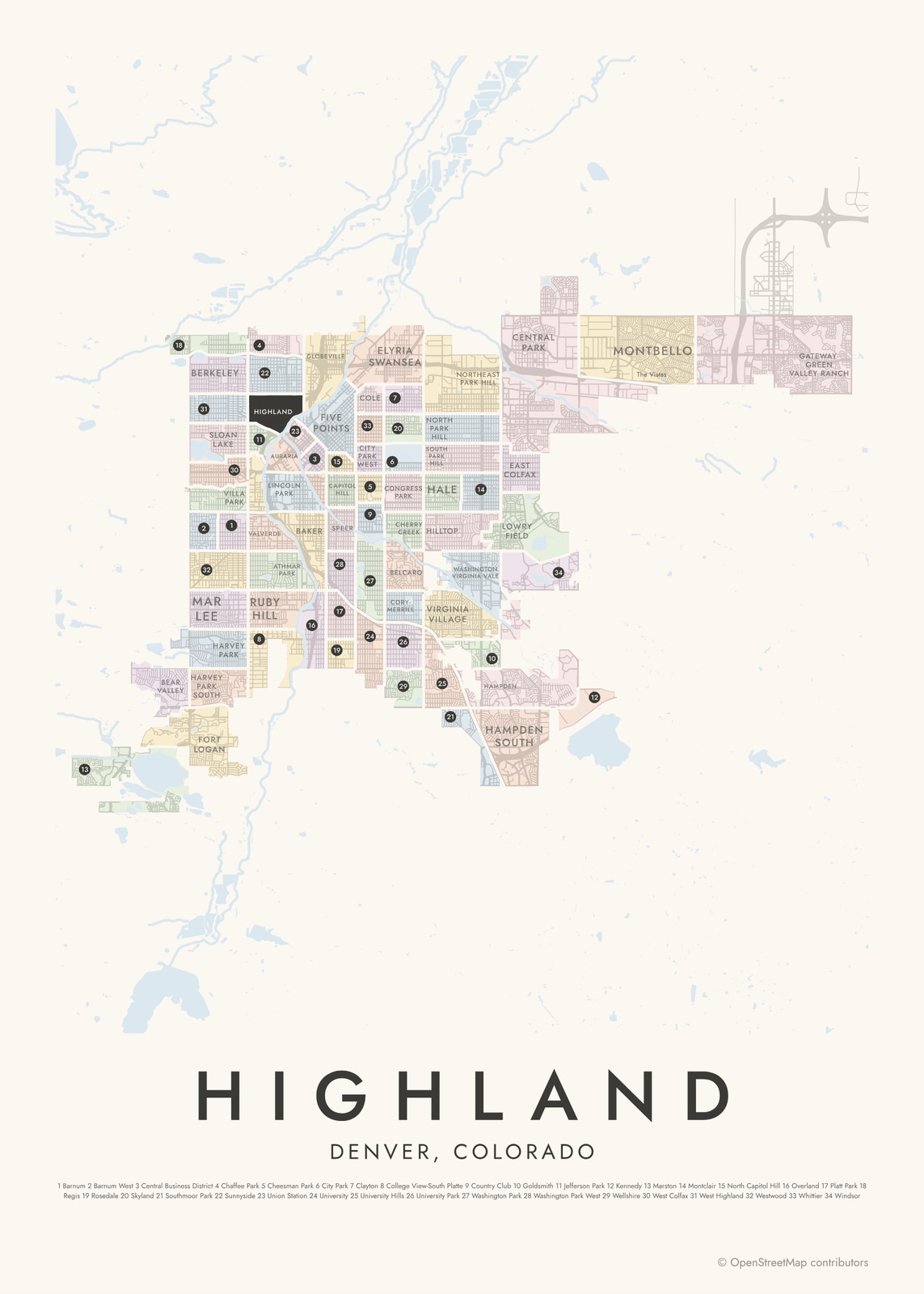 Highland highlighted on a map of DenverEdit this →More neighborhood maps →
How Denver is divided
Denver's official neighborhoods are statistical ones. In 1970 city planners grouped the city's census tracts into 73 neighborhoods, and most borders have stayed the same since, so data can be compared over the years. The city now counts 78. Our map shows 77 of them: the Denver International Airport area, far out on the eastern plains, is left off.
These borders don't always match what people call their part of town. Lower Downtown, or LoDo, is a historic district inside the Union Station neighborhood, and the RiNo Art District spreads over several neighborhoods north of downtown. Many names like these appear on the map as small labels.
All 77 neighborhoods of Denver
- Athmar Park
- Auraria
- Baker
- Barnum
- Barnum West
- Bear Valley
- Belcaro
- Berkeley
- Capitol Hill
- Central Business District
- Central Park
- Chaffee Park
- Cheesman Park
- Cherry Creek
- City Park
- City Park West
- Civic Center
- Clayton
- Cole
- College View-South Platte
- Congress Park
- Cory-Merrill
- Country Club
- East Colfax
- Elyria Swansea
- Five Points
- Fort Logan
- Gateway-Green Valley Ranch
- Globeville
- Goldsmith
- Hale
- Hampden
- Hampden South
- Harvey Park
- Harvey Park South
- Highland
- Hilltop
- Indian Creek
- Jefferson Park
- Kennedy
- Lincoln Park
- Lowry Field
- Mar Lee
- Marston
- Montbello
- Montclair
- North Capitol Hill
- North Park Hill
- Northeast Park Hill
- Overland
- Platt Park
- Regis
- Rosedale
- Ruby Hill
- Skyland
- Sloan Lake
- South Park Hill
- Southmoor Park
- Speer
- Sun Valley
- Sunnyside
- Union Station
- University
- University Hills
- University Park
- Valverde
- Villa Park
- Virginia Village
- Washington Park
- Washington Park West
- Washington Virginia Vale
- Wellshire
- West Colfax
- West Highland
- Westwood
- Whittier
- Windsor
More neighborhood names on the map
Inside the neighborhoods, the map also names 51 smaller neighborhoods where they fit, from OpenStreetMap: La Alma–Lincoln Park, Highlands Garden Village, Highlands Square, Mile High Vista, Little Saigon, Potter Highland Historic District, Lower Highland, East Highland, Riverfront, Mariposa District, Lower Downtown, Union Station North, Theatre District, Fox Island, Upper Downtown, Ballpark, RiNo West, Arapahoe Square, Clement, Sherman Street Historic District, Curtis Park, River North RiNo Art District, Enterprise Hill Historic District, Quality Hill Historic District, Glenarm Place Historic District, Curtis-Champa Streets Historic District, San Rafael Historic District, Alamo Placita, Swallow Hill Historic District, North Wynkoop, Cole Neighborhood Historic District, Belmont Heights, Sandown, The Vistas, Gateway Park, Denver Connection, Green Valley Ranch, Oak Reserve, Kessler Walk, Oak Crest and more. Turn them off under Names if you want only the neighborhoods.
Neighborhoods to know
- Five Points: Denver's historic center of Black business and jazz, along Welton Street.
- Capitol Hill: grand old houses around the Colorado State Capitol, including the Molly Brown House.
- Union Station: built around the restored 1914 station, with trains to the airport and the red-brick warehouses of Lower Downtown.
- Auraria: one downtown campus shared by three colleges.
- City Park: home to the Denver Zoo and the Denver Museum of Nature & Science.
- Washington Park: a big park with two lakes and flower gardens, known locally as Wash Park.
- Cherry Creek: shops and galleries along the creek that gives the neighborhood its name.
- Sloan Lake: houses around Sloan's Lake, with views west to the mountains.
How to make your Denver neighborhood poster
- Open the Denver map.
- Pick a style: Colored areas, Typographic (the names fill the map) or a Street map with the borders over the streets.
- Tap your own neighborhood to highlight it; it becomes the poster's title.
- Drag and zoom to frame the whole city or just your part of it, then pick a size and download the print file.
Questions
How many neighborhoods does Denver have?
The city counts 78 official neighborhoods, first drawn for statistics in 1970. This map shows 77 of them, leaving off the airport area on the eastern plains. Many more local names, like Lower Downtown and Curtis Park, appear as labels.
What happened to the Stapleton neighborhood?
Residents voted in 2020 to rename it Central Park, after the big park at its center. The neighborhood was built on the site of Stapleton International Airport, which closed in 1995. It appears on this map as Central Park.
Are LoDo and RiNo official neighborhoods?
No. LoDo, short for Lower Downtown, is a historic district inside the Union Station neighborhood. RiNo, the River North Art District, spreads over several neighborhoods north of downtown, Five Points among them. Both show on this map as labels.
Where do the Denver boundaries come from?
From OpenStreetMap (© OpenStreetMap contributors) and City of Denver Open Data Catalog. Streets and water are OpenStreetMap's. Boundaries are a snapshot and can differ from what neighbors call home; tell us if one looks wrong.
What sizes can I print?
US Letter, 8 × 10, 11 × 14, 12 × 16 and 12 × 18 in, A4 and A3, free. You download a 300 DPI JPEG drawn at the size you pick. Larger prints, up to 24 × 36 in, are coming soon.
Related




Gift ideas by occasion




Every example is made with the Posterage generators. Change anything, then download it as a 300 DPI JPEG.