Houston neighborhood map all 88 super neighborhoods, named
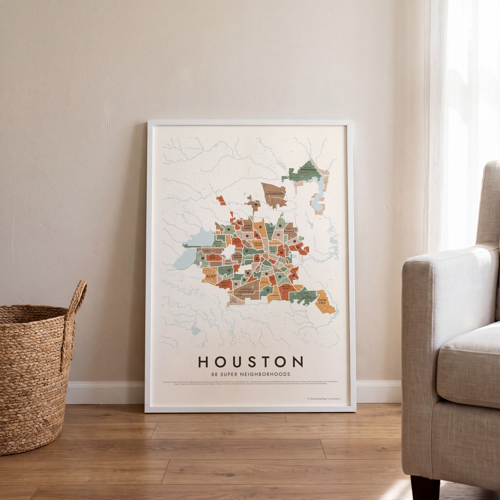
This poster maps Houston split into its 88 super neighborhoods, each named, from Acres Home and Greater Heights to Alief and Clear Lake. Smaller names like Montrose, River Oaks and Rice Village print as labels. Highlight the one you call home and print it.
On the wall
A few of them framed at home. Open any one to make it yours.
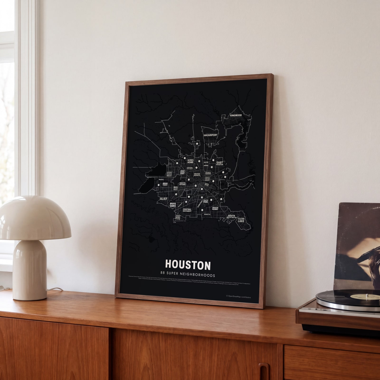 Typographic Houston map: the names fill their super neighborhoodsEdit this →
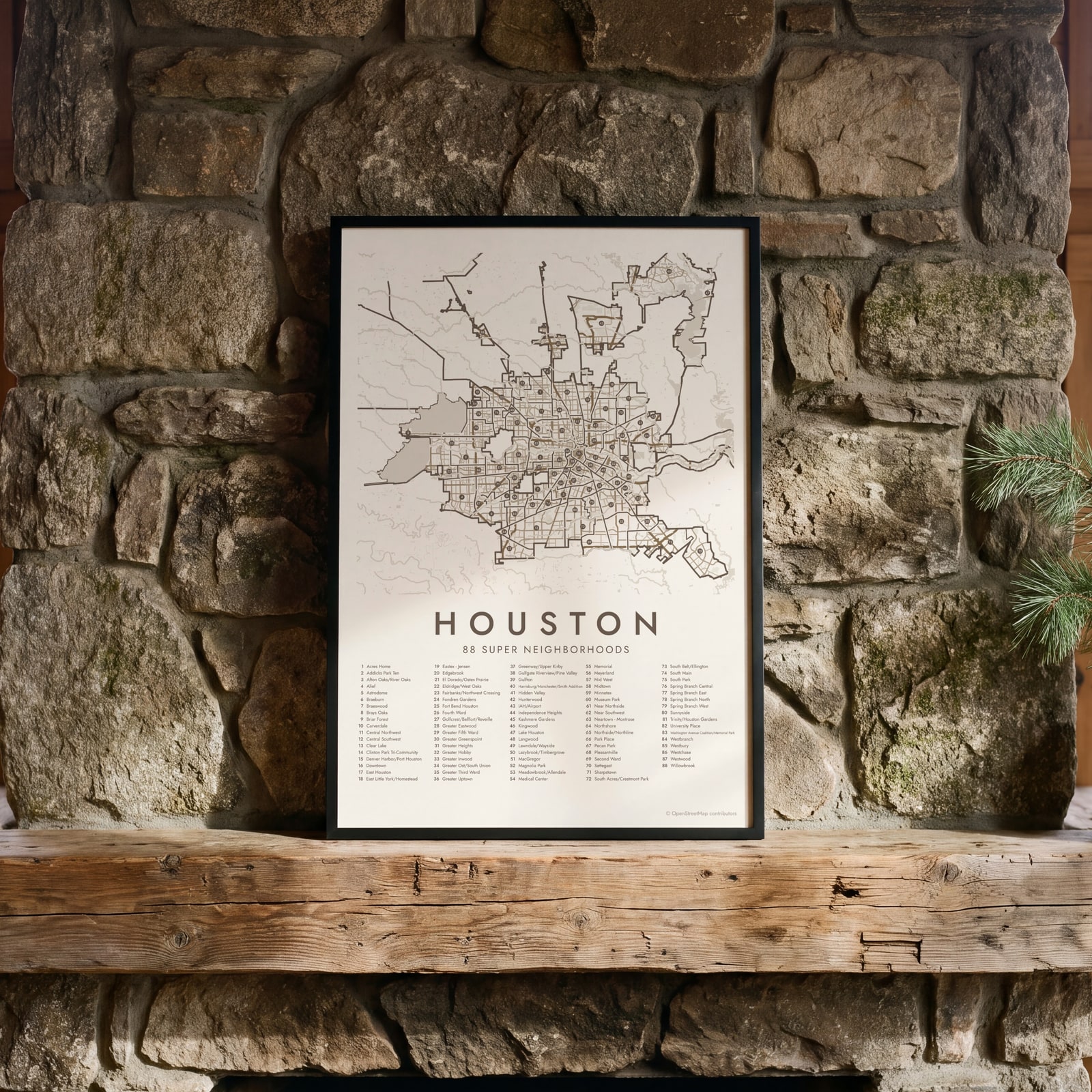 Houston street map with numbered super neighborhoods and their listEdit this →
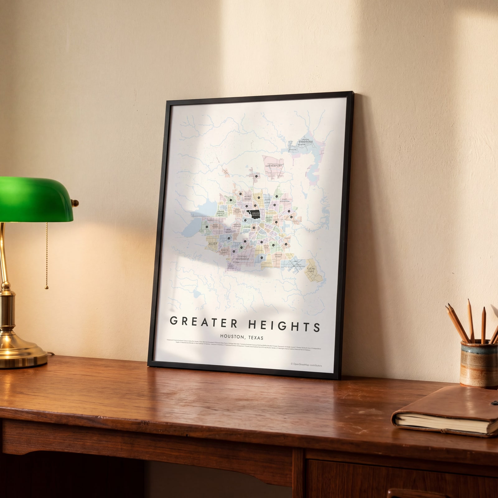 Greater Heights highlighted on a map of HoustonEdit this →
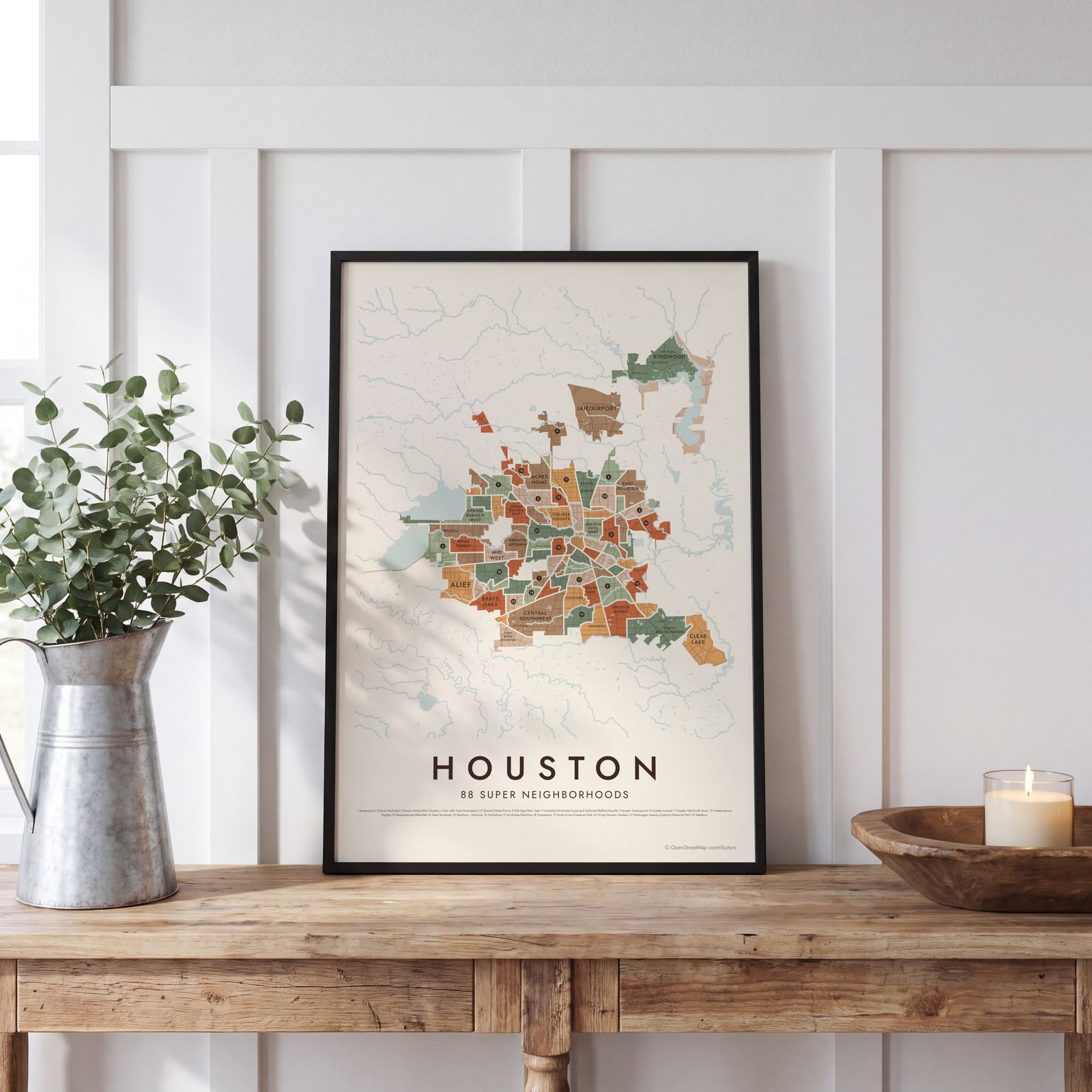 Houston neighborhood map in color, every super neighborhood namedEdit this →
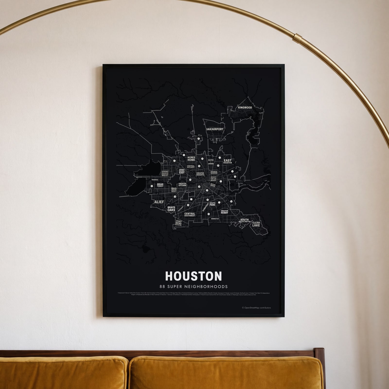 Typographic Houston map: the names fill their super neighborhoodsEdit this →
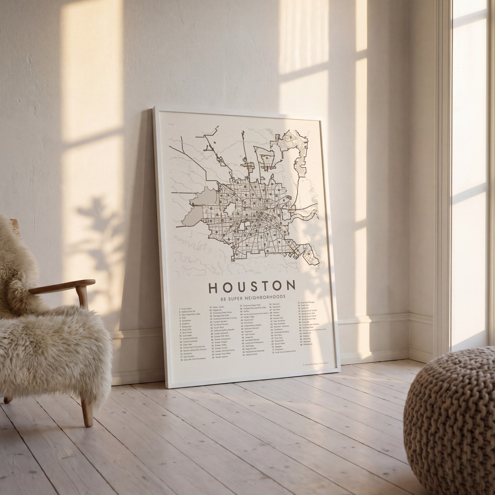 Houston street map with numbered super neighborhoods and their listEdit this →
Examples
Open any of them to change the words, the place, the date and the style, then download the print file.
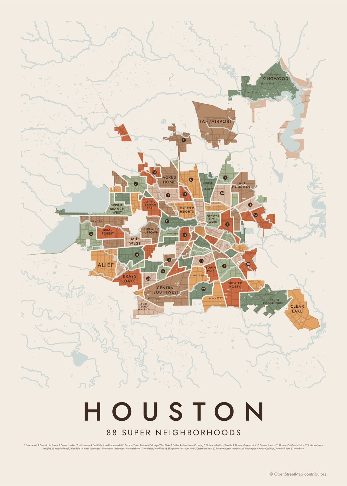 Houston neighborhood map in color, every super neighborhood namedEdit this →More neighborhood maps →
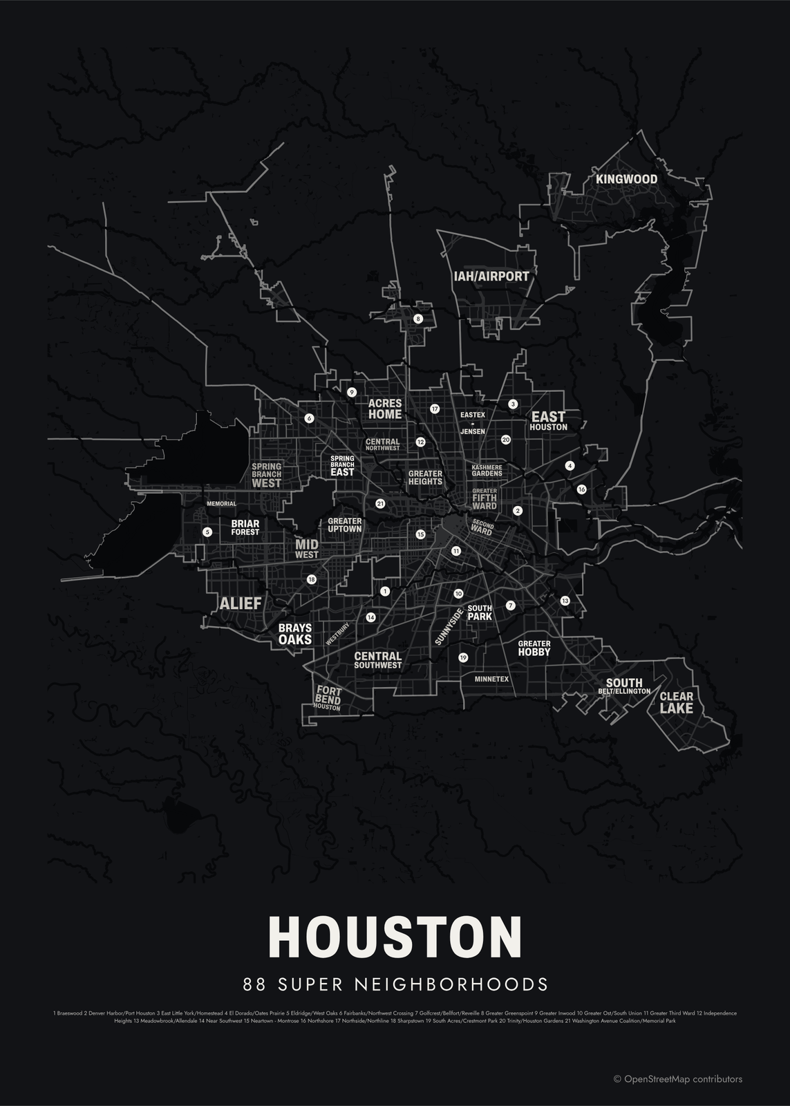 Typographic Houston map: the names fill their super neighborhoodsEdit this →More neighborhood maps →
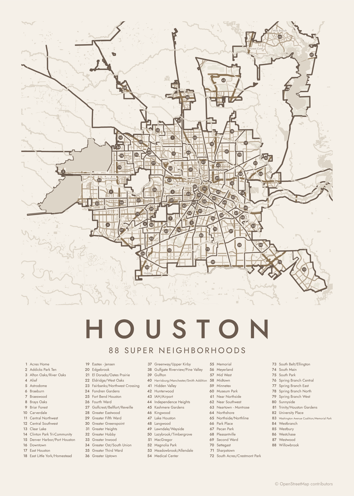 Houston street map with numbered super neighborhoods and their listEdit this →More neighborhood maps →
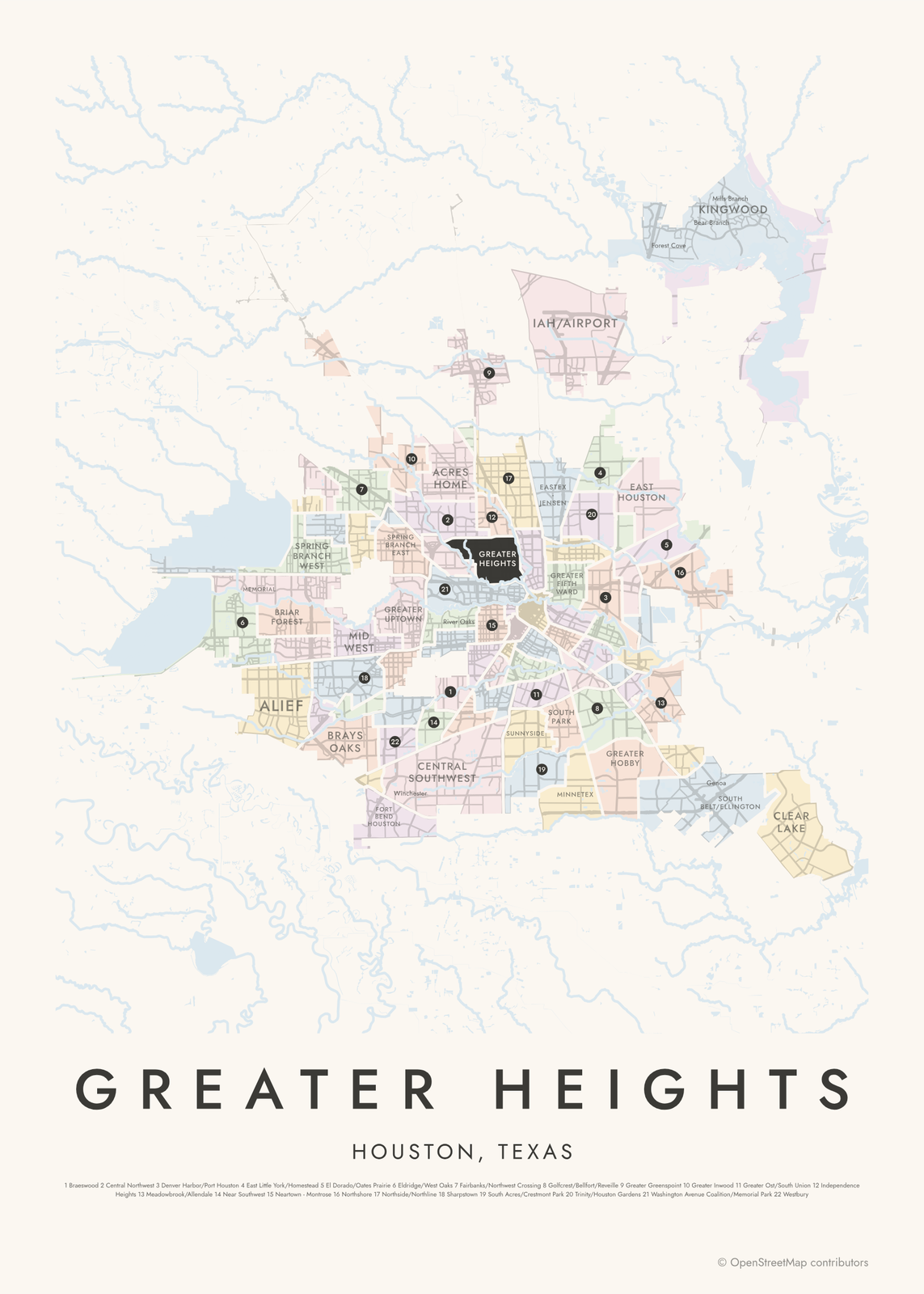 Greater Heights highlighted on a map of HoustonEdit this →More neighborhood maps →
How Houston is divided
Super neighborhoods were created in 1999 under Mayor Lee P. Brown, to give residents across a very large city a simpler way to work with City Hall. Each one groups nearby subdivisions and civic associations, with borders that follow major features like bayous and freeways. Residents and local groups in each can form a super neighborhood council to set priorities and talk with the city.
The names Houstonians use day to day are usually smaller. Montrose sits in Neartown - Montrose, River Oaks in Afton Oaks/River Oaks, and the Texas Medical Center in Medical Center. Many of these local names, from subdivisions to historic districts, print on the map as labels. A few places Houston surrounds, like Bellaire and West University Place, are separate cities.
All 88 super neighborhoods of Houston
- Acres Home
- Addicks Park Ten
- Afton Oaks/River Oaks
- Alief
- Astrodome
- Braeburn
- Braeswood
- Brays Oaks
- Briar Forest
- Carverdale
- Central Northwest
- Central Southwest
- Clear Lake
- Clinton Park Tri-Community
- Denver Harbor/Port Houston
- Downtown
- East Houston
- East Little York/Homestead
- Eastex - Jensen
- Edgebrook
- El Dorado/Oates Prairie
- Eldridge/West Oaks
- Fairbanks/Northwest Crossing
- Fondren Gardens
- Fort Bend Houston
- Fourth Ward
- Golfcrest/Bellfort/Reveille
- Greater Eastwood
- Greater Fifth Ward
- Greater Greenspoint
- Greater Heights
- Greater Hobby
- Greater Inwood
- Greater Ost/South Union
- Greater Third Ward
- Greater Uptown
- Greenway/Upper Kirby
- Gulfgate Riverview/Pine Valley
- Gulfton
- Harrisburg/Manchester/Smith Addition
- Hidden Valley
- Hunterwood
- IAH/Airport
- Independence Heights
- Kashmere Gardens
- Kingwood
- Lake Houston
- Langwood
- Lawndale/Wayside
- Lazybrook/Timbergrove
- MacGregor
- Magnolia Park
- Meadowbrook/Allendale
- Medical Center
- Memorial
- Meyerland
- Mid West
- Midtown
- Minnetex
- Museum Park
- Near Northside
- Near Southwest
- Neartown - Montrose
- Northshore
- Northside/Northline
- Park Place
- Pecan Park
- Pleasantville
- Second Ward
- Settegast
- Sharpstown
- South Acres/Crestmont Park
- South Belt/Ellington
- South Main
- South Park
- Spring Branch Central
- Spring Branch East
- Spring Branch North
- Spring Branch West
- Sunnyside
- Trinity/Houston Gardens
- University Place
- Washington Avenue Coalition/Memorial Park
- Westbranch
- Westbury
- Westchase
- Westwood
- Willowbrook
More neighborhood names on the map
Inside the super neighborhoods, the map also names 181 smaller neighborhoods where they fit, from OpenStreetMap: Addicks, Energy Corridor, Town & Country / CityCentre, Memorial City, Inwood, Uptown, Central Northwest Houston, Acres Homes, Greenway, Central Southwest Houston, Greenspoint, Houston Heights, Texas Medical Center, Montrose, Museum District, Third Ward, East Downtown, Eastwood, Fifth Ward, North Shore, Fairbanks, Rosslyn, Old Sixth Ward, First Ward, Denver Harbor, Golfcrest, Port Houston, Harrisburg, Manchester, El Dorado, Allendale, Oates Prairie, Lakewood Heights, Terraces on Memorial, Briar Park, Fleetwood, Briarhills, Lakes of Parkway, Charlton Park, Memorial Thicket and more. Turn them off under Names if you want only the super neighborhoods.
Neighborhoods to know
- Downtown: the skyline, Discovery Green and a network of pedestrian tunnels under the streets.
- Greater Heights: Houston Heights, a planned suburb from the 1890s with Victorian and Craftsman houses along Heights Boulevard.
- Neartown - Montrose: an arts district with the Menil Collection and the Rothko Chapel.
- Greater Third Ward: Emancipation Park, bought in 1872 for Juneteenth celebrations, and Texas Southern University.
- Medical Center: the hospitals and research centers of the Texas Medical Center.
- Washington Avenue Coalition/Memorial Park: Memorial Park, once the World War I training ground Camp Logan.
- Clear Lake: home to NASA's Johnson Space Center and Space Center Houston.
- Kingwood: wooded subdivisions in the far northeast, annexed by Houston in 1996.
How to make your Houston neighborhood poster
- Open the Houston map.
- Pick a style: Colored areas, Typographic (the names fill the map) or a Street map with the borders over the streets.
- Tap your own neighborhood to highlight it; it becomes the poster's title.
- Drag and zoom to frame the whole city or just your part of it, then pick a size and download the print file.
Questions
What is a super neighborhood in Houston?
A group of nearby neighborhoods that the city treats as one area for planning and outreach. Houston has 88 of them, set up in 1999. Residents and civic groups in each can form a super neighborhood council to work with the city.
How many neighborhoods does Houston have?
The city counts 88 super neighborhoods, but inside them are hundreds of subdivisions and civic associations, each with its own name. This map names all 88 and prints 181 smaller names as labels.
Are Bellaire and West University Place part of Houston?
No. Bellaire, West University Place and Southside Place are separate small cities that Houston surrounds. They aren't part of any super neighborhood.
Where do the Houston boundaries come from?
From OpenStreetMap (© OpenStreetMap contributors) and City of Houston GIS (COHGIS). Streets and water are OpenStreetMap's. Boundaries are a snapshot and can differ from what neighbors call home; tell us if one looks wrong.
What sizes can I print?
US Letter, 8 × 10, 11 × 14, 12 × 16 and 12 × 18 in, A4 and A3, free. You download a 300 DPI JPEG drawn at the size you pick. Larger prints, up to 24 × 36 in, are coming soon.
Related




Gift ideas by occasion




Every example is made with the Posterage generators. Change anything, then download it as a 300 DPI JPEG.