Indianapolis neighborhood map 94 neighborhood areas, named
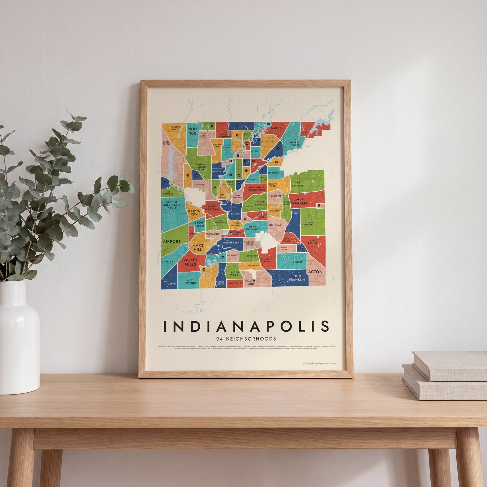
This poster maps Indianapolis as 94 neighborhood areas, from Downtown out to Geist and Traders Point at the county line. Smaller local names, like Woodruff Place and Fletcher Place, print as labels on top. Highlight the area you call home and print it.
On the wall
A few of them framed at home. Open any one to make it yours.
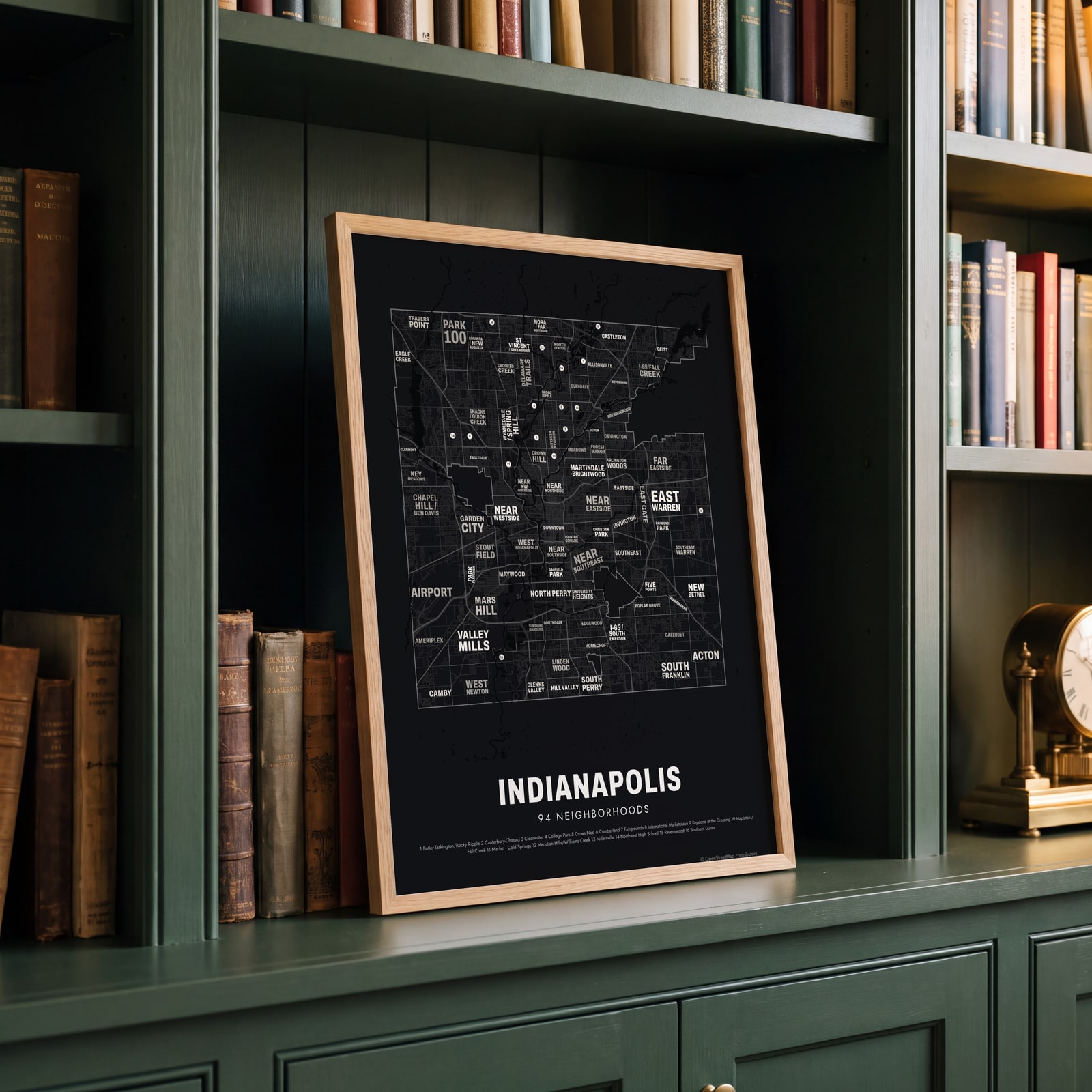 Typographic Indianapolis map: the names fill their neighborhoodsEdit this →
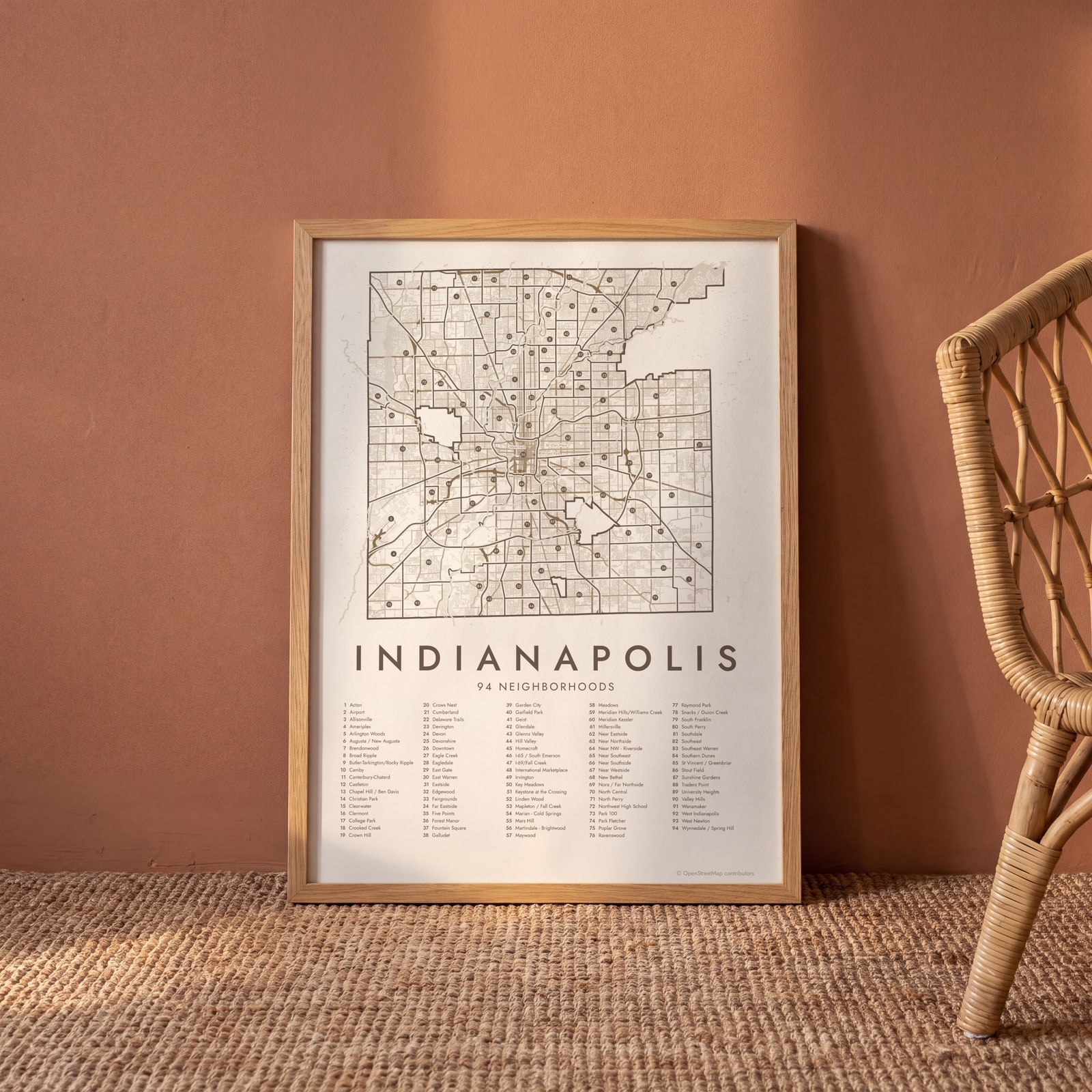 Indianapolis street map with numbered neighborhoods and their listEdit this →
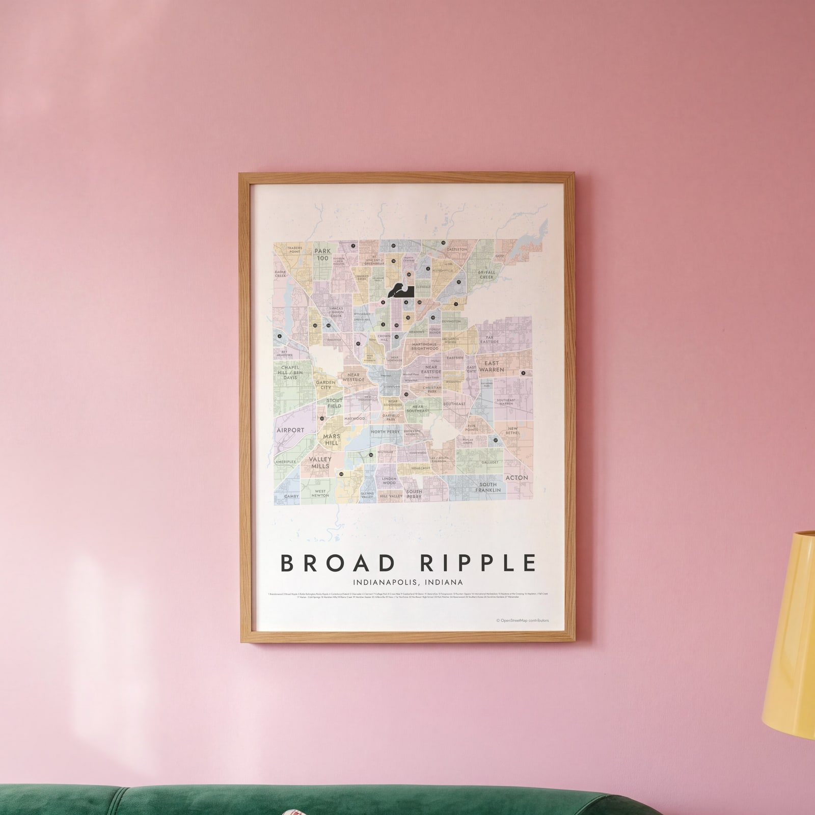 Broad Ripple highlighted on a map of IndianapolisEdit this →
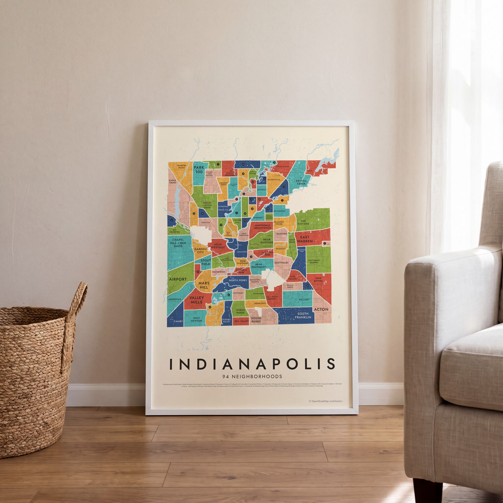 Indianapolis neighborhood map in color, every neighborhood namedEdit this →
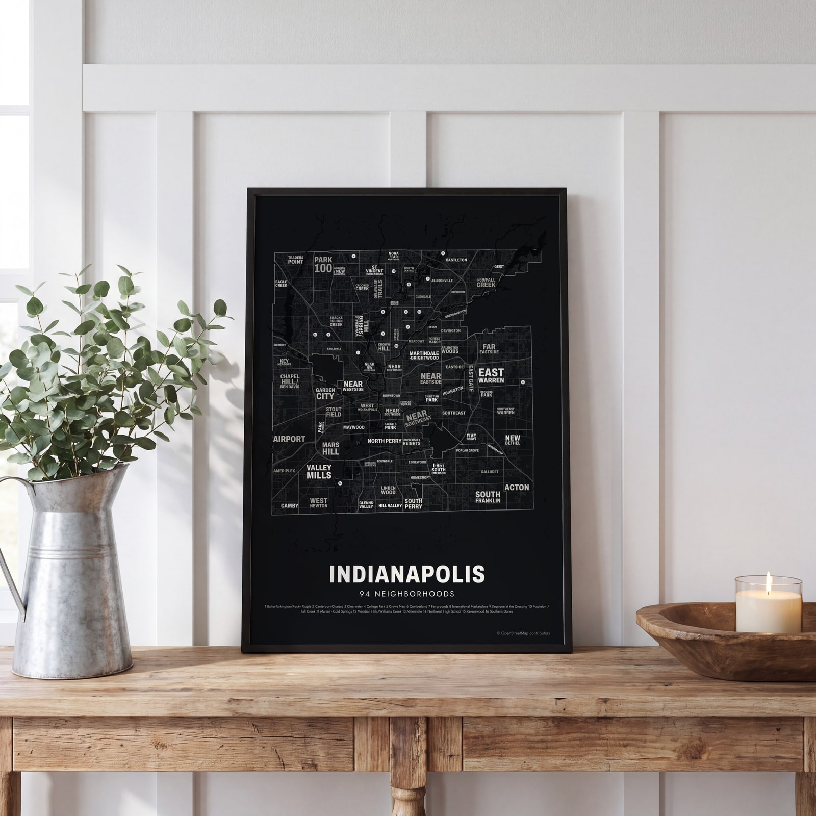 Typographic Indianapolis map: the names fill their neighborhoodsEdit this →
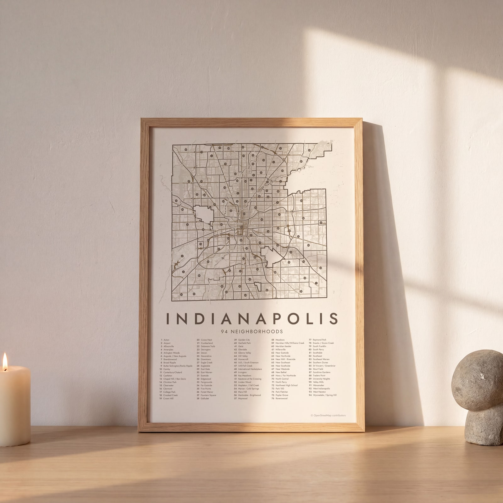 Indianapolis street map with numbered neighborhoods and their listEdit this →
Examples
Open any of them to change the words, the place, the date and the style, then download the print file.
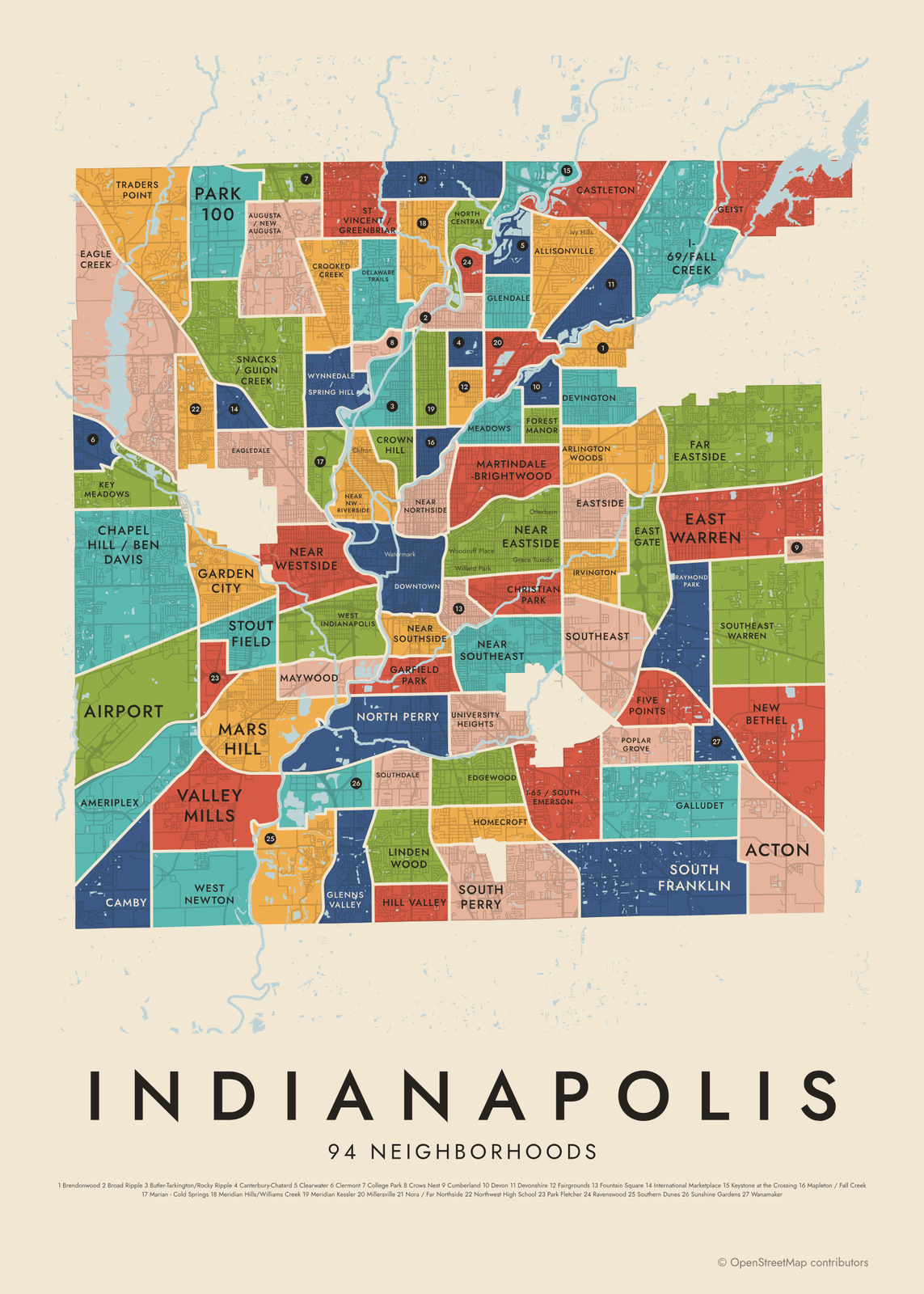 Indianapolis neighborhood map in color, every neighborhood namedEdit this →More neighborhood maps →
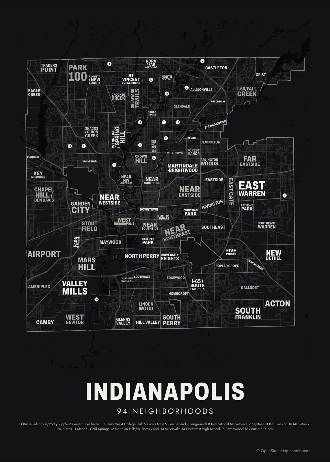 Typographic Indianapolis map: the names fill their neighborhoodsEdit this →More neighborhood maps →
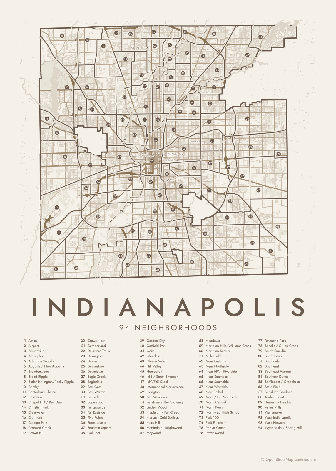 Indianapolis street map with numbered neighborhoods and their listEdit this →More neighborhood maps →
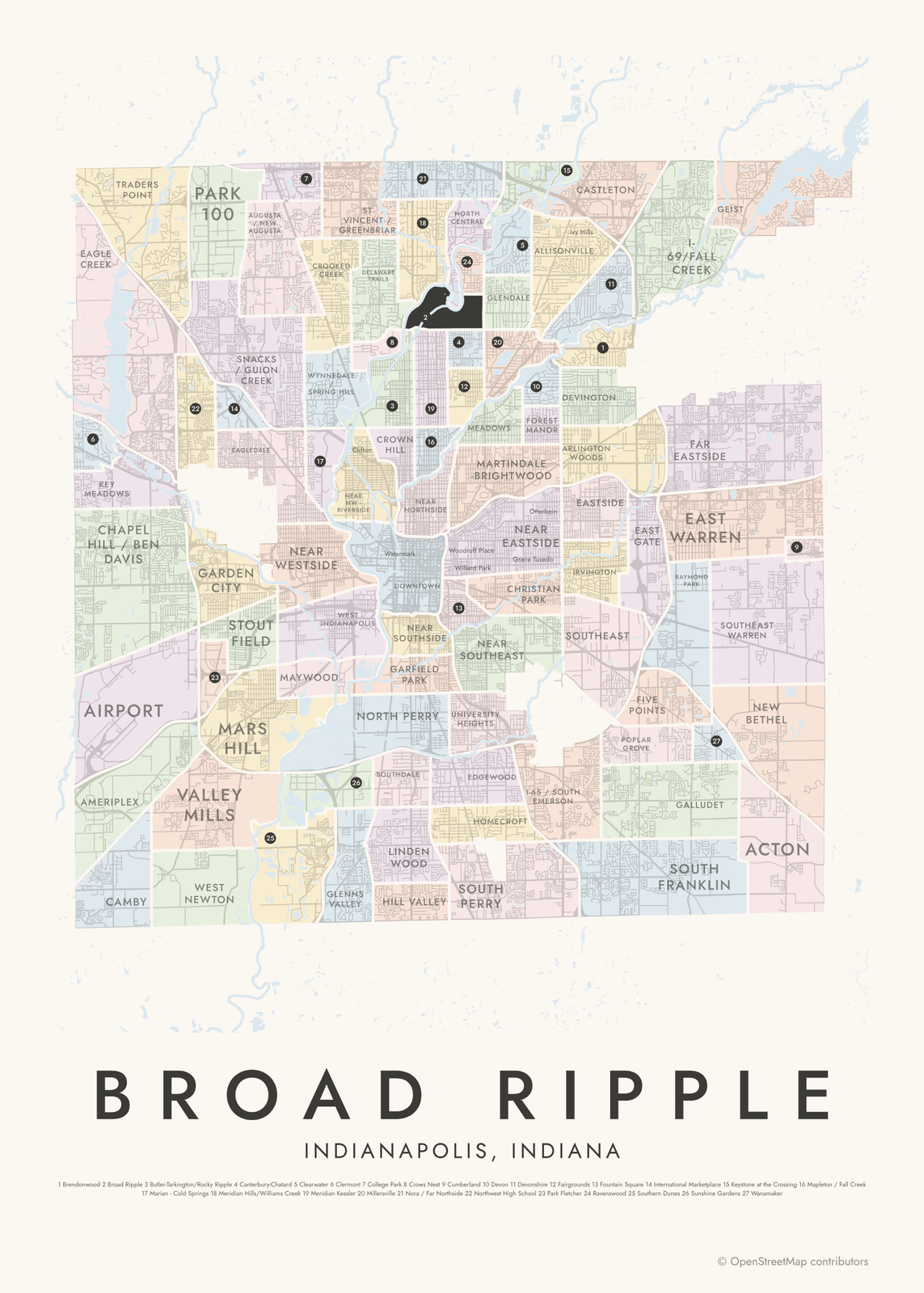 Broad Ripple highlighted on a map of IndianapolisEdit this →More neighborhood maps →
How Indianapolis is divided
Since 1970, Indianapolis and Marion County have shared one government, under a merger called Unigov, so the city covers nearly the whole county. For planning and neighborhood data, the city splits the county into 99 neighborhood areas. Many are named for a landmark, like Garfield Park, Eagle Creek or Northwest High School.
Four places inside the county kept their own governments: the cities of Beech Grove, Lawrence and Southport, and the town of Speedway. Their five areas are left off, so our map shows 94. Each area holds smaller neighborhoods, and many of those names, like Herron Morton, Fall Creek Place and Chatham-Arch, print as small labels.
All 94 neighborhoods of Indianapolis
- Acton
- Airport
- Allisonville
- Ameriplex
- Arlington Woods
- Augusta / New Augusta
- Brendonwood
- Broad Ripple
- Butler-Tarkington/Rocky Ripple
- Camby
- Canterbury-Chatard
- Castleton
- Chapel Hill / Ben Davis
- Christian Park
- Clearwater
- Clermont
- College Park
- Crooked Creek
- Crown Hill
- Crows Nest
- Cumberland
- Delaware Trails
- Devington
- Devon
- Devonshire
- Downtown
- Eagle Creek
- Eagledale
- East Gate
- East Warren
- Eastside
- Edgewood
- Fairgrounds
- Far Eastside
- Five Points
- Forest Manor
- Fountain Square
- Galludet
- Garden City
- Garfield Park
- Geist
- Glendale
- Glenns Valley
- Hill Valley
- Homecroft
- I-65 / South Emerson
- I-69/Fall Creek
- International Marketplace
- Irvington
- Key Meadows
- Keystone at the Crossing
- Linden Wood
- Mapleton / Fall Creek
- Marian - Cold Springs
- Mars Hill
- Martindale - Brightwood
- Maywood
- Meadows
- Meridian Hills/Williams Creek
- Meridian Kessler
- Millersville
- Near Eastside
- Near Northside
- Near NW - Riverside
- Near Southeast
- Near Southside
- Near Westside
- New Bethel
- Nora / Far Northside
- North Central
- North Perry
- Northwest High School
- Park 100
- Park Fletcher
- Poplar Grove
- Ravenswood
- Raymond Park
- Snacks / Guion Creek
- South Franklin
- South Perry
- Southdale
- Southeast
- Southeast Warren
- Southern Dunes
- St Vincent / Greenbriar
- Stout Field
- Sunshine Gardens
- Traders Point
- University Heights
- Valley Mills
- Wanamaker
- West Indianapolis
- West Newton
- Wynnedale / Spring Hill
More neighborhood names on the map
Inside the neighborhoods, the map also names 64 smaller neighborhoods where they fit, from OpenStreetMap: Nora, Noel Forest, Northwest Manor, Quail Ridge, New Augusta, Venerable Flackville, Riverside, Woodstock, Clifton, Greenbriar, North Indianapolis, Historic Ransom Place, Mapleton, Fayette Street Conservation Area, Spring Mill Woods, Watermark, Butler–Tarkington, Old Southside, Highland Vicinity, Meridian Highlands, North Meridian Street Historic District, St. Joseph, Herron Morton, Meridian Park, College Crest, Fall Creek Place, Old Northside Historic District, Oliver Johnson's Woods, Fletcher Place, Chatham-Arch, Young's Sub, Watson Park, Forest Hills, Friends and Neighbors, Holy Cross, Cottage Home, Irish Hill, Arsenal Heights, Sherwood Forest, Canterbury–Chatard and more. Turn them off under Names if you want only the neighborhoods.
Neighborhoods to know
- Downtown: Monument Circle and the Soldiers' and Sailors' Monument, at the center of the 1821 Mile Square.
- Broad Ripple: a former village on the north side, along the Central Canal and the Monon Trail.
- Fountain Square: an arts district southeast of downtown, named for the fountain at its main intersection.
- Irvington: an east-side suburb laid out in 1870 and named for the writer Washington Irving.
- Garfield Park: the city's oldest park, with a conservatory and sunken gardens.
- Crown Hill: named for Crown Hill Cemetery, where President Benjamin Harrison is buried.
- Eagle Creek: Eagle Creek Park and its reservoir, on the northwest side.
- Woodruff Place: a planned 1870s enclave of grassy esplanades and fountains on the near east side.
How to make your Indianapolis neighborhood poster
- Open the Indianapolis map.
- Pick a style: Colored areas, Typographic (the names fill the map) or a Street map with the borders over the streets.
- Tap your own neighborhood to highlight it; it becomes the poster's title.
- Drag and zoom to frame the whole city or just your part of it, then pick a size and download the print file.
Questions
How many neighborhoods does Indianapolis have?
The city uses 99 neighborhood areas that cover all of Marion County. This map shows the 94 in Indianapolis itself. Inside them are many smaller neighborhoods with their own names and associations.
Is Speedway part of Indianapolis?
No. Speedway is a separate town inside Marion County, home of the Indianapolis Motor Speedway. Beech Grove, Lawrence and Southport are separate cities too, so none of them are on this map.
What is Unigov?
Unigov is the 1970 merger of the City of Indianapolis with most of Marion County's government. It made Indianapolis the size of the county, minus a few cities and towns that stayed separate.
What is the Mile Square?
The Mile Square is the original 1821 plan of Indianapolis: one square mile with Monument Circle at the center and four diagonal avenues. Today it's the core of the Downtown area on this map.
Where do the Indianapolis boundaries come from?
From OpenStreetMap (© OpenStreetMap contributors) and City of Indianapolis/Marion County, IN. Streets and water are OpenStreetMap's. Boundaries are a snapshot and can differ from what neighbors call home; tell us if one looks wrong.
What sizes can I print?
US Letter, 8 × 10, 11 × 14, 12 × 16 and 12 × 18 in, A4 and A3, free. You download a 300 DPI JPEG drawn at the size you pick. Larger prints, up to 24 × 36 in, are coming soon.
Related




Gift ideas by occasion




Every example is made with the Posterage generators. Change anything, then download it as a 300 DPI JPEG.