Los Angeles neighborhood map 114 neighborhoods, from Sylmar to San Pedro
This poster maps the City of Los Angeles in 114 named neighborhoods, from Sylmar at the top of the San Fernando Valley to San Pedro on the harbor. Smaller places like Little Tokyo, Miracle Mile and Thai Town appear as labels. Highlight yours and print it.
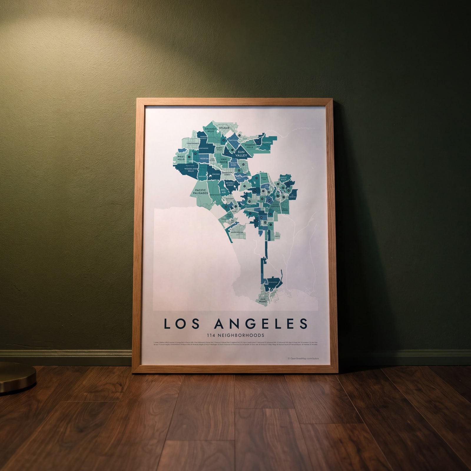
On the wall
A few of them framed at home. Open any one to make it yours.
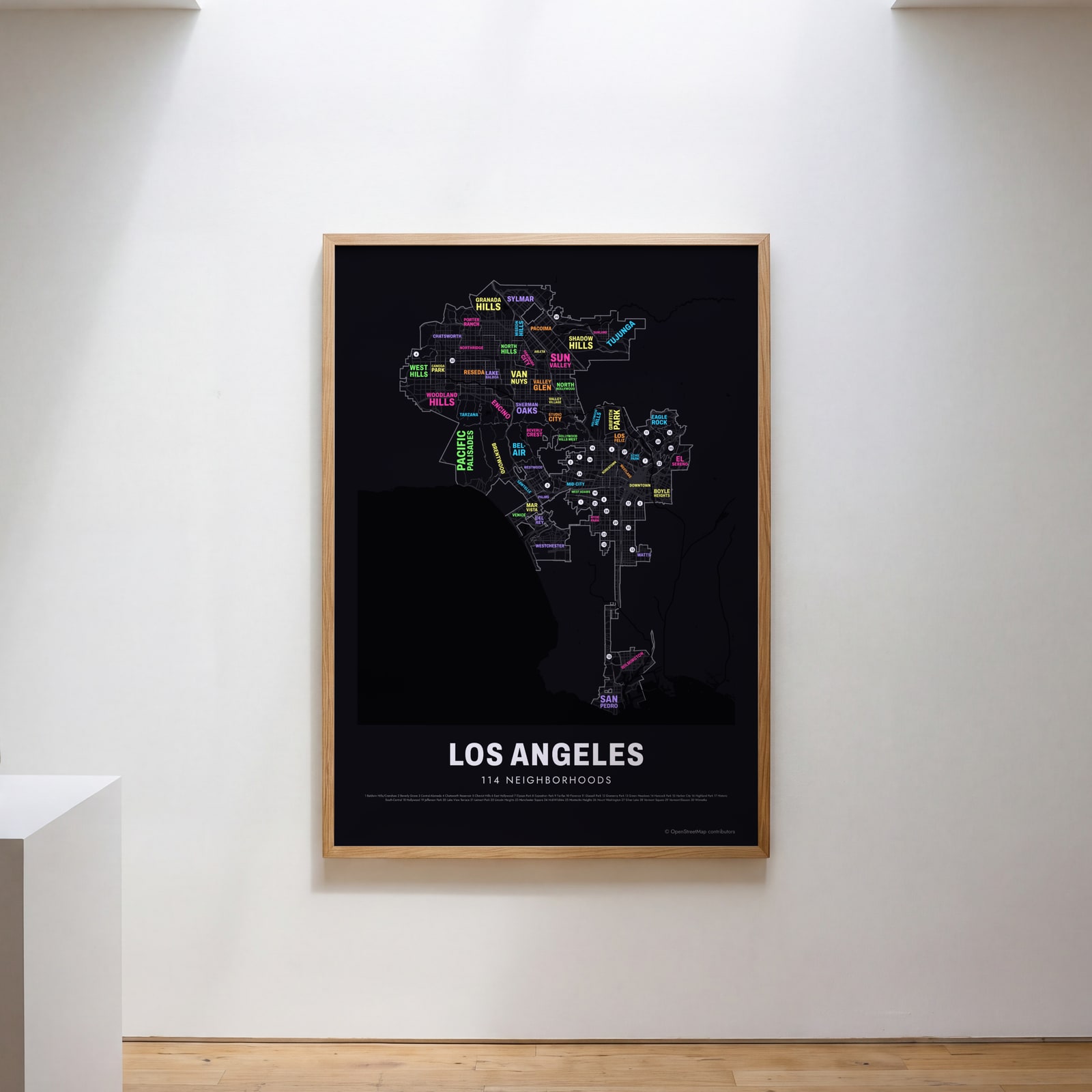 Typographic Los Angeles map: the names fill their neighborhoodsEdit this →
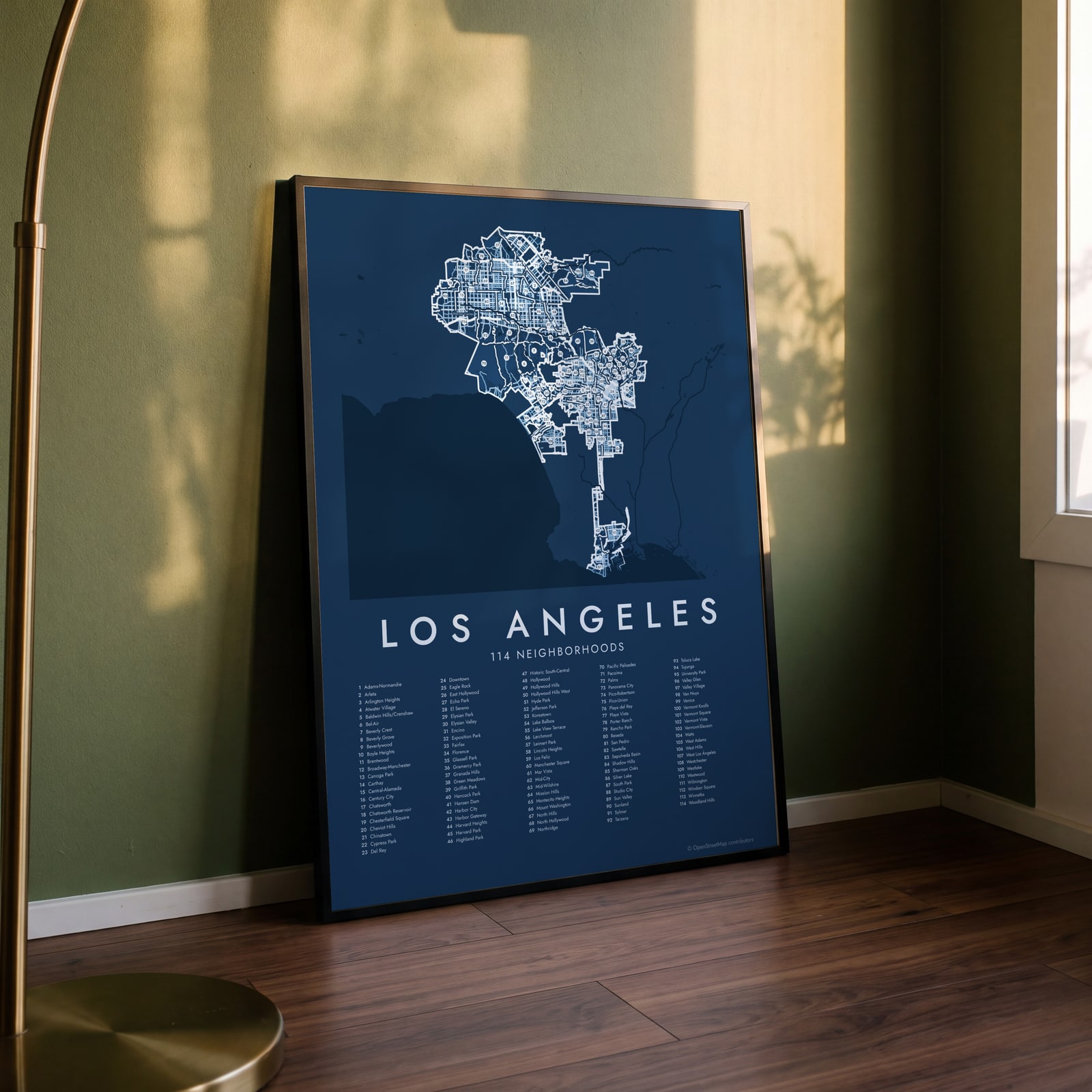 Los Angeles street map with numbered neighborhoods and their listEdit this →
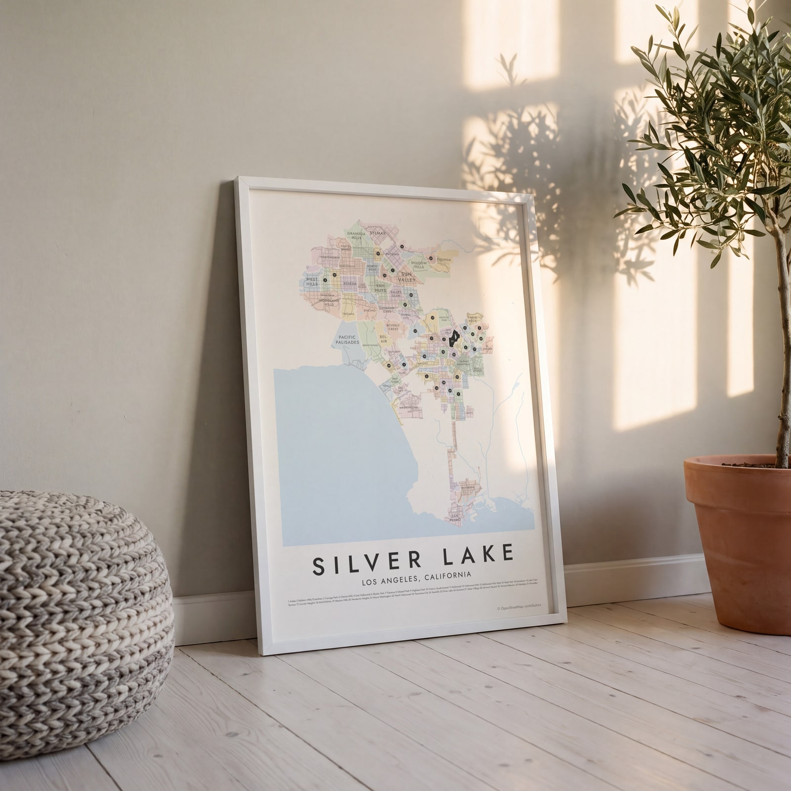 Silver Lake highlighted on a map of Los AngelesEdit this →
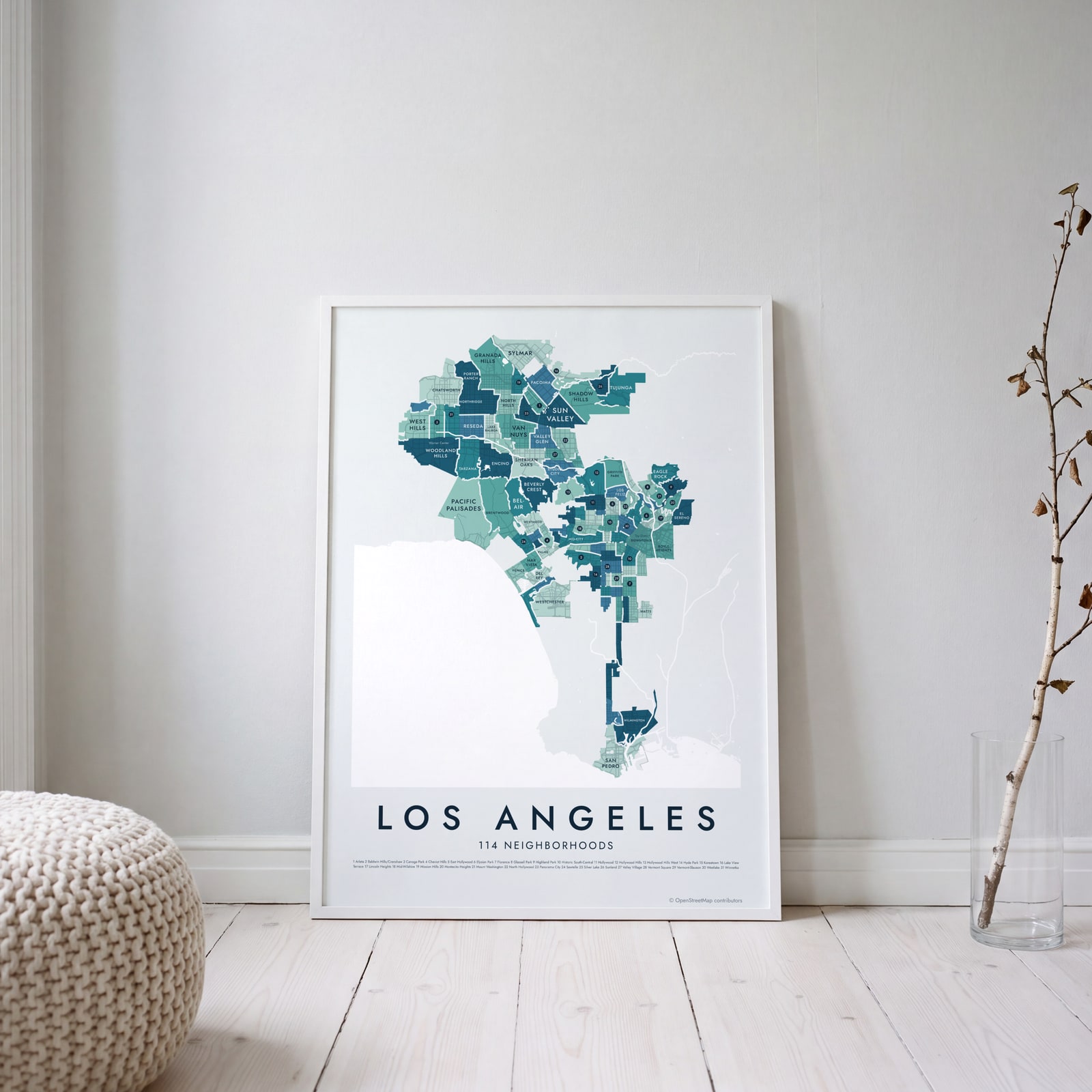 Los Angeles neighborhood map in color, every neighborhood namedEdit this →
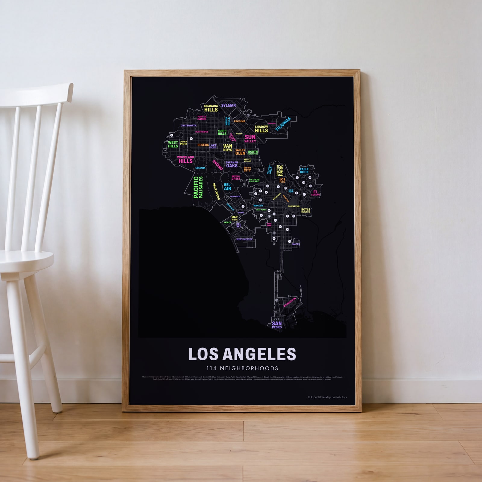 Typographic Los Angeles map: the names fill their neighborhoodsEdit this →
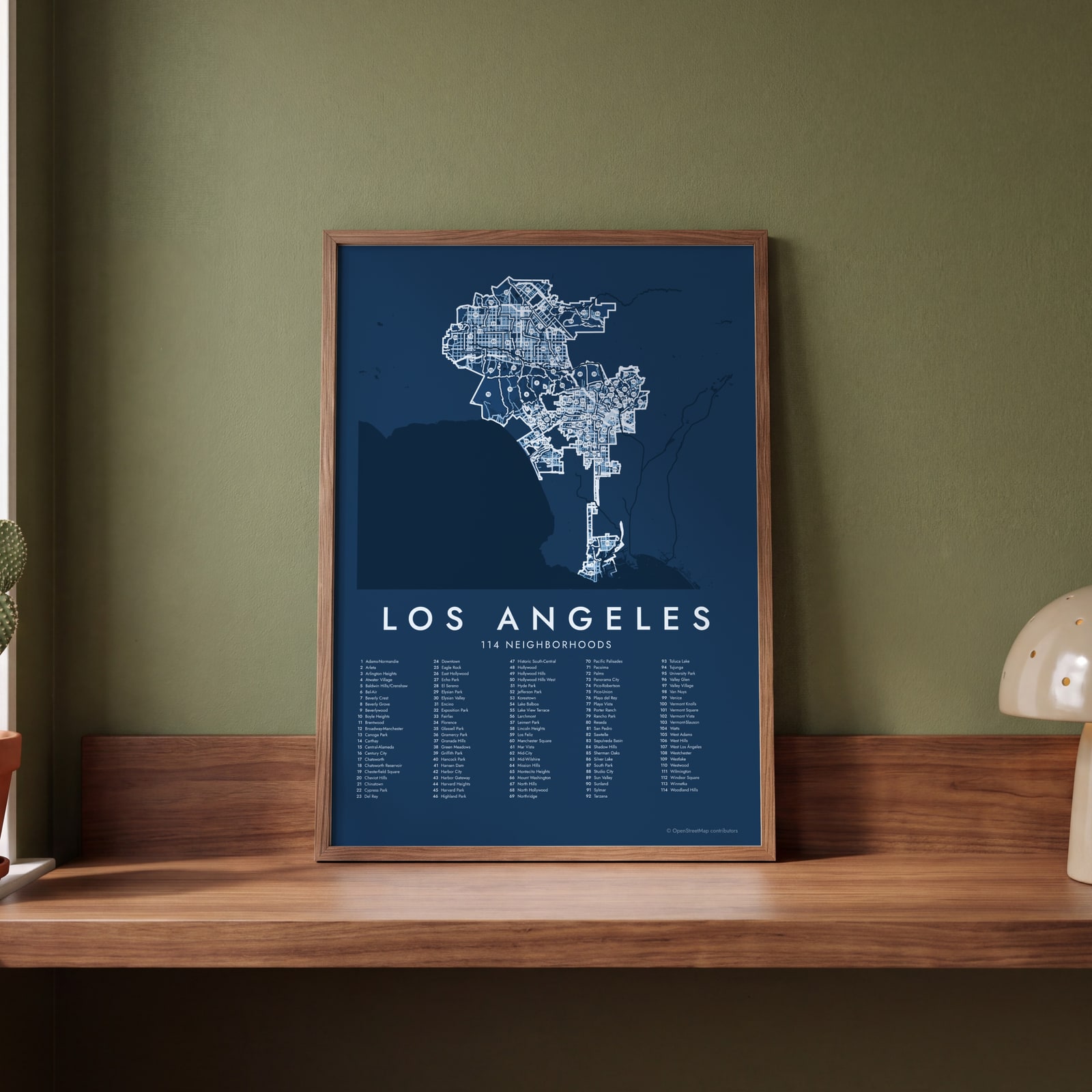 Los Angeles street map with numbered neighborhoods and their listEdit this →
Examples
Open any of them to change the words, the place, the date and the style, then download the print file.
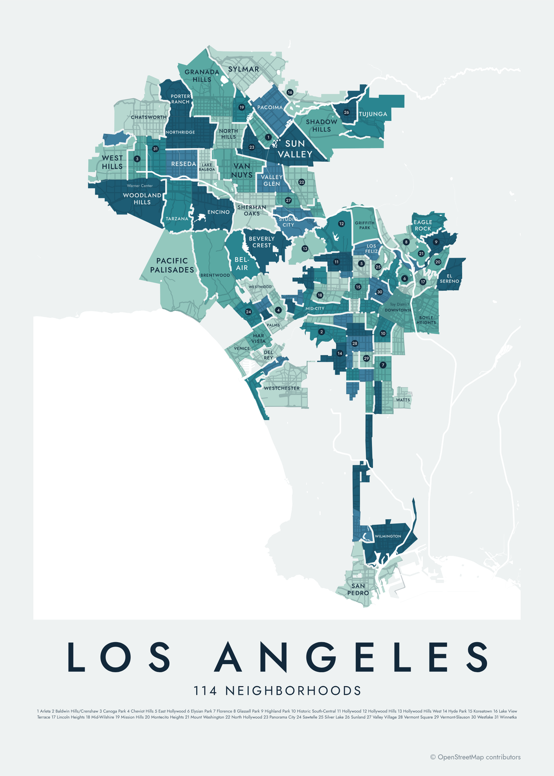 Los Angeles neighborhood map in color, every neighborhood namedEdit this →More neighborhood maps →
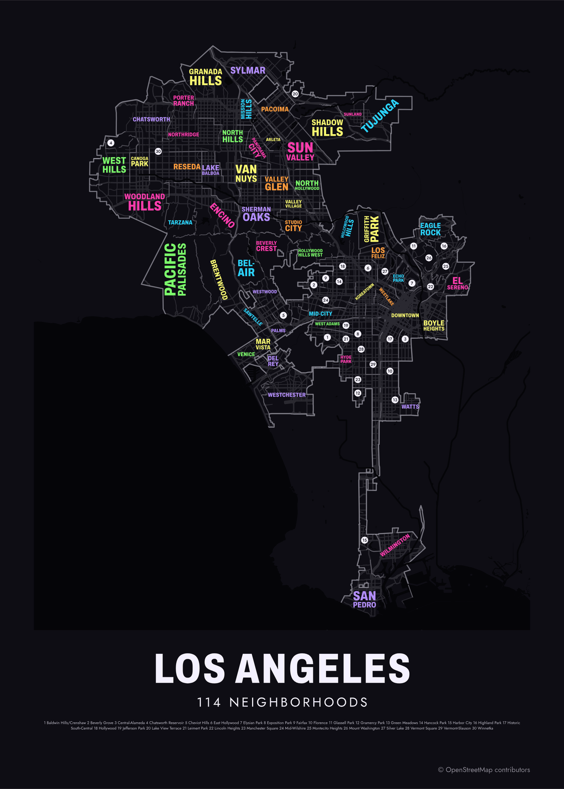 Typographic Los Angeles map: the names fill their neighborhoodsEdit this →More neighborhood maps →
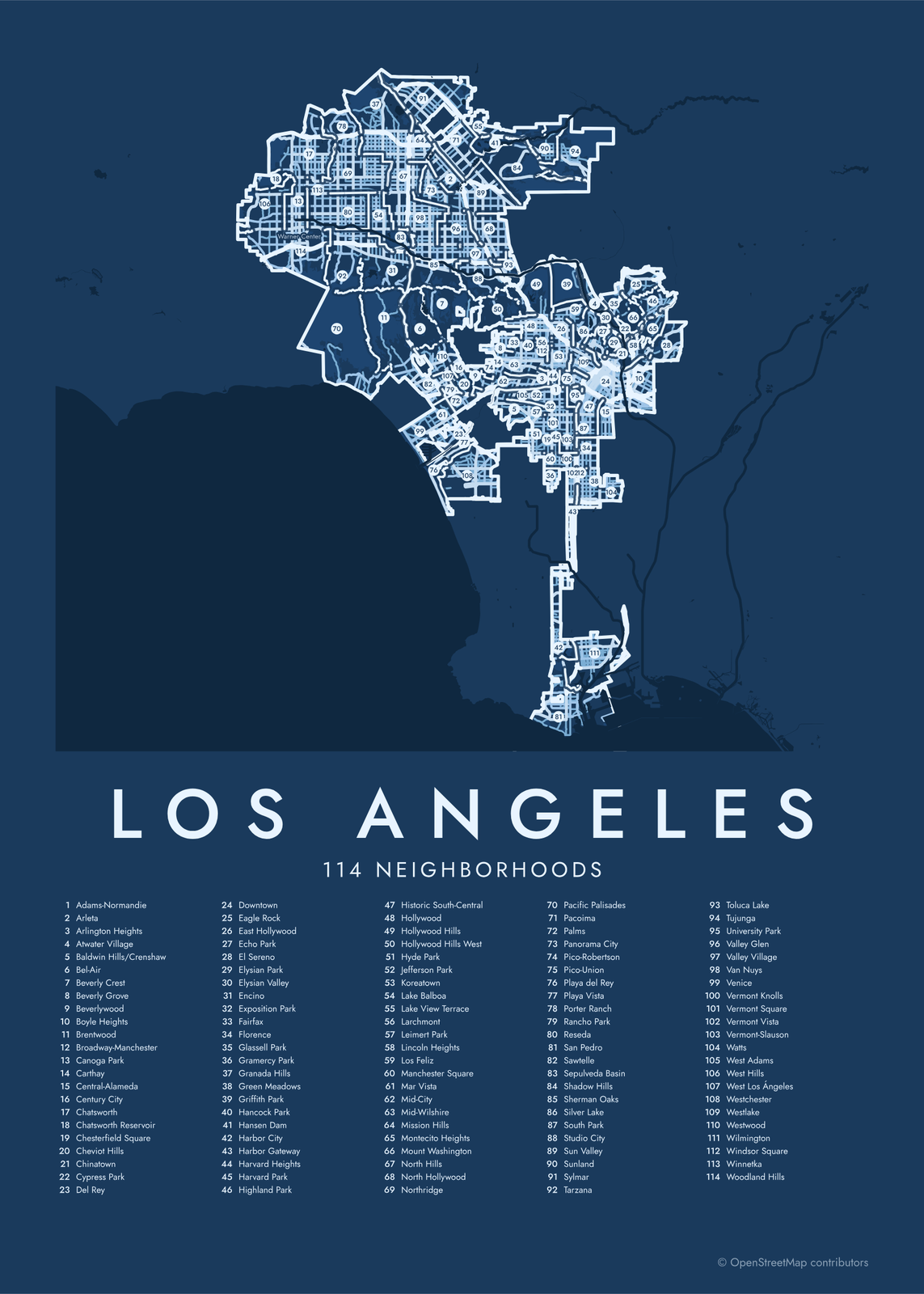 Los Angeles street map with numbered neighborhoods and their listEdit this →More neighborhood maps →
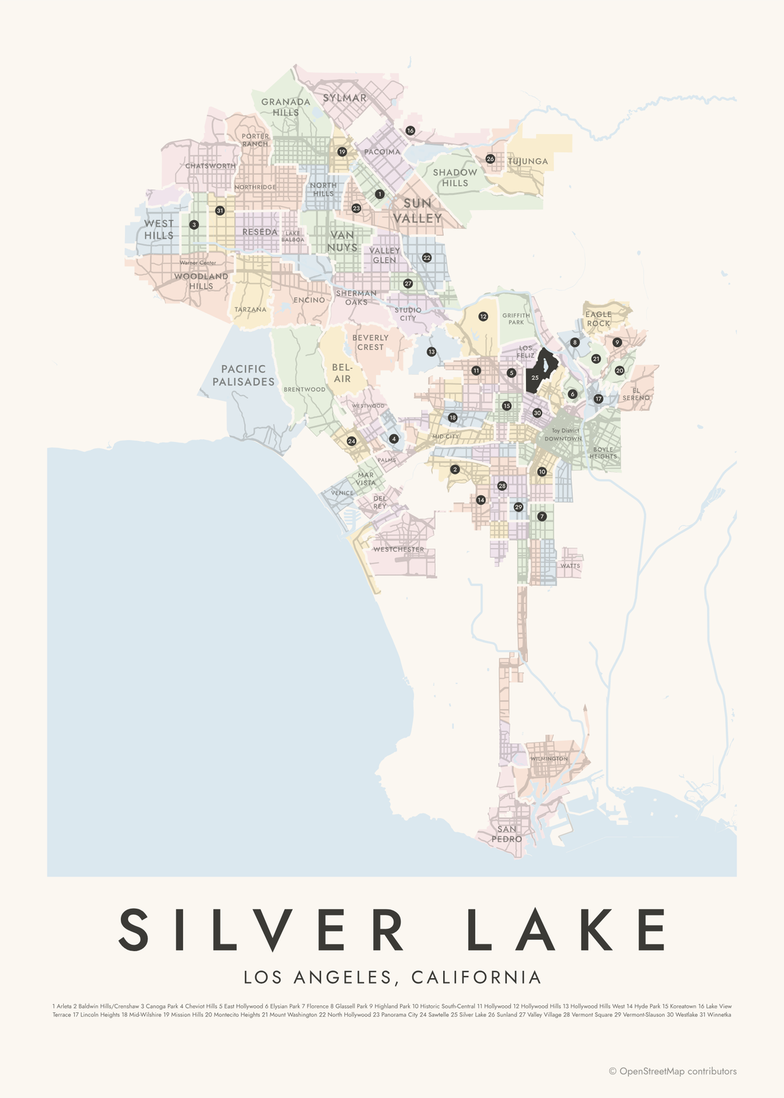 Silver Lake highlighted on a map of Los AngelesEdit this →More neighborhood maps →
How Los Angeles is divided
The City of Los Angeles doesn't draw official neighborhood borders. The 114 here come from the Los Angeles Times' Mapping L.A. project, which began in 2009 and refined its lines with feedback from readers.
The city's shape is unusual. It surrounds or borders separate cities like Beverly Hills, Santa Monica, West Hollywood and Culver City, which aren't part of Los Angeles and so aren't among the 114. Much of the San Fernando Valley joined the city in 1915, and a narrow strip called Harbor Gateway links it to San Pedro and Wilmington on the coast.
All 114 neighborhoods of Los Angeles
- Adams-Normandie
- Arleta
- Arlington Heights
- Atwater Village
- Baldwin Hills/Crenshaw
- Bel-Air
- Beverly Crest
- Beverly Grove
- Beverlywood
- Boyle Heights
- Brentwood
- Broadway-Manchester
- Canoga Park
- Carthay
- Central-Alameda
- Century City
- Chatsworth
- Chatsworth Reservoir
- Chesterfield Square
- Cheviot Hills
- Chinatown
- Cypress Park
- Del Rey
- Downtown
- Eagle Rock
- East Hollywood
- Echo Park
- El Sereno
- Elysian Park
- Elysian Valley
- Encino
- Exposition Park
- Fairfax
- Florence
- Glassell Park
- Gramercy Park
- Granada Hills
- Green Meadows
- Griffith Park
- Hancock Park
- Hansen Dam
- Harbor City
- Harbor Gateway
- Harvard Heights
- Harvard Park
- Highland Park
- Historic South-Central
- Hollywood
- Hollywood Hills
- Hollywood Hills West
- Hyde Park
- Jefferson Park
- Koreatown
- Lake Balboa
- Lake View Terrace
- Larchmont
- Leimert Park
- Lincoln Heights
- Los Feliz
- Manchester Square
- Mar Vista
- Mid-City
- Mid-Wilshire
- Mission Hills
- Montecito Heights
- Mount Washington
- North Hills
- North Hollywood
- Northridge
- Pacific Palisades
- Pacoima
- Palms
- Panorama City
- Pico-Robertson
- Pico-Union
- Playa del Rey
- Playa Vista
- Porter Ranch
- Rancho Park
- Reseda
- San Pedro
- Sawtelle
- Sepulveda Basin
- Shadow Hills
- Sherman Oaks
- Silver Lake
- South Park
- Studio City
- Sun Valley
- Sunland
- Sylmar
- Tarzana
- Toluca Lake
- Tujunga
- University Park
- Valley Glen
- Valley Village
- Van Nuys
- Venice
- Vermont Knolls
- Vermont Square
- Vermont Vista
- Vermont-Slauson
- Watts
- West Adams
- West Hills
- West Los Ángeles
- Westchester
- Westlake
- Westwood
- Wilmington
- Windsor Square
- Winnetka
- Woodland Hills
More neighborhood names on the map
Inside the neighborhoods, the map also names 95 smaller neighborhoods where they fit, from OpenStreetMap: Warner Center, Reseda Ranch, Rancho Cascades, Bel Air, West Los Angeles, Sherman Village, Baldwin Hills, Crenshaw, West Glendale, Historic Filipinotown, Jefferson, Financial District, Fashion District, Angeleno Heights, Bunker Hill, Historic Core, Civic Center, Skid Row, Little Tokyo, Arts District, Lakeside Park, The Heights at Porter Ranch, Castellammare, Devonshire Country Estates, Devonshire Highlands, Cagney Ranch Estates, Riviera, The Legends at Cascades, Brentwood Park, Brentwood Heights, Sylmar Acres, Westgate Heights, Brentwood Village, North Hills East, Venice Canal Historic District, Raymer, Brentwood Glen, Carey Ranch, Shadow Glen Estates, Village Green and more. Turn them off under Names if you want only the neighborhoods.
Neighborhoods to know
- Downtown: Walt Disney Concert Hall on Bunker Hill, Little Tokyo and the old movie palaces of Broadway.
- Hollywood: the Walk of Fame along Hollywood Boulevard and Vine Street.
- Griffith Park: more than 4,000 acres of hills, with Griffith Observatory and the Los Angeles Zoo.
- Elysian Park: hills just north of downtown, and home of Dodger Stadium.
- Venice: canals laid out by Abbot Kinney in 1905, and the Ocean Front Walk.
- Studio City: named for the film studio Mack Sennett built there in the late 1920s.
- San Pedro: the Port of Los Angeles and the Point Fermin Lighthouse.
- Harbor Gateway: the narrow strip, annexed in 1906, that connects the city to its harbor.
How to make your Los Angeles neighborhood poster
- Open the Los Angeles map.
- Pick a style: Colored areas, Typographic (the names fill the map) or a Street map with the borders over the streets.
- Tap your own neighborhood to highlight it; it becomes the poster's title.
- Drag and zoom to frame the whole city or just your part of it, then pick a size and download the print file.
Questions
How many neighborhoods are in Los Angeles?
There's no official number. The Los Angeles Times' Mapping L.A. project counts 114 in the city, the ones on this map. Many smaller names, like Miracle Mile and Little Armenia, are used inside them and show as labels.
Are Beverly Hills, Santa Monica and West Hollywood part of Los Angeles?
No. They're separate cities in Los Angeles County, with their own governments, so they're not on this map. Culver City, Burbank, Glendale and Pasadena are separate cities too.
Is Hollywood a city?
No. Hollywood was its own city for a few years but joined Los Angeles in 1910. Today it's a neighborhood of the city.
Is the San Fernando Valley part of Los Angeles?
Mostly. Los Angeles annexed much of the Valley in 1915, and neighborhoods like Van Nuys, Encino and North Hollywood are part of the city. Burbank and San Fernando are separate cities.
Where do the Los Angeles boundaries come from?
From OpenStreetMap (© OpenStreetMap contributors) and Los Angeles Times (Mapping L.A.), via City of Los Angeles (DataLA). Streets and water are OpenStreetMap's. Boundaries are a snapshot and can differ from what neighbors call home; tell us if one looks wrong.
What sizes can I print?
US Letter, 8 × 10, 11 × 14, 12 × 16 and 12 × 18 in, A4 and A3, free. You download a 300 DPI JPEG drawn at the size you pick. Larger prints, up to 24 × 36 in, are coming soon.
Related




Gift ideas by occasion




Every example is made with the Posterage generators. Change anything, then download it as a 300 DPI JPEG.