Milwaukee neighborhood map all 190 neighborhoods, named
This poster maps Milwaukee split into the 190 neighborhoods on the city's official neighborhood map, each one named, from Bay View to Granville Woods. Smaller labels add 48 more names people use, like Bronzeville, Brady Street and the East Side. Highlight the one you call home and print it.
On the wall
A few of them framed at home. Open any one to make it yours.
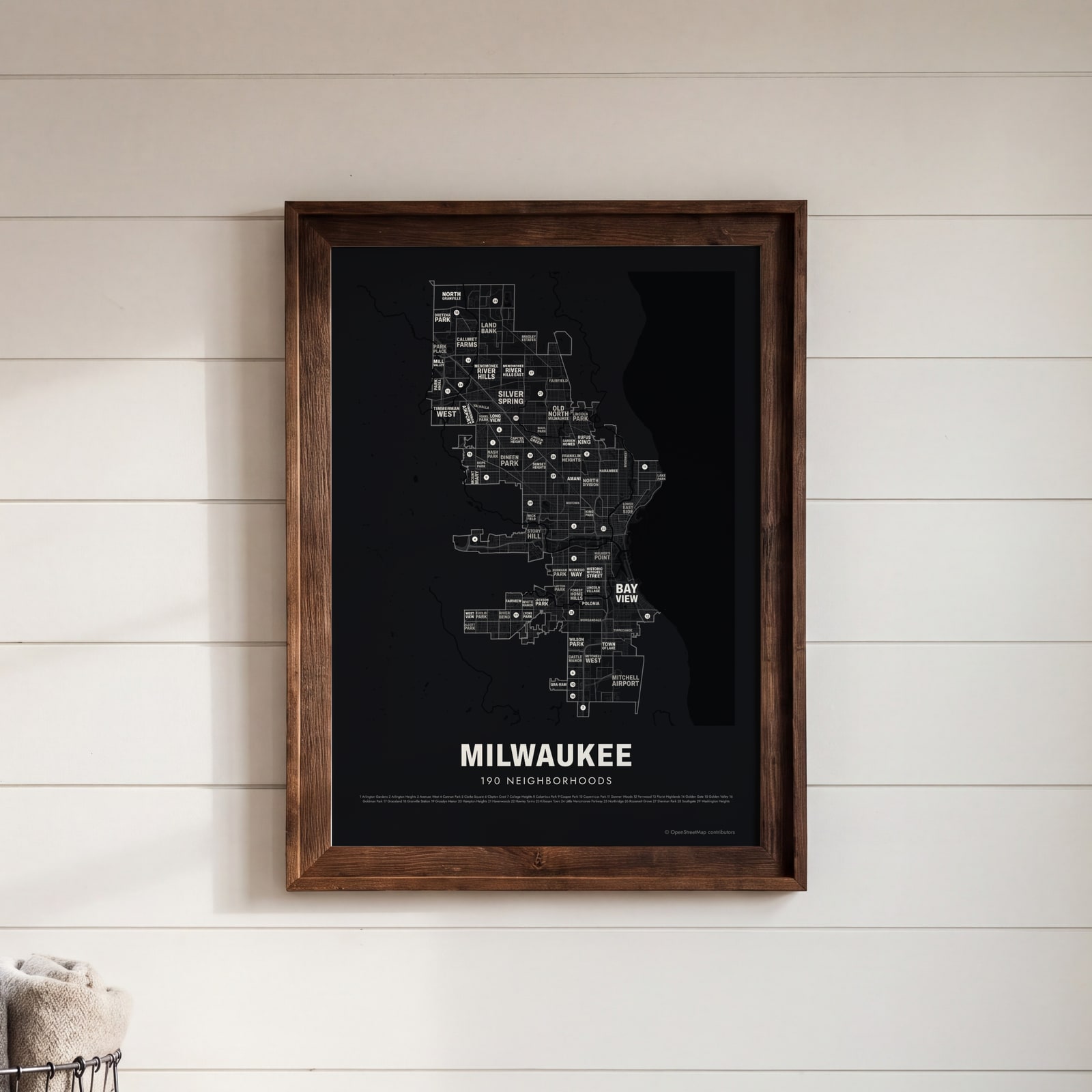 Typographic Milwaukee map: the names fill their neighborhoodsEdit this →
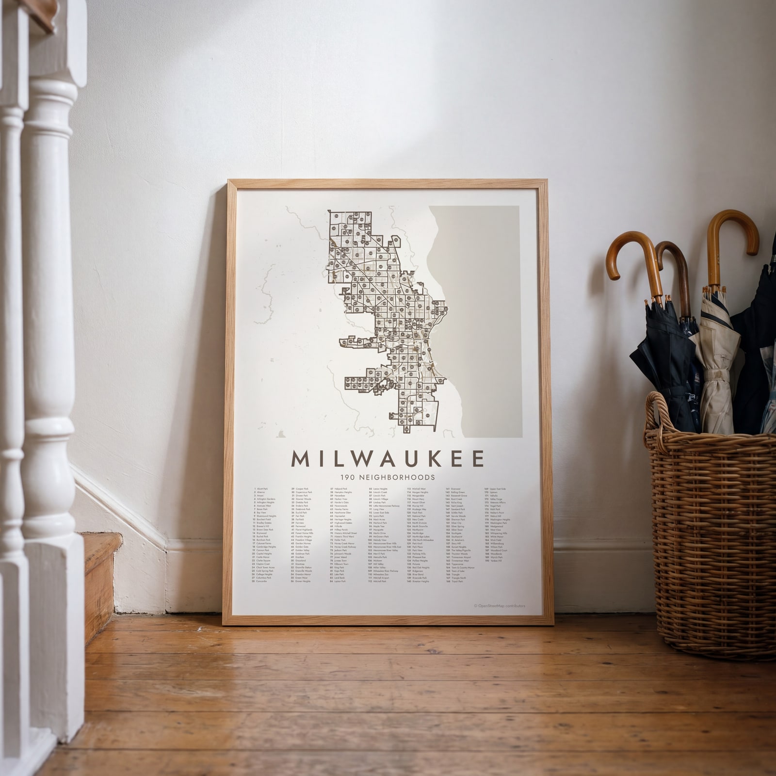 Milwaukee street map with numbered neighborhoods and their listEdit this →
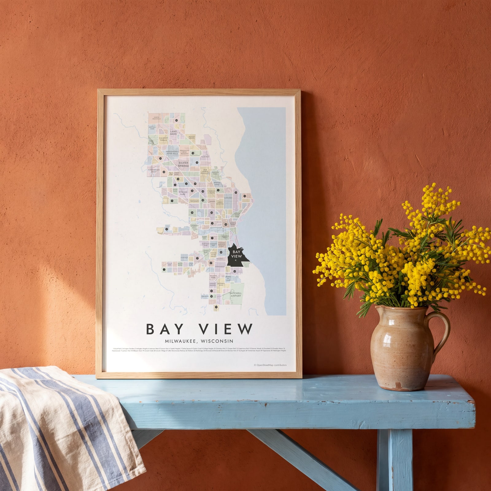 Bay View highlighted on a map of MilwaukeeEdit this →
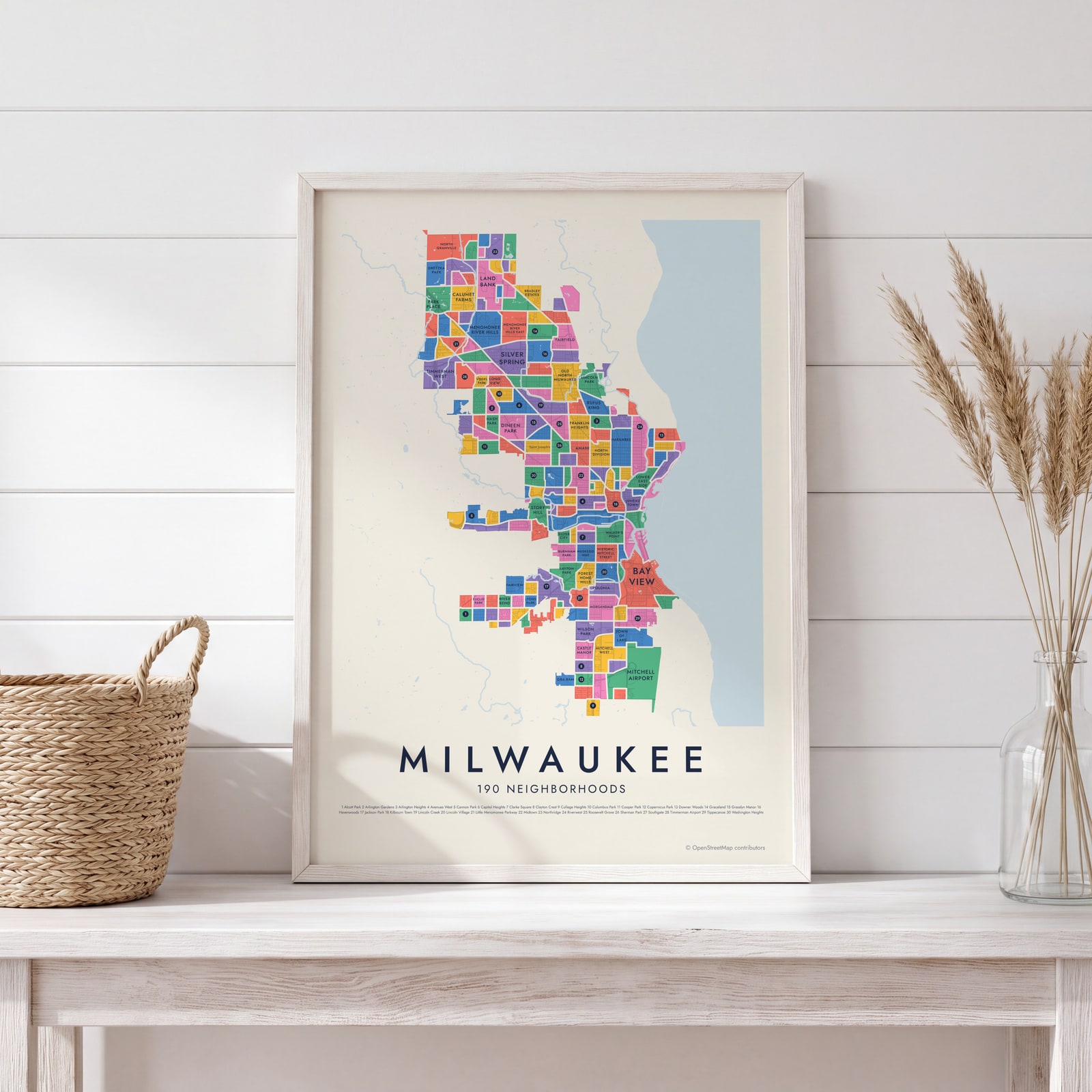
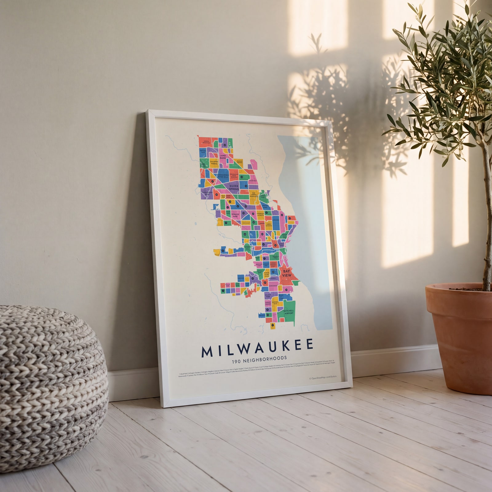 Milwaukee neighborhood map in color, every neighborhood namedEdit this →
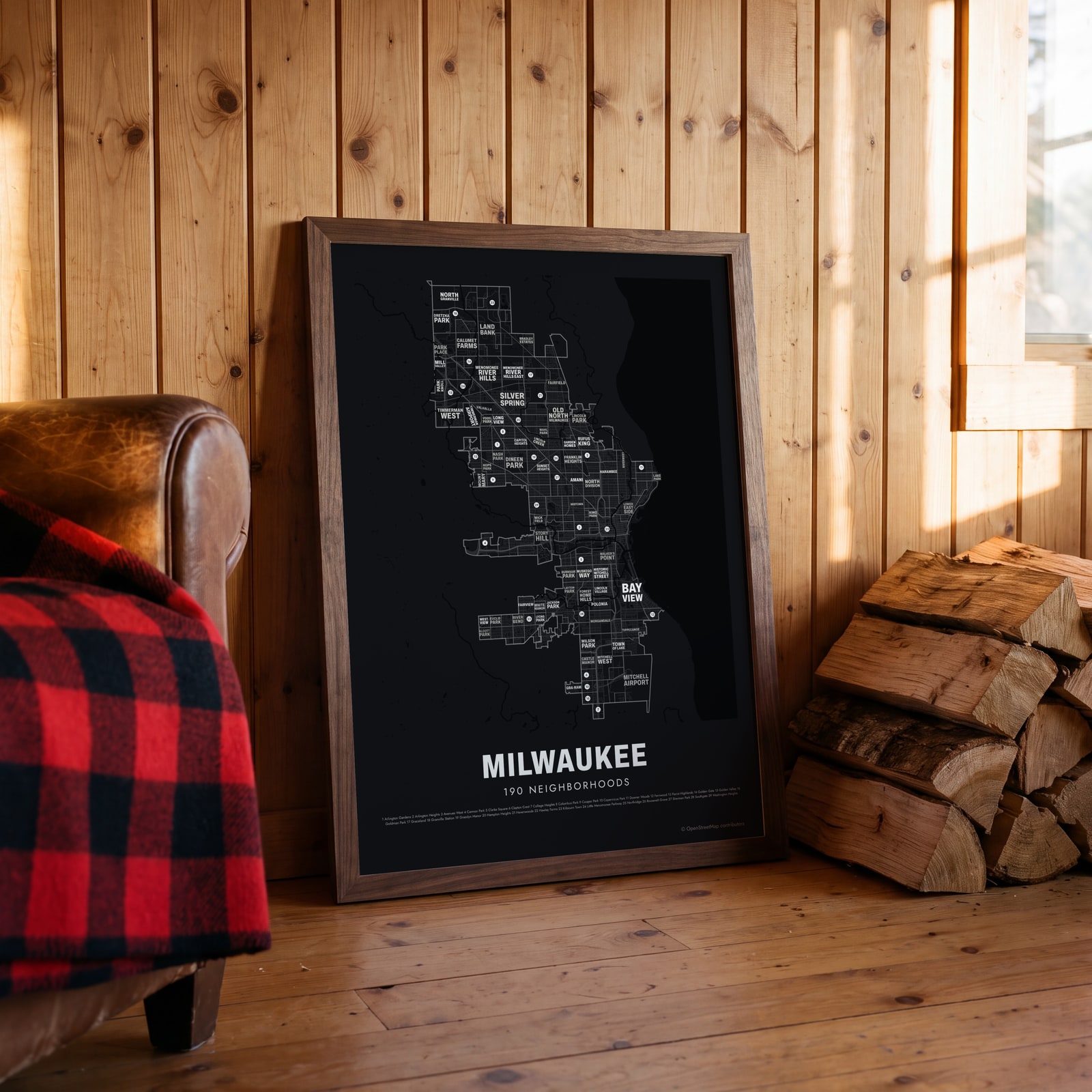 Typographic Milwaukee map: the names fill their neighborhoodsEdit this →
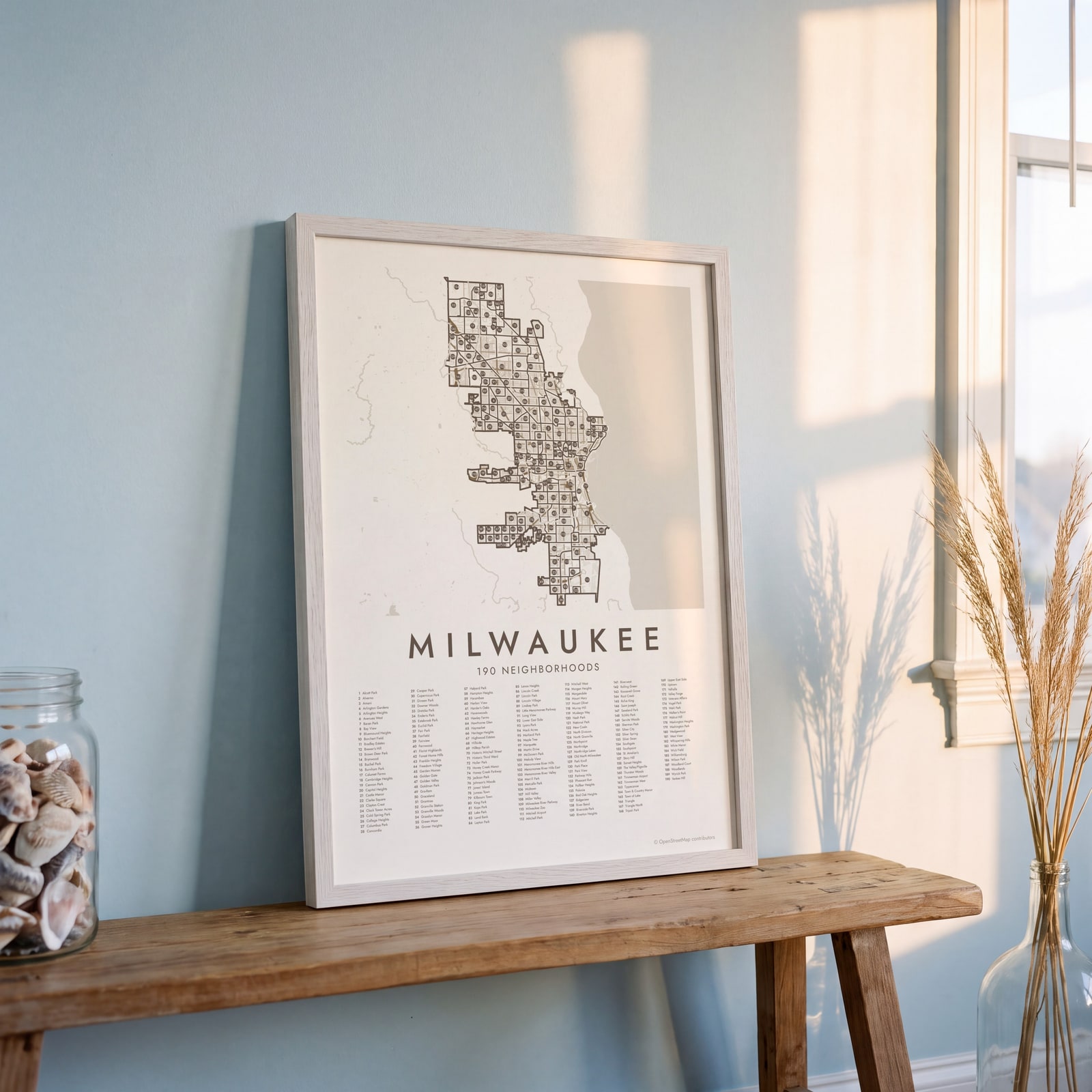 Milwaukee street map with numbered neighborhoods and their listEdit this →
Examples
Open any of them to change the words, the place, the date and the style, then download the print file.
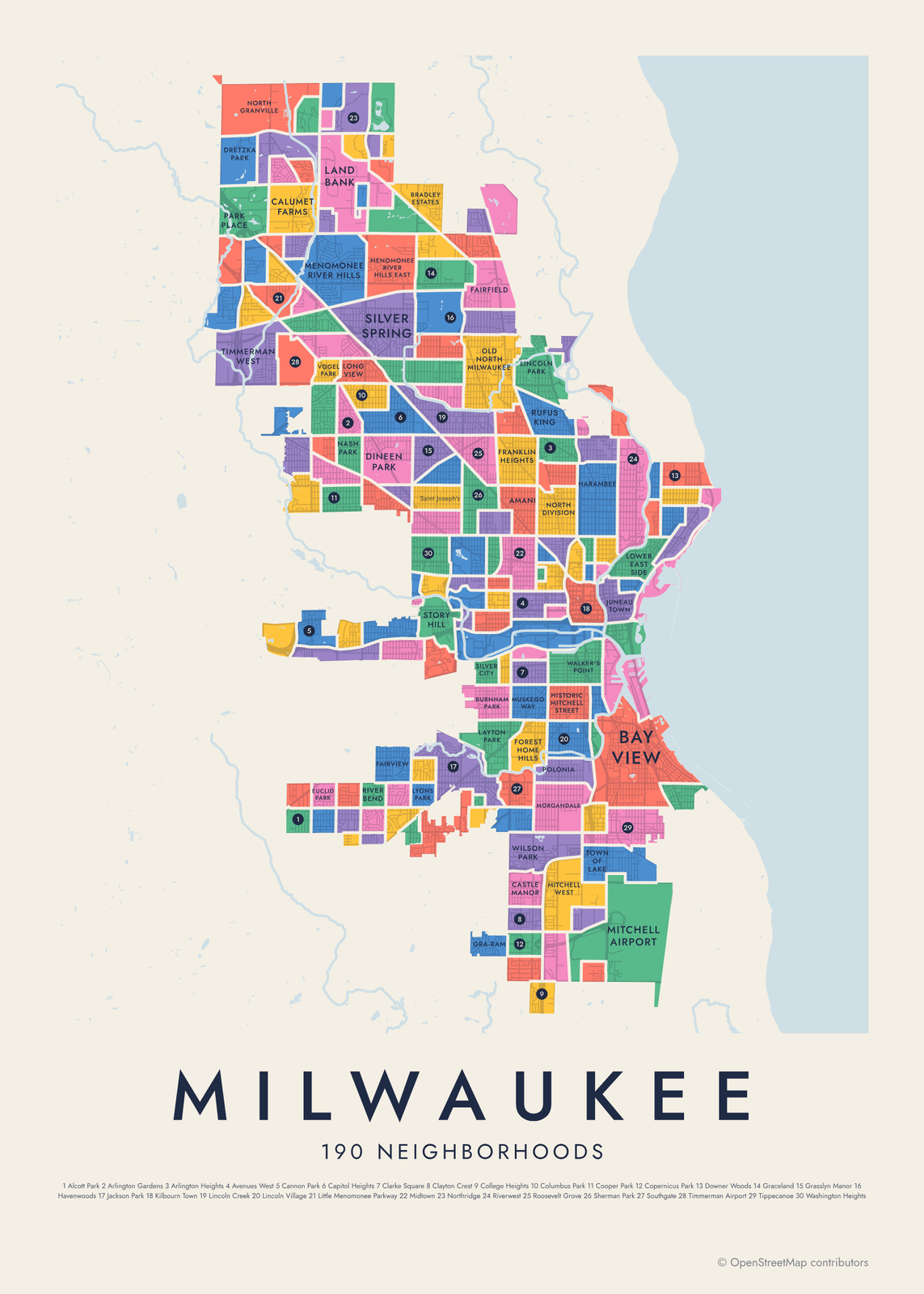 Milwaukee neighborhood map in color, every neighborhood namedEdit this →More neighborhood maps →
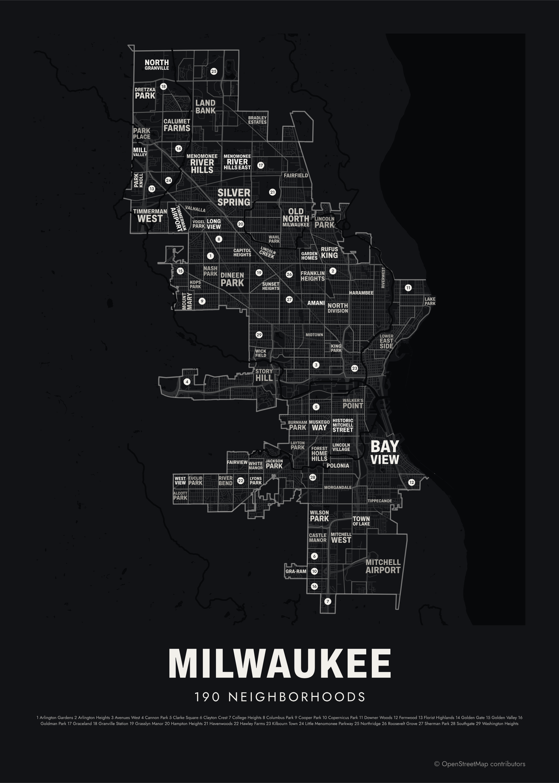 Typographic Milwaukee map: the names fill their neighborhoodsEdit this →More neighborhood maps →
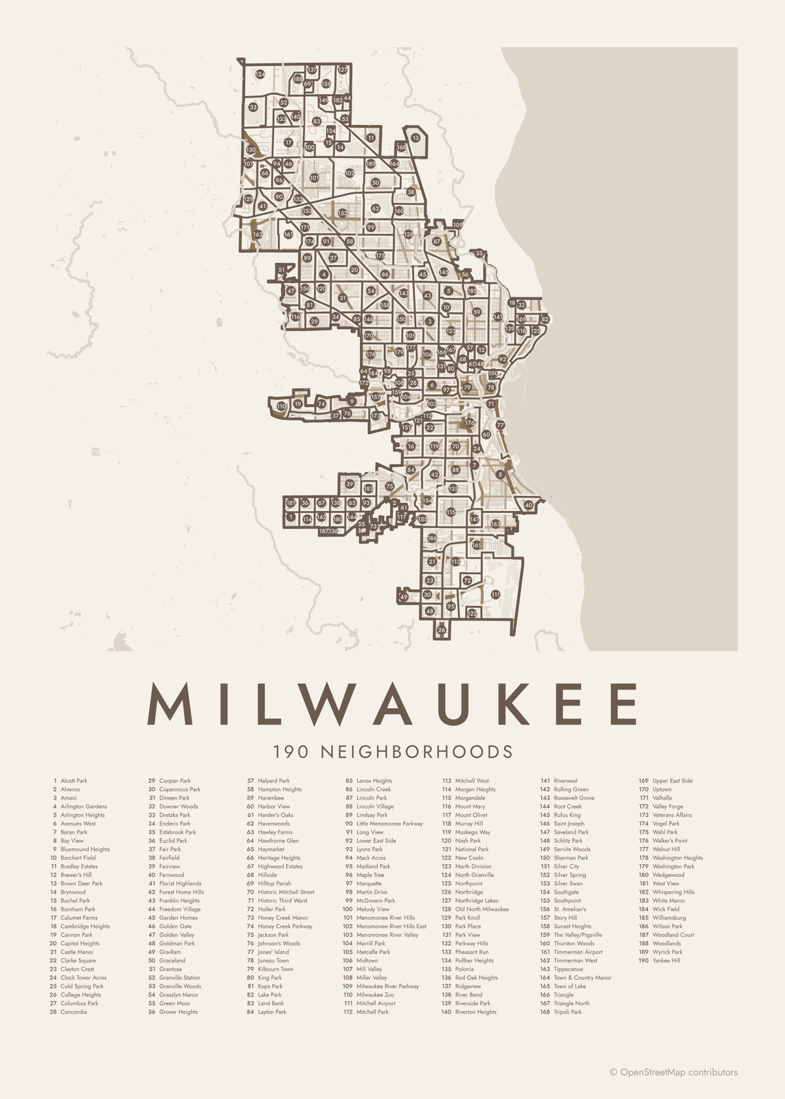 Milwaukee street map with numbered neighborhoods and their listEdit this →More neighborhood maps →
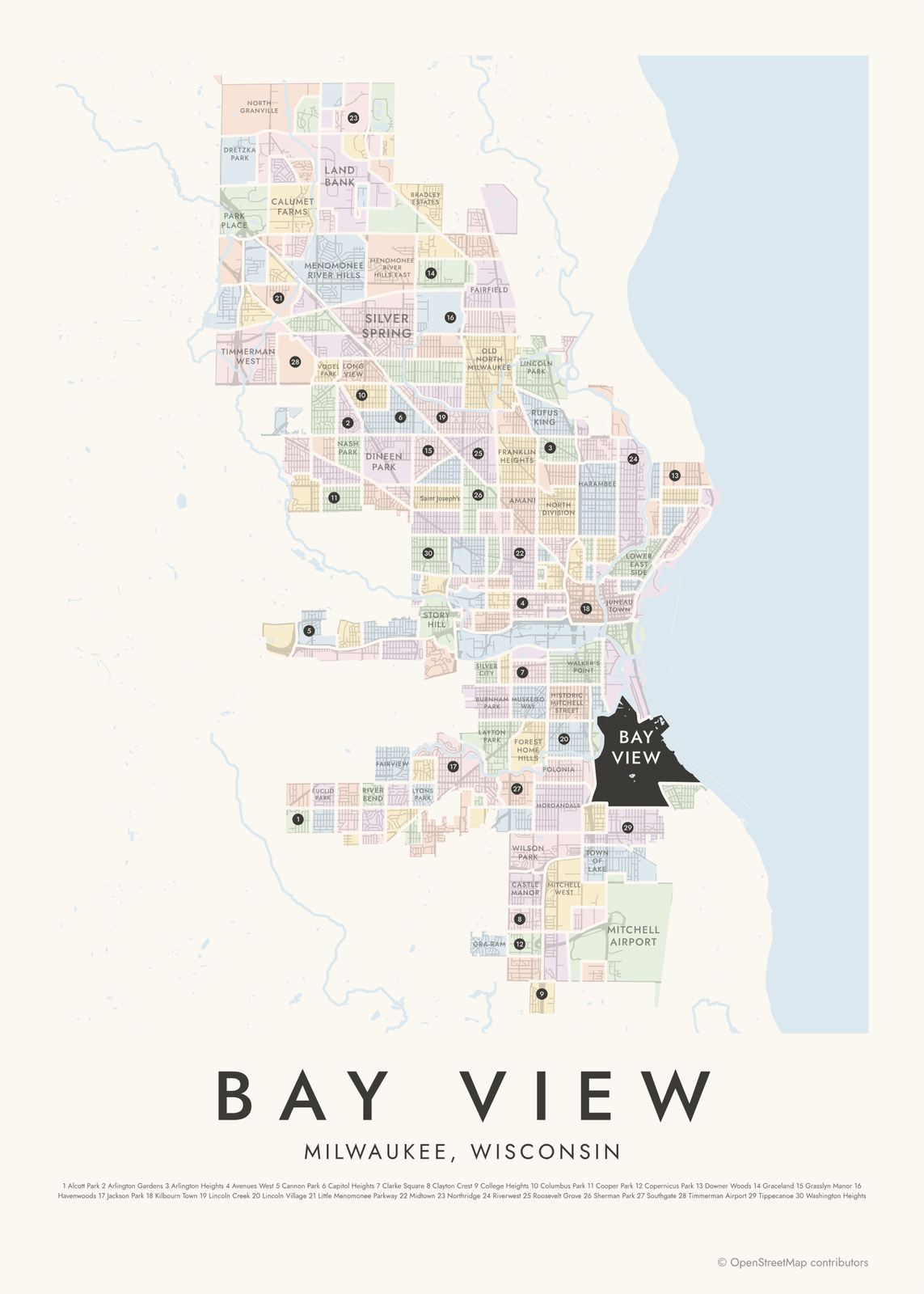 Bay View highlighted on a map of MilwaukeeEdit this →More neighborhood maps →
How Milwaukee is divided
The City of Milwaukee publishes an official map of 190 neighborhoods, and that's the map here. Many are small and named for a park nearby, like Sherman Park, Washington Park and Mitchell Park. A few cover the airport, the zoo and the Veterans Affairs grounds.
Milwaukee itself started as three settlements: Juneau Town east of the Milwaukee River, Kilbourn Town to the west, and Walker's Point to the south. They merged into one city in 1846, and all three names are still on the map. Locals also use broader names that span several official neighborhoods, like the East Side, the Near West Side or the Harbor District, and those appear as labels.
All 190 neighborhoods of Milwaukee
- Alcott Park
- Alverno
- Amani
- Arlington Gardens
- Arlington Heights
- Avenues West
- Baran Park
- Bay View
- Bluemound Heights
- Borchert Field
- Bradley Estates
- Brewer's Hill
- Brown Deer Park
- Brynwood
- Buchel Park
- Burnham Park
- Calumet Farms
- Cambridge Heights
- Cannon Park
- Capitol Heights
- Castle Manor
- Clarke Square
- Clayton Crest
- Clock Tower Acres
- Cold Spring Park
- College Heights
- Columbus Park
- Concordia
- Cooper Park
- Copernicus Park
- Dineen Park
- Downer Woods
- Dretzka Park
- Enderis Park
- Estabrook Park
- Euclid Park
- Fair Park
- Fairfield
- Fairview
- Fernwood
- Florist Highlands
- Forest Home Hills
- Franklin Heights
- Freedom Village
- Garden Homes
- Golden Gate
- Golden Valley
- Goldman Park
- Gra-Ram
- Graceland
- Grantosa
- Granville Station
- Granville Woods
- Grasslyn Manor
- Green Moor
- Grover Heights
- Halyard Park
- Hampton Heights
- Harambee
- Harbor View
- Harder's Oaks
- Havenwoods
- Hawley Farms
- Hawthorne Glen
- Haymarket
- Heritage Heights
- Highwood Estates
- Hillside
- Hilltop Parish
- Historic Mitchell Street
- Historic Third Ward
- Holler Park
- Honey Creek Manor
- Honey Creek Parkway
- Jackson Park
- Johnson's Woods
- Jones' Island
- Juneau Town
- Kilbourn Town
- King Park
- Kops Park
- Lake Park
- Land Bank
- Layton Park
- Lenox Heights
- Lincoln Creek
- Lincoln Park
- Lincoln Village
- Lindsay Park
- Little Menomonee Parkway
- Long View
- Lower East Side
- Lyons Park
- Mack Acres
- Maitland Park
- Maple Tree
- Marquette
- Martin Drive
- McGovern Park
- Melody View
- Menomonee River Hills
- Menomonee River Hills East
- Menomonee River Valley
- Merrill Park
- Metcalfe Park
- Midtown
- Mill Valley
- Miller Valley
- Milwaukee River Parkway
- Milwaukee Zoo
- Mitchell Airport
- Mitchell Park
- Mitchell West
- Morgan Heights
- Morgandale
- Mount Mary
- Mount Olivet
- Murray Hill
- Muskego Way
- Nash Park
- National Park
- New Coeln
- North Division
- North Granville
- Northpoint
- Northridge
- Northridge Lakes
- Old North Milwaukee
- Park Knoll
- Park Place
- Park View
- Parkway Hills
- Pheasant Run
- Pollber Heights
- Polonia
- Red Oak Heights
- Ridgeview
- River Bend
- Riverside Park
- Riverton Heights
- Riverwest
- Rolling Green
- Roosevelt Grove
- Root Creek
- Rufus King
- Saint Joseph
- Saveland Park
- Schlitz Park
- Servite Woods
- Sherman Park
- Silver City
- Silver Spring
- Silver Swan
- Southgate
- Southpoint
- St. Amelian's
- Story Hill
- Sunset Heights
- The Valley/Pigsville
- Thurston Woods
- Timmerman Airport
- Timmerman West
- Tippecanoe
- Town & Country Manor
- Town of Lake
- Triangle
- Triangle North
- Tripoli Park
- Upper East Side
- Uptown
- Valhalla
- Valley Forge
- Veterans Affairs
- Vogel Park
- Wahl Park
- Walker's Point
- Walnut Hill
- Washington Heights
- Washington Park
- Wedgewood
- West View
- Whispering Hills
- White Manor
- Wick Field
- Williamsburg
- Wilson Park
- Woodland Court
- Woodlands
- Wyrick Park
- Yankee Hill
More neighborhood names on the map
Inside the neighborhoods, the map also names 48 smaller neighborhoods where they fit, from OpenStreetMap: Near West Side, Lindsay Heights, Airport Gateway, Downtown, East Side, Fairway Place, River Ridge, Riverview, North Meadows, Silverswan, Lindsey Park, Saint Aemilian's, Wedgewood Park, Johnson Woods, Saint Joseph's, Piggsville, 30th Street Corridor, Crisol Corridor, Ohio Park, Walker Square, Kilbourntown, Reed Street Yards, Williamsburg Heights, Brewers Hill, Harbor District, Jones Island, Cambridge Woods, Granville, Butchel Park, Westlawn, Uptown Crossing, Center Street Marketplace, West End, Sohi, Cesar E. Chavez Drive, University Hill, The Brewery, Deer District, Bronzeville, Theater District and more. Turn them off under Names if you want only the neighborhoods.
Neighborhoods to know
- Historic Third Ward: a former warehouse district by the river, home to the Milwaukee Public Market.
- Bay View: a lakeside former mill town that joined Milwaukee in 1887.
- Walker's Point: one of Milwaukee's three founding settlements, south of the Menomonee River.
- Lake Park: named for the Olmsted-designed park on the bluff above Lake Michigan, with the North Point Lighthouse.
- Mitchell Park: named for the park that holds the Mitchell Park Domes, three glass-domed conservatories.
- Schlitz Park: offices in the old Joseph Schlitz Brewing Company buildings.
- Bronzeville: a North Side district named for Milwaukee's historic center of Black business and culture.
How to make your Milwaukee neighborhood poster
- Open the Milwaukee map.
- Pick a style: Colored areas, Typographic (the names fill the map) or a Street map with the borders over the streets.
- Tap your own neighborhood to highlight it; it becomes the poster's title.
- Drag and zoom to frame the whole city or just your part of it, then pick a size and download the print file.
Questions
How many neighborhoods does Milwaukee have?
The city's official neighborhood map has 190, and all of them are on this poster. Locals also use broader names, like the East Side or the Near West Side, which take in several official neighborhoods. Those appear as labels.
What counts as the East Side?
The East Side is the area between the Milwaukee River and Lake Michigan, north of downtown. It isn't one official neighborhood. On the map it takes in the Lower East Side, the Upper East Side, Murray Hill and others.
Is Wauwatosa part of Milwaukee?
No. Wauwatosa, West Allis and Shorewood are separate municipalities that border the city, so they aren't on this map.
How did Milwaukee start?
As three rival settlements: Juneau Town, Kilbourn Town and Walker's Point, founded by Solomon Juneau, Byron Kilbourn and George Walker. They joined as the City of Milwaukee in 1846.
Where do the Milwaukee boundaries come from?
From OpenStreetMap (© OpenStreetMap contributors) and City of Milwaukee. Streets and water are OpenStreetMap's. Boundaries are a snapshot and can differ from what neighbors call home; tell us if one looks wrong.
What sizes can I print?
US Letter, 8 × 10, 11 × 14, 12 × 16 and 12 × 18 in, A4 and A3, free. You download a 300 DPI JPEG drawn at the size you pick. Larger prints, up to 24 × 36 in, are coming soon.
Related




Gift ideas by occasion




Every example is made with the Posterage generators. Change anything, then download it as a 300 DPI JPEG.