Minneapolis neighborhood map 11 communities and 87 neighborhoods, named
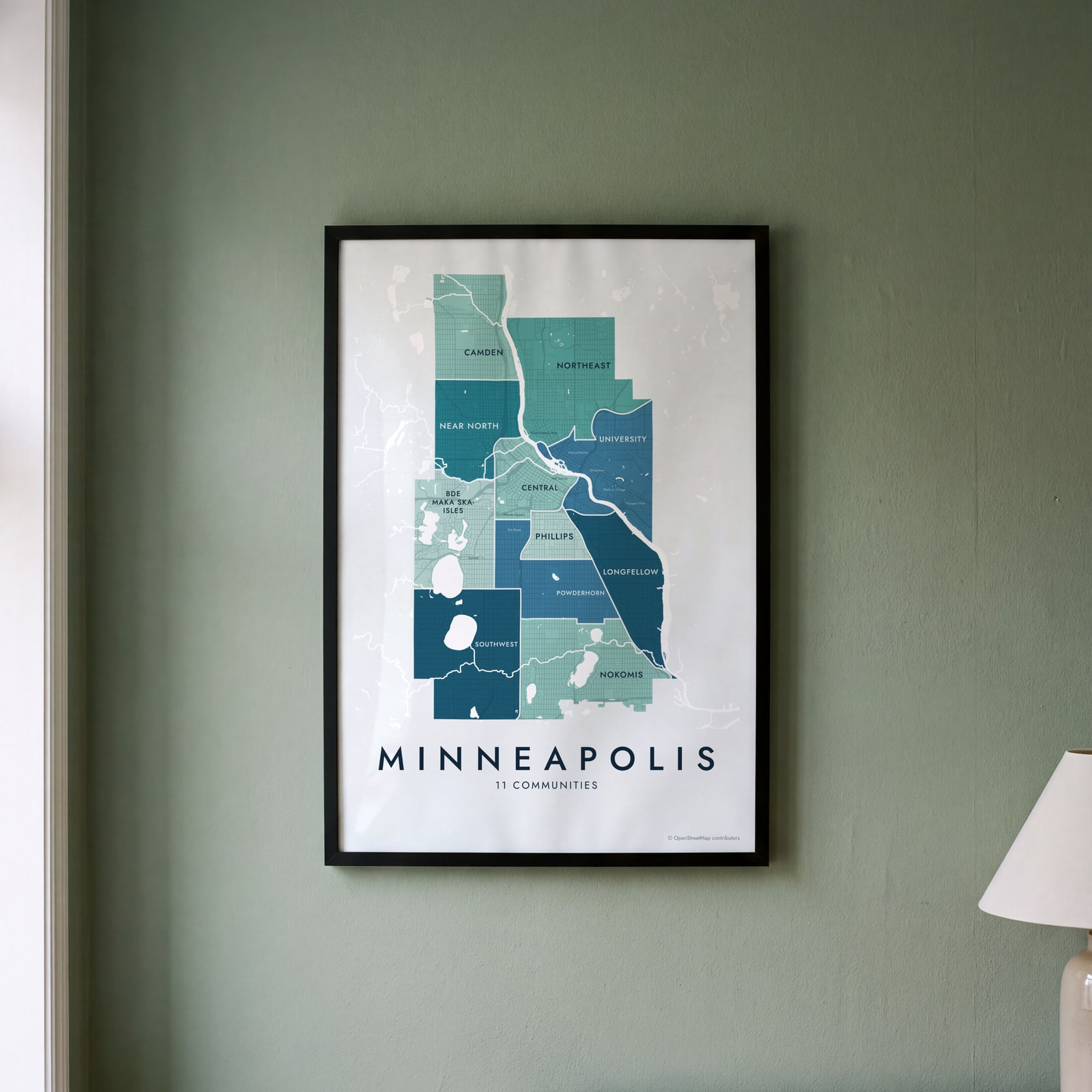
This poster maps Minneapolis split into its 11 communities, each named, from Camden in the north to Nokomis in the south. Switch to the 87 neighborhoods for a finer map, with places like Linden Hills, Whittier and Marcy Holmes. Highlight the one you call home and print it.
On the wall
A few of them framed at home. Open any one to make it yours.
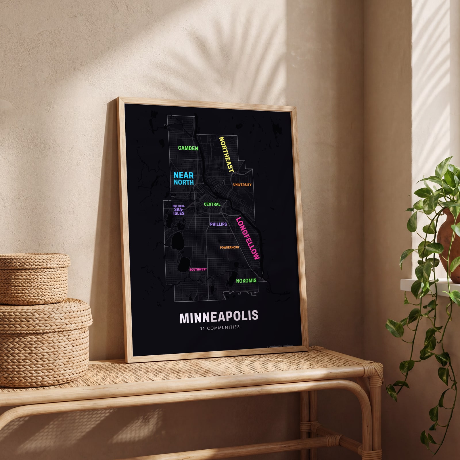 Typographic Minneapolis map: the names fill their communitiesEdit this →
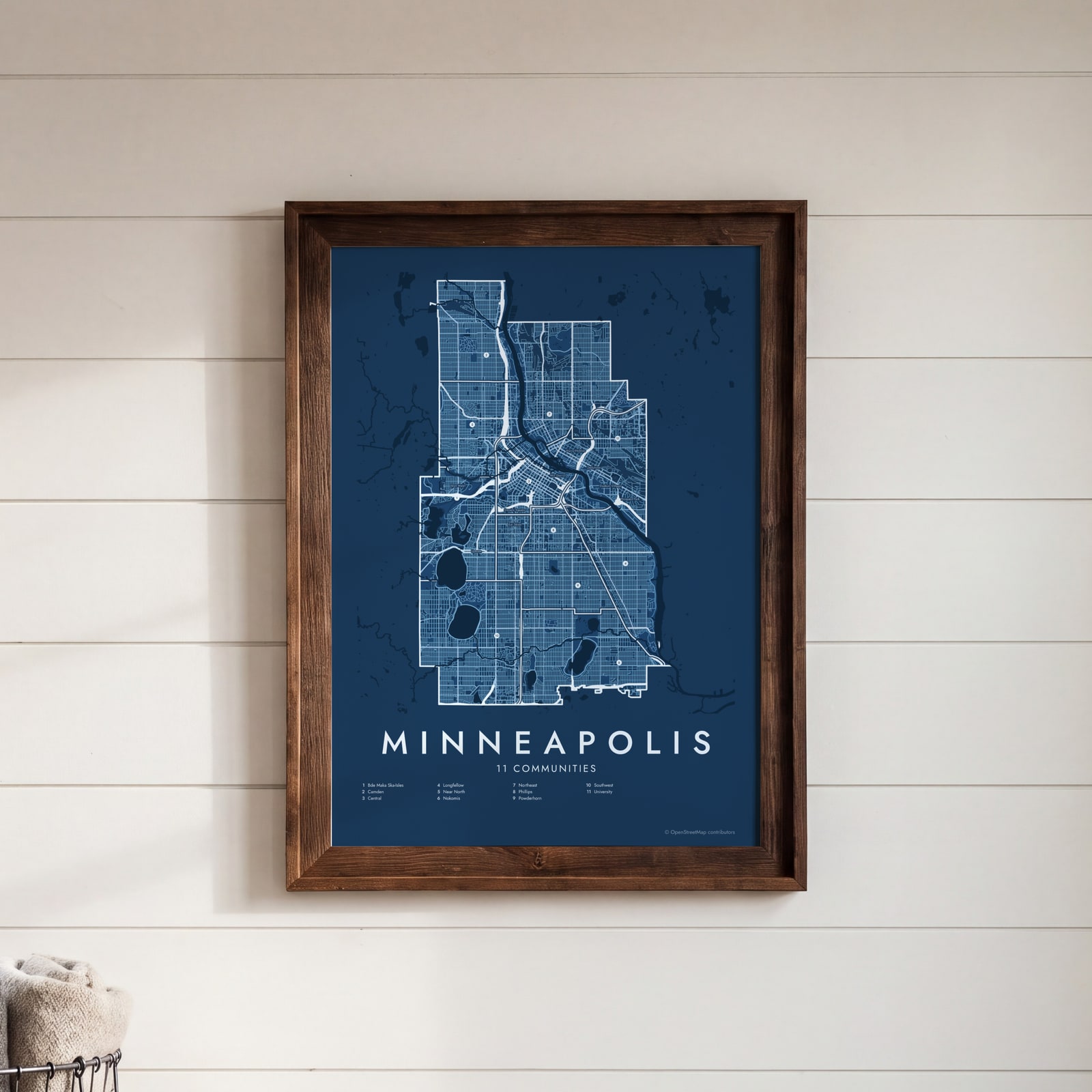 Minneapolis street map with numbered communities and their listEdit this →
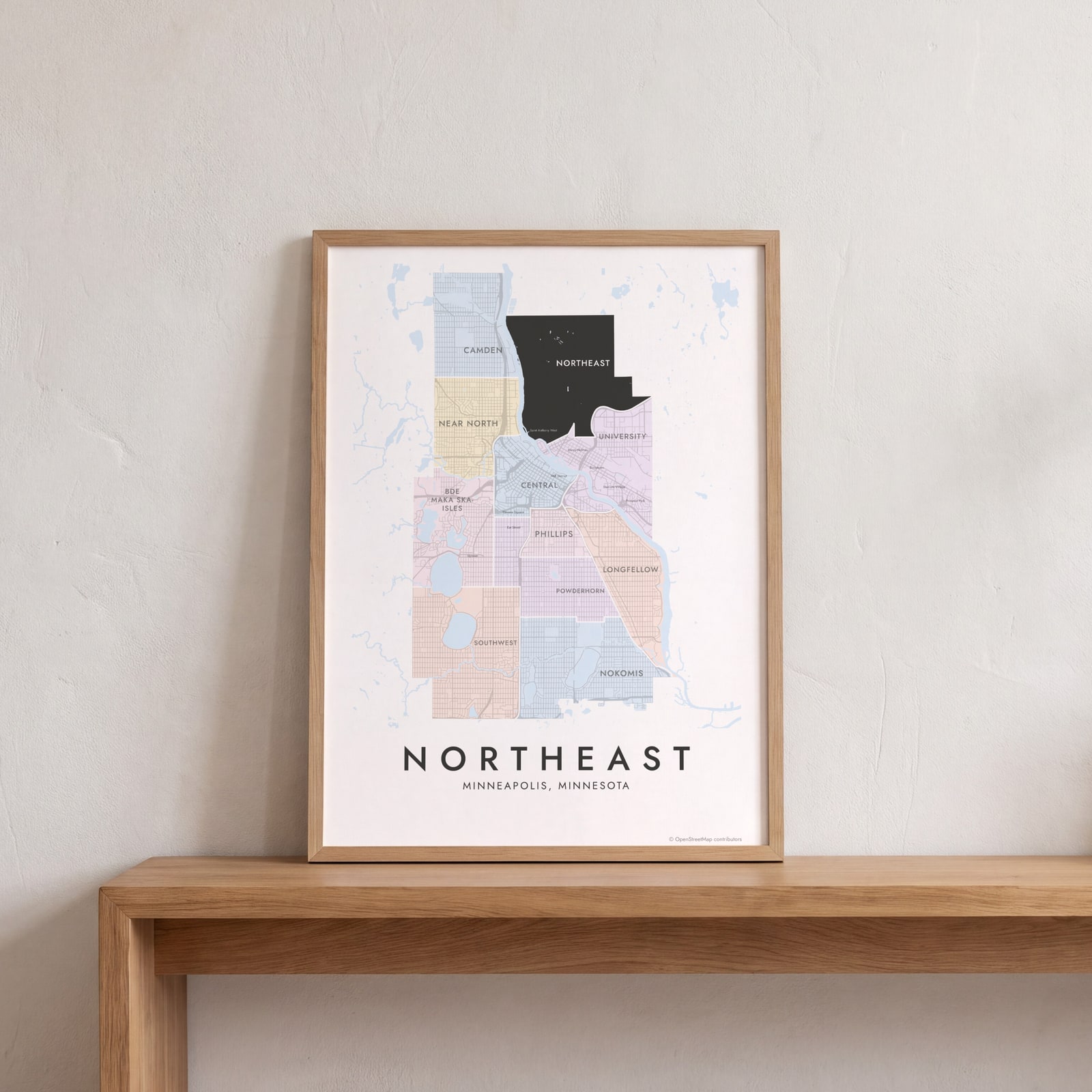 Northeast highlighted on a map of MinneapolisEdit this →
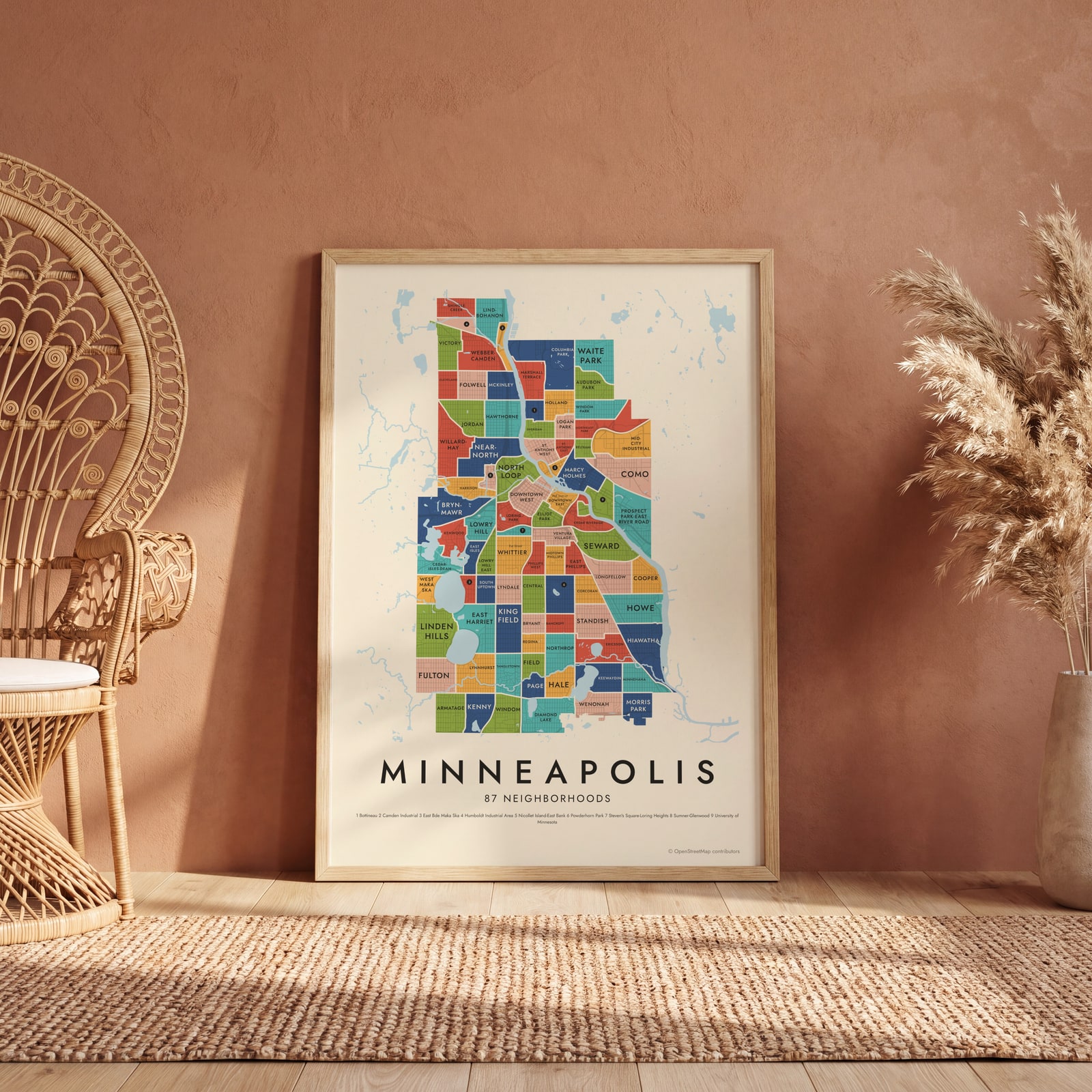 Minneapolis's 87 neighborhoods in colorEdit this →
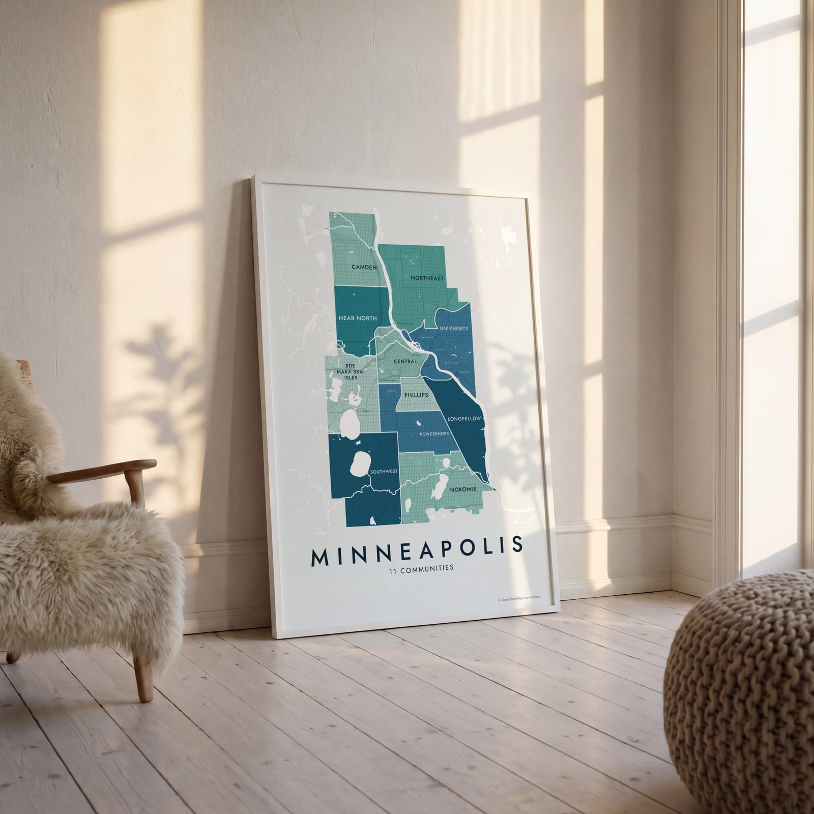 Minneapolis neighborhood map in color, every community namedEdit this →
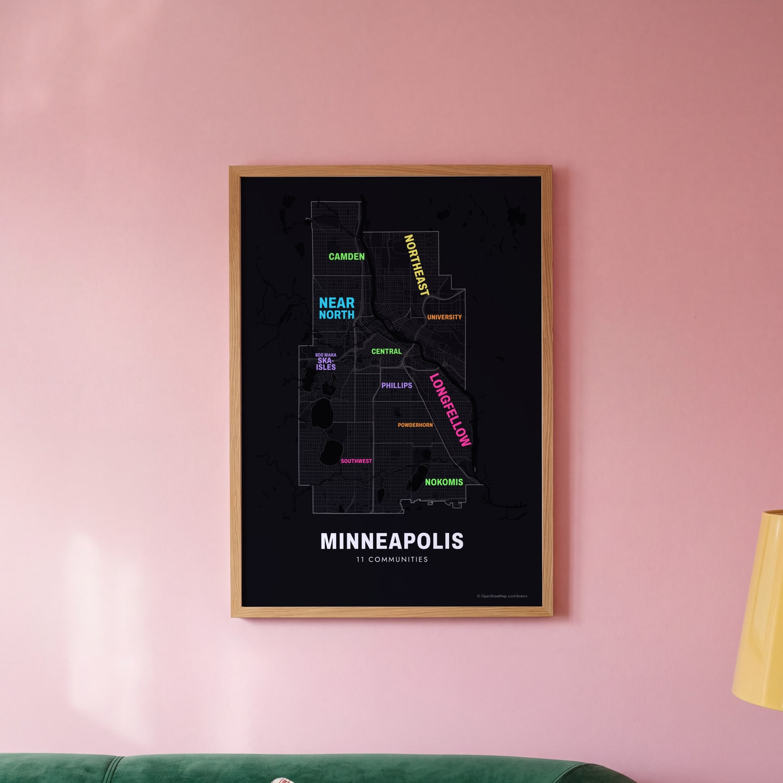 Typographic Minneapolis map: the names fill their communitiesEdit this →
Examples
Open any of them to change the words, the place, the date and the style, then download the print file.
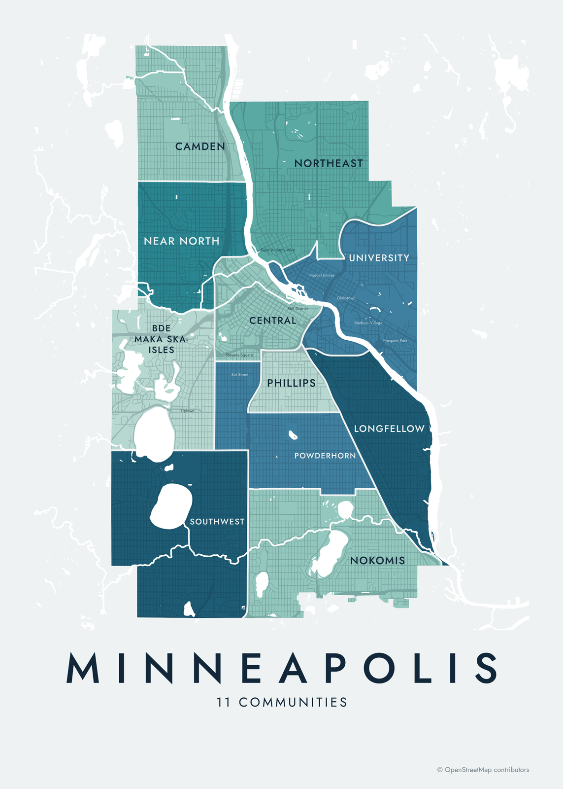 Minneapolis neighborhood map in color, every community namedEdit this →More neighborhood maps →
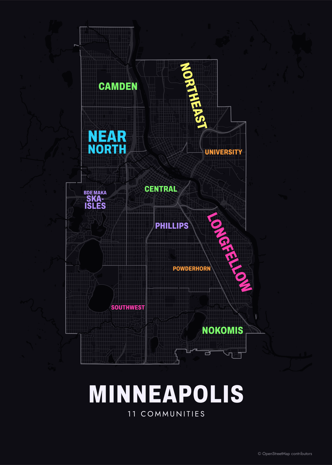 Typographic Minneapolis map: the names fill their communitiesEdit this →More neighborhood maps →
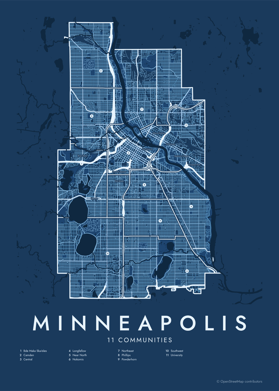 Minneapolis street map with numbered communities and their listEdit this →More neighborhood maps →
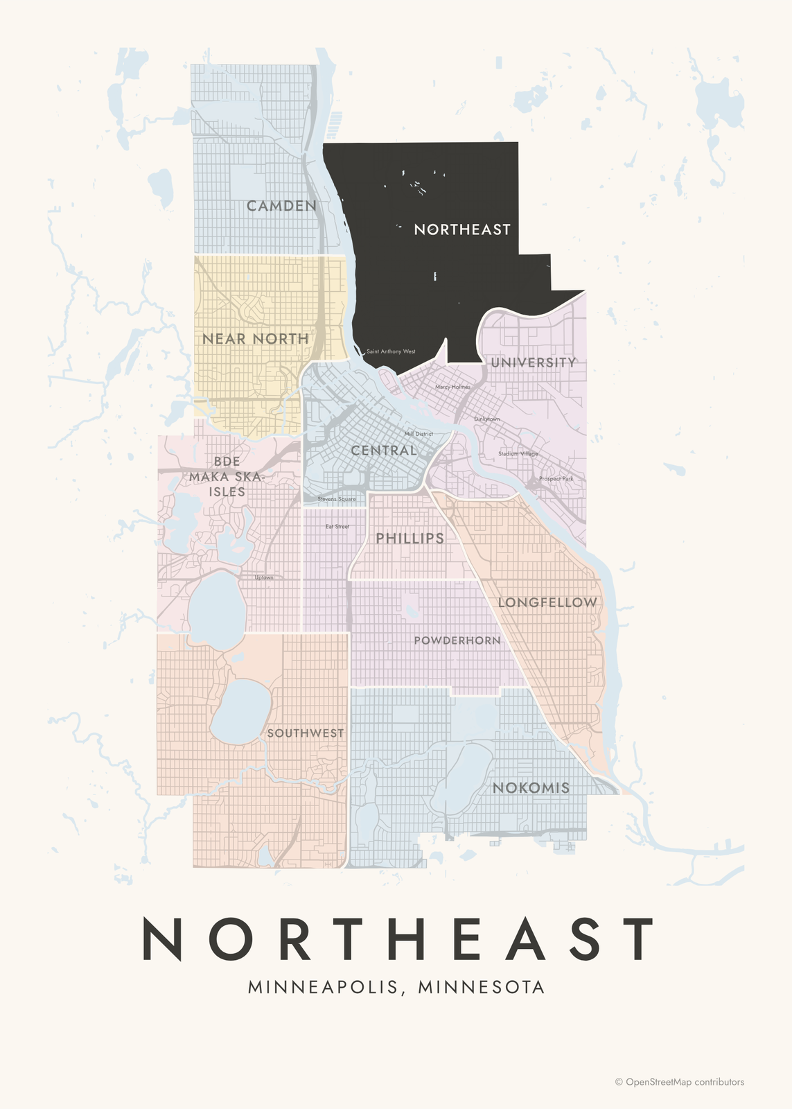 Northeast highlighted on a map of MinneapolisEdit this →More neighborhood maps →
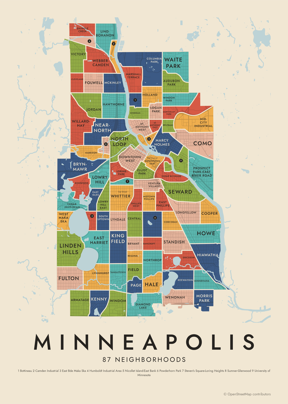 Minneapolis's 87 neighborhoods in colorEdit this →More neighborhood maps →
How Minneapolis is divided
Minneapolis has 83 official neighborhoods, set by the city council and grouped into 11 communities of 4 to 13 neighborhoods each. Some community names, like Northeast and Southwest, are also everyday names for those parts of the city. At the neighborhood level our map shows 87 areas, including a few industrial and campus zones like Mid-City Industrial and the University of Minnesota.
Popular names don't always match the official list. Uptown, around Hennepin Avenue and Lake Street, spreads over four neighborhoods, and Dinkytown sits inside Marcy Holmes. Some names have also changed: Lake Calhoun now goes by its Dakota name, Bde Maka Ska, and the neighborhoods beside it were renamed to match, like East Bde Maka Ska and West Maka Ska.
All 11 communities of Minneapolis
- Bde Maka Ska-Isles
- Camden
- Central
- Longfellow
- Near North
- Nokomis
- Northeast
- Phillips
- Powderhorn
- Southwest
- University
All 87 neighborhoods of Minneapolis
- Armatage
- Audubon Park
- Bancroft
- Beltrami
- Bottineau
- Bryant
- Bryn-Mawr
- Camden Industrial
- Cedar Riverside
- Cedar-Isles-Dean
- Central
- Cleveland
- Columbia Park
- Como
- Cooper
- Corcoran
- Diamond Lake
- Downtown East
- Downtown West
- East Bde Maka Ska
- East Harriet
- East Isles
- East Phillips
- Elliot Park
- Ericsson
- Field
- Folwell
- Fulton
- Hale
- Harrison
- Hawthorne
- Hiawatha
- Holland
- Howe
- Humboldt Industrial Area
- Jordan
- Keewaydin
- Kenny
- Kenwood
- King Field
- Lind-Bohanon
- Linden Hills
- Logan Park
- Longfellow
- Loring Park
- Lowry Hill
- Lowry Hill East
- Lyndale
- Lynnhurst
- Marcy Holmes
- Marshall Terrace
- McKinley
- Mid-City Industrial
- Midtown Phillips
- Minnehaha
- Morris Park
- Near-North
- Nicollet Island-East Bank
- North Loop
- Northeast Park
- Northrop
- Page
- Phillips West
- Powderhorn Park
- Prospect Park-East River Road
- Regina
- Seward
- Sheridan
- Shingle Creek
- South Uptown
- St. Anthony East
- St. Anthony West
- Standish
- Steven's Square-Loring Heights
- Sumner-Glenwood
- Tangletown
- University of Minnesota
- Ventura Village
- Victory
- Waite Park
- Webber-Camden
- Wenonah
- West Maka Ska
- Whittier
- Willard-Hay
- Windom
- Windom Park
More neighborhood names on the map
Inside the communities, the map also names 18 smaller neighborhoods where they fit, from OpenStreetMap: 50th and France, Uptown, Lyn-Lake, Eat Street, Gateway District, Saint Anthony Main, Mill District, Dinkytown, Stadium Village, Cedar - Isles - Dean, Bryn Mawr, Camden Industrial Area, Stevens Square, Saint Anthony West, Saint Anthony East, Cedar-Riverside, Marcy-Holmes, Prospect Park. Turn them off under Names if you want only the communities.
Neighborhoods to know
- Downtown East: the riverfront Mill District, with the Mill City Museum, the Guthrie Theater and the Stone Arch Bridge across the Mississippi.
- Nicollet Island-East Bank: Nicollet Island, in the Mississippi just above St. Anthony Falls, and the riverbank facing downtown.
- Marcy Holmes: Dinkytown's shops and cafes, next to the University of Minnesota.
- North Loop: an old warehouse district on the edge of downtown, now lofts and restaurants.
- Lowry Hill: the Walker Art Center and the Minneapolis Sculpture Garden, with its giant spoon and cherry.
- Whittier: the Minneapolis Institute of Art and Eat Street, a run of restaurants on Nicollet Avenue.
- Linden Hills: a small village center between Lake Harriet and Bde Maka Ska.
- Cedar Riverside: the West Bank, with the colorful towers of Riverside Plaza and part of the University of Minnesota campus.
How to make your Minneapolis neighborhood poster
- Open the Minneapolis map and pick communities or neighborhoods.
- Pick a style: Colored areas, Typographic (the names fill the map) or a Street map with the borders over the streets.
- Tap your own neighborhood to highlight it; it becomes the poster's title.
- Drag and zoom to frame the whole city or just your part of it, then pick a size and download the print file.
Questions
How many neighborhoods does Minneapolis have?
Officially 83, grouped into 11 communities. This map shows 87 areas at the neighborhood level, counting a few industrial and campus zones on their own. Names like Uptown, Dinkytown and Lyn-Lake appear as labels.
What are the 11 communities of Minneapolis?
Camden, Near North, Central, University, Northeast, Phillips, Powderhorn, Longfellow, Nokomis, Southwest and Bde Maka Ska-Isles, once called Calhoun Isles. Each one groups several neighborhoods.
Is Uptown a neighborhood in Minneapolis?
Not officially. Uptown is the area around Hennepin Avenue and Lake Street, where four neighborhoods meet: East Isles, Lowry Hill East, South Uptown and East Bde Maka Ska. It shows on the map as a label.
Where do the Minneapolis boundaries come from?
From OpenStreetMap (© OpenStreetMap contributors) and City of Minneapolis. Streets and water are OpenStreetMap's. Boundaries are a snapshot and can differ from what neighbors call home; tell us if one looks wrong.
What sizes can I print?
US Letter, 8 × 10, 11 × 14, 12 × 16 and 12 × 18 in, A4 and A3, free. You download a 300 DPI JPEG drawn at the size you pick. Larger prints, up to 24 × 36 in, are coming soon.
Related




Gift ideas by occasion




Every example is made with the Posterage generators. Change anything, then download it as a 300 DPI JPEG.