Phoenix neighborhood map 15 urban villages, all named
This poster maps Phoenix split into its 15 urban villages, the planning areas the city uses, from Desert View in the north to Ahwatukee Foothills in the south, each one named. Smaller labels add 136 neighborhood names, like Arcadia, Sunnyslope and Willo. Highlight the one you call home and print it.
On the wall
A few of them framed at home. Open any one to make it yours.
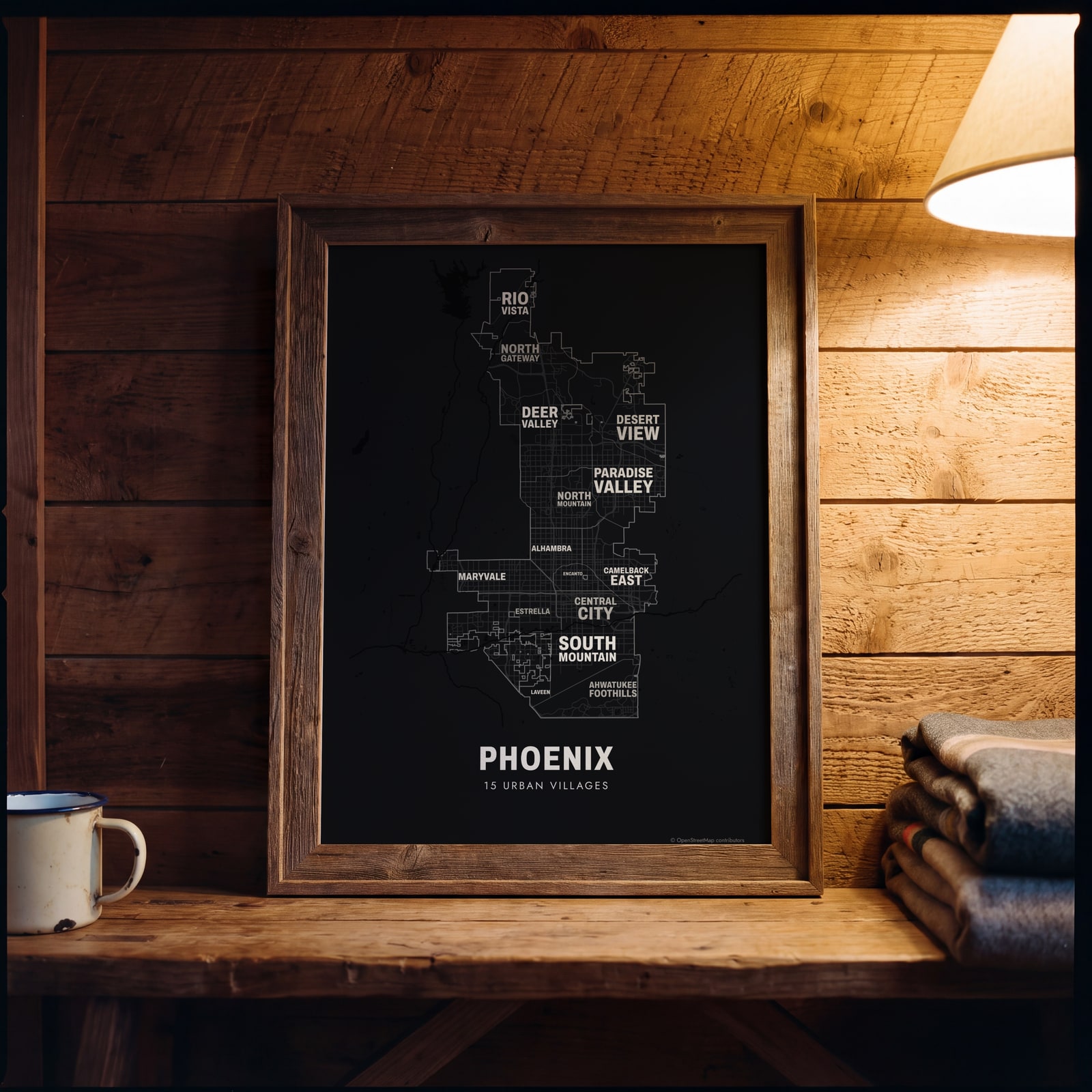 Typographic Phoenix map: the names fill their urban villagesEdit this →
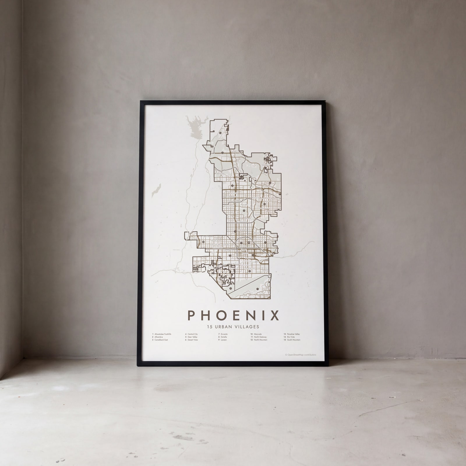 Phoenix street map with numbered urban villages and their listEdit this →
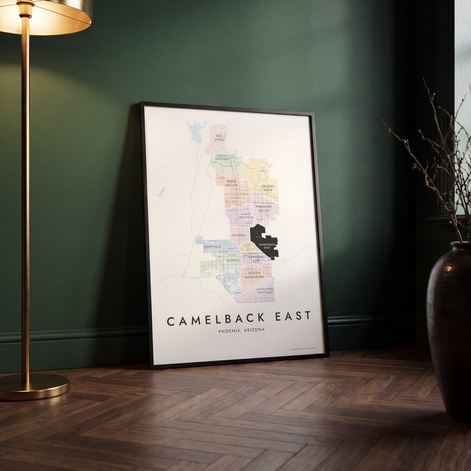 Camelback East highlighted on a map of PhoenixEdit this →
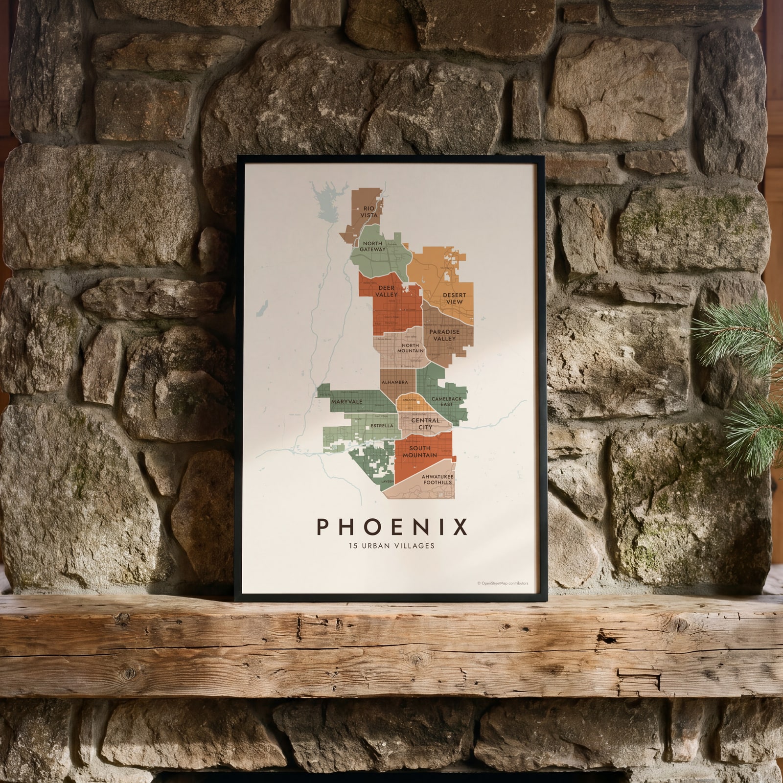
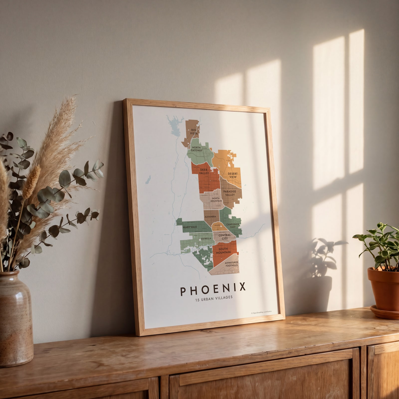 Phoenix neighborhood map in color, every urban village namedEdit this →
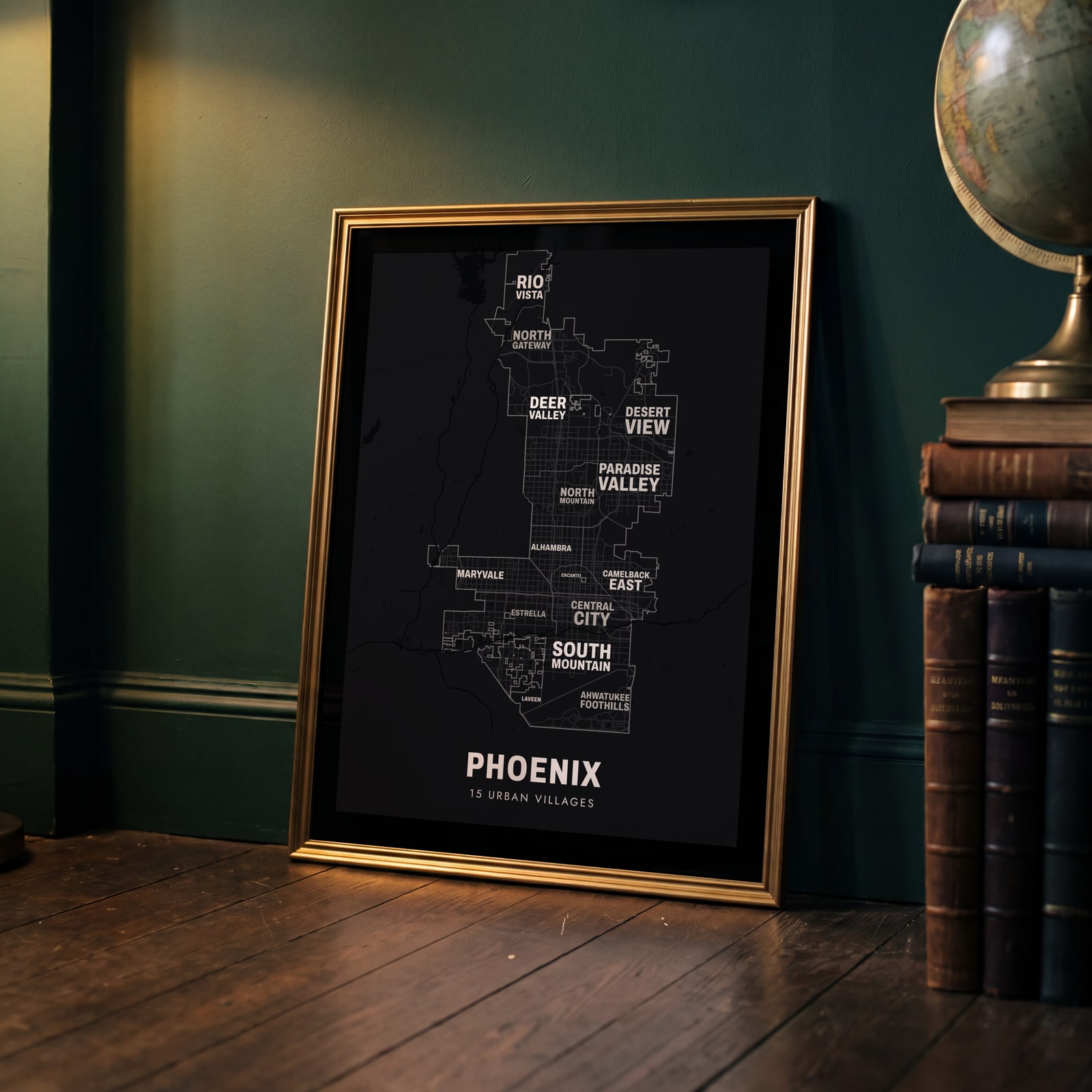 Typographic Phoenix map: the names fill their urban villagesEdit this →
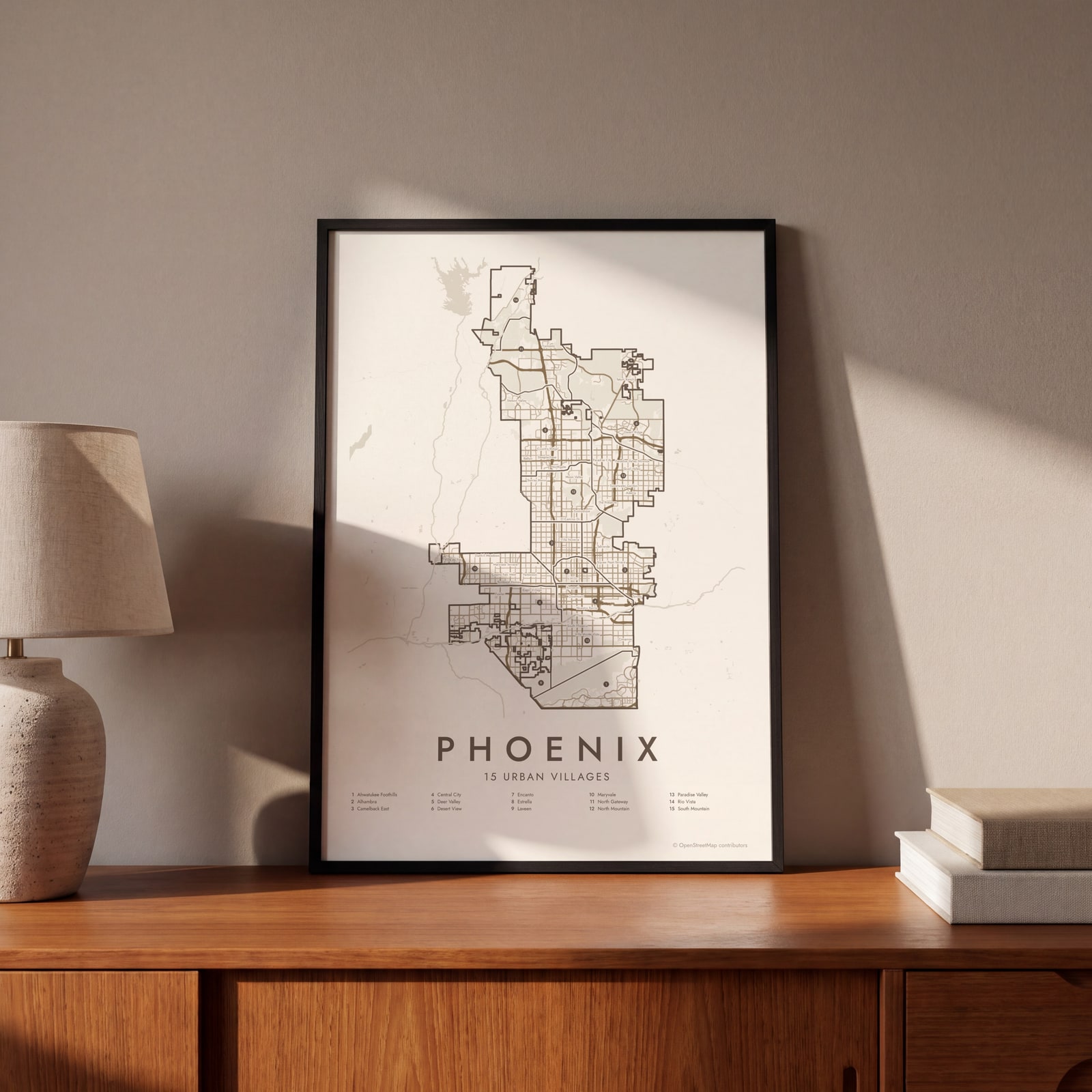 Phoenix street map with numbered urban villages and their listEdit this →
Examples
Open any of them to change the words, the place, the date and the style, then download the print file.
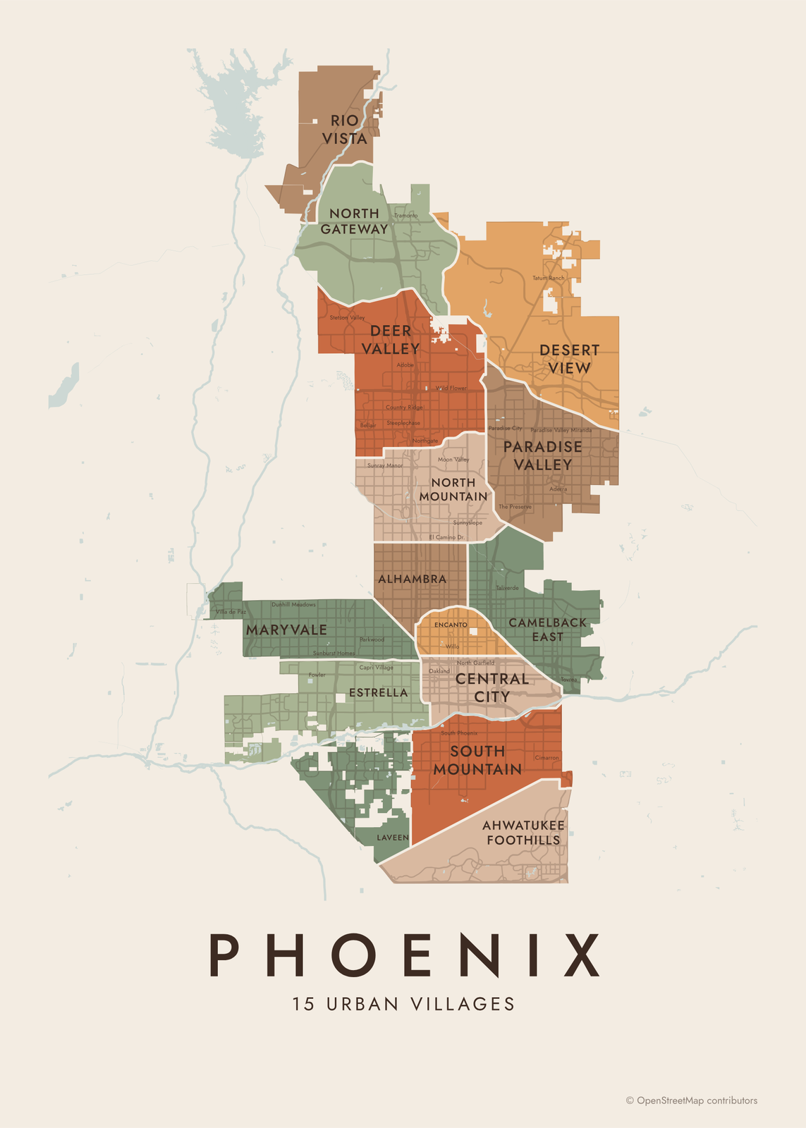 Phoenix neighborhood map in color, every urban village namedEdit this →More neighborhood maps →
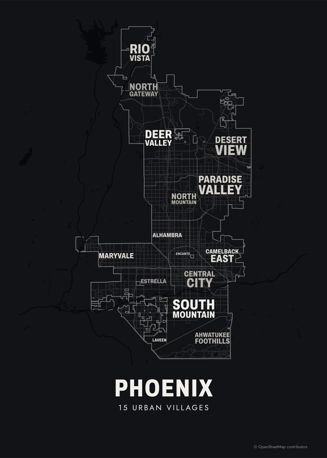 Typographic Phoenix map: the names fill their urban villagesEdit this →More neighborhood maps →
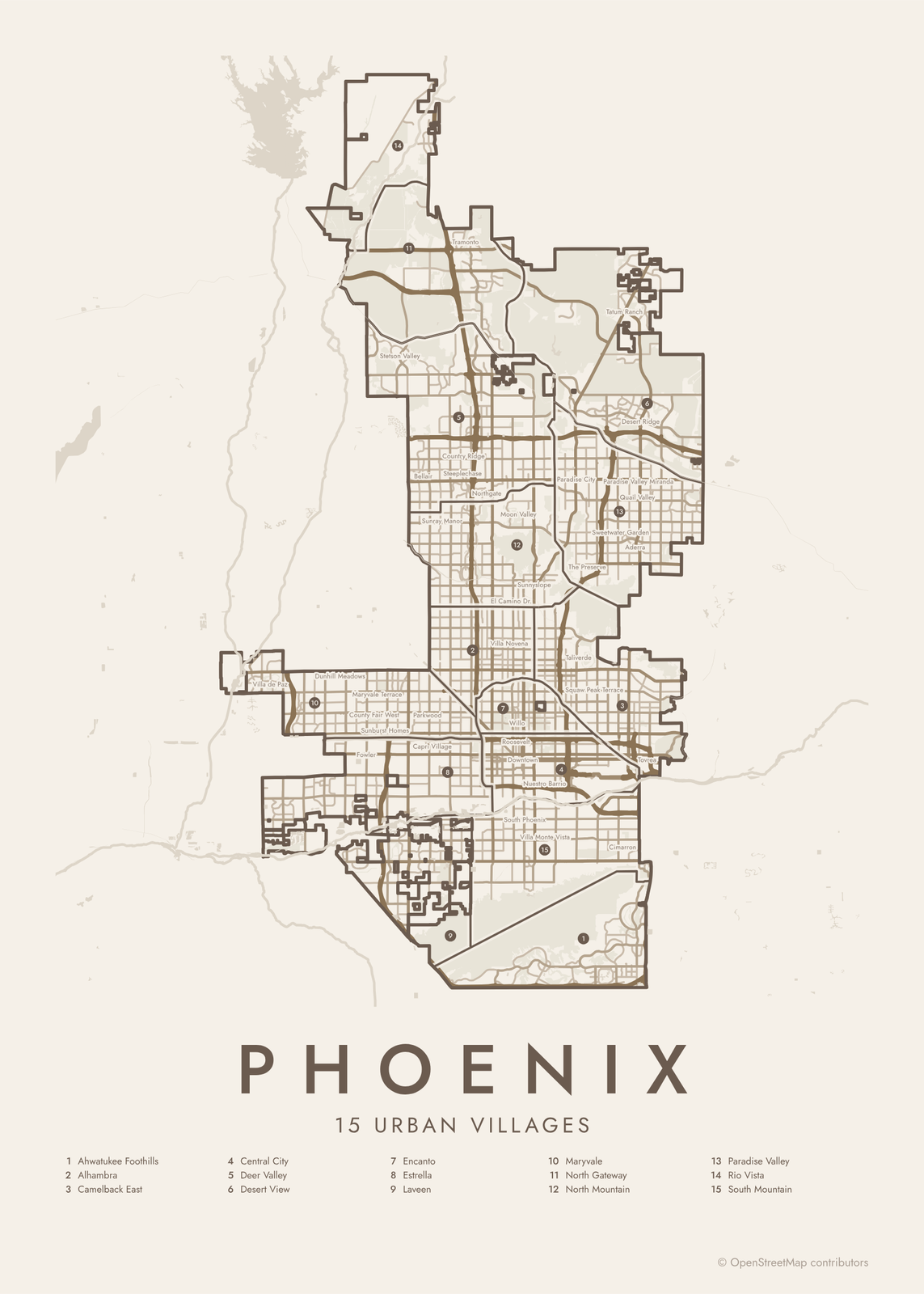 Phoenix street map with numbered urban villages and their listEdit this →More neighborhood maps →
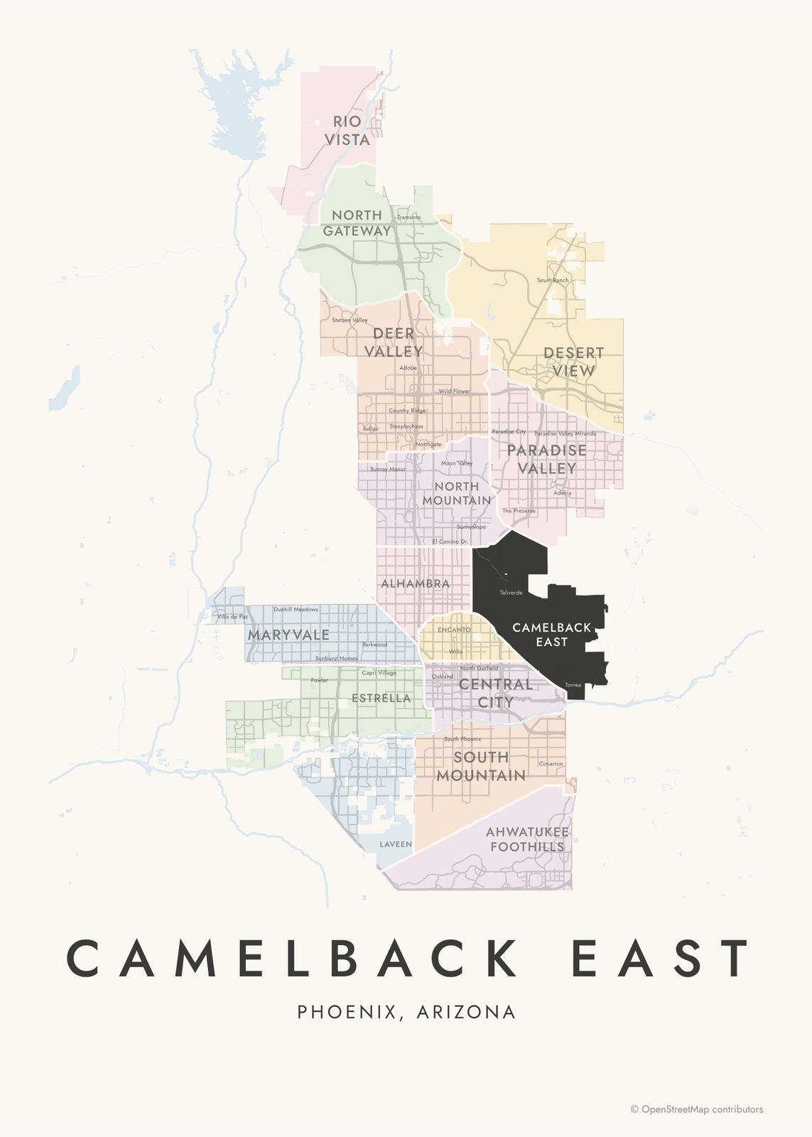 Camelback East highlighted on a map of PhoenixEdit this →More neighborhood maps →
How Phoenix is divided
Phoenix doesn't have an official neighborhood map. Instead, it plans the city by urban village. The idea dates to the 1970s: the Phoenix Concept Plan 2000, adopted in 1979, set up nine villages. Today there are 15, and each has a Village Planning Committee, appointed by the mayor and city council, that reviews zoning cases in its area.
Each village holds many neighborhoods. Camelback East takes in Arcadia and the Biltmore area, Encanto holds Willo and F.Q. Story, and North Mountain includes Sunnyslope. The map prints 136 of these neighborhood names as smaller labels. The Paradise Valley village is part of Phoenix, unlike the separate Town of Paradise Valley next to it.
All 15 urban villages of Phoenix
- Ahwatukee Foothills
- Alhambra
- Camelback East
- Central City
- Deer Valley
- Desert View
- Encanto
- Estrella
- Laveen
- Maryvale
- North Gateway
- North Mountain
- Paradise Valley
- Rio Vista
- South Mountain
More neighborhood names on the map
Inside the urban villages, the map also names 136 smaller neighborhoods where they fit, from OpenStreetMap: Stetson Valley, Moon Valley, Downtown, Sunnyslope, Tatum Ranch, Desert Ridge, Arcadia, Country Greens at Villa de Paz, Villa de Paz, Liberty Village, Sheely Farms, Dunhill Meadows, Indian Springs, Fowler, Westridge Park, Santa Maria, Entrada, Eagle Ridge, County Fair West, Avalon Village, Maryvale Terrace, Sunburst Homes, Cartwright, Longhaven West, Cactus Gale V, Overland Trail, Sunburst Farms, Bellair, Canyon View, Parkwood, Young America Homes, Stetson Hills, Capri Village, Verde Real, Suncrest Villas West, Catalina Village, Amberwood North, Sunray Manor, Steeplechase, Country Ridge and more. Turn them off under Names if you want only the urban villages.
Neighborhoods to know
- Downtown: the city's core, with the Phoenix Convention Center and Arizona State University's downtown campus.
- Roosevelt Row: an arts district north of downtown, with murals and galleries.
- Encanto: named for Encanto Park, with historic districts like Willo and Encanto-Palmcroft.
- Camelback East: named for Camelback Mountain, and home to Arcadia and the Arizona Biltmore hotel.
- Arcadia: big lots and old citrus trees at the foot of Camelback Mountain.
- Maryvale: a 1950s planned community built by John F. Long and named for his wife, Mary.
- South Mountain: below South Mountain Park and Preserve, a desert park of more than 16,000 acres.
- Ahwatukee Foothills: on the far side of South Mountain from the rest of Phoenix, reached by Interstate 10.
How to make your Phoenix neighborhood poster
- Open the Phoenix map.
- Pick a style: Colored areas, Typographic (the names fill the map) or a Street map with the borders over the streets.
- Tap your own neighborhood to highlight it; it becomes the poster's title.
- Drag and zoom to frame the whole city or just your part of it, then pick a size and download the print file.
Questions
How many neighborhoods does Phoenix have?
Phoenix has no official count. The city is divided into 15 urban villages, and those are the areas on this map. Inside them are hundreds of neighborhoods and subdivisions, and 136 of their names appear as labels.
What is an urban village in Phoenix?
A planning area with its own Village Planning Committee, whose members are appointed by the mayor and city council. Each committee reviews zoning and development cases in its village before they go to the Planning Commission.
Is Paradise Valley part of Phoenix?
It depends which one. The Paradise Valley urban village is part of Phoenix and is on this map. The Town of Paradise Valley is a separate town next to it, so it isn't.
Are Scottsdale, Tempe and Mesa part of Phoenix?
No. They're separate cities in the Phoenix metro area, so they aren't on this map. It covers the City of Phoenix only.
Where do the Phoenix boundaries come from?
From OpenStreetMap (© OpenStreetMap contributors) and City of Phoenix. Streets and water are OpenStreetMap's. Boundaries are a snapshot and can differ from what neighbors call home; tell us if one looks wrong.
What sizes can I print?
US Letter, 8 × 10, 11 × 14, 12 × 16 and 12 × 18 in, A4 and A3, free. You download a 300 DPI JPEG drawn at the size you pick. Larger prints, up to 24 × 36 in, are coming soon.
Related




Gift ideas by occasion




Every example is made with the Posterage generators. Change anything, then download it as a 300 DPI JPEG.