Pittsburgh neighborhood map all 90 neighborhoods, named
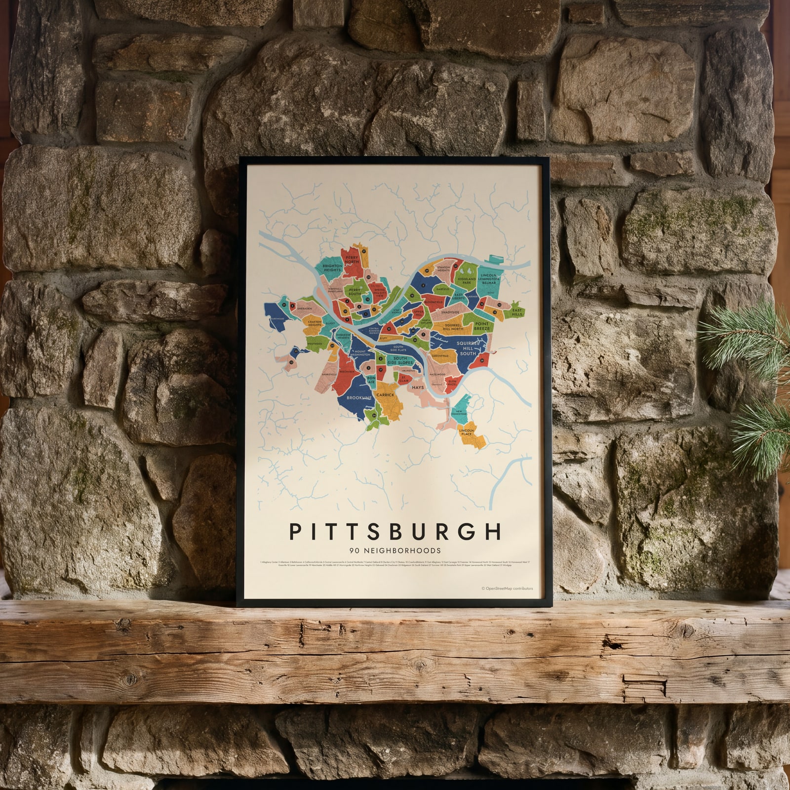
This poster maps Pittsburgh split into its 90 official neighborhoods, each named, from the Strip District and Polish Hill to Mount Washington and Brookline. Rivers, hills and hollows set many of the borders. Highlight the one you call home and print it.
On the wall
A few of them framed at home. Open any one to make it yours.
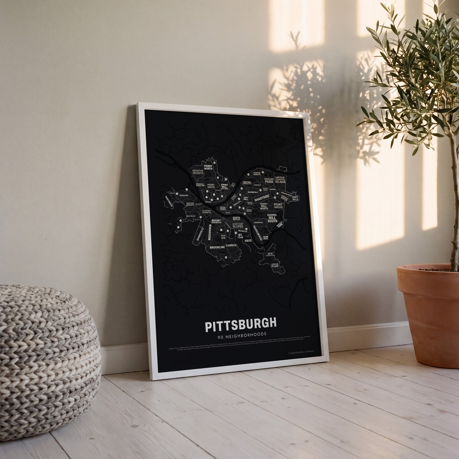 Typographic Pittsburgh map: the names fill their neighborhoodsEdit this →
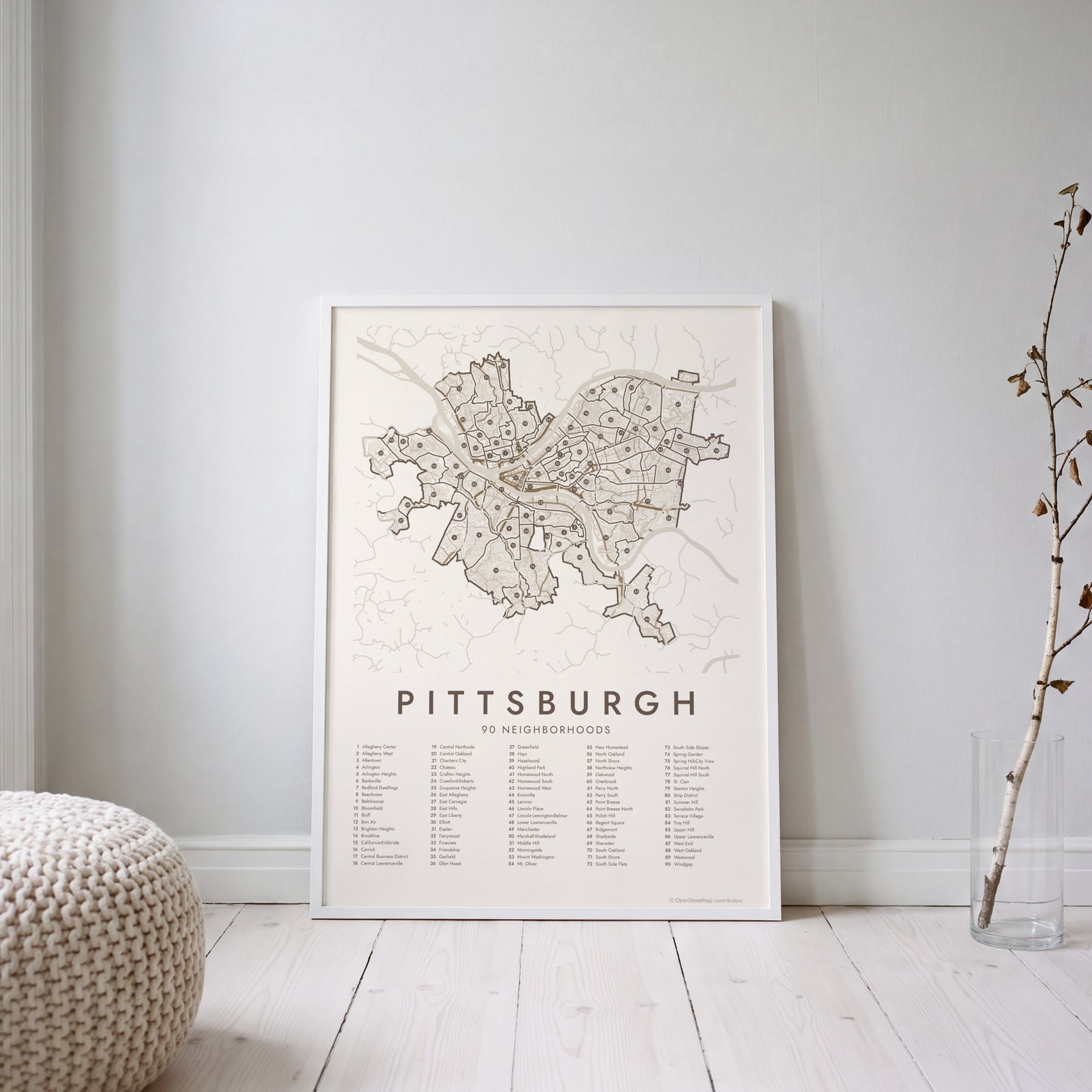 Pittsburgh street map with numbered neighborhoods and their listEdit this →
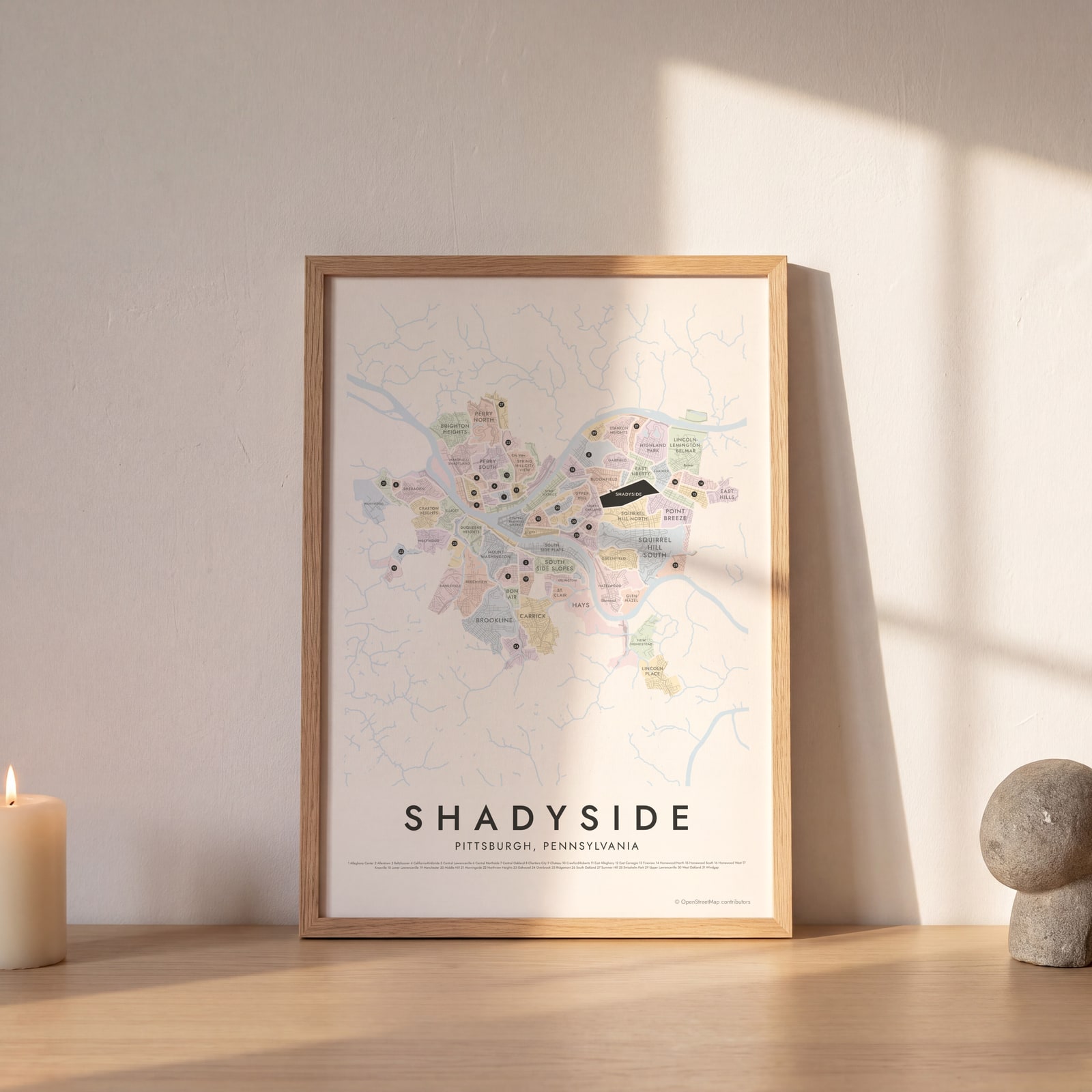 Shadyside highlighted on a map of PittsburghEdit this →
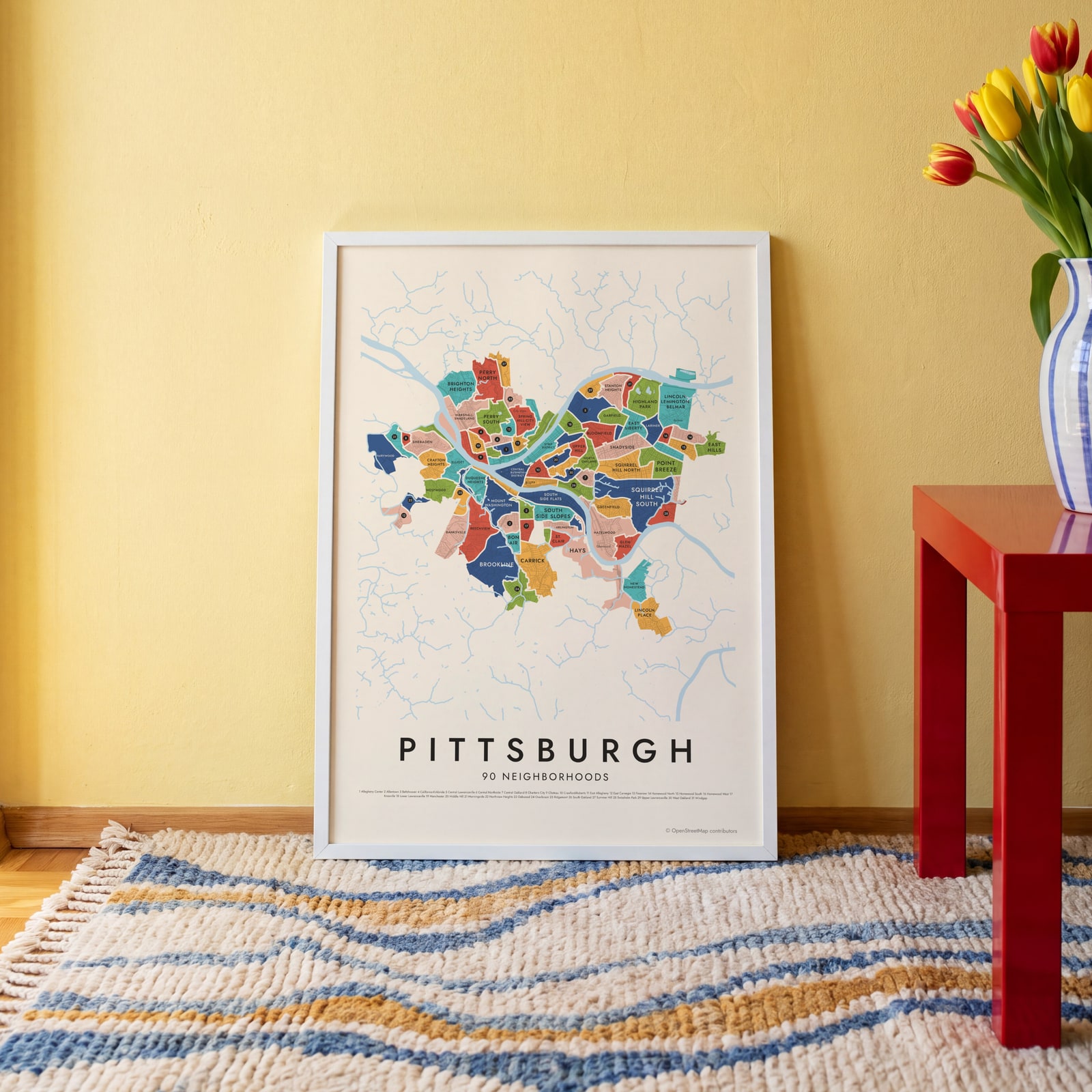 Pittsburgh neighborhood map in color, every neighborhood namedEdit this →
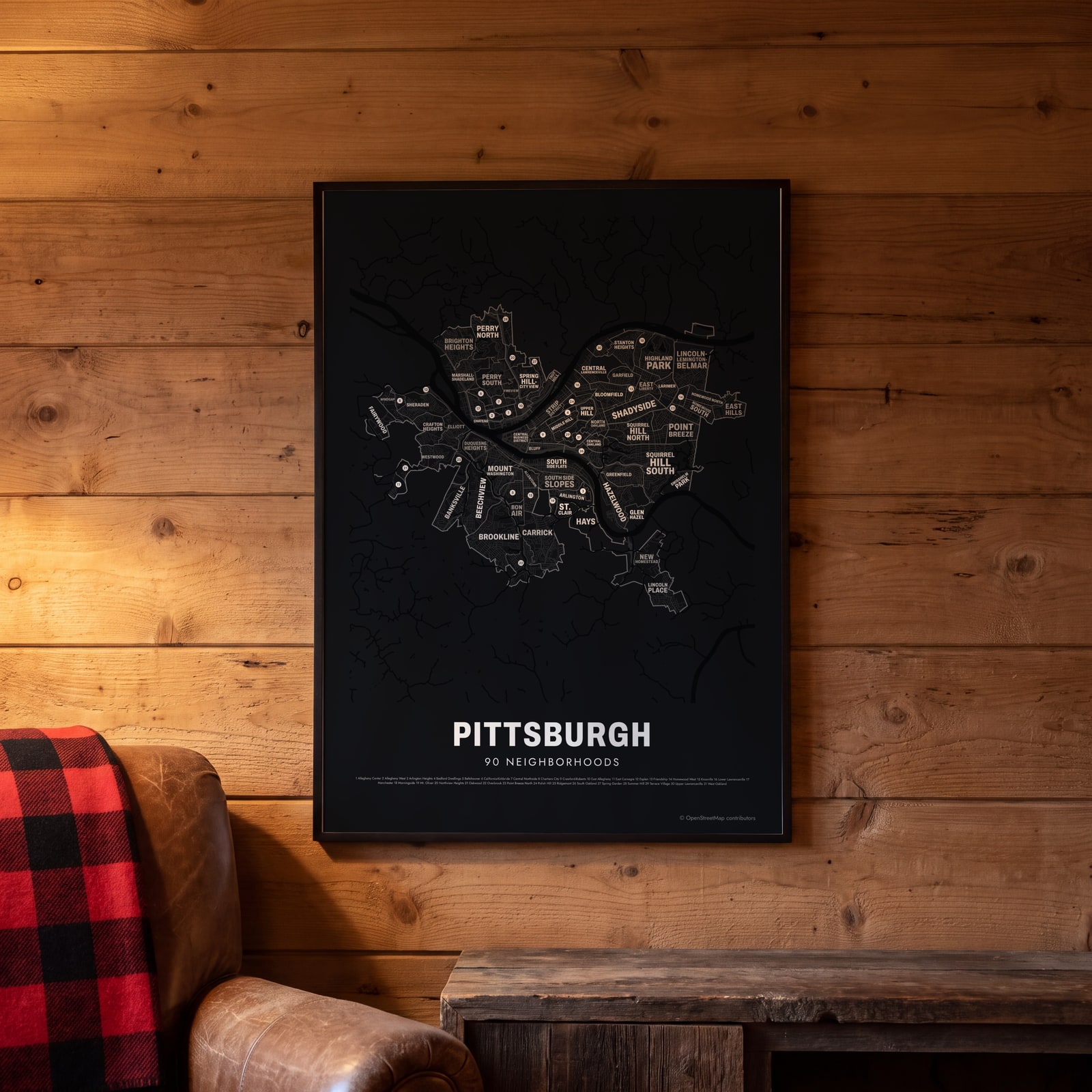 Typographic Pittsburgh map: the names fill their neighborhoodsEdit this →
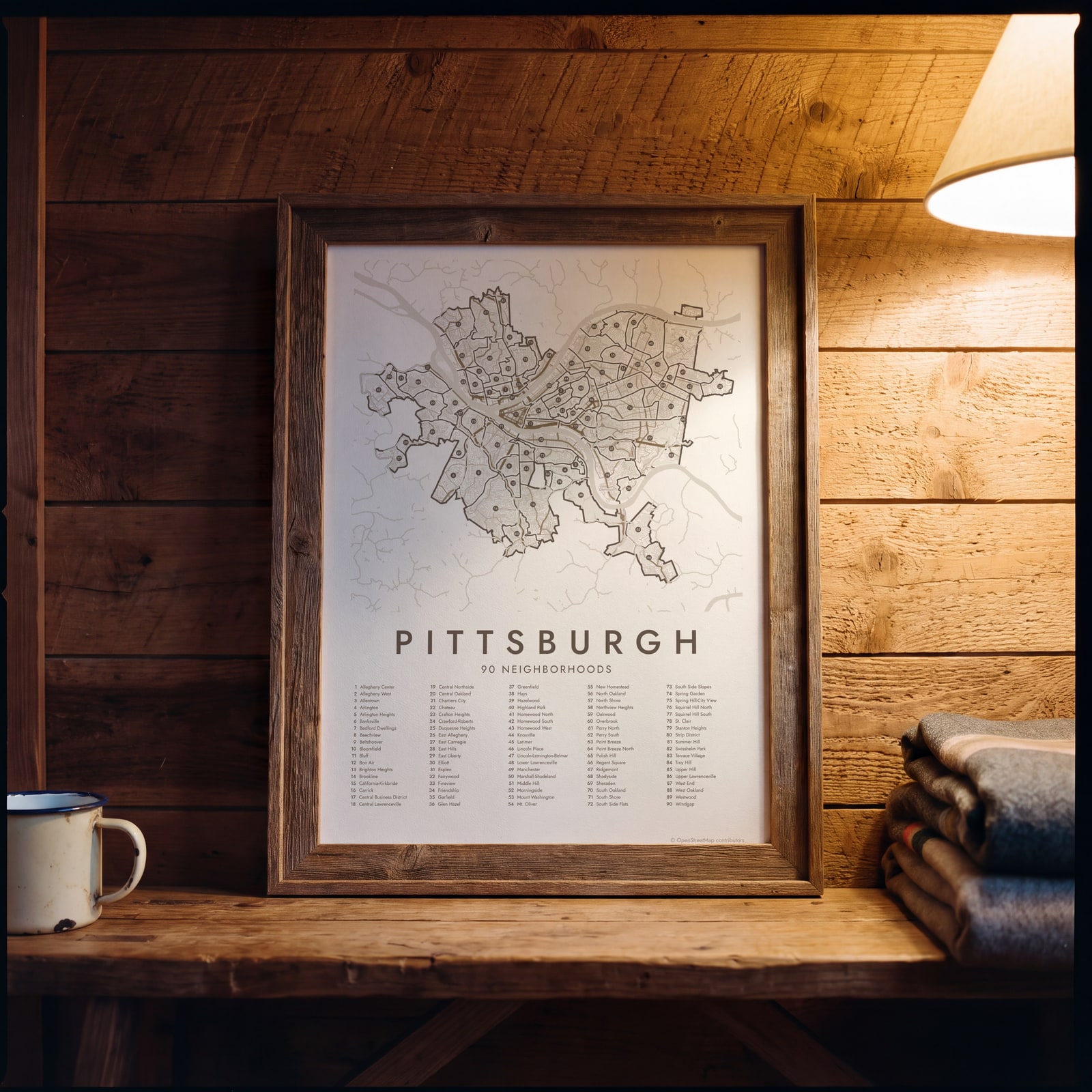 Pittsburgh street map with numbered neighborhoods and their listEdit this →
Examples
Open any of them to change the words, the place, the date and the style, then download the print file.
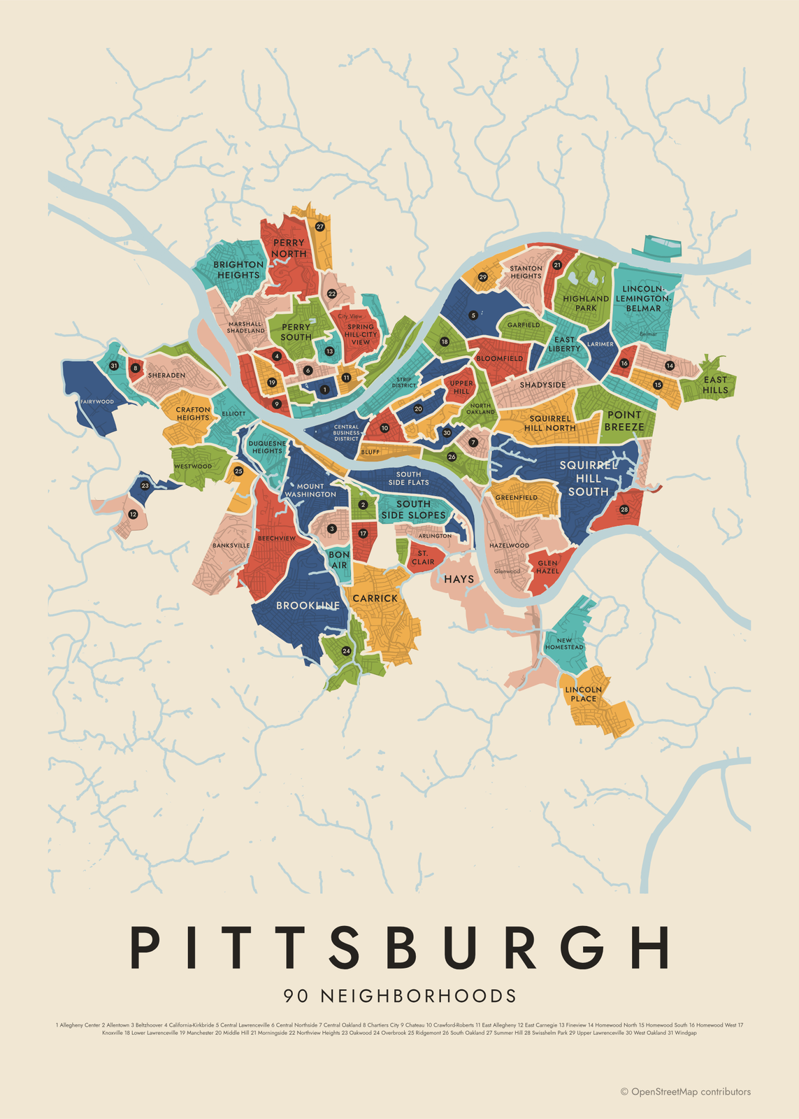 Pittsburgh neighborhood map in color, every neighborhood namedEdit this →More neighborhood maps →
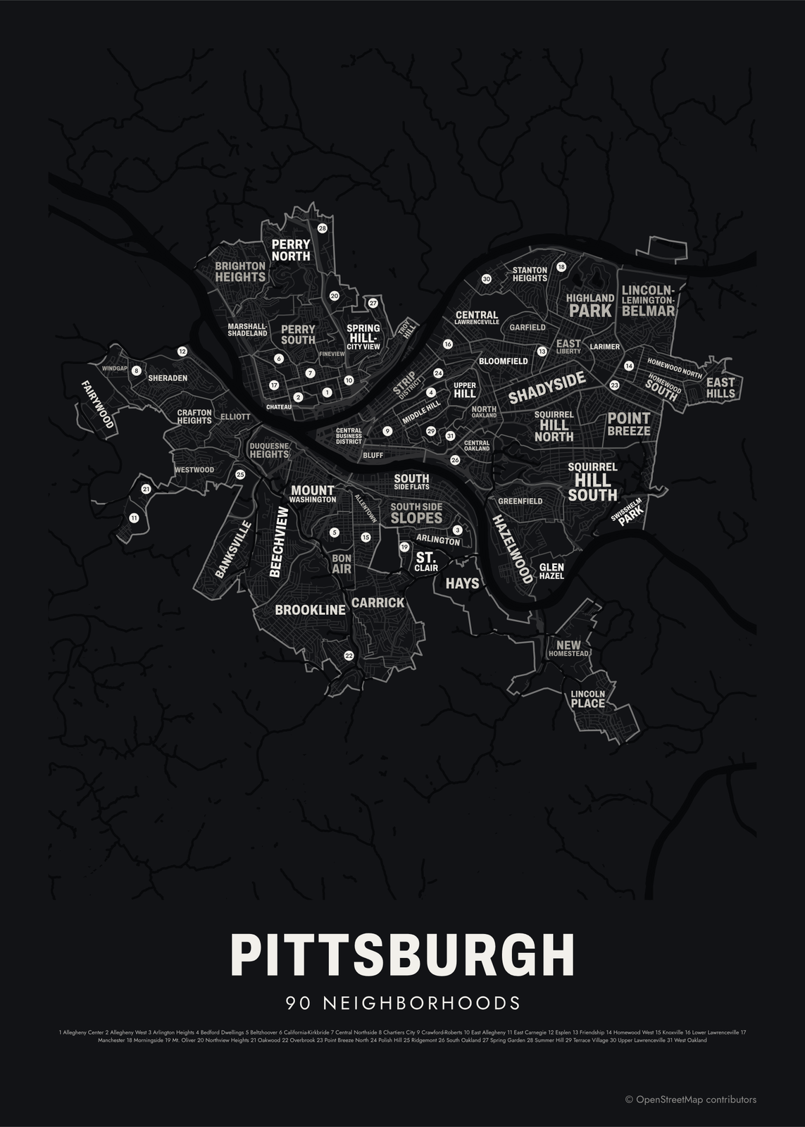 Typographic Pittsburgh map: the names fill their neighborhoodsEdit this →More neighborhood maps →
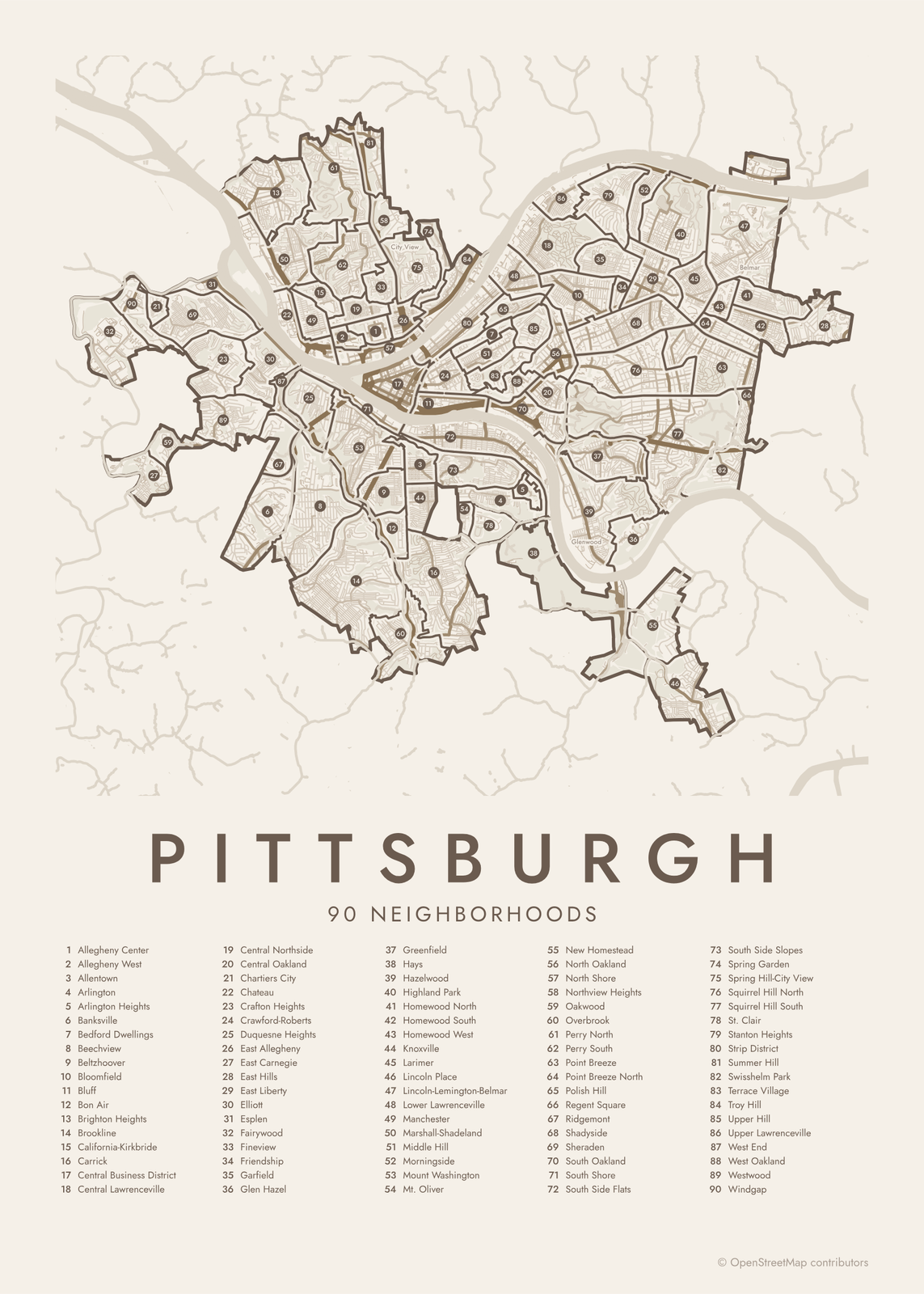 Pittsburgh street map with numbered neighborhoods and their listEdit this →More neighborhood maps →
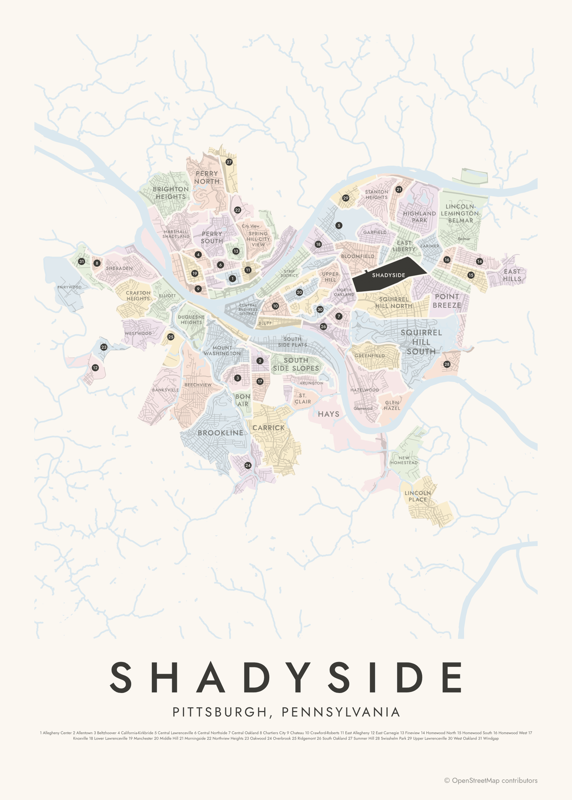 Shadyside highlighted on a map of PittsburghEdit this →More neighborhood maps →
How Pittsburgh is divided
Pittsburgh officially has 90 neighborhoods, and this map shows all of them. The city uses them for planning and statistics. Their borders often follow the land: the Allegheny and Monongahela rivers meet downtown to form the Ohio, and steep hillsides and hollows separate one neighborhood from the next.
Some well-known names are split on the official list. Oakland is four neighborhoods (North, Central, South and West Oakland), Lawrenceville is three, and Squirrel Hill is two. The Hill District is five, from Crawford-Roberts to Upper Hill. These everyday names, plus smaller places like Panther Hollow and the Cultural District, appear on the map as labels.
All 90 neighborhoods of Pittsburgh
- Allegheny Center
- Allegheny West
- Allentown
- Arlington
- Arlington Heights
- Banksville
- Bedford Dwellings
- Beechview
- Beltzhoover
- Bloomfield
- Bluff
- Bon Air
- Brighton Heights
- Brookline
- California-Kirkbride
- Carrick
- Central Business District
- Central Lawrenceville
- Central Northside
- Central Oakland
- Chartiers City
- Chateau
- Crafton Heights
- Crawford-Roberts
- Duquesne Heights
- East Allegheny
- East Carnegie
- East Hills
- East Liberty
- Elliott
- Esplen
- Fairywood
- Fineview
- Friendship
- Garfield
- Glen Hazel
- Greenfield
- Hays
- Hazelwood
- Highland Park
- Homewood North
- Homewood South
- Homewood West
- Knoxville
- Larimer
- Lincoln Place
- Lincoln-Lemington-Belmar
- Lower Lawrenceville
- Manchester
- Marshall-Shadeland
- Middle Hill
- Morningside
- Mount Washington
- Mt. Oliver
- New Homestead
- North Oakland
- North Shore
- Northview Heights
- Oakwood
- Overbrook
- Perry North
- Perry South
- Point Breeze
- Point Breeze North
- Polish Hill
- Regent Square
- Ridgemont
- Shadyside
- Sheraden
- South Oakland
- South Shore
- South Side Flats
- South Side Slopes
- Spring Garden
- Spring Hill-City View
- Squirrel Hill North
- Squirrel Hill South
- St. Clair
- Stanton Heights
- Strip District
- Summer Hill
- Swisshelm Park
- Terrace Village
- Troy Hill
- Upper Hill
- Upper Lawrenceville
- West End
- West Oakland
- Westwood
- Windgap
More neighborhood names on the map
Inside the neighborhoods, the map also names 36 smaller neighborhoods where they fit, from OpenStreetMap: Downtown, Chartiers, Corliss, California Kirkbride, Woods Run, West Liberty, Perry Hilltop, Gateway, Firstside Historic District, Fifth & Forbes, Cultural District, Chinatown, City View, Spring Hill, Billy Buck Hill, Hill District, Mount Oliver, Saint Clair, Oakcliffe, Lawrenceville, Schenley Heights, Schenley Farms Historic District, Oakland, Bellefield, Panther Hollow, Four Mile Run, Glenwood, Squirrel Hill, Duck Hollow, Summerset, Point Breeze South, Homewood, Park Place, Belmar, Brushton, Lincoln-Lemington. Turn them off under Names if you want only the neighborhoods.
Neighborhoods to know
- Central Business District: downtown, on the Point where the Allegheny and Monongahela rivers form the Ohio.
- Strip District: produce warehouses, food markets and shops along Penn Avenue.
- Mount Washington: the hilltop above the Monongahela, reached by the Monongahela Incline, with views over downtown.
- North Shore: the riverfront home of the Pirates' and Steelers' stadiums and the Andy Warhol Museum.
- Oakland: the university district, with the University of Pittsburgh's Cathedral of Learning and the Carnegie museums of art and natural history.
- Lawrenceville: named for Captain James Lawrence of "Don't give up the ship", with shops along Butler Street.
- Polish Hill: crowned by the domed Immaculate Heart of Mary church, built by Polish immigrants.
- Hill District: the setting of most of August Wilson's ten-play Pittsburgh Cycle.
How to make your Pittsburgh neighborhood poster
- Open the Pittsburgh map.
- Pick a style: Colored areas, Typographic (the names fill the map) or a Street map with the borders over the streets.
- Tap your own neighborhood to highlight it; it becomes the poster's title.
- Drag and zoom to frame the whole city or just your part of it, then pick a size and download the print file.
Questions
How many neighborhoods does Pittsburgh have?
90, and this map shows all of them. Familiar names that cover several official neighborhoods, like Oakland, Lawrenceville, Squirrel Hill and the Hill District, appear as labels.
What is the North Side of Pittsburgh?
The North Side, also written Northside, is the group of neighborhoods north of the Allegheny River, like Manchester, Troy Hill and the North Shore. Most of it was the separate city of Allegheny until Pittsburgh annexed it in 1907.
Is Mt. Oliver part of Pittsburgh?
Partly. Mt. Oliver is a Pittsburgh neighborhood, but Mount Oliver borough next to it is a separate town that the city surrounds completely.
Where do the Pittsburgh boundaries come from?
From OpenStreetMap (© OpenStreetMap contributors) and City of Pittsburgh (via WPRDC). Streets and water are OpenStreetMap's. Boundaries are a snapshot and can differ from what neighbors call home; tell us if one looks wrong.
What sizes can I print?
US Letter, 8 × 10, 11 × 14, 12 × 16 and 12 × 18 in, A4 and A3, free. You download a 300 DPI JPEG drawn at the size you pick. Larger prints, up to 24 × 36 in, are coming soon.
Related




Gift ideas by occasion




Every example is made with the Posterage generators. Change anything, then download it as a 300 DPI JPEG.