Portland neighborhood map 93 neighborhoods of Portland, Oregon
This poster maps Portland, Oregon split into its neighborhoods, 93 of them, each named, from Saint Johns and Kenton to Sellwood-Moreland and Multnomah. Smaller names like Nob Hill, Alberta and Hawthorne appear as labels. Highlight the one you call home and print it.
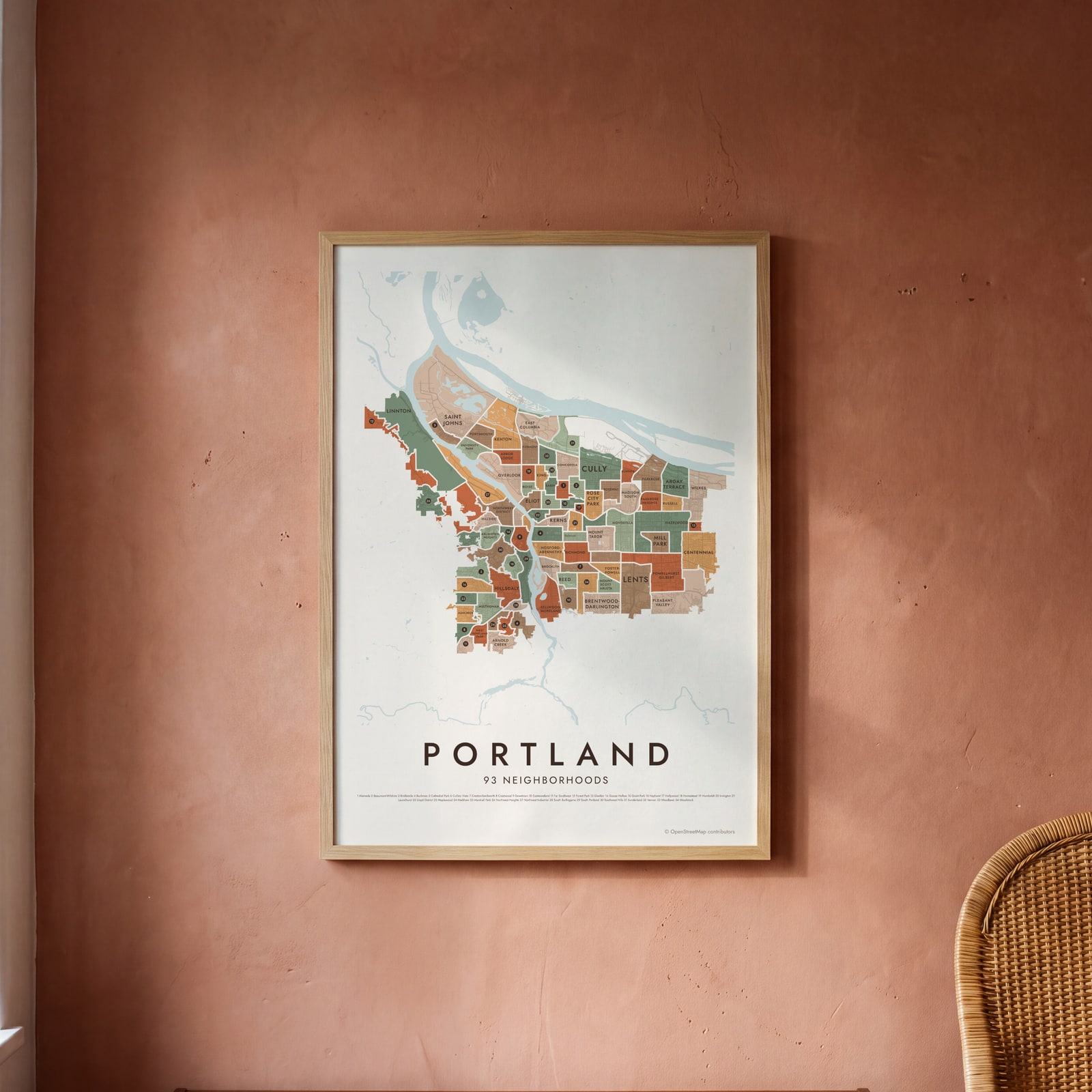
On the wall
A few of them framed at home. Open any one to make it yours.
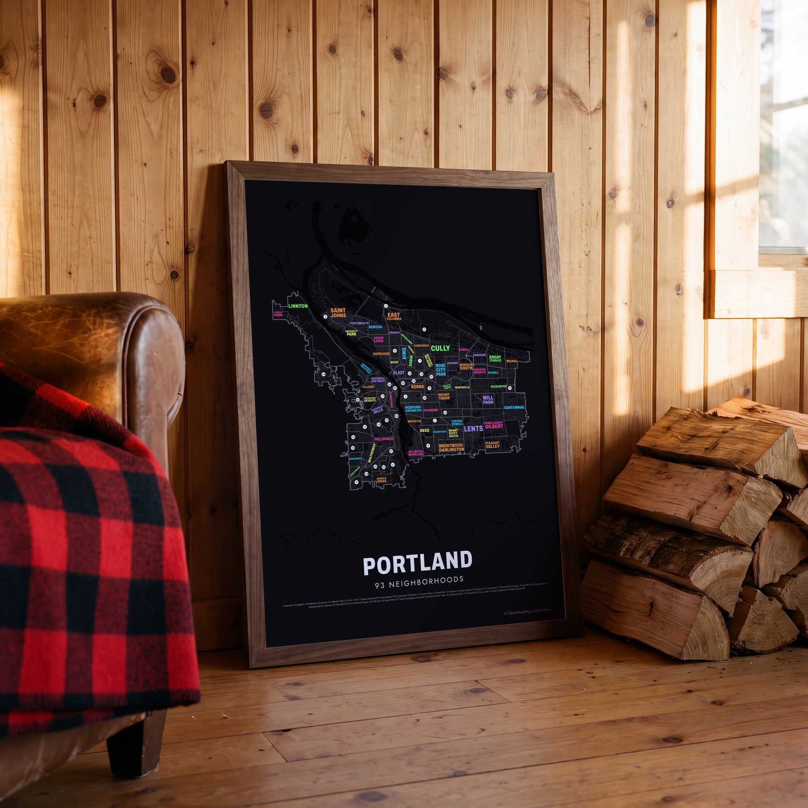 Typographic Portland map: the names fill their neighborhoodsEdit this →
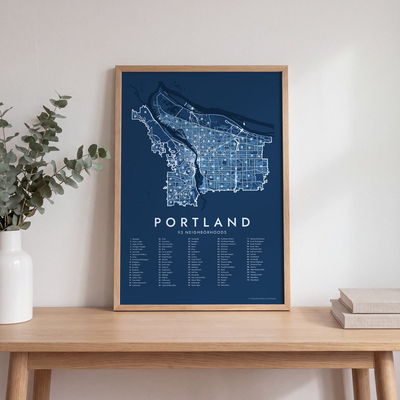 Portland street map with numbered neighborhoods and their listEdit this →
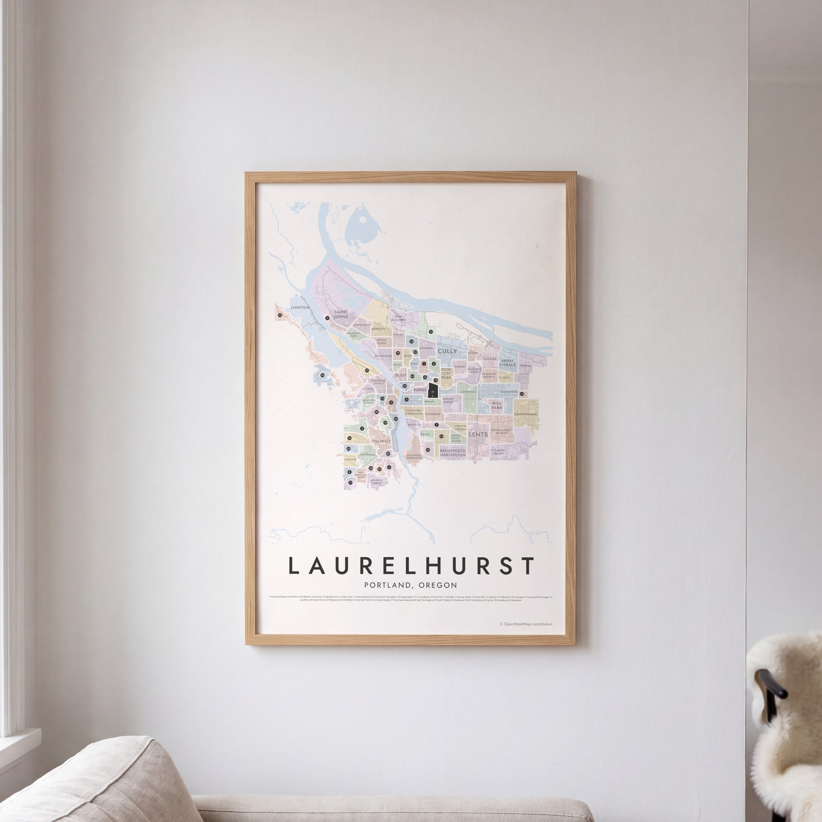 Laurelhurst highlighted on a map of PortlandEdit this →
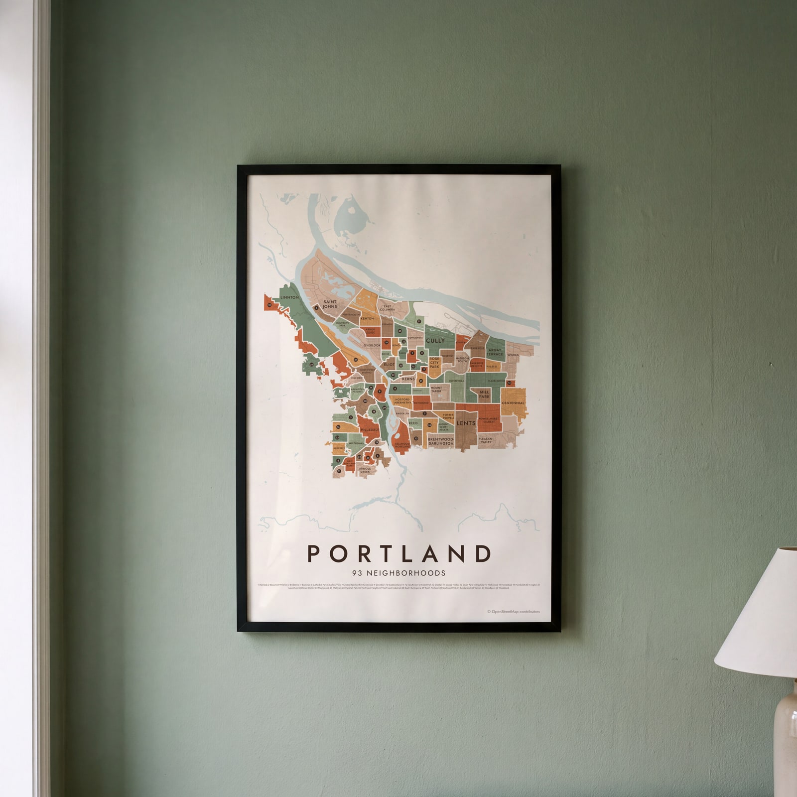 Portland neighborhood map in color, every neighborhood namedEdit this →
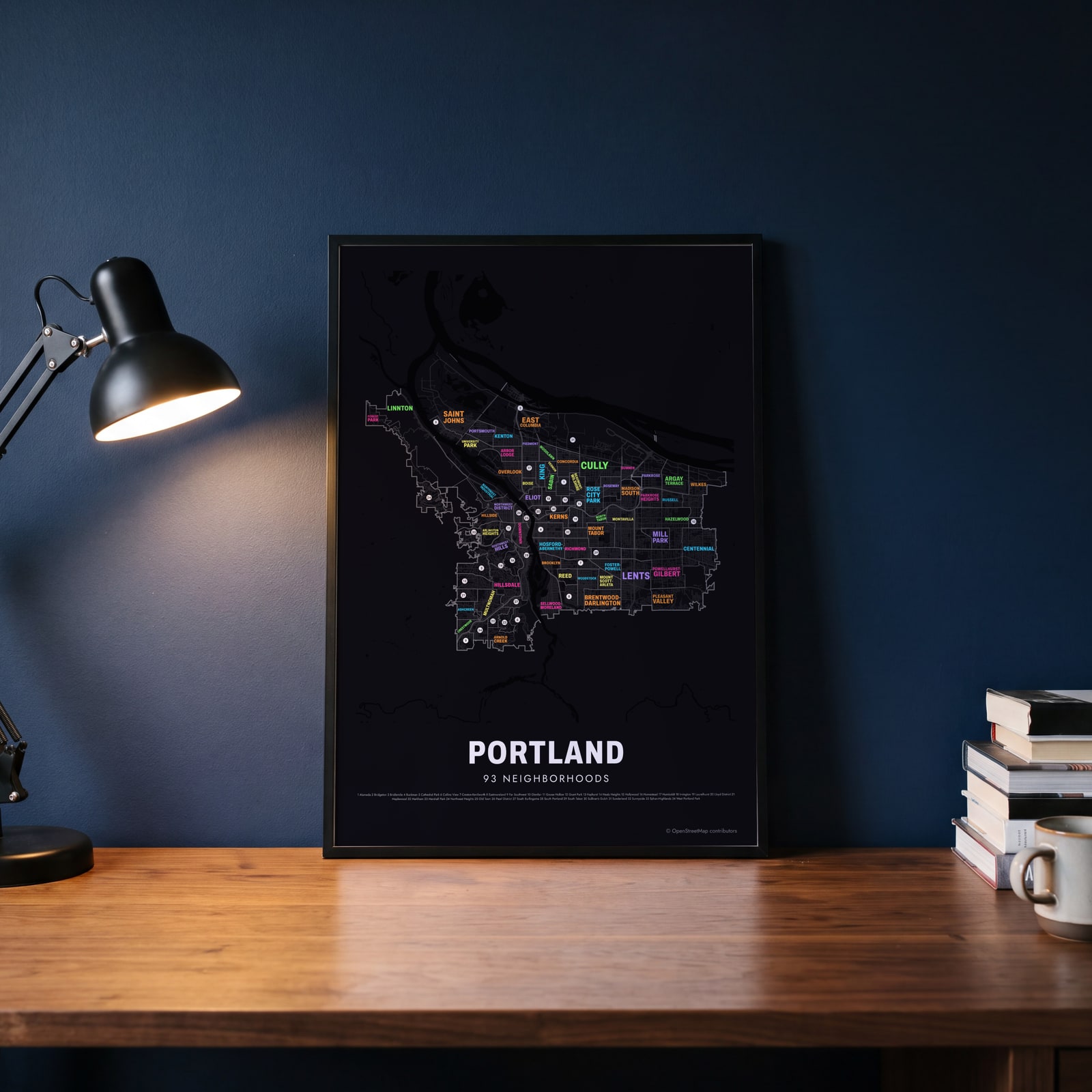 Typographic Portland map: the names fill their neighborhoodsEdit this →
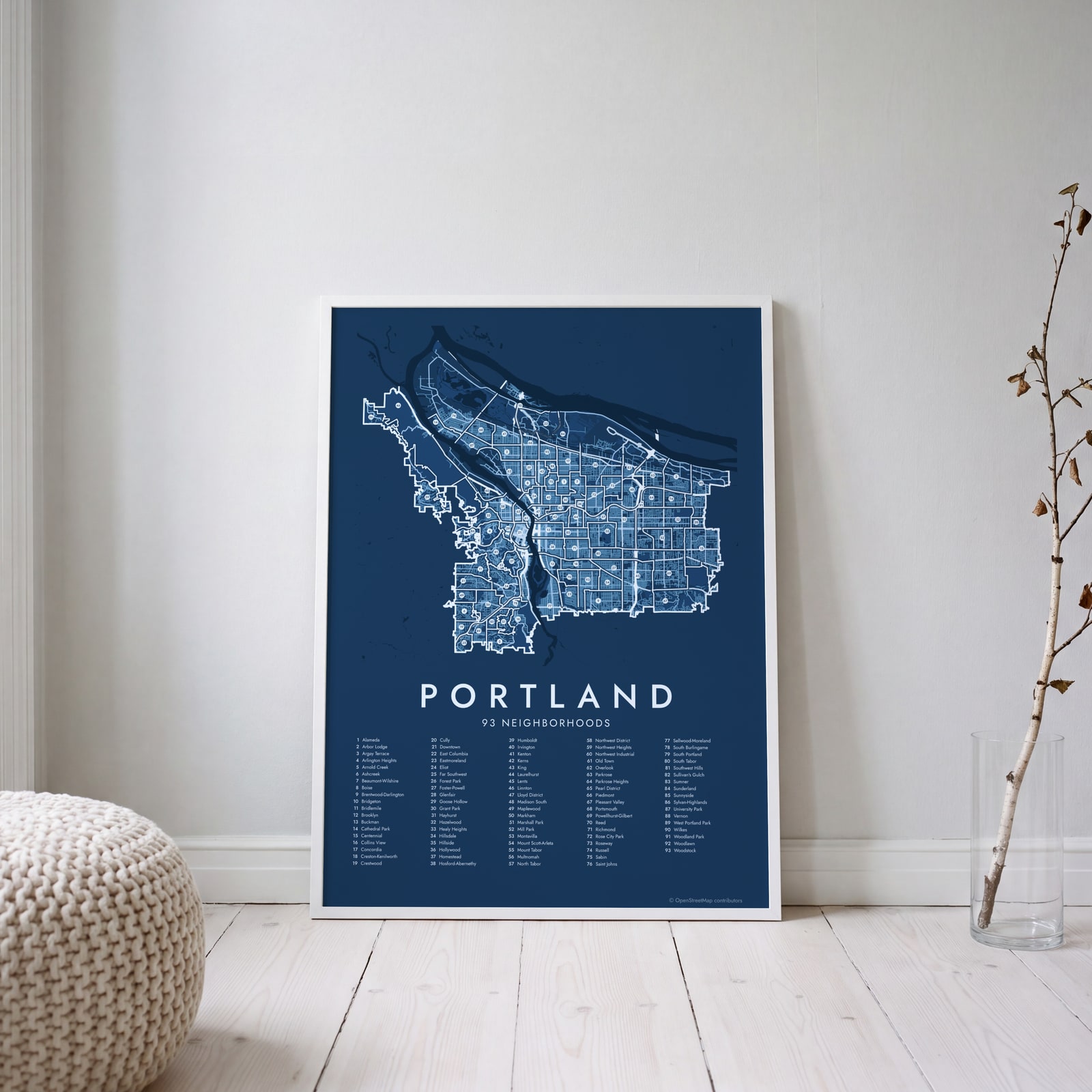 Portland street map with numbered neighborhoods and their listEdit this →
Examples
Open any of them to change the words, the place, the date and the style, then download the print file.
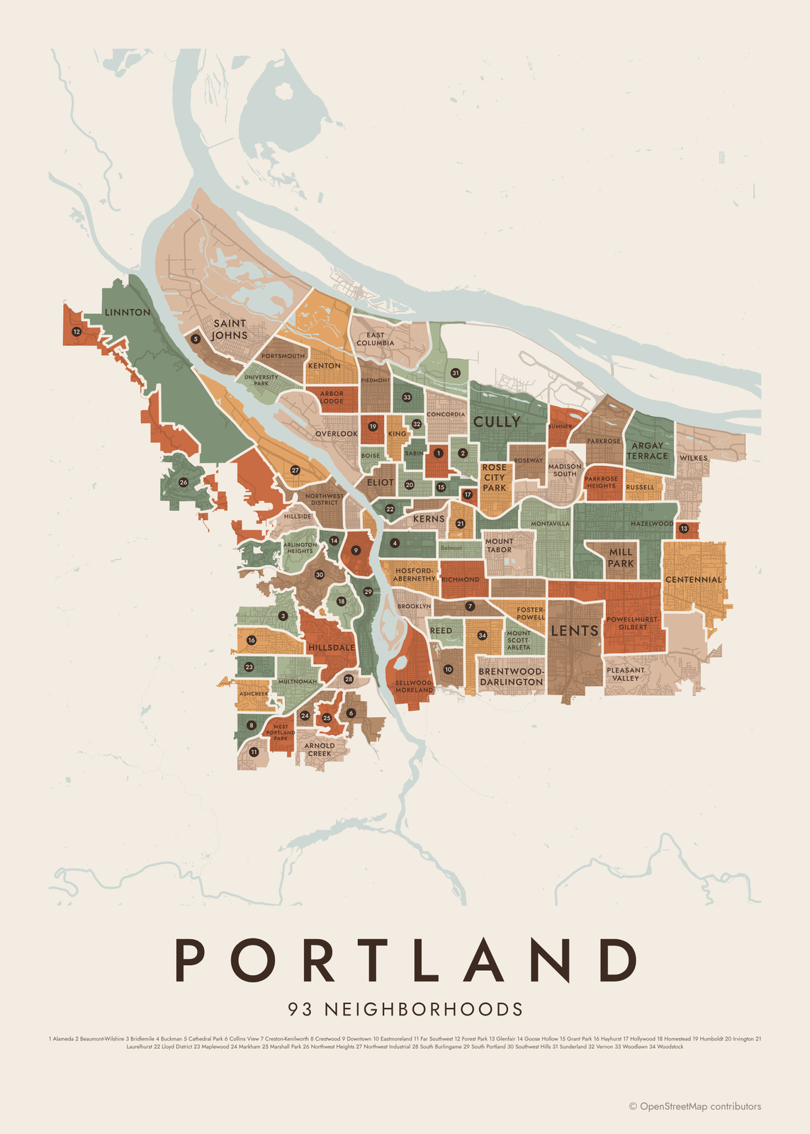 Portland neighborhood map in color, every neighborhood namedEdit this →More neighborhood maps →
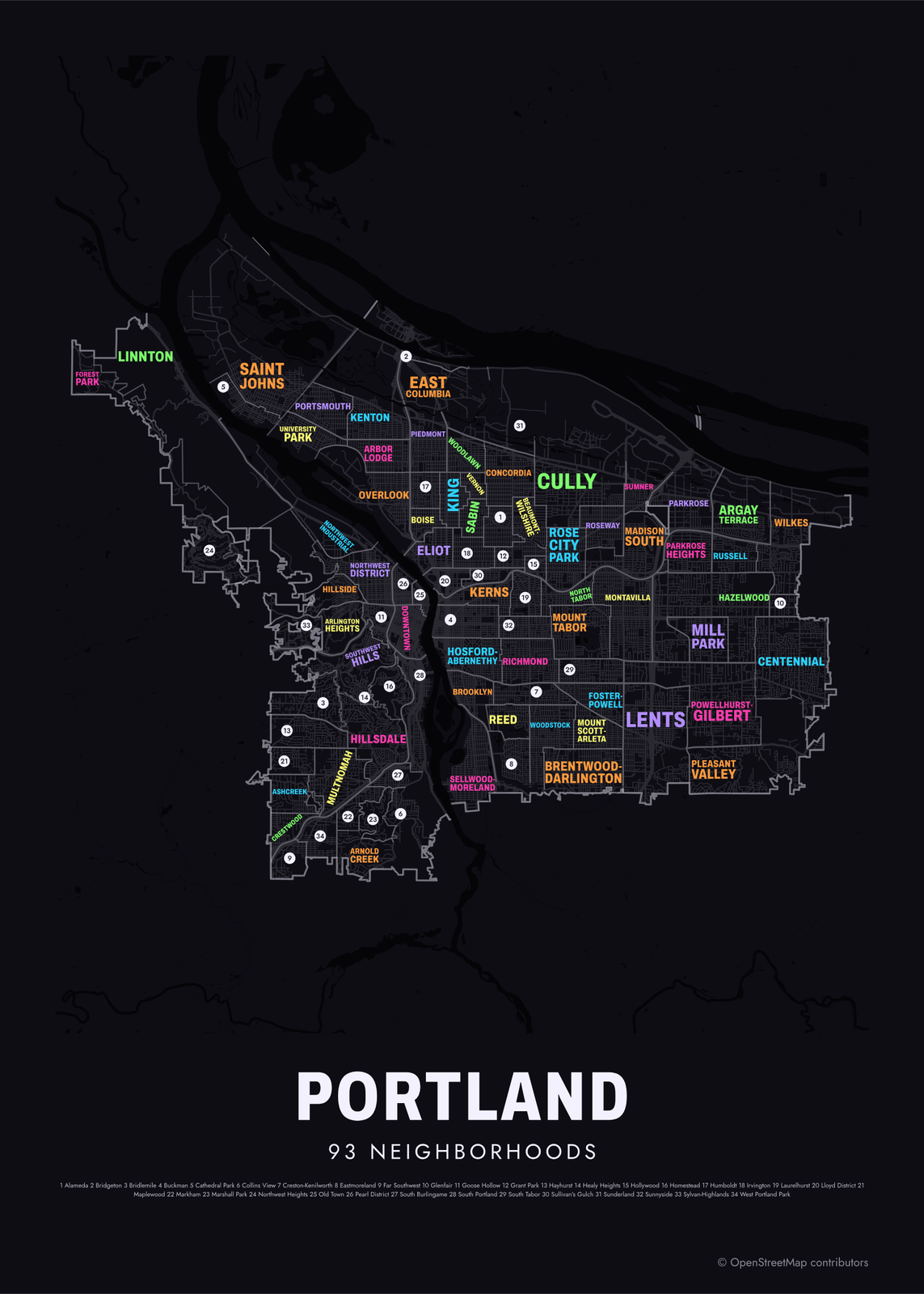 Typographic Portland map: the names fill their neighborhoodsEdit this →More neighborhood maps →
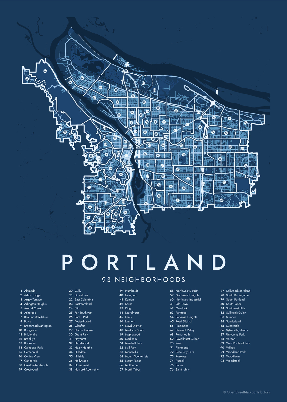 Portland street map with numbered neighborhoods and their listEdit this →More neighborhood maps →
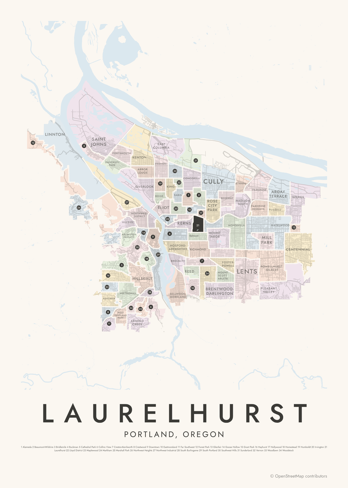 Laurelhurst highlighted on a map of PortlandEdit this →More neighborhood maps →
How Portland is divided
Portland's neighborhoods are defined by its neighborhood associations, volunteer groups recognized by the city. The city counts 94 of them. Each association sets its own borders, so a few overlap and a few small pockets belong to none. Our map shows 93 neighborhoods.
Portland also splits into sections for addresses. Burnside Street divides north from south, the Willamette River divides east from west, and Williams Avenue separates North from Northeast. That made five sections, often called quadrants: N, NE, NW, SE and SW. In 2020 South Portland became a sixth, on the west side of the river south of downtown.
All 93 neighborhoods of Portland
- Alameda
- Arbor Lodge
- Argay Terrace
- Arlington Heights
- Arnold Creek
- Ashcreek
- Beaumont-Wilshire
- Boise
- Brentwood-Darlington
- Bridgeton
- Bridlemile
- Brooklyn
- Buckman
- Cathedral Park
- Centennial
- Collins View
- Concordia
- Creston-Kenilworth
- Crestwood
- Cully
- Downtown
- East Columbia
- Eastmoreland
- Eliot
- Far Southwest
- Forest Park
- Foster-Powell
- Glenfair
- Goose Hollow
- Grant Park
- Hayhurst
- Hazelwood
- Healy Heights
- Hillsdale
- Hillside
- Hollywood
- Homestead
- Hosford-Abernethy
- Humboldt
- Irvington
- Kenton
- Kerns
- King
- Laurelhurst
- Lents
- Linnton
- Lloyd District
- Madison South
- Maplewood
- Markham
- Marshall Park
- Mill Park
- Montavilla
- Mount Scott-Arleta
- Mount Tabor
- Multnomah
- North Tabor
- Northwest District
- Northwest Heights
- Northwest Industrial
- Old Town
- Overlook
- Parkrose
- Parkrose Heights
- Pearl District
- Piedmont
- Pleasant Valley
- Portsmouth
- Powellhurst-Gilbert
- Reed
- Richmond
- Rose City Park
- Roseway
- Russell
- Sabin
- Saint Johns
- Sellwood-Moreland
- South Burlingame
- South Portland
- South Tabor
- Southwest Hills
- Sullivan's Gulch
- Sumner
- Sunderland
- Sunnyside
- Sylvan-Highlands
- University Park
- Vernon
- West Portland Park
- Wilkes
- Woodland Park
- Woodlawn
- Woodstock
More neighborhood names on the map
Inside the neighborhoods, the map also names 36 smaller neighborhoods where they fit, from OpenStreetMap: Central Eastside, Sellwood, Westmoreland, Whitwood Court, Barnes Heights, Villa Ridge, Vermont Hills, Willamette Heights, Multnomah Village, Mocks Bottom, Swan Island, Kings Heights, Nob Hill, Portland Heights, Capitol Hill, Slabtown, Marquam Hill, Burlingame, University District, Lair Hill, Terwilliger, Corbett, Mississippi, John's Landing, Chinatown, South Waterfront, Faloma, Albina, Alberta, Belmont, Hawthorne, Errol Heights, Arleta, Jade District, Gateway, Powellhurst. Turn them off under Names if you want only the neighborhoods.
Neighborhoods to know
- Pearl District: old warehouses and rail yards north of downtown, turned into lofts, galleries and small parks.
- Old Town: the city's oldest blocks by the river, with the Lan Su Chinese Garden.
- Forest Park: more than 5,000 acres of forest and trails in the West Hills.
- Mount Tabor: built around a volcanic cinder cone, now a city park with old reservoirs near the top.
- Saint Johns: a separate city until 1915, under the Gothic towers of the St. Johns Bridge.
- Hosford-Abernethy: home to Ladd's Addition, laid out with diagonal streets and rose gardens.
- Sellwood-Moreland: antique shops along SE 13th Avenue and Oaks Amusement Park by the Willamette.
- Laurelhurst: curving streets laid out around Laurelhurst Park and its pond.
How to make your Portland neighborhood poster
- Open the Portland map.
- Pick a style: Colored areas, Typographic (the names fill the map) or a Street map with the borders over the streets.
- Tap your own neighborhood to highlight it; it becomes the poster's title.
- Drag and zoom to frame the whole city or just your part of it, then pick a size and download the print file.
Questions
How many neighborhoods does Portland have?
The city recognizes 94 neighborhood associations, each standing for a neighborhood. This map shows 93. Popular names that aren't on the official list, like Nob Hill, Alberta and Hawthorne, appear as labels.
What are Portland's quadrants?
Burnside Street, the Willamette River and Williams Avenue split Portland into North, Northeast, Northwest, Southeast and Southwest for addresses. A sixth section, South Portland, was added in 2020, so there are more quadrants than the name suggests.
Is Nob Hill a neighborhood in Portland?
Not on the official list. Nob Hill is the everyday name for the part of the Northwest District around NW 21st and 23rd Avenues. It shows on the map as a label inside Northwest District.
Where do the Portland boundaries come from?
From OpenStreetMap (© OpenStreetMap contributors). Streets and water are OpenStreetMap's. Boundaries are a snapshot and can differ from what neighbors call home; tell us if one looks wrong.
What sizes can I print?
US Letter, 8 × 10, 11 × 14, 12 × 16 and 12 × 18 in, A4 and A3, free. You download a 300 DPI JPEG drawn at the size you pick. Larger prints, up to 24 × 36 in, are coming soon.
Related




Gift ideas by occasion




Every example is made with the Posterage generators. Change anything, then download it as a 300 DPI JPEG.