Queens neighborhood map 82 neighborhoods, named
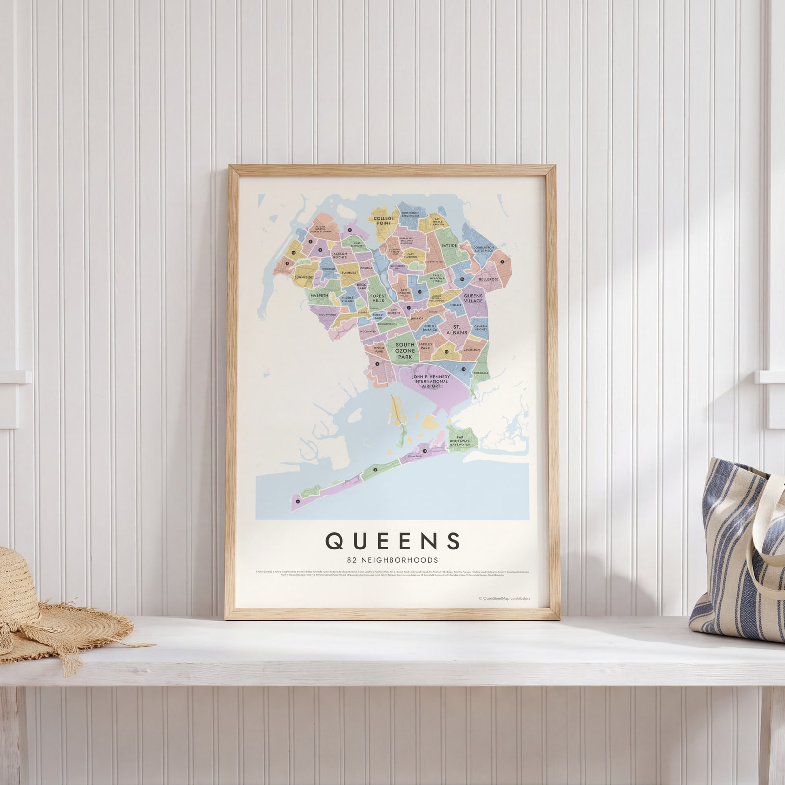
This poster maps the borough of Queens split into 82 neighborhood areas, each named, from Astoria and Long Island City to Jamaica and the Rockaways. Big parks, cemeteries and both airports get areas of their own. Highlight the one you call home and print it.
On the wall
A few of them framed at home. Open any one to make it yours.
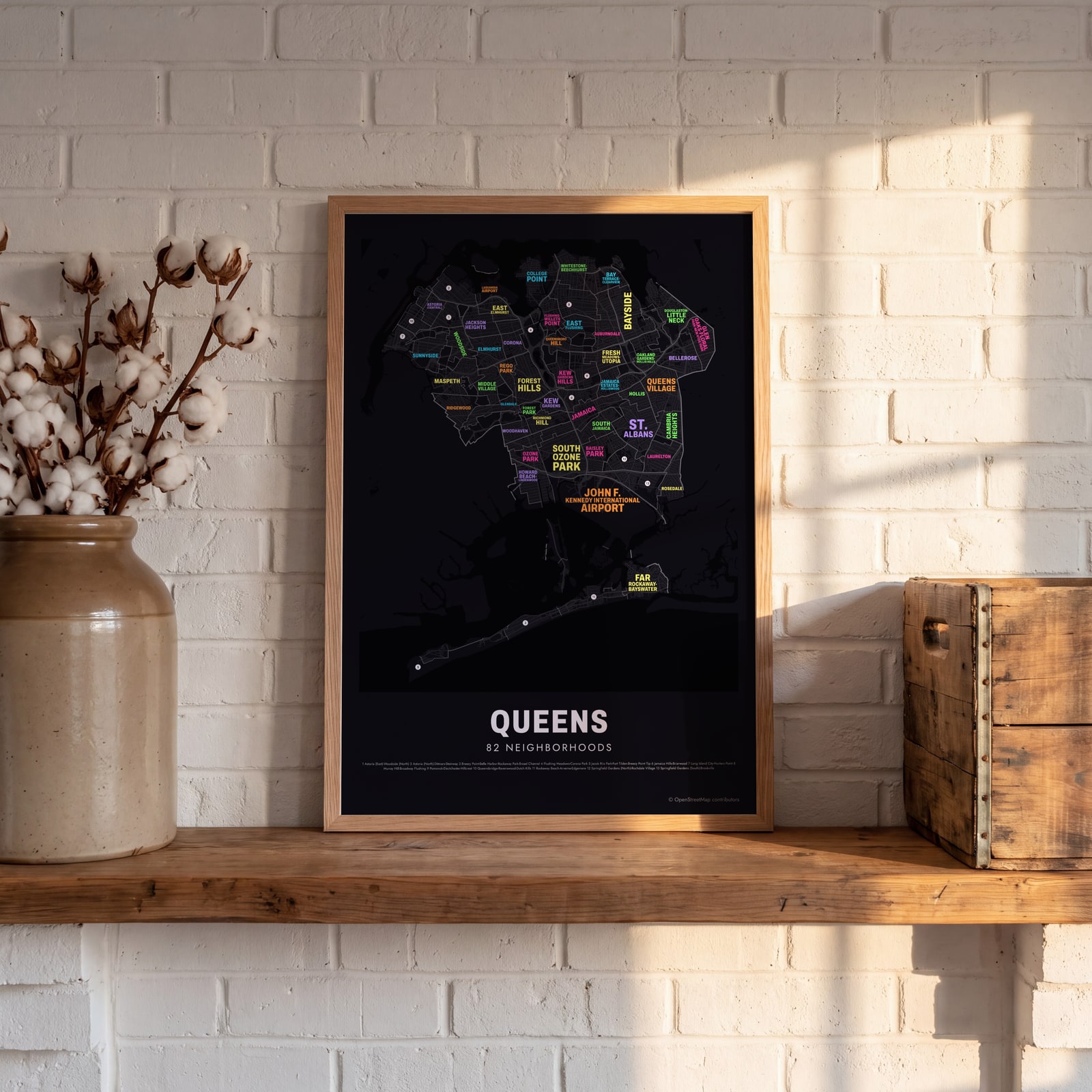 Typographic Queens map: the names fill their neighborhoodsEdit this →
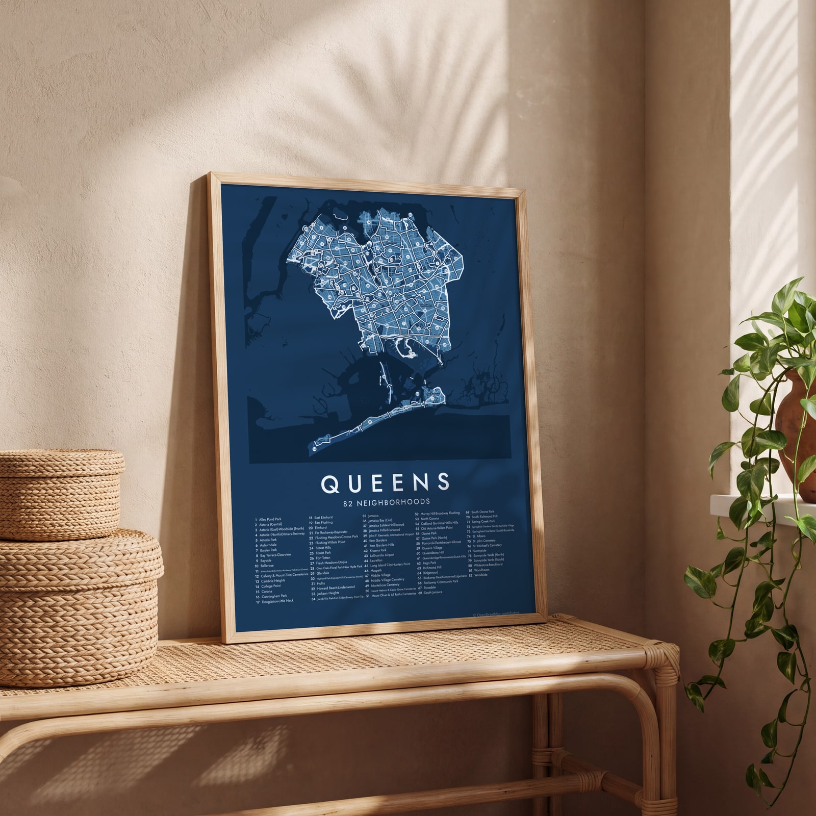 Queens street map with numbered neighborhoods and their listEdit this →
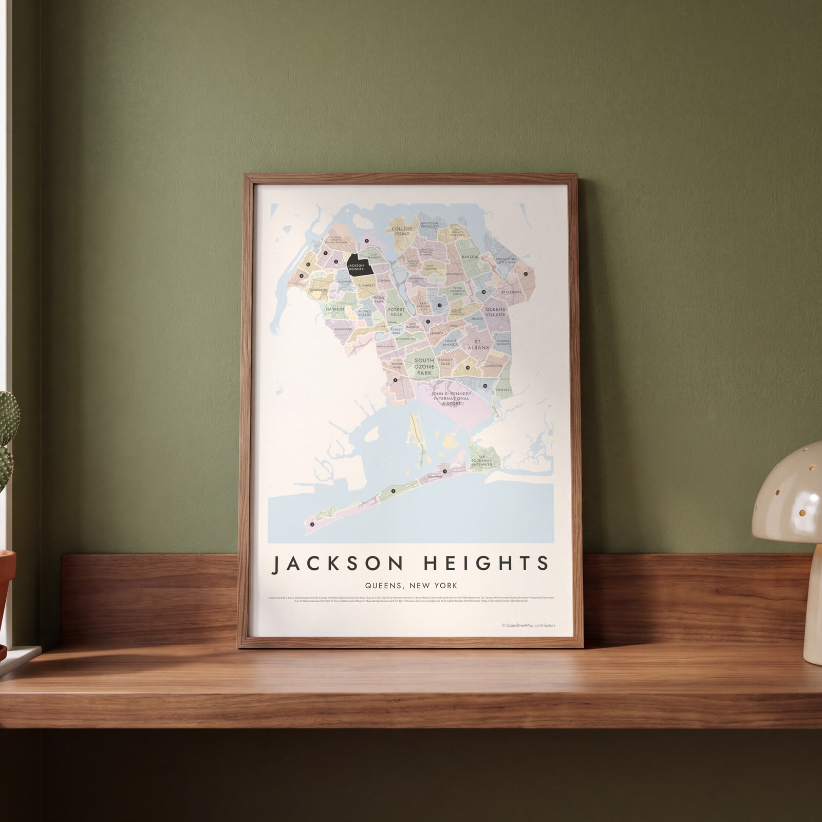 Jackson Heights highlighted on a map of QueensEdit this →
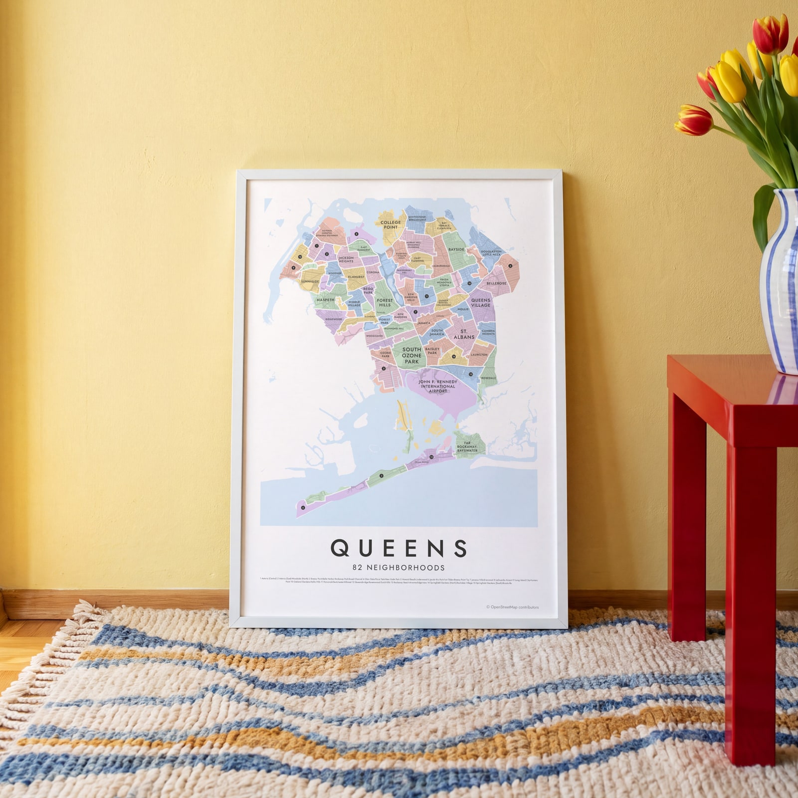 Queens neighborhood map in color, every neighborhood namedEdit this →
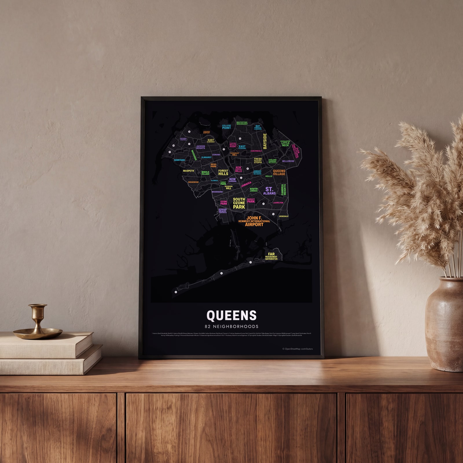 Typographic Queens map: the names fill their neighborhoodsEdit this →
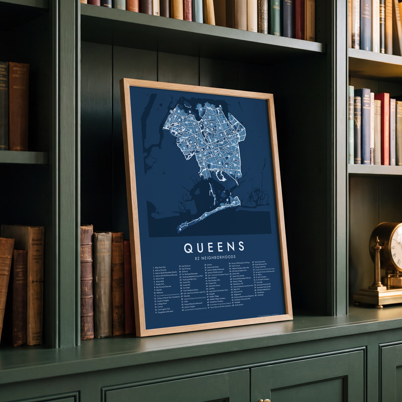 Queens street map with numbered neighborhoods and their listEdit this →
Examples
Open any of them to change the words, the place, the date and the style, then download the print file.
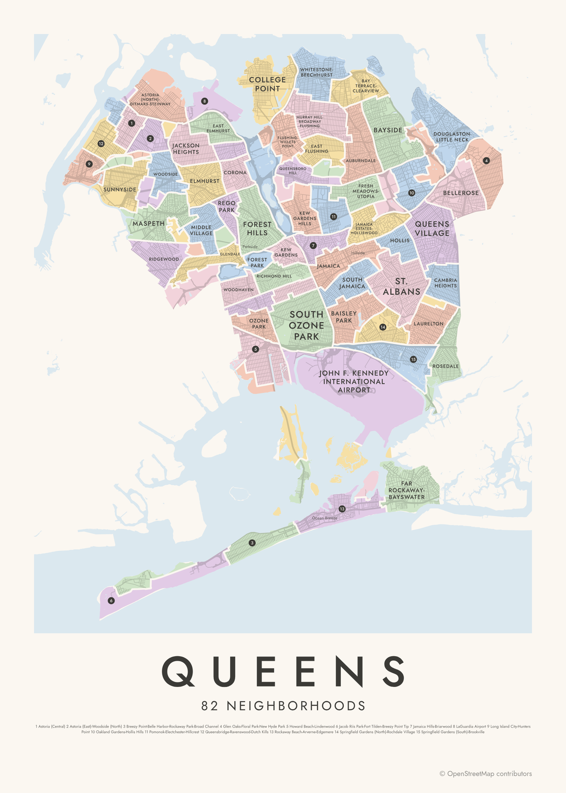 Queens neighborhood map in color, every neighborhood namedEdit this →More neighborhood maps →
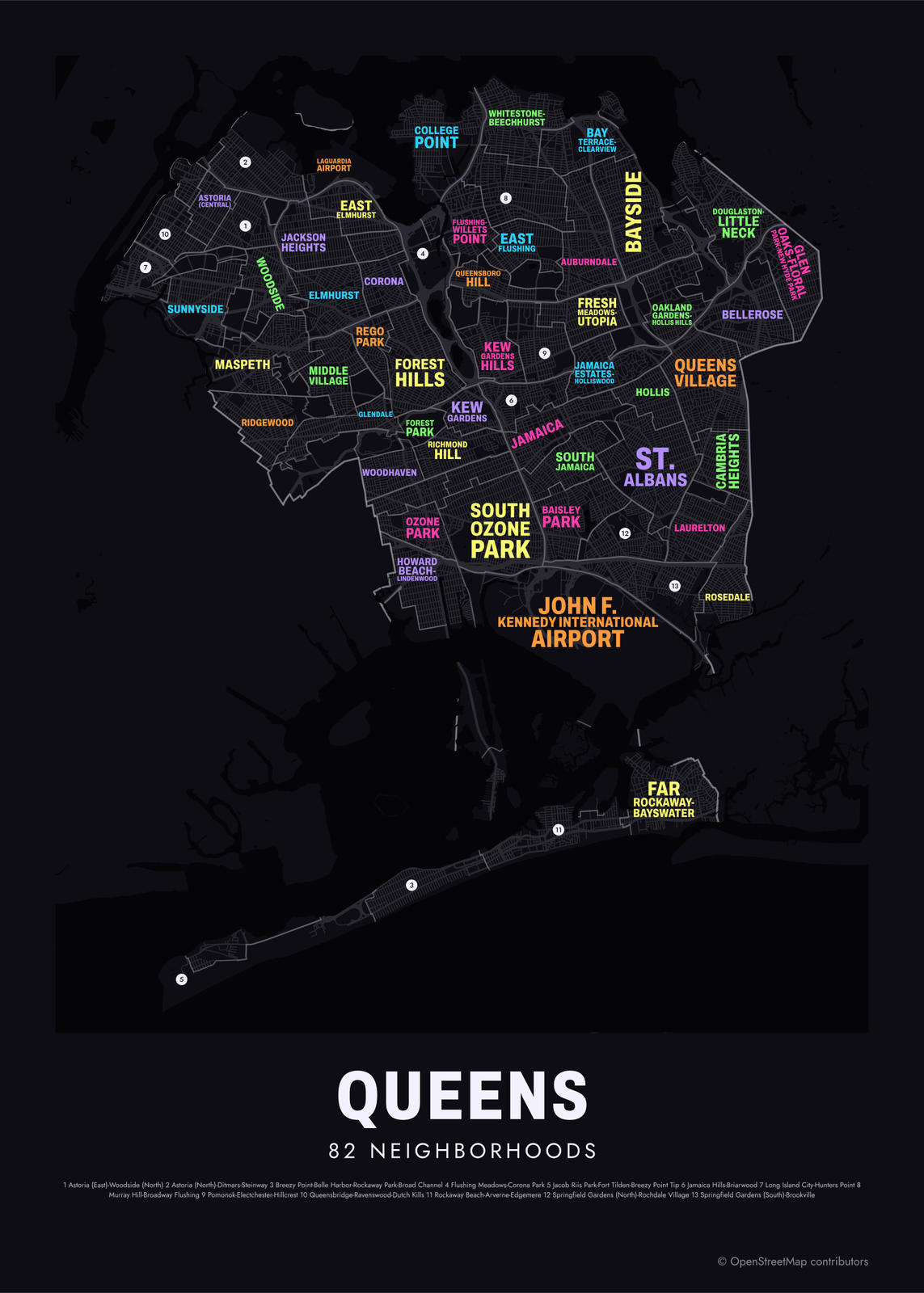 Typographic Queens map: the names fill their neighborhoodsEdit this →More neighborhood maps →
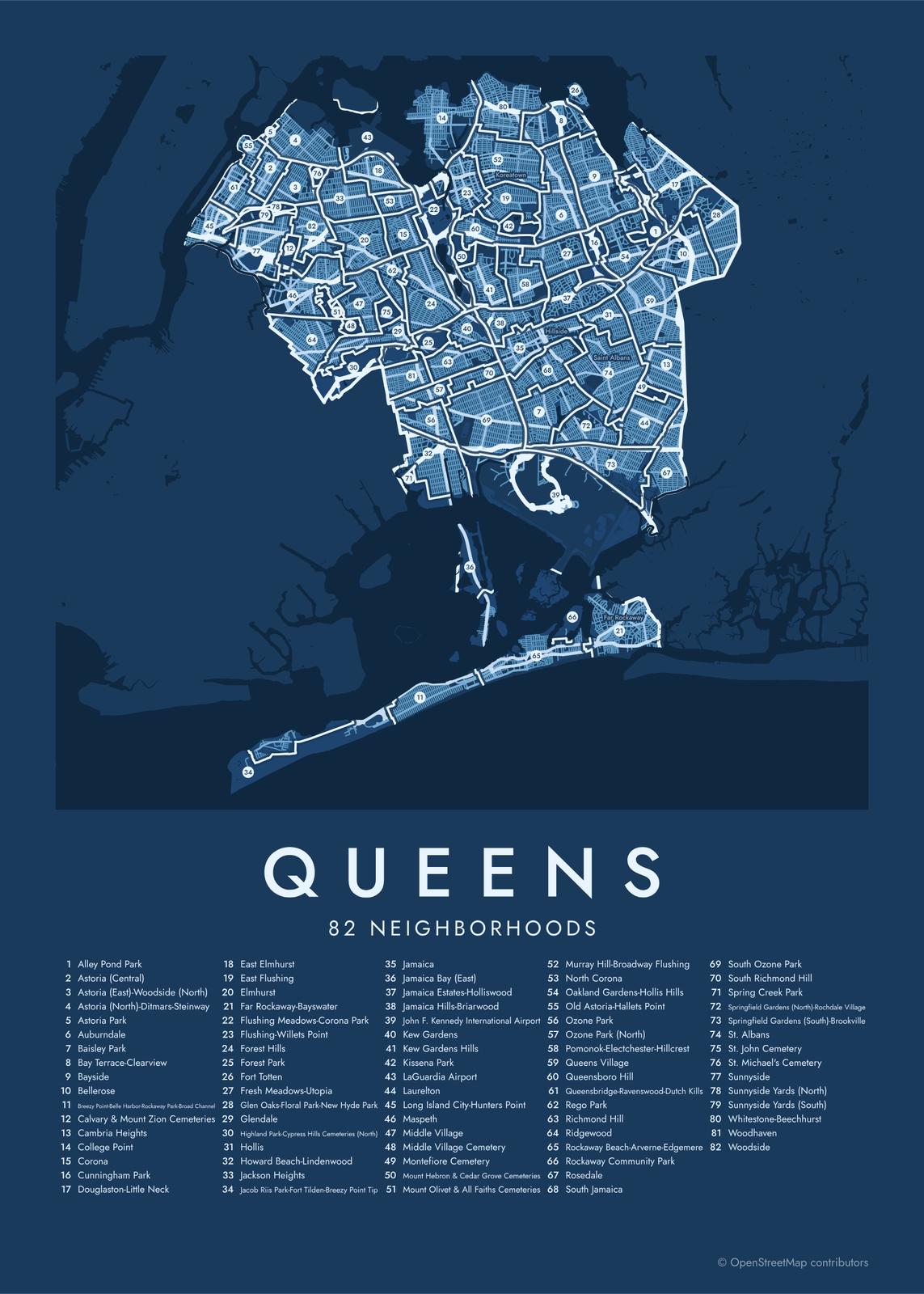 Queens street map with numbered neighborhoods and their listEdit this →More neighborhood maps →
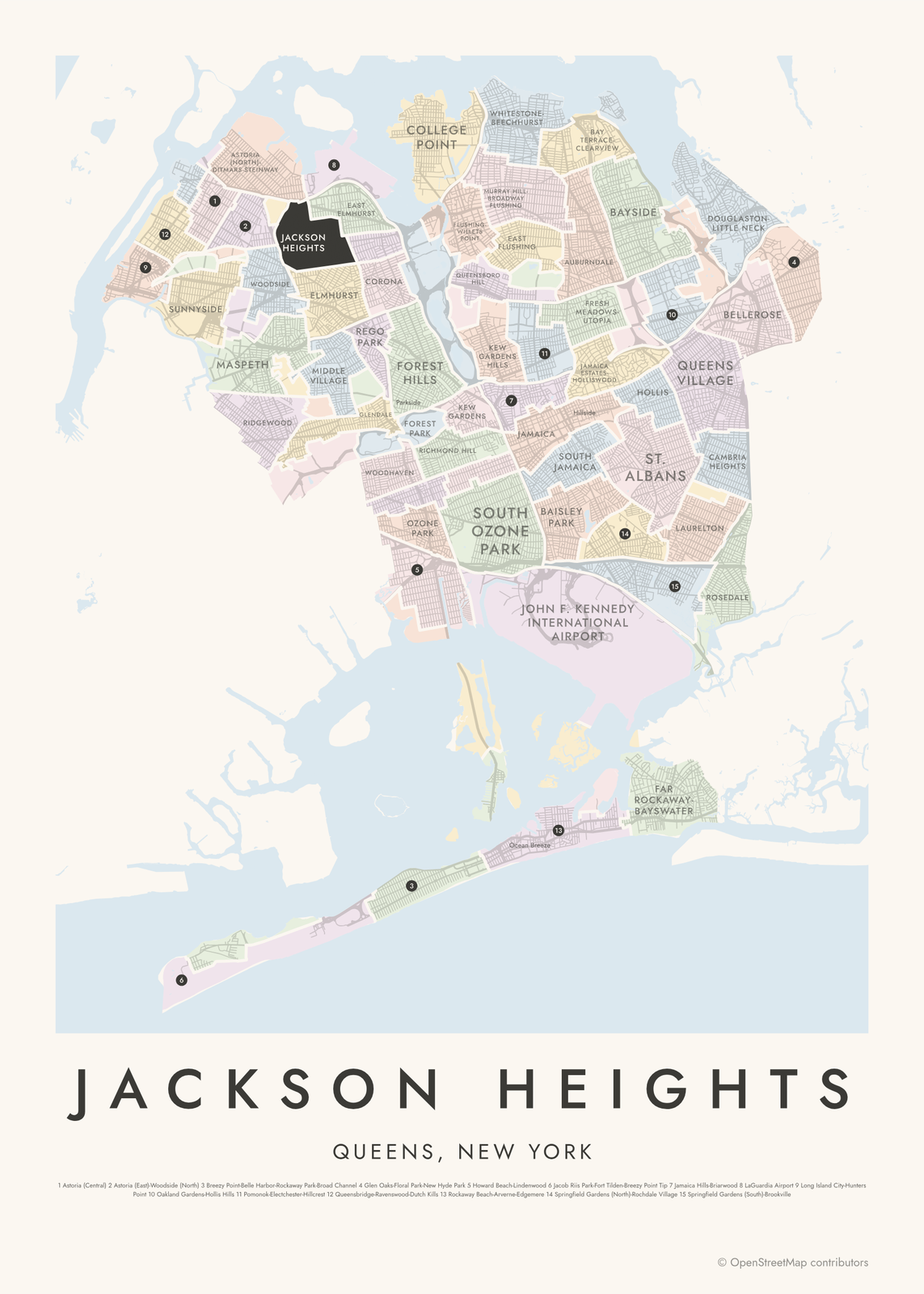 Jackson Heights highlighted on a map of QueensEdit this →More neighborhood maps →
How Queens is divided
New York City has no official neighborhood borders, so this map uses the Neighborhood Tabulation Areas that the Department of City Planning draws for census data. The 2020 version splits Queens into 82 areas. Many join a few neighborhoods under one hyphenated name, like Douglaston-Little Neck, and big parks, cemeteries and the two airports, LaGuardia and JFK, are areas of their own.
Queens is also one of the city's five boroughs, with the same borders as Queens County, and it is split into 14 community districts, each with its own community board. Locals tend to name the neighborhood first: mail goes to places like Flushing, Jamaica, Astoria and Far Rockaway rather than to Queens. Those names and smaller ones, like Sunnyside Gardens and Hamilton Beach, appear on the map as labels.
All 82 neighborhoods of Queens
- Alley Pond Park
- Astoria (Central)
- Astoria (East)-Woodside (North)
- Astoria (North)-Ditmars-Steinway
- Astoria Park
- Auburndale
- Baisley Park
- Bay Terrace-Clearview
- Bayside
- Bellerose
- Breezy Point-Belle Harbor-Rockaway Park-Broad Channel
- Calvary & Mount Zion Cemeteries
- Cambria Heights
- College Point
- Corona
- Cunningham Park
- Douglaston-Little Neck
- East Elmhurst
- East Flushing
- Elmhurst
- Far Rockaway-Bayswater
- Flushing Meadows-Corona Park
- Flushing-Willets Point
- Forest Hills
- Forest Park
- Fort Totten
- Fresh Meadows-Utopia
- Glen Oaks-Floral Park-New Hyde Park
- Glendale
- Highland Park-Cypress Hills Cemeteries (North)
- Hollis
- Howard Beach-Lindenwood
- Jackson Heights
- Jacob Riis Park-Fort Tilden-Breezy Point Tip
- Jamaica
- Jamaica Bay (East)
- Jamaica Estates-Holliswood
- Jamaica Hills-Briarwood
- John F. Kennedy International Airport
- Kew Gardens
- Kew Gardens Hills
- Kissena Park
- LaGuardia Airport
- Laurelton
- Long Island City-Hunters Point
- Maspeth
- Middle Village
- Middle Village Cemetery
- Montefiore Cemetery
- Mount Hebron & Cedar Grove Cemeteries
- Mount Olivet & All Faiths Cemeteries
- Murray Hill-Broadway Flushing
- North Corona
- Oakland Gardens-Hollis Hills
- Old Astoria-Hallets Point
- Ozone Park
- Ozone Park (North)
- Pomonok-Electchester-Hillcrest
- Queens Village
- Queensboro Hill
- Queensbridge-Ravenswood-Dutch Kills
- Rego Park
- Richmond Hill
- Ridgewood
- Rockaway Beach-Arverne-Edgemere
- Rockaway Community Park
- Rosedale
- South Jamaica
- South Ozone Park
- South Richmond Hill
- Spring Creek Park
- Springfield Gardens (North)-Rochdale Village
- Springfield Gardens (South)-Brookville
- St. Albans
- St. John Cemetery
- St. Michael's Cemetery
- Sunnyside
- Sunnyside Yards (North)
- Sunnyside Yards (South)
- Whitestone-Beechhurst
- Woodhaven
- Woodside
More neighborhood names on the map
Inside the neighborhoods, the map also names 61 smaller neighborhoods where they fit, from OpenStreetMap: Long Island City, Rockaway Park, Flushing, Arverne, Far Rockaway, Hunters Point, Queensbridge, Court Square, Ravenswood, Blissville, Astoria, Sunnyside Gardens, Steinway, Fresh Pond, Fresh Pond Junction, The Hole, Parkside, Brooklyn Manor, Silverpointe Estates, Howard Beach, Flushing Chinatown, Hamilton Beach, Malba, Linden Hill, Whitestone, Rockaway Beach, Morris Park, Murray Hill, Hammels, Koreatown, Ocean Breeze, Beechhurst, Palmer's Landing, The Sands, The Breakers, Somerville, The Tides, Arverne By The Sea, The Dunes, Fresh Meadows and more. Turn them off under Names if you want only the neighborhoods.
Neighborhoods to know
- Long Island City-Hunters Point: waterfront towers and Gantry Plaza State Park, facing Midtown Manhattan across the East River.
- Astoria Park: a riverside park under the Hell Gate and RFK bridges, with a large public pool opened in 1936.
- Flushing Meadows-Corona Park: site of the 1939 and 1964 World's Fairs, with the Unisphere and the US Open tennis center.
- Jackson Heights: early 20th-century garden apartment buildings set around private courtyard gardens.
- Forest Hills: Forest Hills Gardens, a planned community of Tudor-style houses and winding streets.
- Sunnyside: Sunnyside Gardens, a 1920s planned community of row houses around shared courtyards.
- Jamaica: a transit hub where the Long Island Rail Road, the subway and the AirTrain to JFK meet.
- Rockaway Beach-Arverne-Edgemere: ocean beach and boardwalk on the Rockaway peninsula.
How to make your Queens neighborhood poster
- Open the Queens map.
- Pick a style: Colored areas, Typographic (the names fill the map) or a Street map with the borders over the streets.
- Tap your own neighborhood to highlight it; it becomes the poster's title.
- Drag and zoom to frame the whole city or just your part of it, then pick a size and download the print file.
Questions
How many neighborhoods are in Queens?
There's no official count. The city's planning department splits Queens into 82 Neighborhood Tabulation Areas, which this map shows, and many of them join two or more neighborhoods. Dozens of smaller names appear as labels.
Is Queens a borough or a county?
Both. Queens is one of New York City's five boroughs and has the same borders as Queens County. It became part of the city in 1898.
Why do Queens addresses have hyphens?
The part before the hyphen is the number of the nearest cross street, and the part after it is the house number. So an address like 37-20 82nd Street is near 37th Avenue, which makes most addresses easy to find on a map.
Why do Queens addresses say Flushing or Astoria instead of Queens?
Mail in Queens is addressed by post office area, and most areas carry the names of older towns and villages, like Flushing, Jamaica and Far Rockaway. So people often name the neighborhood instead of the borough.
Where do the Queens boundaries come from?
From OpenStreetMap (© OpenStreetMap contributors) and NYC Department of City Planning. Streets and water are OpenStreetMap's. Boundaries are a snapshot and can differ from what neighbors call home; tell us if one looks wrong.
What sizes can I print?
US Letter, 8 × 10, 11 × 14, 12 × 16 and 12 × 18 in, A4 and A3, free. You download a 300 DPI JPEG drawn at the size you pick. Larger prints, up to 24 × 36 in, are coming soon.
Related




Gift ideas by occasion




Every example is made with the Posterage generators. Change anything, then download it as a 300 DPI JPEG.