Sacramento neighborhood map 128 neighborhoods, all named
This poster maps Sacramento split into 9 community plan areas, like Central City, Land Park and Pocket, each one named. Switch to the finer level for 128 neighborhoods, from Alkali Flat and Curtis Park to Natomas Park and Meadowview. Highlight the one you call home and print it.
On the wall
A few of them framed at home. Open any one to make it yours.
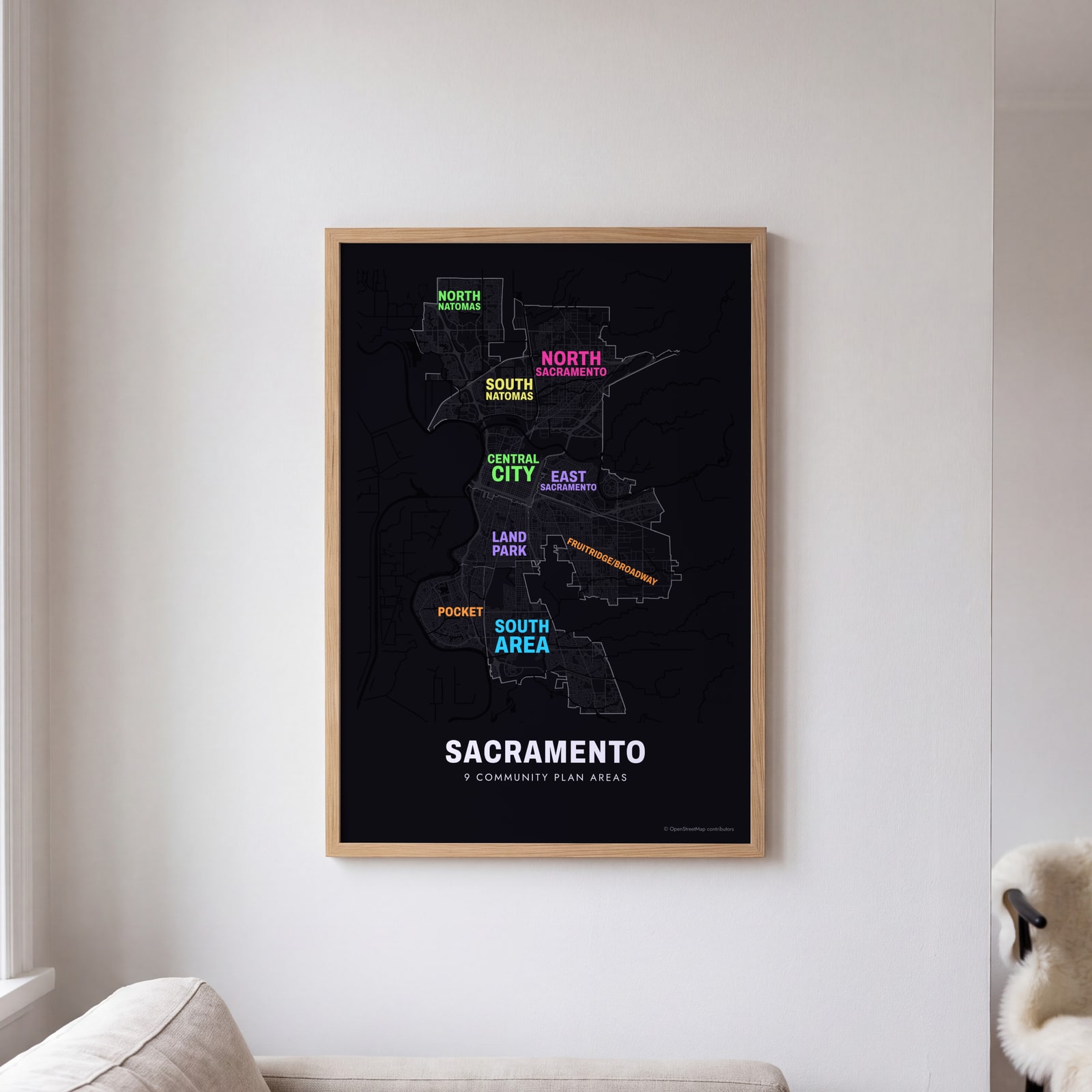 Typographic Sacramento map: the names fill their community plan areasEdit this →
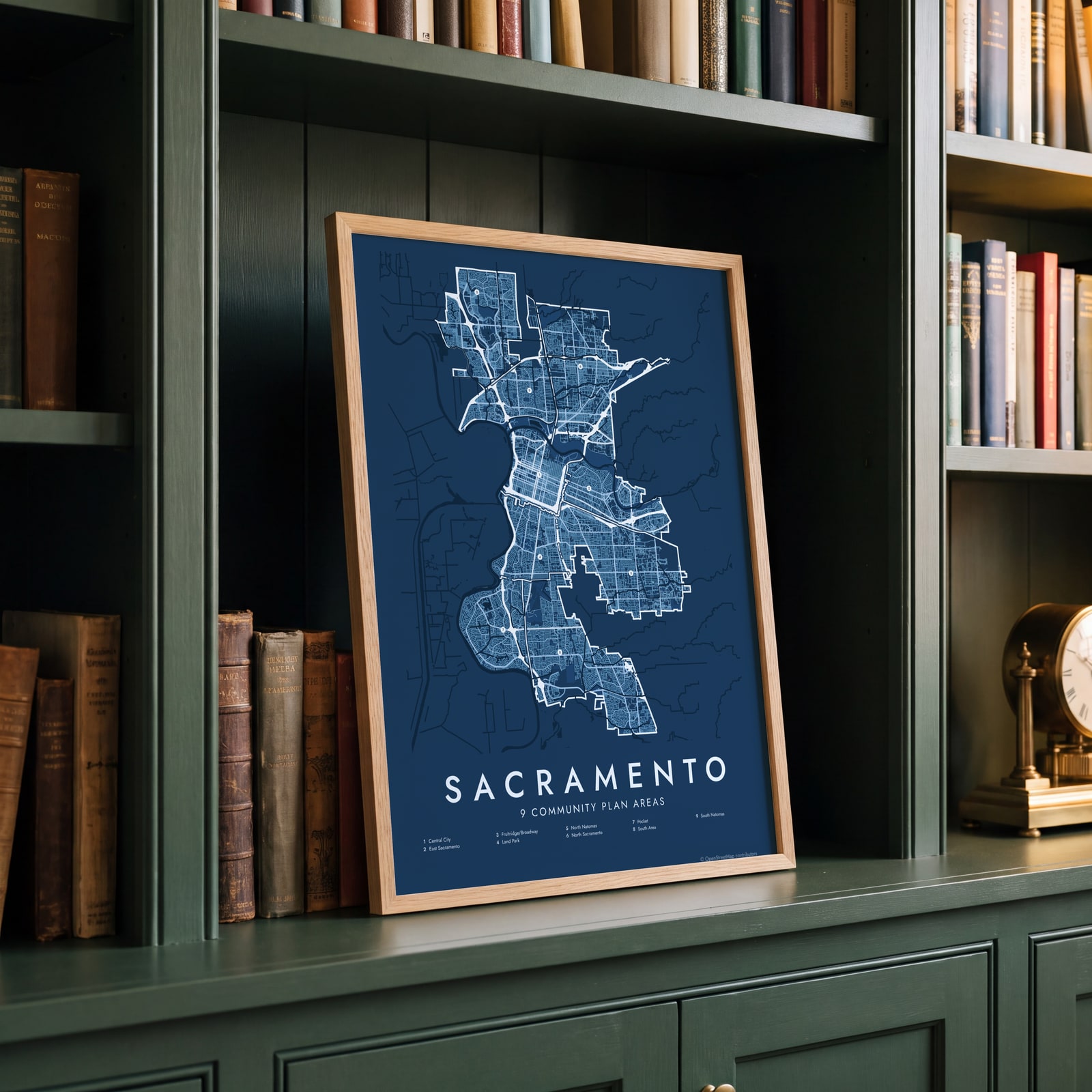 Sacramento street map with numbered community plan areas and their listEdit this →
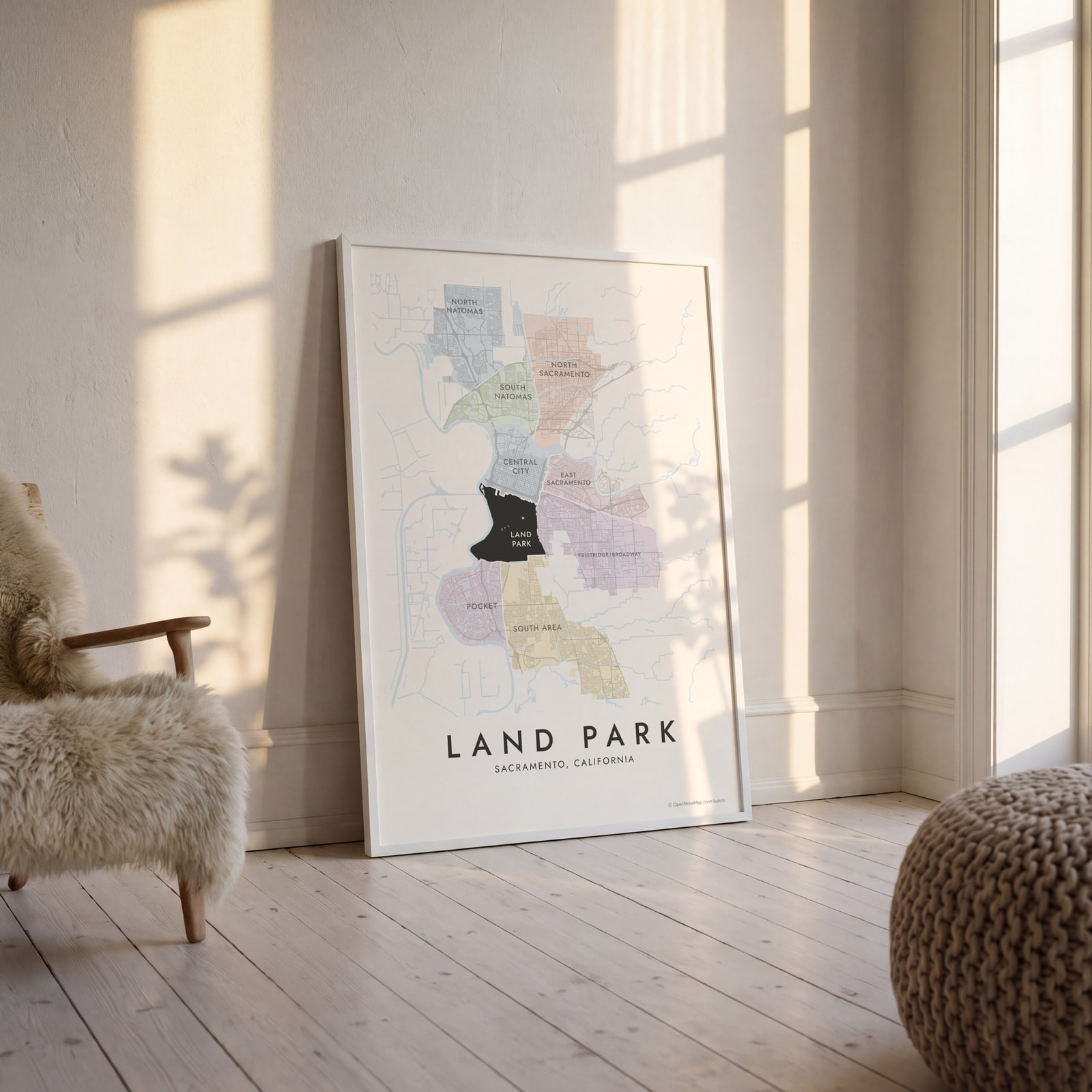 Land Park highlighted on a map of SacramentoEdit this →
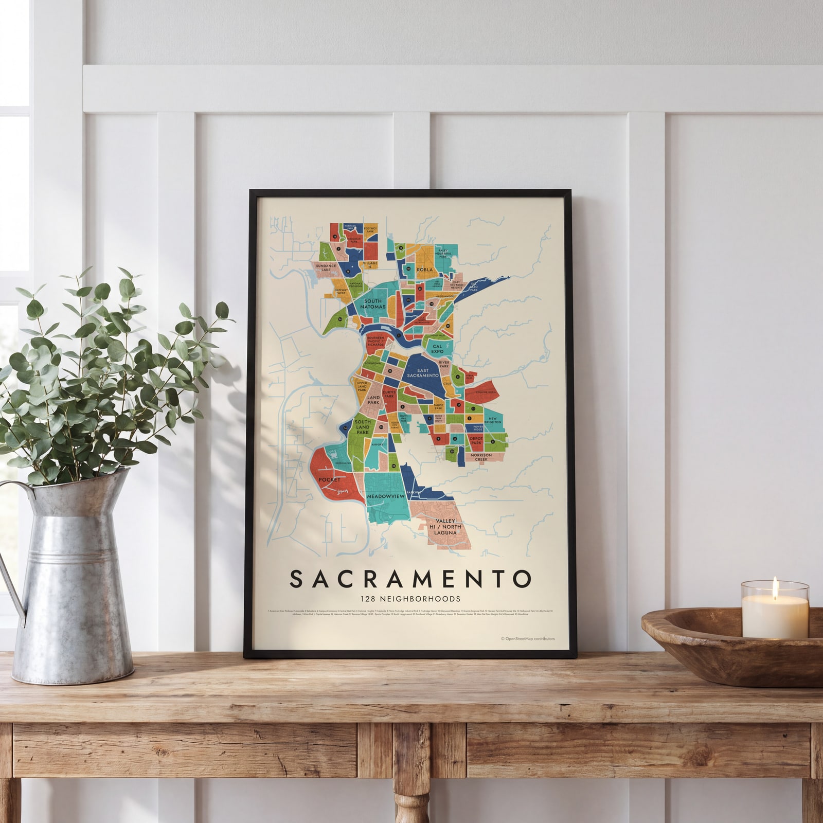 Sacramento's 128 neighborhoods in colorEdit this →
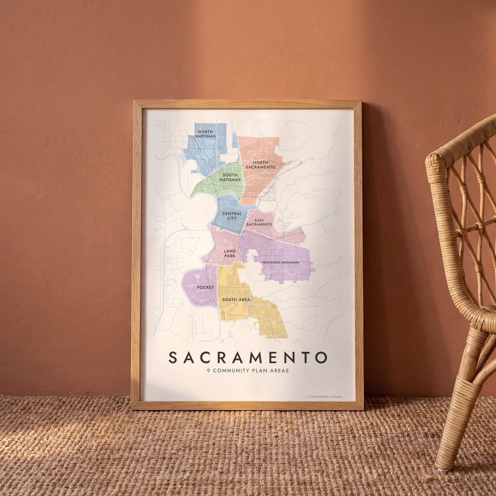
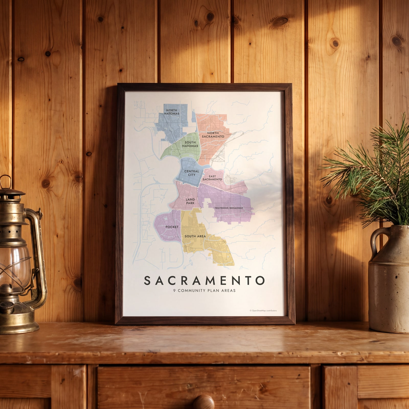 Sacramento neighborhood map in color, every community plan area namedEdit this →
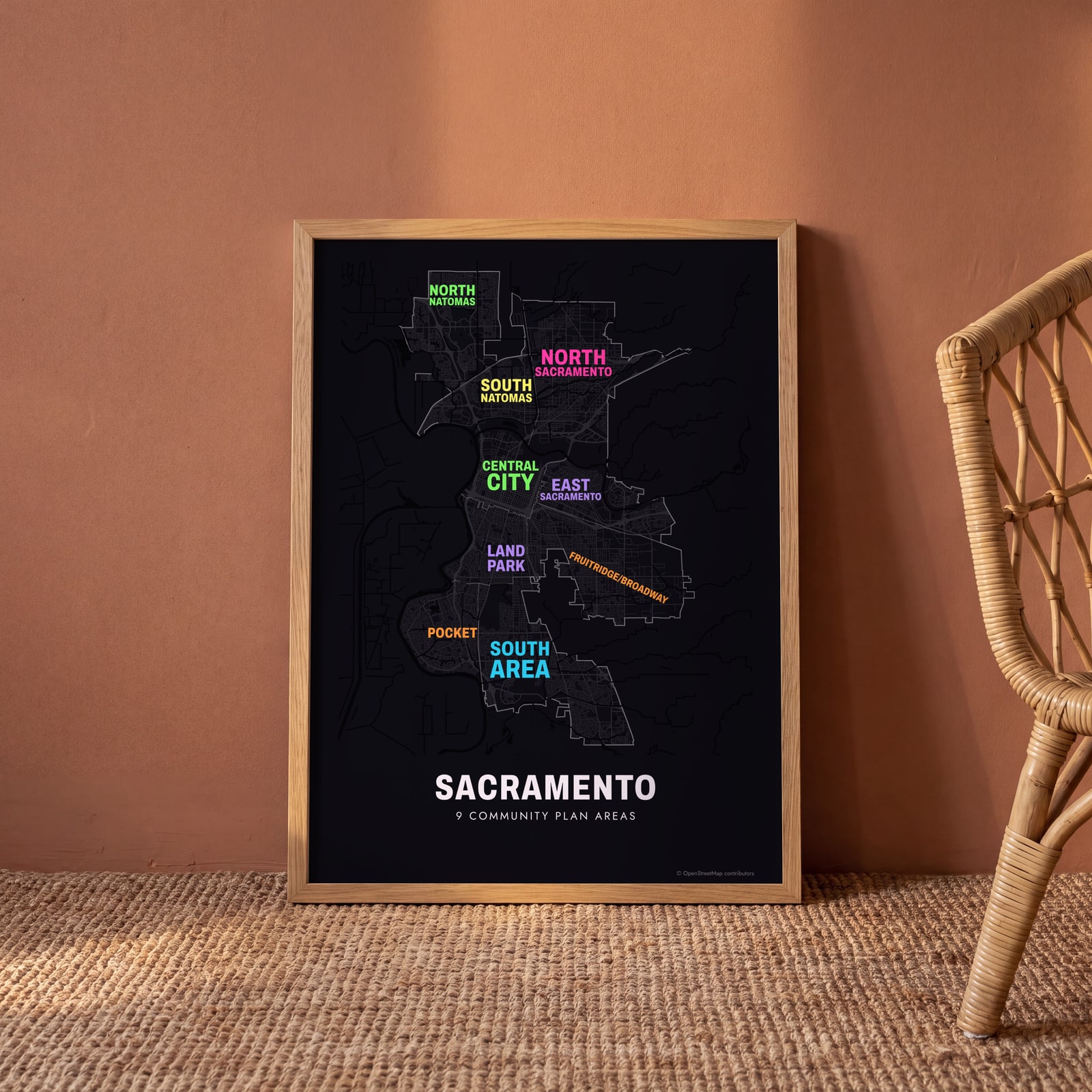 Typographic Sacramento map: the names fill their community plan areasEdit this →
Examples
Open any of them to change the words, the place, the date and the style, then download the print file.
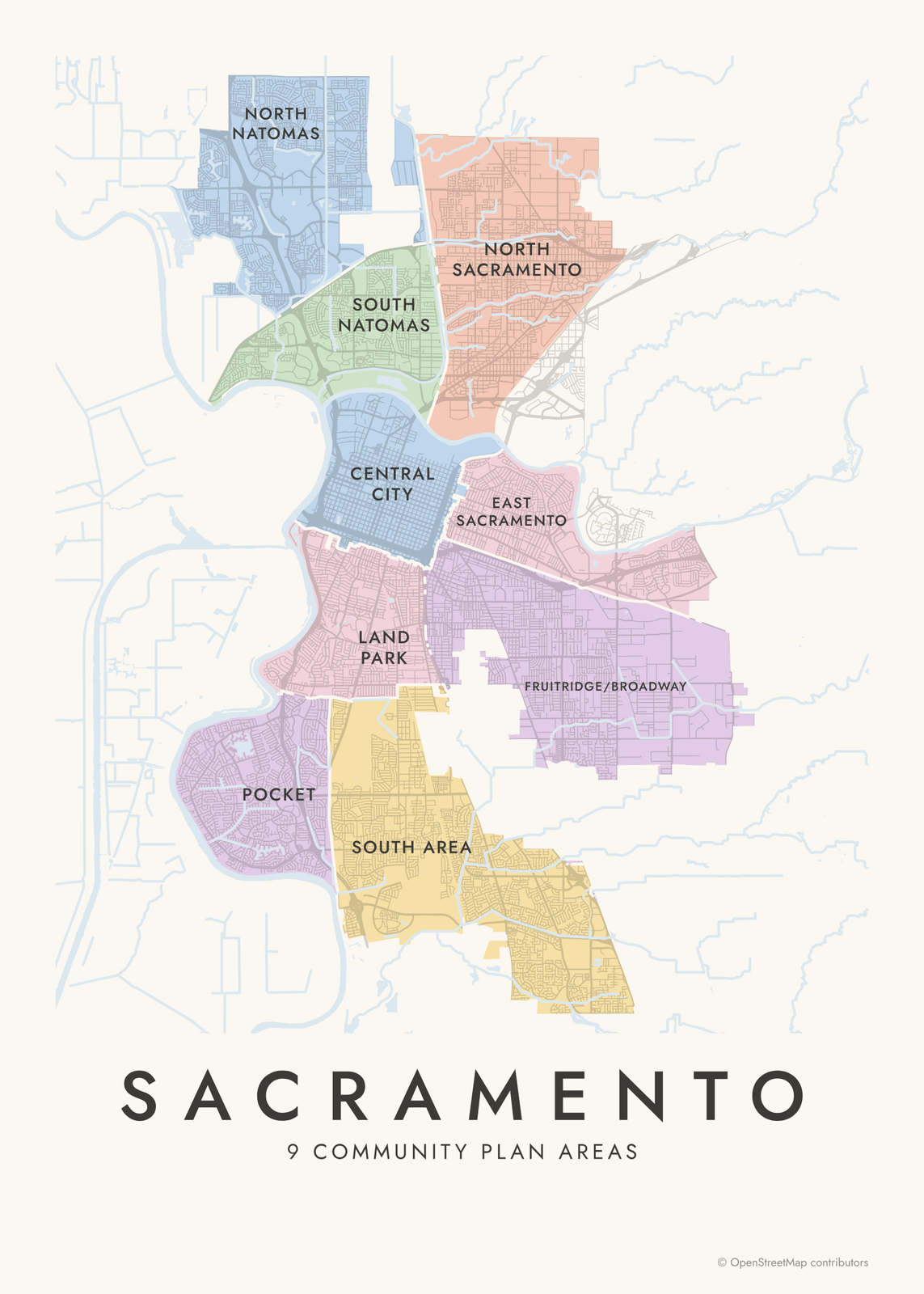 Sacramento neighborhood map in color, every community plan area namedEdit this →More neighborhood maps →
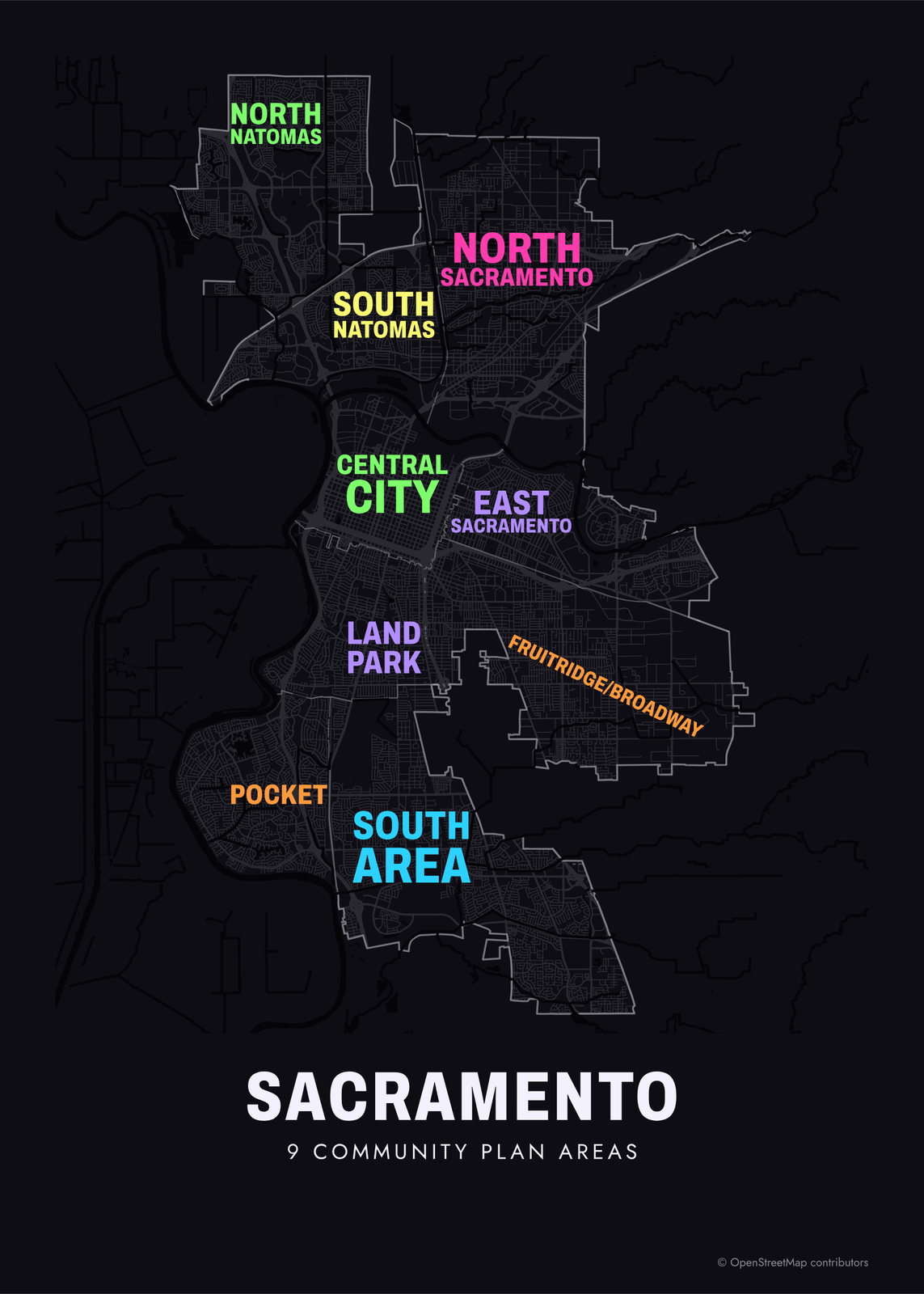 Typographic Sacramento map: the names fill their community plan areasEdit this →More neighborhood maps →
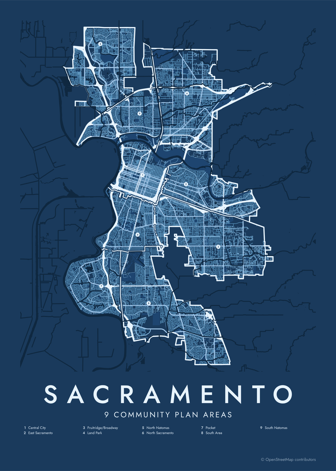 Sacramento street map with numbered community plan areas and their listEdit this →More neighborhood maps →
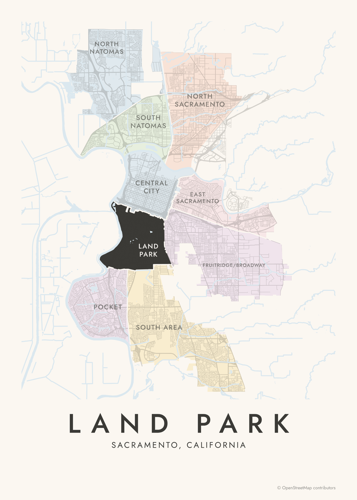 Land Park highlighted on a map of SacramentoEdit this →More neighborhood maps →
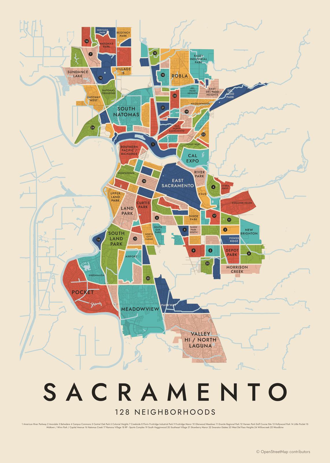 Sacramento's 128 neighborhoods in colorEdit this →More neighborhood maps →
How Sacramento is divided
Sacramento's general plan splits the city into 10 community plan areas, each with its own plan for land use and growth. One of them, Arden Arcade, lies mostly outside city limits, so this map shows the other 9. Central City is the original grid of lettered and numbered streets around the State Capitol, and North and South Natomas cover the city north of the American River.
The finer level shows the 128 neighborhoods on the city's own neighborhood map. They range from older neighborhoods near downtown, like Alkali Flat and Boulevard Park, to business parks and places like Cal Expo and the Sacramento State campus.
All 9 community plan areas of Sacramento
- Central City
- East Sacramento
- Fruitridge/Broadway
- Land Park
- North Natomas
- North Sacramento
- South Area
- South Natomas
All 128 neighborhoods of Sacramento
- Airport
- Alhambra Triangle
- Alkali Flat
- American River Parkway
- Arden Fair
- Avondale
- Belvedere
- Ben Ali
- Boulevard Park
- Brentwood
- Cal Expo
- Campus Commons
- Cannon Industrial Park
- Carleton Tract
- Central Oak Park
- College Town
- College/Glen
- Colonial Heights
- Colonial Manor
- Colonial Village
- Creekside
- CSUS
- Curtis Park
- Del Paso Heights
- Del Paso Park
- Depot Park
- Dos Rios Triangle
- Downtown
- East Del Paso Heights
- East Sacramento
- Elder Creek
- Elmhurst
- Erikson Industrial Park
- Fairgrounds
- Florin Fruitridge Industrial Park
- Freeport Manor
- Fruitridge Manor
- Gardenland
- Gateway Center
- Gateway West
- Glen Elder
- Glenwood Meadows
- Golf Course Terrace
- Granite Regional Park
- Greenhaven
- Hagginwood
- Hansen Park Golf Course Site
- Heritage Park
- Hollywood Park
- Johnson Business Park
- Johnson Heights
- Land Park
- Lawrence Park
- Little Pocket
- Mangan Park
- Mansion Flats
- Marshall School
- Meadowview
- Med Center
- Metro Center
- Midtown / Winn Park / Capital Avenue
- Morrison Creek
- Natomas Corporate Center
- Natomas Creek
- Natomas Crossing
- Natomas Park
- New Brighton
- New Era Park
- Newton Booth
- Noralto
- North City Farms
- North Oak Park
- Northgate
- Northpointe
- Norwood I-80
- Norwood Tech
- Oak Knoll
- Old North Sacramento
- Old Sacramento
- Parker Homes
- Parkway
- Pell/Main Industrial Park
- Point West
- Power Ridge
- Raley Industrial Park
- Ramona Village
- Regency Park
- Richardson Village
- Richmond Grove
- River Gardens
- River Park
- Robla
- RP - Sports Complex
- SCC
- Sierra Oaks
- South City Farms
- South Hagginwood
- South Land Park
- South Natomas
- South Oak Park
- Southeast Village
- Southern Pacific / Richards
- Southside Park
- Strawberry Manor
- Sundance Lake
- Swanston Estates
- Tahoe Park
- Tahoe Park East
- Tahoe Park South
- Tallac Village
- Upper Land Park
- Valley Hi / North Laguna
- Valleyview Acres
- Village 5
- Village 7
- Village 12
- Village 14
- Village Green
- West Del Paso Heights
- West Tahoe Park
- Westlake
- Willowcreek
- Wills Acres
- Woodbine
- Woodlake
- Youngs Heights
- Z'berg Park
Neighborhoods to know
- Central City: the original grid of lettered and numbered streets, with downtown, Midtown and the State Capitol.
- Old Sacramento: a Gold Rush-era district on the Sacramento River, home to the California State Railroad Museum.
- Land Park: named for William Land Park, home to the Sacramento Zoo and Fairytale Town.
- East Sacramento: tree-lined streets around McKinley Park and its rose garden.
- Midtown / Winn Park / Capital Avenue: the grid between downtown and East Sacramento, with Victorian houses and small parks like Winn Park.
- Pocket: set in a bend of the Sacramento River, south of downtown.
- Cal Expo: the grounds of the California State Fair.
How to make your Sacramento neighborhood poster
- Open the Sacramento map and pick community plan areas or neighborhoods.
- Pick a style: Colored areas, Typographic (the names fill the map) or a Street map with the borders over the streets.
- Tap your own neighborhood to highlight it; it becomes the poster's title.
- Drag and zoom to frame the whole city or just your part of it, then pick a size and download the print file.
Questions
How many neighborhoods does Sacramento have?
The city's neighborhood map has 128, and all of them are on this poster. The general plan groups the city into 10 community plan areas, and 9 of those are on the map.
What are Sacramento's community plan areas?
They're the 10 parts of the city that each get their own chapter in Sacramento's general plan, with local policies for land use and growth. Central City, Land Park, Pocket and the two Natomas areas are among them.
Is Arden-Arcade part of Sacramento?
Mostly no. Arden-Arcade is largely unincorporated Sacramento County, and only a small part lies inside city limits, so its plan area isn't on this map. Carmichael, Citrus Heights and Elk Grove aren't part of the city either.
Where do the Sacramento boundaries come from?
From OpenStreetMap (© OpenStreetMap contributors) and City of Sacramento and City of Sacramento. Streets and water are OpenStreetMap's. Boundaries are a snapshot and can differ from what neighbors call home; tell us if one looks wrong.
What sizes can I print?
US Letter, 8 × 10, 11 × 14, 12 × 16 and 12 × 18 in, A4 and A3, free. You download a 300 DPI JPEG drawn at the size you pick. Larger prints, up to 24 × 36 in, are coming soon.
Related




Gift ideas by occasion




Every example is made with the Posterage generators. Change anything, then download it as a 300 DPI JPEG.