San Diego neighborhood map 56 communities and 124 neighborhoods, named
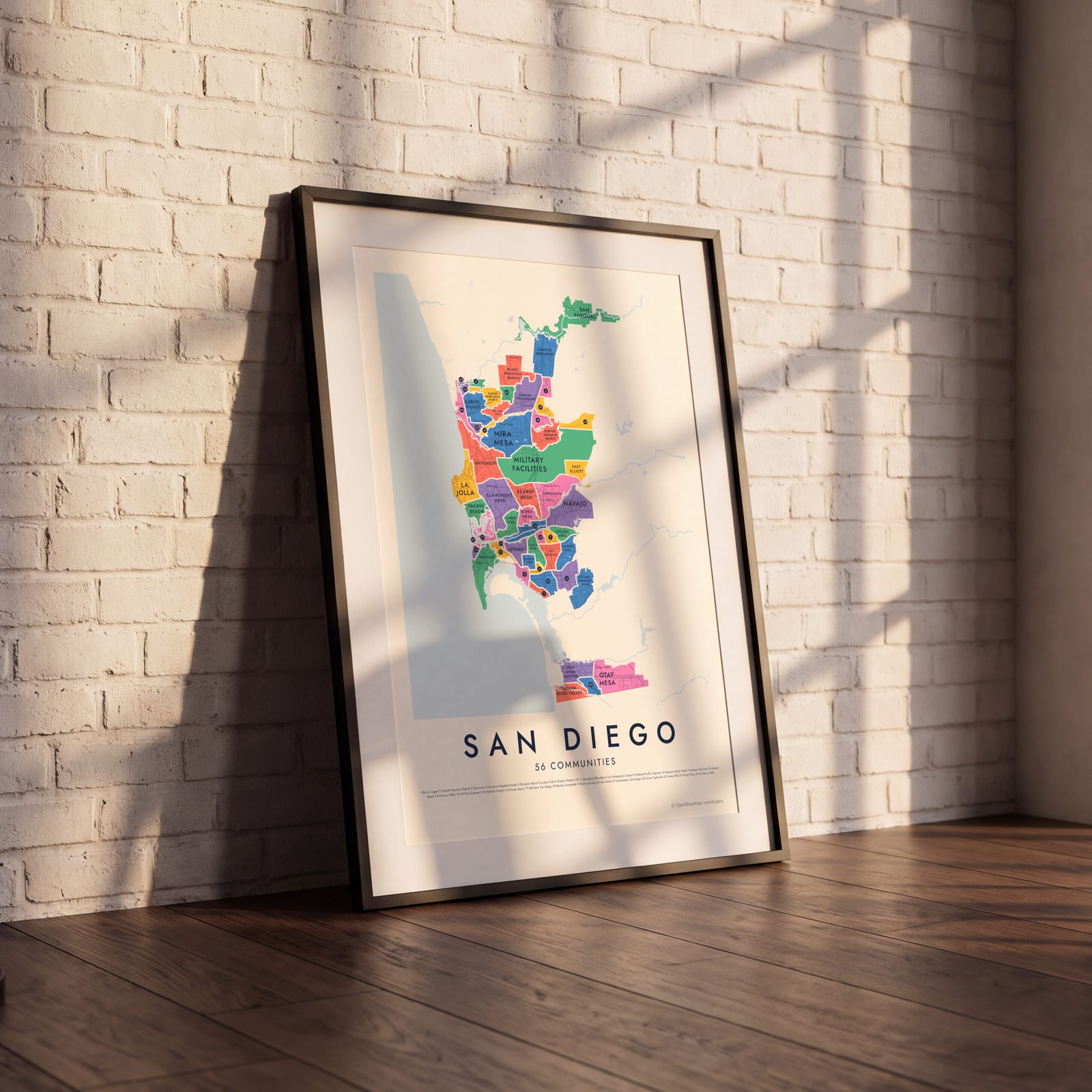
This poster maps San Diego split into its 56 communities, each named, from La Jolla and Rancho Bernardo to Barrio Logan and San Ysidro. Switch to 124 neighborhoods for a finer map, with places like Hillcrest, Little Italy and the Gaslamp. Highlight the one you call home and print it.
On the wall
A few of them framed at home. Open any one to make it yours.
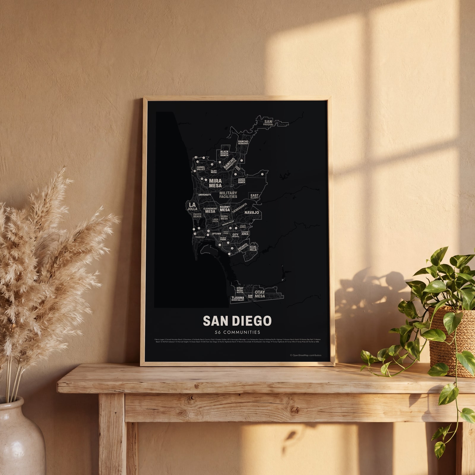 Typographic San Diego map: the names fill their communitiesEdit this →
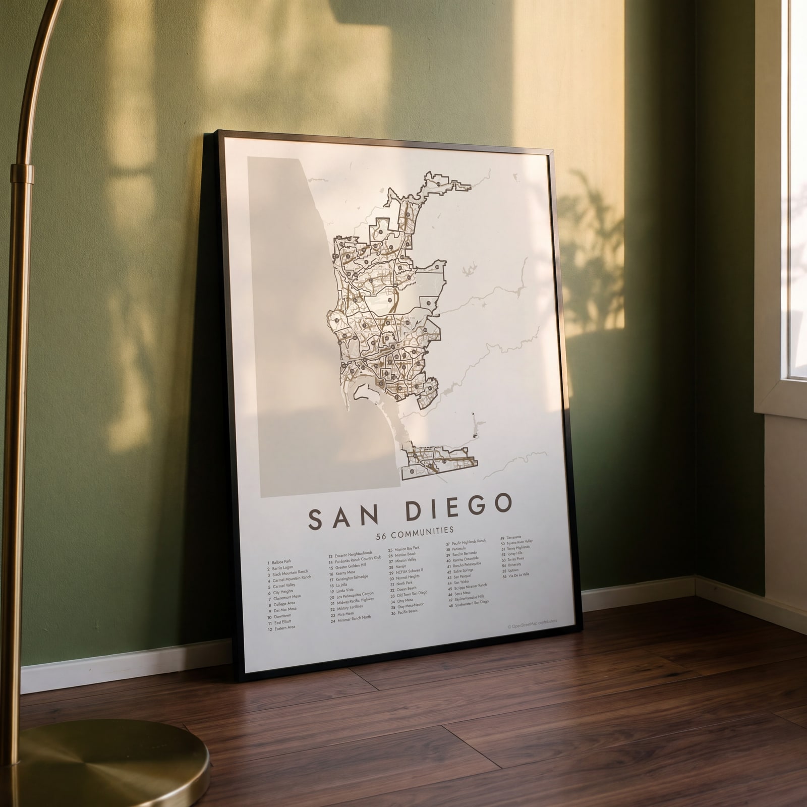 San Diego street map with numbered communities and their listEdit this →
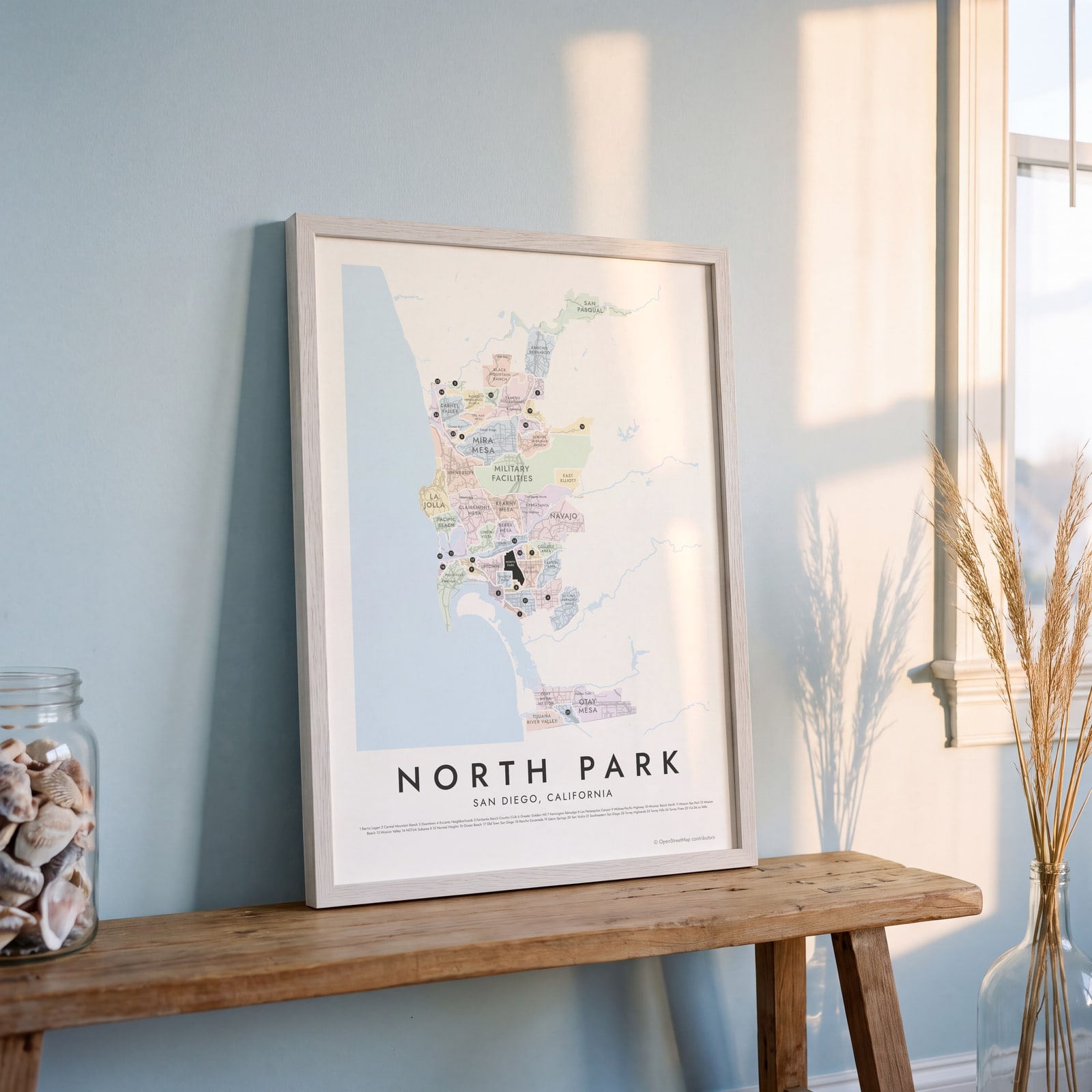 North Park highlighted on a map of San DiegoEdit this →
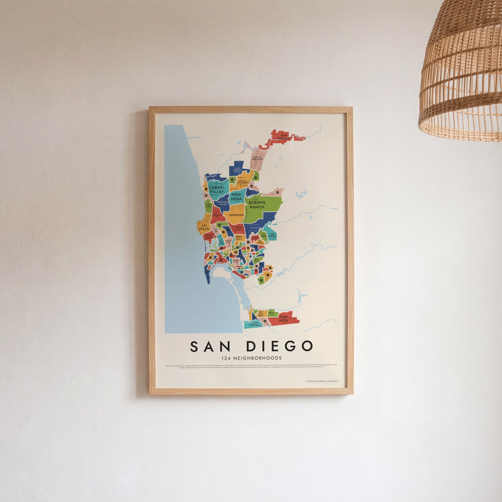 San Diego's 124 neighborhoods in colorEdit this →
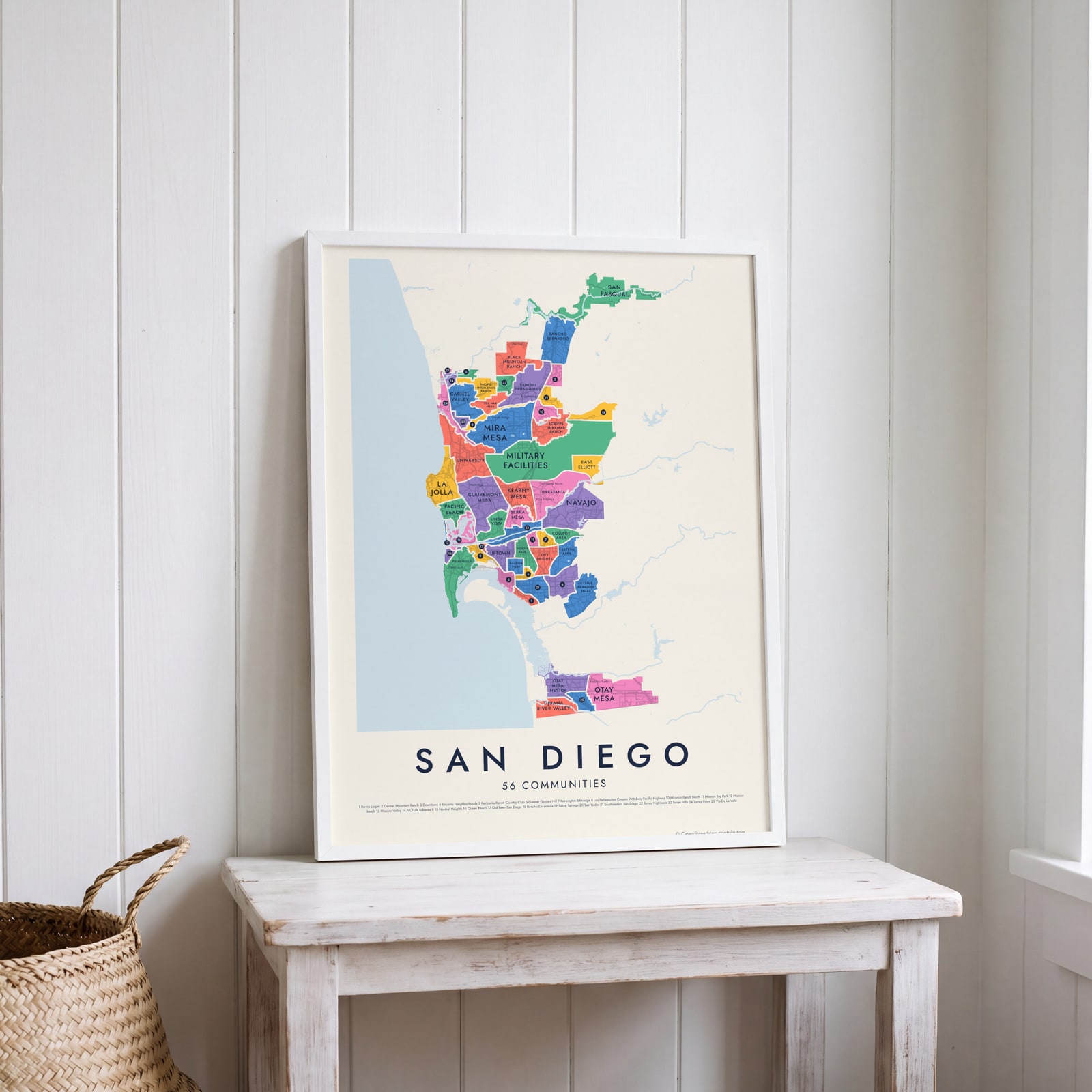 San Diego neighborhood map in color, every community namedEdit this →
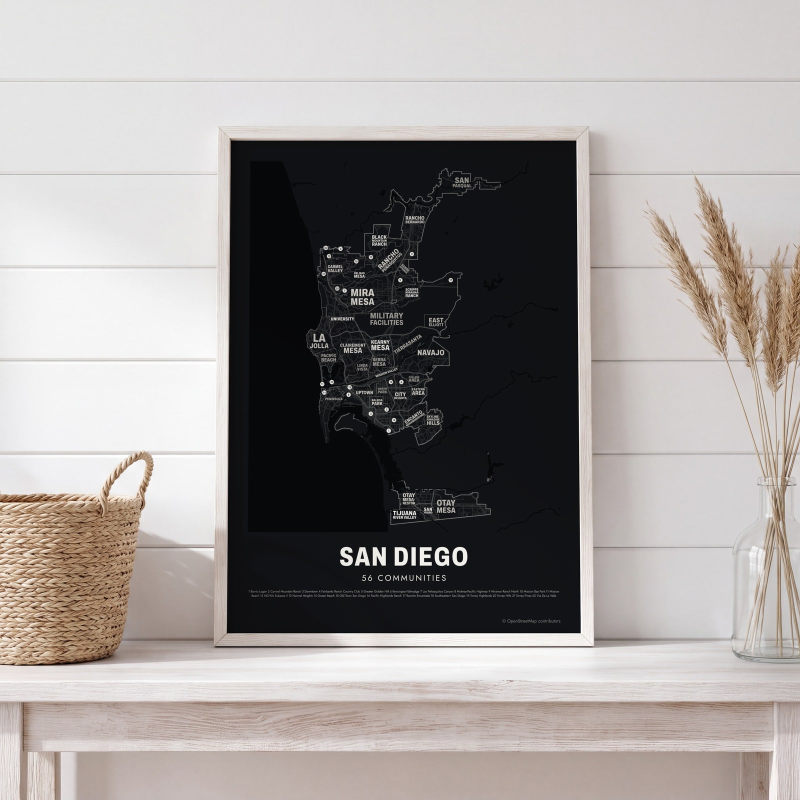 Typographic San Diego map: the names fill their communitiesEdit this →
Examples
Open any of them to change the words, the place, the date and the style, then download the print file.
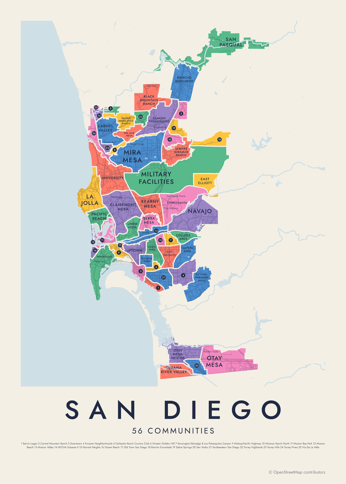 San Diego neighborhood map in color, every community namedEdit this →More neighborhood maps →
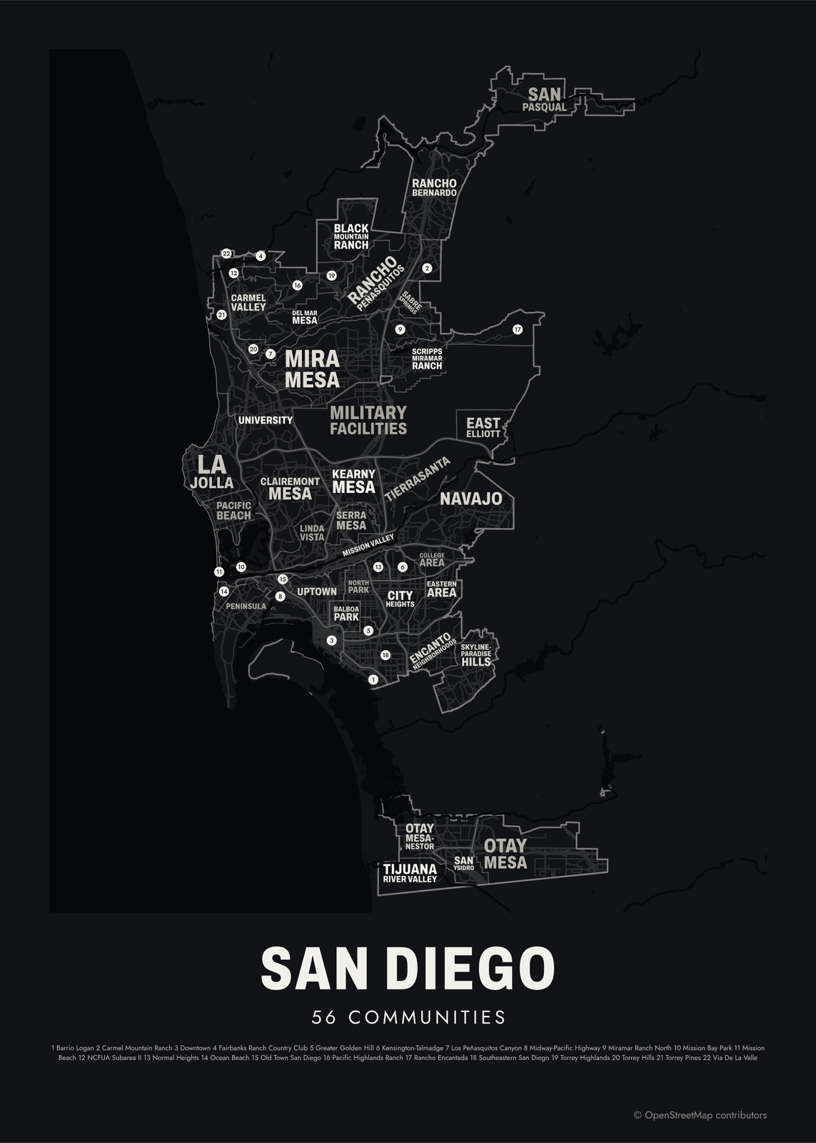 Typographic San Diego map: the names fill their communitiesEdit this →More neighborhood maps →
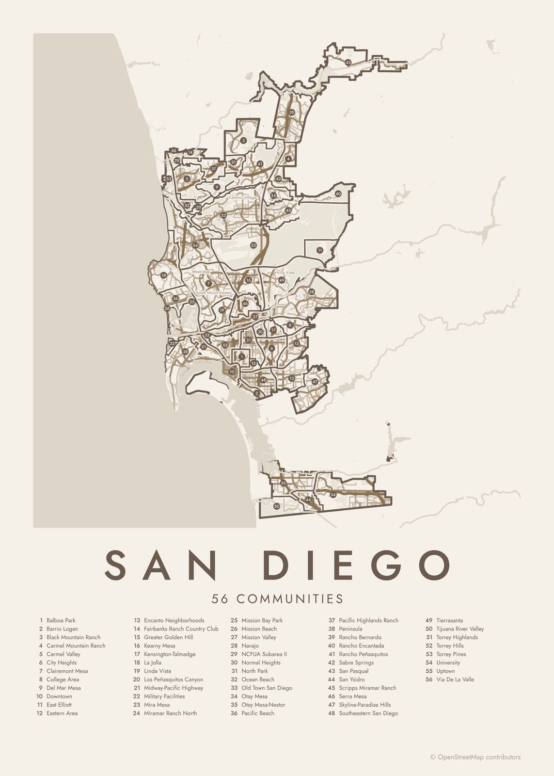 San Diego street map with numbered communities and their listEdit this →More neighborhood maps →
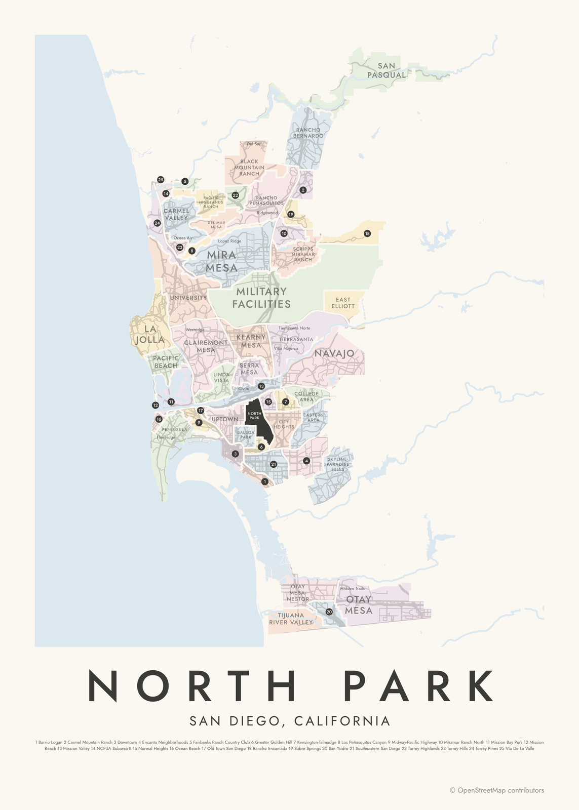 North Park highlighted on a map of San DiegoEdit this →More neighborhood maps →
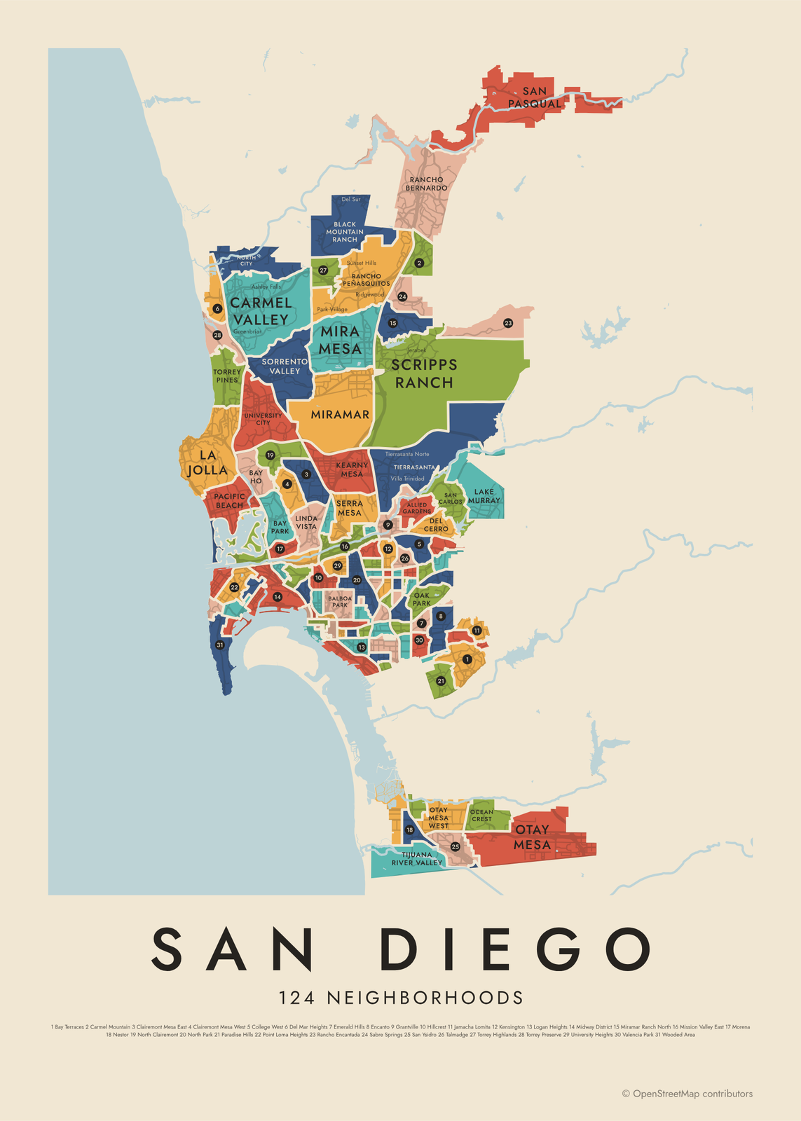 San Diego's 124 neighborhoods in colorEdit this →More neighborhood maps →
How San Diego is divided
The City of San Diego plans by community. It is divided into more than 50 community planning areas, and most have their own community plan for land use and growth. Our map shows 56, counting big parks and military land, like Balboa Park, Mission Bay Park and Military Facilities, as areas of their own.
Communities are often bigger than what locals call a neighborhood. Uptown holds Hillcrest, Mission Hills and Bankers Hill, and Peninsula covers most of Point Loma. That's why the map has a second level of 124 neighborhoods, and hundreds more local names, like Bird Rock and Liberty Station, appear as small labels. Coronado, Chula Vista and Del Mar are separate cities.
All 56 communities of San Diego
- Balboa Park
- Barrio Logan
- Black Mountain Ranch
- Carmel Mountain Ranch
- Carmel Valley
- City Heights
- Clairemont Mesa
- College Area
- Del Mar Mesa
- Downtown
- East Elliott
- Eastern Area
- Encanto Neighborhoods
- Fairbanks Ranch Country Club
- Greater Golden Hill
- Kearny Mesa
- Kensington-Talmadge
- La Jolla
- Linda Vista
- Los Peñasquitos Canyon
- Midway-Pacific Highway
- Military Facilities
- Mira Mesa
- Miramar Ranch North
- Mission Bay Park
- Mission Beach
- Mission Valley
- Navajo
- NCFUA Subarea II
- Normal Heights
- North Park
- Ocean Beach
- Old Town San Diego
- Otay Mesa
- Otay Mesa-Nestor
- Pacific Beach
- Pacific Highlands Ranch
- Peninsula
- Rancho Bernardo
- Rancho Encantada
- Rancho Peñasquitos
- Sabre Springs
- San Pasqual
- San Ysidro
- Scripps Miramar Ranch
- Serra Mesa
- Skyline-Paradise Hills
- Southeastern San Diego
- Tierrasanta
- Tijuana River Valley
- Torrey Highlands
- Torrey Hills
- Torrey Pines
- University
- Uptown
- Via De La Valle
All 124 neighborhoods of San Diego
- Adams North
- Allied Gardens
- Alta Vista
- Azalea/Hollywood Park
- Balboa Park
- Barrio Logan
- Bay Ho
- Bay Park
- Bay Terraces
- Birdland
- Black Mountain Ranch
- Border
- Broadway Heights
- Burlingame
- Carmel Mountain
- Carmel Valley
- Castle
- Cherokee Point
- Chollas Creek
- Chollas View
- Clairemont Mesa East
- Clairemont Mesa West
- Colina del Sol
- College East
- College West
- Core-Columbia
- Corridor
- Cortez
- Del Cerro
- Del Mar Heights
- East Village
- Egger Highlands
- El Cerrito
- Emerald Hills
- Encanto
- Fairmont Park
- Fairmont Village
- Fox Canyon
- Gaslamp
- Golden Hill
- Grant Hill
- Grantville
- Harborview
- Hillcrest
- Horton Plaza
- Islenair
- Jamacha Lomita
- Kearny Mesa
- Kensington
- La Jolla
- La Playa
- Lake Murray
- Lincoln Park
- Linda Vista
- Little Italy
- Logan Heights
- Loma Portal
- Marina
- Midtown
- Midway District
- Mira Mesa
- Miramar
- Miramar Ranch North
- Mission Bay
- Mission Bay Park
- Mission Beach
- Mission Hills
- Mission Valley East
- Mission Valley West
- Morena
- Mount Hope
- Mountain View
- Nestor
- Normal Heights
- North City
- North Clairemont
- North Park
- Oak Park
- Ocean Beach
- Ocean Crest
- Old Town
- Otay Mesa
- Otay Mesa West
- Pacific Beach
- Palm City
- Paradise Hills
- Park West
- Petco Park
- Point Loma Heights
- Qualcomm
- Rancho Bernardo
- Rancho Encantada
- Rancho Peñasquitos
- Redwood Village/Rolando Park
- Ridgeview/Webster
- Rolando
- Roseville/Fleet Ridge
- Sabre Springs
- San Carlos
- San Pasqual
- San Ysidro
- Scripps Ranch
- Serra Mesa
- Shelltown
- Sherman Heights
- Skyline
- Sorrento Valley
- South Park
- Southcrest
- Stockton
- Sunset Cliffs
- Swan Canyon
- Talmadge
- Teralta East
- Teralta West
- Tierrasanta
- Tijuana River Valley
- Torrey Highlands
- Torrey Pines
- Torrey Preserve
- University City
- University Heights
- Valencia Park
- Wooded Area
More neighborhood names on the map
Inside the communities, the map also names 287 smaller neighborhoods where they fit, from OpenStreetMap: Point Loma, Sorrento Mesa, Clairemont, Middletown, Banker's Hill, Downtown San Diego, South Chollas Valley, South San Diego, Mid-City, Montezuma Mesa, San Pasqual Valley, Beach Barber Tract, La Jolla Hermosa, Village of La Jolla, Bird Rock, La Jolla Country Club, The Muirlands, La Jolla Mesa, North Pacific Beach, Torrey Pines Terrace, La Jolla Shores, South Mission Beach, Hidden Valley, La Jolla Alta, Sail Bay, La Jolla Farms, Ocean Beach Highlands, Soledad South, La Jolla Heights, Fleetridge, San Dieguito (NCFUA Subarea-II), Crown Point, Vacation Isle, Carmel View, Del Mar Highlands, La Jolla Village, Roseville, La Jolla Colony, Carmel Del Mar, Alcott Estates and more. Turn them off under Names if you want only the communities.
Neighborhoods to know
- Balboa Park: the San Diego Zoo and museums, set among Spanish-style buildings from the 1915 exposition.
- Gaslamp: the Gaslamp Quarter's Victorian-era buildings, in the heart of downtown.
- Little Italy: once home to Italian tuna fishing families, by the bay north of downtown.
- La Jolla: a seaside community with La Jolla Cove, its sea caves and its sea lions.
- Old Town: the city's early settlement, with adobe buildings in Old Town San Diego State Historic Park.
- Barrio Logan: Chicano Park, with murals painted on the pillars of the Coronado Bridge.
- North Park: Craftsman bungalows and a neon sign over University Avenue.
- Mission Beach: a strip of sand between the ocean and Mission Bay, with the Giant Dipper roller coaster from 1925.
How to make your San Diego neighborhood poster
- Open the San Diego map and pick communities or neighborhoods.
- Pick a style: Colored areas, Typographic (the names fill the map) or a Street map with the borders over the streets.
- Tap your own neighborhood to highlight it; it becomes the poster's title.
- Drag and zoom to frame the whole city or just your part of it, then pick a size and download the print file.
Questions
How many neighborhoods does San Diego have?
It depends on the level. The city plans by more than 50 community planning areas, and this map shows 56 communities, counting parks and military land. Its finer level has 124 neighborhoods, and hundreds more local names appear as labels.
Is La Jolla its own city?
No. La Jolla is part of the City of San Diego, though its mail is addressed to La Jolla. It appears on both levels of this map.
Is Coronado part of San Diego?
No. Coronado is a separate city across the bay, as are Chula Vista, National City and Del Mar. They sit outside the city lines this map follows.
What is Uptown in San Diego?
Uptown is a community planning area just north of downtown. It includes Hillcrest, Mission Hills and Bankers Hill, which show on the neighborhood level of this map.
Where do the San Diego boundaries come from?
From OpenStreetMap (© OpenStreetMap contributors) and City of San Diego and City of San Diego. Streets and water are OpenStreetMap's. Boundaries are a snapshot and can differ from what neighbors call home; tell us if one looks wrong.
What sizes can I print?
US Letter, 8 × 10, 11 × 14, 12 × 16 and 12 × 18 in, A4 and A3, free. You download a 300 DPI JPEG drawn at the size you pick. Larger prints, up to 24 × 36 in, are coming soon.
Related




Gift ideas by occasion




Every example is made with the Posterage generators. Change anything, then download it as a 300 DPI JPEG.