San Francisco neighborhood map 41 neighborhoods, or 117 smaller ones
This poster maps San Francisco in 41 named neighborhoods, from the Presidio to Visitacion Valley. Switch to the detailed level for 117 smaller ones, like Cole Valley, Dogpatch and Telegraph Hill. Highlight yours and print it.
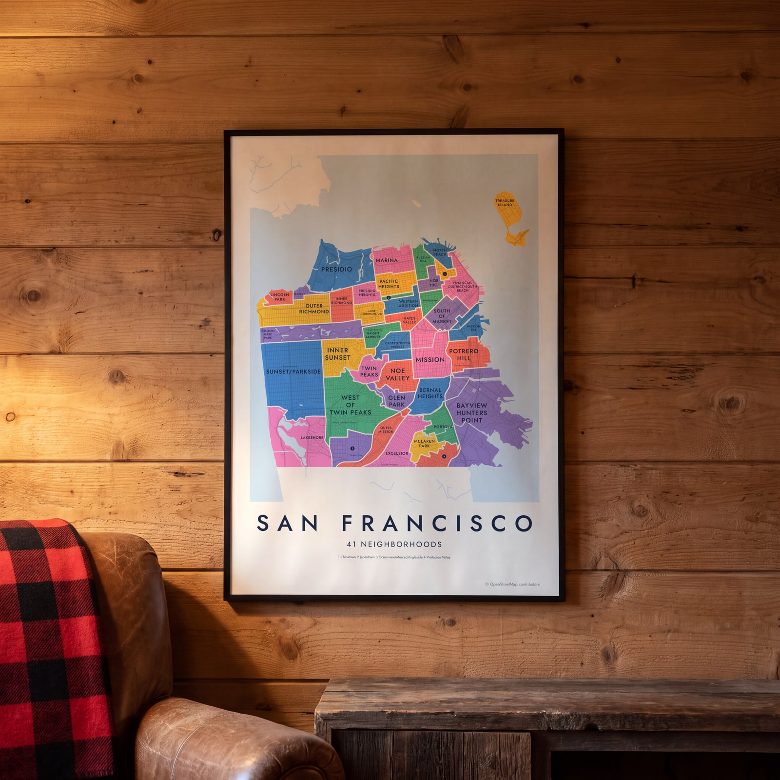
On the wall
A few of them framed at home. Open any one to make it yours.
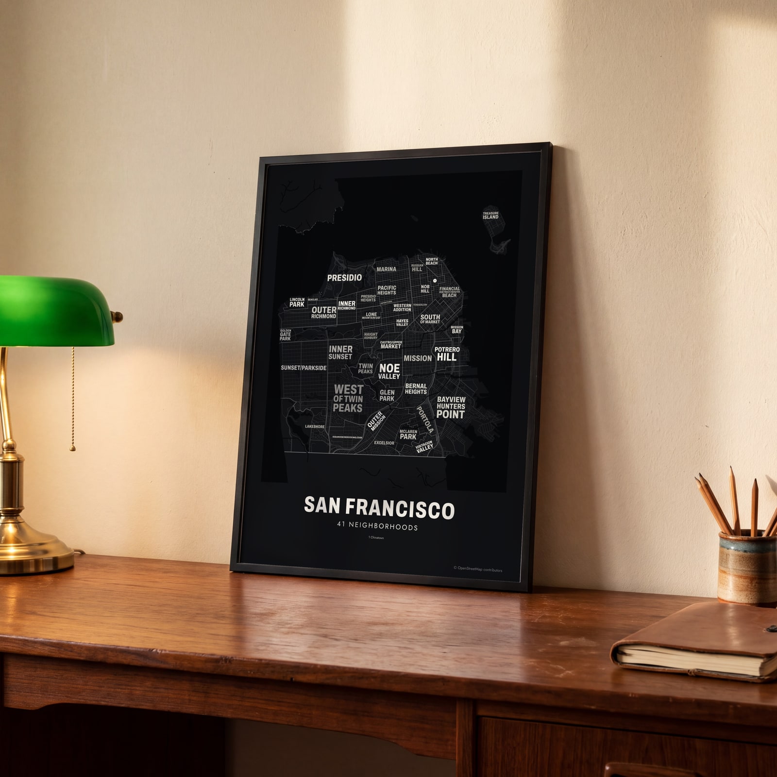 Typographic San Francisco map: the names fill their neighborhoodsEdit this →
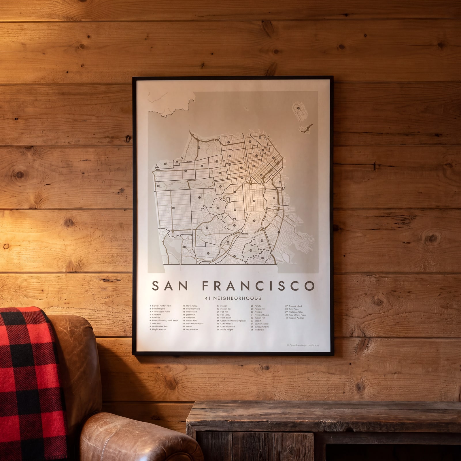 San Francisco street map with numbered neighborhoods and their listEdit this →
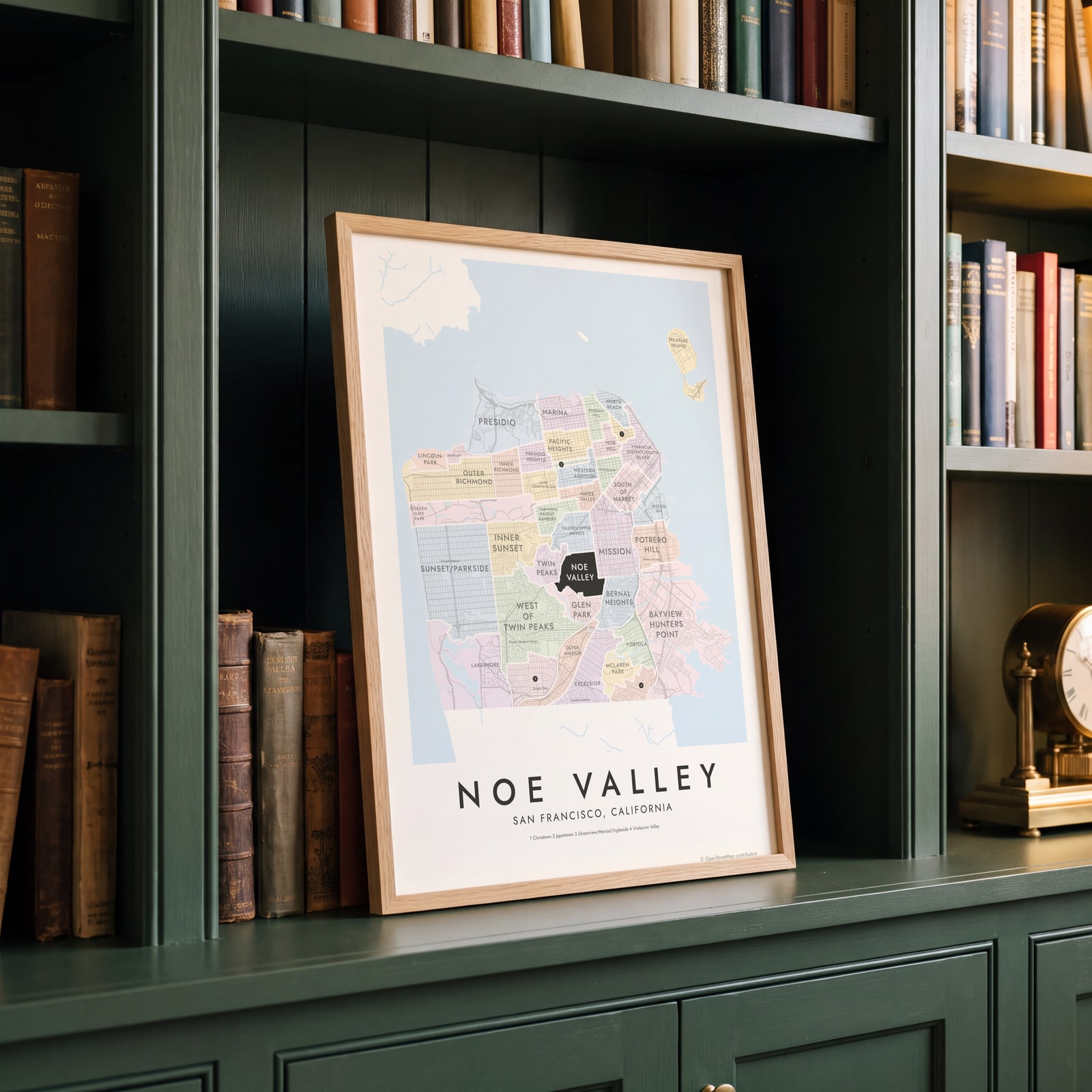 Noe Valley highlighted on a map of San FranciscoEdit this →
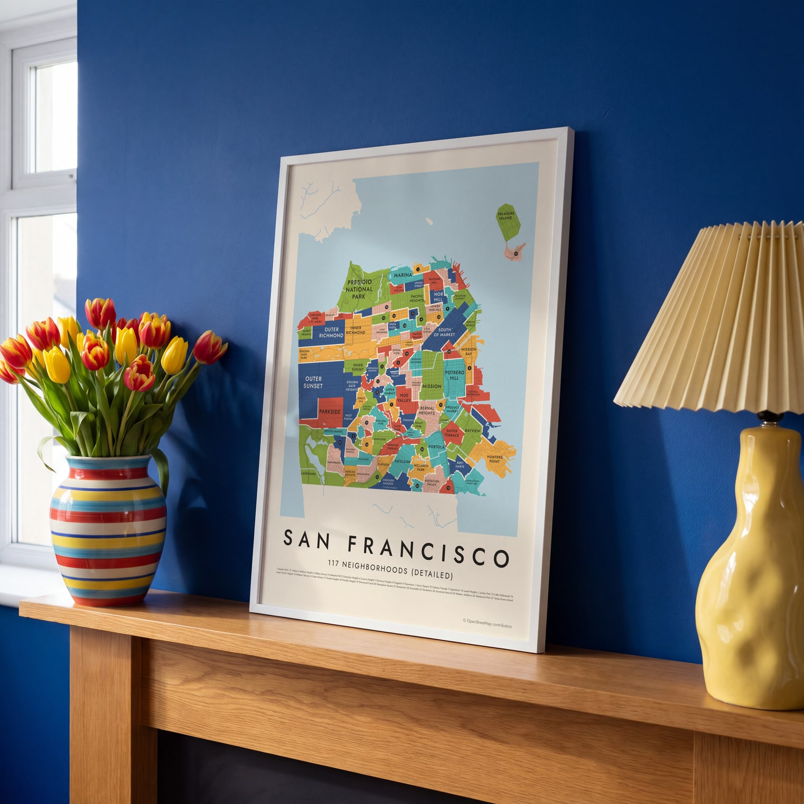 San Francisco's 117 neighborhoods (detailed) in colorEdit this →
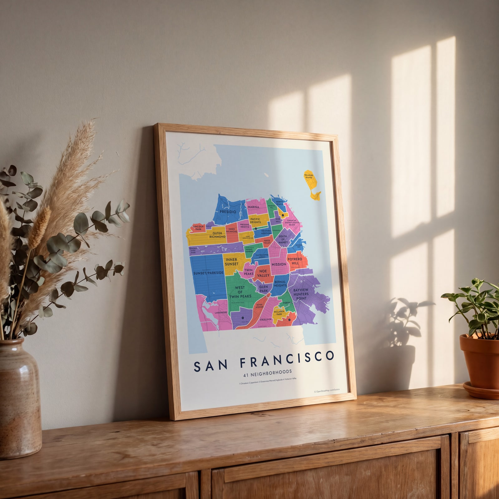 San Francisco neighborhood map in color, every neighborhood namedEdit this →
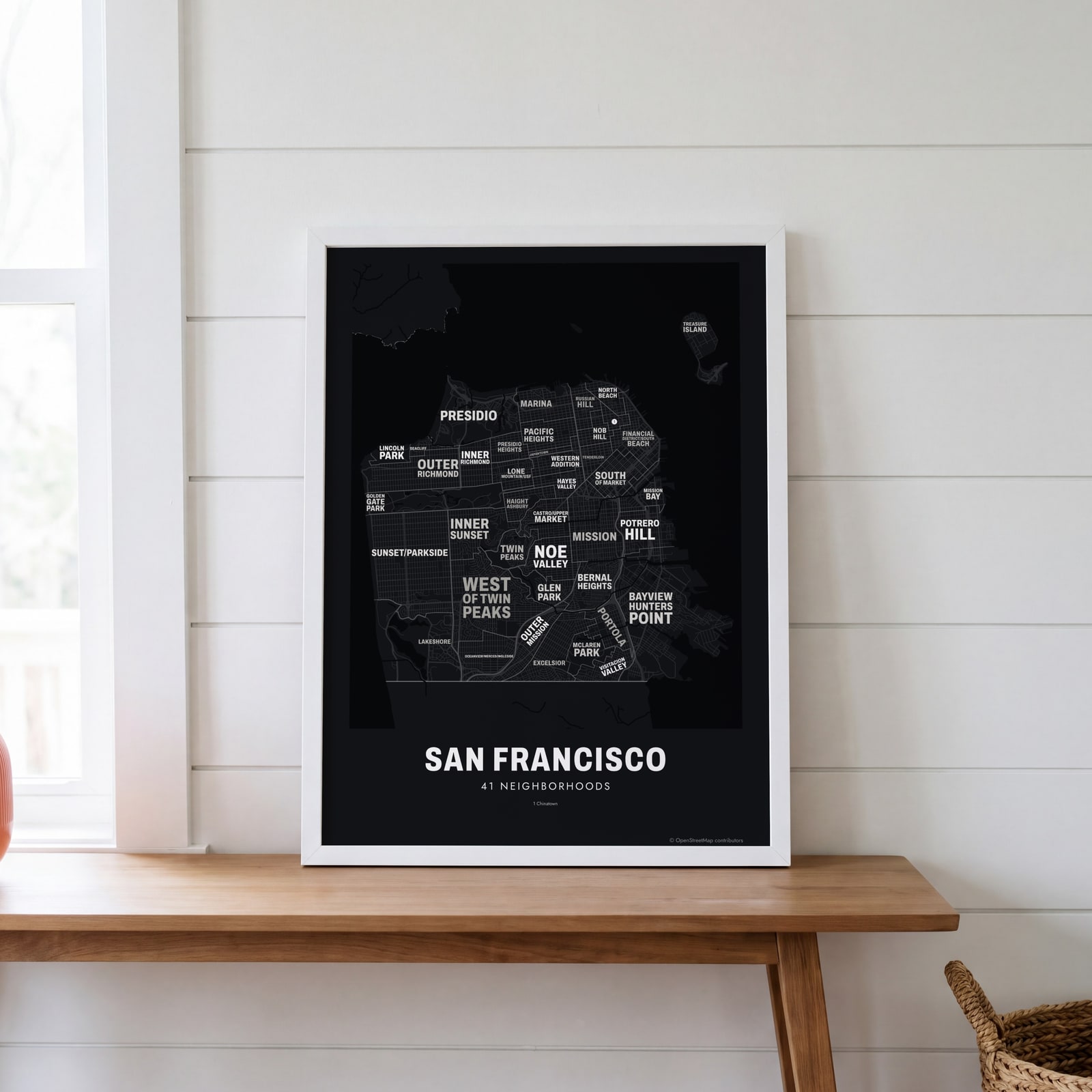 Typographic San Francisco map: the names fill their neighborhoodsEdit this →
Examples
Open any of them to change the words, the place, the date and the style, then download the print file.
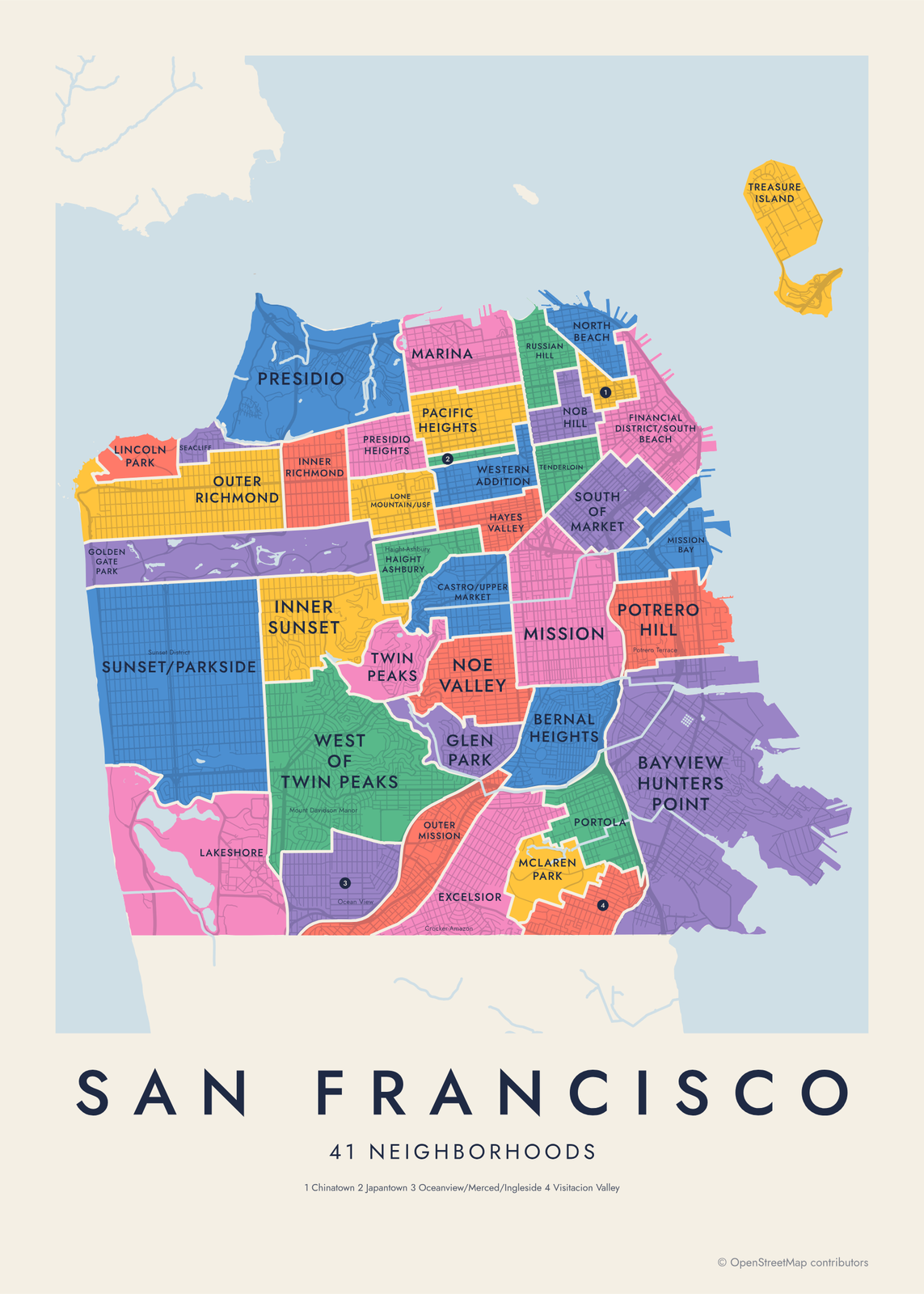 San Francisco neighborhood map in color, every neighborhood namedEdit this →More neighborhood maps →
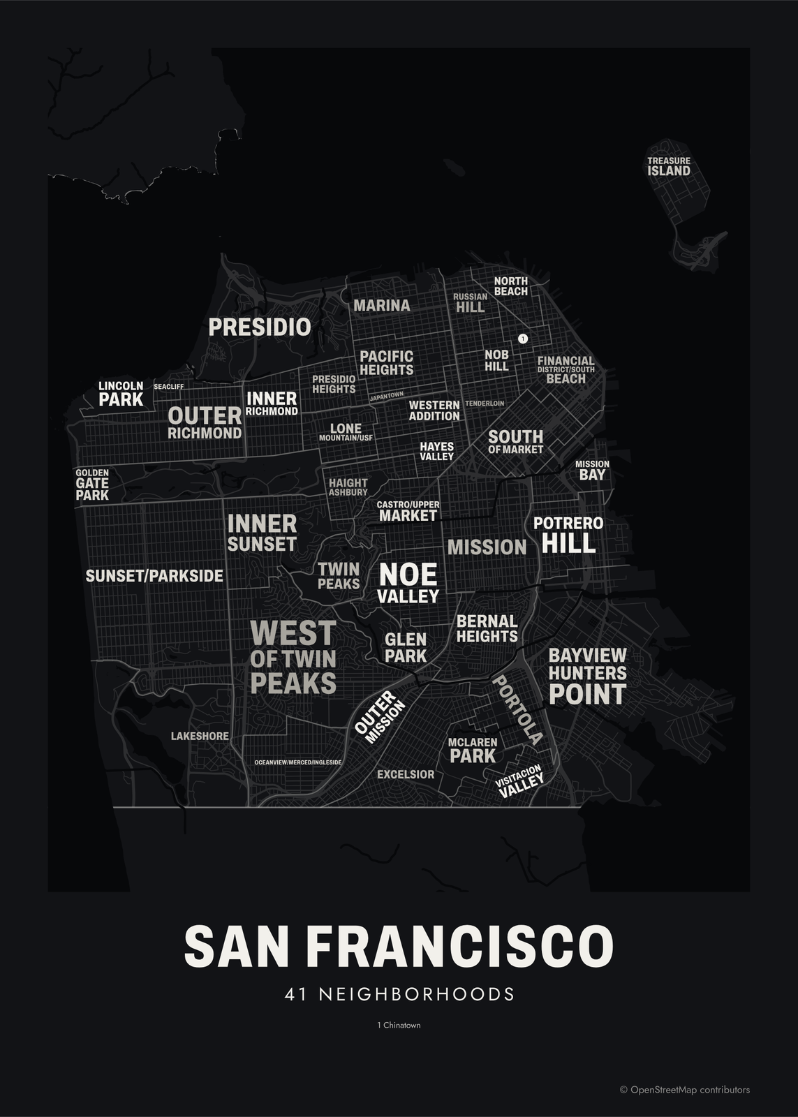 Typographic San Francisco map: the names fill their neighborhoodsEdit this →More neighborhood maps →
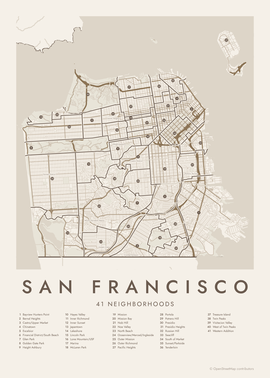 San Francisco street map with numbered neighborhoods and their listEdit this →More neighborhood maps →
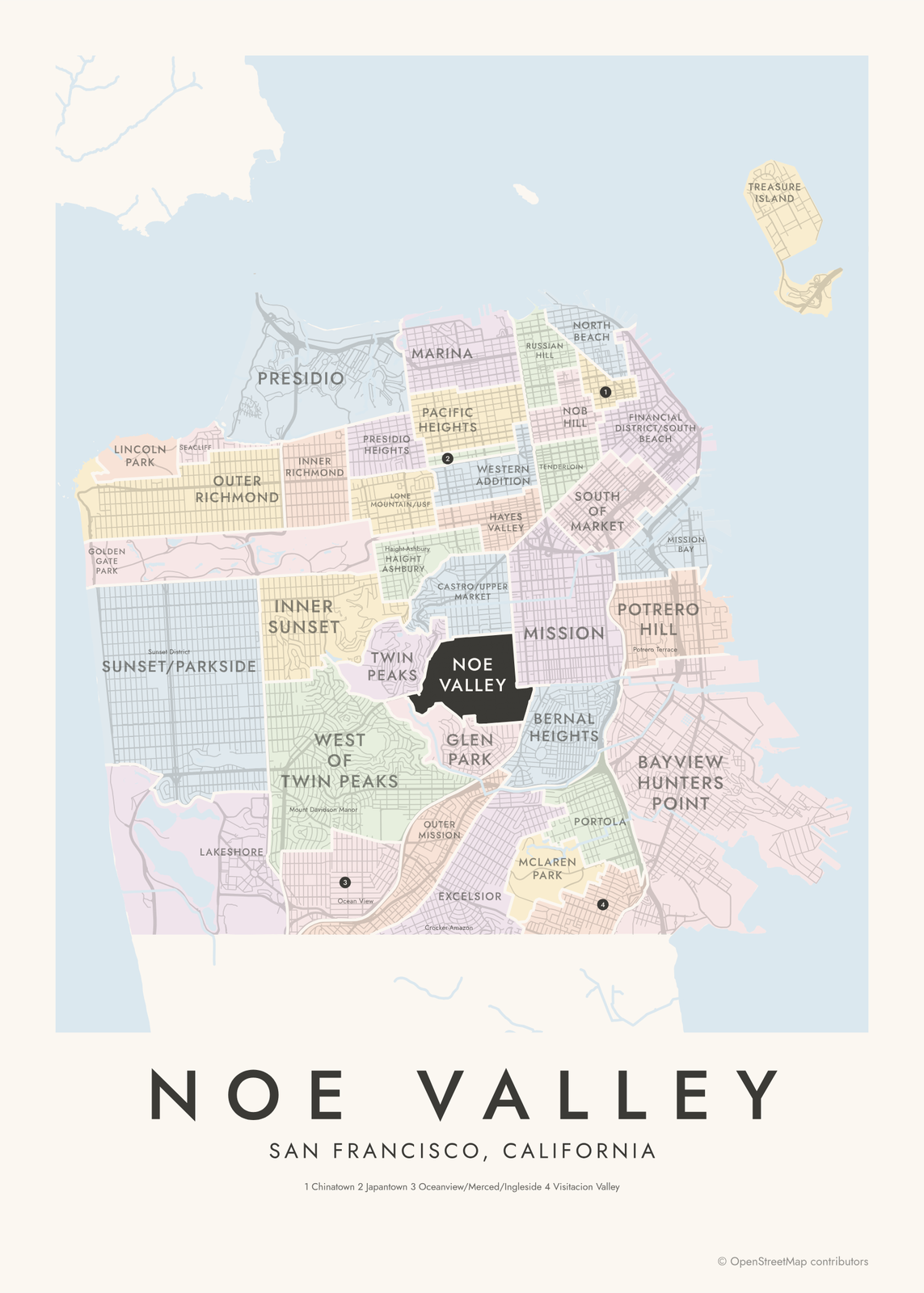 Noe Valley highlighted on a map of San FranciscoEdit this →More neighborhood maps →
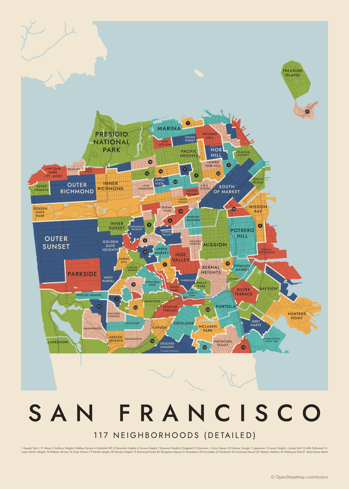 San Francisco's 117 neighborhoods (detailed) in colorEdit this →More neighborhood maps →
How San Francisco is divided
San Francisco is a city and a county in one. The 41 neighborhoods on the first level are the city's Analysis Neighborhoods, drawn by the Department of Public Health and the Mayor's Office of Housing with help from the Planning Department. They group census tracts so the city can report data by neighborhood, which is why some carry two names, like Castro/Upper Market.
The city says no map of its neighborhoods is official, and residents name far more places. The detailed level uses 117 neighborhoods from the city's planning data, splitting the big areas into places like Cow Hollow, Duboce Triangle and Eureka Valley. Names like the Sunset District, the Richmond District and West SoMa appear as labels.
All 41 neighborhoods of San Francisco
- Bayview Hunters Point
- Bernal Heights
- Castro/Upper Market
- Chinatown
- Excelsior
- Financial District/South Beach
- Glen Park
- Golden Gate Park
- Haight Ashbury
- Hayes Valley
- Inner Richmond
- Inner Sunset
- Japantown
- Lakeshore
- Lincoln Park
- Lone Mountain/USF
- Marina
- McLaren Park
- Mission
- Mission Bay
- Nob Hill
- Noe Valley
- North Beach
- Oceanview/Merced/Ingleside
- Outer Mission
- Outer Richmond
- Pacific Heights
- Portola
- Potrero Hill
- Presidio
- Presidio Heights
- Russian Hill
- Seacliff
- South of Market
- Sunset/Parkside
- Tenderloin
- Treasure Island
- Twin Peaks
- Visitacion Valley
- West of Twin Peaks
- Western Addition
All 117 neighborhoods (detailed) of San Francisco
- Alamo Square
- Anza Vista
- Apparel City
- Aquatic Park / Ft. Mason
- Ashbury Heights
- Balboa Terrace
- Bayview
- Bernal Heights
- Bret Harte
- Buena Vista
- Candlestick Point SRA
- Castro
- Cathedral Hill
- Cayuga
- Central Waterfront
- Chinatown
- Civic Center
- Clarendon Heights
- Cole Valley
- Corona Heights
- Cow Hollow
- Crocker Amazon
- Diamond Heights
- Dogpatch
- Dolores Heights
- Downtown / Union Square
- Duboce Triangle
- Eureka Valley
- Excelsior
- Fairmount
- Financial District
- Fisherman's Wharf
- Forest Hill
- Forest Knolls
- Glen Park
- Golden Gate Heights
- Golden Gate Park
- Haight Ashbury
- Hayes Valley
- Holly Park
- Hunters Point
- India Basin
- Ingleside
- Ingleside Terraces
- Inner Richmond
- Inner Sunset
- Japantown
- Laguna Honda
- Lake Street
- Lakeshore
- Laurel Heights / Jordan Park
- Lincoln Park / Ft. Miley
- Little Hollywood
- Lone Mountain
- Lower Haight
- Lower Nob Hill
- Lower Pacific Heights
- Marina
- McLaren Park
- Merced Heights
- Merced Manor
- Midtown Terrace
- Mint Hill
- Miraloma Park
- Mission
- Mission Bay
- Mission Dolores
- Mission Terrace
- Monterey Heights
- Mt. Davidson Manor
- Nob Hill
- Noe Valley
- North Beach
- Northern Waterfront
- Oceanview
- Outer Mission
- Outer Richmond
- Outer Sunset
- Pacific Heights
- Panhandle
- Parkmerced
- Parkside
- Parnassus Heights
- Peralta Heights
- Polk Gulch
- Portola
- Potrero Hill
- Presidio Heights
- Presidio National Park
- Presidio Terrace
- Produce Market
- Rincon Hill
- Russian Hill
- Seacliff
- Sherwood Forest
- Showplace Square
- Silver Terrace
- South Beach
- South of Market
- St. Francis Wood
- St. Mary's Park
- Stonestown
- Sunnydale
- Sunnyside
- Sutro Heights
- Telegraph Hill
- Tenderloin
- Treasure Island
- Union Street
- University Mound
- Upper Market
- Visitacion Valley
- West Portal
- Western Addition
- Westwood Highlands
- Westwood Park
- Yerba Buena Island
More neighborhood names on the map
Inside the neighborhoods, the map also names 19 smaller neighborhoods where they fit, from OpenStreetMap: Sunset District, Richmond District, Bayview District, Haight-Ashbury, Crocker-Amazon, Marina District, Castro District, Saint Francis Wood, Mount Davidson Manor, Ocean View, Jordan Park, Laurel Heights, North of Panhandle, Fillmore District, Little Saigon, West SoMa, Union Square, Potrero Terrace, Pier 70. Turn them off under Names if you want only the neighborhoods.
Neighborhoods to know
- Mission: named for Mission Dolores, the city's oldest building, and known for murals like those in Balmy Alley.
- Chinatown: dating to the Gold Rush, entered through the Dragon Gate on Grant Avenue.
- North Beach: the old Italian quarter around Washington Square, below Coit Tower.
- Haight Ashbury: the corner of Haight and Ashbury streets, center of 1967's Summer of Love.
- Golden Gate Park: more than 1,000 acres running to Ocean Beach, with the de Young museum and the California Academy of Sciences.
- Presidio: a military post for more than 200 years, now a national park site at the foot of the Golden Gate Bridge.
- Alamo Square: the Painted Ladies, a row of Victorian houses facing the park on Steiner Street.
- Treasure Island: a man-made island built for the 1939 Golden Gate International Exposition.
How to make your San Francisco neighborhood poster
- Open the San Francisco map and pick neighborhoods or neighborhoods (detailed).
- Pick a style: Colored areas, Typographic (the names fill the map) or a Street map with the borders over the streets.
- Tap your own neighborhood to highlight it; it becomes the poster's title.
- Drag and zoom to frame the whole city or just your part of it, then pick a size and download the print file.
Questions
How many neighborhoods does San Francisco have?
There's no official count. The city reports data by 41 Analysis Neighborhoods, and its planning data splits the city into 117 smaller ones. This map lets you use either.
What's the difference between the Sunset and the Richmond?
Both are large, mostly residential districts on the west side, by Ocean Beach. The Richmond lies north of Golden Gate Park and the Sunset south of it. On the detailed level, each splits into an Inner and an Outer part.
What does SoMa mean?
SoMa is short for South of Market: the area south of Market Street, running toward the Bay and Mission Bay. On this map it's named South of Market.
Is Treasure Island part of San Francisco?
Yes. Treasure Island and its natural neighbor, Yerba Buena Island, are part of the city, out in the Bay along the Bay Bridge.
Where do the San Francisco boundaries come from?
From OpenStreetMap (© OpenStreetMap contributors) and DataSF (City and County of San Francisco) and DataSF / SF Planning. Streets and water are OpenStreetMap's. Boundaries are a snapshot and can differ from what neighbors call home; tell us if one looks wrong.
What sizes can I print?
US Letter, 8 × 10, 11 × 14, 12 × 16 and 12 × 18 in, A4 and A3, free. You download a 300 DPI JPEG drawn at the size you pick. Larger prints, up to 24 × 36 in, are coming soon.
Related




Gift ideas by occasion




Every example is made with the Posterage generators. Change anything, then download it as a 300 DPI JPEG.