Seattle neighborhood map 20 districts, 94 neighborhoods
This poster maps Seattle as 20 named districts, like Ballard, Capitol Hill and West Seattle, or as 94 smaller neighborhoods for more detail. Places like Fremont, Georgetown and Alki show up by name. Highlight yours and print it.
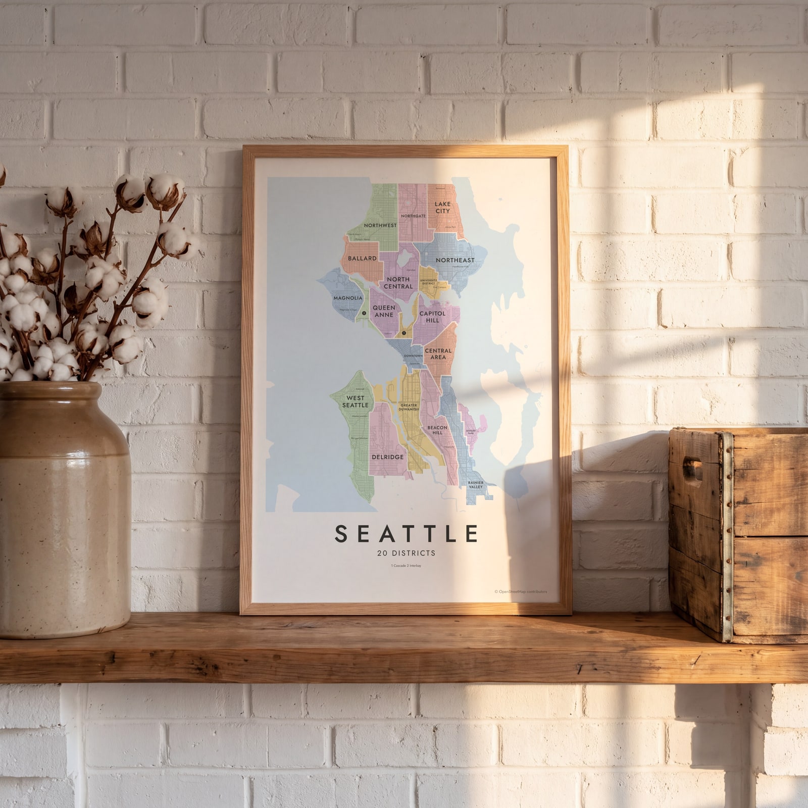
On the wall
A few of them framed at home. Open any one to make it yours.
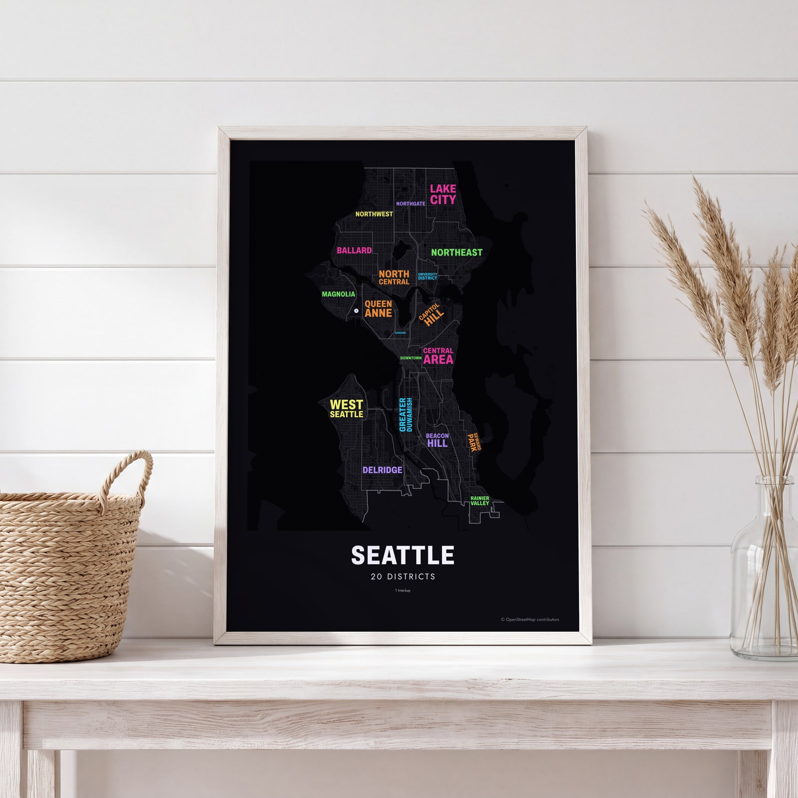 Typographic Seattle map: the names fill their districtsEdit this →
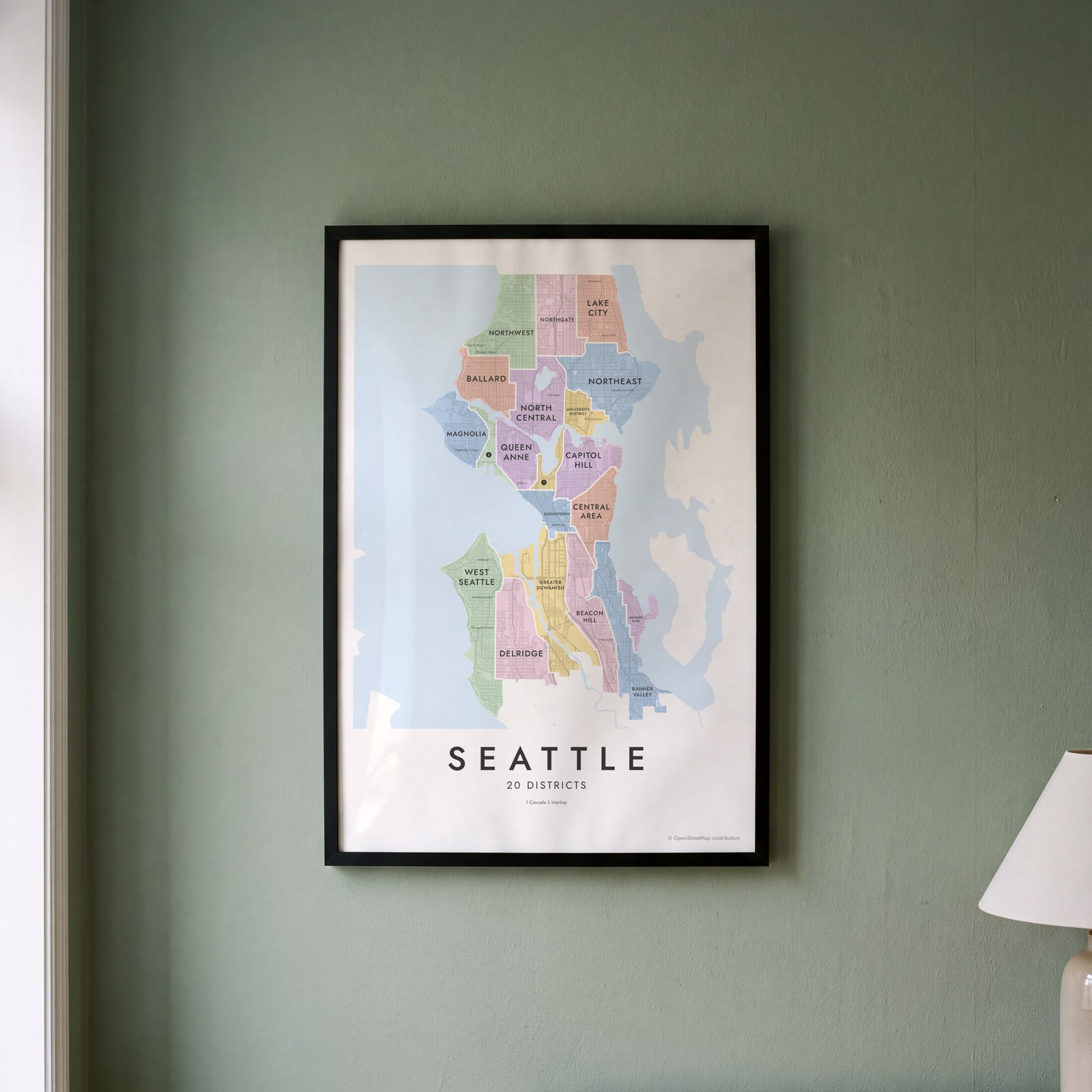
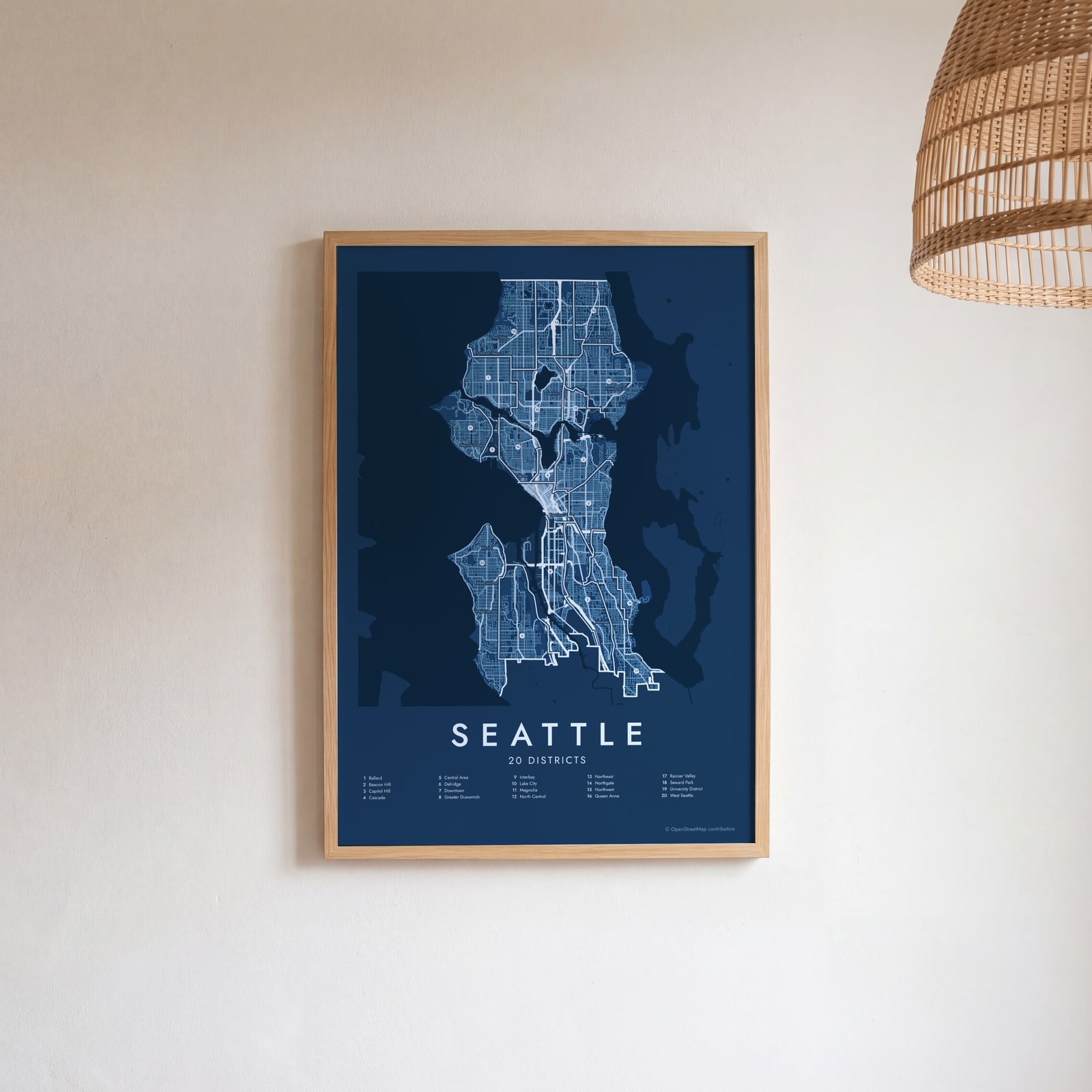 Seattle street map with numbered districts and their listEdit this →
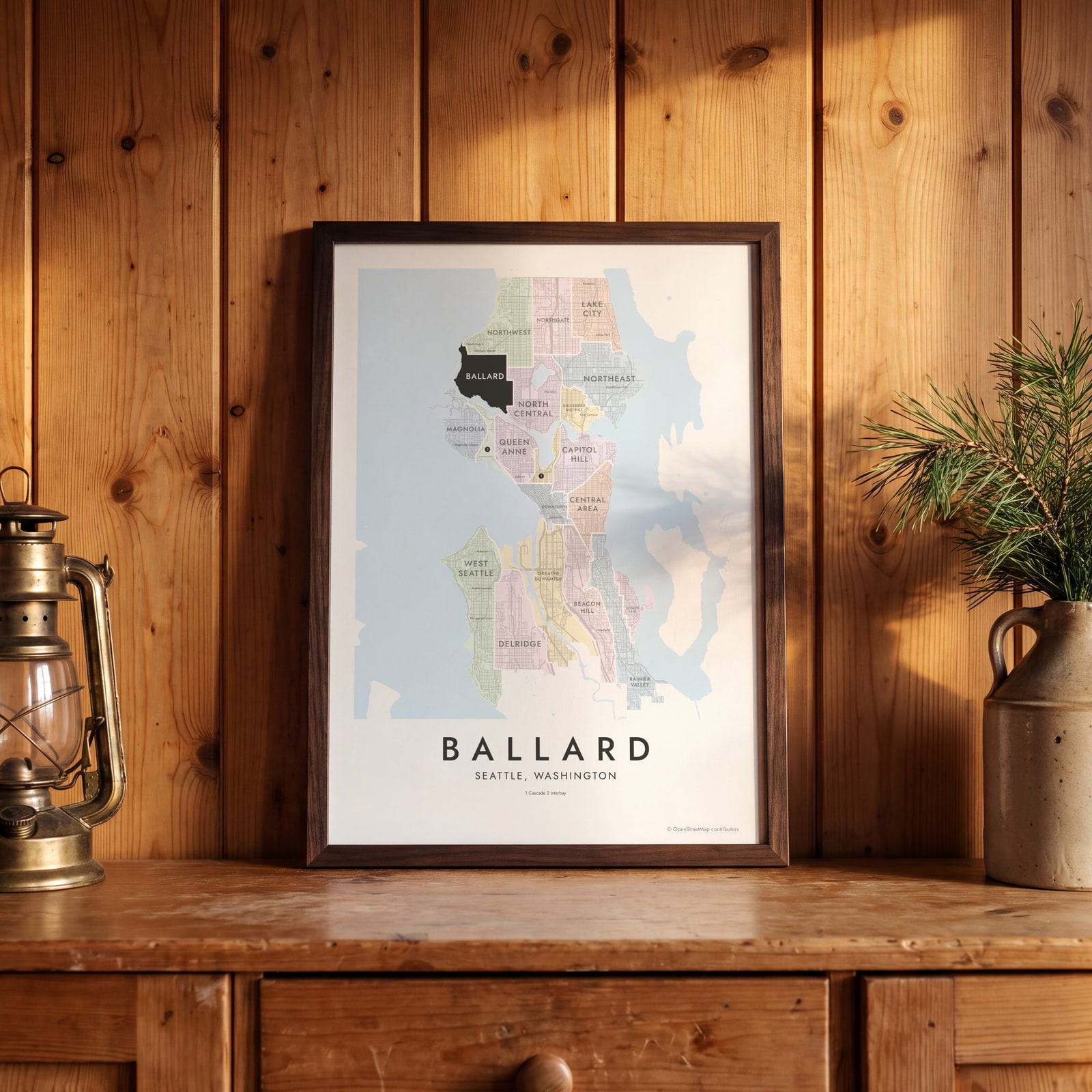 Ballard highlighted on a map of SeattleEdit this →
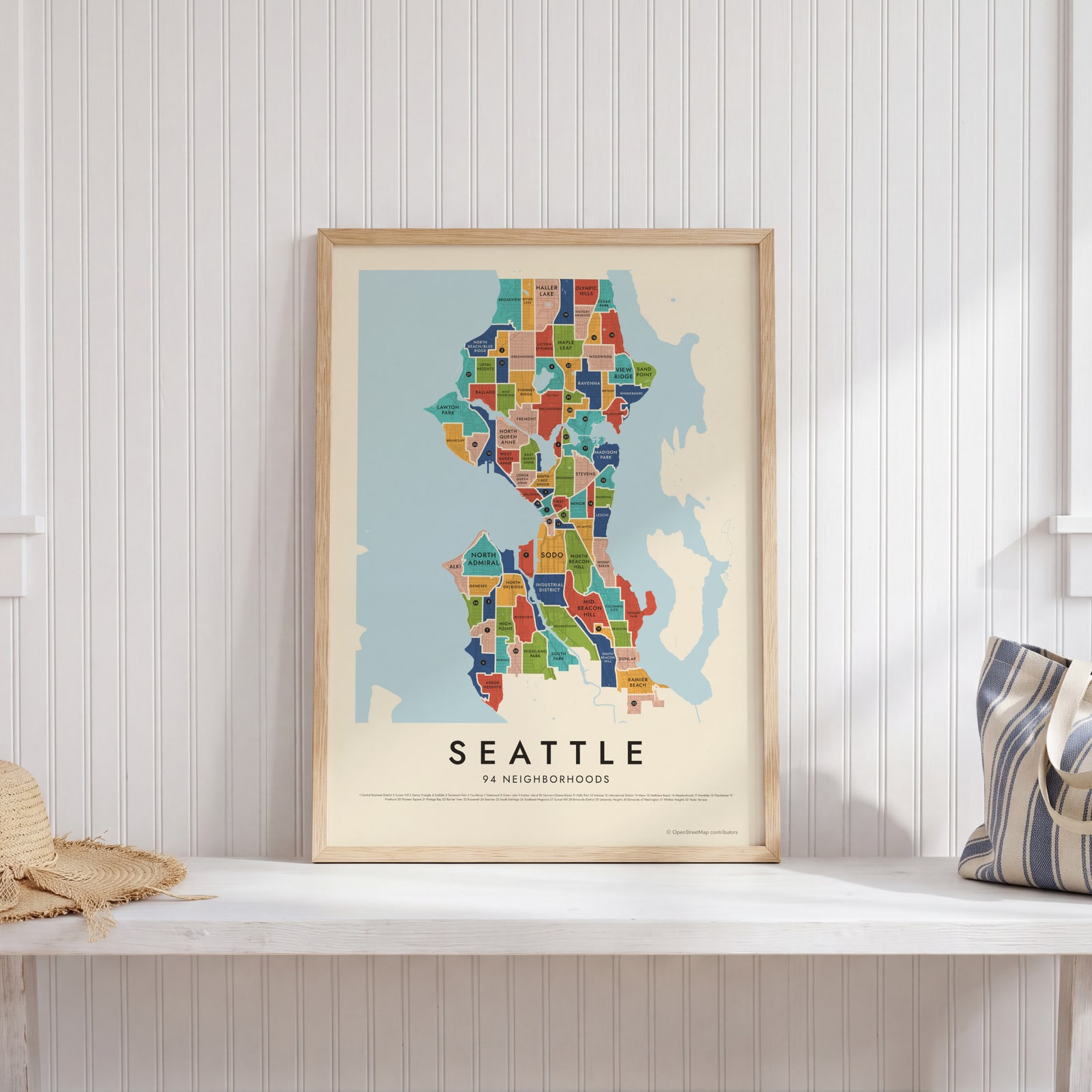 Seattle's 94 neighborhoods in colorEdit this →
 Seattle neighborhood map in color, every district namedEdit this →
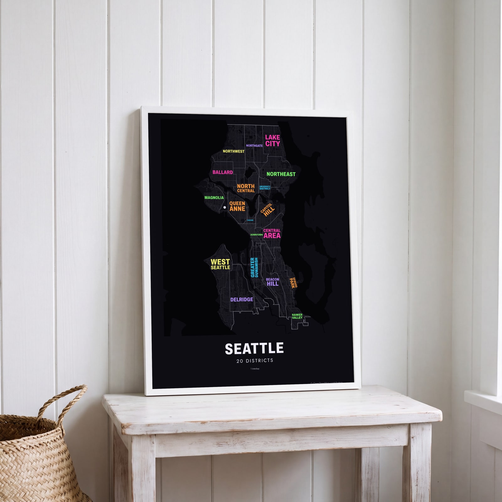 Typographic Seattle map: the names fill their districtsEdit this →
Examples
Open any of them to change the words, the place, the date and the style, then download the print file.
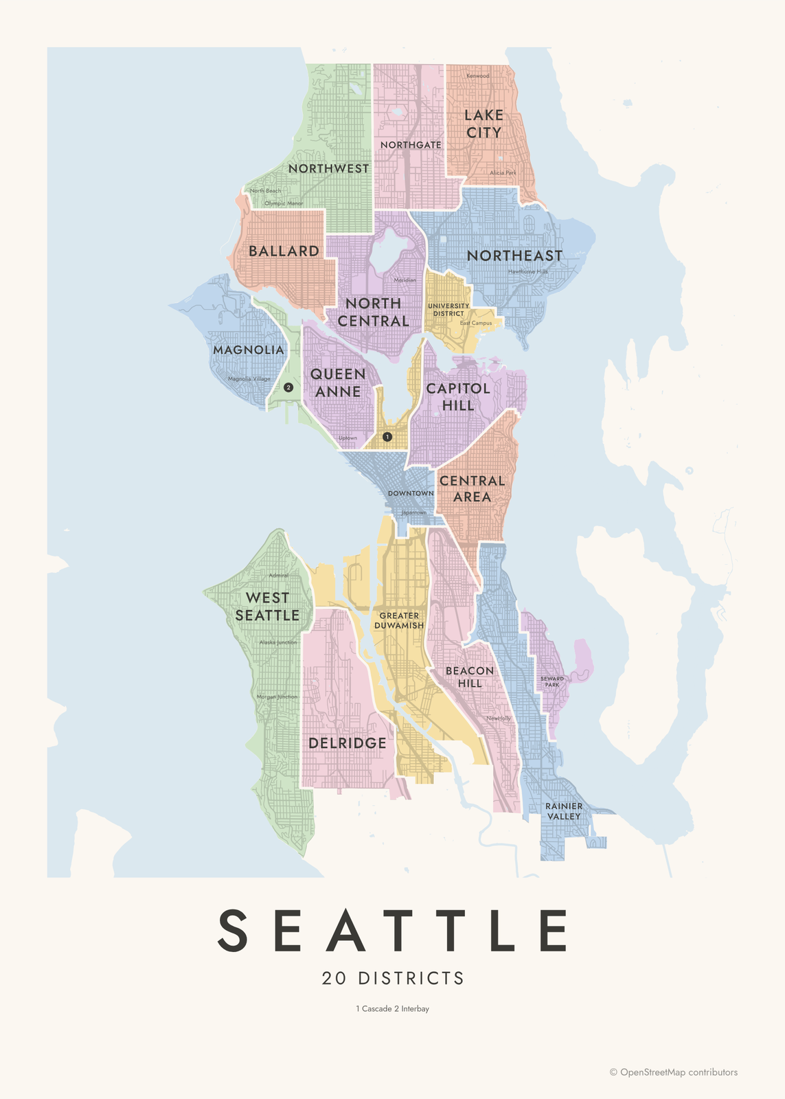 Seattle neighborhood map in color, every district namedEdit this →More neighborhood maps →
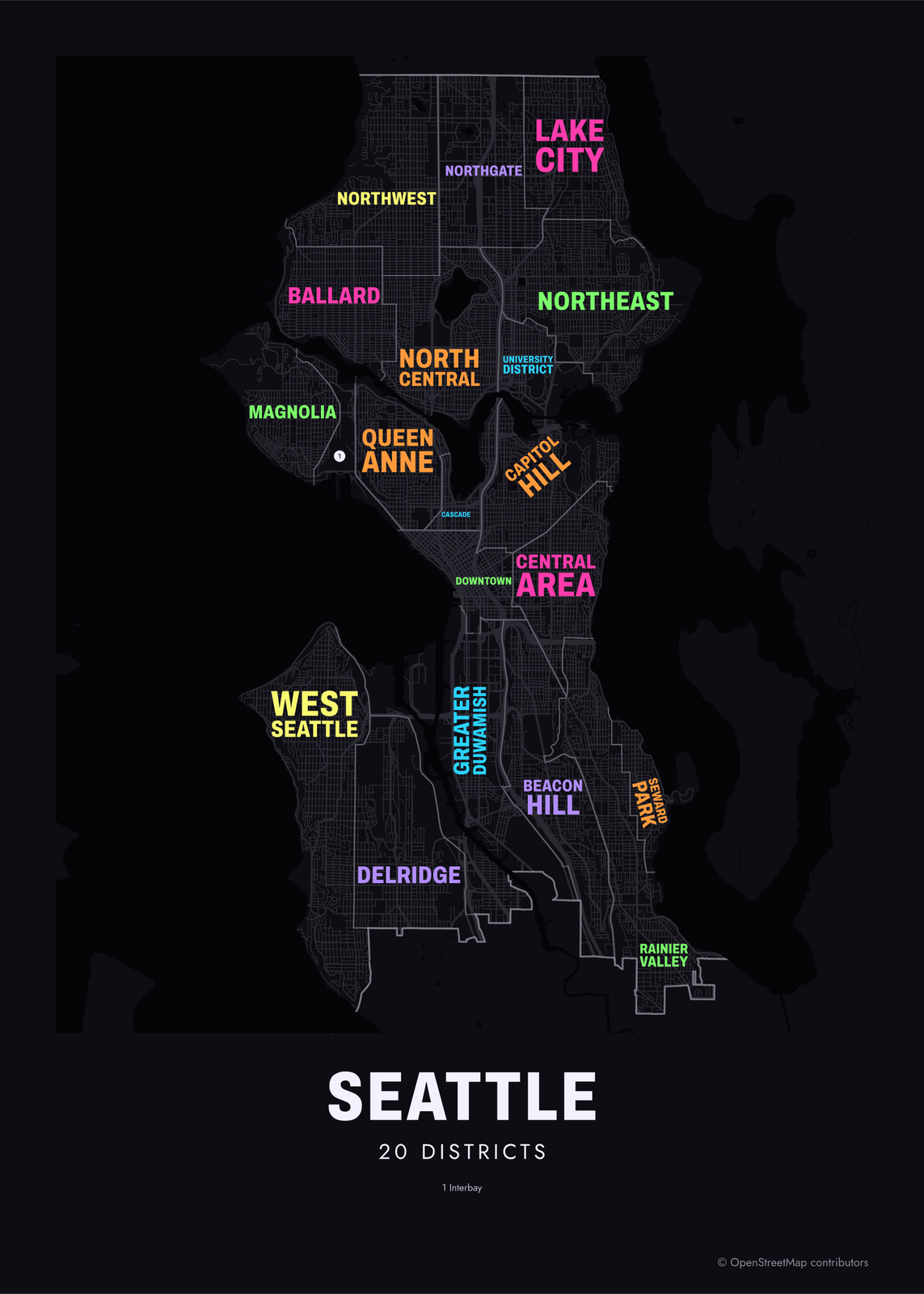 Typographic Seattle map: the names fill their districtsEdit this →More neighborhood maps →
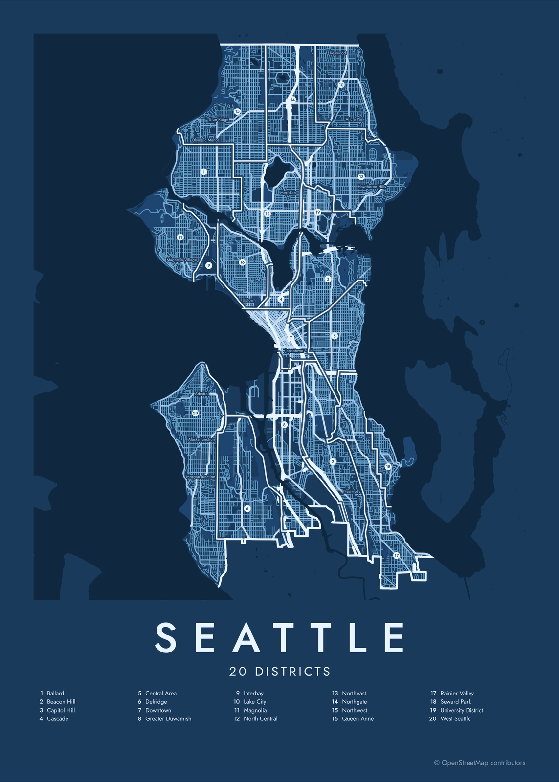 Seattle street map with numbered districts and their listEdit this →More neighborhood maps →
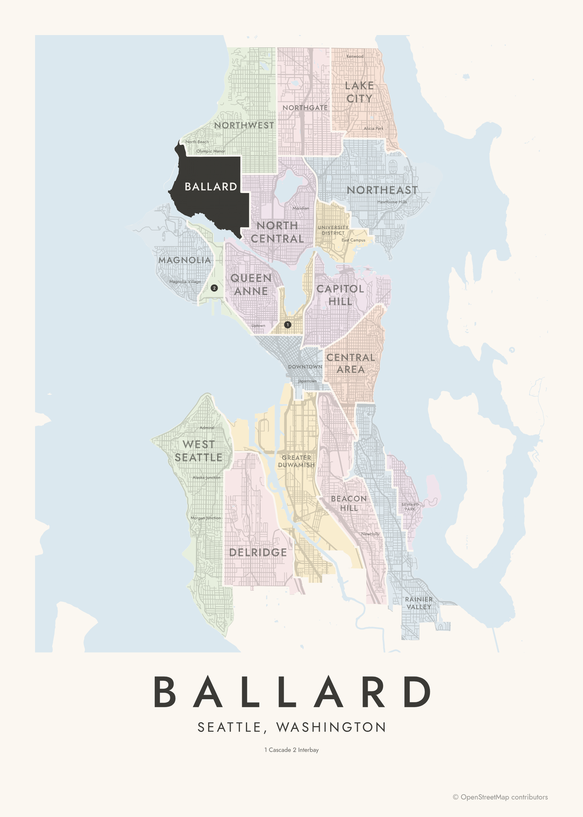 Ballard highlighted on a map of SeattleEdit this →More neighborhood maps →
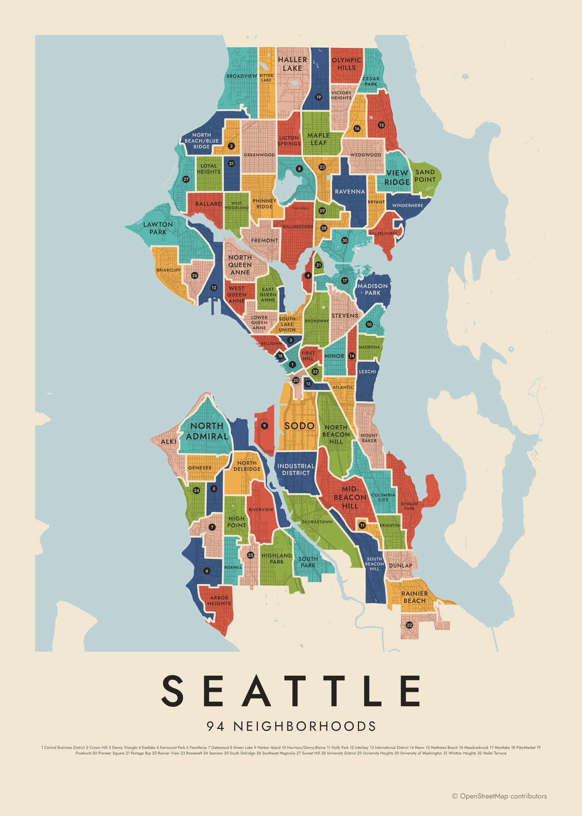 Seattle's 94 neighborhoods in colorEdit this →More neighborhood maps →
How Seattle is divided
Seattle has no official neighborhood map. Both levels here come from the City Clerk's Neighborhood Map Atlas, which the clerk uses to index city records by place. Its names draw on an older city map, library indexes and newspaper features.
The atlas works in two layers. The 20 districts are the big areas people use to describe the city, like Queen Anne, Magnolia and Rainier Valley. Each one splits into neighborhoods, 94 in all, so the Ballard district holds Loyal Heights, Sunset Hill and Whittier Heights. Names like Uptown, Othello and Morgan Junction appear as labels.
All 20 districts of Seattle
- Ballard
- Beacon Hill
- Capitol Hill
- Cascade
- Central Area
- Delridge
- Downtown
- Greater Duwamish
- Interbay
- Lake City
- Magnolia
- North Central
- Northeast
- Northgate
- Northwest
- Queen Anne
- Rainier Valley
- Seward Park
- University District
- West Seattle
All 94 neighborhoods of Seattle
- Alki
- Arbor Heights
- Atlantic
- Ballard
- Belltown
- Bitter Lake
- Briarcliff
- Brighton
- Broadview
- Broadway
- Bryant
- Cedar Park
- Central Business District
- Columbia City
- Crown Hill
- Denny Triangle
- Dunlap
- East Queen Anne
- Eastlake
- Fairmount Park
- Fauntleroy
- First Hill
- Fremont
- Gatewood
- Genesee
- Georgetown
- Green Lake
- Greenwood
- Haller Lake
- Harbor Island
- Harrison/Denny-Blaine
- High Point
- Highland Park
- Holly Park
- Industrial District
- Interbay
- International District
- Laurelhurst
- Lawton Park
- Leschi
- Licton Springs
- Lower Queen Anne
- Loyal Heights
- Madison Park
- Madrona
- Mann
- Maple Leaf
- Matthews Beach
- Meadowbrook
- Mid-Beacon Hill
- Minor
- Montlake
- Mount Baker
- North Admiral
- North Beach/Blue Ridge
- North Beacon Hill
- North Delridge
- North Queen Anne
- Olympic Hills
- Phinney Ridge
- Pike-Market
- Pinehurst
- Pioneer Square
- Portage Bay
- Rainier Beach
- Rainier View
- Ravenna
- Riverview
- Roosevelt
- Roxhill
- Sand Point
- Seaview
- Seward Park
- Sodo
- South Beacon Hill
- South Delridge
- South Lake Union
- South Park
- Southeast Magnolia
- Stevens
- Sunset Hill
- University District
- University Heights
- University of Washington
- Victory Heights
- View Ridge
- Wallingford
- Wedgwood
- West Queen Anne
- West Woodland
- Westlake
- Whittier Heights
- Windermere
- Yesler Terrace
More neighborhood names on the map
Inside the districts, the map also names 53 smaller neighborhoods where they fit, from OpenStreetMap: Chinatown-International District, South Seattle, Central District, Madison Valley, Washington Park, Denny-Blaine, Van Asselt, Jefferson Park, Rainier Vista, NewHolly, Othello, Hillman City, Lakewood, Carleton Park, Magnolia Village, Endolyne, North Beach, Morgan Junction, Alaska Junction, Admiral, Olympic Manor, Fairmont Springs, Arroyo Heights, Blue Ridge, Westwood, Youngstown, Uptown, Foy, West Edge, Meridian, Japantown, Chinatown, Little Saigon, West Campus, Greek Row, South Campus, Central Campus, University Park, East Campus, Kenwood and more. Turn them off under Names if you want only the districts.
Neighborhoods to know
- Pike-Market: Pike Place Market, open above the waterfront since 1907.
- Pioneer Square: the city's first downtown, rebuilt in brick and stone after the Great Seattle Fire of 1889.
- Capitol Hill: Volunteer Park, with its water tower and glass conservatory.
- Fremont: the Fremont Troll, a giant sculpture under the Aurora Bridge.
- Ballard: the Ballard Locks, where boats pass between Puget Sound and the city's lakes.
- Alki: the beach where the Denny Party landed in 1851, looking across Elliott Bay.
- Green Lake: a lake ringed by a busy walking and biking path.
- University District: the University of Washington campus and the Ave, its main street.
How to make your Seattle neighborhood poster
- Open the Seattle map and pick districts or neighborhoods.
- Pick a style: Colored areas, Typographic (the names fill the map) or a Street map with the borders over the streets.
- Tap your own neighborhood to highlight it; it becomes the poster's title.
- Drag and zoom to frame the whole city or just your part of it, then pick a size and download the print file.
Questions
How many neighborhoods does Seattle have?
There's no official count. The City Clerk's atlas, which this map uses, has 20 districts and 94 neighborhoods, and locals use many more names.
What's the difference between a district and a neighborhood on this map?
Districts are the 20 broad areas, like West Seattle or Northeast. Neighborhoods are their parts: West Seattle, for example, includes Alki, Fauntleroy and North Admiral.
Is Bellevue part of Seattle?
No. Bellevue is a separate city across Lake Washington, and so are Shoreline, Burien and Mercer Island, so they're not on this map.
Where do the Seattle boundaries come from?
From OpenStreetMap (© OpenStreetMap contributors) and City of Seattle and City of Seattle. Streets and water are OpenStreetMap's. Boundaries are a snapshot and can differ from what neighbors call home; tell us if one looks wrong.
What sizes can I print?
US Letter, 8 × 10, 11 × 14, 12 × 16 and 12 × 18 in, A4 and A3, free. You download a 300 DPI JPEG drawn at the size you pick. Larger prints, up to 24 × 36 in, are coming soon.
Related




Gift ideas by occasion




Every example is made with the Posterage generators. Change anything, then download it as a 300 DPI JPEG.