St. Louis neighborhood map all 79 neighborhoods, named
This poster maps the City of St. Louis split into its 79 official neighborhoods, each one named, from Baden on the north side to Carondelet on the south. Highlight the one you call home, pick a style and print it.
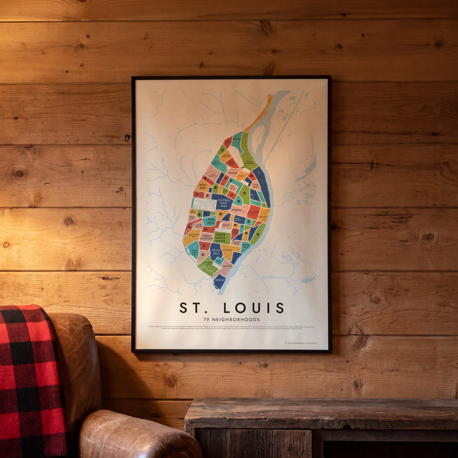
On the wall
A few of them framed at home. Open any one to make it yours.
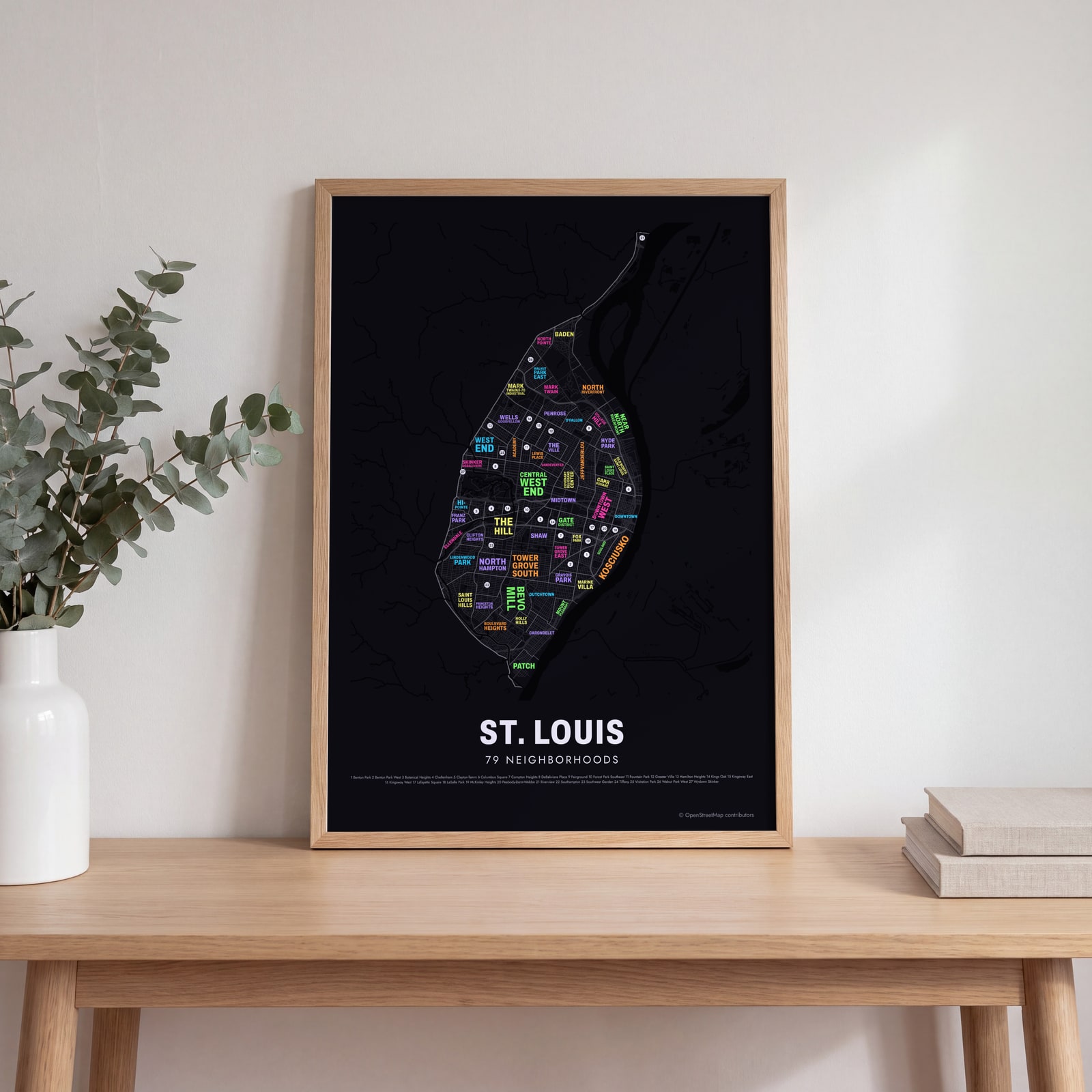 Typographic St. Louis map: the names fill their neighborhoodsEdit this →
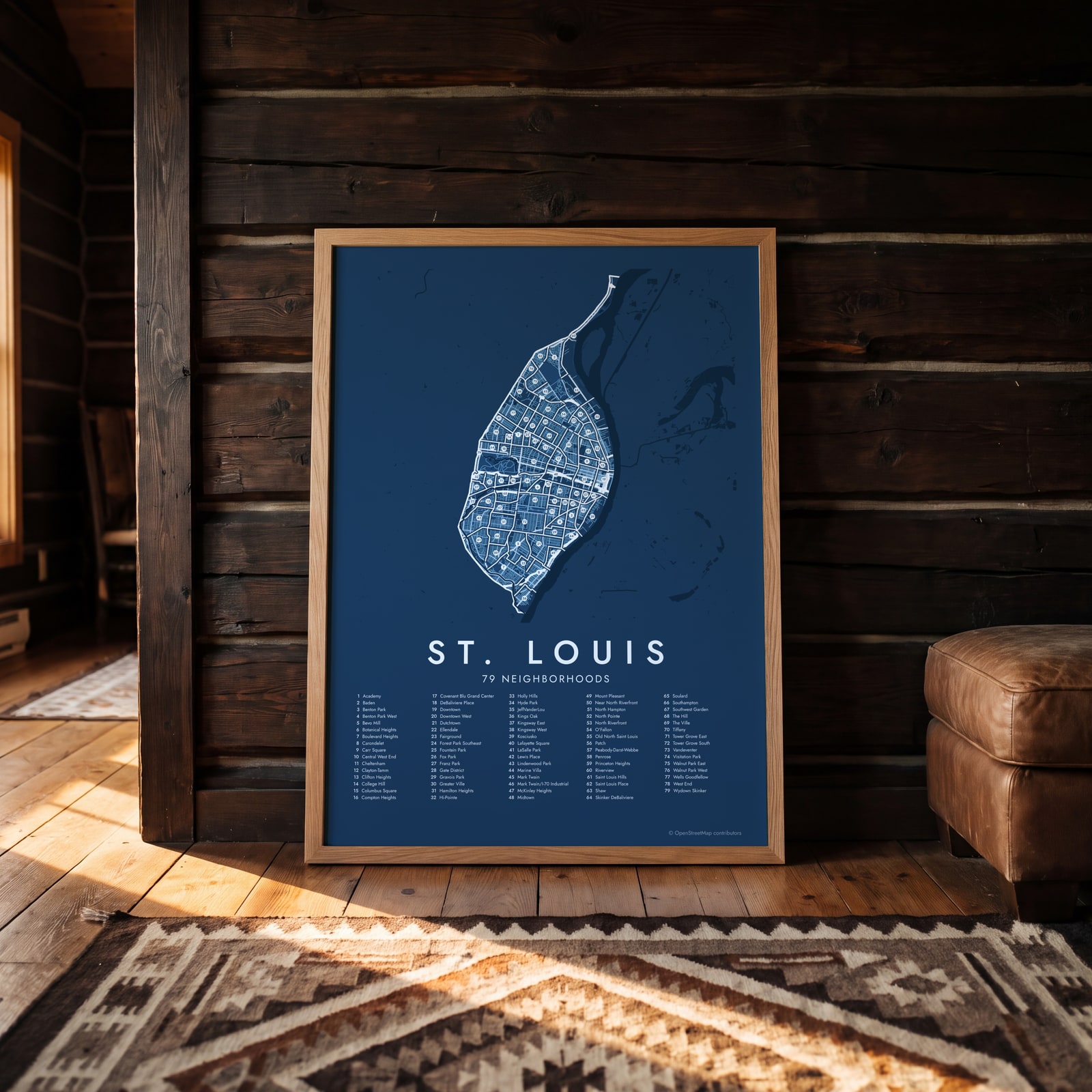 St. Louis street map with numbered neighborhoods and their listEdit this →
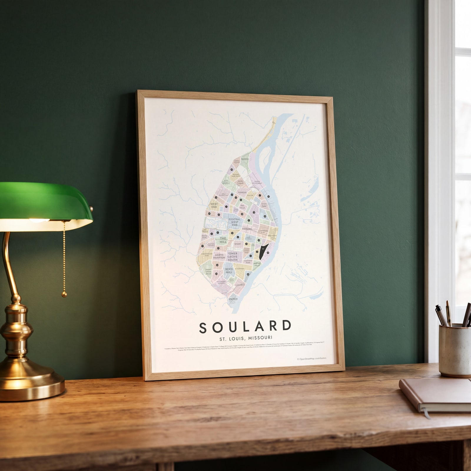 Soulard highlighted on a map of St. LouisEdit this →
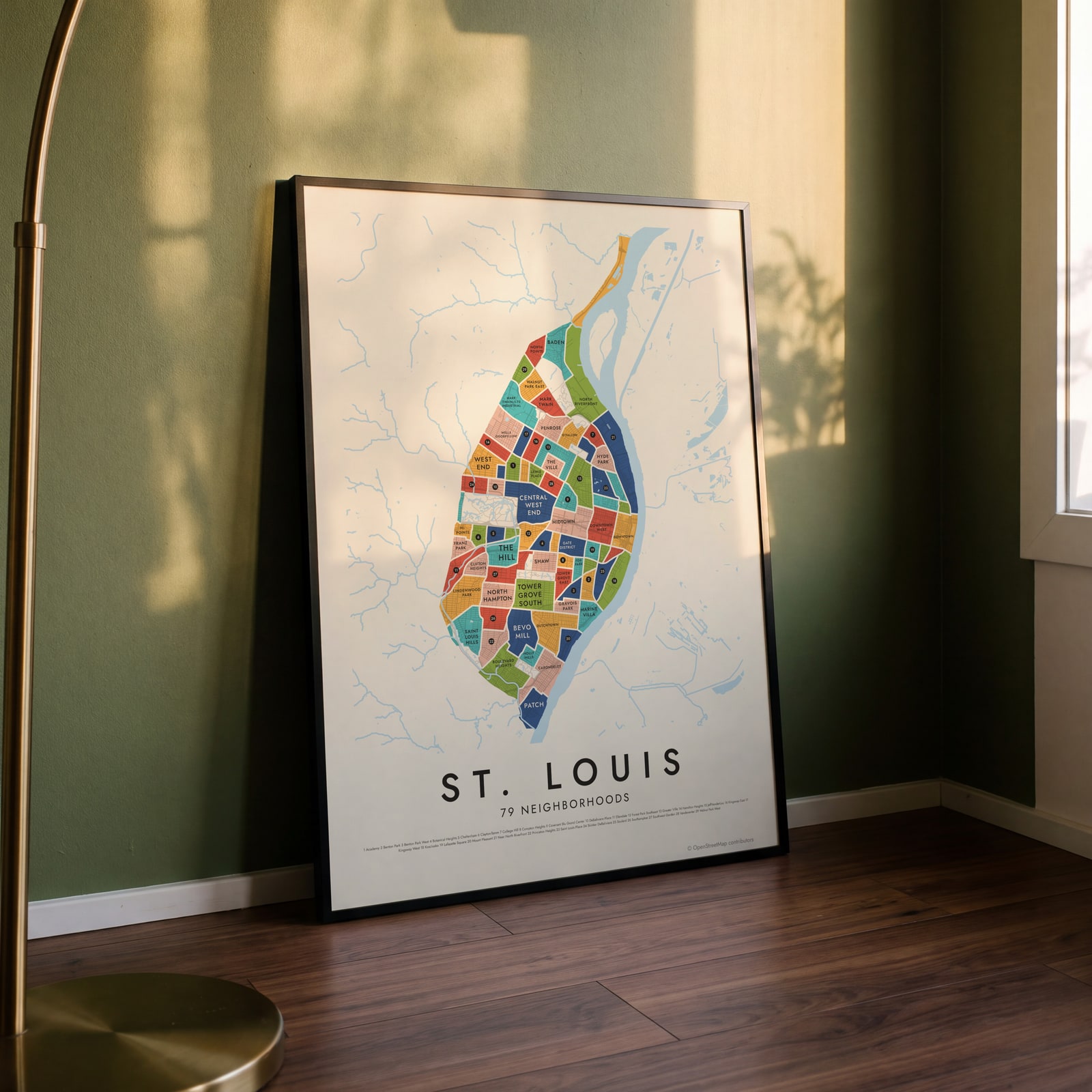 St. Louis neighborhood map in color, every neighborhood namedEdit this →
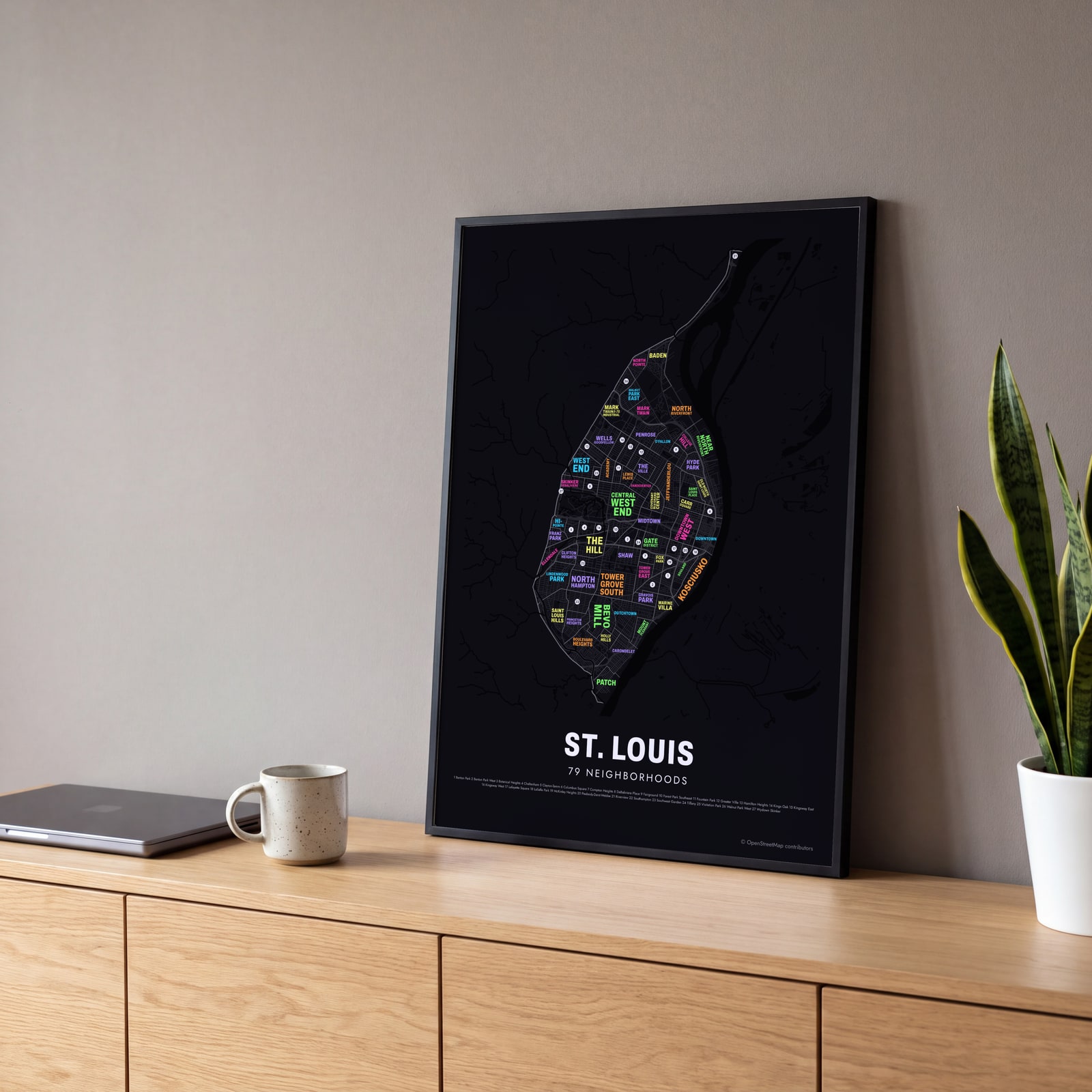 Typographic St. Louis map: the names fill their neighborhoodsEdit this →
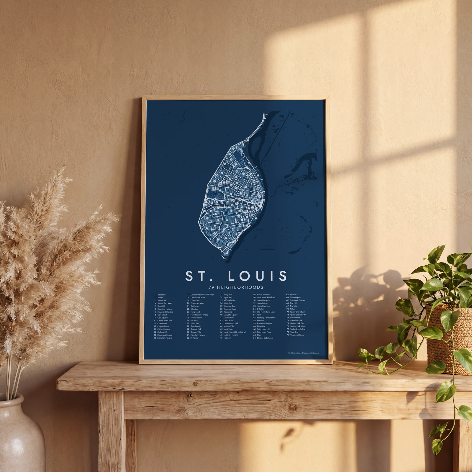 St. Louis street map with numbered neighborhoods and their listEdit this →
Examples
Open any of them to change the words, the place, the date and the style, then download the print file.
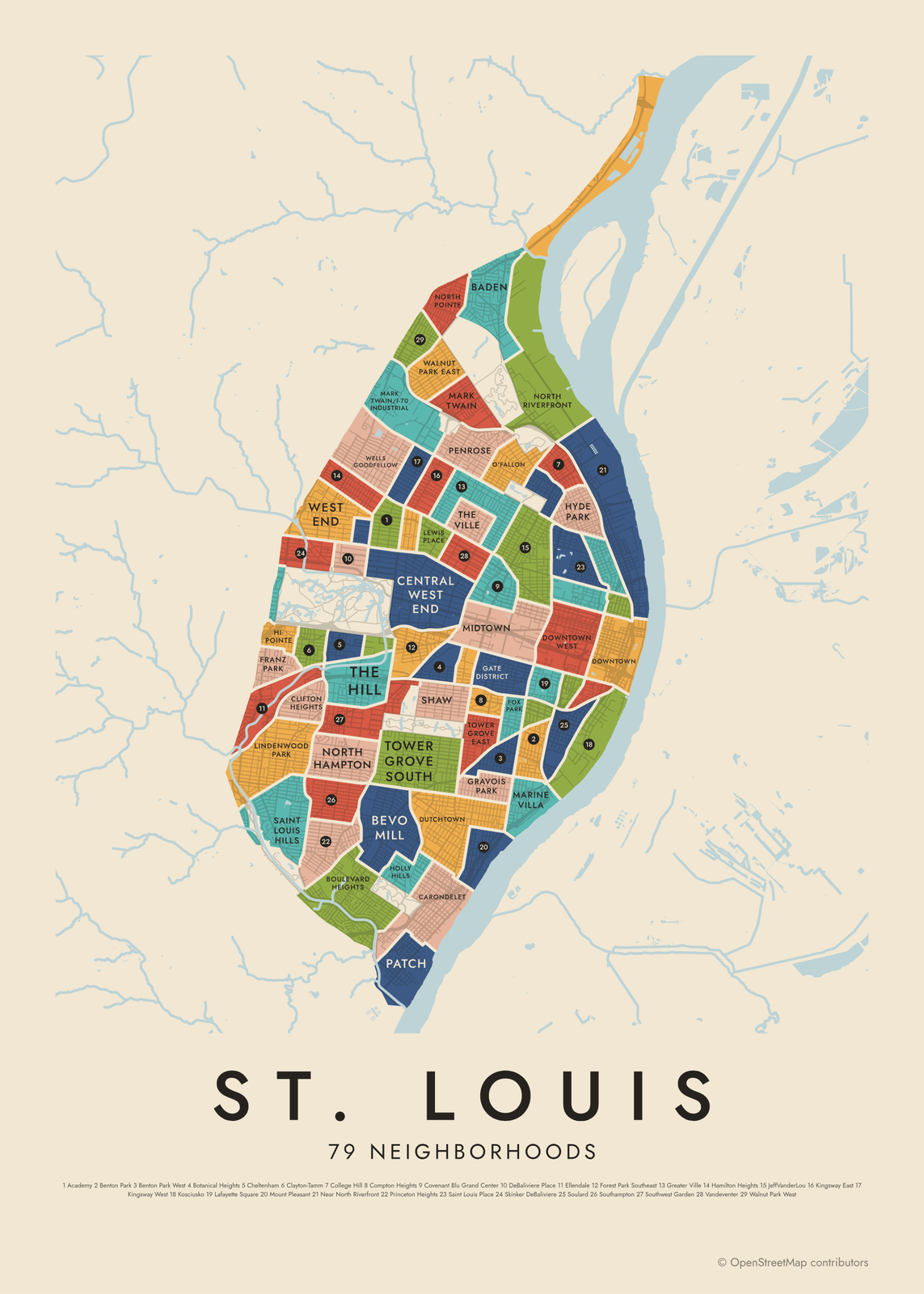 St. Louis neighborhood map in color, every neighborhood namedEdit this →More neighborhood maps →
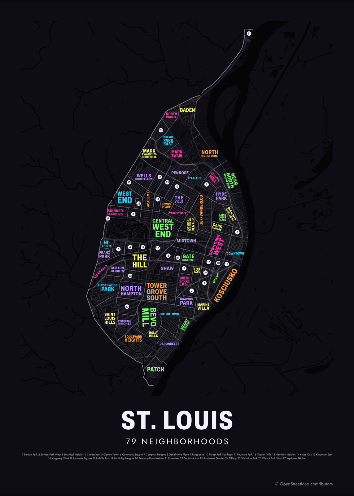 Typographic St. Louis map: the names fill their neighborhoodsEdit this →More neighborhood maps →
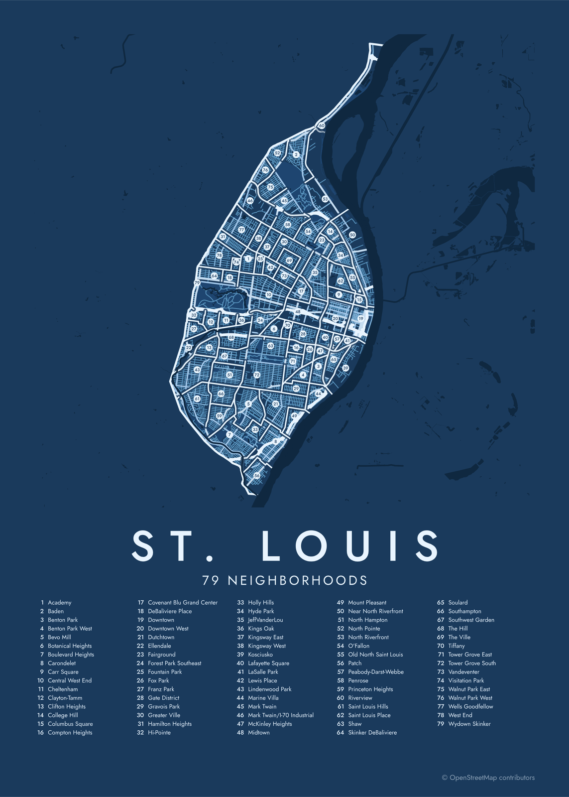 St. Louis street map with numbered neighborhoods and their listEdit this →More neighborhood maps →
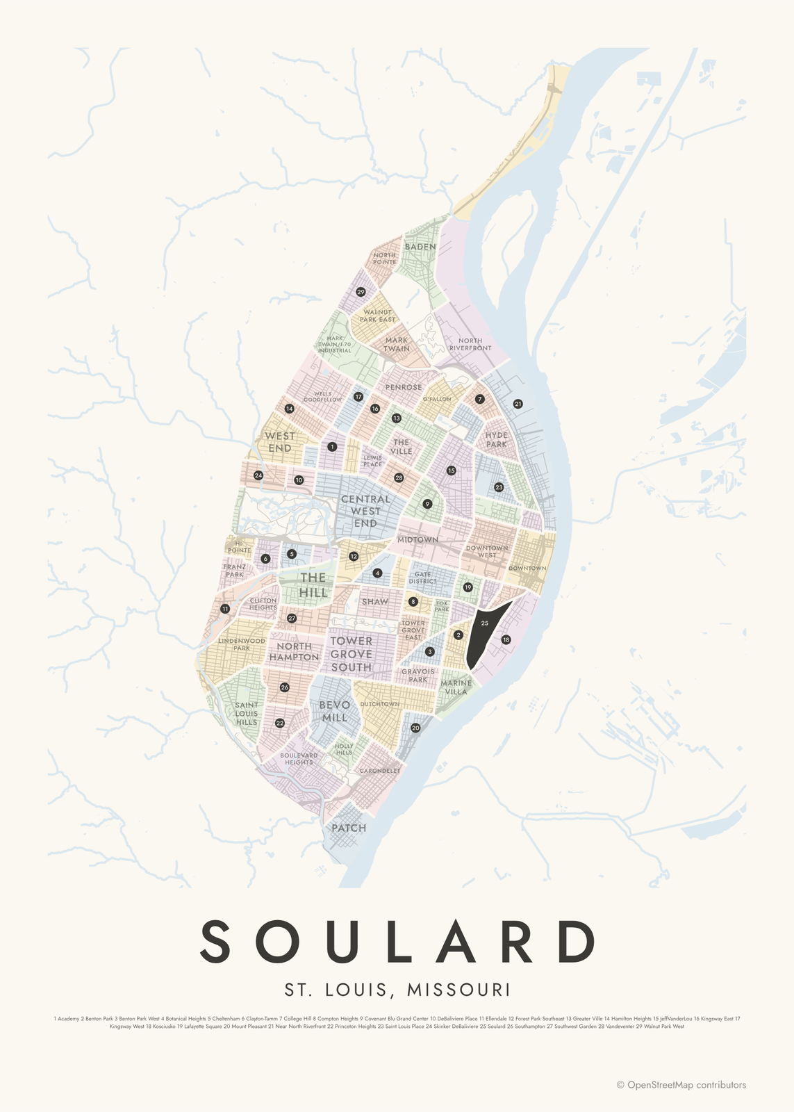 Soulard highlighted on a map of St. LouisEdit this →More neighborhood maps →
How St. Louis is divided
The City of St. Louis officially recognizes 79 neighborhoods, and most locals know theirs by name. The city's planning agency publishes a map for each one, and the borders here follow that list. The biggest parks, like Forest Park and Tower Grove Park, aren't part of any neighborhood.
St. Louis has been independent of St. Louis County since 1876, so the map stops at the city line. Suburbs like Clayton, Kirkwood and University City aren't on it. Names follow the map data, which spells out Saint, as in Saint Louis Hills and Old North Saint Louis.
All 79 neighborhoods of St. Louis
- Academy
- Baden
- Benton Park
- Benton Park West
- Bevo Mill
- Botanical Heights
- Boulevard Heights
- Carondelet
- Carr Square
- Central West End
- Cheltenham
- Clayton-Tamm
- Clifton Heights
- College Hill
- Columbus Square
- Compton Heights
- Covenant Blu Grand Center
- DeBaliviere Place
- Downtown
- Downtown West
- Dutchtown
- Ellendale
- Fairground
- Forest Park Southeast
- Fountain Park
- Fox Park
- Franz Park
- Gate District
- Gravois Park
- Greater Ville
- Hamilton Heights
- Hi-Pointe
- Holly Hills
- Hyde Park
- JeffVanderLou
- Kings Oak
- Kingsway East
- Kingsway West
- Kosciusko
- Lafayette Square
- LaSalle Park
- Lewis Place
- Lindenwood Park
- Marine Villa
- Mark Twain
- Mark Twain/I-70 Industrial
- McKinley Heights
- Midtown
- Mount Pleasant
- Near North Riverfront
- North Hampton
- North Pointe
- North Riverfront
- O'Fallon
- Old North Saint Louis
- Patch
- Peabody-Darst-Webbe
- Penrose
- Princeton Heights
- Riverview
- Saint Louis Hills
- Saint Louis Place
- Shaw
- Skinker DeBaliviere
- Soulard
- Southampton
- Southwest Garden
- The Hill
- The Ville
- Tiffany
- Tower Grove East
- Tower Grove South
- Vandeventer
- Visitation Park
- Walnut Park East
- Walnut Park West
- Wells Goodfellow
- West End
- Wydown Skinker
Neighborhoods to know
- Downtown: the Gateway Arch and its park on the Mississippi riverfront.
- Soulard: red-brick rowhouses south of downtown, with Soulard Market.
- The Hill: an Italian American neighborhood of restaurants and bakeries, where Yogi Berra and Joe Garagiola grew up on the same block.
- Central West End: shops along Euclid Avenue and the Cathedral Basilica of Saint Louis, next to Forest Park.
- Lafayette Square: Victorian townhouses around Lafayette Park.
- Carondelet: founded in 1767 and a separate city until St. Louis annexed it in 1870.
- Forest Park Southeast: home to The Grove, a strip of bars and restaurants on Manchester Avenue.
- Old North Saint Louis: brick rowhouses north of downtown, with Crown Candy Kitchen, a soda fountain from 1913.
How to make your St. Louis neighborhood poster
- Open the St. Louis map.
- Pick a style: Colored areas, Typographic (the names fill the map) or a Street map with the borders over the streets.
- Tap your own neighborhood to highlight it; it becomes the poster's title.
- Drag and zoom to frame the whole city or just your part of it, then pick a size and download the print file.
Questions
How many neighborhoods does St. Louis have?
The city officially recognizes 79, and all 79 are on this map. Large parks like Forest Park and Tower Grove Park sit outside them.
Is St. Louis City part of St. Louis County?
No. St. Louis split from the county in 1876 and has been an independent city since. Clayton, Kirkwood, Webster Groves and University City are in the county, so they aren't on this map.
Is Forest Park a neighborhood?
No. Forest Park is one of the city's large parks and isn't counted among the 79 neighborhoods. The Central West End, DeBaliviere Place, Skinker DeBaliviere and Forest Park Southeast border it.
Where do the St. Louis boundaries come from?
From OpenStreetMap (© OpenStreetMap contributors). Streets and water are OpenStreetMap's. Boundaries are a snapshot and can differ from what neighbors call home; tell us if one looks wrong.
What sizes can I print?
US Letter, 8 × 10, 11 × 14, 12 × 16 and 12 × 18 in, A4 and A3, free. You download a 300 DPI JPEG drawn at the size you pick. Larger prints, up to 24 × 36 in, are coming soon.
Related




Gift ideas by occasion




Every example is made with the Posterage generators. Change anything, then download it as a 300 DPI JPEG.