Staten Island neighborhood map 23 areas and 62 neighborhood names
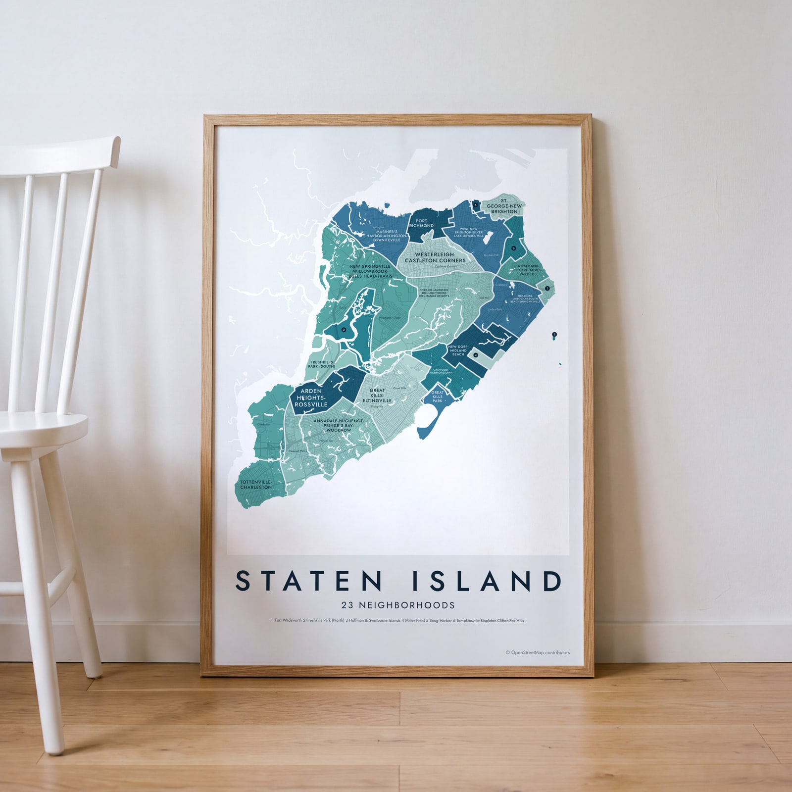
This poster maps Staten Island split into the 23 neighborhood areas New York City uses for its census data, each one named. Because those areas are large, the map also prints 62 neighborhood names islanders use, from St. George to Tottenville. Highlight the one you call home and print it.
On the wall
A few of them framed at home. Open any one to make it yours.
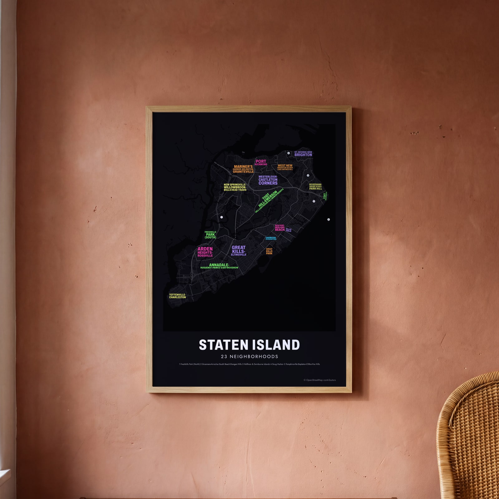 Typographic Staten Island map: the names fill their neighborhoodsEdit this →
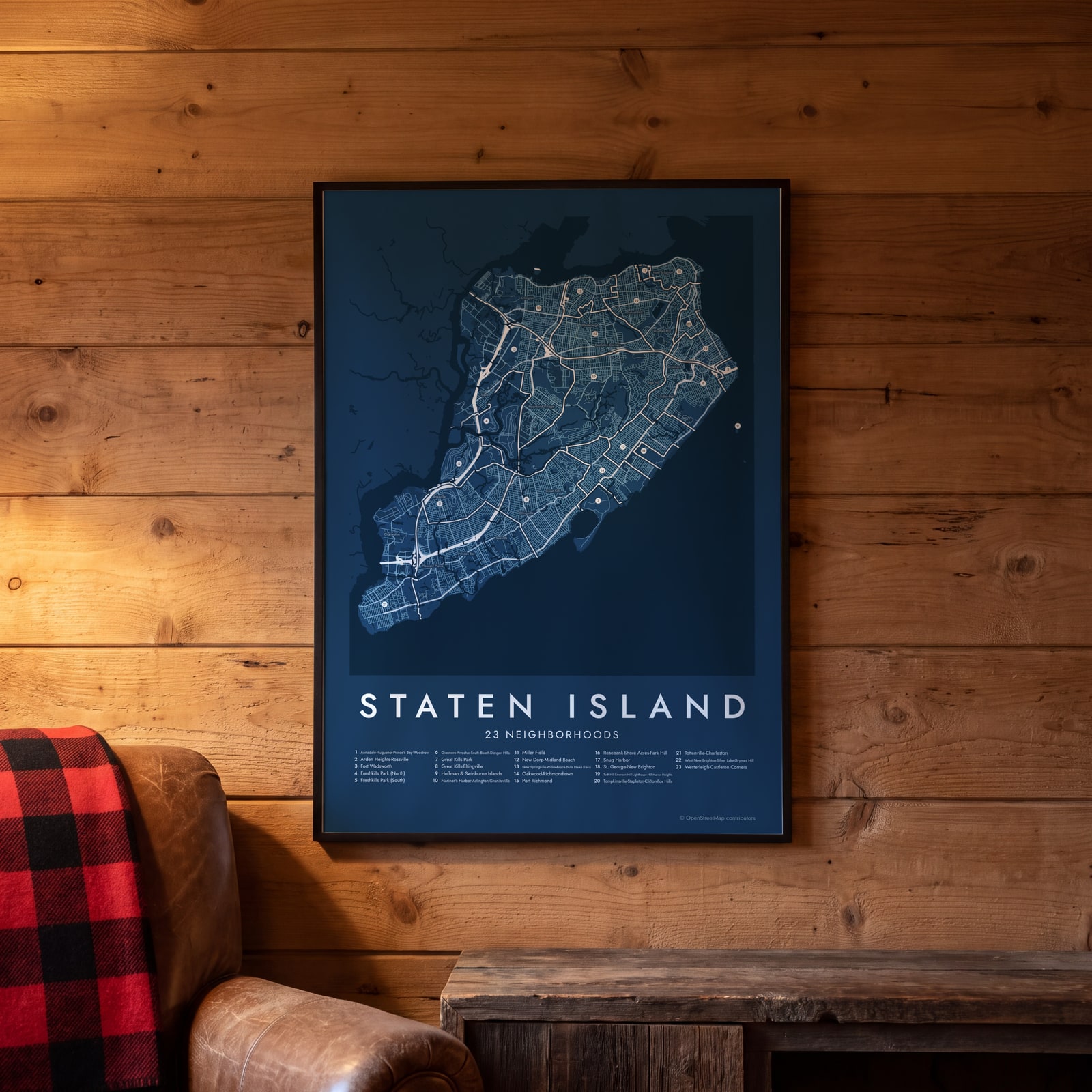 Staten Island street map with numbered neighborhoods and their listEdit this →
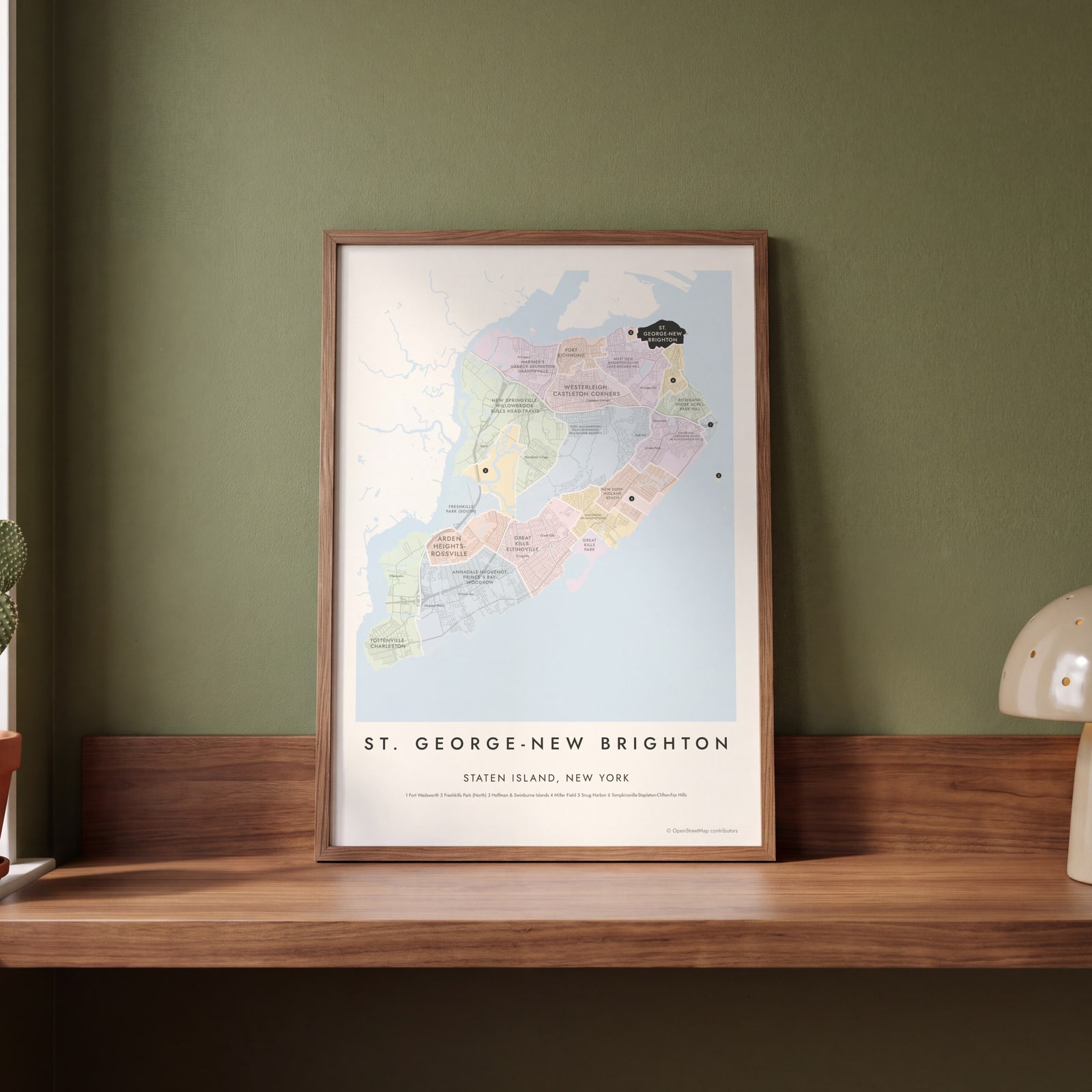 St. George-New Brighton highlighted on a map of Staten IslandEdit this →
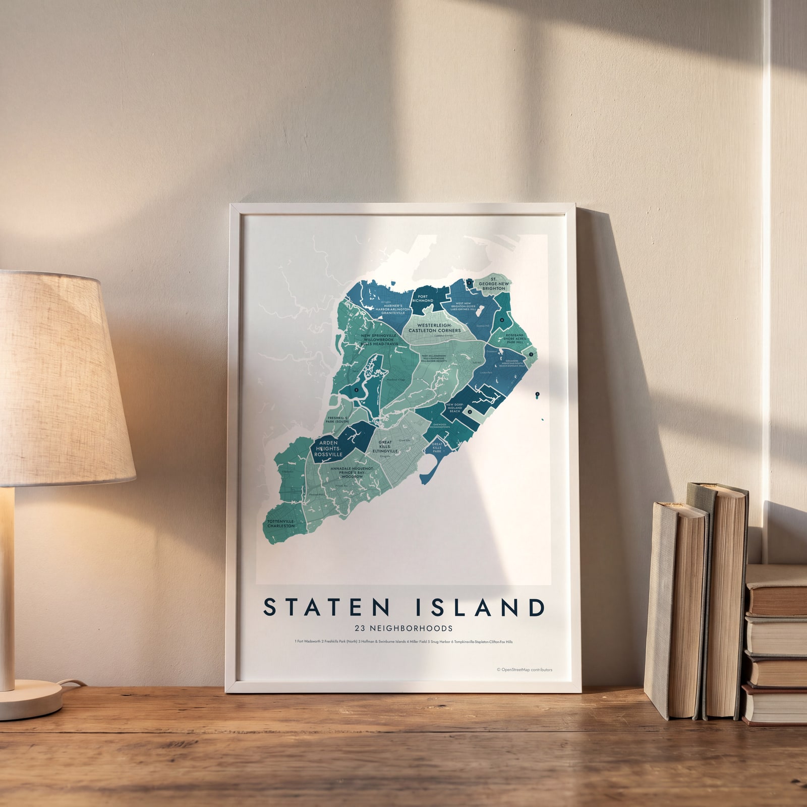 Staten Island neighborhood map in color, every neighborhood namedEdit this →
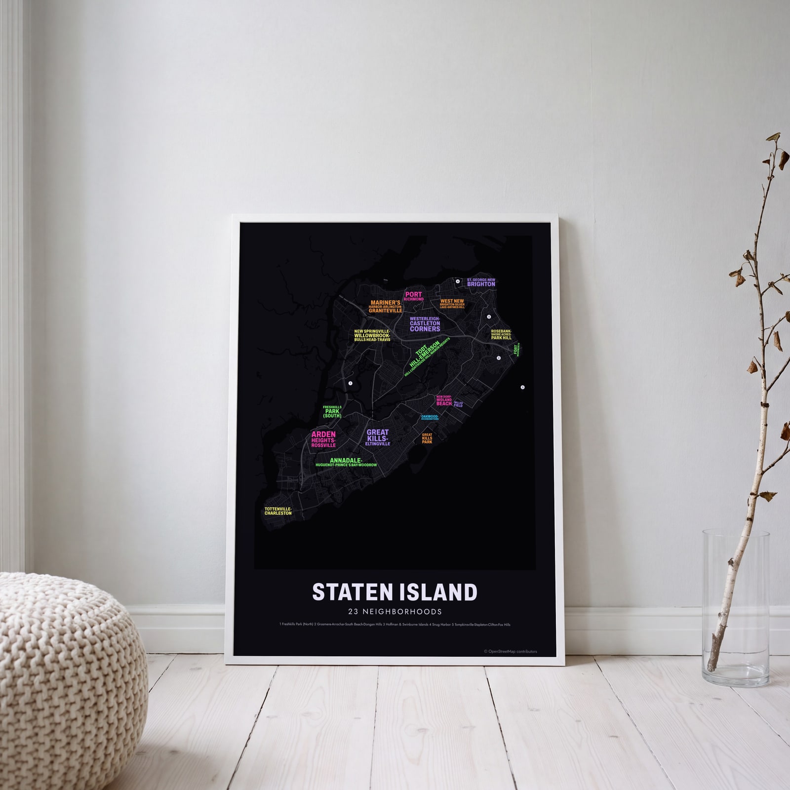 Typographic Staten Island map: the names fill their neighborhoodsEdit this →
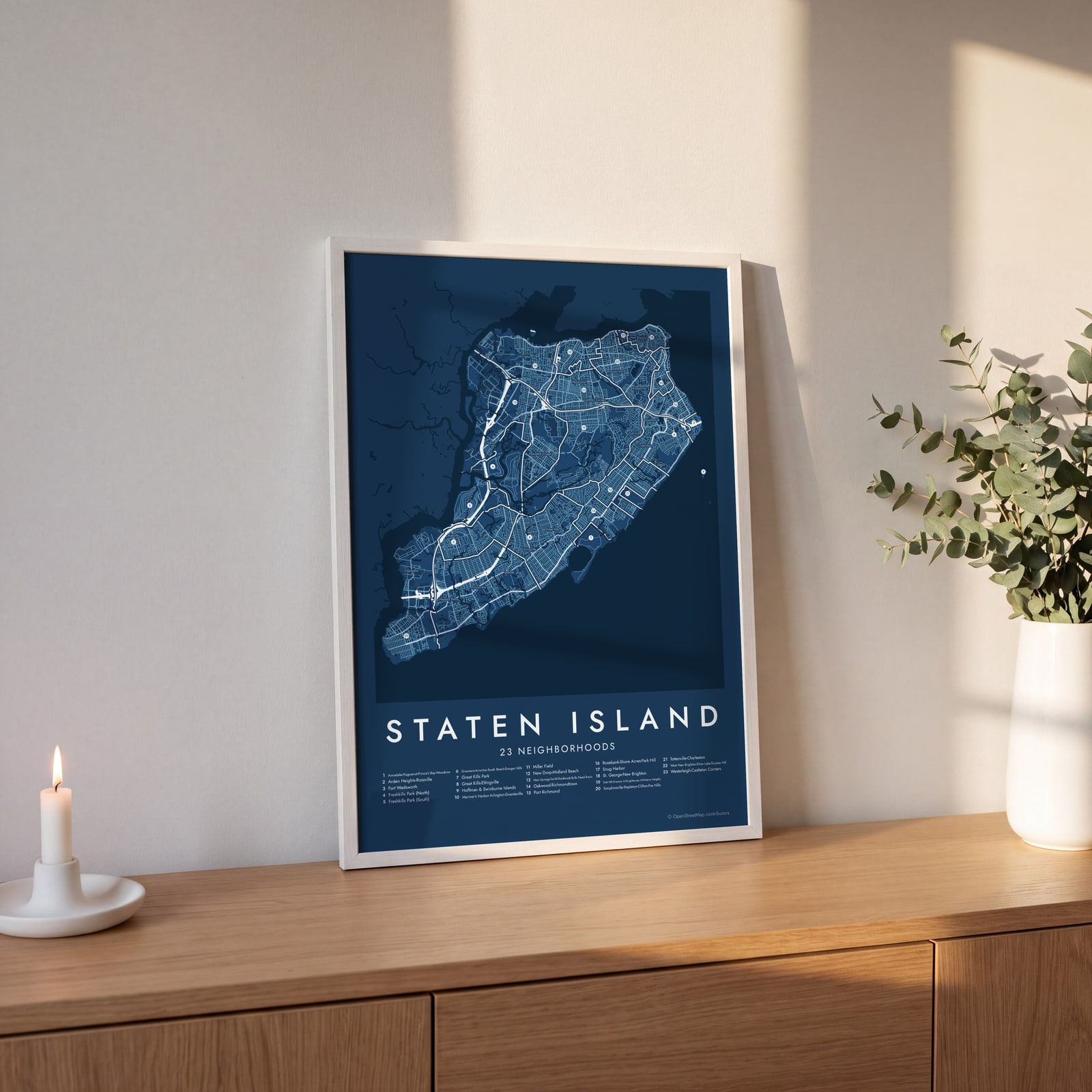 Staten Island street map with numbered neighborhoods and their listEdit this →
Examples
Open any of them to change the words, the place, the date and the style, then download the print file.
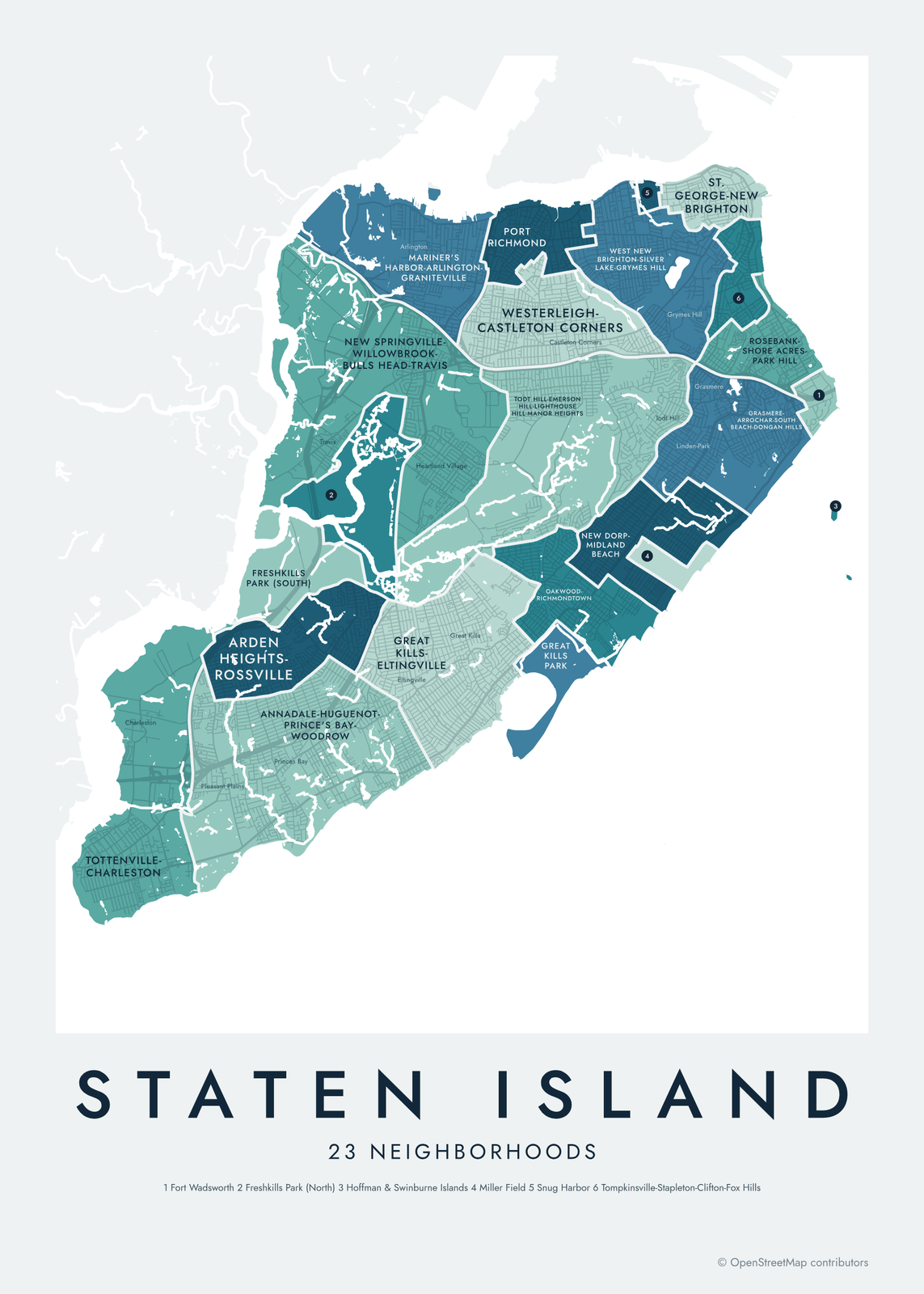 Staten Island neighborhood map in color, every neighborhood namedEdit this →More neighborhood maps →
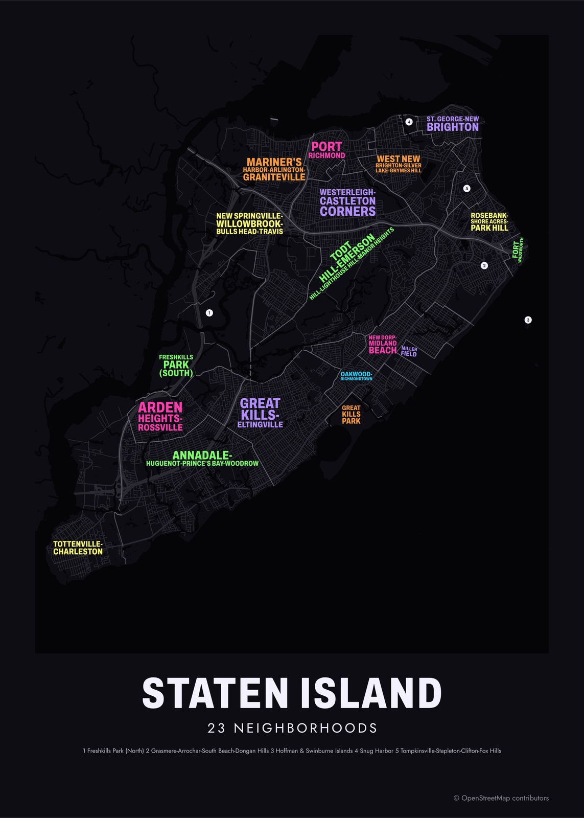 Typographic Staten Island map: the names fill their neighborhoodsEdit this →More neighborhood maps →
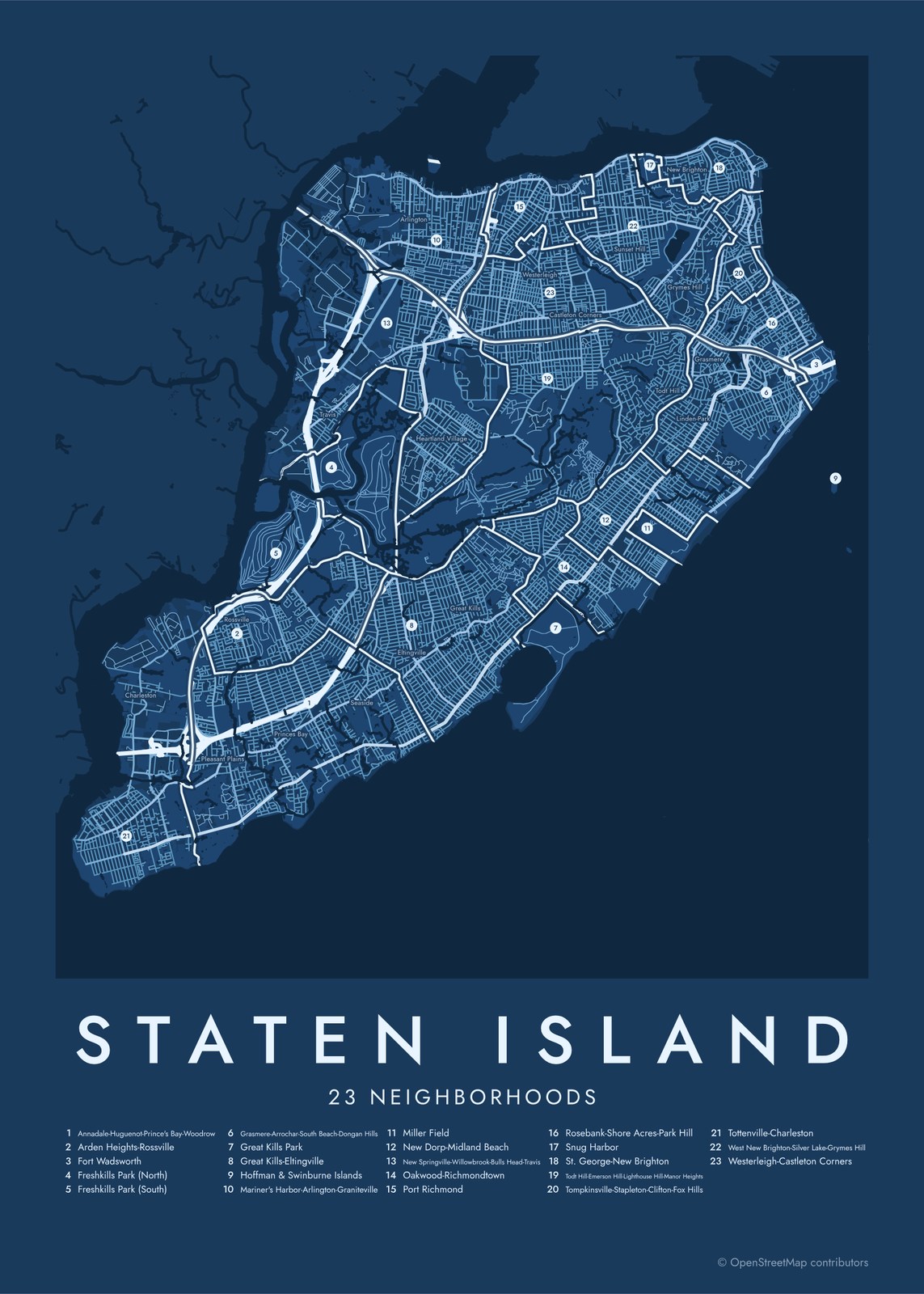 Staten Island street map with numbered neighborhoods and their listEdit this →More neighborhood maps →
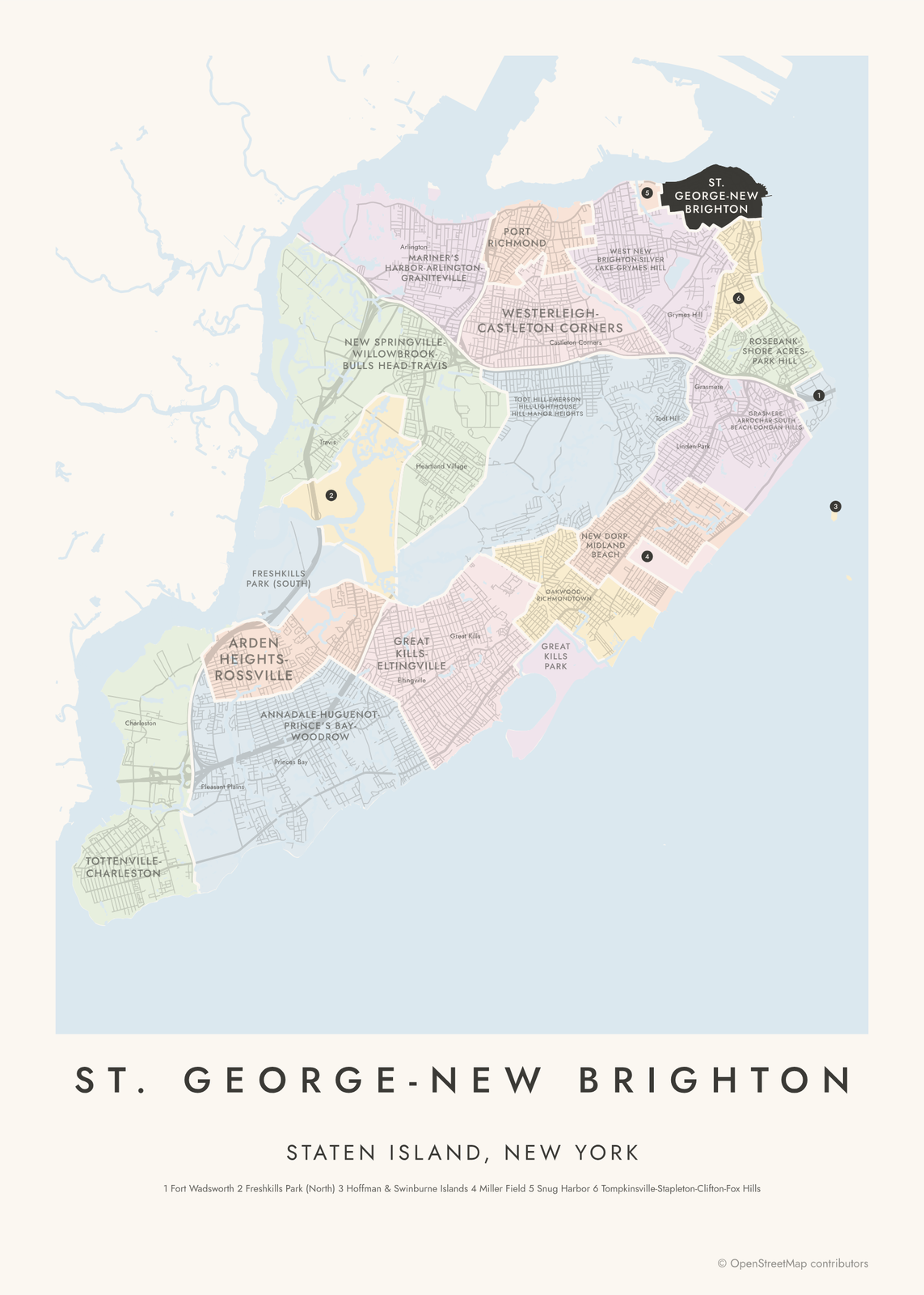 St. George-New Brighton highlighted on a map of Staten IslandEdit this →More neighborhood maps →
How Staten Island is divided
The areas on this map are Staten Island's Neighborhood Tabulation Areas, drawn by the NYC Department of City Planning from census tracts for the 2020 Census. Staten Island is less densely built than the other boroughs, so each area takes in several neighborhoods and carries a long name like Todt Hill-Emerson Hill-Lighthouse Hill-Manor Heights. Sixteen are residential. The other 7 are parkland and other special areas, such as Freshkills Park, Fort Wadsworth, Snug Harbor and Hoffman & Swinburne Islands.
Islanders usually name smaller places, so the map adds 62 neighborhood names as labels: New Dorp, Great Kills, Westerleigh, Mariners Harbor and more. People also split the island into the North Shore, Mid-Island and South Shore, which roughly match its three community districts.
All 23 neighborhoods of Staten Island
- Annadale-Huguenot-Prince's Bay-Woodrow
- Arden Heights-Rossville
- Fort Wadsworth
- Freshkills Park (North)
- Freshkills Park (South)
- Grasmere-Arrochar-South Beach-Dongan Hills
- Great Kills Park
- Great Kills-Eltingville
- Hoffman & Swinburne Islands
- Mariner's Harbor-Arlington-Graniteville
- Miller Field
- New Dorp-Midland Beach
- New Springville-Willowbrook-Bulls Head-Travis
- Oakwood-Richmondtown
- Port Richmond
- Rosebank-Shore Acres-Park Hill
- Snug Harbor
- St. George-New Brighton
- Todt Hill-Emerson Hill-Lighthouse Hill-Manor Heights
- Tompkinsville-Stapleton-Clifton-Fox Hills
- Tottenville-Charleston
- West New Brighton-Silver Lake-Grymes Hill
- Westerleigh-Castleton Corners
More neighborhood names on the map
Inside the neighborhoods, the map also names 62 smaller neighborhoods where they fit, from OpenStreetMap: Tottenville, Charleston, Richmond Valley, Pleasant Plains, Rossville, Princes Bay, Woodrow, Gulfport, Chelsea, Huguenot, Travis, Fresh Kills, Old Place, Port Ivory, Seaside, Bloomfield, Annadale, Greenridge, Eltingville, Arlington, New Springville, Woods of Arden, Bulls Head, Mariners Harbor, Heartland Village, Great Kills, Elm Park, Graniteville, Willowbrook, Bay Terrace, Westerleigh, Richmond, Oakwood Heights Station, Castleton Corners, Oakwood, New Dorp, Oakwood Beach, West New Brighton, Sunset Hill, New Dorp Beach and more. Turn them off under Names if you want only the neighborhoods.
Neighborhoods to know
- St. George-New Brighton: where the Staten Island Ferry lands from Manhattan, next to Borough Hall.
- Snug Harbor: a 19th-century home for retired sailors, now a cultural center and botanical garden.
- Fort Wadsworth: a fort on the Narrows at the foot of the Verrazzano-Narrows Bridge, now part of Gateway National Recreation Area.
- Freshkills Park (North): parkland on the former Fresh Kills Landfill, which closed in 2001.
- Oakwood-Richmondtown: home to Historic Richmond Town, a museum village at the island's old county seat.
- Todt Hill: the highest natural point in New York City.
- Tottenville: the southern tip of Staten Island and of New York State, with the Conference House, where British and American delegates met in 1776 in a failed attempt to end the Revolutionary War.
- Great Kills Park: a shoreline park with beaches and a marina, part of Gateway National Recreation Area.
How to make your Staten Island neighborhood poster
- Open the Staten Island map.
- Pick a style: Colored areas, Typographic (the names fill the map) or a Street map with the borders over the streets.
- Tap your own neighborhood to highlight it; it becomes the poster's title.
- Drag and zoom to frame the whole city or just your part of it, then pick a size and download the print file.
Questions
How many neighborhoods does Staten Island have?
There's no official count. City planners split the island into 23 Neighborhood Tabulation Areas, 16 of them residential, and those are the areas on this map. Islanders use many more names, and 62 of them appear on the map as labels.
Is Staten Island part of New York City?
Yes. Staten Island has been one of the city's five boroughs since 1898. It's also Richmond County, with the same borders.
What are the North Shore, Mid-Island and South Shore?
They're the informal thirds of the island, and they roughly match its three community districts. The North Shore takes in St. George, Port Richmond and Mariners Harbor. Mid-Island covers places like New Dorp and Todt Hill, and the South Shore runs from Great Kills to Tottenville.
Where do the Staten Island boundaries come from?
From OpenStreetMap (© OpenStreetMap contributors) and NYC Department of City Planning. Streets and water are OpenStreetMap's. Boundaries are a snapshot and can differ from what neighbors call home; tell us if one looks wrong.
What sizes can I print?
US Letter, 8 × 10, 11 × 14, 12 × 16 and 12 × 18 in, A4 and A3, free. You download a 300 DPI JPEG drawn at the size you pick. Larger prints, up to 24 × 36 in, are coming soon.
Related




Gift ideas by occasion




Every example is made with the Posterage generators. Change anything, then download it as a 300 DPI JPEG.