Tampa neighborhood map 5 planning districts, 126 neighborhoods
This poster maps Tampa as its five planning districts: Central Tampa, South Tampa, Westshore, New Tampa and the University Area. Switch to 126 neighborhoods for a finer map, from Ybor City and Hyde Park to Davis Islands and Seminole Heights. Highlight yours and print it.
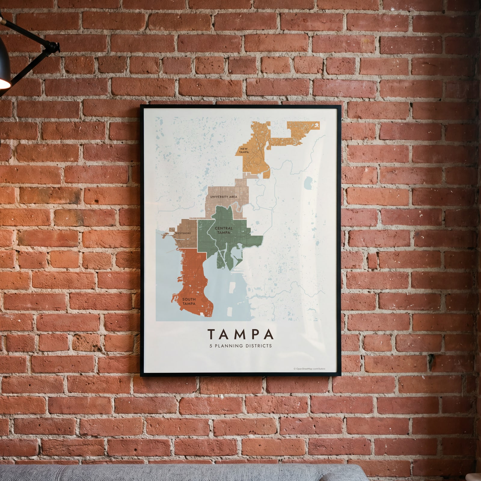
On the wall
A few of them framed at home. Open any one to make it yours.
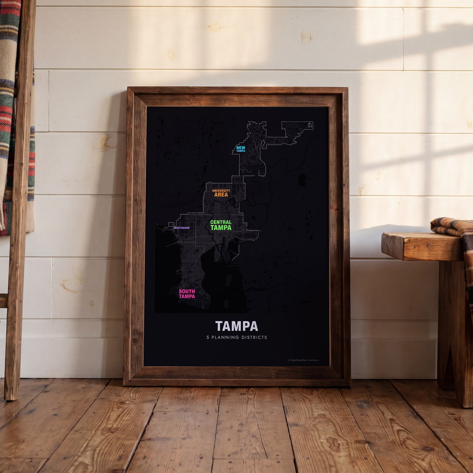 Typographic Tampa map: the names fill their planning districtsEdit this →
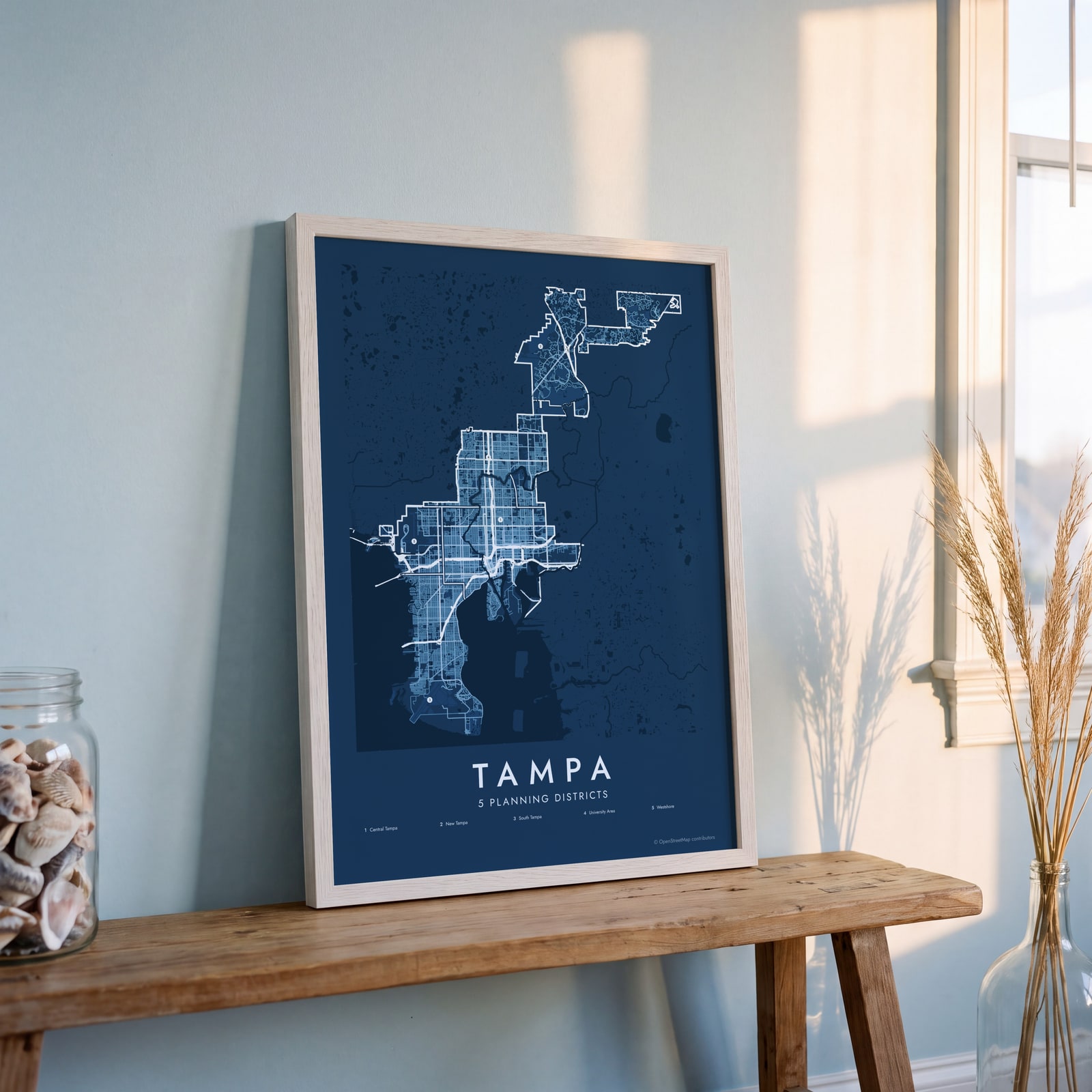 Tampa street map with numbered planning districts and their listEdit this →
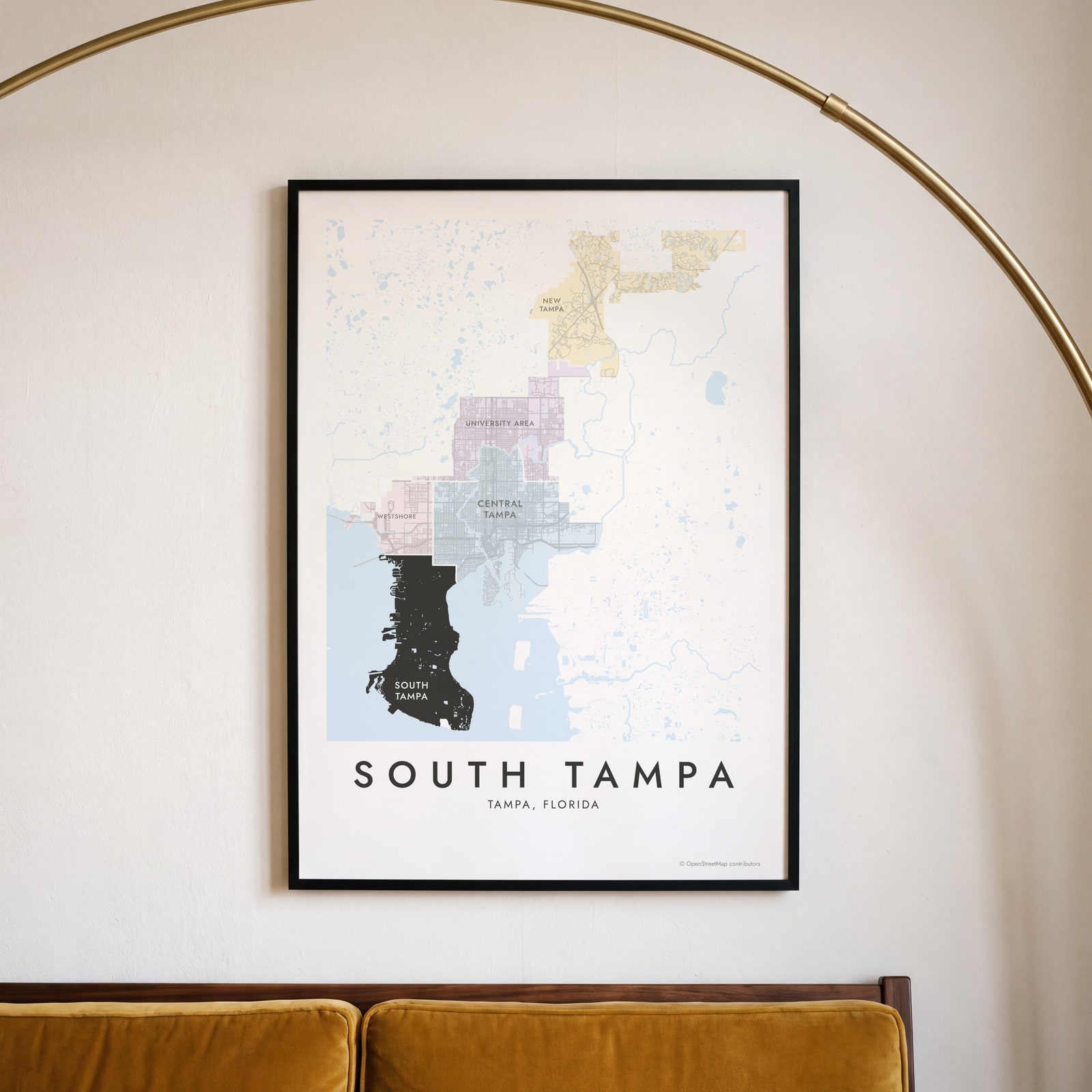 South Tampa highlighted on a map of TampaEdit this →
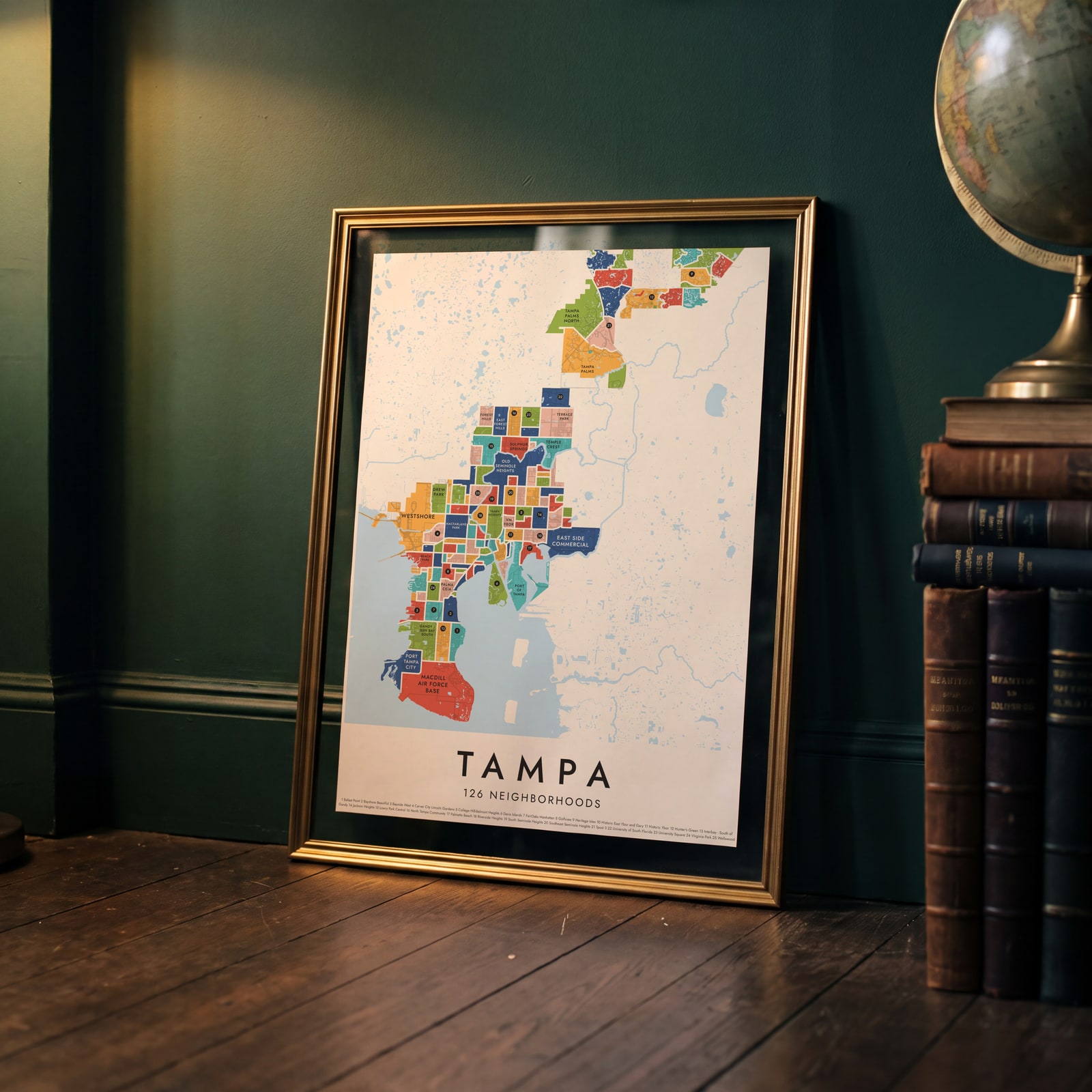 Tampa's 126 neighborhoods in colorEdit this →
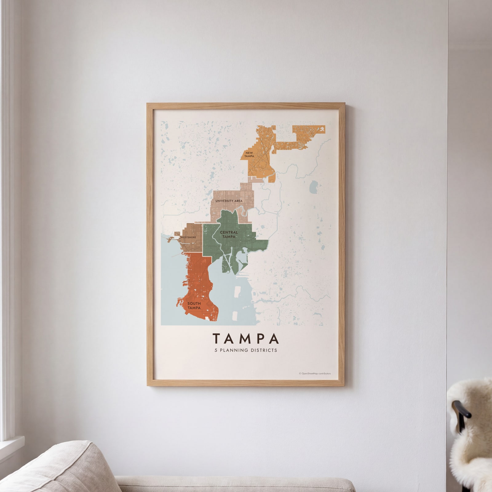 Tampa neighborhood map in color, every planning district namedEdit this →
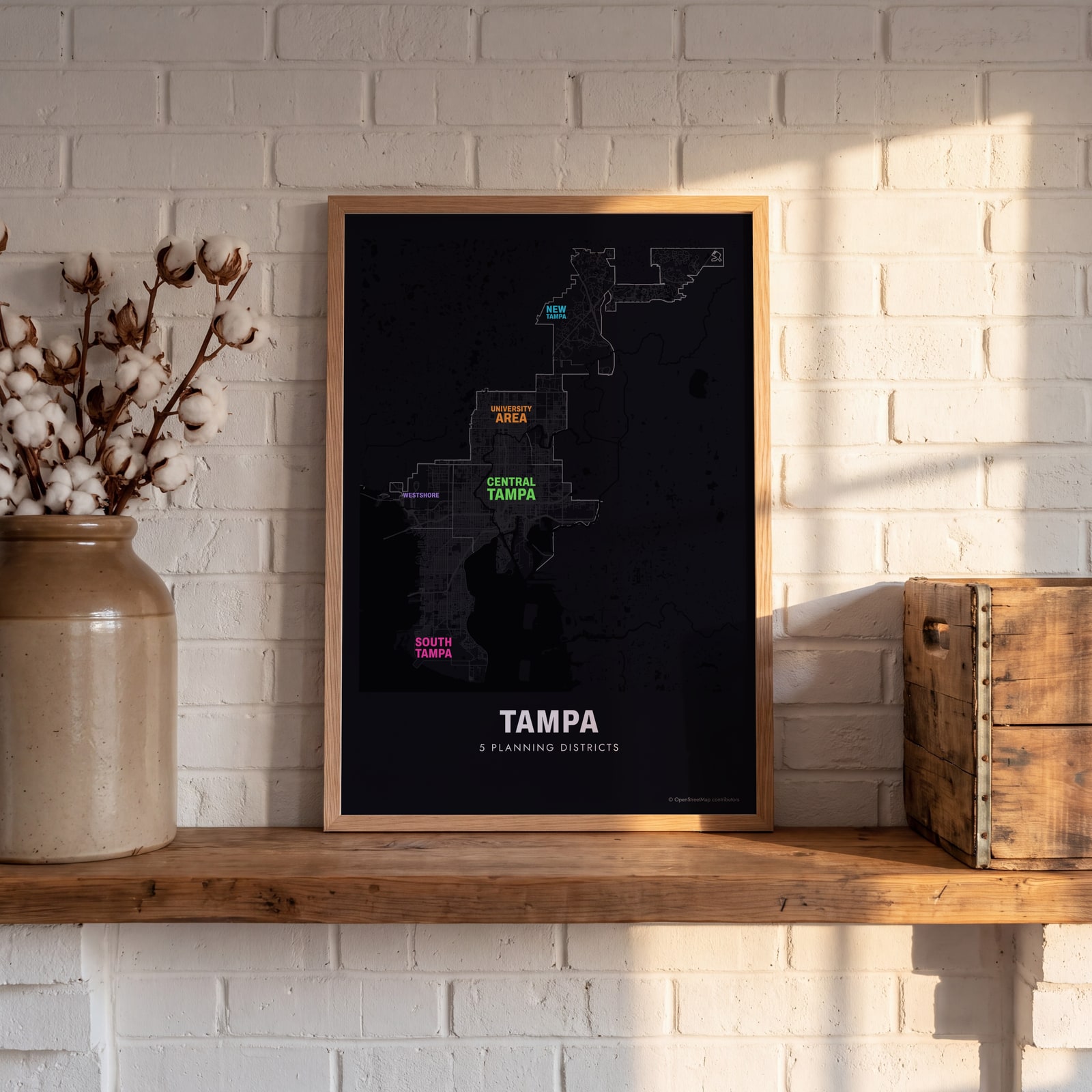 Typographic Tampa map: the names fill their planning districtsEdit this →
Examples
Open any of them to change the words, the place, the date and the style, then download the print file.
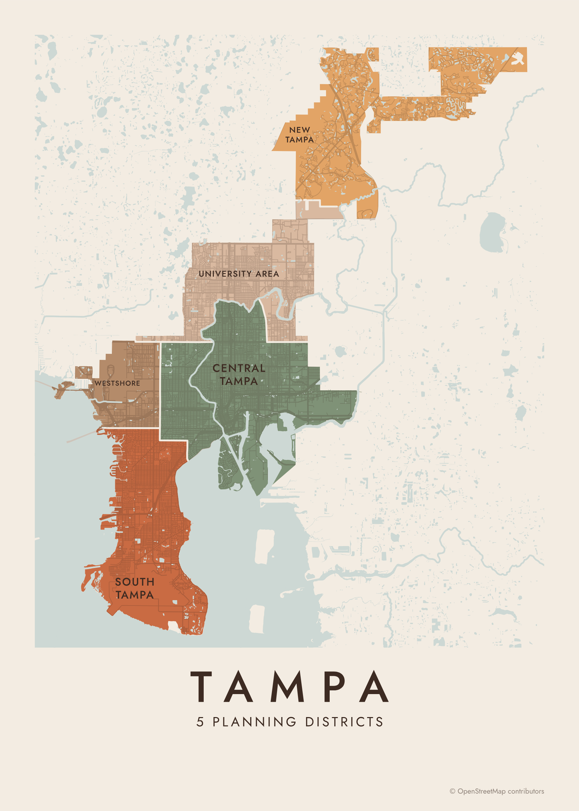 Tampa neighborhood map in color, every planning district namedEdit this →More neighborhood maps →
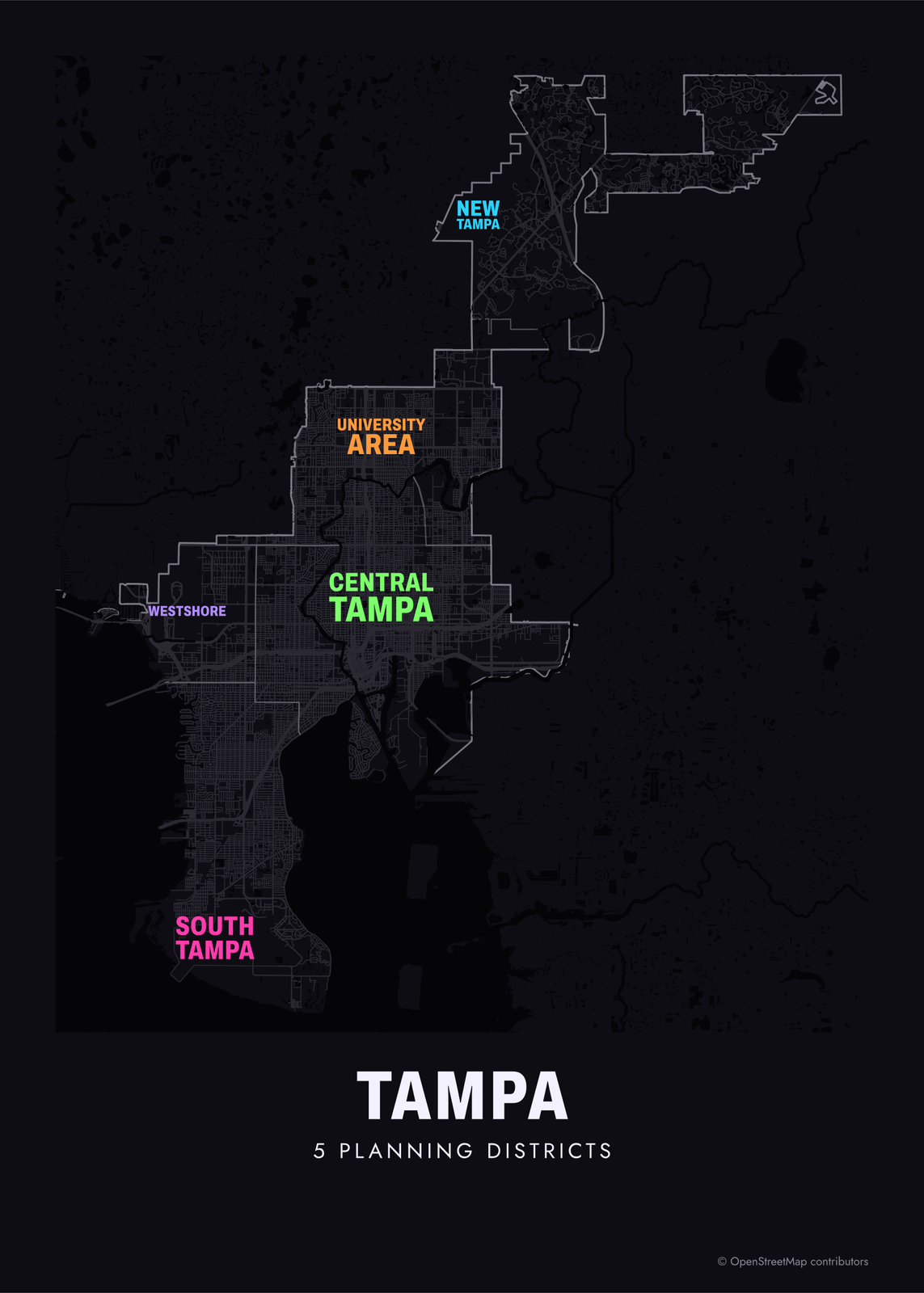 Typographic Tampa map: the names fill their planning districtsEdit this →More neighborhood maps →
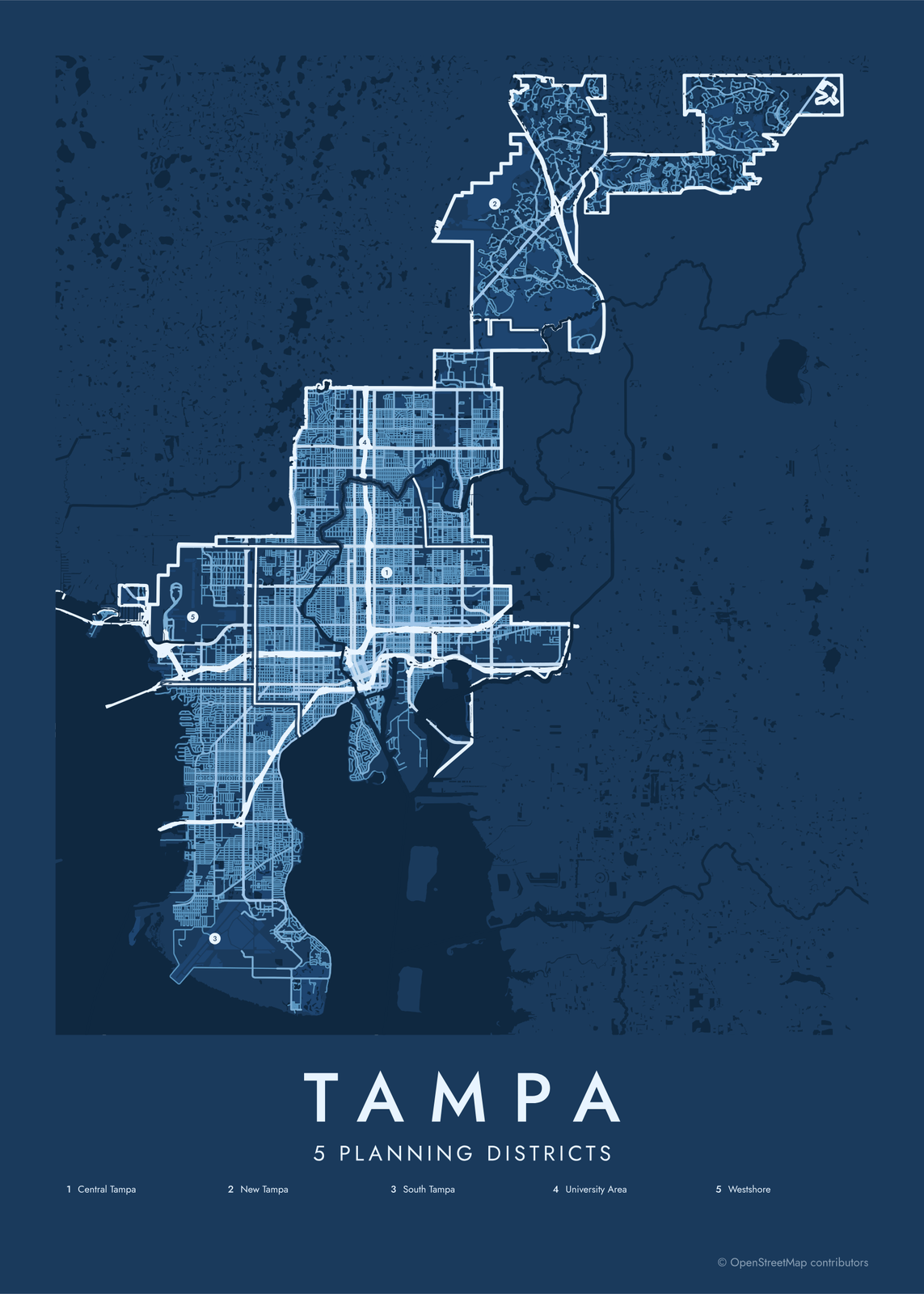 Tampa street map with numbered planning districts and their listEdit this →More neighborhood maps →
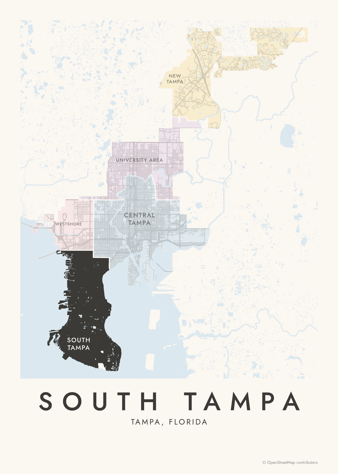 South Tampa highlighted on a map of TampaEdit this →More neighborhood maps →
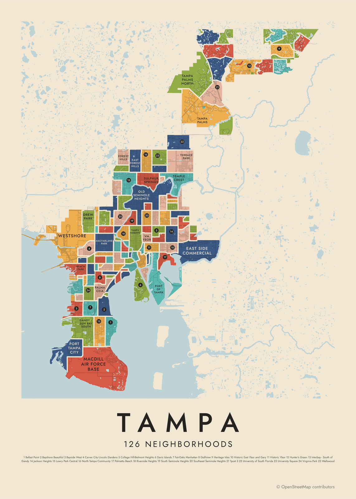 Tampa's 126 neighborhoods in colorEdit this →More neighborhood maps →
How Tampa is divided
Tampa's comprehensive plan, which guides how the city grows, splits it into five planning districts. Central Tampa takes in the older neighborhoods around downtown, like Ybor City, Tampa Heights and Seminole Heights. South Tampa fills the peninsula south of downtown. Westshore is the business district by the airport, the University Area surrounds USF, and New Tampa is the newer, mostly suburban area in the far north.
The 126 neighborhoods are the areas of Tampa's neighborhood associations, as the city maps them. Some are historic districts, like Hyde Park and Ybor; some are a single subdivision; a few are named for what fills them, like MacDill Air Force Base or the University of South Florida. The many small Hunter's Green associations are joined into one, and parts of the city with no association carry no neighborhood name.
All 5 planning districts of Tampa
- Central Tampa
- New Tampa
- South Tampa
- University Area
- Westshore
All 126 neighborhoods of Tampa
- Academy of the Holy Names
- Al Lopez Park
- Arbor Greene
- Armenia Gardens Estates
- Armenia Terrace
- Armory Gardens
- Ballast Point
- Bayshore Beautiful
- Bayshore Gardens
- Bayside West
- Beach Park
- Beach Park Isles
- Bel Mar Shores
- Belmar Gardens
- Bon Air
- Bowman Heights
- Carver City Lincoln Gardens
- Channel District
- College Hill-Belmont Heights
- Cory Lake Isles
- CSX
- Culbreath Bayou
- Culbreath Heights
- Culbreath Isles
- Davis Islands
- Downtown River Arts
- Drew Park
- East Forest Hills
- East Side Commercial
- East Tampa 1
- Eastern Heights
- Easton Park
- Encore
- FairOaks Manhattan
- Florence Villa
- Forest Hills
- Gandy / Sun Bay South
- Golfview
- Grand Hampton
- Grant Park
- Gray Gables
- Hampton Terrace
- Harbour Island
- Heritage Isles
- Highland Pines
- Historic Belmont Heights
- Historic East Ybor and Gary
- Historic Forest Hills
- Historic Hyde Park
- Historic Ybor
- Hunter's Green
- Hunters' Green Heritage Oaks
- Hyde Park Preservation
- Hyde Park Spanishtown Creek
- Hyde Park Village
- Interbay - South of Gandy
- Jackson Heights
- Julian B Lane Riverfront Park
- K Bar Ranch
- Live Oaks Square
- Lowry Park Central
- MacDill Air Force Base
- Macfarlane Park
- Midtown Tampa
- New Suburb Beautiful
- New Tampa
- North Bon Air
- North Hyde Park
- North Tampa Community
- North Ybor
- Northeast Community
- Northview Hills
- Oakford Park
- Old Seminole Heights
- Old West Tampa
- Palma Ceia
- Palma Ceia Pines
- Palma Ceia West
- Palmetto Beach
- Parkland Estates
- Plaza Terrace
- Port of Tampa
- Port Tampa City
- Rainbow Heights
- Raymond James Stadium
- Richmond Place
- Ridgewood Park
- Riverbend
- Rivergrove
- Riverside Heights
- Rowlett Park
- Seminole Heights East
- South Howard
- South Seminole Heights
- Southeast Seminole Heights
- Southtown Park
- St Joseph's Hospital
- Sulphur Springs
- Sunset Park
- Swann Estates
- Tampa Downtown Partnership
- Tampa Heights
- Tampa Overlook
- Tampa Palms
- Tampa Palms - The Sanctuary
- Tampa Palms North
- Temple Crest
- Terrace Park
- The Legacy of Fair Oaks
- The Marina Club of Tampa
- Tpost 3
- University of South Florida
- University of Tampa
- University Square
- Virginia Park
- VM Ybor
- Wellswood
- West Meadows
- West River
- West Riverfront Neighborhood
- West Riverside Heights
- West Tampa Heights (Stadium Area)
- Westshore
- Westshore Palms
- Woodland Terrace
- Ybor Heights
Neighborhoods to know
- Historic Ybor: brick streets and old cigar factories in Ybor City, a National Historic Landmark District.
- Historic Hyde Park: streets of early 1900s houses just inland from Bayshore Boulevard.
- Davis Islands: built on dredged land in the 1920s, with Tampa General Hospital and Peter O. Knight Airport.
- Old Seminole Heights: streets of 1910s and 1920s bungalows north of downtown.
- Channel District: next to downtown, with the Florida Aquarium and the cruise ship terminals.
- University of Tampa: Plant Hall, the former Tampa Bay Hotel of 1891, with its silver minarets.
- Sulphur Springs: named for its natural spring, with a 1920s water tower as its landmark.
- Ballast Point: a park and fishing pier on Hillsborough Bay.
How to make your Tampa neighborhood poster
- Open the Tampa map and pick planning districts or neighborhoods.
- Pick a style: Colored areas, Typographic (the names fill the map) or a Street map with the borders over the streets.
- Tap your own neighborhood to highlight it; it becomes the poster's title.
- Drag and zoom to frame the whole city or just your part of it, then pick a size and download the print file.
Questions
How many neighborhoods does Tampa have?
There's no fixed number. The city maps the areas of its neighborhood associations, and this map shows 126 of them, grouped into five planning districts. Some parts of the city have no association.
What are Tampa's five planning districts?
Central Tampa, South Tampa, Westshore, New Tampa and the University Area. They come from the city's comprehensive plan, which uses them to guide growth and land use.
Is Ybor City part of Tampa?
Yes. Ybor City was founded in 1885 as its own town, built around cigar factories, and became part of Tampa in 1887. On this map it's split into areas like Historic Ybor, North Ybor and VM Ybor.
Where do the Tampa boundaries come from?
From OpenStreetMap (© OpenStreetMap contributors) and City of Tampa and City of Tampa. Streets and water are OpenStreetMap's. Boundaries are a snapshot and can differ from what neighbors call home; tell us if one looks wrong.
What sizes can I print?
US Letter, 8 × 10, 11 × 14, 12 × 16 and 12 × 18 in, A4 and A3, free. You download a 300 DPI JPEG drawn at the size you pick. Larger prints, up to 24 × 36 in, are coming soon.
Related




Gift ideas by occasion




Every example is made with the Posterage generators. Change anything, then download it as a 300 DPI JPEG.