Washington DC neighborhood map 127 neighborhoods and the four quadrants
This poster maps Washington, D.C. by its neighborhoods, 127 of them, each named, from Georgetown and Dupont Circle to Capitol Hill and Anacostia. Switch to the four quadrants for a simpler map of NW, NE, SE and SW. Highlight the one you call home and print it.
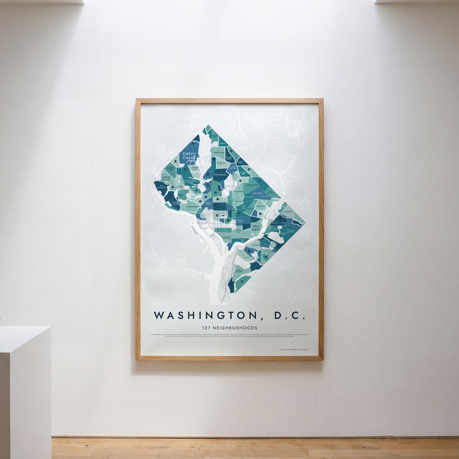
On the wall
A few of them framed at home. Open any one to make it yours.
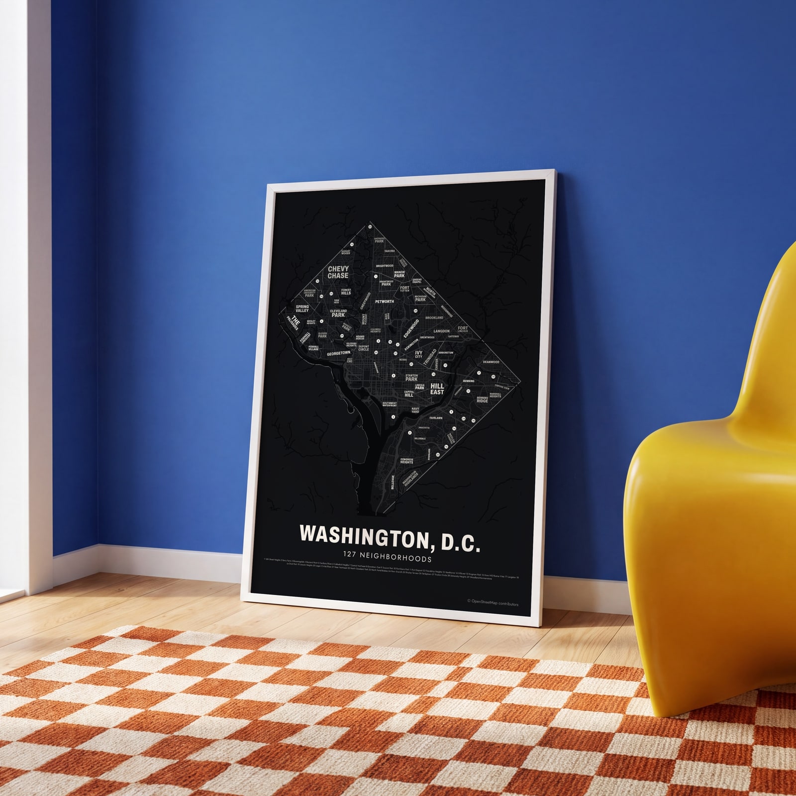 Typographic Washington, D.C. map: the names fill their neighborhoodsEdit this →
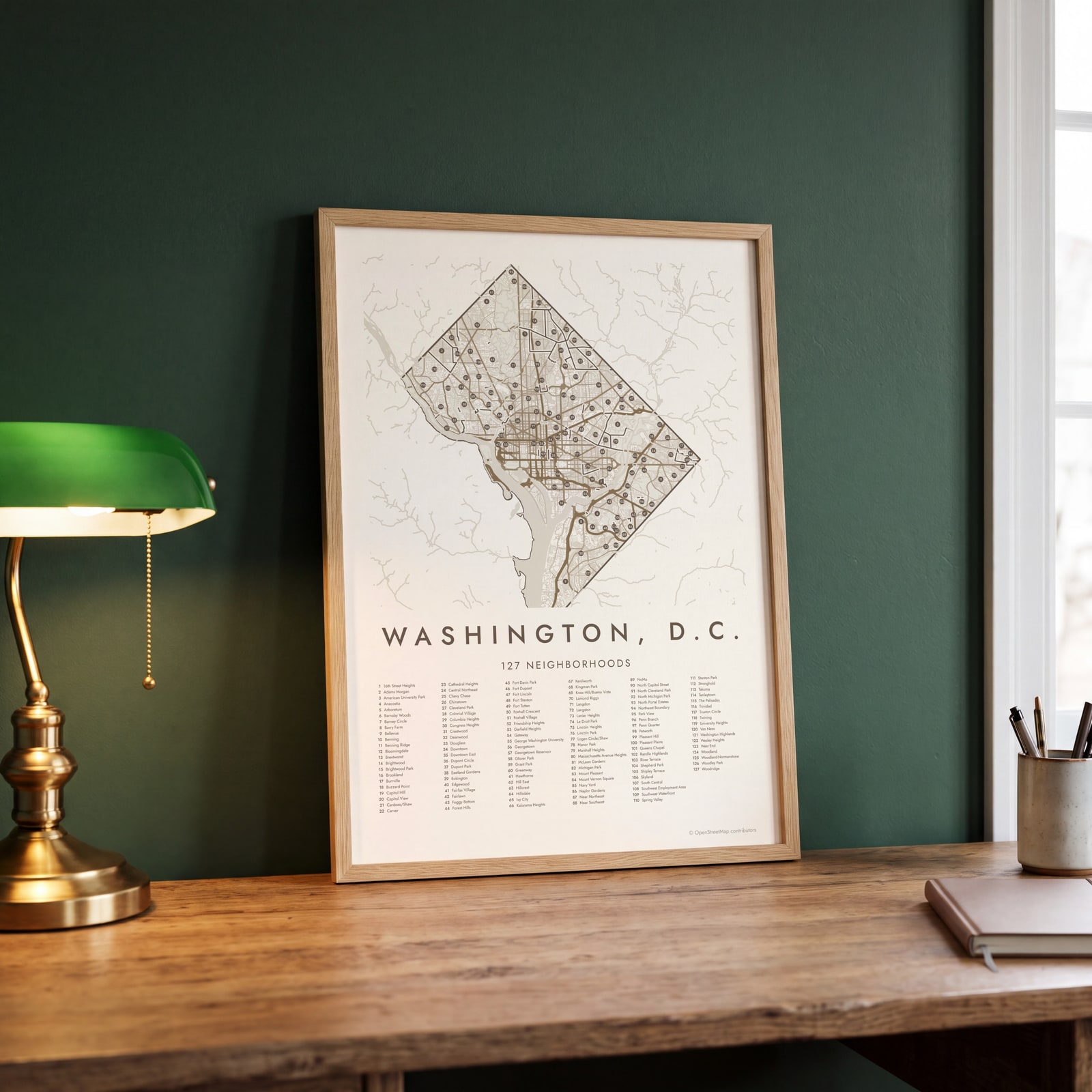 Washington, D.C. street map with numbered neighborhoods and their listEdit this →
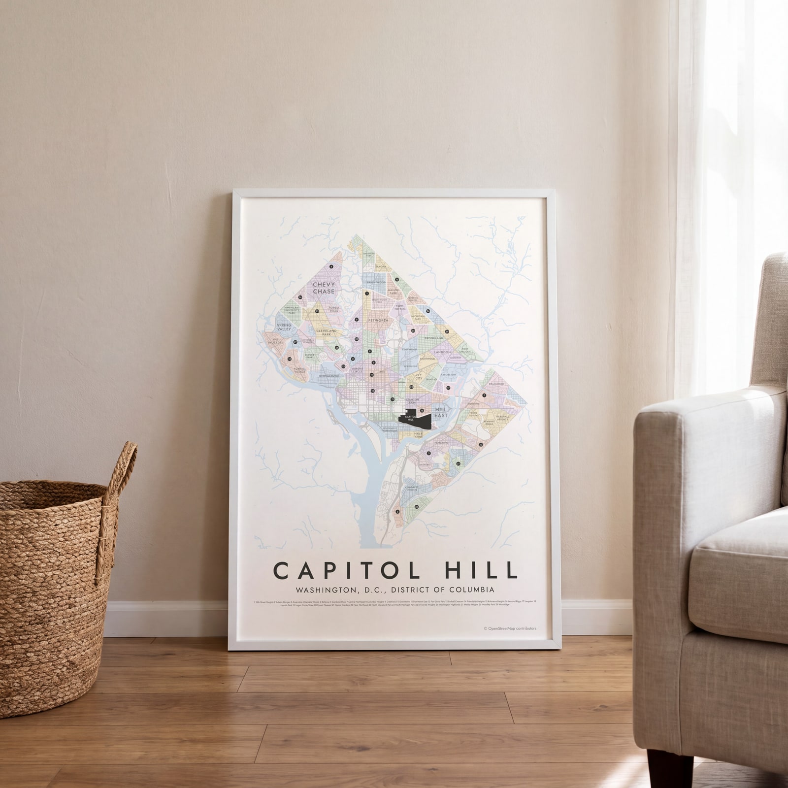 Capitol Hill highlighted on a map of Washington, D.C.Edit this →
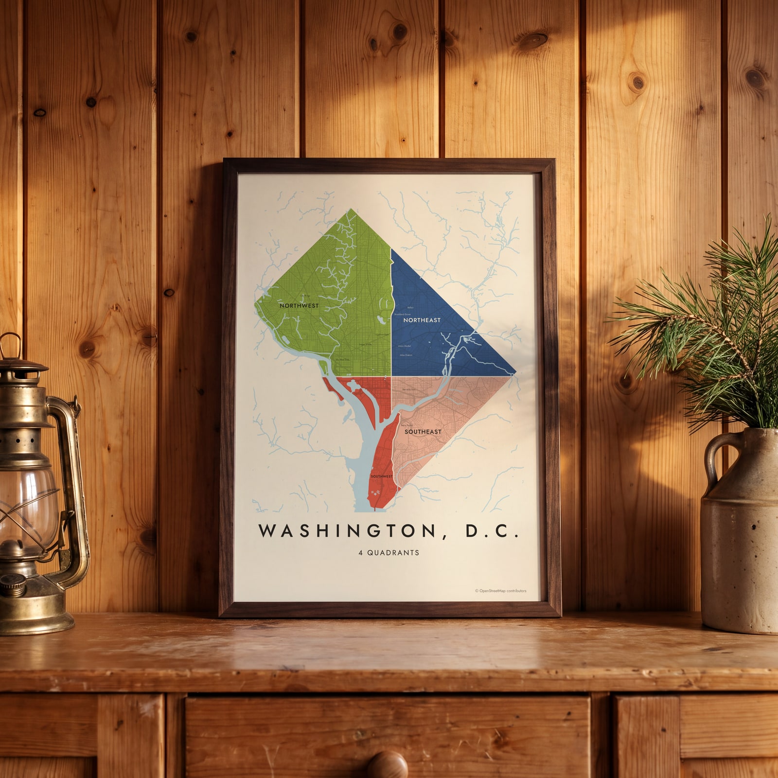 Washington, D.C.'s 4 quadrants in colorEdit this →
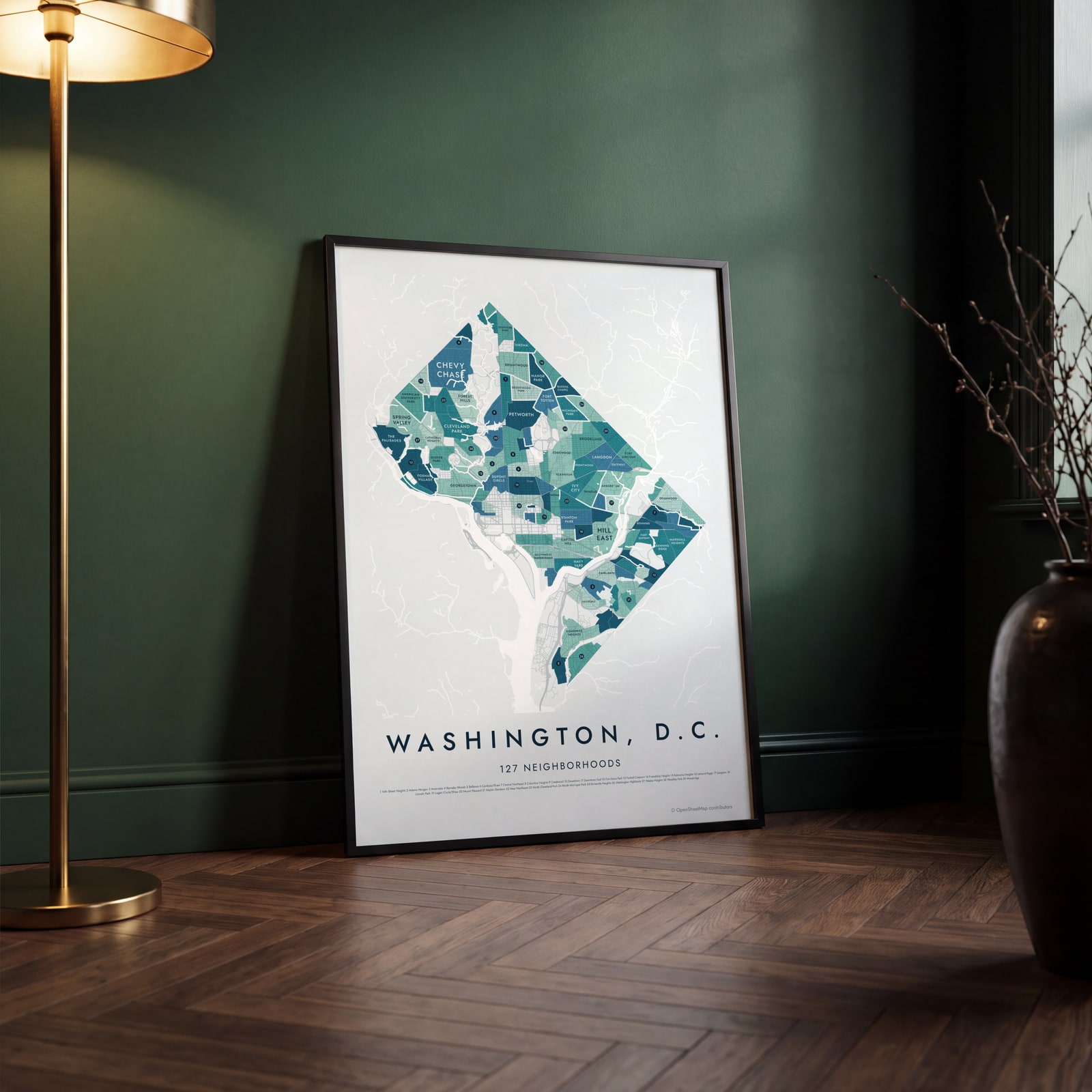 Washington, D.C. neighborhood map in color, every neighborhood namedEdit this →
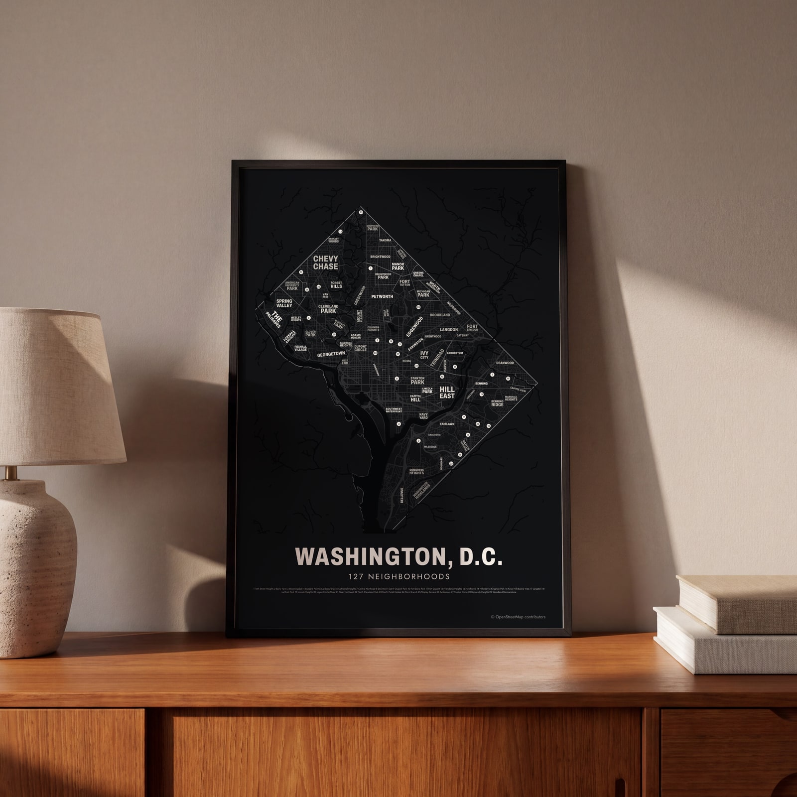 Typographic Washington, D.C. map: the names fill their neighborhoodsEdit this →
Examples
Open any of them to change the words, the place, the date and the style, then download the print file.
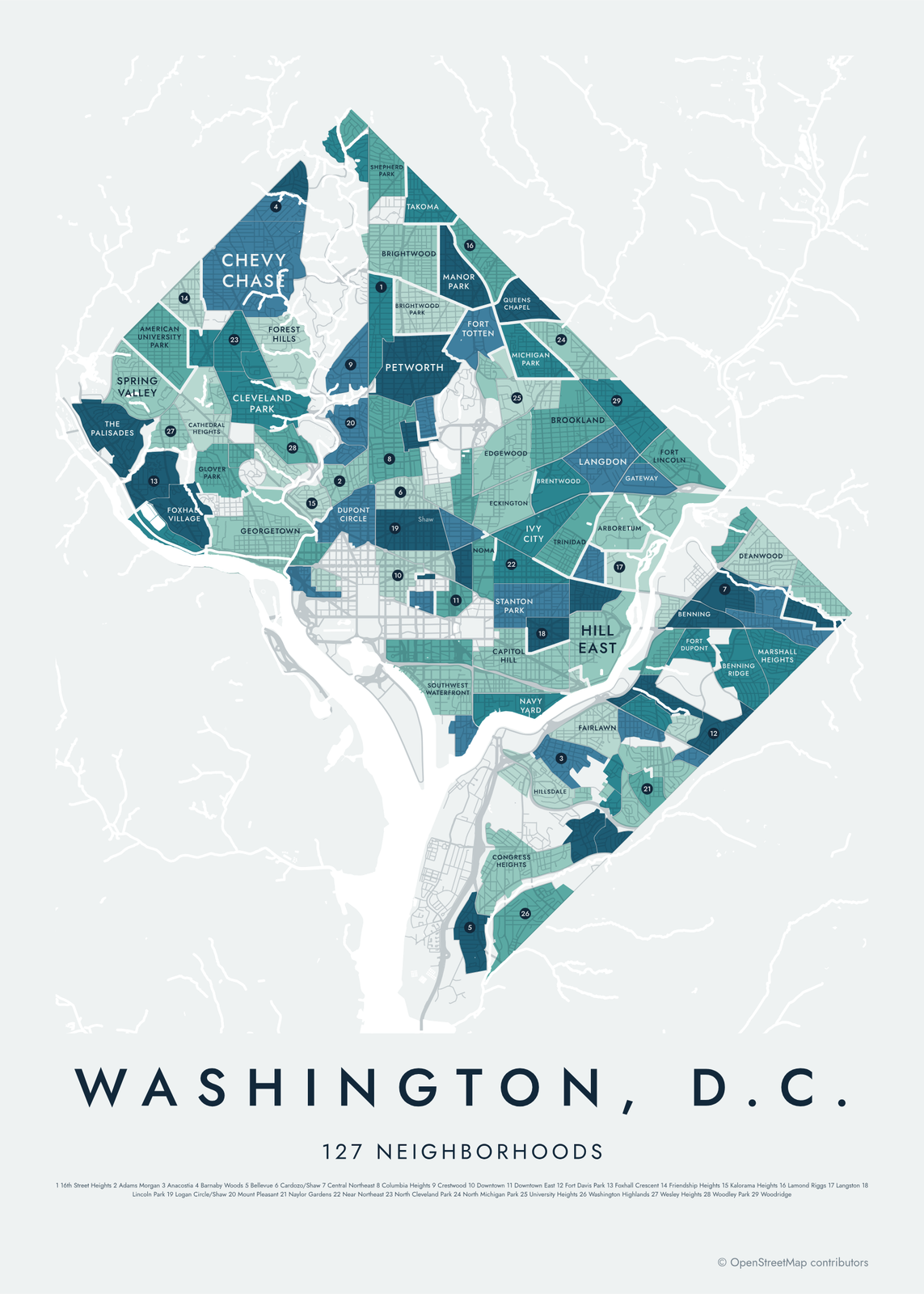 Washington, D.C. neighborhood map in color, every neighborhood namedEdit this →More neighborhood maps →
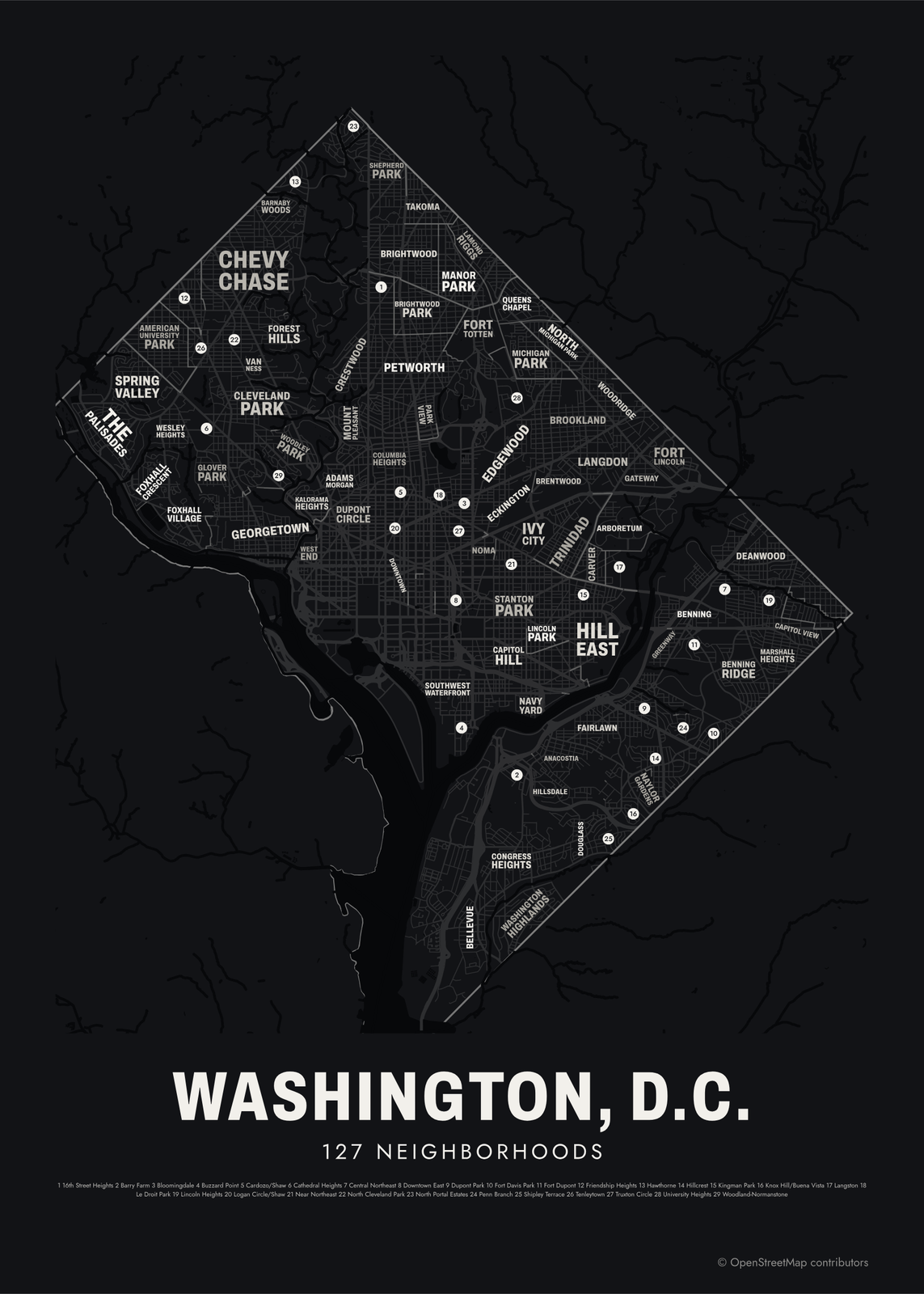 Typographic Washington, D.C. map: the names fill their neighborhoodsEdit this →More neighborhood maps →
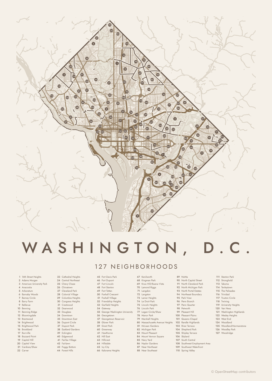 Washington, D.C. street map with numbered neighborhoods and their listEdit this →More neighborhood maps →
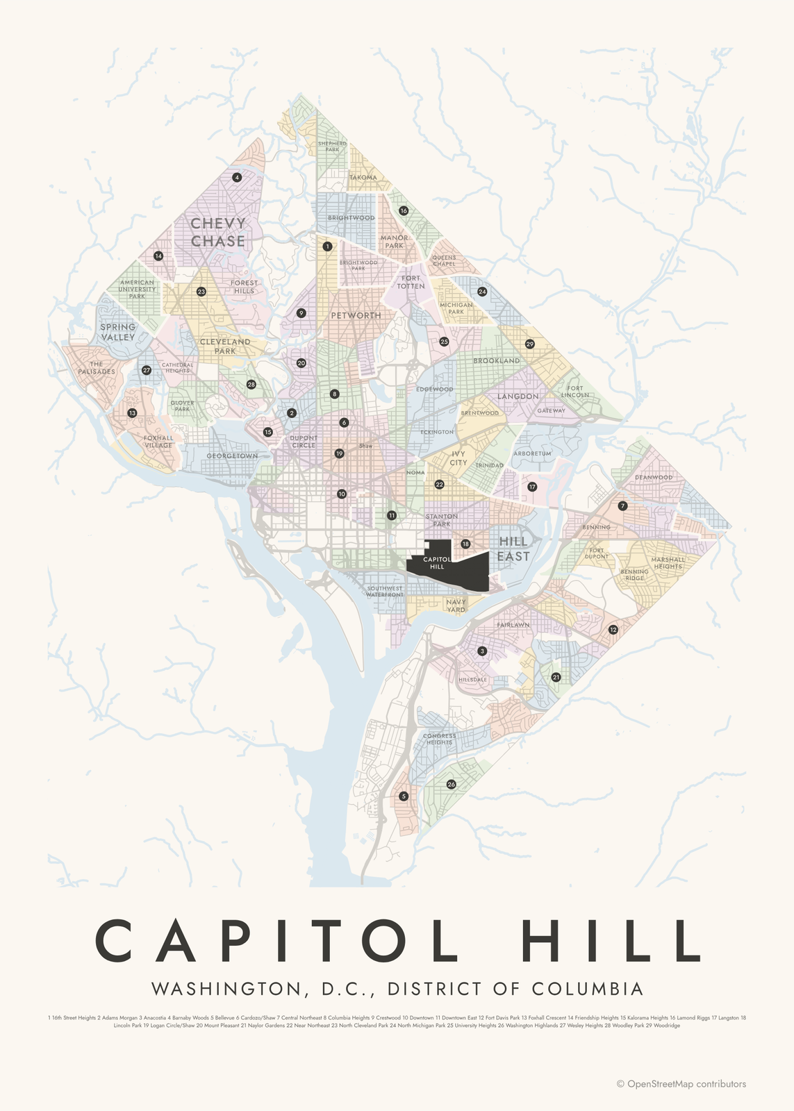 Capitol Hill highlighted on a map of Washington, D.C.Edit this →More neighborhood maps →
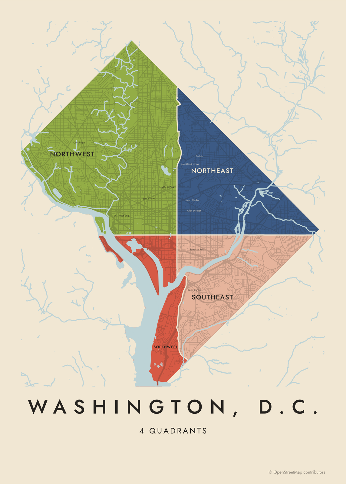 Washington, D.C.'s 4 quadrants in colorEdit this →More neighborhood maps →
How Washington is divided
DC has no official neighborhood boundaries. The names are old and well known, but the city never fixed their edges. Planners group the District into 39 neighborhood clusters for statistics, and this map uses finer borders mapped by OpenStreetMap contributors instead: 127 neighborhoods covering about two thirds of the city. Rock Creek Park, the National Mall and other parks and federal land are left blank. Local names like The Wharf, Union Market and Barracks Row appear as small labels.
The quadrants are official, and they are part of every address. North, South and East Capitol Streets and the National Mall divide the city into four parts that meet at the Capitol. They are far from equal: Northwest is the largest and Southwest the smallest. The same street address can exist in more than one quadrant, which is why locals always add NW, NE, SE or SW.
All 127 neighborhoods of Washington, D.C.
- 16th Street Heights
- Adams Morgan
- American University Park
- Anacostia
- Arboretum
- Barnaby Woods
- Barney Circle
- Barry Farm
- Bellevue
- Benning
- Benning Ridge
- Bloomingdale
- Brentwood
- Brightwood
- Brightwood Park
- Brookland
- Burrville
- Buzzard Point
- Capitol Hill
- Capitol View
- Cardozo/Shaw
- Carver
- Cathedral Heights
- Central Northeast
- Chevy Chase
- Chinatown
- Cleveland Park
- Colonial Village
- Columbia Heights
- Congress Heights
- Crestwood
- Deanwood
- Douglass
- Downtown
- Downtown East
- Dupont Circle
- Dupont Park
- Eastland Gardens
- Eckington
- Edgewood
- Fairfax Village
- Fairlawn
- Foggy Bottom
- Forest Hills
- Fort Davis Park
- Fort Dupont
- Fort Lincoln
- Fort Stanton
- Fort Totten
- Foxhall Crescent
- Foxhall Village
- Friendship Heights
- Garfield Heights
- Gateway
- George Washington University
- Georgetown
- Georgetown Reservoir
- Glover Park
- Grant Park
- Greenway
- Hawthorne
- Hill East
- Hillcrest
- Hillsdale
- Ivy City
- Kalorama Heights
- Kenilworth
- Kingman Park
- Knox Hill/Buena Vista
- Lamond Riggs
- Langdon
- Langston
- Lanier Heights
- Le Droit Park
- Lincoln Heights
- Lincoln Park
- Logan Circle/Shaw
- Manor Park
- Marshall Heights
- Massachusetts Avenue Heights
- McLean Gardens
- Michigan Park
- Mount Pleasant
- Mount Vernon Square
- Navy Yard
- Naylor Gardens
- Near Northeast
- Near Southeast
- NoMa
- North Capitol Street
- North Cleveland Park
- North Michigan Park
- North Portal Estates
- Northeast Boundary
- Park View
- Penn Branch
- Penn Quarter
- Petworth
- Pleasant Hill
- Pleasant Plains
- Queens Chapel
- Randle Highlands
- River Terrace
- Shepherd Park
- Shipley Terrace
- Skyland
- South Central
- Southwest Employment Area
- Southwest Waterfront
- Spring Valley
- Stanton Park
- Stronghold
- Takoma
- Tenleytown
- The Palisades
- Trinidad
- Truxton Circle
- Twining
- University Heights
- Van Ness
- Washington Highlands
- Wesley Heights
- West End
- Woodland
- Woodland-Normanstone
- Woodley Park
- Woodridge
All 4 quadrants of Washington, D.C.
- Northeast
- Northwest
- Southeast
- Southwest
More neighborhood names on the map
Inside the neighborhoods, the map also names 17 smaller neighborhoods where they fit, from OpenStreetMap: City Ridge, The West End, Rock Creek Gardens, Logan Circle, The Wharf, Shaw, LeDroit Park, Hampshire Knolls, Brookland Grove, Bridge District, Union Market, Atlas District, Barry Farms, Barracks Row, Bellair, Buena Vista, Knox Hill. Turn them off under Names if you want only the neighborhoods.
Neighborhoods to know
- Georgetown: a tobacco port founded in 1751, before the capital existed, home to Georgetown University and the C&O Canal.
- Capitol Hill: rowhouse blocks behind the U.S. Capitol, with Eastern Market, a public market built in 1873.
- Dupont Circle: named for its traffic circle and fountain, with embassies along Massachusetts Avenue nearby.
- Adams Morgan: named after two local elementary schools, Adams and Morgan, with 18th Street as its main strip.
- Navy Yard: built up around the Washington Navy Yard, founded in 1799, with Nationals Park by the river.
- Anacostia: east of the Anacostia River, below Cedar Hill, the home of Frederick Douglass.
- Brookland: home to the Catholic University of America and the Basilica of the National Shrine of the Immaculate Conception.
- Tenleytown: next to Fort Reno Park, the highest point in the District.
How to make your Washington, D.C. neighborhood poster
- Open the Washington, D.C. map and pick neighborhoods or quadrants.
- Pick a style: Colored areas, Typographic (the names fill the map) or a Street map with the borders over the streets.
- Tap your own neighborhood to highlight it; it becomes the poster's title.
- Drag and zoom to frame the whole city or just your part of it, then pick a size and download the print file.
Questions
How many neighborhoods does Washington, DC have?
There's no official number, because the city has never set neighborhood boundaries. The Office of Planning groups DC into 39 neighborhood clusters for statistics. This map shows 127 neighborhoods mapped by OpenStreetMap contributors, plus smaller local names as labels.
What are the four quadrants of DC?
Northwest, Northeast, Southeast and Southwest. They meet at the U.S. Capitol and are divided by North, South and East Capitol Streets and the National Mall. Northwest covers the largest share of the city, including Georgetown, Dupont Circle and Rock Creek Park.
Is Georgetown part of Washington, DC?
Yes. Georgetown was a Maryland port town before the District was created, and it kept its own government until 1871, when Congress merged it with the City of Washington under one government for the whole District.
What's the difference between a ward and a neighborhood in DC?
DC has eight wards. Each elects a member of the DC Council, and their borders are redrawn after every census to keep populations even. Neighborhoods are older and informal, and one ward usually holds many of them.
Where do the Washington, D.C. boundaries come from?
From OpenStreetMap (© OpenStreetMap contributors) and Government of the District of Columbia, Office of the Chief Technology Officer (Open Data DC). Streets and water are OpenStreetMap's. Boundaries are a snapshot and can differ from what neighbors call home; tell us if one looks wrong.
What sizes can I print?
US Letter, 8 × 10, 11 × 14, 12 × 16 and 12 × 18 in, A4 and A3, free. You download a 300 DPI JPEG drawn at the size you pick. Larger prints, up to 24 × 36 in, are coming soon.
Related




Gift ideas by occasion




Every example is made with the Posterage generators. Change anything, then download it as a 300 DPI JPEG.